Durgates

Settlement in Sussex Wealden

England

Durgates

Mill Oast, Washwell Lane, Wadhurst, East Sussex Single round kiln oast house, just off the centre of Wadhurst. Possibly not an original oast.
Mill Oast, Washwell Lane, Wadhurst, East Sussex Credit: Oast House Archive

Durgates, Sussex is a small village located in the picturesque county of Sussex in southeastern England. With a population of around 500 residents, it is known for its scenic countryside views, charming cottages, and a close-knit community.

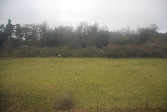
Situated amidst rolling hills and lush green fields, Durgates offers a tranquil and idyllic setting for its residents. The village is surrounded by an abundance of natural beauty, including dense woodlands, meandering rivers, and stunning walking trails, making it a popular destination for outdoor enthusiasts and nature lovers.

One of the notable landmarks in Durgates is the St. Mary's Church, a historic 13th-century church that showcases beautiful medieval architecture. The church serves as a focal point for the community, hosting regular religious services, as well as various events and gatherings.

Despite its small size, Durgates boasts a vibrant community spirit, with residents actively involved in various local initiatives and events. The village often organizes festivals, fairs, and community gatherings throughout the year, providing opportunities for the villagers to come together and celebrate.

For amenities, Durgates has a few local shops and businesses catering to the daily needs of its residents, including a convenience store and a cozy village pub. However, for more extensive shopping and entertainment options, the nearby town of East Grinstead is easily accessible.

Overall, Durgates, Sussex offers a peaceful and picturesque retreat from the hustle and bustle of city life, providing residents with a close community, stunning natural surroundings, and a rich sense of history and tradition.

If you have any feedback on the listing, please let us know in the comments section below.
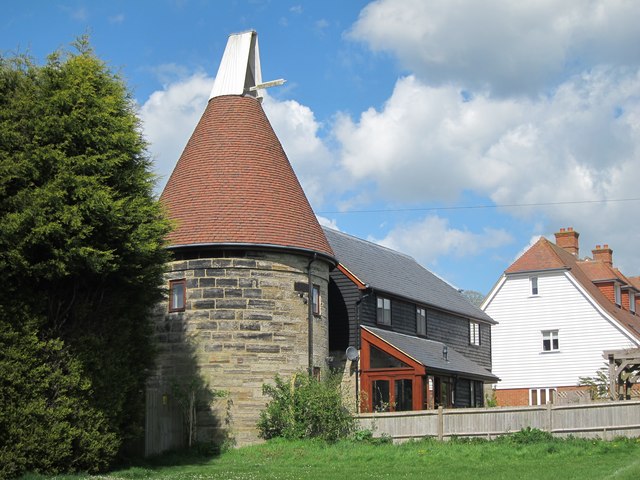
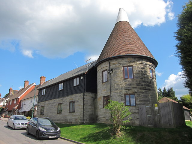
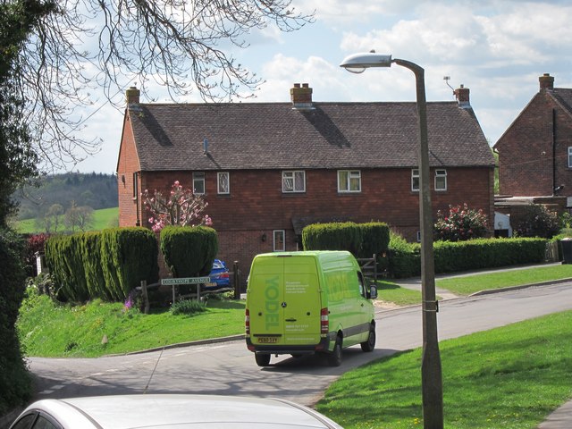
Durgates Images

Images are sourced within 2km of 51.066074/0.32729284 or Grid Reference TQ6332. Thanks to Geograph Open Source API. All images are credited.

Mill Oast, Washwell Lane, Wadhurst, East Sussex Single round kiln oast house, just off the centre of Wadhurst. Possibly not an original oast.
Mill Oast, Washwell Lane, Wadhurst, East Sussex
Single round kiln oast house, just off the centre of Wadhurst. Possibly not an original oast.
Mill Oast, Washwell Lane, Wadhurst, East Sussex Single round kiln oast house, just off the centre of Wadhurst. Possibly not an original oast.
Mill Oast, Washwell Lane, Wadhurst, East Sussex
Single round kiln oast house, just off the centre of Wadhurst. Possibly not an original oast.
Well kept garden Front garden of a semi detached house at number 2 Courthope Avenue, at junction with Washwell Lane.
Well kept garden
Front garden of a semi detached house at number 2 Courthope Avenue, at junction with Washwell Lane.
Washwell Lane Top of Washwell Lane heading into the centre of Wadhurst village. A new development is under construction to the left, on the site of demolished bungalow. Church of Peter and Paul seen in centre.
Washwell Lane
Top of Washwell Lane heading into the centre of Wadhurst village. A new development is under construction to the left, on the site of demolished bungalow. Church of Peter and Paul seen in centre.
Cherry Blossom Beside the footpath just off Washwell Lane.
Cherry Blossom
Beside the footpath just off Washwell Lane.
New Development on Townsend Road Built on the site of a bungalow, demolished to make way for this terrace of houses.
New Development on Townsend Road
Built on the site of a bungalow, demolished to make way for this terrace of houses.
Yodel Van on Courthope Avenue Washwell Lane to left.
Yodel Van on Courthope Avenue
Washwell Lane to left.
Fields south of Wadhurst Looking from Foxes Bank towards Wadhurst village.
Fields south of Wadhurst
Looking from Foxes Bank towards Wadhurst village.
Trees at Foxes Bank By footpath off Washwell Lane.
Trees at Foxes Bank
By footpath off Washwell Lane.
Woodland by the Hastings Line near Wadhurst Station
Railway cutting, southern end of the Wadhurst Tunnel
Gill's Wood
Gill's Wood
Trees by the Hastings line
Station House, Wadhurst Station Wadhurst station was opened by the South Eastern Railway (SER) in 1851. It is on the Hastings line. The station is about one mile from the village at the foot of a steep hill. It is an important commuter station for the surrounding rural area.
Station House, Wadhurst Station
Wadhurst station was opened by the South Eastern Railway (SER) in 1851. It is on the Hastings line. The station is about one mile from the village at the foot of a steep hill. It is an important commuter station for the surrounding rural area.
Field between Wadhurst Rd and the railway line
Tidebrook Road
Tidebrook Road
Best Beech Inn
Best Beech Inn
Wadhurst Station
Wadhurst Station
Show me another place!

Durgates is located at Grid Ref: TQ6332 (Lat: 51.066074, Lng: 0.32729284)

Administrative County: East Sussex

District: Wealden

Police Authority: Sussex

What 3 Words

///smoker.enough.marching. Near Wadhurst, East Sussex

Related Wikis

Wadhurst

Wadhurst is a market town in East Sussex, England. It is the centre of the civil parish of Wadhurst, which also includes the hamlets of Cousley Wood and...
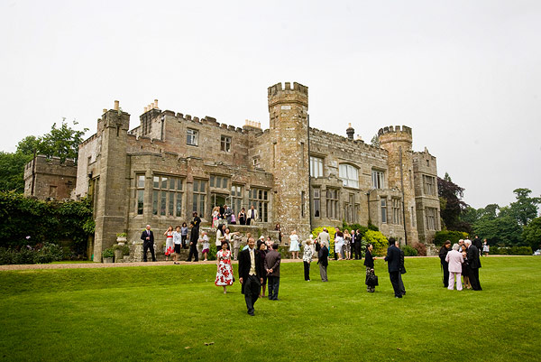
Wadhurst Castle

Wadhurst Castle is a 19th-century castellated mansion just to the west of the town of Wadhurst, East Sussex, England, in an elevated position overlooking...

Uplands Academy

Uplands Academy (formerly Uplands Community College) is a coeducational secondary school and sixth form located in Wadhurst, East Sussex, England. ��2...

Wadhurst railway station

Wadhurst railway station is on the Hastings line in the south of England and serves the town of Wadhurst, East Sussex. It is 39 miles 23 chains (63.2 km...

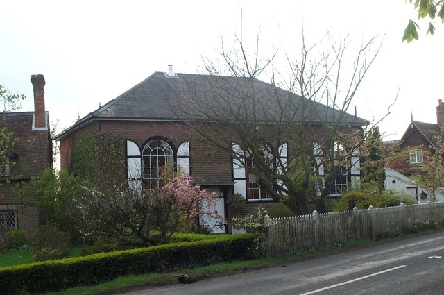
Rehoboth Chapel, Pell Green

Rehoboth Chapel is a former Strict Baptist place of worship in the hamlet of Pell Green in East Sussex, England. Pell Green is in the parish of Wadhurst...

Best Beech Hill

Best Beech Hill is a locality in the civil parish of Wadhurst in the Wealden district of East Sussex, England. Wadhurst lies approximately 1.6 miles...

Shover's Green Baptist Chapel

Shover's Green Baptist Chapel is a former Strict Baptist place of worship in the hamlet of Shover's Green in East Sussex, England. Shover's Green is in...

Tidebrook

Tidebrook is a hamlet within the parish of Wadhurst in East Sussex, England. It is located between the villages of Mayfield and Wadhurst. The brook for...

Nearby Amenities

Located within 500m of 51.066074,0.32729284
Turning Circle
Source: Bing
Lat/Long: 51.0684589/0.3274141
Turning Circle
Source: Bing
Lat/Long: 51.0675545/0.3271027
Turning Circle
Source: Bing
Lat/Long: 51.0649658/0.3280263
Turning Circle
Lat/Long: 51.0690694/0.3311969
Give Way
Direction: backward
Lat/Long: 51.066467/0.3279076
Turning Circle
Lat/Long: 51.0683797/0.3283809
Turning Circle
Source: Bing
Lat/Long: 51.0660444/0.3253212
Turning Circle
Source: Bing
Lat/Long: 51.0657838/0.3241586
Turning Circle
Lat/Long: 51.0662853/0.3316934
Barrier: bollard
Bollard: fixed
Lat/Long: 51.065798/0.332692
Durgates
Place: village
Source: OS_OpenData_Streetview
Lat/Long: 51.0660367/0.3311455
Post Box
Operator: Royal Mail
Operator Wikidata: Q638098
Post Box Type: pillar
Ref: TN5 199
Royal Cypher: EIIR
Royal Cypher Wikidata: Q33102113
Lat/Long: 51.066074/0.3285926
Fuel
Wadhurst Service Station
Compressed Air: yes
Lat/Long: 51.0667446/0.3275514
Veterinary
Culverden Vet Group
Check Date: 2023-06-21
Lat/Long: 51.0676127/0.3338653
Ben Greig Motors
Check Date: 2023-06-21
Shop: car
Lat/Long: 51.0670008/0.334053
Power: pole
Lat/Long: 51.066716/0.3226027
Power: pole
Lat/Long: 51.0665171/0.3210175
Power: pole
Lat/Long: 51.0664176/0.3210282
Power: pole
Lat/Long: 51.066603/0.3226268
Give Way
Direction: backward
Lat/Long: 51.0663331/0.3278984
Give Way
Direction: forward
Lat/Long: 51.0650699/0.3330648
Crossing
Crossing: uncontrolled
Crossing Island: no
Crossing Markings: zebra
Tactile Paving: yes
Lat/Long: 51.0654172/0.3330634
Post Box
Lat/Long: 51.0631331/0.3225859
Telephone
Booth: K6
Covered: booth
Lat/Long: 51.065557/0.3298128
The data included in this document is from www.openstreetmap.org. The data is made available under ODbL.

Have you been to Durgates?

Leave your review of Durgates below (or comments, questions and feedback).