Larch Spinney

Wood, Forest in Northamptonshire

England

Larch Spinney

Leicester Branch, summit level Haddon Road Bridge (no.22) in the distance.
Leicester Branch, summit level Credit: Alan Murray-Rust

Larch Spinney is a picturesque wood located in Northamptonshire, England. Situated in the heart of the county, this forested area spans approximately 50 acres and is renowned for its stunning beauty and diverse range of flora and fauna.

The wood is predominantly composed of larch trees, which lend their name to the spinney. These tall and elegant conifers create a dense canopy that provides a sheltered habitat for a variety of wildlife. Visitors to Larch Spinney can expect to encounter a rich array of bird species, including woodpeckers, nuthatches, and thrushes, as well as small mammals like squirrels and rabbits.

The forest is intersected by several well-maintained footpaths, allowing visitors to explore its winding trails and discover hidden gems along the way. The enchanting atmosphere of Larch Spinney makes it a popular destination for nature lovers, hikers, and photographers alike.

In addition to its natural beauty, the wood also boasts a small picnic area, making it a perfect spot for families and groups to enjoy a leisurely outdoor lunch amidst the tranquility of the surroundings. The picnic area offers seating and tables, as well as waste disposal facilities, ensuring a comfortable and clean experience for all visitors.

Larch Spinney is open to the public year-round, offering a different experience with each changing season. Whether it's the vibrant colors of autumn leaves, the blooming wildflowers of spring, or the peaceful serenity of a snowy winter, Larch Spinney never fails to captivate visitors with its timeless charm and natural splendor.

If you have any feedback on the listing, please let us know in the comments section below.

Larch Spinney Images

Images are sourced within 2km of 52.369345/-1.0900103 or Grid Reference SP6274. Thanks to Geograph Open Source API. All images are credited.

Leicester Branch, summit level Haddon Road Bridge (no.22) in the distance.
Leicester Branch, summit level
Haddon Road Bridge (no.22) in the distance.
Crossroads west of Winwick Here at this country crossroads the West Haddon - Yelvertoft road crosses the more minor route from Crick to Winwick. The signpost leans at a drunken angle. In the distance is Yelvertoft Wind Farm.
Crossroads west of Winwick
Here at this country crossroads the West Haddon - Yelvertoft road crosses the more minor route from Crick to Winwick. The signpost leans at a drunken angle. In the distance is Yelvertoft Wind Farm.
Road to Yelvertoft High pressure conditions have created blue sky and sunshine but as the bare trees show this is still winter. The road leads from West Haddon to Yelvertoft across Northamptonshire farmland.
Road to Yelvertoft
High pressure conditions have created blue sky and sunshine but as the bare trees show this is still winter. The road leads from West Haddon to Yelvertoft across Northamptonshire farmland.
Bridge Cottage, Winwick Winwick is a very small village - it would be best described as a hamlet were it not for its church - on the road to nowhere. It is perhaps surprising that such isolated places continue their quiet existence in the heart of England. These crossroads are at the centre of things with the thatched Bridge Cottage on the corner. Bridge Cottage dates from the early 18th century and is grade II listed.
Bridge Cottage, Winwick
Winwick is a very small village - it would be best described as a hamlet were it not for its church - on the road to nowhere. It is perhaps surprising that such isolated places continue their quiet existence in the heart of England. These crossroads are at the centre of things with the thatched Bridge Cottage on the corner. Bridge Cottage dates from the early 18th century and is grade II listed.
Snowdrops at Winwick Always the harbinger of spring, a carpet of snowdrops fills the verge beside the stream that runs through Winwick, close to the church.
Snowdrops at Winwick
Always the harbinger of spring, a carpet of snowdrops fills the verge beside the stream that runs through Winwick, close to the church.
Winwick Church The path to the church of St Michael & All Angels leads past the Old School House through the gate in the foreground to the door on the south side of the building. The church dates from the 13th century, although it is believed that the site may have been used as a place of worship going back to pre-Christian times. As with so many English churches there was a restoration in the mid-19th century, in this case carried out by E F Law. The building is grade II* listed.
Winwick Church
The path to the church of St Michael & All Angels leads past the Old School House through the gate in the foreground to the door on the south side of the building. The church dates from the 13th century, although it is believed that the site may have been used as a place of worship going back to pre-Christian times. As with so many English churches there was a restoration in the mid-19th century, in this case carried out by E F Law. The building is grade II* listed.
Winwick Church  The Church of St Michael & All Angels mainly dates from the 13th century although the tower was added later. It is grade II* listed.
Winwick Church
The Church of St Michael & All Angels mainly dates from the 13th century although the tower was added later. It is grade II* listed.
Winwick Millennium Seat This unique oak bench stands at the western end of the church of St Michael & All Saints. It was designed and constructed by students at Rugby School.
Winwick Millennium Seat
This unique oak bench stands at the western end of the church of St Michael & All Saints. It was designed and constructed by students at Rugby School.
Bridge Cottage, Winwick This thatched house dates from the early 18th century and is grade II listed. The bus shelter is unusual in that it serves as the village war memorial - a tablet inside records three men who fell in the First World War.
Bridge Cottage, Winwick
This thatched house dates from the early 18th century and is grade II listed. The bus shelter is unusual in that it serves as the village war memorial - a tablet inside records three men who fell in the First World War.
Narrowboats moored at Yelvertoft
Bridge 21 on the Grand Union
Steps up to the Yelverton Road by bridge 20
Towpath of the Grand Union
Footpath to Elkington
All Saints' Yelvertoft
Bridge on the footpath to Elkington
All Saints' Church
All Saints' Church
Footpath into Yelvertoft
Show me another place!

Larch Spinney is located at Grid Ref: SP6274 (Lat: 52.369345, Lng: -1.0900103)

Unitary Authority: West Northamptonshire

Police Authority: Northamptonshire

What 3 Words

///rating.storm.pacemaker. Near West Haddon, Northamptonshire

Related Wikis

Fieldside Covert

Fieldside Covert is a woodland in Northamptonshire, England, near the village of Yelvertoft. It covers a total area of 6.11 hectares (15.10 acres). It...

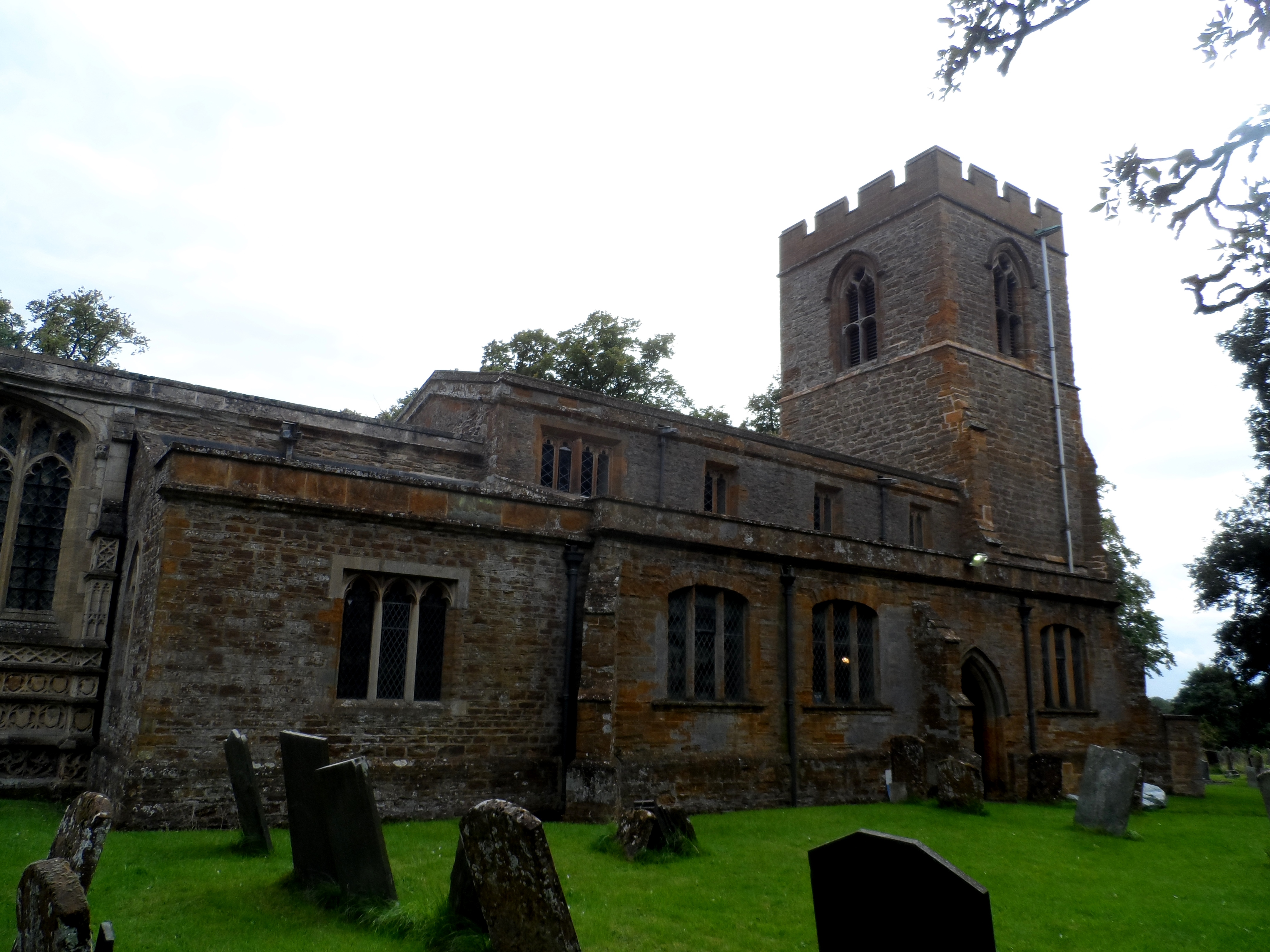
St Michael & All Angels' Church, Winwick

St Michael & All Angels' Church is an Anglican Church and the parish church of Winwick, Northamptonshire. It is a Grade II* listed building. There was...

Winwick, Northamptonshire

Winwick is a small village, a lost settlement and civil parish in West Northamptonshire in England. The modern settlement is north of West Haddon. A 16th...

Elkington, Northamptonshire

Elkington is a hamlet and civil parish in the West Northamptonshire in England. The villages name means 'Elta's hill' or perhaps, less likely, 'swan hill...

Yelvertoft

Yelvertoft is a village and civil parish in West Northamptonshire unitary authority in the county of Northamptonshire, England. At the time of the 2001...

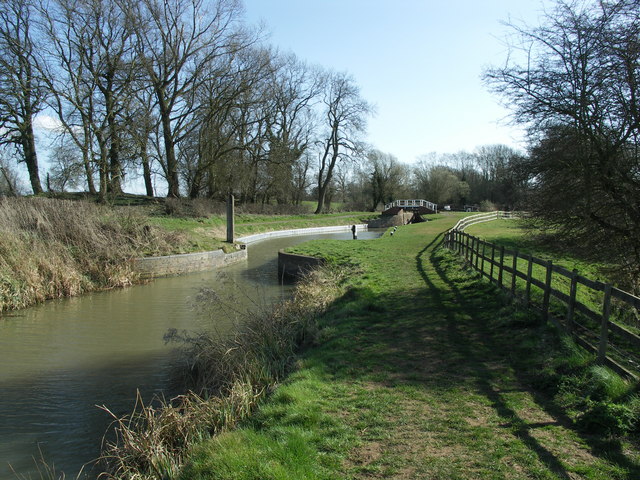
Grand Union Canal (old)

The Grand Union Canal was a canal in England from Foxton, Leicestershire on the Leicestershire and Northamptonshire Union Canal to Norton Junction, close...
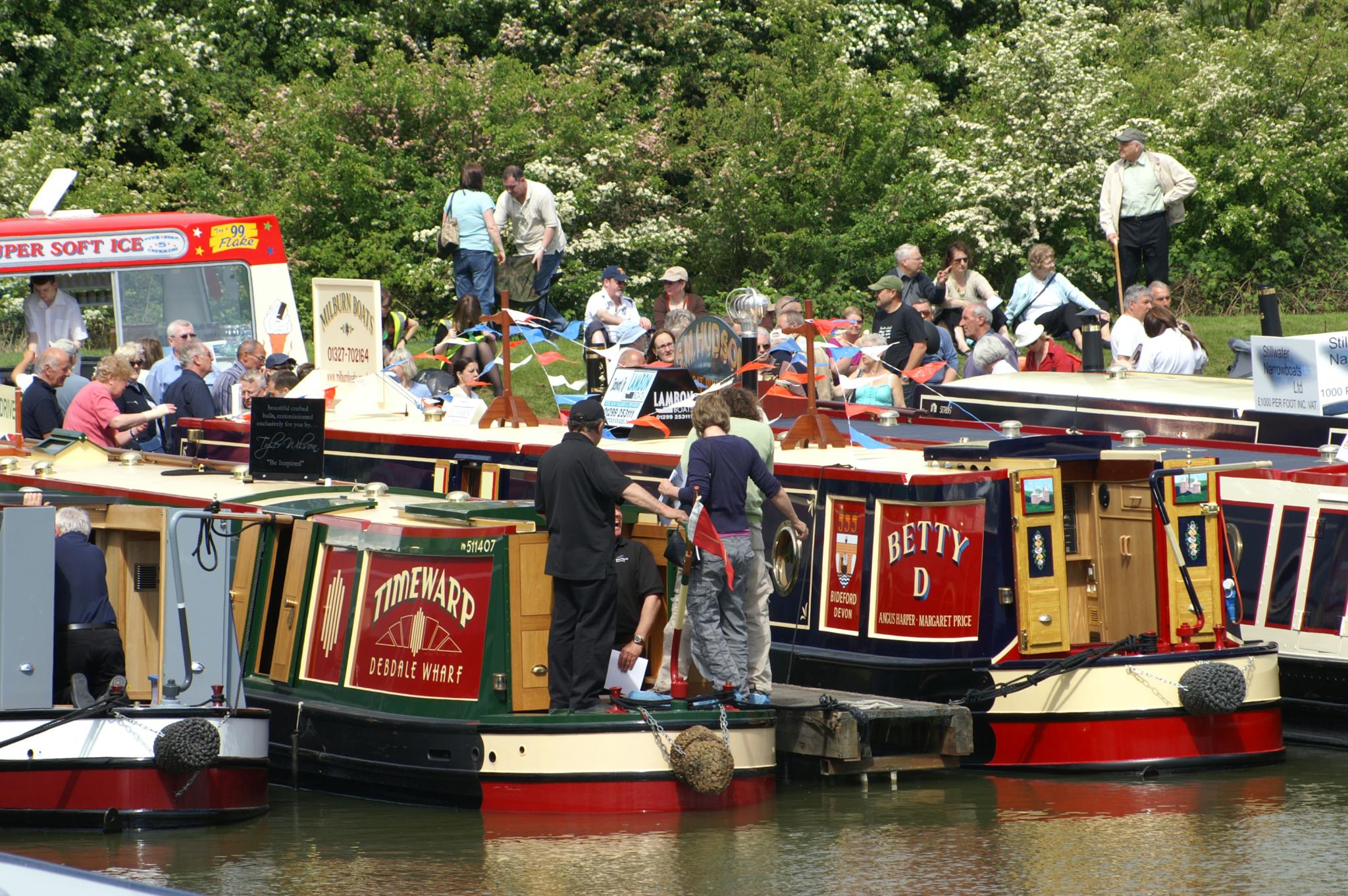
Crick Boat Show

The Crick Boat Show & Waterways Festival is an event that has been held annually at Crick Marina in Northamptonshire, England, since its inception in 2000...

All Saints' Church, West Haddon

All Saints' Church is an Anglican church and the parish church of West Haddon, Northamptonshire. It is a Grade I listed building and stands on the north...

Nearby Amenities

Located within 500m of 52.369345,-1.0900103
Power: pole
Lat/Long: 52.3658823/-1.0866313
Power: pole
Lat/Long: 52.366273/-1.0880984
Power: pole
Lat/Long: 52.3667217/-1.0898151
Power: pole
Lat/Long: 52.3670059/-1.090896
Power: pole
Lat/Long: 52.3674472/-1.092398
Power: pole
Lat/Long: 52.3679427/-1.0941052
Power: pole
Lat/Long: 52.3682784/-1.0953699
Power: pole
Lat/Long: 52.3687009/-1.0968518
The data included in this document is from www.openstreetmap.org. The data is made available under ODbL.

Have you been to Larch Spinney?

Leave your review of Larch Spinney below (or comments, questions and feedback).