Back Wood

Wood, Forest in Yorkshire

England

Back Wood

Mother Drain A walk around Potteric Carr nature reserve.
Mother Drain Credit: steven ruffles

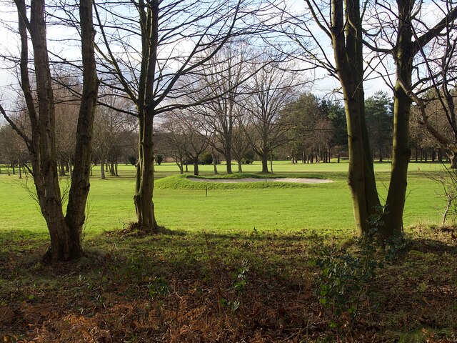
Back Wood, Yorkshire is a picturesque region located in the northern part of England. Situated in the county of Yorkshire, it is renowned for its abundant forests and woodlands, offering visitors a serene and natural escape from the bustling city life. Back Wood is a well-preserved area, rich in biodiversity and known for its stunning landscapes.

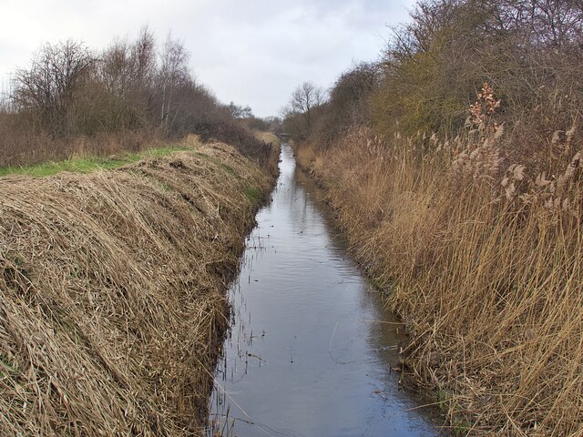
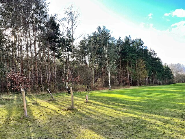
Covering a vast area, the woodlands of Back Wood are home to a plethora of flora and fauna species. Majestic oak, beech, and pine trees dominate the landscape, providing a haven for various wildlife such as deer, rabbits, and a wide array of bird species. It is a popular destination for nature enthusiasts, birdwatchers, and photographers due to its diverse ecosystem.

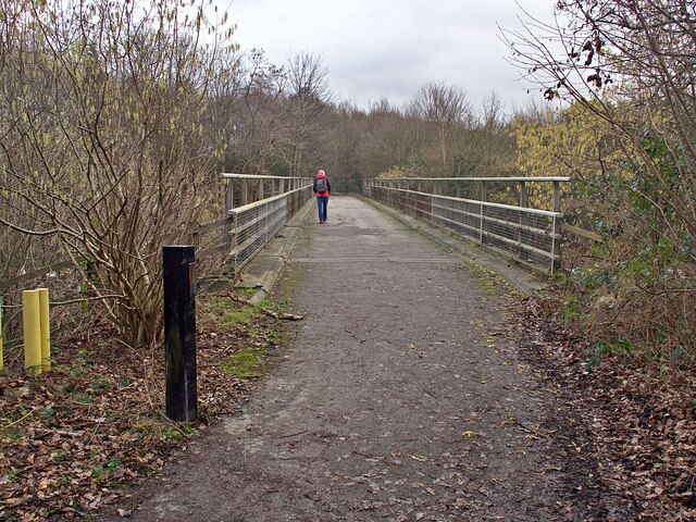
The woodlands of Back Wood offer numerous recreational activities for visitors. Walking trails meander through the forest, allowing for leisurely hikes and opportunities to explore the surroundings. Additionally, the region offers camping facilities, enabling visitors to immerse themselves in the tranquility of nature. The woodlands are also suitable for picnics, providing a perfect setting for families and friends to enjoy a day out.

Back Wood is well-connected to nearby towns and villages, making it easily accessible for visitors. The region has a rich history, with evidence of human habitation dating back centuries. Local folklore and legends add an air of mystery and intrigue to the area, further captivating visitors.

Overall, Back Wood, Yorkshire is a natural haven, offering a peaceful retreat for those seeking solace in the beauty of nature. With its diverse wildlife, scenic landscapes, and recreational activities, it is an ideal destination for anyone looking to escape the hustle and bustle of everyday life.

If you have any feedback on the listing, please let us know in the comments section below.

Back Wood Images

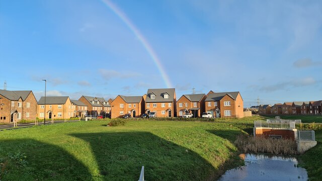
Images are sourced within 2km of 53.492367/-1.0700421 or Grid Reference SK6199. Thanks to Geograph Open Source API. All images are credited.

Mother Drain A walk around Potteric Carr nature reserve.
Mother Drain
A walk around Potteric Carr nature reserve.
View from Roger Mitchell Hide, Potteric Carr
Rainbow over Pheasant Hill Park From Harworth Plc's website "The building of new homes on the former Rossington colliery site – now known as Pheasant Hill Park – forms a key part of a wider ‘Gateway to the Sheffield City region’ programme that is a game-changing proposition for Yorkshire’s economy." See; <span class="nowrap"><a title="https://harworthgroup.com/projects/pheasant-hill-park/" rel="nofollow ugc noopener" href="https://harworthgroup.com/projects/pheasant-hill-park/">Link</a><img style="margin-left:2px;" alt="External link" title="External link - shift click to open in new window" src="https://s1.geograph.org.uk/img/external.png" width="10" height="10"/></span>

Making more from property development than coal.
Rainbow over Pheasant Hill Park
From Harworth Plc's website "The building of new homes on the former Rossington colliery site – now known as Pheasant Hill Park – forms a key part of a wider ‘Gateway to the Sheffield City region’ programme that is a game-changing proposition for Yorkshire’s economy." See; LinkExternal link Making more from property development than coal.
Entrance to Rossington St Michael's C of E Primary School
Bridleway to the north of Rossington The delightfully named Toad Holes Lane.
Bridleway to the north of Rossington
The delightfully named Toad Holes Lane.
Bunker on the Warren Golf Course
Church of St Michael Grade II* listed parish church dating from the 12th century.
Church of St Michael
Grade II* listed parish church dating from the 12th century.
Vulcan sculpture  These plant-filled sculptures of Vulcan bombers are on a roundabout on the A6182 Great Yorkshire Way. They commemorate the aeroplanes of 101 Squadron which was based at nearby RAF Finningley (now Doncaster Sheffield Airport).
Vulcan sculpture
These plant-filled sculptures of Vulcan bombers are on a roundabout on the A6182 Great Yorkshire Way. They commemorate the aeroplanes of 101 Squadron which was based at nearby RAF Finningley (now Doncaster Sheffield Airport).
Vulcan sculpture These plant-filled sculptures of Vulcan bombers are on a roundabout on the A6182 Great Yorkshire Way. They commemorate the aeroplanes of 101 Squadron which was based at nearby RAF Finningley (now Doncaster Sheffield Airport).
Vulcan sculpture
These plant-filled sculptures of Vulcan bombers are on a roundabout on the A6182 Great Yorkshire Way. They commemorate the aeroplanes of 101 Squadron which was based at nearby RAF Finningley (now Doncaster Sheffield Airport).
Vulcan bomber sculpture (detail) Two of the six plant-filled sculptures of Vulcan bombers on a roundabout on the A6182 Great Yorkshire Way. They commemorate the aeroplanes of 101 Squadron which was based at nearby RAF Finningley (now Doncaster Sheffield Airport).
Vulcan bomber sculpture (detail)
Two of the six plant-filled sculptures of Vulcan bombers on a roundabout on the A6182 Great Yorkshire Way. They commemorate the aeroplanes of 101 Squadron which was based at nearby RAF Finningley (now Doncaster Sheffield Airport).
Rusty footbridge over the River Torne
Rainbow over Pheasant Hill Park A new housing development on the former Rossington colliery site.
Rainbow over Pheasant Hill Park
A new housing development on the former Rossington colliery site.
Floral tributes in St Michael's Churchyard
Mother Drain Looking northwest from a bridleway bridge.
Mother Drain
Looking northwest from a bridleway bridge.
Motorway footbridge Over the M18 near Rossington
Motorway footbridge
Over the M18 near Rossington
Trees and shadows At the southern edge of The Warren golf course
Trees and shadows
At the southern edge of The Warren golf course
Mother Drain Viewed from a footbridge <a href="https://www.geograph.org.uk/photo/7383270">SK6299 : Mother Drain footbridge</a> looking north east towards Rossington Bridge.
Mother Drain
Viewed from a footbridge SK6299 : Mother Drain footbridge looking north east towards Rossington Bridge.
Mother Drain footbridge
Show me another place!

Back Wood is located at Grid Ref: SK6199 (Lat: 53.492367, Lng: -1.0700421)

Division: West Riding

Unitary Authority: Doncaster

Police Authority: South Yorkshire

What 3 Words

///encloses.dandelions.closed. Near Cantley, South Yorkshire

Nearby Locations

Back Wood

Related Wikis

Bessacarr Halt railway station

Bessacarr railway halt was a small halt on the Great Northern and Great Eastern Joint Railway in the suburbs of Doncaster, South Yorkshire, England. It...

Rossington Main F.C.

Rossington Main Football Club is an English football club based in Rossington, Doncaster, South Yorkshire. They play in the Northern Counties East League...

Doncaster Rovers Belles L.F.C.

Doncaster Rovers Belles Ladies Football Club, previously Doncaster Belles, is an English women's football club that currently plays in the FA Women's National...

St Wilfrid's Church, Cantley

St Wilfrid's Cantley is a Grade II* listed church in Doncaster in South Yorkshire, England, and serves as the parish church for the areas of Cantley, Bessacarr...

Nearby Amenities

Located within 500m of 53.492367,-1.0700421
Bus Stop
Bawtry Road/Plumpton Park Road
Naptan AtcoCode: 370040389
Naptan Bearing: SE
Naptan CommonName: Bawtry Road/Plumpton Park Road
Naptan Indicator: 40389
Naptan Landmark: 40389
Naptan PlusbusZoneRef: ROTHCEN
Naptan Street: Bawtry Road
Naptan Verified: no
Shelter: yes
Source: naptan_import
Lat/Long: 53.4958908/-1.0663744
Bus Stop
Bawtry Road/Warren Lane
Alt Name: Bawtry Road/Warren Lane
Naptan AltCommonName: Bawtry Road/Warren Lane
Naptan AtcoCode: 370045181
Naptan Bearing: NW
Naptan CommonName: Bawtry Road/Warren Lane
Naptan Indicator: 45181
Naptan Landmark: Dunniwood Lodge
Naptan PlusbusZoneRef: ROTHCEN
Naptan Street: Bawtry Road
Naptan Verified: no
Shelter: yes
Source: naptan_import
Lat/Long: 53.4965444/-1.0683499
Railway: level_crossing
Lat/Long: 53.495831/-1.0748668
Crossing Barrier: no
Crossing Bell: no
Railway: level_crossing
Lat/Long: 53.4957993/-1.0748279
Barrier: motorcycle_barrier
Lat/Long: 53.4949598/-1.068602
Noexit: yes
Lat/Long: 53.4917559/-1.0746323
Generator Method: photovoltaic
Generator Output Electricity: yes
Generator Source: solar
Generator Type: solar_photovoltaic_panel
Location: roof
Power: generator
Lat/Long: 53.496419/-1.07282
Generator Method: photovoltaic
Generator Output Electricity: yes
Generator Source: solar
Generator Type: solar_photovoltaic_panel
Location: roof
Power: generator
Lat/Long: 53.4961477/-1.0738956
Generator Method: photovoltaic
Generator Output Electricity: yes
Generator Source: solar
Generator Type: solar_photovoltaic_panel
Location: roof
Power: generator
Lat/Long: 53.49606/-1.0725947
Generator Method: photovoltaic
Generator Output Electricity: yes
Generator Source: solar
Generator Type: solar_photovoltaic_panel
Location: roof
Power: generator
Lat/Long: 53.4961567/-1.0684754
Generator Method: photovoltaic
Generator Output Electricity: yes
Generator Source: solar
Generator Type: solar_photovoltaic_panel
Location: roof
Power: generator
Lat/Long: 53.4960912/-1.0685585
Generator Method: photovoltaic
Generator Output Electricity: yes
Generator Source: solar
Generator Type: solar_photovoltaic_panel
Location: roof
Power: generator
Lat/Long: 53.4961232/-1.0734549
Generator Method: photovoltaic
Generator Output Electricity: yes
Generator Source: solar
Generator Type: solar_photovoltaic_panel
Location: roof
Power: generator
Lat/Long: 53.4961327/-1.0736856
Generator Method: photovoltaic
Generator Output Electricity: yes
Generator Source: solar
Generator Type: solar_photovoltaic_panel
Location: roof
Power: generator
Lat/Long: 53.4960386/-1.0703141
Generator Method: photovoltaic
Generator Output Electricity: yes
Generator Source: solar
Generator Type: solar_photovoltaic_panel
Location: roof
Power: generator
Lat/Long: 53.4964534/-1.06996
The data included in this document is from www.openstreetmap.org. The data is made available under ODbL.

Have you been to Back Wood?

Leave your review of Back Wood below (or comments, questions and feedback).