Budby Carr

Wood, Forest in Nottinghamshire Newark and Sherwood

England

Budby Carr

RSPB welcome sign Budby South Forest.
RSPB welcome sign Credit: David Lally

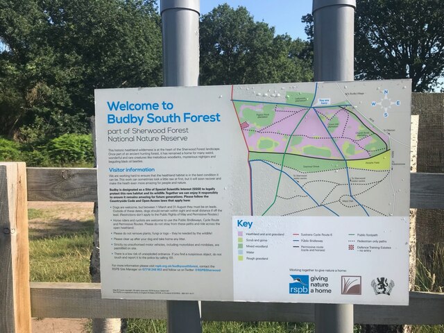
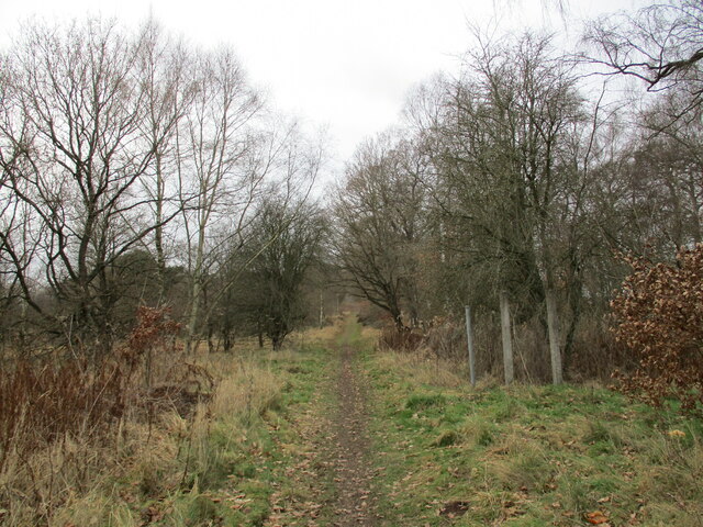
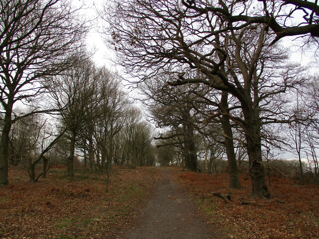
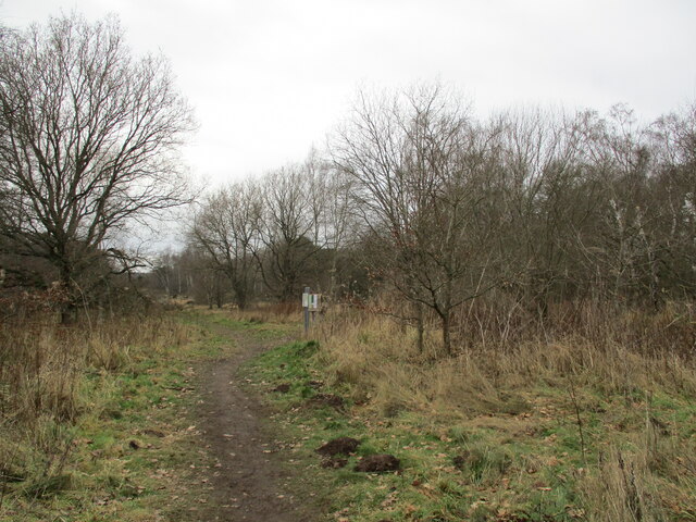
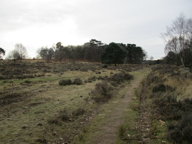
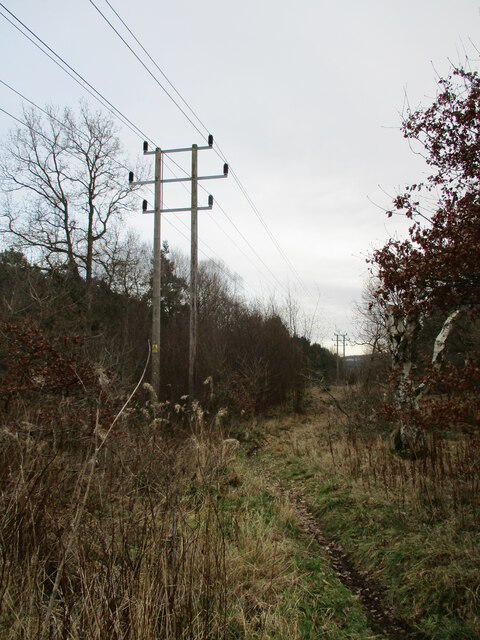
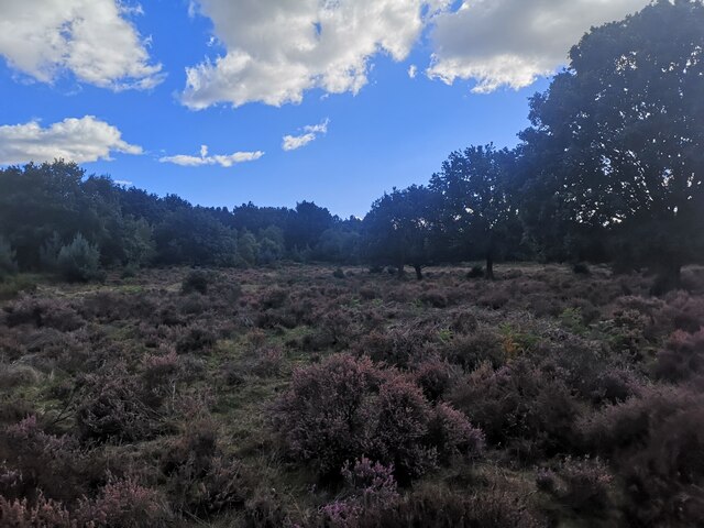
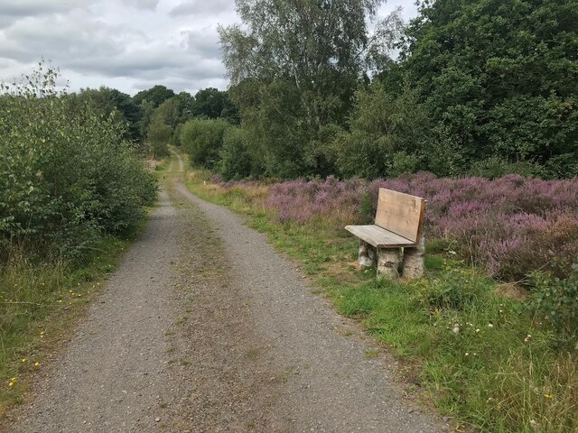
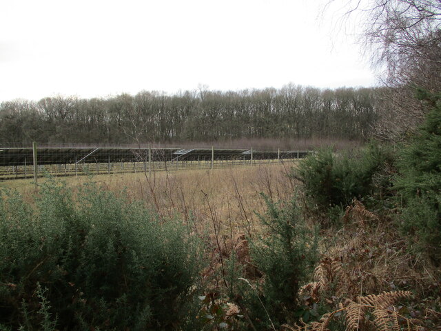
Budby Carr is a nature reserve located in Nottinghamshire, England. It is part of the Sherwood Forest and covers an area of approximately 320 hectares. Budby Carr is known for its ancient woodland and wetland habitats, making it an important site for biodiversity conservation.

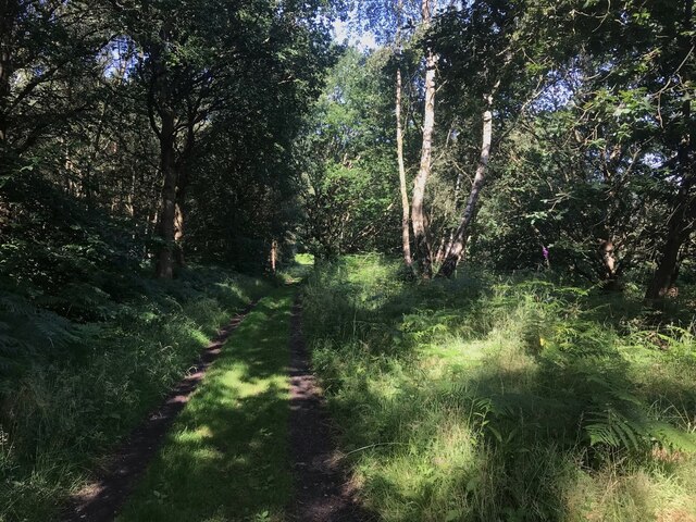
The reserve is characterized by its diverse range of plant and animal species. The woodland consists primarily of oak and birch trees, with an understory of ferns, mosses, and wildflowers. It provides a haven for various bird species, including woodpeckers, owls, and warblers. Bird enthusiasts can spot a variety of species here, especially during the breeding season.

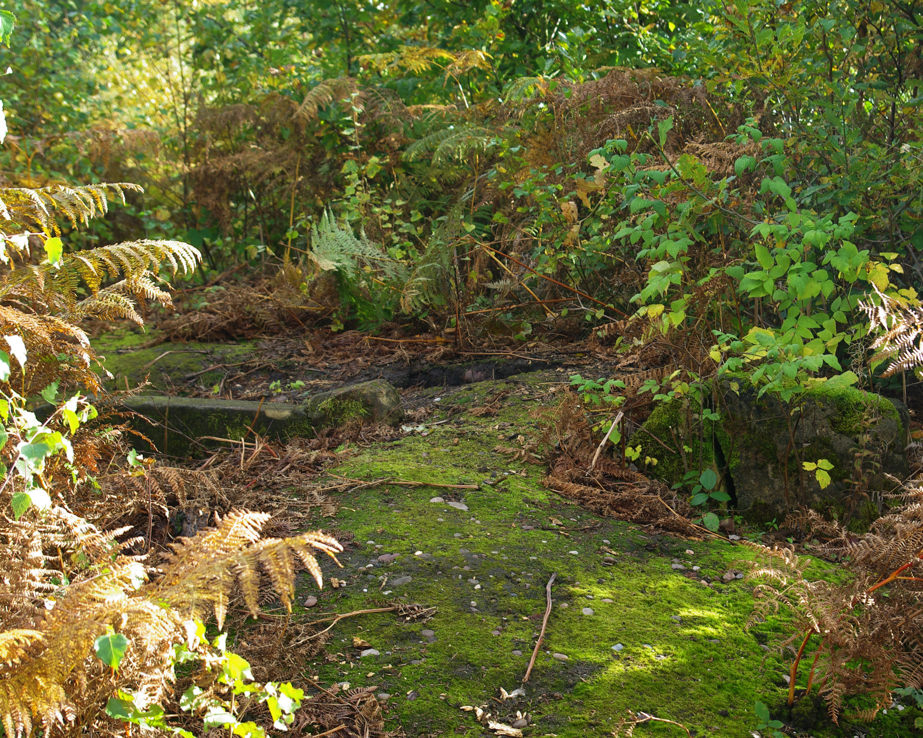
The wetland area of Budby Carr is home to a wide range of aquatic plants, such as water lilies and reeds. This habitat attracts numerous amphibians and insects, including frogs, newts, and dragonflies. Visitors can observe these creatures in their natural habitat by walking along the designated trails and boardwalks that wind through the reserve.

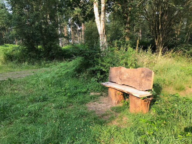
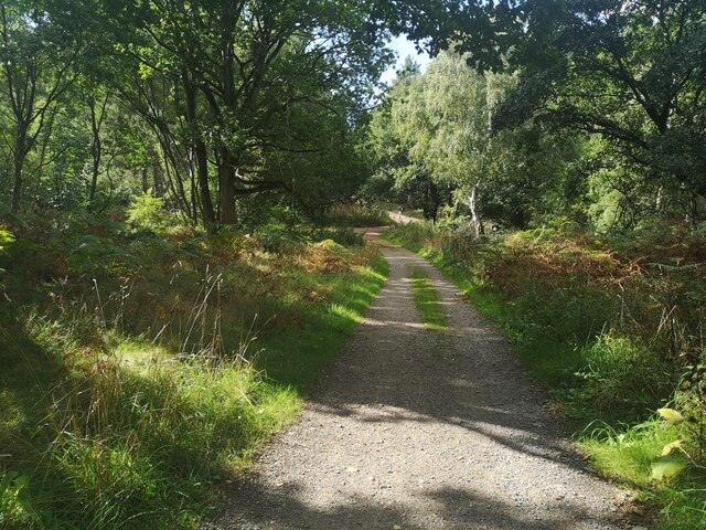
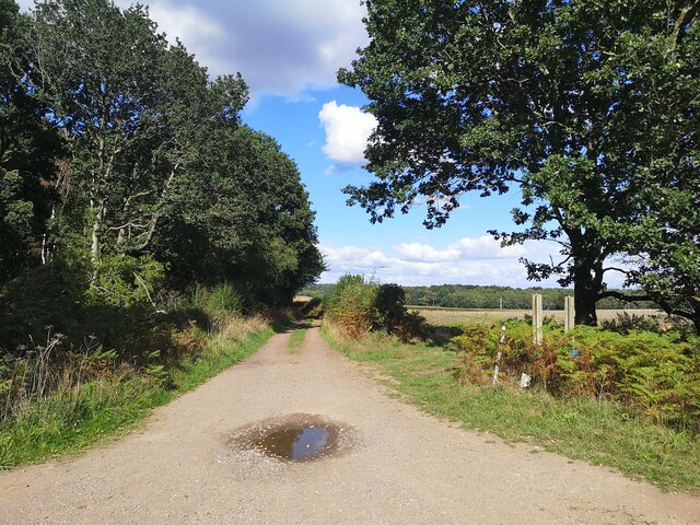
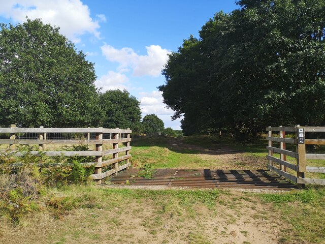
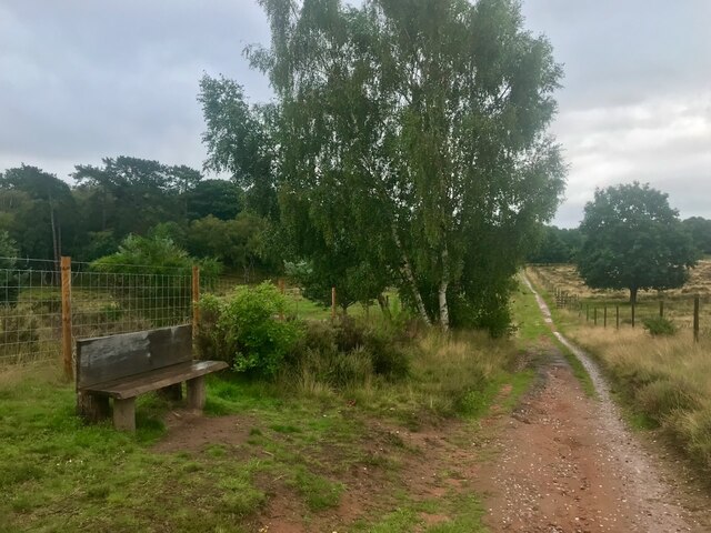
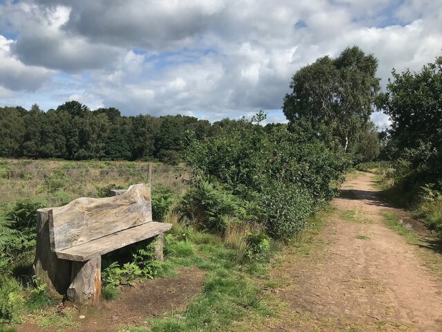
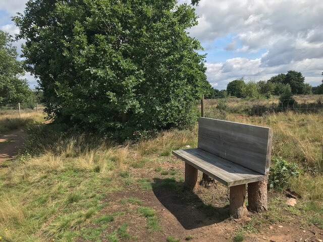
Budby Carr also offers opportunities for recreational activities, such as walking, picnicking, and nature photography. There are well-maintained paths throughout the reserve, allowing visitors to explore its diverse landscapes and enjoy the tranquility of the forest. Interpretive signs provide information about the flora and fauna, enhancing the educational experience for visitors of all ages.

Overall, Budby Carr is a remarkable nature reserve that showcases the beauty and importance of woodlands and wetlands. Its rich biodiversity and accessible trails make it an ideal destination for nature lovers and those seeking a peaceful retreat in the heart of Nottinghamshire.

If you have any feedback on the listing, please let us know in the comments section below.

Budby Carr Images

Images are sourced within 2km of 53.226673/-1.0923446 or Grid Reference SK6070. Thanks to Geograph Open Source API. All images are credited.

RSPB welcome sign Budby South Forest.
RSPB welcome sign
Budby South Forest.
Wooded track Follows the margin between the open heath of Budby South Forest and the wooded area around the Sherwood Forest Visitor Centre, centring on the Major Oak.
Wooded track
Follows the margin between the open heath of Budby South Forest and the wooded area around the Sherwood Forest Visitor Centre, centring on the Major Oak.
Rustic bench
Rustic bench
Naturism sign The area around Budby South Forest is a popular area for naturist walking.  After some discussions, in particular with a local man who has walked naked in this area for many years, these signs have been put up.

I was not complying with the last of these requests at the time of taking this photo as I was only carrying my car key and phone!
Naturism sign
The area around Budby South Forest is a popular area for naturist walking. After some discussions, in particular with a local man who has walked naked in this area for many years, these signs have been put up. I was not complying with the last of these requests at the time of taking this photo as I was only carrying my car key and phone!
Bridleway to Church Warsop Budby South Forest.
Bridleway to Church Warsop
Budby South Forest.
Bridleway to Church Warsop Budby South Forest.
Bridleway to Church Warsop
Budby South Forest.
Path in Budby South Forest Connects with several other paths in the area between Edwinstow and Budby.
Path in Budby South Forest
Connects with several other paths in the area between Edwinstow and Budby.
Heathland, Budby South Forest
Power line, Budby South Forest
Path Junction in Budby South Forest
Track towards Budby
Track towards Budby
Cattle Grid in Budby South Forest
Heathland in Budby South Forest There are some English Longhorn cattle grazing on here which look intimidating. They let me pass without incident.
Heathland in Budby South Forest
There are some English Longhorn cattle grazing on here which look intimidating. They let me pass without incident.
Bench beside a bridleway On the RSPB Budby South Forest reserve.
Bench beside a bridleway
On the RSPB Budby South Forest reserve.
Bench beside a public footpath On the RSPB Budby South Forest reserve.
Bench beside a public footpath
On the RSPB Budby South Forest reserve.
Bench beside a public footpath On the RSPB Budby South Forest reserve.
Bench beside a public footpath
On the RSPB Budby South Forest reserve.
Bench beside a track Just outside the fenced area of the RSPB Budby South Forest reserve.
Bench beside a track
Just outside the fenced area of the RSPB Budby South Forest reserve.
Solar Farm, Budby North Forest
Show me another place!

Budby Carr is located at Grid Ref: SK6070 (Lat: 53.226673, Lng: -1.0923446)

Administrative County: Nottinghamshire

District: Newark and Sherwood

Police Authority: Nottinghamshire

What 3 Words

///sues.flamingo.reserves. Near Edwinstowe, Nottinghamshire

Related Wikis

Budby

Budby is a hamlet and former civil parish, now in the parish of Perlethorpe cum Budby, in the Newark and Sherwood district, in the county of Nottinghamshire...

Thynghowe

Thynghowe was an important Viking Era open-air assembly place or thing, located at Sherwood Forest, in Nottinghamshire, England. It was lost to history...

Meden Vale

Meden Vale is a small former coal mining village originally known as Welbeck Colliery Village prior to renaming in the late 1960s.It is situated close...

Major Oak

The Major Oak is a large English oak (Quercus robur) near the village of Edwinstowe in the midst of Sherwood Forest, Nottinghamshire, England. According...

Sherwood Forest

Sherwood Forest is a royal forest in Nottinghamshire, England. Its peculiar fame arises from its historic association with the legend of Robin Hood. The...

Carburton

Carburton or Carberton is a small village on the west side of Clumber within the Bassetlaw district of Nottinghamshire, England. It is primarily rural...

St Giles Church, Carburton

St Giles Church is a redundant Anglican church in Carburton, Nottinghamshire. == History == The church is an unusual shape and dates back to the early...

The Royal Lancers and Nottinghamshire Yeomanry Museum

The Royal Lancers & Nottinghamshire Yeomanry Museum traces the history of three old and famous cavalry regiments, the Royal Lancers, the Sherwood Rangers...

Nearby Amenities

Located within 500m of 53.226673,-1.0923446
Power: pole
Source: Bing
Lat/Long: 53.2227432/-1.0909617
Power: pole
Source: Bing
Lat/Long: 53.223347/-1.0920773
Power: pole
Source: Bing
Lat/Long: 53.2239444/-1.0931394
Power: pole
Source: Bing
Lat/Long: 53.2247138/-1.0945182
Power: pole
Source: Bing
Lat/Long: 53.2251592/-1.0928859
Power: pole
Source: Bing
Lat/Long: 53.2254377/-1.0944537
Power: pole
Source: Bing
Lat/Long: 53.2245975/-1.0897035
Power: pole
Source: Bing
Lat/Long: 53.2256627/-1.095701
Power: pole
Source: Bing
Lat/Long: 53.2248725/-1.091348
Power: pole
Source: Bing
Lat/Long: 53.2253382/-1.0957895
Barrier: cycle_barrier
Lat/Long: 53.2282959/-1.0958333
Power: pole
Lat/Long: 53.2253729/-1.0971132
Power: pole
Lat/Long: 53.2262422/-1.0995582
Power: pole
Lat/Long: 53.227061/-1.0991612
Power: pole
Lat/Long: 53.2260984/-1.0979982
Power: pole
Lat/Long: 53.2266098/-1.0986007
Power: pole
Lat/Long: 53.2256392/-1.097325
Power: pole
Lat/Long: 53.2245079/-1.0881023
Power: pole
Lat/Long: 53.2244164/-1.0864474
Power: pole
Lat/Long: 53.225465/-1.0956984
The data included in this document is from www.openstreetmap.org. The data is made available under ODbL.

Have you been to Budby Carr?

Leave your review of Budby Carr below (or comments, questions and feedback).