Ashclose Spinney
Wood, Forest in Leicestershire
England
Ashclose Spinney
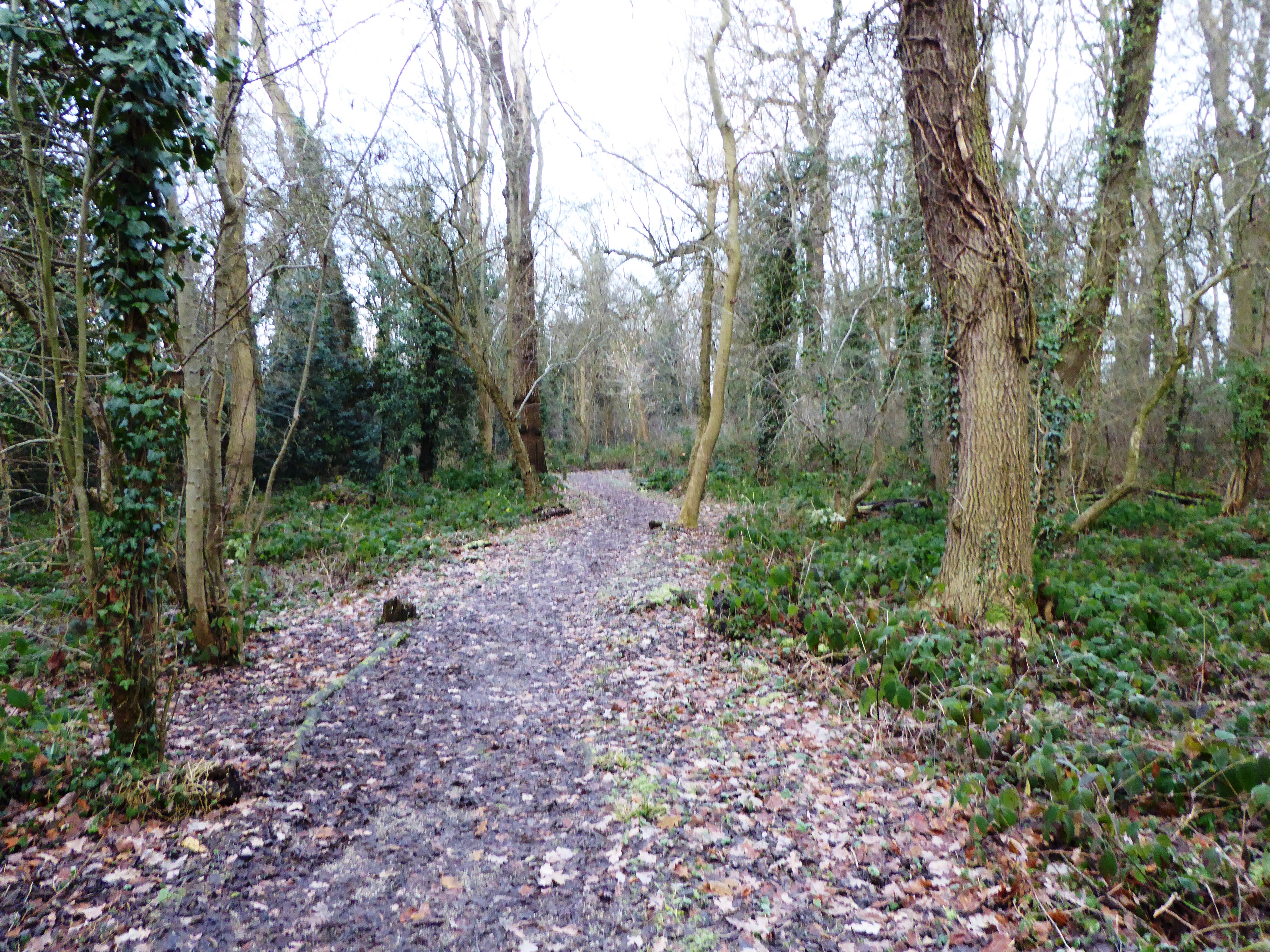
Ashclose Spinney is a small woodland area located in Leicestershire, England. It is situated in the rural village of Ashby-de-la-Zouch, known for its picturesque countryside and historic architecture. The spinney covers an area of approximately 5 acres and is predominantly made up of ash trees, hence its name.
The woodland is a popular spot for nature enthusiasts and walkers, offering a peaceful and tranquil atmosphere. It provides a habitat for a variety of wildlife, including birds, squirrels, and small mammals. The diverse flora within the spinney includes bluebells, wild garlic, and wood anemones, creating a vibrant display during springtime.
The spinney is crisscrossed by a network of well-maintained footpaths, providing visitors with easy access to explore the area. The paths wind their way through the trees, allowing visitors to immerse themselves in the natural beauty of the woodland. The peaceful ambiance and the sounds of birdsong make it an ideal place for individuals seeking tranquility and respite from the hustle and bustle of daily life.
Ashclose Spinney is also a designated site of local importance for nature conservation. Efforts have been made to protect and preserve the woodland, ensuring the continued survival of the diverse range of flora and fauna that call it home. This commitment to conservation has made Ashclose Spinney a valuable asset to the local community and a place of interest for visitors to Leicestershire who appreciate the beauty of nature.
If you have any feedback on the listing, please let us know in the comments section below.
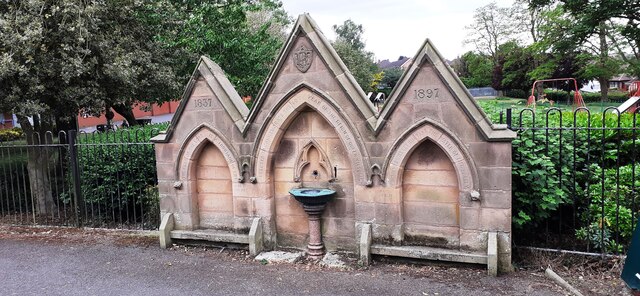
Ashclose Spinney Images
Images are sourced within 2km of 52.603799/-1.1109712 or Grid Reference SK6001. Thanks to Geograph Open Source API. All images are credited.


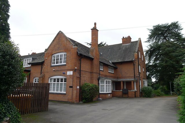
![32 Ratcliffe Road, Knighton, Leicester Listed Grade &quot; ... II* House with coach house and stabling range. 1892 by Ernest Gimson for himself ... A fine house by this eminent Arts and Crafts architect with virtually unaltered interior retaining many features of interest.&quot; <span class="nowrap"><a title="https://historicengland.org.uk/listing/the-list/list-entry/1074805" rel="nofollow ugc noopener" href="https://historicengland.org.uk/listing/the-list/list-entry/1074805">Link</a><img style="margin-left:2px;" alt="External link" title="External link - shift click to open in new window" src="https://s1.geograph.org.uk/img/external.png" width="10" height="10"/></span>
Nikolaus Pevsner called Gimson &quot;the greatest of the English architect-designers&quot; [Wiki], but I don&#039;t find this building at all attractive.](https://s1.geograph.org.uk/geophotos/06/99/75/6997561_8c86b6bf.jpg)
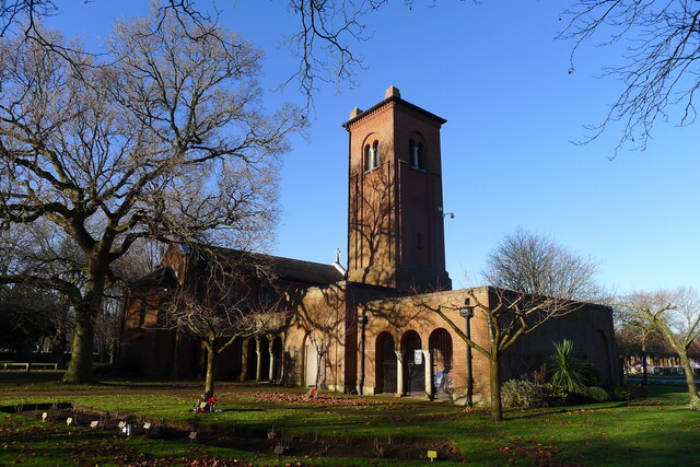
![Church of St Thomas More, Knighton Road, Leicester &quot;A good example of a mid 20th century Catholic church designed by the Manchester-based ecclesiastical architects Reynolds &amp; Scott, who built a great number of Catholic churches in the post-war years. The church was built in 1950-52 by the builders G. Duxbury &amp; Sons and is a buff brick building in a stripped back Italianate style, with a broad west tower that dominates the streetscene, it is a local landmark.&quot; [Local Heritage Asset Register, Leicester City Council]](https://s1.geograph.org.uk/geophotos/06/99/77/6997749_2c5908e9.jpg)

Ashclose Spinney is located at Grid Ref: SK6001 (Lat: 52.603799, Lng: -1.1109712)
Unitary Authority: Leicester
Police Authority: Leicestershire
What 3 Words
///hands.gent.locals. Near Oadby, Leicestershire
Nearby Locations
Related Wikis
Knighton Spinney
Knighton Spinney is a 2.9-hectare (7.2-acre) Local Nature Reserve in Leicester. It is owned by Leicester City Council and managed by Environ for the council...
Knighton, Leicester
Knighton is a residential suburban area of Leicester, in the Leicester district, in the ceremonial county of Leicestershire, England. It situated between...

Sir Jonathan North College
Sir Jonathan North College is an all-girls secondary school located in Leicester, England. == History == It was founded in 1904 by Rev. David Field, a...
Leicester High School for Girls
Leicester High School for Girls also known as 'LHS' is an independent day school for girls aged 3–18 situated in South Knighton, Leicester. It was originally...
West Knighton, Leicester
West Knighton is a community in Leicester in the United Kingdom. West Knighton's boundaries include Knighton Fields Road East to the North, Welford Road...
Lancaster Academy
Lancaster Academy is a co-educational secondary school located in Knighton, Leicester, England. == History == On 1 September 2000 Lancaster School acquired...
Leicester Racecourse
Leicester Racecourse is a horse racing course in Oadby, Leicestershire, about three miles south of the city centre. == History of horse racing in Leicester... ==
Wigston Fields
Wigston Fields is a district of the borough of Oadby and Wigston in Leicestershire, England. It lies between Leicester and the town of Wigston on the A5199...
Nearby Amenities
Located within 500m of 52.603799,-1.1109712Have you been to Ashclose Spinney?
Leave your review of Ashclose Spinney below (or comments, questions and feedback).