Dunsford
Settlement in Surrey Waverley
England
Dunsford

Dunsford is a small village located in the county of Surrey, England. Situated about 20 miles southwest of London, it falls under the administrative district of Mole Valley. With a population of around 800 residents, Dunsford maintains a close-knit and peaceful community atmosphere.
The village is characterized by its picturesque countryside setting, surrounded by rolling hills, lush green fields, and dense woodlands. It offers a tranquil escape from the hustle and bustle of city life, making it an attractive destination for nature lovers and those seeking a rural lifestyle.
Dunsford is home to a number of historic buildings and landmarks, including St. Mary's Church, a beautiful example of medieval architecture. The village also boasts a local pub, The Dunsford Arms, which serves as a gathering spot for residents and visitors alike.
While Dunsford may be small in size, it is well-connected to larger towns and cities in the region. The nearby town of Leatherhead provides convenient access to various amenities, such as shops, supermarkets, and healthcare facilities. Additionally, the village benefits from excellent transport links, with the A24 road passing through the area, connecting it to London and other major cities.
Overall, Dunsford offers a peaceful and idyllic setting, making it an attractive place to live for those seeking a countryside lifestyle with easy access to urban amenities.
If you have any feedback on the listing, please let us know in the comments section below.
Dunsford Images
Images are sourced within 2km of 51.114576/-0.5727489 or Grid Reference TQ0036. Thanks to Geograph Open Source API. All images are credited.


Dunsford is located at Grid Ref: TQ0036 (Lat: 51.114576, Lng: -0.5727489)
Administrative County: Surrey
District: Waverley
Police Authority: Surrey
What 3 Words
///piglets.client.awards. Near Chiddingfold, Surrey
Nearby Locations
Related Wikis

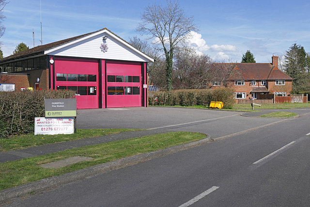
Dunsfold
Dunsfold is a village in the borough of Waverley, Surrey, England, 8.7 miles (14.0 kilometres) south of Guildford. It lies in the Weald and reaches in...

Top Gear test track
The Top Gear test track is used by the BBC automotive television programme Top Gear. It is located at Dunsfold Aerodrome in Surrey, United Kingdom. The...

Fir Tree Copse
Fir Tree Copse is a 6-hectare (15-acre) nature reserve south-east of Dunsfold in Surrey. It is managed by the Surrey Wildlife Trust and is part of the...

Hascombe Hill
Hascombe Hill or Hascombe Camp is the site of an Iron Age multivallate hill fort close to the village of Hascombe in Surrey, England. == History == The...

Dunsfold Aerodrome
Dunsfold Aerodrome (former ICAO code EGTD) is an unlicensed airfield in Surrey, England, near the village of Cranleigh. It extends across land in the villages...

Chiddingfold Forest
Chiddingfold Forest is a 542.5-hectare (1,341-acre) biological Site of Special Scientific Interest in Chiddingfold in Surrey and West Sussex. One part...

Wey and Arun Canal
The Wey and Arun Canal is a partially open, 23-mile-long (37 km) canal in the southeast of England. It runs southwards from the River Wey at Gunsmouth...

London to Portsmouth canal
The London to Portsmouth canal was a concept for the construction of a secure inland canal route from the British capital of London to the headquarters...
Nearby Amenities
Located within 500m of 51.114576,-0.5727489Have you been to Dunsford?
Leave your review of Dunsford below (or comments, questions and feedback).