Bridgford Covert

Wood, Forest in Nottinghamshire Rushcliffe

England

Bridgford Covert

Grantham Canal Recreating this 'First' for the square <a title="https://www.geograph.org.uk/photo/51950" href="https://www.geograph.org.uk/photo/51950">Link</a>
Grantham Canal Credit: Alan Murray-Rust

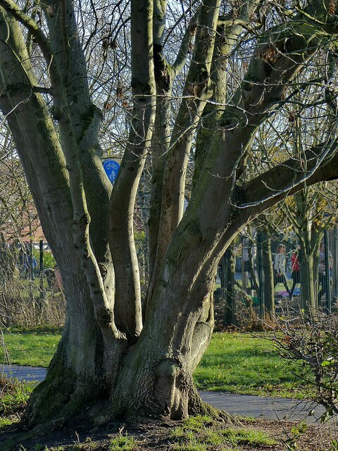
Bridgford Covert is a picturesque woodland located in Nottinghamshire, England. Situated in the heart of Sherwood Forest, this enchanting woodland covers an area of approximately 50 acres. It is known for its dense canopy of ancient oak and beech trees, creating a serene and tranquil atmosphere for visitors.

The woodland is home to a diverse range of flora and fauna, making it a popular spot for nature lovers and wildlife enthusiasts. The forest floor is adorned with a carpet of bluebells in the springtime, adding a touch of vibrant color to the surroundings. Visitors can also spot various species of birds, including woodpeckers and owls, as well as small mammals such as squirrels and rabbits.

Bridgford Covert offers several walking trails, allowing visitors to explore its natural beauty at their own pace. These well-maintained paths wind through the woodland, providing glimpses of ancient trees and hidden clearings along the way. The peacefulness of the surroundings makes it an ideal location for a leisurely stroll or a family picnic.

The woodland is also rich in history, with legends of Robin Hood and his Merry Men being associated with Sherwood Forest. Visitors can soak in the mythical atmosphere as they wander through the ancient trees, imagining the adventures that may have taken place in this very spot centuries ago.

Overall, Bridgford Covert is a delightful destination for those seeking a peaceful retreat amidst nature's beauty. Its stunning woodland, abundant wildlife, and historical significance make it a must-visit location in Nottinghamshire.

If you have any feedback on the listing, please let us know in the comments section below.

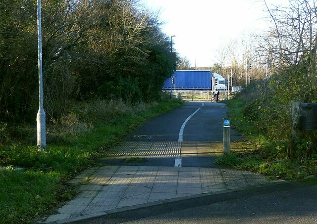
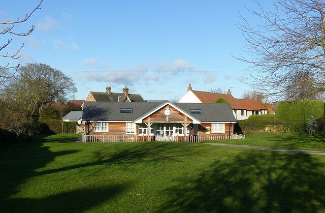
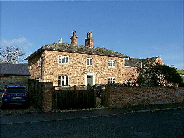
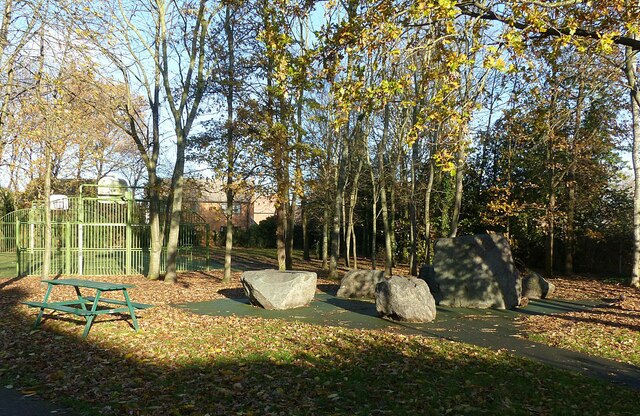
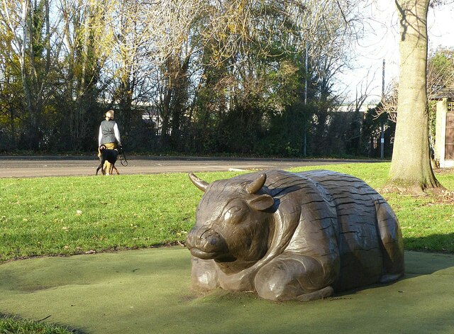
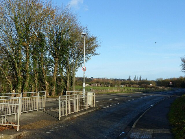
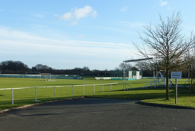
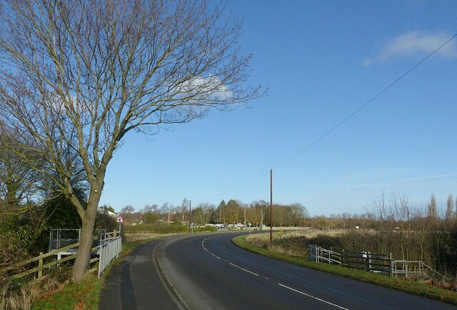
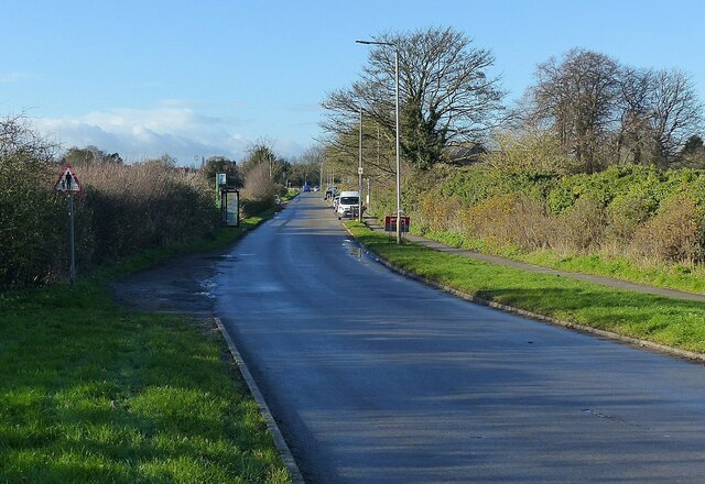
Bridgford Covert Images

Images are sourced within 2km of 52.921576/-1.1092968 or Grid Reference SK5936. Thanks to Geograph Open Source API. All images are credited.

Grantham Canal Recreating this 'First' for the square <a title="https://www.geograph.org.uk/photo/51950" href="https://www.geograph.org.uk/photo/51950">Link</a>
Grantham Canal
Recreating this 'First' for the square Link
I 'specs someone is missing these Abandoned spectacles alongside the Grantham Canal at Tollerton Road.
I 'specs someone is missing these
Abandoned spectacles alongside the Grantham Canal at Tollerton Road.
Gamston Cycleway Recreating this 'First' for the square <a title="https://www.geograph.org.uk/photo/51948" href="https://www.geograph.org.uk/photo/51948">Link</a>

This links Gamston and Nottingham with the Grantham Canal towpath. Here it follows the original line of Bassingfield Lane prior to the construction of the Lings Bar section of the A52.
Gamston Cycleway
Recreating this 'First' for the square Link This links Gamston and Nottingham with the Grantham Canal towpath. Here it follows the original line of Bassingfield Lane prior to the construction of the Lings Bar section of the A52.
Old Tollerton Road The heart of the small village of Gamston before the late 20th century housing estate was developed.
Old Tollerton Road
The heart of the small village of Gamston before the late 20th century housing estate was developed.
Telephone kiosk and fingerpost As with many such kiosks, it has been taken over by the parish council, in this instance as an information centre. The fingerpost is a traditional Nottinghamshire County Council style.
Telephone kiosk and fingerpost
As with many such kiosks, it has been taken over by the parish council, in this instance as an information centre. The fingerpost is a traditional Nottinghamshire County Council style.
Gamston Village Hall Timber building set in an attractive green.
Gamston Village Hall
Timber building set in an attractive green.
Gamston Village postbox, ref NG2 38 Standard VR wall box with wider mouth in typical projecting brickwork of the period.
Gamston Village postbox, ref NG2 38
Standard VR wall box with wider mouth in typical projecting brickwork of the period.
Hall Farmhouse, Gamston Brick and stone farmhouse dating from the 18th and 19th centuries, Listed Grade II.
Hall Farmhouse, Gamston
Brick and stone farmhouse dating from the 18th and 19th centuries, Listed Grade II.
Manor Farmhouse, Gamston An attractive early 19th century house, long divorced from any farming activity.
Manor Farmhouse, Gamston
An attractive early 19th century house, long divorced from any farming activity.
Stone circle, Gamston Nothing ancient about this; it forms part of the Ambleside Play Park.
Stone circle, Gamston
Nothing ancient about this; it forms part of the Ambleside Play Park.
Not a Raging Bull Timber sculpture in the Ambleside Play Park, Gamston.
Not a Raging Bull
Timber sculpture in the Ambleside Play Park, Gamston.
Regatta Way, West Bridgford The island provides a crossing point for the cycle route which changes sides at this point.
Regatta Way, West Bridgford
The island provides a crossing point for the cycle route which changes sides at this point.
Regatta Way Sports Club, West Bridgford A sign at the entrance shows that it is home to Gedling & Sherwood Cricket Club, West Bridgford Colts FC and Gedling Colliery Cricket Club and the Gamston Cricket Academy. There are three separate football grounds and two cricket grounds.
Regatta Way Sports Club, West Bridgford
A sign at the entrance shows that it is home to Gedling & Sherwood Cricket Club, West Bridgford Colts FC and Gedling Colliery Cricket Club and the Gamston Cricket Academy. There are three separate football grounds and two cricket grounds.
Regatta Way, West Bridgford Looking towards the junction with Adbolton Lane.
Regatta Way, West Bridgford
Looking towards the junction with Adbolton Lane.
Not the '25th Nottingham Marathon' Recreating this 'First' for the square <a title="https://www.geograph.org.uk/photo/51943" href="https://www.geograph.org.uk/photo/51943">Link</a> . The bus stop has been re-sited and provided with a shelter.
Not the '25th Nottingham Marathon'
Recreating this 'First' for the square Link . The bus stop has been re-sited and provided with a shelter.
'What I tell you three times is true' Following the dictum of the Bellman in Lewis Carroll's 'The Hunting of the Snark', this must be the Alphabet House Day Nursery.
'What I tell you three times is true'
Following the dictum of the Bellman in Lewis Carroll's 'The Hunting of the Snark', this must be the Alphabet House Day Nursery.
Ash tree alongside the Grantham Canal This looks to have regrown from the stump of a tree felled many years ago.
Ash tree alongside the Grantham Canal
This looks to have regrown from the stump of a tree felled many years ago.
New electric car charging point, Gamston retail centre Nearly ready to go into service.
New electric car charging point, Gamston retail centre
Nearly ready to go into service.
Show me another place!

Bridgford Covert is located at Grid Ref: SK5936 (Lat: 52.921576, Lng: -1.1092968)

Administrative County: Nottinghamshire

District: Rushcliffe

Police Authority: Nottinghamshire

What 3 Words

///taped.units.sage. Near West Bridgford, Nottinghamshire

Nearby Locations

Bridgford Covert

Related Wikis

Abbey Park, Nottinghamshire

Abbey Park in West Bridgford is a housing estate that was constructed in the mid–to–late–70s by Costain Homes on land that were previously uncultivated...

Gamston, Rushcliffe

Gamston is a village, civil parish and suburb of West Bridgford, in the Rushcliffe district of Nottinghamshire, England. The population of the civil parish...

Edwalton

Edwalton is an area of West Bridgford and former civil parish in the Rushcliffe district, in Nottinghamshire, England, covering Gamston and the older Edwalton...

Rushcliffe School

Rushcliffe Spencer Academy (formerly Rushcliffe School) is a secondary school with academy status in the Rushcliffe district of Nottinghamshire and is...

West Bridgford F.C.

West Bridgford Football Club are a football club based in West Bridgford, Nottinghamshire, England. They are currently members of the United Counties League...

Church of the Holy Rood, Edwalton

The Church of the Holy Rood, Edwalton is a Church of England church in Edwalton, Nottinghamshire. == History == The church dates from the 12th century...

Edwalton railway station

Edwalton railway station served the village and district of Edwalton in the English county of Nottinghamshire. It was opened on the Midland Railway Melton...

West Bridgford

West Bridgford () is a town and the administrative centre of the Borough of Rushcliffe in the county of Nottinghamshire, England. It lies immediately south...

Nearby Amenities

Located within 500m of 52.921576,-1.1092968
Turning Circle
Lat/Long: 52.9226501/-1.1112179
Give Way
Direction: forward
Lat/Long: 52.9215786/-1.1118145
Turning Circle
Lat/Long: 52.9232524/-1.1118527
Turning Circle
Lat/Long: 52.9246712/-1.113152
Turning Circle
Lat/Long: 52.9253728/-1.1122917
Turning Circle
Lat/Long: 52.9256064/-1.1109576
Crossing
Bicycle: yes
Crossing: uncontrolled
Crossing Ref: zebra
Kerb: raised
Supervised: no
Tactile Paving: yes
Traffic Calming: table
Lat/Long: 52.9228445/-1.1024922
Post Box
Collection Times: Mo-Fr 17:30; Sa 12:00; Su off
Post Box Design: type_k
Post Box Type: pillar
Ref: NG2 368
Royal Cypher: EIIR
Royal Cypher Wikidata: Q33102113
Lat/Long: 52.9206379/-1.1114017
Turning Circle
Lat/Long: 52.9179981/-1.1069264
Bench
Lat/Long: 52.9208128/-1.1125641
Turning Circle
Lat/Long: 52.9239186/-1.1082983
Turning Circle
Lat/Long: 52.9225899/-1.1075738
Turning Circle
Lat/Long: 52.9222692/-1.105359
Turning Circle
Lat/Long: 52.9201857/-1.1058742
Yes
Access: no
Barrier: fire_path
Emergency: yes
Foot: yes
Lat/Long: 52.9196426/-1.1047745
Turning Circle
Lat/Long: 52.9195362/-1.1038606
Post Office
Hilton Crescent Post Office
Addr City: Nottingham
Addr Housenumber: 28
Addr Postcode: NG2 6HT
Addr Street: Hilton Crescent
Source Addr: interpolation
Lat/Long: 52.9206557/-1.1108358
Entrance: main
Lat/Long: 52.9210349/-1.111112
Turning Circle
Lat/Long: 52.9194894/-1.1072469
Turning Circle
Lat/Long: 52.9182955/-1.1056555
Bus Stop
Yewdale Close
Bus: yes
Loc Ref: RU0147
Naptan AtcoCode: 3300RU0147
Naptan Bearing: S
Naptan CommonName: Yewdale Close
Naptan Crossing: Yewdale Close
Naptan Indicator: adj
Naptan NaptanCode: ntsdmajw
Naptan Notes: none (This stop renumbered from 3300WB142) -BW
Naptan PlusbusZoneRef: NTNG
Naptan Street: Beckside
Naptan Verified: yes
Public Transport: platform
Shelter: no
Source: naptan_import
Lat/Long: 52.9206635/-1.1024844
Bus Stop
Spinney Close
Bus: yes
Loc Ref: RU0214
Naptan AtcoCode: 3300RU0214
Naptan Bearing: NW
Naptan CommonName: Spinney Close
Naptan Crossing: Spinney Close
Naptan Indicator: opp
Naptan NaptanCode: ntsdmjmj
Naptan Notes: none (This stop renumbered from 3300WB31)
Naptan PlusbusZoneRef: NTNG
Naptan Street: Alford Road
Naptan Verified: yes
Public Transport: platform
Shelter: yes
Source: naptan_import
Lat/Long: 52.9172344/-1.1101161
Bus Stop
Leahurst Road
Bus: yes
Loc Ref: RU0220
Naptan AtcoCode: 3300RU0220
Naptan Bearing: NW
Naptan CommonName: Leahurst Road
Naptan Crossing: Leahurst Road
Naptan Indicator: NW-bound
Naptan NaptanCode: ntsdmjpd
Naptan Notes: none (This stop renumbered from 3300WB33)
Naptan PlusbusZoneRef: NTNG
Naptan Street: Alford Road
Naptan Verified: yes
Public Transport: platform
Shelter: yes
Source: naptan_import
Lat/Long: 52.9213656/-1.1131699
Bus Stop
Leahurst Road
Bus: yes
Loc Ref: RU0221
Naptan AtcoCode: 3300RU0221
Naptan Bearing: SE
Naptan CommonName: Leahurst Road
Naptan Crossing: Leahurst Road
Naptan Indicator: SE-bound
Naptan NaptanCode: ntsdmjpg
Naptan Notes: none (This stop renumbered from 3300WB46)
Naptan PlusbusZoneRef: NTNG
Naptan Street: Alford Road
Naptan Verified: yes
Public Transport: platform
Shelter: no
Source: naptan_import
Lat/Long: 52.9209668/-1.1127318
Bus Stop
Alford Road
Bus: yes
Loc Ref: RU0222
Naptan AtcoCode: 3300RU0222
Naptan Bearing: NW
Naptan CommonName: Alford Road
Naptan Crossing: Valley Road
Naptan Indicator: NW-bound
Naptan NaptanCode: ntsagamj
Naptan Notes: none (This stop renumbered from 3300WB32)
Naptan PlusbusZoneRef: NTNG
Naptan Street: Alford Road
Naptan Verified: yes
Public Transport: platform
Shelter: yes
Source: naptan_import
Lat/Long: 52.9201814/-1.1122868
Bus Stop
Alford Road
Bus: yes
Loc Ref: RU0223
Naptan AtcoCode: 3300RU0223
Naptan Bearing: SE
Naptan CommonName: Alford Road
Naptan Crossing: Valley Road
Naptan Indicator: SE-bound
Naptan NaptanCode: ntsagamp
Naptan Notes: none (This stop renumbered from 3300WB47)
Naptan PlusbusZoneRef: NTNG
Naptan Street: Alford Road
Naptan Verified: yes
Public Transport: platform
Shelter: no
Source: naptan_import
Lat/Long: 52.9195385/-1.1116752
Bus Stop
Spinney Close
Bus: yes
Loc Ref: RU0224
Naptan AtcoCode: 3300RU0224
Naptan Bearing: SE
Naptan CommonName: Spinney Close
Naptan Crossing: Spinney Close
Naptan Indicator: adj
Naptan NaptanCode: ntsagamt
Naptan Notes: none (This stop renumbered from 3300WB48)
Naptan PlusbusZoneRef: NTNG
Naptan Street: Alford Road
Naptan Verified: yes
Public Transport: platform
Shelter: no
Source: naptan_import
Lat/Long: 52.9174864/-1.1101556
Bus Stop
Nearsby Drive
Bus: yes
Naptan AtcoCode: 3300RU0272
Naptan Bearing: SE
Naptan CommonName: Nearsby Drive
Naptan Crossing: Nearsby Drive
Naptan Indicator: opp
Naptan Landmark: The Willow Tree
Naptan NaptanCode: ntsajmat
Naptan Notes: none (This stop renumbered from 3300WB157)
Naptan PlusbusZoneRef: NTNG
Naptan Street: Rufford Way
Public Transport: platform
Source: naptan_import
Lat/Long: 52.9251422/-1.1111661
Bus Stop
Covert Road
Bus: yes
Naptan AtcoCode: 3300RU0273
Naptan Bearing: SW
Naptan CommonName: Covert Road
Naptan Crossing: Covert Road
Naptan Indicator: adj
Naptan NaptanCode: ntsajmaw
Naptan Notes: none (This stop renumbered from 3300WB158)
Naptan PlusbusZoneRef: NTNG
Naptan Street: Stamford Road
Naptan Verified: no
Public Transport: platform
Source: naptan_import
Lat/Long: 52.923918/-1.1130731
Bus Stop
Glenmore Road
Bus: yes
Naptan AtcoCode: 3300RU0286
Naptan Bearing: NE
Naptan CommonName: Glenmore Road
Naptan Crossing: Glenmore Road
Naptan Indicator: adj
Naptan NaptanCode: ntsatgtm
Naptan Notes: none (This stop renumbered from 3300WB34)
Naptan PlusbusZoneRef: NTNG
Naptan Street: Stamford Road
Naptan Verified: no
Public Transport: platform
Source: naptan_import
Lat/Long: 52.9235023/-1.1155353
Bus Stop
Nearsby Drive
Bus: yes
Naptan AtcoCode: 3300RU0305
Naptan Bearing: NW
Naptan CommonName: Nearsby Drive
Naptan Crossing: Nearsby Drive
Naptan Indicator: adj
Naptan Landmark: The Willow Tree
Naptan NaptanCode: ntsagdtg
Naptan Notes: none (This stop renumbered from 3300WB86)
Naptan PlusbusZoneRef: NTNG
Naptan Street: Rufford Way
Naptan Verified: no
Public Transport: platform
Source: naptan_import
Lat/Long: 52.9249039/-1.1112026
Bus Stop
Glenmore Road
Bus: yes
Naptan AtcoCode: 3300RU0319
Naptan Bearing: NE
Naptan CommonName: Glenmore Road
Naptan Crossing: Glenmore Road
Naptan Indicator: opp
Naptan NaptanCode: ntsajgmp
Naptan Notes: none (This stop renumbered from 3300WB45)
Naptan PlusbusZoneRef: NTNG
Naptan Street: Stamford Road
Naptan Verified: no
Public Transport: platform
Source: naptan_import
Lat/Long: 52.9235795/-1.1159063
Bus Stop
Covert Road
Bus: yes
Naptan AtcoCode: 3300RU0337
Naptan Bearing: NE
Naptan CommonName: Covert Road
Naptan Crossing: Covert Road
Naptan Indicator: opp
Naptan NaptanCode: ntsdjdaj
Naptan Notes: none (This stop renumbered from 3300WB85)
Naptan PlusbusZoneRef: NTNG
Naptan Street: Stamford Road
Naptan Verified: no
Public Transport: platform
Source: naptan_import
Lat/Long: 52.9239904/-1.1131311
Bus Stop
Yewdale Close
Bus: yes
Loc Ref: RU0714
Naptan AtcoCode: 3300RU0714
Naptan Bearing: NW
Naptan CommonName: Yewdale Close
Naptan Crossing: Yewdale Close
Naptan Indicator: opp
Naptan NaptanCode: ntsgjtpm
Naptan Notes: CUS--3300WB142
Naptan PlusbusZoneRef: NTNG
Naptan Street: Beckside
Naptan Verified: yes
Public Transport: platform
Shelter: no
Source: naptan_import
Lat/Long: 52.9206204/-1.1026043
Bench
Lat/Long: 52.9203182/-1.1102038
Dentist
Hilton Dental Clinic
Addr City: Nottingham
Addr Housenumber: 1
Addr Postcode: NG2 6HT
Addr Street: Hilton Crescent
Cqc Location Id: 1-195102441
Healthcare: dentist
Source Addr: CQC open data
Lat/Long: 52.9204163/-1.110254
Man Made: mast
Operator: orange
Source: survey
Tower Construction: freestanding
Tower Type: communication
Lat/Long: 52.9243554/-1.1100431
Barrier: cycle_barrier
Lat/Long: 52.9240176/-1.1121767
Barrier: cycle_barrier
Lat/Long: 52.9236668/-1.1119184
Bicycle Parking
Capacity: 4
Covered: no
Source: survey
Lat/Long: 52.920742/-1.1115936
Bicycle Parking
Bicycle Parking: stands
Capacity: 2
Covered: no
Source: survey
Lat/Long: 52.9210138/-1.1110292
Barrier: cycle_barrier
Lat/Long: 52.9181863/-1.1092771
Give Way
Direction: forward
Lat/Long: 52.9216251/-1.1113435
Post Box
Collection Times: Mo-Fr 17:30; Sa 11:00; Su off
Post Box Type: lamp
Ref: NG2 90
Royal Cypher: EIIR
Royal Cypher Wikidata: Q33102113
Lat/Long: 52.9209315/-1.1029973
Post Box
Collection Times: Mo-Fr 17:30; Sa 10:00; Su off
Post Box Type: pillar
Ref: NG2 312
Royal Cypher: GVIR
Royal Cypher Wikidata: Q33102169
Lat/Long: 52.9235006/-1.1159887
La Santé House
Addr City: Nottingham
Addr Postcode: NG2 6HT
Addr Street: Hilton Crescent
Shop: beauty
Source: survey
Source Addr Postcode: interpolation
Lat/Long: 52.9208334/-1.1116819
Entrance: main
Lat/Long: 52.9206126/-1.1112975
Entrance: main
Lat/Long: 52.920656/-1.1111297
Entrance: main
Lat/Long: 52.9206796/-1.1110398
Entrance: main
Lat/Long: 52.9207189/-1.1108731
Bicycle Parking
Capacity: 4
Covered: no
Source: survey
Lat/Long: 52.9207714/-1.1113636
Atm
Operator: The Co-operative
Lat/Long: 52.9210247/-1.1111526
Historic Waterway: lock_gate
Lat/Long: 52.9251215/-1.1047823
Entrance: main
Lat/Long: 52.9238815/-1.1108349
Bench
Lat/Long: 52.9250963/-1.1047059
Bench
Lat/Long: 52.9250124/-1.1051274
Entrance: main
Lat/Long: 52.9249317/-1.1106579
Exit: yes
Lat/Long: 52.9250693/-1.11086
Defibrillator
Emergency: defibrillator
Lat/Long: 52.9251562/-1.110718
Generator Method: photovoltaic
Generator Output Electricity: yes
Generator Source: solar
Generator Type: solar_photovoltaic_panel
Location: roof
Power: generator
Lat/Long: 52.9224392/-1.1025528
Generator Method: photovoltaic
Generator Output Electricity: yes
Generator Source: solar
Generator Type: solar_photovoltaic_panel
Location: roof
Power: generator
Lat/Long: 52.9215805/-1.1026279
Generator Method: photovoltaic
Generator Output Electricity: yes
Generator Source: solar
Generator Type: solar_photovoltaic_panel
Location: roof
Power: generator
Lat/Long: 52.9189482/-1.1050412
Generator Method: photovoltaic
Generator Output Electricity: yes
Generator Source: solar
Generator Type: solar_photovoltaic_panel
Location: roof
Power: generator
Lat/Long: 52.9215599/-1.1050399
Generator Method: photovoltaic
Generator Output Electricity: yes
Generator Source: solar
Generator Type: solar_photovoltaic_panel
Location: roof
Power: generator
Lat/Long: 52.9229106/-1.1076101
Generator Method: photovoltaic
Generator Output Electricity: yes
Generator Source: solar
Generator Type: solar_photovoltaic_panel
Location: roof
Power: generator
Lat/Long: 52.9256337/-1.110749
Generator Method: photovoltaic
Generator Output Electricity: yes
Generator Source: solar
Generator Type: solar_photovoltaic_panel
Location: roof
Power: generator
Lat/Long: 52.9230016/-1.1121544
Generator Method: photovoltaic
Generator Output Electricity: yes
Generator Source: solar
Generator Type: solar_photovoltaic_panel
Location: roof
Power: generator
Lat/Long: 52.9206281/-1.1099396
Generator Method: photovoltaic
Generator Output Electricity: yes
Generator Source: solar
Generator Type: solar_photovoltaic_panel
Location: roof
Power: generator
Lat/Long: 52.9181099/-1.1054772
Generator Method: photovoltaic
Generator Output Electricity: yes
Generator Source: solar
Generator Type: solar_photovoltaic_panel
Location: roof
Power: generator
Lat/Long: 52.9186876/-1.1066101
Generator Method: photovoltaic
Generator Output Electricity: yes
Generator Source: solar
Generator Type: solar_photovoltaic_panel
Location: roof
Power: generator
Lat/Long: 52.9209928/-1.1132969
Generator Method: photovoltaic
Generator Output Electricity: yes
Generator Source: solar
Generator Type: solar_photovoltaic_panel
Location: roof
Power: generator
Lat/Long: 52.9221543/-1.1099167
Generator Method: photovoltaic
Generator Output Electricity: yes
Generator Source: solar
Generator Type: solar_photovoltaic_panel
Location: roof
Power: generator
Lat/Long: 52.9255574/-1.1123079
Barrier: cycle_barrier
Lat/Long: 52.9249557/-1.105388
Barrier: bollard
Lat/Long: 52.9221979/-1.1080605
Barrier: cycle_barrier
Lat/Long: 52.9249826/-1.1114325
Turning Circle
Lat/Long: 52.922065/-1.1066767
Generator Method: photovoltaic
Generator Output Electricity: yes
Generator Source: solar
Generator Type: solar_photovoltaic_panel
Location: roof
Power: generator
Lat/Long: 52.9254047/-1.1125578
Generator Method: photovoltaic
Generator Output Electricity: yes
Generator Source: solar
Generator Type: solar_photovoltaic_panel
Location: roof
Power: generator
Lat/Long: 52.9252369/-1.1120321
Direction: SSE
Generator Method: photovoltaic
Generator Output Electricity: yes
Generator Solar Modules: 10
Generator Source: solar
Generator Type: solar_photovoltaic_panel
Location: roof
Power: generator
Lat/Long: 52.9176265/-1.1089466
Direction: ENE
Generator Method: photovoltaic
Generator Output Electricity: yes
Generator Solar Modules: 5
Generator Source: solar
Generator Type: solar_photovoltaic_panel
Location: roof
Power: generator
Lat/Long: 52.9198966/-1.1090358
Direction: WSW
Generator Method: photovoltaic
Generator Output Electricity: yes
Generator Solar Modules: 5
Generator Source: solar
Generator Type: solar_photovoltaic_panel
Location: roof
Power: generator
Lat/Long: 52.9198845/-1.1090814
Direction: S
Generator Method: photovoltaic
Generator Output Electricity: yes
Generator Solar Modules: 10
Generator Source: solar
Generator Type: solar_photovoltaic_panel
Location: roof
Power: generator
Lat/Long: 52.9209776/-1.1065731
Direction: SE
Generator Method: photovoltaic
Generator Output Electricity: yes
Generator Solar Modules: 10
Generator Source: solar
Generator Type: solar_photovoltaic_panel
Location: roof
Power: generator
Lat/Long: 52.9226669/-1.1040663
Direction: SSE
Generator Method: photovoltaic
Generator Output Electricity: yes
Generator Solar Modules: 9
Generator Source: solar
Generator Type: solar_photovoltaic_panel
Location: roof
Power: generator
Lat/Long: 52.9222056/-1.1067532
Direction: WSW
Generator Method: photovoltaic
Generator Output Electricity: yes
Generator Solar Modules: 12
Generator Source: solar
Generator Type: solar_photovoltaic_panel
Location: roof
Power: generator
Lat/Long: 52.9224752/-1.1065775
Direction: WSW
Generator Method: photovoltaic
Generator Output Electricity: yes
Generator Solar Modules: 14
Generator Source: solar
Generator Type: solar_photovoltaic_panel
Location: roof
Power: generator
Lat/Long: 52.9233909/-1.1078991
Generator Method: photovoltaic
Generator Output Electricity: yes
Generator Solar Modules: 15
Generator Source: solar
Generator Type: solar_photovoltaic_panel
Location: roof
Power: generator
Lat/Long: 52.9216812/-1.1130711
Generator Method: photovoltaic
Generator Output Electricity: yes
Generator Solar Modules: 8
Generator Source: solar
Generator Type: solar_photovoltaic_panel
Location: roof
Power: generator
Lat/Long: 52.9202901/-1.1127667
Generator Method: photovoltaic
Generator Output Electricity: yes
Generator Solar Modules: 20
Generator Source: solar
Generator Type: solar_photovoltaic_panel
Location: roof
Power: generator
Lat/Long: 52.9204429/-1.1132106
Generator Method: photovoltaic
Generator Output Electricity: yes
Generator Source: solar
Generator Type: solar_photovoltaic_panel
Location: roof
Power: generator
Lat/Long: 52.9209207/-1.1135151
Fixme: continue
Lat/Long: 52.9218469/-1.1099259
Generator Method: photovoltaic
Generator Output Electricity: yes
Generator Source: solar
Generator Type: solar_photovoltaic_panel
Location: roof
Power: generator
Lat/Long: 52.9232591/-1.1133541
Generator Method: photovoltaic
Generator Output Electricity: yes
Generator Source: solar
Generator Type: solar_photovoltaic_panel
Location: roof
Power: generator
Lat/Long: 52.9216048/-1.1151646
Generator Method: photovoltaic
Generator Output Electricity: yes
Generator Source: solar
Generator Type: solar_photovoltaic_panel
Location: roof
Power: generator
Lat/Long: 52.9213202/-1.1158975
Generator Method: photovoltaic
Generator Output Electricity: yes
Generator Source: solar
Generator Type: solar_photovoltaic_panel
Location: roof
Power: generator
Lat/Long: 52.9229288/-1.1160839
Generator Method: photovoltaic
Generator Output Electricity: yes
Generator Source: solar
Generator Type: solar_photovoltaic_panel
Location: roof
Power: generator
Lat/Long: 52.9232599/-1.1148736
Generator Method: photovoltaic
Generator Output Electricity: yes
Generator Source: solar
Generator Type: solar_photovoltaic_panel
Location: roof
Power: generator
Lat/Long: 52.9252517/-1.1120841
Generator Method: photovoltaic
Generator Output Electricity: yes
Generator Source: solar
Generator Type: solar_photovoltaic_panel
Location: roof
Power: generator
Lat/Long: 52.9195195/-1.1049353
Generator Method: photovoltaic
Generator Output Electricity: yes
Generator Source: solar
Generator Type: solar_photovoltaic_panel
Location: roof
Power: generator
Lat/Long: 52.9192575/-1.1034554
Turning Circle
Lat/Long: 52.9196486/-1.1057758
Generator Method: photovoltaic
Generator Output Electricity: yes
Generator Source: solar
Generator Type: solar_photovoltaic_panel
Location: roof
Power: generator
Lat/Long: 52.9239358/-1.1064461
Generator Method: photovoltaic
Generator Output Electricity: yes
Generator Source: solar
Generator Type: solar_photovoltaic_panel
Location: roof
Power: generator
Lat/Long: 52.9238792/-1.1066177
Give Way
Direction: forward
Lat/Long: 52.9218729/-1.1106085
Give Way
Direction: forward
Lat/Long: 52.9242853/-1.1108773
Give Way
Direction: backward
Lat/Long: 52.9238608/-1.1135113
Give Way
Direction: forward
Lat/Long: 52.9236681/-1.1148151
Give Way
Direction: backward
Lat/Long: 52.9206294/-1.1156904
Give Way
Direction: backward
Lat/Long: 52.9209608/-1.1143583
Give Way
Direction: forward
Lat/Long: 52.9212335/-1.1130745
Give Way
Direction: backward
Lat/Long: 52.9212591/-1.1129698
Give Way
Direction: forward
Lat/Long: 52.9199523/-1.1121261
Give Way
Direction: backward
Lat/Long: 52.91997/-1.1120102
Give Way
Direction: backward
Lat/Long: 52.9192922/-1.1115195
Give Way
Direction: forward
Lat/Long: 52.9184977/-1.1109164
Give Way
Direction: backward
Lat/Long: 52.9178144/-1.1104044
Give Way
Direction: backward
Lat/Long: 52.9171818/-1.1099367
Give Way
Direction: forward
Lat/Long: 52.9236331/-1.1045263
Give Way
Direction: backward
Lat/Long: 52.9206914/-1.110606
Give Way
Direction: forward
Lat/Long: 52.9209989/-1.1109362
Give Way
Direction: backward
Lat/Long: 52.9183998/-1.1139283
Give Way
Direction: backward
Lat/Long: 52.9240031/-1.1077401
Give Way
Direction: backward
Lat/Long: 52.921773/-1.1037142
Give Way
Direction: backward
Lat/Long: 52.9216712/-1.1044311
Give Way
Direction: backward
Lat/Long: 52.9217293/-1.1054364
Give Way
Direction: backward
Lat/Long: 52.9220113/-1.1059339
Give Way
Direction: backward
Lat/Long: 52.9222153/-1.1062507
Give Way
Direction: backward
Lat/Long: 52.9226654/-1.1062877
Give Way
Direction: backward
Lat/Long: 52.9228819/-1.1065482
Give Way
Direction: backward
Lat/Long: 52.9234542/-1.1072531
Give Way
Direction: backward
Lat/Long: 52.9232775/-1.1068668
Give Way
Direction: backward
Lat/Long: 52.9234415/-1.1064907
Give Way
Direction: forward
Lat/Long: 52.923897/-1.1051334
Give Way
Direction: backward
Lat/Long: 52.9237943/-1.1055688
Give Way
Direction: backward
Lat/Long: 52.9227679/-1.1036218
Give Way
Direction: forward
Lat/Long: 52.9229967/-1.1038651
Give Way
Direction: backward
Lat/Long: 52.9232721/-1.104357
Give Way
Direction: backward
Lat/Long: 52.9202812/-1.1103525
Give Way
Direction: forward
Lat/Long: 52.9251044/-1.1113406
Generator Method: photovoltaic
Generator Output Electricity: yes
Generator Source: solar
Generator Type: solar_photovoltaic_panel
Location: roof
Power: generator
Lat/Long: 52.9185067/-1.1055898
Generator Method: photovoltaic
Generator Output Electricity: yes
Generator Source: solar
Generator Type: solar_photovoltaic_panel
Location: roof
Power: generator
Lat/Long: 52.9184764/-1.1056166
Crossing
Bicycle: yes
Crossing: uncontrolled
Crossing Ref: zebra
Kerb: raised
Supervised: no
Tactile Paving: yes
Traffic Calming: table
Lat/Long: 52.9228503/-1.102479
Parcel Locker
Amazon Hub Locker - Moishe
Brand: Amazon Hub
Brand Wikidata: Q16974764
Colour: #ff9200
Operator: Amazon Locker
Parcel Mail In: yes
Parcel Pickup: yes
Lat/Long: 52.9210828/-1.1110771
Historic Waterway: lock_gate
Lat/Long: 52.9250371/-1.1052225
The data included in this document is from www.openstreetmap.org. The data is made available under ODbL.

Have you been to Bridgford Covert?

Leave your review of Bridgford Covert below (or comments, questions and feedback).