Beaconhill Beeches

Wood, Forest in Hampshire Winchester

England

Beaconhill Beeches

Lomer Farm Seen from drive to Lomer Cottage, on the South Downs Way. Unclearly seen in front of the farm are works for Esso pipeline laying <a title="https://www.geograph.org.uk/snippet/22652" href="https://www.geograph.org.uk/snippet/22652">Link</a> .
Lomer Farm Credit: Peter Facey

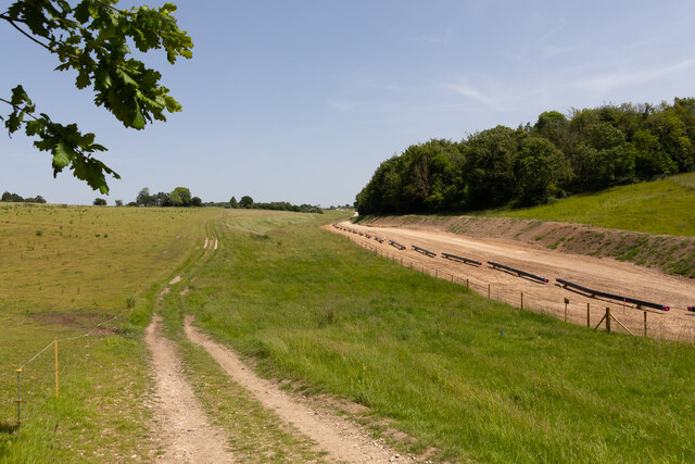
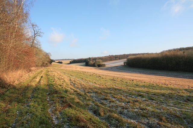
Beaconhill Beeches is a beautiful woodland located in Hampshire, England. Spanning over 100 hectares, it is a part of the extensive New Forest National Park. The beech trees that dominate the landscape give the area its name and create a stunning canopy of green during the summer months.

The woodland is known for its diverse wildlife and is home to a variety of species. Birdwatchers can spot woodpeckers, nuthatches, and tawny owls among many other bird species. Mammals such as deer, badgers, and foxes can also be found roaming the area. The woodland floor is covered with a rich carpet of bluebells in spring, making it a popular spot for nature enthusiasts and photographers.

Beaconhill Beeches offers ample opportunities for outdoor activities. There are several walking trails that wind through the woodland, allowing visitors to explore its beauty at their own pace. The trails vary in length and difficulty, catering to both casual strollers and more experienced hikers. Additionally, the forest is a great place for picnics and family outings, with designated picnic areas and open spaces.

The woodland is easily accessible by car, with a dedicated car park available for visitors. There is also a visitor center where people can find information about the local flora and fauna, as well as maps and guides for the walking trails.

Overall, Beaconhill Beeches is a captivating woodland in Hampshire, offering a peaceful and enchanting escape into nature for all who visit.

If you have any feedback on the listing, please let us know in the comments section below.

Beaconhill Beeches Images

Images are sourced within 2km of 51.002341/-1.1473332 or Grid Reference SU5922. Thanks to Geograph Open Source API. All images are credited.

Lomer Farm Seen from drive to Lomer Cottage, on the South Downs Way. Unclearly seen in front of the farm are works for Esso pipeline laying <a title="https://www.geograph.org.uk/snippet/22652" href="https://www.geograph.org.uk/snippet/22652">Link</a> .
Lomer Farm
Seen from drive to Lomer Cottage, on the South Downs Way. Unclearly seen in front of the farm are works for Esso pipeline laying Link .
Studio of Robert Hunt, Sculptor at Lomer Farm With Mr Hunt in the doorway beside two of his works. I was passing upon the footpath and Mr Hunt was working inside on a hot day so I stopped for a chat. His web site is <span class="nowrap"><a title="https://roberthuntsculpture.com/" rel="nofollow ugc noopener" href="https://roberthuntsculpture.com/">Link</a><img style="margin-left:2px;" alt="External link" title="External link - shift click to open in new window" src="https://s1.geograph.org.uk/img/external.png" width="10" height="10"/></span> . The upper floor of this building is occupied by an office of the Preshaw Estate.
Studio of Robert Hunt, Sculptor at Lomer Farm
With Mr Hunt in the doorway beside two of his works. I was passing upon the footpath and Mr Hunt was working inside on a hot day so I stopped for a chat. His web site is LinkExternal link . The upper floor of this building is occupied by an office of the Preshaw Estate.
Esso pipeline laying works on Lomer Farm The individual pipes are lying upon wooden cradles, known as 'skids', which are actually just four pieces of <a href="https://www.geograph.org.uk/photo/7173617">SU6126 : Timber used to support the pipes temporarily</a>. Later they will be welded together and supported upon piles of earth before burying.
Esso pipeline laying works on Lomer Farm
The individual pipes are lying upon wooden cradles, known as 'skids', which are actually just four pieces of SU6126 : Timber used to support the pipes temporarily. Later they will be welded together and supported upon piles of earth before burying.
Esso pipeline laying works on Lomer Farm The individual pipes are lying upon wooden cradles, known as 'skids', which are actually just four pieces of SU6126 <a href="https://www.geograph.org.uk/photo/7173617">SU6126 : Timber used to support the pipes temporarily</a>. Later they will be welded together and supported upon piles of earth before burying.
Esso pipeline laying works on Lomer Farm
The individual pipes are lying upon wooden cradles, known as 'skids', which are actually just four pieces of SU6126 SU6126 : Timber used to support the pipes temporarily. Later they will be welded together and supported upon piles of earth before burying.
Esso pipeline laying works on Lomer Farm The individual pipes are lying upon wooden cradles, known as 'skids', which are actually just four pieces of <a href="https://www.geograph.org.uk/photo/7173617">SU6126 : Timber used to support the pipes temporarily</a>. Later they will be welded together and supported upon piles of earth before burying. The new pipeline here takes a slightly different route to the old one, which comes through the woodland off-picture in left foreground, and runs northwards across the field on the other side of this woodland strip.
Esso pipeline laying works on Lomer Farm
The individual pipes are lying upon wooden cradles, known as 'skids', which are actually just four pieces of SU6126 : Timber used to support the pipes temporarily. Later they will be welded together and supported upon piles of earth before burying. The new pipeline here takes a slightly different route to the old one, which comes through the woodland off-picture in left foreground, and runs northwards across the field on the other side of this woodland strip.
Farm land seen from Beacon Hill Looking towards Preshaw Down and Downleaze Copse from the top end of Sailor's Lane.
Farm land seen from Beacon Hill
Looking towards Preshaw Down and Downleaze Copse from the top end of Sailor's Lane.
Tree felling on Beacon Hill due to ash dieback Many ash trees in the Beauworth area have been felled if they were near public footpaths or highways. The branches and trunks when cut up do not look rotten. I sometimes wonder if it is the Ash dieback disease or human reaction to it that is more dangerous to Ash trees.
Tree felling on Beacon Hill due to ash dieback
Many ash trees in the Beauworth area have been felled if they were near public footpaths or highways. The branches and trunks when cut up do not look rotten. I sometimes wonder if it is the Ash dieback disease or human reaction to it that is more dangerous to Ash trees.
The South Downs Way crossing a field of cattle near Exton, Hampshire There seemed to be around 500 head of cattle in this one field. The two walkers approaching the field look set for an interesting encounter...

Taken from Beacon Hill (the one near Exton).
The South Downs Way crossing a field of cattle near Exton, Hampshire
There seemed to be around 500 head of cattle in this one field. The two walkers approaching the field look set for an interesting encounter... Taken from Beacon Hill (the one near Exton).
The Meon Valley, Exton, Hampshire
The beacon on Beacon Hill There are two Beacon Hills in Hampshire.  This one lies to the west of the Meon Valley and its sister hill, Old Winchester Hill, can clearly be seen across the valley from it.
The beacon on Beacon Hill
There are two Beacon Hills in Hampshire. This one lies to the west of the Meon Valley and its sister hill, Old Winchester Hill, can clearly be seen across the valley from it.
Close-up of the beacon on Beacon Hill
On the Monarch’s Way north of Beacon Hill A view looking across the Meon Valley.  A pond appears below, a rare sign of water in this chalk landscape.
On the Monarch’s Way north of Beacon Hill
A view looking across the Meon Valley. A pond appears below, a rare sign of water in this chalk landscape.
Beacon Hill from Wheely Down Seen from part of the Monarch’s Way.  

The Monarch’s Way and the South Downs Way cross both Beacon Hill and Old Winchester Hill across the other side of the Meon Valley.
Beacon Hill from Wheely Down
Seen from part of the Monarch’s Way. The Monarch’s Way and the South Downs Way cross both Beacon Hill and Old Winchester Hill across the other side of the Meon Valley.
Clouds over Beacon Hill
Cows on the lower slopes of Beacon Hill
Meon Valley view from near the beacon on Beacon Hill
Trig point on Beacon Hill The highest point on the hill though not the best viewpoint.
Trig point on Beacon Hill
The highest point on the hill though not the best viewpoint.
Riversdown Road
Riversdown Road
Show me another place!

Beaconhill Beeches is located at Grid Ref: SU5922 (Lat: 51.002341, Lng: -1.1473332)

Administrative County: Hampshire

District: Winchester

Police Authority: Hampshire

What 3 Words

///sweep.outwards.perfectly. Near Swanmore, Hampshire

Nearby Locations

Beaconhill Beeches

Related Wikis

Beacon Hill, Warnford

There are two hills in Hampshire called Beacon Hill; the other one is near BurghclereBeacon Hill, Warnford is a 46.4-hectare (115-acre) biological Site...

Betty Mundy's Bottom

Betty Mundy's Bottom is a wooded valley in the South Downs of Hampshire. There are a variety of folk tales about the name, which goes back centuries....

Preshaw

Preshaw (variously named Presshawe, Presthawe, and Preishawe in old documents) is a manor to the north of Corhampton in the United Kingdom. In the 19th...

Exton, Hampshire

Exton is a small village and civil parish in the City of Winchester district of Hampshire, England. The village lies in the South Downs National Park,...

Nearby Amenities

Located within 500m of 51.002341,-1.1473332
Barrier: stile
Lat/Long: 50.9984573/-1.1467605
The data included in this document is from www.openstreetmap.org. The data is made available under ODbL.

Have you been to Beaconhill Beeches?

Leave your review of Beaconhill Beeches below (or comments, questions and feedback).