Park Plantation
Wood, Forest in Yorkshire Hambleton
England
Park Plantation
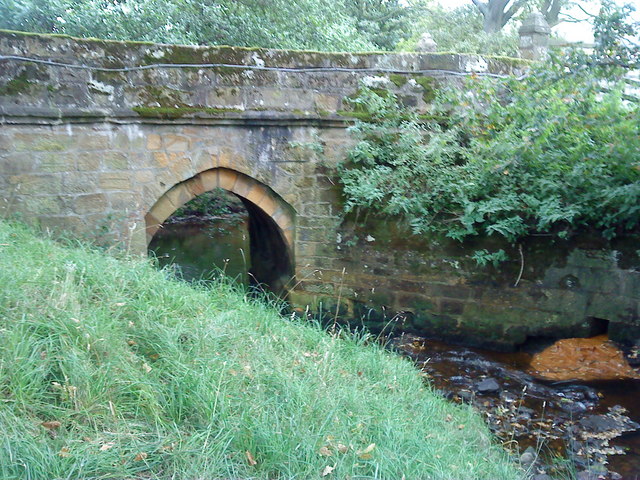
![A block of dressed sandstone with holding down bolts Hidden away in the forestry above Bank Foot is a tramway incline that served the sandstones quarries higher on Greenhow Bank. It first appears on the 1893 OS 25 inch map.
Blocks of sandstone would have been lowered down to a siding by the Rosedale Ironstone railway. I guess here a bridge was built to allow the incline to pass carrying an existing track. The line of the incline can be followed quite easily.
The lowest of these quarries is at 230m level. Here the incline branches, one climbs to a quarry at 330m level, the main incline to one at 290m. The 330m quarry was the subject of a post in 2015.
It is tempting to assume that these quarries, which seem to have been used entirely for building stone were operated by the Ingleby Ironstone & Freestone Company which built the original three mile long narrow gauge line to their ironstone mine at Rudd Scar. However, that mine was abandoned in 1860. Their narrow gauge railway had by then been upgraded to standard gauge by the North Yorkshire and Cleveland Railway.
For sources and references see my blog: Out and about ... (2021). Park Plantation Quarry Tramway. [online] Available at: <span class="nowrap"><a title="http://www.fhithich.uk/?p=24999" rel="nofollow ugc noopener" href="http://www.fhithich.uk/?p=24999">Link</a><img style="margin-left:2px;" alt="External link" title="External link - shift click to open in new window" src="https://s1.geograph.org.uk/img/external.png" width="10" height="10"/></span> [Accessed 11 Dec. 2021].
Update 26/12/21
The quarry was operated by the Ingleby Stone Quarry Company, a company probably under the direction of a Mr. Wren. The stone was lowered down to the Rosedale Railway by an incline known as Wren&#039;s Incline see [The Gazette. (1883). Page 6651 | Issue 25299, 25 December 1883 | London ... [online] Available at: <span class="nowrap"><a title="https://www.thegazette.co.uk/London/issue/25299/page/6651/data.htm" rel="nofollow ugc noopener" href="https://www.thegazette.co.uk/London/issue/25299/page/6651/data.htm">Link</a><img style="margin-left:2px;" alt="External link" title="External link - shift click to open in new window" src="https://s1.geograph.org.uk/img/external.png" width="10" height="10"/></span> [Accessed 22 Oct. 2021].].
In 1866, it was reported that a Mr Wren (the same?) had opened an ironstone mine in the area which was &quot;soon afterwards abandoned&quot; [&#039;The Cleveland Ironstone&#039; (1866) Yorkshire Gazette, 25 Aug, 4, available: <span class="nowrap"><a title="https://link-gale-com.ezproxy.is.ed.ac.uk/apps/doc/JF3231098185/GDCS?u=ed_itw&amp;sid=bookmark-GDCS&amp;xid=baf2da3d" rel="nofollow ugc noopener" href="https://link-gale-com.ezproxy.is.ed.ac.uk/apps/doc/JF3231098185/GDCS?u=ed_itw&amp;sid=bookmark-GDCS&amp;xid=baf2da3d">Link</a><img style="margin-left:2px;" alt="External link" title="External link - shift click to open in new window" src="https://s1.geograph.org.uk/img/external.png" width="10" height="10"/></span> [accessed 26 Dec 2021].]. This must be referring to the Ingleby Manor ironstone mine which briefly operated between 1856 and 1860 [Tuffs, Peter. &quot;Catalogue of Cleveland Ironstone Mines&quot;. Page 17. Cleveland Ironstone Series 1996.]. The mine had been developed with high hopes, having expectations of an annual yield of 150,000 tons [&#039;News&#039; (1857) Newcastle Journal, 12 Dec, 8, available: <span class="nowrap"><a title="https://link-gale-com.ezproxy.is.ed.ac.uk/apps/doc/GR3216193104/GDCS?u=ed_itw&amp;sid=bookmark-GDCS&amp;xid=711c2fad" rel="nofollow ugc noopener" href="https://link-gale-com.ezproxy.is.ed.ac.uk/apps/doc/GR3216193104/GDCS?u=ed_itw&amp;sid=bookmark-GDCS&amp;xid=711c2fad">Link</a><img style="margin-left:2px;" alt="External link" title="External link - shift click to open in new window" src="https://s1.geograph.org.uk/img/external.png" width="10" height="10"/></span> [accessed 26 Dec 2021].].](https://s3.geograph.org.uk/geophotos/07/04/11/7041191_d10cbe10.jpg)
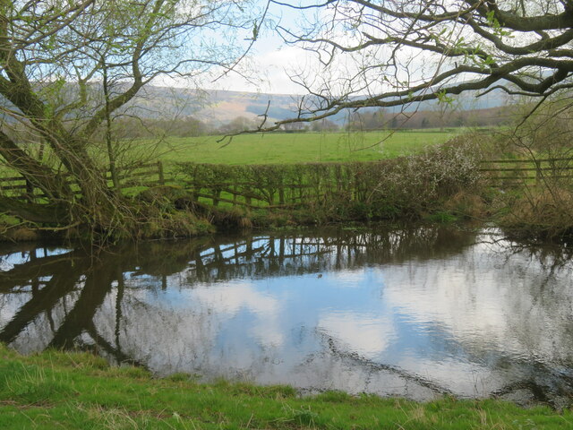
Park Plantation is a picturesque woodland located in Yorkshire, England. Spanning across a vast area, it is known for its lush greenery, towering trees, and diverse flora and fauna. The plantation is situated within the stunning landscape of the Yorkshire Dales National Park, offering visitors a tranquil and serene environment to explore.
The woodland boasts a mix of deciduous and coniferous trees, including oak, birch, beech, and pine, creating a rich and varied ecosystem. This diverse vegetation provides a haven for numerous species of birds, mammals, and insects, making it a popular spot for birdwatching and wildlife enthusiasts.
Visitors to Park Plantation can enjoy a network of well-maintained footpaths and trails, allowing them to explore the woodland at their own pace. The paths wind through the trees, offering glimpses of hidden clearings, babbling brooks, and enchanting wildlife.
For those seeking a more immersive experience, the plantation also offers camping facilities, allowing visitors to spend the night under the starry skies amidst the sounds of nature. Additionally, there are picnic areas dotted throughout the woodland, providing the perfect setting for a family outing or a peaceful lunch surrounded by nature.
Park Plantation is easily accessible, with ample parking and nearby public transportation options. It is a popular destination for nature lovers, hikers, and those seeking a peaceful retreat in the heart of Yorkshire's natural beauty.
If you have any feedback on the listing, please let us know in the comments section below.
Park Plantation Images
Images are sourced within 2km of 54.437391/-1.0807002 or Grid Reference NZ5905. Thanks to Geograph Open Source API. All images are credited.


Park Plantation is located at Grid Ref: NZ5905 (Lat: 54.437391, Lng: -1.0807002)
Division: North Riding
Administrative County: North Yorkshire
District: Hambleton
Police Authority: North Yorkshire
What 3 Words
///store.years.baths. Near Ingleby Greenhow, North Yorkshire
Nearby Locations
Related Wikis

Battersby
Battersby is a hamlet in North Yorkshire, England. It lies on the edge of the North York Moors National Park and within the historic boundaries of the...

Ingleby Greenhow
Ingleby Greenhow is a village and civil parish in the Hambleton district of North Yorkshire, England. It is on the border of the North York Moors and 3...
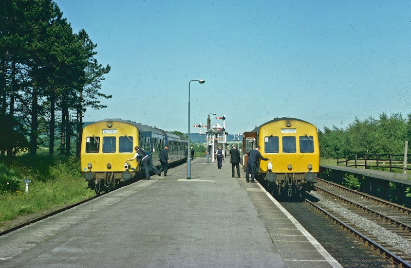
Battersby railway station
Battersby is a railway station on the Esk Valley Line, which runs between Middlesbrough and Whitby via Nunthorpe. The station, situated 11 miles 4 chains...

Ingleby railway station
Ingleby railway station was a railway station built to serve the village of Ingleby Greenhow in North Yorkshire, England. The station was on the North...
Basedale Priory
Basedale Priory or Baysdale Priory was a priory in North Yorkshire, England located 8 miles (13 km) East from the parish church of Stokesley. It was a...

Urra Moor
Urra Moor is the highest moor in the North York Moors, North Yorkshire, England. At 1,490 feet (454 m) above sea level it is the highest point in Hambleton...
Easby, Hambleton
Easby is a village and civil parish in Hambleton District of North Yorkshire, England. It lies approximately 2 miles (3.2 km) south-east of Great Ayton...

Kildale railway station
Kildale is a railway station on the Esk Valley Line, which runs between Middlesbrough and Whitby via Nunthorpe. The station, situated 12 miles 65 chains...
Nearby Amenities
Located within 500m of 54.437391,-1.0807002Have you been to Park Plantation?
Leave your review of Park Plantation below (or comments, questions and feedback).