Coombe Wood

Wood, Forest in Oxfordshire South Oxfordshire

England

Coombe Wood

Farmland, Cuddesdon A footpath descending through wheat to the east of the village.  The mast at Stokenchurch can be seen in the background atop the Chilterns.
Farmland, Cuddesdon Credit: Andrew Smith

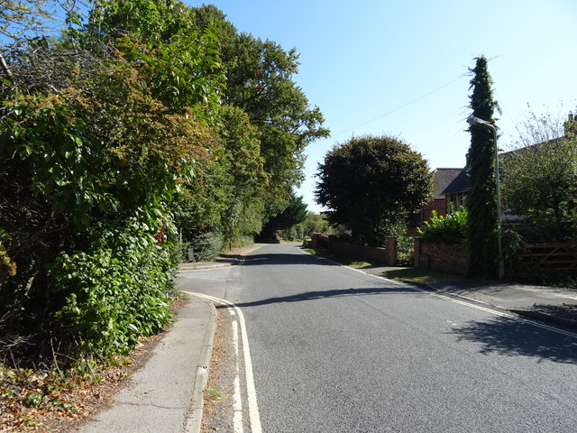
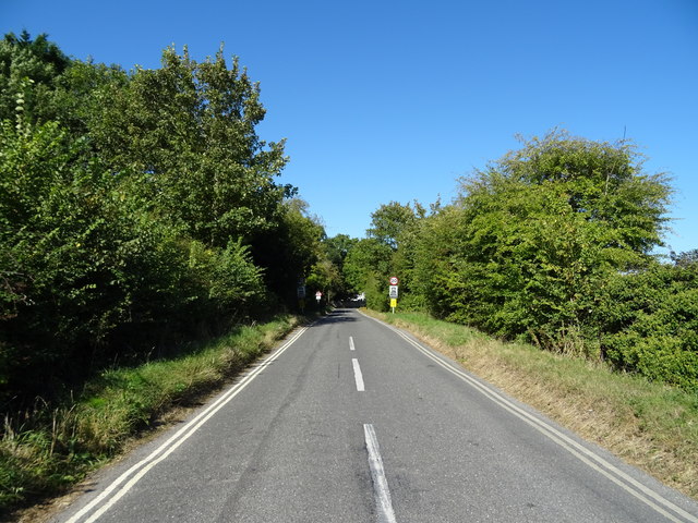
Coombe Wood, located in Oxfordshire, is a picturesque woodland area known for its natural beauty and abundance of flora and fauna. Covering an expansive area of approximately 200 acres, the wood is characterized by its dense trees, rolling hills, and meandering footpaths, making it a popular destination for nature enthusiasts and hikers.

The wood is primarily composed of native tree species such as oak, beech, and birch, which provide a rich habitat for a diverse range of wildlife. Visitors to Coombe Wood may encounter various bird species, including woodpeckers, owls, and thrushes, as well as small mammals like rabbits, squirrels, and foxes.

The wood is well-maintained, with a network of well-marked trails that allow visitors to explore the area at their own pace. These trails meander through the woodland, offering stunning views of the surrounding countryside and opportunities to observe the local wildlife. Additionally, benches and picnic areas are scattered throughout the wood, providing visitors with a chance to rest and enjoy the peaceful atmosphere.

Coombe Wood is a designated Site of Special Scientific Interest (SSSI), reflecting its ecological importance. It is managed by local conservation organizations, who work to preserve and protect its natural habitat. As such, visitors are encouraged to respect the wood's delicate ecosystem and follow any guidelines or restrictions put in place.

Overall, Coombe Wood in Oxfordshire is a tranquil and enchanting woodland that offers visitors a chance to immerse themselves in nature and experience the beauty of the Oxfordshire countryside.

If you have any feedback on the listing, please let us know in the comments section below.

Coombe Wood Images

Images are sourced within 2km of 51.73612/-1.1381309 or Grid Reference SP5904. Thanks to Geograph Open Source API. All images are credited.

Farmland, Cuddesdon A footpath descending through wheat to the east of the village.  The mast at Stokenchurch can be seen in the background atop the Chilterns.
Farmland, Cuddesdon
A footpath descending through wheat to the east of the village. The mast at Stokenchurch can be seen in the background atop the Chilterns.
Wheatley: High Street and the United Reformed Church This is the eastern end of the High Street with Friday Lane leading off to the right, and the United Reformed Church <span class="nowrap"><a title="http://www.findachurch.co.uk/churches/sp/sp50/wheatleyurc/" rel="nofollow ugc noopener" href="http://www.findachurch.co.uk/churches/sp/sp50/wheatleyurc/">Link</a><img style="margin-left:2px;" alt="External link" title="External link - shift click to open in new window" src="https://s1.geograph.org.uk/img/external.png" width="10" height="10"/></span> on the left.
Wheatley: High Street and the United Reformed Church
This is the eastern end of the High Street with Friday Lane leading off to the right, and the United Reformed Church LinkExternal link on the left.
A40 crossing Waterperry Road
A40 north of Wheatley Bridge
A40 The A40 road runs 256 miles from the City of London to Fishguard. It is a major trunk road and runs through High Wycombe, Oxford, Cheltenham, Ross on Wye, Abergavenny, Llandeilo and Carmarthen.
A40
The A40 road runs 256 miles from the City of London to Fishguard. It is a major trunk road and runs through High Wycombe, Oxford, Cheltenham, Ross on Wye, Abergavenny, Llandeilo and Carmarthen.
A40, eastbound The A40 road runs 256 miles from the City of London to Fishguard. It is a major trunk road and runs through High Wycombe, Oxford, Cheltenham, Ross on Wye, Abergavenny, Llandeilo and Carmarthen.
A40, eastbound
The A40 road runs 256 miles from the City of London to Fishguard. It is a major trunk road and runs through High Wycombe, Oxford, Cheltenham, Ross on Wye, Abergavenny, Llandeilo and Carmarthen.
Old Milestone by London Road, Wheatley Stokenchurch pillar by the UC road, in parish of Wheatley (South Oxfordshire District), London Road; by No.120, 60m East of The Avenue, to left of drive, on grass verge, South side of road.

Inscription reads:-
XLVIII
Miles from
London
To Oxford
VI
 
Grade II listed.
List Entry Number: 1369286 <span class="nowrap"><a title="https://historicengland.org.uk/listing/the-list/list-entry/1369286" rel="nofollow ugc noopener" href="https://historicengland.org.uk/listing/the-list/list-entry/1369286">Link</a><img style="margin-left:2px;" alt="External link" title="External link - shift click to open in new window" src="https://s1.geograph.org.uk/img/external.png" width="10" height="10"/></span>

Surveyed

Milestone Society National ID: OX_lw48
Old Milestone by London Road, Wheatley
Stokenchurch pillar by the UC road, in parish of Wheatley (South Oxfordshire District), London Road; by No.120, 60m East of The Avenue, to left of drive, on grass verge, South side of road. Inscription reads:- XLVIII Miles from London To Oxford VI Grade II listed. List Entry Number: 1369286 LinkExternal link Surveyed Milestone Society National ID: OX_lw48
The Kings Arms, Wheatley On Church Road.
The Kings Arms, Wheatley
On Church Road.
Sign for the Kings Arms, Wheatley See <a href="https://www.geograph.org.uk/photo/6274342">SP6005 : The Kings Arms, Wheatley</a> for context.
Sign for the Kings Arms, Wheatley
Biscoe Court, Wheatley
Old London Road, Wheatley National Cycle Route 57.
Old London Road, Wheatley
National Cycle Route 57.
A40 bridge over Waterperry Road National Cycle Route 57.
A40 bridge over Waterperry Road
National Cycle Route 57.
Grazing near The Hollies
Minor road towards Holton
River Thame near Wheatley The former railway between Oxford and Princes Risborough used to cross the river here.
River Thame near Wheatley
The former railway between Oxford and Princes Risborough used to cross the river here.
Path by the River Thame Because of the abundance of foliage, you don't see much of the river. The ground cover of nettles is not yet intruding onto the path.
Path by the River Thame
Because of the abundance of foliage, you don't see much of the river. The ground cover of nettles is not yet intruding onto the path.
River Thame near Wheatley Currently flowing very smoothly and gently.
River Thame near Wheatley
Currently flowing very smoothly and gently.
Flood plain of the River Thame Used only for grazing because of its propensity to flood.
Flood plain of the River Thame
Used only for grazing because of its propensity to flood.
Show me another place!

Coombe Wood is located at Grid Ref: SP5904 (Lat: 51.73612, Lng: -1.1381309)

Administrative County: Oxfordshire

District: South Oxfordshire

Police Authority: Thames Valley

What 3 Words

///potential.lakes.swoop. Near Wheatley, Oxfordshire

Nearby Locations

Coombe Wood

Related Wikis

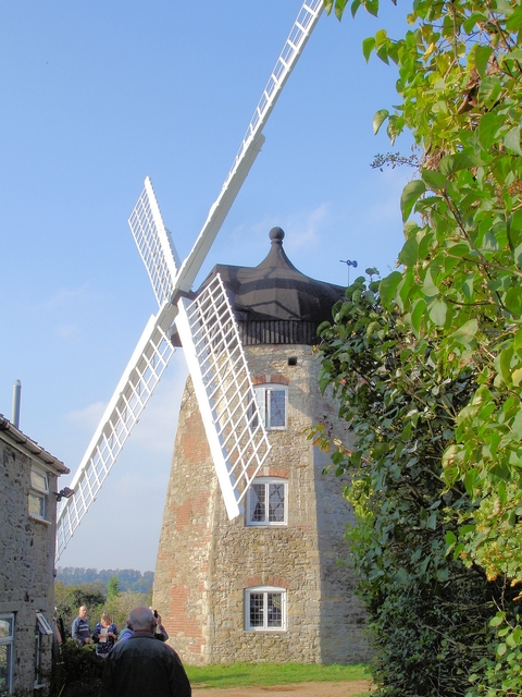
Wheatley Windmill, Wheatley, Oxfordshire

Wheatley Windmill is an 18th-century tower mill at grid reference SP 589 053 between the hamlet of Littleworth and Wheatley in Oxfordshire, England. The...

Wheatley railway station

Wheatley railway station was on the Wycombe Railway and served the village of Wheatley in Oxfordshire. It was opened in 1864 as part of an extension from...

Wheatley, Oxfordshire

Wheatley is a village and civil parish in Oxfordshire, about 5 miles (8 km) east of Oxford. The parish includes the hamlet of Littleworth, which is immediately...

St Mary the Virgin, Wheatley

The Church of St Mary the Virgin is a parish church in Wheatley, Oxfordshire, in the Church of England Diocese of Oxford. The church was designed by George...

Waterstock House Training Centre

Waterstock House Training Centre (WHTC) is situated in the village of Waterstock in Oxfordshire, England. It is a well used venue for local and national...

Oxford Centre for Ecclesiology and Practical Theology

The Oxford Centre for Ecclesiology and Practical Theology (OxCEPT) is a research centre based at Ripon College Cuddesdon. == Overview == OxCEPT was founded...

Ripon College Cuddesdon

Ripon College Cuddesdon is a Church of England theological college in Cuddesdon, a village 5.5 miles (8.9 km) outside Oxford, England. The College trains...

Bishop Edward King Chapel

Bishop Edward King Chapel is the chapel of Ripon College Cuddesdon, a Church of England theological college near Oxford, and of the Sisters of the Communities...

Nearby Amenities

Located within 500m of 51.73612,-1.1381309
Power: tower
Lat/Long: 51.737846/-1.1413466
Note: sign marking boundary of place
Source: gps_survey;photograph
Lat/Long: 51.7323185/-1.1391085
Power: tower
Lat/Long: 51.7383391/-1.1364158
Power: tower
Lat/Long: 51.7393099/-1.1331286
Power: pole
Source: Bing
Lat/Long: 51.7326966/-1.1417672
Power: pole
Source: Bing
Lat/Long: 51.7380892/-1.1342316
Power: pole
Source: Bing
Lat/Long: 51.7372289/-1.1346741
Power: pole
Source: Bing
Lat/Long: 51.7390156/-1.1338214
Power: pole
Source: Bing
Lat/Long: 51.7364748/-1.1350443
Power: pole
Source: Bing
Lat/Long: 51.7347572/-1.1359696
Power: pole
Lat/Long: 51.7329832/-1.1400863
Generator Method: photovoltaic
Generator Output Electricity: yes
Generator Solar Modules: 12
Generator Source: solar
Generator Type: solar_photovoltaic_panel
Location: roof
Power: generator
Tilted: no
Lat/Long: 51.7400682/-1.1405056
Direction: 220
Generator Method: photovoltaic
Generator Output Electricity: yes
Generator Solar Modules: 14
Generator Source: solar
Generator Type: solar_photovoltaic_panel
Location: roof
Power: generator
Lat/Long: 51.7401635/-1.1403703
The data included in this document is from www.openstreetmap.org. The data is made available under ODbL.

Have you been to Coombe Wood?

Leave your review of Coombe Wood below (or comments, questions and feedback).