Sherwood Forest

Wood, Forest in Nottinghamshire Newark and Sherwood

England

Sherwood Forest

Course of Former Railway to Clipstone Colliery Pictured here in the south west corner of this grid square.
Course of Former Railway to Clipstone Colliery Credit: Jonathan Clitheroe

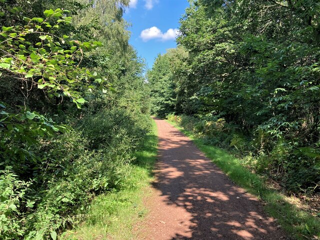
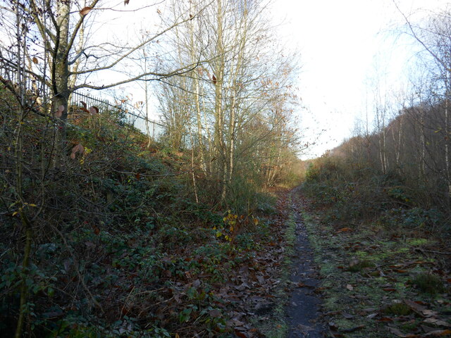
Sherwood Forest, located in the county of Nottinghamshire, England, is a historic woodland area renowned for its association with the legendary outlaw, Robin Hood. Spanning over 1,000 acres, this ancient forest is an important natural and cultural site.

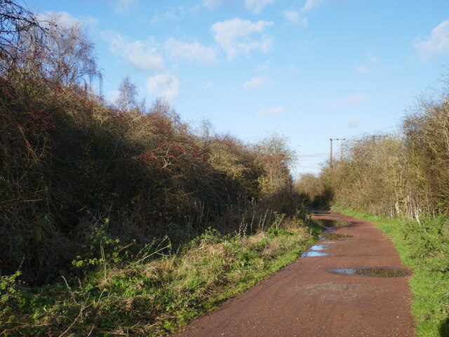
The forest is predominantly composed of oak trees, with some birch, beech, and pine trees scattered throughout. It is home to a diverse range of wildlife, including deer, foxes, badgers, and a variety of bird species. The forest floor is covered in a rich carpet of ferns, wildflowers, and mosses, creating a picturesque and tranquil atmosphere.

Sherwood Forest has a long and storied history. It was initially used as a royal hunting ground by the kings of England, including King John and King Richard the Lionheart. The forest also served as a hideout for outlaws and rebels, with Robin Hood and his band of Merry Men being the most famous inhabitants. Many of the forest's ancient oaks are believed to be over 500 years old, providing a link to this fascinating past.

Today, Sherwood Forest is a popular tourist destination, attracting visitors from all over the world. The forest offers a range of activities, including walking and cycling trails, guided tours, and an interactive visitor center where visitors can learn about the forest's history and folklore. The Major Oak, a massive oak tree estimated to be over 1,000 years old, is a major attraction within the forest, with its sprawling branches and hollow trunk.

Sherwood Forest, with its natural beauty and historical significance, continues to captivate and inspire visitors, offering a glimpse into England's rich past and the enduring legend of Robin Hood.

If you have any feedback on the listing, please let us know in the comments section below.

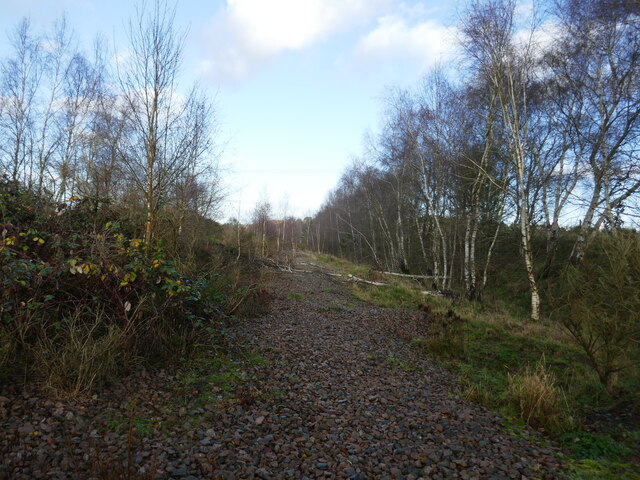
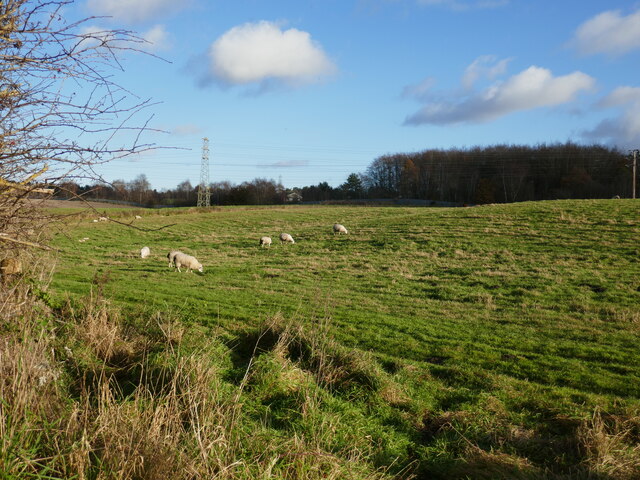
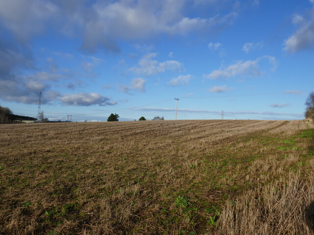
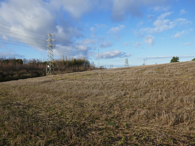
Sherwood Forest Images

Images are sourced within 2km of 53.154479/-1.1112445 or Grid Reference SK5962. Thanks to Geograph Open Source API. All images are credited.

Course of Former Railway to Clipstone Colliery Pictured here in the south west corner of this grid square.
Course of Former Railway to Clipstone Colliery
Pictured here in the south west corner of this grid square.
Path along the course of an old railway This was the Mansfield Railway, opened in 1913 and initially operated by the Great Central Railway <span class="nowrap"><a title="https://en.wikipedia.org/wiki/Mansfield_Railway" rel="nofollow ugc noopener" href="https://en.wikipedia.org/wiki/Mansfield_Railway">Link</a><img style="margin-left:2px;" alt="External link" title="External link - shift click to open in new window" src="https://s1.geograph.org.uk/img/external.png" width="10" height="10"/></span>
Path along the course of an old railway
This was the Mansfield Railway, opened in 1913 and initially operated by the Great Central Railway LinkExternal link
Field boundary and view of the headstocks of the former Clipstone Colliery
Isolated barn
Isolated barn
Course of the former Mansfield Railway The Mansfield Railway opened in 1913 and was initially operated by the Great Central Railway <span class="nowrap"><a title="https://en.wikipedia.org/wiki/Mansfield_Railway" rel="nofollow ugc noopener" href="https://en.wikipedia.org/wiki/Mansfield_Railway">Link</a><img style="margin-left:2px;" alt="External link" title="External link - shift click to open in new window" src="https://s1.geograph.org.uk/img/external.png" width="10" height="10"/></span>
Course of the former Mansfield Railway
The Mansfield Railway opened in 1913 and was initially operated by the Great Central Railway LinkExternal link
Grazing sheep near Clipstone
Stubble field near Clipstone
Stubble field and pylons
Bridleway to Kings Clipstone
Clipstone Drive
Clipstone Drive
Autumn sown crop near Clipstone The headstocks of the former Clipstone Colliery visible in the distance.
Autumn sown crop near Clipstone
The headstocks of the former Clipstone Colliery visible in the distance.
Bauhaus style (broken) glazing On powerhouse section of the pit head building of Clipstone colliery. 

The buildings are Grade II listed: List Entry Number:1380235 <span class="nowrap"><a title="https://historicengland.org.uk/listing/the-list/list-entry/1380235" rel="nofollow ugc noopener" href="https://historicengland.org.uk/listing/the-list/list-entry/1380235">Link</a><img style="margin-left:2px;" alt="External link" title="External link - shift click to open in new window" src="https://s1.geograph.org.uk/img/external.png" width="10" height="10"/></span>
Bauhaus style (broken) glazing
On powerhouse section of the pit head building of Clipstone colliery. The buildings are Grade II listed: List Entry Number:1380235 LinkExternal link
North headstock; Clipstone colliery This gear was used for personnel transfer up and down the shaft below.

The buildings are Grade II listed: List Entry Number:1380235 <span class="nowrap"><a title="https://historicengland.org.uk/listing/the-list/list-entry/1380235" rel="nofollow ugc noopener" href="https://historicengland.org.uk/listing/the-list/list-entry/1380235">Link</a><img style="margin-left:2px;" alt="External link" title="External link - shift click to open in new window" src="https://s1.geograph.org.uk/img/external.png" width="10" height="10"/></span>
North headstock; Clipstone colliery
This gear was used for personnel transfer up and down the shaft below. The buildings are Grade II listed: List Entry Number:1380235 LinkExternal link
Houses on The Circle, Clipstone With the colliery headstones "emerging" from the roofs.
Houses on The Circle, Clipstone
With the colliery headstones "emerging" from the roofs.
Railway Tunnel seen from Adjacent Railway Bridge
Colliery Line near Clipstone The path swings left here departing company with the old railway course.
Colliery Line near Clipstone
The path swings left here departing company with the old railway course.
Path in Vicar Water Country Park
Roundabout at Newlands Looking along Clipstone Road East from the direction of Forest Town.
Roundabout at Newlands
Looking along Clipstone Road East from the direction of Forest Town.
Show me another place!

Sherwood Forest is located at Grid Ref: SK5962 (Lat: 53.154479, Lng: -1.1112445)

Administrative County: Nottinghamshire

District: Newark and Sherwood

Police Authority: Nottinghamshire

What 3 Words

///freezing.shoppers.daydreams. Near King's Clipstone, Nottinghamshire

Nearby Locations

Sherwood Forest Vicar Pond

Related Wikis

Clipstone railway station

Clipstone Colliery Sidings railway station was a station in Clipstone, Nottinghamshire.While primarily a goods station, there was an unadvertised halt...
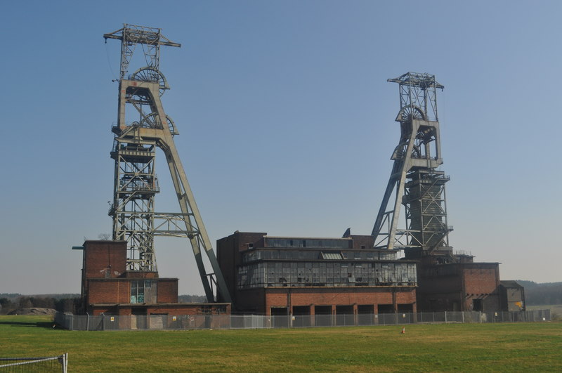
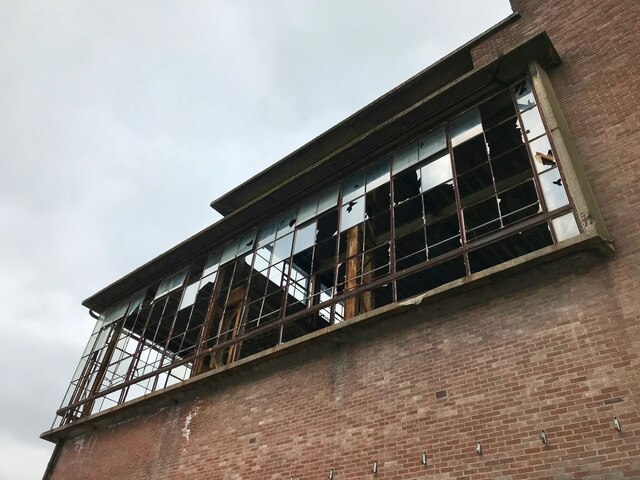
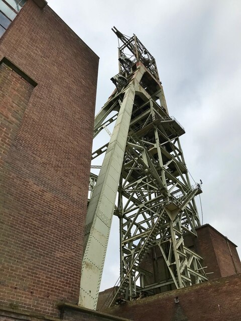
Clipstone Colliery

Clipstone Colliery was a coal mine in the village of Clipstone, Nottinghamshire, part of the area known as The Dukeries. The colliery opened in 1922 and...

Clipstone F.C.

Clipstone Football Club is a football club based in Clipstone, Nottinghamshire, England. They are currently members of the United Counties League Division...

The Garibaldi School

The Garibaldi School (formerly Garibaldi College) is a co-educational secondary school and sixth form built in the 1960s. It is situated near to the edge...

Clipstone

Clipstone in north Nottinghamshire is a small ex-coal mining village built on the site of an old army base and close to the site of a medieval royal palace...

Rufford Colliery

Rufford Colliery was a coal mine located near Rainworth, a village in Nottinghamshire, England. Its first shafts were sunk in 1911. In February 1913,...

St Alban's Church, Forest Town

St. Albans Church, Forest Town is a parish church in the Church of England in Forest Town, Nottinghamshire. == History == St. Albans Church was built by...

Kings Clipstone

Kings Clipstone is a settlement and civil parish, in the Newark and Sherwood district, in the county of Nottinghamshire, England. The parish lies in the...

Nearby Amenities

Located within 500m of 53.154479,-1.1112445
Tourism: picnic_site
Lat/Long: 53.1578843/-1.1123381
Barrier: block
Lat/Long: 53.1523552/-1.1107552
Barrier: block
Lat/Long: 53.1525585/-1.1108317
Rufford Junction
Railway: junction
Lat/Long: 53.1572517/-1.1087847
Clipstone Colliery Junction
Railway: junction
Lat/Long: 53.1576744/-1.1077616
Information: board
Tourism: information
Lat/Long: 53.1545847/-1.1186395
Millennium Milepost Sherwood Pines
Description: 1) Centre Tree 3.5, Worksop 14 2) Blidworth 6 3) Mansfield 14
Image: https://www.cyclestreets.net/location/183245/cyclestreets183245.jpg
Information: guidepost
Ncn Milepost: rowe
Source: survey
Sustrans Ref: MP 493
Tourism: information
Lat/Long: 53.1545196/-1.1185403
Barrier: block
Source: Bing;local_knowledge
Lat/Long: 53.1531421/-1.1110414
Barrier: block
Lat/Long: 53.1570021/-1.1134011
Barrier: kissing_gate
Lat/Long: 53.1574328/-1.1119068
Note: No obvious path beyond here
Lat/Long: 53.1568863/-1.1123927
Power: pole
Lat/Long: 53.1548549/-1.1177918
Power: pole
Lat/Long: 53.1552023/-1.1164159
Power: pole
Lat/Long: 53.1557701/-1.1148843
Power: pole
Lat/Long: 53.1564311/-1.1132079
Power: pole
Lat/Long: 53.157068/-1.1113411
Power: pole
Lat/Long: 53.1576406/-1.1098284
Power: pole
Lat/Long: 53.1582581/-1.108278
Power: tower
Lat/Long: 53.1506407/-1.1136907
Power: tower
Lat/Long: 53.1513854/-1.1134037
Power: tower
Lat/Long: 53.1521704/-1.1131543
Power: tower
Lat/Long: 53.1529119/-1.1133045
Power: tower
Lat/Long: 53.1540137/-1.1134869
Power: tower
Lat/Long: 53.1551315/-1.1136907
Power: tower
Lat/Long: 53.1561255/-1.1134467
Power: tower
Lat/Long: 53.1567142/-1.1118856
Power: tower
Lat/Long: 53.1572128/-1.1105338
Power: tower
Lat/Long: 53.1577644/-1.10908
Power: tower
Lat/Long: 53.1583176/-1.1076075
Empty Wagon Branch Junction
Railway: junction
Lat/Long: 53.1580014/-1.1104847
Information: board
Tourism: information
Lat/Long: 53.1573157/-1.1133796
The data included in this document is from www.openstreetmap.org. The data is made available under ODbL.

Have you been to Sherwood Forest?

Leave your review of Sherwood Forest below (or comments, questions and feedback).