Wellingley Holt
Wood, Forest in Yorkshire
England
Wellingley Holt
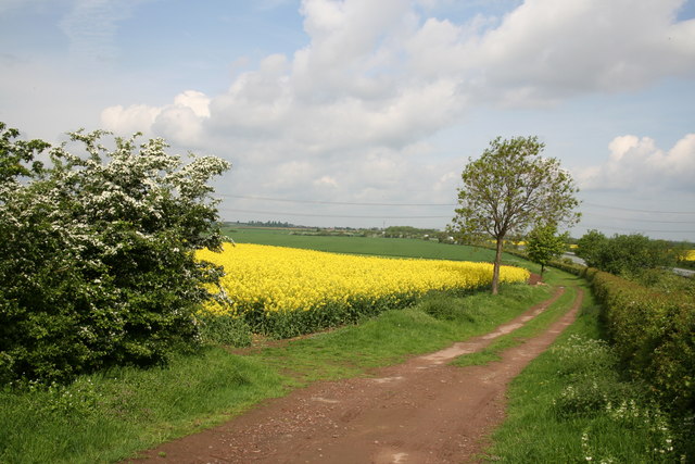
Wellingley Holt is a small village located in the county of Yorkshire, England. Situated in the heart of the countryside, it is known for its picturesque woodlands and lush forests that surround the area. The village is situated near the larger towns of Leeds and Sheffield, making it easily accessible for both residents and visitors.
With its serene and tranquil atmosphere, Wellingley Holt is a popular destination for nature lovers and outdoor enthusiasts. The woodlands offer a wide range of activities, including hiking, cycling, and birdwatching. The ancient trees and diverse wildlife make it an ideal spot for those seeking a peaceful retreat from the hustle and bustle of city life.
The village itself is small but charming, with a handful of traditional stone cottages and a quaint village pub serving local ales and traditional cuisine. The locals are friendly and welcoming, creating a sense of community among residents and visitors alike.
Wellingley Holt also has a rich history, with some buildings dating back several centuries. The village church, St. Mary's, is a notable landmark and showcases stunning architecture from the past.
Overall, Wellingley Holt is a hidden gem in the Yorkshire countryside, offering a peaceful and idyllic setting for those seeking a break from city life. Its woodlands, charming village, and rich history make it a must-visit destination for nature lovers and history enthusiasts.
If you have any feedback on the listing, please let us know in the comments section below.
Wellingley Holt Images
Images are sourced within 2km of 53.454847/-1.1052882 or Grid Reference SK5995. Thanks to Geograph Open Source API. All images are credited.


Wellingley Holt is located at Grid Ref: SK5995 (Lat: 53.454847, Lng: -1.1052882)
Division: West Riding
Unitary Authority: Doncaster
Police Authority: South Yorkshire
What 3 Words
///solution.superbly.slings. Near Tickhill, South Yorkshire
Nearby Locations
Related Wikis

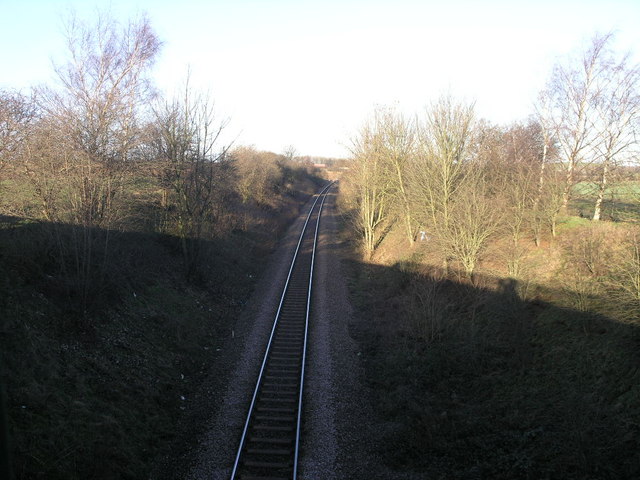
Tickhill and Wadworth railway station
Tickhill and Wadworth railway station, originally simply known as Tickhill, was located where the road linking the town of Tickhill and the village of...
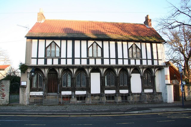
St Leonard's Hospital, Tickhill
St Leonard's Hospital is a grade II* listed timber-framed building in Tickhill, South Yorkshire, in England. It was originally constructed in the 15th...
Tickhill & Wadworth (ward)
Tickhill & Wadworth—consisting of Braithwell, Micklebring, Stainton, Tickhill, Wadworth and Woodfield—is one of 21 electoral wards in the Metropolitan...

Strafforth and Tickhill
Strafforth and Tickhill , originally known as Strafforth, was the southernmost wapentake in the West Riding of Yorkshire, England. The west of the district...
Nearby Amenities
Located within 500m of 53.454847,-1.1052882Have you been to Wellingley Holt?
Leave your review of Wellingley Holt below (or comments, questions and feedback).