Angels Copse

Wood, Forest in Hampshire

England

Angels Copse

Bridleway in Whitefield Wood At the eastern edge of Whitefield Wood a small section of bridleway links the A3055 with a byway.  It is very overgrown as can be seen here.
Bridleway in Whitefield Wood Credit: Graham Horn

Angels Copse is a picturesque woodland located in the county of Hampshire, England. Spanning an area of approximately 20 acres, this enchanting forest is renowned for its natural beauty and tranquil atmosphere. The copse is situated near the small village of Kingsclere, just a few miles northeast of the town of Basingstoke.

Angels Copse is predominantly made up of native broadleaf trees, including oak, beech, and birch. These towering trees provide a dense canopy, casting dappled sunlight onto the forest floor below. The woodland is also home to a variety of wildlife, such as deer, foxes, and numerous species of birds, making it a popular spot for nature enthusiasts and birdwatchers.

The copse features a network of well-maintained footpaths, allowing visitors to explore its winding trails and discover its hidden gems. One of the highlights of Angels Copse is a beautiful stream that meanders through the forest, adding to its picturesque charm. Along the stream, visitors can find small waterfalls and cascades, creating a soothing and peaceful ambiance.

The woodland is easily accessible, with a car park available for visitors. It is a popular destination for walkers, joggers, and families looking to enjoy the great outdoors. The copse also has picnic areas and benches, providing the perfect setting for a leisurely lunch surrounded by nature.

Angels Copse offers a tranquil retreat from the hustle and bustle of everyday life, allowing visitors to immerse themselves in the beauty of the Hampshire countryside. Whether it's a peaceful stroll, birdwatching, or simply appreciating the serenity of the woodlands, Angels Copse is a hidden gem waiting to be explored.

If you have any feedback on the listing, please let us know in the comments section below.
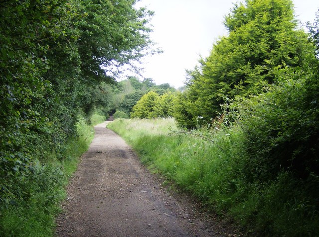
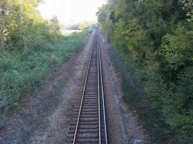
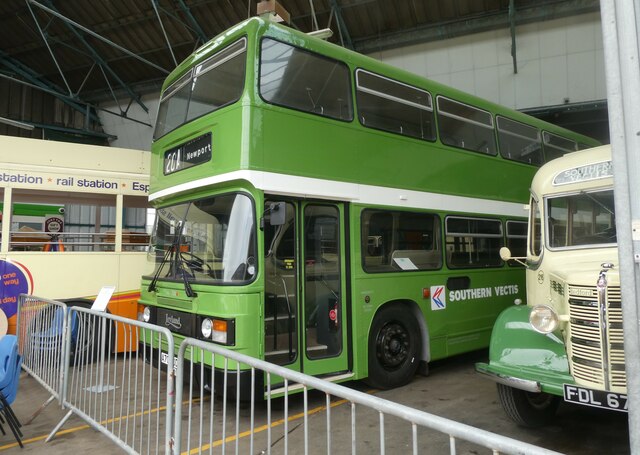
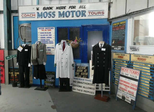
Angels Copse Images

Images are sourced within 2km of 50.708625/-1.1588032 or Grid Reference SZ5990. Thanks to Geograph Open Source API. All images are credited.

Bridleway in Whitefield Wood At the eastern edge of Whitefield Wood a small section of bridleway links the A3055 with a byway.  It is very overgrown as can be seen here.
Bridleway in Whitefield Wood
At the eastern edge of Whitefield Wood a small section of bridleway links the A3055 with a byway. It is very overgrown as can be seen here.
Whitefield Forest touring park Touring caravan park in the depths of Whitefield Forest, but easily accessible on a byway from the main road.
Whitefield Forest touring park
Touring caravan park in the depths of Whitefield Forest, but easily accessible on a byway from the main road.
Byway east of Whitefield Forest Looking west as the forest starts to peter out.
Byway east of Whitefield Forest
Looking west as the forest starts to peter out.
The Wight Line Looking down from the bridge on Harding Shute to the Wight Line.
The Wight Line
Looking down from the bridge on Harding Shute to the Wight Line.
A superb visit to the Isle Of Wight Bus & Coach Museum (1)
A superb visit to the Isle Of Wight Bus & Coach Museum (2)
A superb visit to the Isle Of Wight Bus & Coach Museum (3)
A superb visit to the Isle Of Wight Bus & Coach Museum (4)
A superb visit to the Isle Of Wight Bus & Coach Museum (5)
A superb visit to the Isle Of Wight Bus & Coach Museum (6)
A superb visit to the Isle Of Wight Bus & Coach Museum (7)
A superb visit to the Isle Of Wight Bus & Coach Museum (8)
A superb visit to the Isle Of Wight Bus & Coach Museum (9)
A superb visit to the Isle Of Wight Bus & Coach Museum (10)
A superb visit to the Isle Of Wight Bus & Coach Museum (11)
A superb visit to the Isle Of Wight Bus & Coach Museum (12)
A superb visit to the Isle Of Wight Bus & Coach Museum (13)
A superb visit to the Isle Of Wight Bus & Coach Museum (14)
Show me another place!

Angels Copse is located at Grid Ref: SZ5990 (Lat: 50.708625, Lng: -1.1588032)

Unitary Authority: Isle of Wight

Police Authority: Hampshire

What 3 Words

///sample.caged.tower. Near Ryde, Isle of Wight

Related Wikis

Smallbrook Junction railway station

Smallbrook Junction railway station is a railway station on the Isle of Wight, England. It is unusual because it has no public access but exists purely...

Westridge, Isle of Wight

Westridge is an area on the edge of Ryde on the Isle of Wight, based on the road junction of Westridge Cross. Its location on the outskirts of the largest...

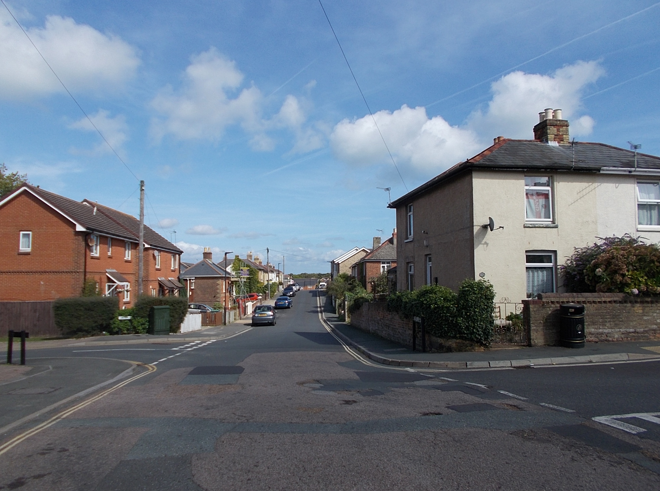
Oakfield, Isle of Wight

Oakfield is a suburb of the town of Ryde on the Isle of Wight, England. Historically part of the St Helens parish, it was absorbed into Ryde Borough in...

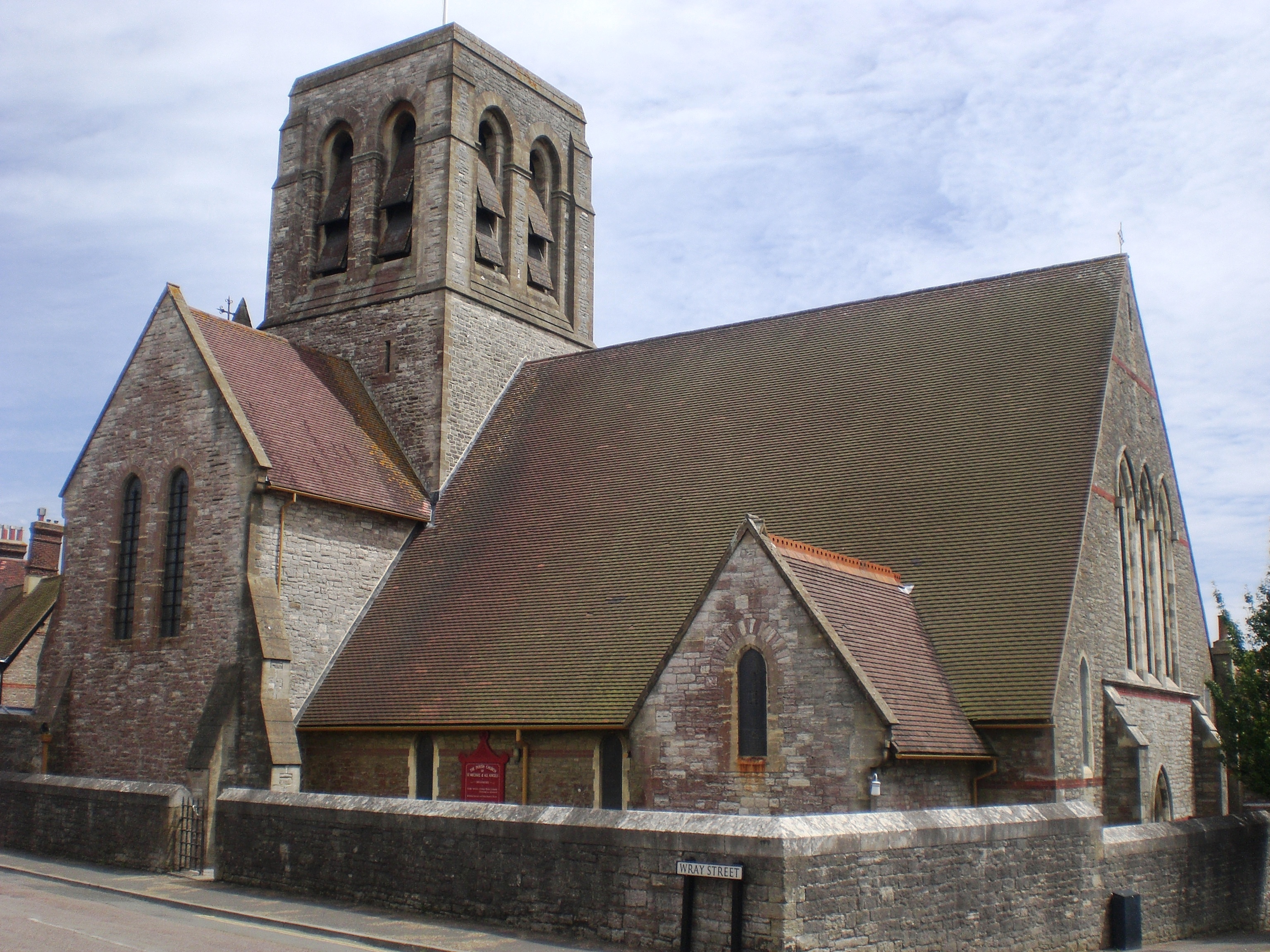
Church of St Michael and All Angels, Swanmore, Ryde

The Church of St. Michael and All Angels, Swanmore, near Haylands in Ryde is a former parish church in the Church of England located in Ryde, Isle of Wight...

Nearby Amenities

Located within 500m of 50.708625,-1.1588032
Source: Bing
Lat/Long: 50.7117966/-1.162288
Smallbrook Junction
Naptan AtcoCode: 9100SMALBRK
Network: National Rail
Network Website: https://www.nationalrail.co.uk/stations/sab/
Network Wikidata: Q26334
Note: No road/path access - open for interchange only
Operator: Island Line Trains
Public Transport: station
Railway: station
Ref Crs: SAB
Wikidata: Q1868757
Wikipedia: en:Smallbrook Junction railway station
Lat/Long: 50.7114593/-1.1550109
Source: Locally rectified NPE map
Lat/Long: 50.7044219/-1.1603378
Source: Yahoo
Lat/Long: 50.7067578/-1.1624391
Source: Locally rectified NPE map
Lat/Long: 50.7113144/-1.1544971
Source: Bing
Lat/Long: 50.7109731/-1.1623627
Source: Bing
Lat/Long: 50.7117071/-1.1625567
Source: Yahoo
Lat/Long: 50.7064627/-1.1624403
Source: Bing
Lat/Long: 50.7118285/-1.1617507
Source: Bing
Lat/Long: 50.7119329/-1.1619965
Crossing: uncontrolled
Horse: yes
Railway: level_crossing
Lat/Long: 50.7051862/-1.1612467
Power: pole
Source: Bing
Lat/Long: 50.7071516/-1.1615763
Power: pole
Source: Bing
Lat/Long: 50.7084289/-1.164347
Power: pole
Source: Bing
Lat/Long: 50.7043284/-1.1584649
Power: pole
Source: Bing
Lat/Long: 50.7049807/-1.159173
Power: pole
Source: Bing
Lat/Long: 50.7061358/-1.1604471
Material: wood
Power: pole
Source: Bing
Lat/Long: 50.7090811/-1.1657443
Power: pole
Source: Bing
Lat/Long: 50.7077953/-1.1629737
Source: Bing
Lat/Long: 50.7117472/-1.1616025
Source: Bing
Lat/Long: 50.7107842/-1.1623772
Source: Bing
Lat/Long: 50.7098649/-1.1630565
Source: Bing
Lat/Long: 50.7103707/-1.1625918
Barrier: stile
Foot: yes
Lat/Long: 50.7119077/-1.1619466
Barrier: kissing_gate
Foot: yes
Lat/Long: 50.7091298/-1.1653331
Railway: switch
Lat/Long: 50.7118888/-1.155306
Control: manual
Railway: switch
Lat/Long: 50.7103383/-1.1550862
Control: spring
Railway: switch
Lat/Long: 50.7122679/-1.1557872
Railway: buffer_stop
Lat/Long: 50.7123804/-1.1556351
Smallbrook Junction
Railway: junction
Lat/Long: 50.7122854/-1.1556527
Barrier: stile
Lat/Long: 50.7076449/-1.1651784
Source: Locally rectified NPE map
Lat/Long: 50.7071264/-1.1653662
Source: Bing
Lat/Long: 50.7122566/-1.161567
Railway: signal
Railway Signal Direction: forward
Lat/Long: 50.7118153/-1.1552507
Addr Housename: Culfin
Lat/Long: 50.7061375/-1.1623916
Hiking: yes
Information: guidepost
Tourism: information
Lat/Long: 50.7071409/-1.1652917
Addr Housename: Kerry Cottage
Lat/Long: 50.7070029/-1.1652629
Hiking: yes
Information: guidepost
Tourism: information
Lat/Long: 50.7091478/-1.1653268
Hiking: yes
Information: guidepost
Tourism: information
Lat/Long: 50.7076522/-1.1652153
Parking
Access: private
Lat/Long: 50.707442/-1.1648539
The data included in this document is from www.openstreetmap.org. The data is made available under ODbL.

Have you been to Angels Copse?

Leave your review of Angels Copse below (or comments, questions and feedback).