Cherryorchard Copse

Wood, Forest in Berkshire

England

Cherryorchard Copse

The Garden House, Stanford Dingley, Berkshire Early C18. Red brick with moulded plat band. Moulded brick eaves cornice, old tile roof with end stacks and parapets, and 3 gabled dormers with casements. 2 storeys and attic; 3 bays, glazing bar sashes with exposed wooden boxes and gauged heads. Central glazed door with radial fanlight and doorcase with triangular pediment supported on plain brackets.

(Source:Historic England)
The Garden House, Stanford Dingley, Berkshire Credit: Oswald Bertram

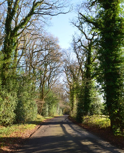
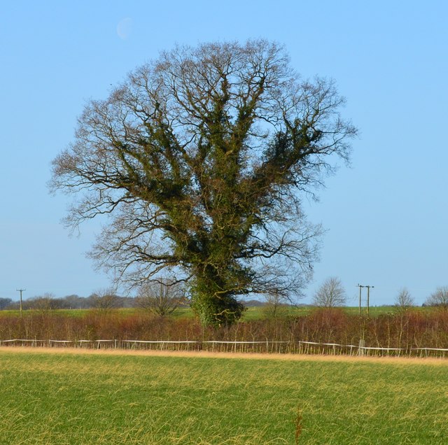
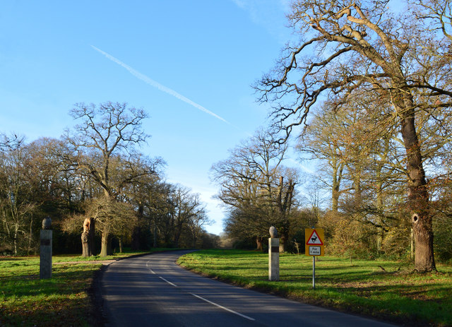
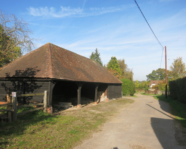
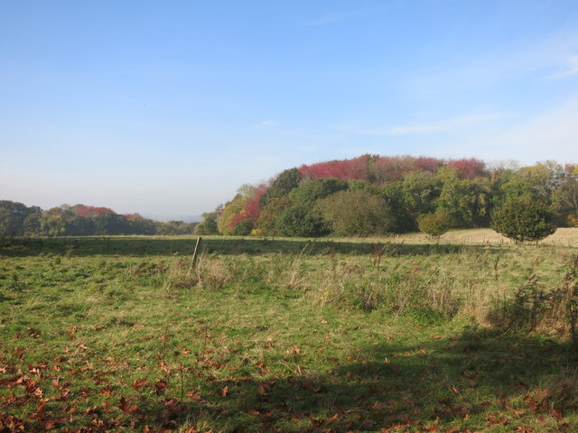
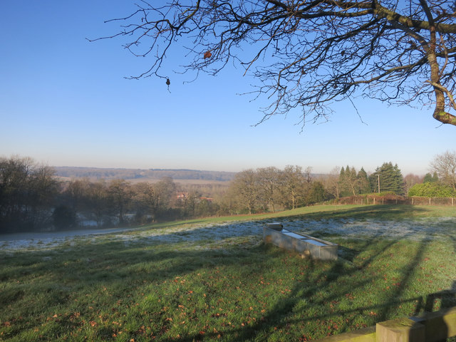
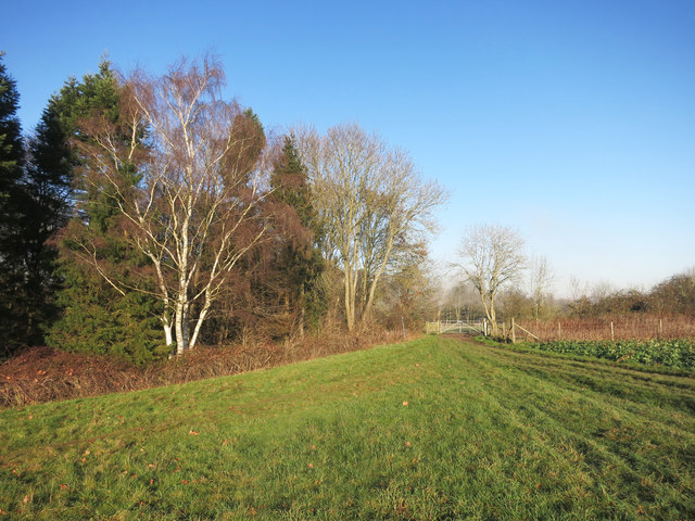
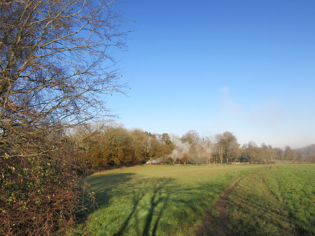
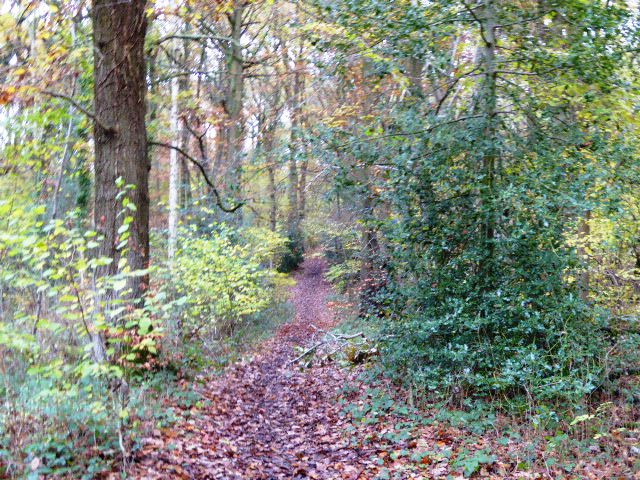
Cherryorchard Copse, located in Berkshire, England, is a beautiful woodland area known for its sprawling trees and serene atmosphere. Covering an area of approximately 30 hectares, this copse is a popular destination for nature enthusiasts and outdoor lovers.

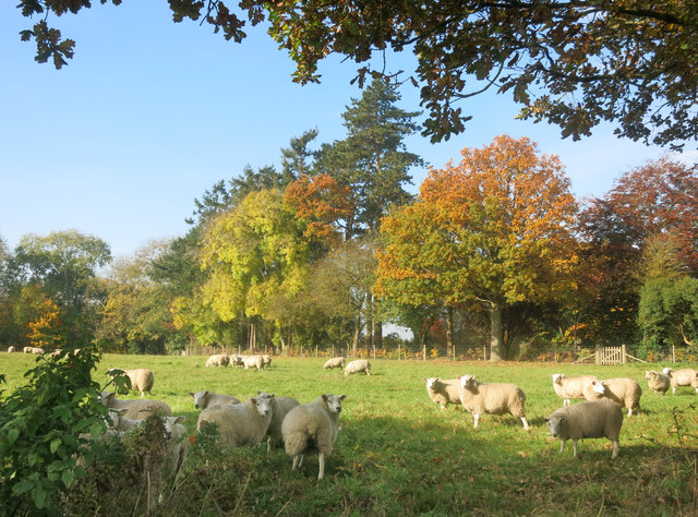
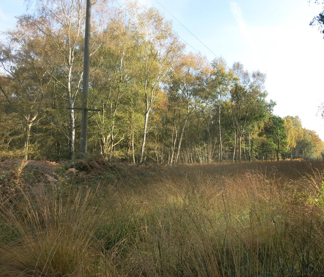
The copse is predominantly composed of broadleaf trees, including oak, beech, and cherry. These trees create a stunning canopy overhead, providing shade and shelter for a variety of plant and animal species. Walking through Cherryorchard Copse, visitors are greeted by a diverse range of flora, such as bluebells, primroses, and foxgloves, which add a splash of color to the woodland floor.

The copse also boasts several well-maintained footpaths and trails, making it an ideal location for hikers and joggers. It offers a peaceful retreat from the hustle and bustle of daily life, allowing visitors to immerse themselves in the tranquility of nature.

Wildlife thrives in Cherryorchard Copse, with a wide array of species calling this woodland their home. Birdwatchers can spot an assortment of birds, including woodpeckers, owls, and various songbirds. Squirrels are a common sight, playfully darting amongst the trees, while deer and foxes occasionally make appearances, adding to the copse's natural allure.

Cherryorchard Copse is a cherished natural gem in Berkshire, providing a haven for both wildlife and humans alike. Whether it's for a leisurely stroll, a picnic, or simply a moment of solace in nature, this woodland sanctuary offers a tranquil escape from the outside world.

If you have any feedback on the listing, please let us know in the comments section below.

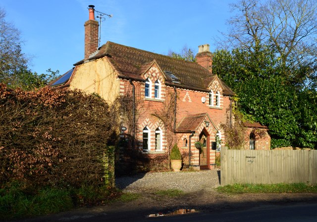
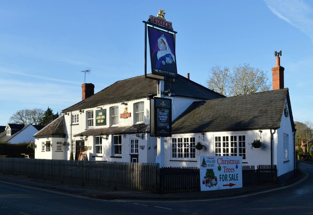
Cherryorchard Copse Images

Images are sourced within 2km of 51.438018/-1.1523693 or Grid Reference SU5971. Thanks to Geograph Open Source API. All images are credited.

The Garden House, Stanford Dingley, Berkshire Early C18. Red brick with moulded plat band. Moulded brick eaves cornice, old tile roof with end stacks and parapets, and 3 gabled dormers with casements. 2 storeys and attic; 3 bays, glazing bar sashes with exposed wooden boxes and gauged heads. Central glazed door with radial fanlight and doorcase with triangular pediment supported on plain brackets.

(Source:Historic England)
The Garden House, Stanford Dingley, Berkshire
Early C18. Red brick with moulded plat band. Moulded brick eaves cornice, old tile roof with end stacks and parapets, and 3 gabled dormers with casements. 2 storeys and attic; 3 bays, glazing bar sashes with exposed wooden boxes and gauged heads. Central glazed door with radial fanlight and doorcase with triangular pediment supported on plain brackets. (Source:Historic England)
The Spring, Standford Dingley, Berkshire Late C16 with C20 additions. Timber framed with angled braces, brick ground floor, first floor plaster panels, and tile hung gable end to left. Old tile roof with catslide to rear, part to right with slightly lower eaves; central ridge stack, and ridge stack off-centre to right. 3 framed bays to left. 2 storeys. 3 first floor 2-light C20 leaded casements, 4 ground floor C20 leaded casements, canted bay second from left with hipped tile roof. 

(Source:Historic England)
The Spring, Standford Dingley, Berkshire
Late C16 with C20 additions. Timber framed with angled braces, brick ground floor, first floor plaster panels, and tile hung gable end to left. Old tile roof with catslide to rear, part to right with slightly lower eaves; central ridge stack, and ridge stack off-centre to right. 3 framed bays to left. 2 storeys. 3 first floor 2-light C20 leaded casements, 4 ground floor C20 leaded casements, canted bay second from left with hipped tile roof. (Source:Historic England)
Village house, Bradfield Southend, Berkshire
The Queen's Head, Bradfield Southend, Berkshire
Country lane, Tutts Clump, Berkshire
Field boundary, Bradfield, Berkshire
Avenue of Oaks, Bucklebury, Berkshire The inner row of oaks was planted to celebrate a visit by Elizabeth I and the outer row to commemorate Wellington's victory at Waterloo in 1815. 

(Source:website of the Bucklebury Estate)

The gate posts were erected in 2015 to mark the marriage of Catherine Middleton, a resident of the village, to Prince William.
Avenue of Oaks, Bucklebury, Berkshire
The inner row of oaks was planted to celebrate a visit by Elizabeth I and the outer row to commemorate Wellington's victory at Waterloo in 1815. (Source:website of the Bucklebury Estate) The gate posts were erected in 2015 to mark the marriage of Catherine Middleton, a resident of the village, to Prince William.
New Way from the Cricket Ground New Way is one of the residential streets which surround the large cricket ground which occupies the prime spot in the centre of the village.
New Way from the Cricket Ground
New Way is one of the residential streets which surround the large cricket ground which occupies the prime spot in the centre of the village.
Houses in Heath Road
Rolling the Pitch Routine groundwork on the village cricket field.
Rolling the Pitch
Routine groundwork on the village cricket field.
Barn at Nine Elms Nine Elms Farm, or just Nine Elms depending which map you look at, is at the end of this drive. A short footpath through surrounding fields begins just beside the barn here.
Barn at Nine Elms
Nine Elms Farm, or just Nine Elms depending which map you look at, is at the end of this drive. A short footpath through surrounding fields begins just beside the barn here.
Sheep by the path Pasture near Clay Hill.
Sheep by the path
Pasture near Clay Hill.
Red Leaves in King's Copse A typical view for the area, mixed fields and woods.
Red Leaves in King's Copse
A typical view for the area, mixed fields and woods.
Cleared for Cables A view in the woods on Bucklebury Common where a power line cuts a swathe through the trees.
Cleared for Cables
A view in the woods on Bucklebury Common where a power line cuts a swathe through the trees.
Path between Paddocks A short public footpath cutting a corner between two lanes.
Path between Paddocks
A short public footpath cutting a corner between two lanes.
The Pang Valley near Bradfield The River Pang is the only tributary catchment of any size to join the Thames between Abingdon and Reading.
The Pang Valley near Bradfield
The River Pang is the only tributary catchment of any size to join the Thames between Abingdon and Reading.
Paths meet at the gate A convergence of footpaths by Fisher's Copse.
Paths meet at the gate
A convergence of footpaths by Fisher's Copse.
Bonfire in the wood Something on fire near some stables.
Bonfire in the wood
Something on fire near some stables.
Show me another place!

Cherryorchard Copse is located at Grid Ref: SU5971 (Lat: 51.438018, Lng: -1.1523693)

Unitary Authority: West Berkshire

Police Authority: Thames Valley

What 3 Words

///tango.enlighten.nearly. Near Bradfield, Berkshire

Related Wikis

Tutts Clump

Tutts Clump is a small hamlet in the civil parish of Bradfield in the English county of Berkshire. It is 8 mi (13 km) from the centre of Reading. It lies...

Southend, Berkshire

Southend or Bradfield Southend is a small rural village in the west of the civil parish of Bradfield in the English county of Berkshire. Until the 1965...

Stanford Dingley

Stanford Dingley is a small village and civil parish in West Berkshire, England, between Newbury and Theale. == Geography == Stanford Dingley fills part...

Bradfield Rural District

Bradfield was a rural district in Berkshire, England, from 1894 to 1974.It was created under the Local Government Act 1894 from the Bradfield rural sanitary...

King's Copse

King's Copse is a 13.7-hectare (34-acre) biological Site of Special Scientific Interest between Chapel Row and Clay Hill in Berkshire. It is in the North...

Bradfield, Berkshire

Bradfield is a village and civil parish in Berkshire, England. Aside from farms and a smaller amount of woodland its main settlements are Bradfield Southend...

Bradfield College

Bradfield College, formally St Andrew's College, Bradfield, is a public school (English fee-charging boarding and day school) for pupils aged 13–18, located...

Beenham

Beenham is a village and civil parish centred 6 miles (9.7 km) east of Newbury in the West Berkshire district of Berkshire, England. == Geography == Beenham...

Nearby Amenities

Located within 500m of 51.438018,-1.1523693
Toilets
Lat/Long: 51.4371499/-1.1466256
Tutts Clamp
Place: hamlet
Lat/Long: 51.4362251/-1.1563382
The data included in this document is from www.openstreetmap.org. The data is made available under ODbL.

Have you been to Cherryorchard Copse?

Leave your review of Cherryorchard Copse below (or comments, questions and feedback).