Dunkirk

Settlement in Cambridgeshire East Cambridgeshire

England

Dunkirk

Main Street, Pymoor
Main Street, Pymoor Credit: David Howard

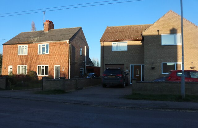
Dunkirk is a small village located in the county of Cambridgeshire, England. Situated approximately five miles southeast of the city of Cambridge, Dunkirk is nestled amidst the picturesque English countryside. The village is surrounded by rolling green fields, quaint country lanes, and charming cottages, creating a serene and idyllic setting.

Dunkirk is a tight-knit community with a population of around 400 residents. The village maintains a strong sense of community spirit, with various local events and gatherings bringing the residents together throughout the year. The village hall serves as a central hub for these activities and also hosts a range of clubs and societies, catering to the diverse interests of the villagers.

Despite its small size, Dunkirk boasts a rich history. The village is believed to have ancient origins, with evidence of Roman settlements in the area. Dunkirk also played a role in World War II, serving as a vital military airfield during the conflict.

The village is well-connected to nearby towns and cities. The A11 road runs just to the west of Dunkirk, providing easy access to Cambridge and other destinations. Additionally, the village is served by regular bus services, ensuring convenient transportation links for residents and visitors alike.

Dunkirk, Cambridgeshire, offers a peaceful and picturesque escape from the bustling city life. With its charming countryside scenery, strong community spirit, and convenient location, Dunkirk is a hidden gem in the heart of Cambridgeshire.

If you have any feedback on the listing, please let us know in the comments section below.

Dunkirk Images

Images are sourced within 2km of 52.452252/0.228786 or Grid Reference TL5186. Thanks to Geograph Open Source API. All images are credited.

Main Street, Pymoor
Main Street, Pymoor
Houses on Main Street, Pymoor
Pymoor cricket pavilion
B1411 approaching Pymoor
Barcham Farm The end of one of the poultry sheds and a large pile of straw bales.
Barcham Farm
The end of one of the poultry sheds and a large pile of straw bales.
Bus shelter, Pymoor
Bus shelter, Pymoor
Main Street, Pymoor
Main Street, Pymoor
The hub of the village - Pymoor near Ely You can make a phone call, catch a bus, post a letter, dump your litter, read the information boards, follow the road signs, sit on a bench, follow the footpath on the right or study the village sign. According to an information sign below the village sign Pymoor means "flies over marshland"
The hub of the village - Pymoor near Ely
You can make a phone call, catch a bus, post a letter, dump your litter, read the information boards, follow the road signs, sit on a bench, follow the footpath on the right or study the village sign. According to an information sign below the village sign Pymoor means "flies over marshland"
Field of cereal in Pymoor, Ely
Methodist Church bell, Pymoor
Pymoor, B1411
Pymoor, B1411
Cottages in Pymoor
Cottages in Pymoor
Vintage David Brown Tractor in Pymoor
Main Street, Pymoor The prominent building on the left is the old Knife and Steel pub, beyond that, the white building used to be the village Post Office.  In the distance, beside the telephone box, is the bus shelter at the crossroads.
Main Street, Pymoor
The prominent building on the left is the old Knife and Steel pub, beyond that, the white building used to be the village Post Office. In the distance, beside the telephone box, is the bus shelter at the crossroads.
Pymoor Methodist Chapel
Pymoor village sign
Pymoor village sign
Plaque on Pymoor Village sign On the post of the sign in photo <a href="https://www.geograph.org.uk/photo/723180">TL4986 : Pymoor village sign</a>.
Plaque on Pymoor Village sign
On the post of the sign in photo TL4986 : Pymoor village sign.
Farm building, Barcham Farm
Show me another place!

Dunkirk is located at Grid Ref: TL5186 (Lat: 52.452252, Lng: 0.228786)

Division: Isle of Ely

Administrative County: Cambridgeshire

District: East Cambridgeshire

Police Authority: Cambridgeshire

What 3 Words

///butter.cloud.skinning. Near Manea, Cambridgeshire

Nearby Locations

Downham Dunkirk

Related Wikis

Black Bank railway station

Black Bank railway station was a railway station in Black Bank, Cambridgeshire which is now closed. The station platforms have been demolished but the...

North West Cambridgeshire (UK Parliament constituency)

North West Cambridgeshire is a county constituency represented in the House of Commons of the Parliament of the United Kingdom since 2005 by Shailesh Vara...

Pymoor

Pymoor is a village in Cambridgeshire in the vicinity of Ely and in the parish of Little Downham. There are approximately 390 residents according to the...

Little Downham

Situated in the east of Cambridgeshire, the village of Little Downham is located just 3 miles (5 km) north of the city of Ely. The Parish of Downham comprises...

Nearby Amenities

Located within 500m of 52.452252,0.228786
Dunkirk
Is In: Cambridgeshire, England, UK
Place: hamlet
Source Name: npe
Lat/Long: 52.452022/0.2272935
Power: pole
Lat/Long: 52.4523253/0.2316719
Power: pole
Lat/Long: 52.4524748/0.2238303
Power: pole
Lat/Long: 52.4522786/0.2249957
Power: pole
Lat/Long: 52.4514172/0.2293825
Power: pole
Lat/Long: 52.4526521/0.2226528
Power: pole
Lat/Long: 52.4520677/0.2286542
Power: pole
Lat/Long: 52.4519443/0.2271656
Power: pole
Lat/Long: 52.4520907/0.2261571
Power: pole
Lat/Long: 52.4521936/0.2301496
Power: pole
Lat/Long: 52.4515486/0.2348327
Power: pole
Lat/Long: 52.4524281/0.2331671
Power: pole
Lat/Long: 52.4520014/0.2339771
Power: pole
Lat/Long: 52.4505843/0.2293905
Power: pole
Lat/Long: 52.449757/0.2293771
Power: pole
Lat/Long: 52.4489707/0.2293691
Dunkirk Farm
Place: farm
Lat/Long: 52.4490193/0.2286143
The data included in this document is from www.openstreetmap.org. The data is made available under ODbL.

Have you been to Dunkirk?

Leave your review of Dunkirk below (or comments, questions and feedback).