Budd's Plantation

Wood, Forest in Berkshire

England

Budd's Plantation

Tadley Common Road
Tadley Common Road Credit: David Howard

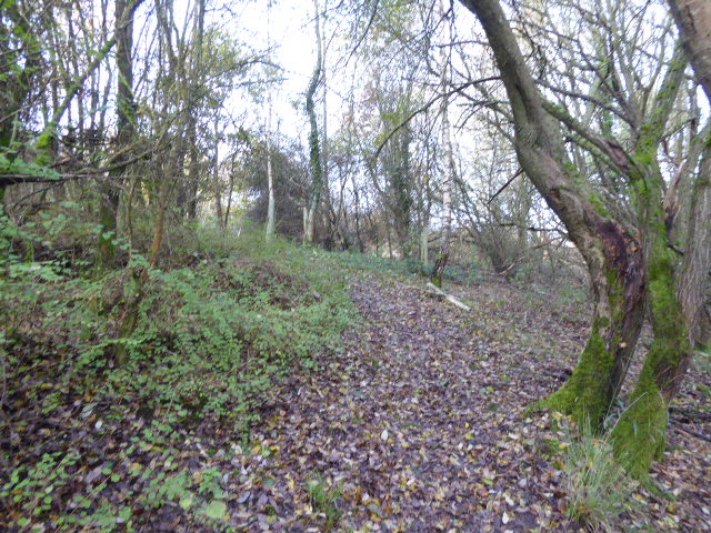
Budd's Plantation is a picturesque woodland located in Berkshire, England. Nestled in the heart of the county, this enchanting forest covers an expansive area of land, providing a tranquil escape from the hustle and bustle of nearby towns and cities.

The plantation is renowned for its diverse range of plant species, creating a lush and vibrant ecosystem. Towering oak, beech, and ash trees dominate the landscape, their canopies interweaving to form a captivating canopy overhead. Beneath this verdant canopy, a tapestry of wildflowers, ferns, and mosses flourish, adding bursts of color and texture to the forest floor.

Traversing the woodland, visitors are greeted by a network of well-maintained trails, offering the perfect opportunity for leisurely strolls, hikes, and nature exploration. These paths wind through the plantation, leading to hidden clearings, babbling brooks, and secluded picnic spots, where one can pause and immerse themselves in the serenity of the surroundings.

Budd's Plantation is also home to a variety of wildlife. The forest provides a haven for numerous bird species, including woodpeckers, owls, and thrushes, while squirrels and rabbits can often be spotted darting amongst the undergrowth. If lucky, visitors may even catch a glimpse of the elusive deer that roam the woodland.

With its natural beauty and tranquility, Budd's Plantation offers a peaceful retreat for nature enthusiasts, hikers, and those seeking solace in the embrace of the natural world. Whether it's a leisurely stroll or an immersive exploration, this idyllic Berkshire woodland promises a memorable experience for all who venture within its boundaries.

If you have any feedback on the listing, please let us know in the comments section below.

Budd's Plantation Images

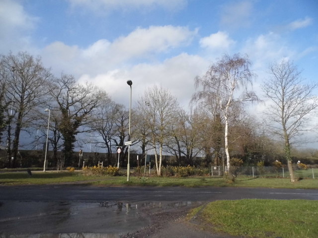
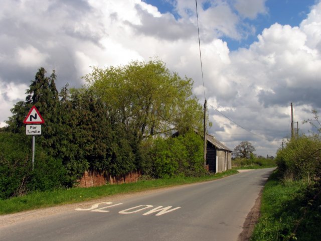
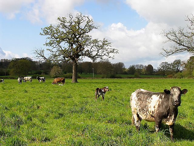
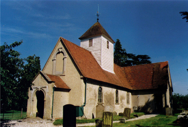
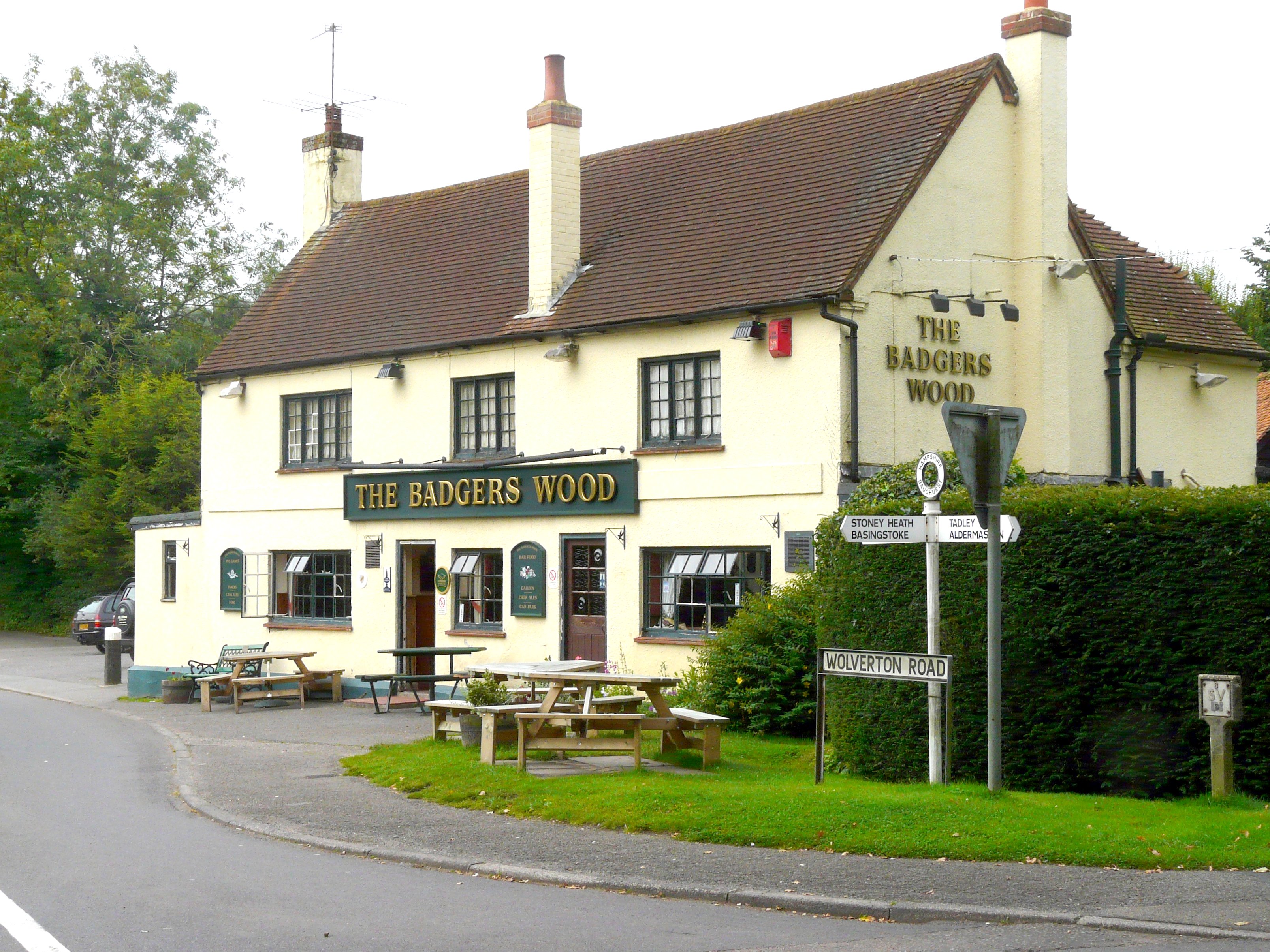
Images are sourced within 2km of 51.363243/-1.1624974 or Grid Reference SU5863. Thanks to Geograph Open Source API. All images are credited.

Tadley Common Road
Tadley Common Road
Access land south of the road This is an odd square for Geographs, with 2/3 of it taken up by the heavy duty security of the Aldermaston nuke labs.
I'm not sure how secret it all is or what the rules are about taking pictures of these places and posting them on the internet. I just notice none of us Geographers have tried to find out, so I'm not going to be the first to get arrested.
So....safe photo opportunities are on the south side of the road. This is a small patch of heath marked as access land, although it doesn't look as if anybody does. It's fairly impenetrable, and that's before the nettles have grown up.
Access land south of the road
This is an odd square for Geographs, with 2/3 of it taken up by the heavy duty security of the Aldermaston nuke labs. I'm not sure how secret it all is or what the rules are about taking pictures of these places and posting them on the internet. I just notice none of us Geographers have tried to find out, so I'm not going to be the first to get arrested. So....safe photo opportunities are on the south side of the road. This is a small patch of heath marked as access land, although it doesn't look as if anybody does. It's fairly impenetrable, and that's before the nettles have grown up.
Not Much of a Path This is the public footpath shown on the map heading over a patch of access land towards Upper Moor's Gully. It appears to be virtually disused.
There is a lane a short distance away which has been blocked at the top end and reduced to a cycleway. This would be the easy route for walkers now, and the footpath is pretty much redundant.
Not Much of a Path
This is the public footpath shown on the map heading over a patch of access land towards Upper Moor's Gully. It appears to be virtually disused. There is a lane a short distance away which has been blocked at the top end and reduced to a cycleway. This would be the easy route for walkers now, and the footpath is pretty much redundant.
Wasing Estate Taken from the back of the lodge, this view is southeast across the grid square.
Wasing Estate
Taken from the back of the lodge, this view is southeast across the grid square.
Farmland opposite Boot Farm This section of farmland is situated in the north western corner of the grid square. The picture was taken from the section of the road opposite the Boot Farm Buildings looking east and north.
Farmland opposite Boot Farm
This section of farmland is situated in the north western corner of the grid square. The picture was taken from the section of the road opposite the Boot Farm Buildings looking east and north.
Boot Farm Buildings These buildings are situated on the western side of the road and the picture was taken looking north. The buildings are situated in the north eastern section of the grid square.
Boot Farm Buildings
These buildings are situated on the western side of the road and the picture was taken looking north. The buildings are situated in the north eastern section of the grid square.
Inhurst Farm: Baughurst Area Situated in the lower half of the grid square, almost dead centre, this farm house is at the intersection of two roads. The picture was taken from the west side of the intersection.
Inhurst Farm: Baughurst Area
Situated in the lower half of the grid square, almost dead centre, this farm house is at the intersection of two roads. The picture was taken from the west side of the intersection.
Field next to Inhurst Lane This field is on the western side of the grid square and between the Inhurst Lane and the road from Brimpton Common, opposite Larkwhistle Farm (a landfill site).
Field next to Inhurst Lane
This field is on the western side of the grid square and between the Inhurst Lane and the road from Brimpton Common, opposite Larkwhistle Farm (a landfill site).
Aldermaston Park The beautiful grounds of Portland House and Aldermaston Park are situated in the northern half of the square. This view, taken looking towards the east of the square is situated in the north eastern section of the square.
Aldermaston Park
The beautiful grounds of Portland House and Aldermaston Park are situated in the northern half of the square. This view, taken looking towards the east of the square is situated in the north eastern section of the square.
Tadley Intersection This pub is situated A340 and on the north side of the A340. It can be seen in the top half of the grid square, in the centre. This picture was taken from the east side of the intersection.
Tadley Intersection
This pub is situated A340 and on the north side of the A340. It can be seen in the top half of the grid square, in the centre. This picture was taken from the east side of the intersection.
Business Park on the B3051 The business park is situated on the roundabout that  is the intersection of the A340 to Basingstoke and the B3051 to Kingsklere. It is situated north of the centre of the grid square. The picture was taken looking north west from the roundabout.
Business Park on the B3051
The business park is situated on the roundabout that is the intersection of the A340 to Basingstoke and the B3051 to Kingsklere. It is situated north of the centre of the grid square. The picture was taken looking north west from the roundabout.
Paices Hill This house on Paices Hill is situated next to the Aldermaston Plant and in the extreme north western section of the grid square.
Paices Hill
This house on Paices Hill is situated next to the Aldermaston Plant and in the extreme north western section of the grid square.
Wasing Park:  Aldermaston A view of the field and tree area in the centre of the grid square, looking east towards breaches gulley.
Wasing Park: Aldermaston
A view of the field and tree area in the centre of the grid square, looking east towards breaches gulley.
Cows and Calves: Wasing Estate Aldermaston This view is of the north western section of the grid square. The picture was taken from the footpath intersection looking west.
Cows and Calves: Wasing Estate Aldermaston
This view is of the north western section of the grid square. The picture was taken from the footpath intersection looking west.
Paddock near Brimpton Common This paddock is situated to the west of the last cottage in the centre of the lower half of the grid square. The picture was taken from the footpath looking west.
Paddock near Brimpton Common
This paddock is situated to the west of the last cottage in the centre of the lower half of the grid square. The picture was taken from the footpath looking west.
Brimpton Common Road This pub is situated in the north eastern section of the grid square at the Brimpton Common.
Brimpton Common Road
This pub is situated in the north eastern section of the grid square at the Brimpton Common.
Cornfield at Baughurst This cornfield is in the southern half of the square. The picture was taken from the footpath looking north across the farmland towards Heath End. The square is mostly farmland but also contains residences and the golf course.
Cornfield at Baughurst
This cornfield is in the southern half of the square. The picture was taken from the footpath looking north across the farmland towards Heath End. The square is mostly farmland but also contains residences and the golf course.
Upper Farm: Farmhouse in Baughurst This farmhouse on the western side of the minor road in the south western corner of the square was taken from the footpath opposite.
Upper Farm: Farmhouse in Baughurst
This farmhouse on the western side of the minor road in the south western corner of the square was taken from the footpath opposite.
Show me another place!

Budd's Plantation is located at Grid Ref: SU5863 (Lat: 51.363243, Lng: -1.1624974)

Unitary Authority: West Berkshire

Police Authority: Thames Valley

What 3 Words

///defrost.between.headache. Near Tadley, Hampshire

Related Wikis

Wasing

Wasing is an agricultural and woodland village, country estate and civil parish in West Berkshire, England owned almost wholly by the descendants of the...

Wasing Wood Ponds

Wasing Wood Ponds is a 13.5-hectare (33-acre) biological Site of Special Scientific Interest south of Aldermaston in Berkshire.The ponds are special for...

Baughurst

Baughurst is a village and civil parish in Hampshire, England. It is located west of the town of Tadley, 6 miles (9.7 km) north of Basingstoke. In the...

Heath End, Hampshire

Heath End is a small village between Tadley and Baughurst in Hampshire, England. == Governance == The village is part of the civil parish of Tadley and...

Paices Wood Country Parkland

Paices Wood Country Parkland is a country park on the edge of the village of Aldermaston in Berkshire, England. The parkland is under the management of...

The Hurst School

The Hurst School, previously The Hurst Community College, is a state secondary school in the village of Baughurst, within the county of Hampshire in England...

West's Meadow, Aldermaston

West's Meadow, Aldermaston is a 1.2-hectare (3.0-acre) biological Site of Special Scientific Interest south of Aldermaston in Berkshire.The site consists...

A340 road

The A340 is a major road in the south of England, portions of which are known as the Aldermaston Road, Tadley Hill, Basingstoke Road and Tidmarsh Road...

Nearby Amenities

Located within 500m of 51.363243,-1.1624974
Man Made: mast
Lat/Long: 51.3613373/-1.165648
Barrier: lift_gate
Lat/Long: 51.3612546/-1.1622744
Mini Roundabout
Direction: clockwise
Lat/Long: 51.3613294/-1.1622232
Crossing
Bicycle: yes
Crossing Island: yes
Kerb: lowered
Sloped Curb: yes
Lat/Long: 51.3622523/-1.1599795
Crossing
Bicycle: yes
Crossing: traffic_signals
Crossing Ref: toucan
Kerb: lowered
Lat/Long: 51.3602724/-1.1589986
Post Box
Brand: Royal Mail
Brand Wikidata: Q638098
Mapillary: 640471521138125
Operator: Royal Mail
Operator Wikidata: Q638098
Post Box Type: meter
Postal Code: RG7
Ref: RG7 651
Survey Date: 2023-07-17
Lat/Long: 51.3616291/-1.1627365
Post Box
Brand: Royal Mail
Brand Wikidata: Q638098
Mapillary: 621574720068487
Operator: Royal Mail
Operator Wikidata: Q638098
Post Box Type: pillar
Postal Code: RG7
Ref: RG7 251
Survey Date: 2023-07-17
Lat/Long: 51.3616396/-1.1627684
Barrier: kissing_gate
Lat/Long: 51.362603/-1.1598987
Barrier: stile
Lat/Long: 51.3629768/-1.1606711
Bus Stop
Calleva Park
Naptan AtcoCode: 1900HA010498
Naptan Bearing: NE
Naptan CommonName: Calleva Park
Naptan Crossing: Birch Road
Naptan NaptanCode: hamdtmpa
Naptan Street: Heath End Road
Naptan Verified: no
Source: naptan_import
Lat/Long: 51.3599102/-1.1623684
Bus Stop
Calleva Park
Naptan AtcoCode: 1900HA010499
Naptan Bearing: SW
Naptan CommonName: Calleva Park
Naptan Crossing: Birch Road
Naptan NaptanCode: hamdtmpd
Naptan Street: Heath End Road
Naptan Verified: no
Source: naptan_import
Lat/Long: 51.3598112/-1.1623559
Bicycle Parking
Bicycle Parking: stands
Capacity: 8
Covered: yes
Operator: Aldermaston Recreation Society
Lat/Long: 51.3631057/-1.1559151
Crossing
Bicycle: yes
Crossing Island: yes
Kerb: lowered
Lat/Long: 51.360483/-1.1580308
Crossing
Bicycle: yes
Crossing Island: yes
Kerb: lowered
Lat/Long: 51.3604748/-1.1581407
Traffic Signals
Traffic Signals: pedestrian_crossing
Traffic Signals Direction: forward
Lat/Long: 51.3602691/-1.1589552
Crossing
Bicycle: yes
Crossing Island: yes
Kerb: lowered
Lat/Long: 51.3602504/-1.157781
Crossing
Bicycle: yes
Crossing Island: yes
Kerb: lowered
Lat/Long: 51.3603258/-1.1577614
Traffic Signals
Traffic Signals Direction: backward
Lat/Long: 51.3602735/-1.1590391
Crossing
Bicycle: yes
Crossing: uncontrolled
Kerb: lowered
Sloped Curb: yes
Lat/Long: 51.3601896/-1.1584416
Crossing
Crossing: uncontrolled
Crossing Ref: zebra
Kerb: lowered
Sloped Curb: yes
Lat/Long: 51.3612022/-1.1579217
Crossing
Crossing: uncontrolled
Crossing Ref: zebra
Kerb: lowered
Sloped Curb: yes
Lat/Long: 51.3613832/-1.1579834
Crossing
Crossing: uncontrolled
Crossing Ref: zebra
Kerb: lowered
Sloped Curb: yes
Lat/Long: 51.3612978/-1.15789
Crossing
Bicycle: yes
Crossing: unmarked
Kerb: lowered
Sloped Curb: yes
Lat/Long: 51.360752/-1.1619703
Crossing
Bicycle: yes
Crossing Island: yes
Kerb: lowered
Sloped Curb: yes
Lat/Long: 51.3620679/-1.1597347
Crossing
Bicycle: yes
Crossing Island: yes
Kerb: lowered
Sloped Curb: yes
Lat/Long: 51.3620352/-1.1597575
Crossing
Bicycle: yes
Crossing: unmarked
Kerb: lowered
Sloped Curb: yes
Lat/Long: 51.360436/-1.1623197
Bus Stop
Lat/Long: 51.3623208/-1.1573862
Crossing
Bicycle: yes
Crossing Island: yes
Kerb: lowered
Sloped Curb: yes
Lat/Long: 51.3622481/-1.159929
Crossing
Crossing: unmarked
Kerb: lowered
Sloped Curb: yes
Lat/Long: 51.3637775/-1.1586553
Crossing
Crossing: unmarked
Kerb: lowered
Sloped Curb: yes
Lat/Long: 51.3596242/-1.1621718
Crossing
Crossing: unmarked
Kerb: lowered
Sloped Curb: yes
Lat/Long: 51.3596084/-1.1624885
Power: pole
Lat/Long: 51.3670131/-1.1600232
Power: pole
Lat/Long: 51.3661122/-1.1611524
Power: pole
Lat/Long: 51.3652213/-1.162338
Power: pole
Lat/Long: 51.3644107/-1.1634135
Power: pole
Lat/Long: 51.362324/-1.1637327
Power: pole
Lat/Long: 51.3605889/-1.1647868
Power: pole
Lat/Long: 51.3597599/-1.1652884
Give Way
Direction: forward
Source: Bing
Lat/Long: 51.3600109/-1.1585358
Give Way
Direction: forward
Source: Bing
Lat/Long: 51.360005/-1.1584411
International Mailing Systems
Addr City: Reading
Addr Housename: Saturn House
Addr Housenumber: Unit 4
Addr Postcode: RG7 8HA
Addr Street: Calleva Park
Addr Suburb: Aldermaston
Opening Hours: Mo-Fr 09:00-18:00
Phone: +44 118 982 0988
Website: https://www.ims-franking.co.uk
Lat/Long: 51.3610241/-1.1639605
The data included in this document is from www.openstreetmap.org. The data is made available under ODbL.

Have you been to Budd's Plantation?

Leave your review of Budd's Plantation below (or comments, questions and feedback).