Ramper Covert

Wood, Forest in Nottinghamshire Gedling

England

Ramper Covert

Gravelly Hollow This road has been blocked off at the far end, so now it is purely an access road for Watchwood Plantation. This is by the main parking area.
Gravelly Hollow Credit: Bill Boaden

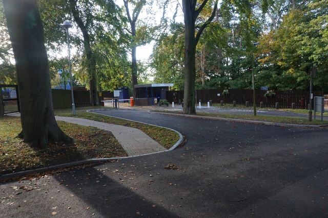
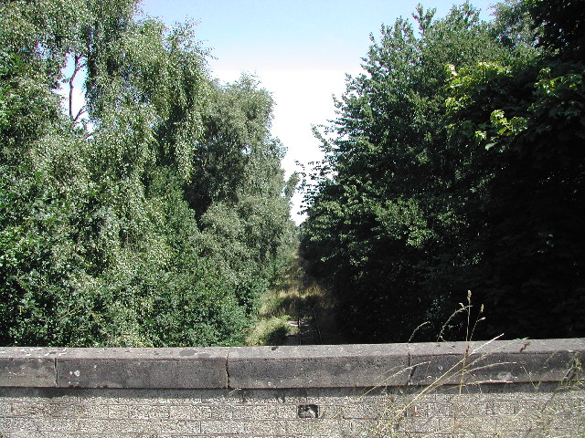
Ramper Covert is a small woodland located in Nottinghamshire, England. Situated within the larger area known as Sherwood Forest, Ramper Covert is a peaceful and tranquil natural space that attracts both locals and visitors alike.

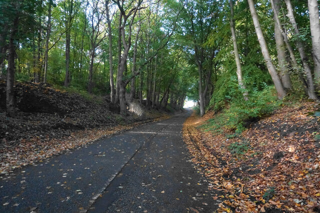
Covering an area of approximately 50 acres, Ramper Covert is characterized by its dense woodland, consisting mainly of broadleaf trees such as oak, beech, and birch. The thick canopy provides a haven for various wildlife species, including deer, squirrels, and a variety of bird species.

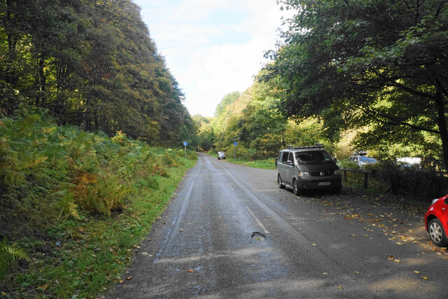
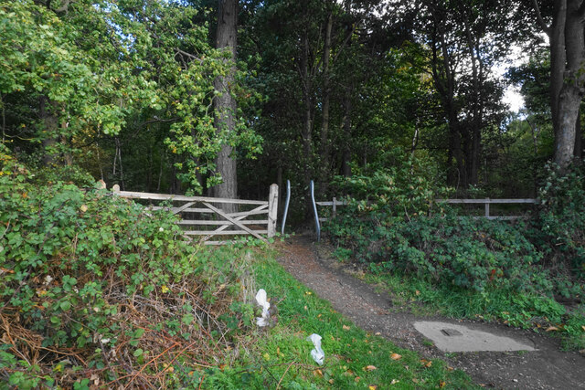
The woodland is crisscrossed by a network of well-maintained footpaths, allowing visitors to explore and appreciate the beauty of the area. These paths wind through the trees, providing opportunities for leisurely walks, jogging, or simply enjoying the natural surroundings. The tranquil atmosphere makes Ramper Covert a popular spot for nature enthusiasts, photographers, and those seeking a peaceful retreat from the hustle and bustle of everyday life.

Ramper Covert is also home to a diverse range of plant species, including wildflowers, ferns, and mosses. During the spring and summer months, the woodland comes alive with vibrant colors and fragrant scents as the flora blooms and thrives.

Overall, Ramper Covert offers a serene and picturesque escape for those seeking to connect with nature. Its rich biodiversity and well-maintained paths make it an ideal destination for outdoor activities and an excellent place to immerse oneself in the beauty of Sherwood Forest.

If you have any feedback on the listing, please let us know in the comments section below.

Ramper Covert Images

Images are sourced within 2km of 53.036632/-1.1385 or Grid Reference SK5749. Thanks to Geograph Open Source API. All images are credited.

Gravelly Hollow This road has been blocked off at the far end, so now it is purely an access road for Watchwood Plantation. This is by the main parking area.
Gravelly Hollow
This road has been blocked off at the far end, so now it is purely an access road for Watchwood Plantation. This is by the main parking area.
Gravelly Hollow This used to be a through route between Calverton and Burntstump, but it has been blocked off at the top of this rise. Now it only provides access to woodland.
Gravelly Hollow
This used to be a through route between Calverton and Burntstump, but it has been blocked off at the top of this rise. Now it only provides access to woodland.
Footpath into Foxcovert Plantation One of numerous forest walks in the locality.
Footpath into Foxcovert Plantation
One of numerous forest walks in the locality.
Road junction on Ollerton Road This used to be a crossroads but the approach from the right has been blocked off.
Road junction on Ollerton Road
This used to be a crossroads but the approach from the right has been blocked off.
The entrance to Sherwood Lodge The joint HQ of Nottinghamshire Police and Fire and Rescue Service. The public cannot go beyond this point.
The entrance to Sherwood Lodge
The joint HQ of Nottinghamshire Police and Fire and Rescue Service. The public cannot go beyond this point.
The Park Hospital A private hospital in the Burntstump complex.
The Park Hospital
A private hospital in the Burntstump complex.
Prepared field near Burntstump
Farmland below Raceground Hill A brief glimpse from the Robin Hood Way, seen across the former railway which serviced Calverton Colliery.
Farmland below Raceground Hill
A brief glimpse from the Robin Hood Way, seen across the former railway which serviced Calverton Colliery.
DAF HGV on Ollerton Road
Former roadway off Gravelly Hollow Now blocked.
Former roadway off Gravelly Hollow
Now blocked.
Burntstump Country Park
Burntstump Lodge On the eastern side of Burntstump Country Park it was once a school.
Burntstump Lodge
On the eastern side of Burntstump Country Park it was once a school.
Disused Railway From the bridge which carries the A60, this is a view NE of the old Calverton Mine Railway
Disused Railway
From the bridge which carries the A60, this is a view NE of the old Calverton Mine Railway
Gravelly Hollow View parallel to the now dead-end road towards Foxcovert Plantation.
Gravelly Hollow
View parallel to the now dead-end road towards Foxcovert Plantation.
Burntstump Country Park The Burntstump Inn taken from the park
Burntstump Country Park
The Burntstump Inn taken from the park
Blidworth Woods A sunny day in Sherwood Forest.
Blidworth Woods
A sunny day in Sherwood Forest.
Cricket ground, Burntstump The home of Ravenshead C.C. in Burntstump Country Park
Cricket ground, Burntstump
The home of Ravenshead C.C. in Burntstump Country Park
Old Paviors sports ground The club was originally formed by former pupils of High Pavement School in Nottingham
Old Paviors sports ground
The club was originally formed by former pupils of High Pavement School in Nottingham
Show me another place!

Ramper Covert is located at Grid Ref: SK5749 (Lat: 53.036632, Lng: -1.1385)

Administrative County: Nottinghamshire

District: Gedling

Police Authority: Nottinghamshire

What 3 Words

///talent.figure.rounds. Near Calverton, Nottinghamshire

Related Wikis

Bestwood Pumping Station

Bestwood Pumping Station was a water pumping station operating in Nottinghamshire from 1874 until 1964. == History == Bestwood Pumping Station was built...

Arnold Town F.C.

Arnold Town Football Club is a football club based in Arnold, Nottinghamshire, England. They are currently members of the Central Midlands League South...

Dorket Head

Dorket Head is the name of the immediate area surrounding the junction of Lime Lane and Calverton Road in the town of Arnold, Nottinghamshire. It is the...

Calverton Miners' Welfare F.C.

Calverton Miners' Welfare Football Club is an association football club in Calverton, near Nottingham, Nottinghamshire, England. They are currently members...

Redhill, Nottinghamshire

Redhill () is a small community forming part of the much larger town of Arnold in Nottinghamshire, England. It is approximately 4 miles (6.4 km) north...

The Oakwood Academy

The Oakwood Academy (formerly Big Wood School)' is a secondary school located on Bewcastle Road, Warren Hill, Nottingham, England. It is for 11- to 16...

St Albans, Nottinghamshire

St. Albans is a civil parish in the Gedling borough of Nottinghamshire, England. It was part of the wider Bestwood St. Albans parish, which ceased to exist...

Bestwood Country Park

Bestwood Country Park is a country park near Bestwood Village, Nottinghamshire, England. Bestwood was a hunting estate owned by the Crown from the medieval...

Nearby Amenities

Located within 500m of 53.036632,-1.1385
Power: pole
Source: Bing
Lat/Long: 53.0341265/-1.1333568
Material: wood
Power: pole
Source: Bing
Lat/Long: 53.0356022/-1.1319674
Power: pole
Source: Bing
Lat/Long: 53.0346797/-1.1326111
Material: wood
Power: pole
Source: Bing
Lat/Long: 53.036368/-1.1314394
Power: pole
Source: Bing
Lat/Long: 53.037336/-1.1315597
Power: pole
Lat/Long: 53.0351297/-1.1446917
Power: pole
Lat/Long: 53.0353103/-1.1432916
Power: pole
Lat/Long: 53.0354877/-1.1421812
Material: wood
Power: pole
Lat/Long: 53.0356781/-1.1406255
Power: pole
Lat/Long: 53.0357958/-1.1396599
Power: pole
Lat/Long: 53.0359087/-1.1388043
Power: pole
Lat/Long: 53.037007/-1.1361408
Power: pole
Lat/Long: 53.0371328/-1.134494
The data included in this document is from www.openstreetmap.org. The data is made available under ODbL.

Have you been to Ramper Covert?

Leave your review of Ramper Covert below (or comments, questions and feedback).