Lattice Coppice

Wood, Forest in Leicestershire Blaby

England

Lattice Coppice

The Chartwell Arms A public house on the corner of Chartwell Drive and West Avenue in Wigston.
The Chartwell Arms Credit: Mat Fascione

Lattice Coppice is a stunning woodland located in Leicestershire, England. Situated in the heart of the county, this captivating forest covers an area of approximately 200 acres and is renowned for its natural beauty and diverse range of flora and fauna.

The woodland is predominantly made up of coppiced trees, which have been carefully managed and cultivated for centuries. This traditional method of woodland management involves regularly cutting down certain trees to ground level, allowing new shoots to grow and ensuring the longevity of the woodland ecosystem.

Lattice Coppice is home to a rich variety of tree species, including oak, ash, beech, and birch. These towering trees create a dense canopy that provides shelter for a plethora of wildlife. Visitors can expect to encounter a wide array of birds, such as woodpeckers, jays, and owls, as well as small mammals like squirrels, rabbits, and foxes.

The woodland also boasts a diverse understory, with an abundance of wildflowers, ferns, and mosses carpeting the forest floor. During spring and summer, the forest comes alive with vibrant blooms, attracting butterflies, bees, and other pollinators.

Lattice Coppice is a popular destination for nature enthusiasts, walkers, and photographers, offering a tranquil retreat away from the hustle and bustle of modern life. The forest is crisscrossed with a network of well-maintained footpaths, allowing visitors to explore its hidden corners and discover its many delights.

Overall, Lattice Coppice is a cherished natural gem in Leicestershire, attracting visitors with its enchanting beauty, rich biodiversity, and peaceful atmosphere.

If you have any feedback on the listing, please let us know in the comments section below.

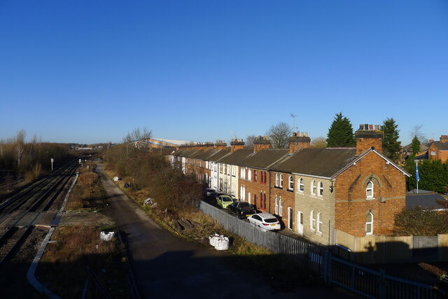
Lattice Coppice Images

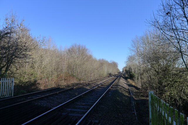
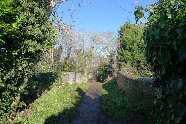
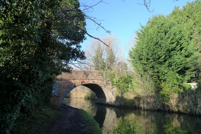
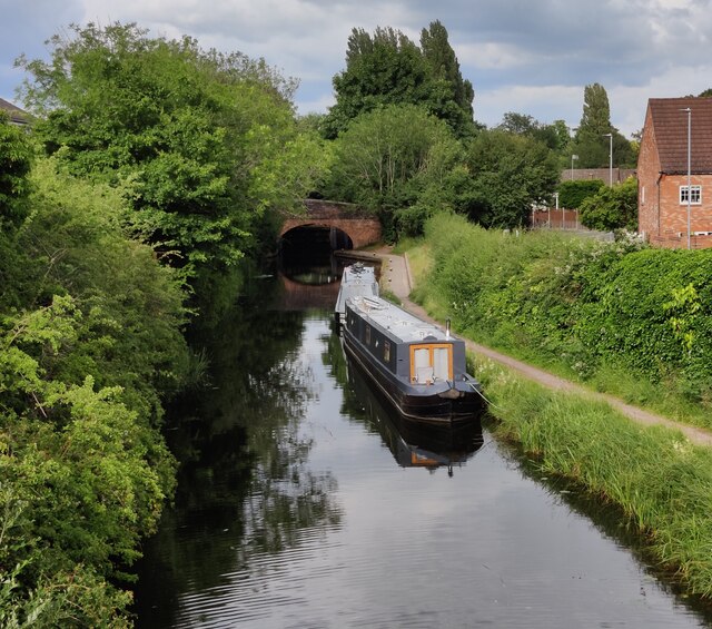
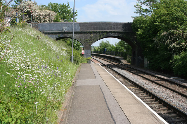
Images are sourced within 2km of 52.58378/-1.1479497 or Grid Reference SP5798. Thanks to Geograph Open Source API. All images are credited.
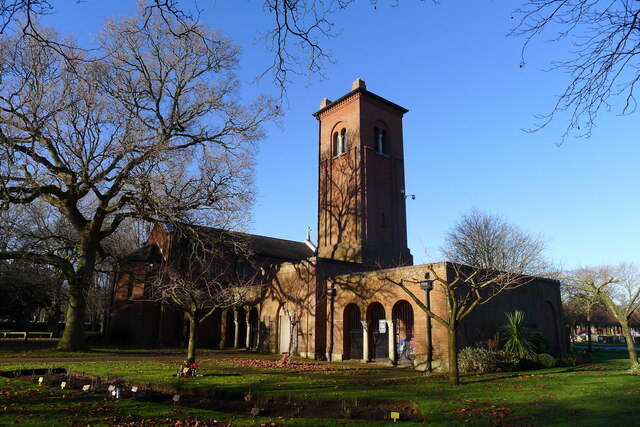
The Chartwell Arms A public house on the corner of Chartwell Drive and West Avenue in Wigston.
The Chartwell Arms
A public house on the corner of Chartwell Drive and West Avenue in Wigston.
Church of St Hugh of Lincoln, Eyres Monsell, Leicester "Built 1955-58, an excellent representative of a mid-20th century parish church designed by the practice of the nationally recognised architect Sir Basil Spence." [Local Heritage Asset Register, Leicester city Council]. This is an 'Anglo Catholic' church <span class="nowrap"><a title="https://sthugheyresmonsell.org.uk/" rel="nofollow ugc noopener" href="https://sthugheyresmonsell.org.uk/">Link</a><img style="margin-left:2px;" alt="External link" title="External link - shift click to open in new window" src="https://s1.geograph.org.uk/img/external.png" width="10" height="10"/></span> within the Church of England.
Church of St Hugh of Lincoln, Eyres Monsell, Leicester
"Built 1955-58, an excellent representative of a mid-20th century parish church designed by the practice of the nationally recognised architect Sir Basil Spence." [Local Heritage Asset Register, Leicester city Council]. This is an 'Anglo Catholic' church LinkExternal link within the Church of England.
The Birmingham-Peterborough cross-country line entering Leicester from the south-west
Footpath over Simpkin's Bridge The footpath, from Blaby, crosses the Grand Union Canal, and the railway line from Birmingham (gate ahead) to enter the City of Leicester (Eyres Monsell ward)
Footpath over Simpkin's Bridge
The footpath, from Blaby, crosses the Grand Union Canal, and the railway line from Birmingham (gate ahead) to enter the City of Leicester (Eyres Monsell ward)
Simpkin's Bridge, Grand Union Canal
Glen Parva Manor (pub restaurant) Listed Grade II "Late C16 or early C17 core extended c1860 and modernised" <span class="nowrap"><a title="https://historicengland.org.uk/listing/the-list/list-entry/1074733?section=official-listing" rel="nofollow ugc noopener" href="https://historicengland.org.uk/listing/the-list/list-entry/1074733?section=official-listing">Link</a><img style="margin-left:2px;" alt="External link" title="External link - shift click to open in new window" src="https://s1.geograph.org.uk/img/external.png" width="10" height="10"/></span>. "Sizable countryside restaurant/bar with outdoor seats and pub grub from grills to global classics." <span class="nowrap"><a title="https://www.glenparvamanorpub.co.uk/" rel="nofollow ugc noopener" href="https://www.glenparvamanorpub.co.uk/">Link</a><img style="margin-left:2px;" alt="External link" title="External link - shift click to open in new window" src="https://s1.geograph.org.uk/img/external.png" width="10" height="10"/></span>
Glen Parva Manor (pub restaurant)
Listed Grade II "Late C16 or early C17 core extended c1860 and modernised" LinkExternal link. "Sizable countryside restaurant/bar with outdoor seats and pub grub from grills to global classics." LinkExternal link
The Ford, Glen Parva Crossing the River Sence
The Ford, Glen Parva
Crossing the River Sence
Church of St Thomas the Apostle, South Wigston Listed Grade II "1892-3 with tower of 1901, by Stockdale Harrison" <span class="nowrap"><a title="https://historicengland.org.uk/listing/the-list/list-entry/1073656?section=official-listing" rel="nofollow ugc noopener" href="https://historicengland.org.uk/listing/the-list/list-entry/1073656?section=official-listing">Link</a><img style="margin-left:2px;" alt="External link" title="External link - shift click to open in new window" src="https://s1.geograph.org.uk/img/external.png" width="10" height="10"/></span>
Church of St Thomas the Apostle, South Wigston
Listed Grade II "1892-3 with tower of 1901, by Stockdale Harrison" LinkExternal link
South Wigston War Memorial Listed Grade II. "The aftermath of the First World War saw the biggest single wave of public commemoration ever with tens of thousands of memorials erected across England. This was the result of both the huge impact on communities of the loss of 750,000 British lives, and also the official policy of not repatriating the dead which meant that the memorials provided the main focus of the grief felt at this great loss. One such memorial was raised at South Wigston, as a permanent testament to the sacrifice made by the 106 members of the parishes of South Wigston and Glen Parva who lost their lives in the First World War" Unveiled in 1923, and altered in 1951 to commemorate a further 51 lives lost in the Second World War. <span class="nowrap"><a title="https://historicengland.org.uk/listing/the-list/list-entry/1464815?section=official-listing" rel="nofollow ugc noopener" href="https://historicengland.org.uk/listing/the-list/list-entry/1464815?section=official-listing">Link</a><img style="margin-left:2px;" alt="External link" title="External link - shift click to open in new window" src="https://s1.geograph.org.uk/img/external.png" width="10" height="10"/></span>
South Wigston War Memorial
Listed Grade II. "The aftermath of the First World War saw the biggest single wave of public commemoration ever with tens of thousands of memorials erected across England. This was the result of both the huge impact on communities of the loss of 750,000 British lives, and also the official policy of not repatriating the dead which meant that the memorials provided the main focus of the grief felt at this great loss. One such memorial was raised at South Wigston, as a permanent testament to the sacrifice made by the 106 members of the parishes of South Wigston and Glen Parva who lost their lives in the First World War" Unveiled in 1923, and altered in 1951 to commemorate a further 51 lives lost in the Second World War. LinkExternal link
Midland Cottages (road) alongside the Midland Main Line into Leicester The cottages were built by the railway company, for its workers, between 1871 and 1881, and form part of the small 'Midland Cottages Conservation Area' <span class="nowrap"><a title="https://www.oadby-wigston.gov.uk/files/documents/midland_cottages_conservation_area_appraisal_and_dc_guidance_part_1/Midland%20adopted%201-.pdf" rel="nofollow ugc noopener" href="https://www.oadby-wigston.gov.uk/files/documents/midland_cottages_conservation_area_appraisal_and_dc_guidance_part_1/Midland%20adopted%201-.pdf">Link</a><img style="margin-left:2px;" alt="External link" title="External link - shift click to open in new window" src="https://s1.geograph.org.uk/img/external.png" width="10" height="10"/></span>
Midland Cottages (road) alongside the Midland Main Line into Leicester
The cottages were built by the railway company, for its workers, between 1871 and 1881, and form part of the small 'Midland Cottages Conservation Area' LinkExternal link
Saffron Hill Cemetery Chapel Listed Grade II, 1928-9.
Saffron Hill Cemetery Chapel
Listed Grade II, 1928-9.
Janazahgah (Muslim Prayer Building),  Saffron Lane Cemetery "Muslim burials have taken place at Saffron Hill since June 1963 with a special area opened as a Muslim burial ground in 1977. Saffron Hill contains the first purpose built Muslim chapel or janazgah in Western Europe which was opened on 27 July 1985 by His Excellency Ali Arshad, Ambassador for Pakistan." <span class="nowrap"><a title="https://www.storyofleicester.info/a-place-to-live/saffron-hill-cemetery/" rel="nofollow ugc noopener" href="https://www.storyofleicester.info/a-place-to-live/saffron-hill-cemetery/">Link</a><img style="margin-left:2px;" alt="External link" title="External link - shift click to open in new window" src="https://s1.geograph.org.uk/img/external.png" width="10" height="10"/></span>
Janazahgah (Muslim Prayer Building), Saffron Lane Cemetery
"Muslim burials have taken place at Saffron Hill since June 1963 with a special area opened as a Muslim burial ground in 1977. Saffron Hill contains the first purpose built Muslim chapel or janazgah in Western Europe which was opened on 27 July 1985 by His Excellency Ali Arshad, Ambassador for Pakistan." LinkExternal link
Ye Olde Bakers Arms in Blaby A thatched pub dating from 1485.
Ye Olde Bakers Arms in Blaby
A thatched pub dating from 1485.
A426 Leicester Road, Blaby Bridge
Former Grand Hotel on Canal Street in South Wigston Built in c.1885 by Orson Wright, the architect was Cecil Ogden. Now converted into apartments.
Former Grand Hotel on Canal Street in South Wigston
Built in c.1885 by Orson Wright, the architect was Cecil Ogden. Now converted into apartments.
Narrowboats at Blue Bank Lock No 37 The Leicester section branches off the main line at Braunston and it is 66 miles long with 59 locks (including two five chamber staircase locks at Foxton) and two tunnels. Near Leicester it continues into the River Soar, and briefly along the River Wreake. The navigation then proceeds along the river, with some canalised diversions, to Loughborough and the River Trent south of Long Eaton.
Narrowboats at Blue Bank Lock No 37
The Leicester section branches off the main line at Braunston and it is 66 miles long with 59 locks (including two five chamber staircase locks at Foxton) and two tunnels. Near Leicester it continues into the River Soar, and briefly along the River Wreake. The navigation then proceeds along the river, with some canalised diversions, to Loughborough and the River Trent south of Long Eaton.
Rocket Round sculpture Outside the reception at the North Warwickshire and South Leicestershire College in South Wigston. This was one of the 40 giant rocket sculptures which were displayed across Leicester in 2021. Each sculpture is more than 8ft in height and sponsored by a local business.
Rocket Round sculpture
Outside the reception at the North Warwickshire and South Leicestershire College in South Wigston. This was one of the 40 giant rocket sculptures which were displayed across Leicester in 2021. Each sculpture is more than 8ft in height and sponsored by a local business.
Narrowboats moored along the Grand Union Canal The boats are moored between bridges 99 and 99A in Glen Parva.
Narrowboats moored along the Grand Union Canal
The boats are moored between bridges 99 and 99A in Glen Parva.
Show me another place!

Lattice Coppice is located at Grid Ref: SP5798 (Lat: 52.58378, Lng: -1.1479497)

Administrative County: Leicestershire

District: Blaby

Police Authority: Leicestershire

What 3 Words

///cost.sulk.pile. Near Blaby, Leicestershire

Related Wikis

HM Prison Glen Parva

HM Prison Glen Parva was an adult male prison and Young Offenders Institution, located in Glen Parva, Leicestershire, England. Glen Parva was operated...

HMP Fosse Way

HMP Fosse Way is a Category C prison in Leicester, England, UK. It has a planned capacity of 1,930 male inmates and cost £286 million to construct. It...

Glen Parva Barracks

Glen Parva Barracks was a military installation at Glen Parva near South Wigston in Leicestershire. == History == The barracks opened under the name of...

Wigston Glen Parva railway station

Wigston Glen Parva railway station was a railway station on the Birmingham to Peterborough Line that served Glen Parva in Leicestershire, England. ��2...

Eyres Monsell

Eyres Monsell is an electoral ward and administrative division in Leicester, England. == Geography == Eyres Monsell is bounded to the north by the historic...

South Wigston High School

South Wigston High School is a coeducational secondary school in Leicester, United Kingdom. It was founded in 1938 to serve the community of South Wigston...

St Thomas' Church, South Wigston

St Thomas’ Church, South Wigston is a Grade II* listed parish church in the Church of England in South Wigston, Leicestershire. == History == The foundation...

South Wigston railway station

South Wigston railway station is a railway station serving the large village of South Wigston in Leicestershire. The station is on the Birmingham to Peterborough...

Nearby Amenities

Located within 500m of 52.58378,-1.1479497
Glen Parva
Place: suburb
Lat/Long: 52.5798408/-1.1505523
Post Box
Postal Code: LE2 9RJ
Ref: LE2 443
Lat/Long: 52.5832882/-1.1534735
Bus Stop
Bus: yes
Naptan AtcoCode: 269040026
Naptan NaptanCode: lecdapta
Public Transport: platform
Lat/Long: 52.5836797/-1.1543032
Post Box
Postal Code: LE2
Ref: LE2 826
Lat/Long: 52.5823188/-1.1519943
Noexit: yes
Lat/Long: 52.5805522/-1.1508384
Noexit: yes
Lat/Long: 52.5803831/-1.149742
Barrier: bollard
Lat/Long: 52.5807939/-1.1496579
Railway: crossing
Lat/Long: 52.5805779/-1.1522275
Noexit: yes
Lat/Long: 52.5803682/-1.1501865
Place Of Worship
Glencroft Church
Node Id: 2142979600
Religion: christian
Source: OS_OpenData_StreetView
Source Name: OS Open Local Important Buildings Layer
Lat/Long: 52.5808234/-1.1467177
Atm
Lat/Long: 52.5854944/-1.1512481
Barrier: rope
Lat/Long: 52.5861543/-1.1507219
Mark Jarvis
Shop: bookmaker
Lat/Long: 52.5853306/-1.1517553
Check Date: 2015-07-05
Disused Amenity: pharmacy
Old Name: Lloyds Pharmacy
Lat/Long: 52.5852328/-1.1517821
Shop: newsagent
Wheelchair: limited
Lat/Long: 52.5851758/-1.1517794
Railway: crossing
Lat/Long: 52.5806126/-1.1522502
Generator Method: photovoltaic
Generator Output Electricity: yes
Generator Source: solar
Generator Type: solar_photovoltaic_panel
Location: roof
Power: generator
Lat/Long: 52.5882681/-1.1474412
Generator Method: photovoltaic
Generator Output Electricity: yes
Generator Source: solar
Generator Type: solar_photovoltaic_panel
Location: roof
Power: generator
Lat/Long: 52.5882195/-1.1472563
Generator Method: photovoltaic
Generator Output Electricity: yes
Generator Source: solar
Generator Type: solar_photovoltaic_panel
Location: roof
Power: generator
Lat/Long: 52.5879869/-1.1472611
Generator Method: photovoltaic
Generator Output Electricity: yes
Generator Source: solar
Generator Type: solar_photovoltaic_panel
Location: roof
Power: generator
Lat/Long: 52.5880064/-1.1473617
Generator Method: photovoltaic
Generator Output Electricity: yes
Generator Source: solar
Generator Type: solar_photovoltaic_panel
Location: roof
Power: generator
Lat/Long: 52.5881979/-1.1471766
Generator Method: photovoltaic
Generator Output Electricity: yes
Generator Source: solar
Generator Type: solar_photovoltaic_panel
Location: roof
Power: generator
Lat/Long: 52.5882443/-1.1483377
Generator Method: photovoltaic
Generator Output Electricity: yes
Generator Source: solar
Generator Type: solar_photovoltaic_panel
Location: roof
Power: generator
Lat/Long: 52.58792/-1.1490568
Generator Method: photovoltaic
Generator Output Electricity: yes
Generator Source: solar
Generator Type: solar_photovoltaic_panel
Location: roof
Power: generator
Lat/Long: 52.5879412/-1.1492365
Generator Method: photovoltaic
Generator Output Electricity: yes
Generator Source: solar
Generator Type: solar_photovoltaic_panel
Location: roof
Power: generator
Lat/Long: 52.5874927/-1.1520642
Generator Method: photovoltaic
Generator Output Electricity: yes
Generator Source: solar
Generator Type: solar_photovoltaic_panel
Location: roof
Power: generator
Lat/Long: 52.5871784/-1.1510211
Generator Method: photovoltaic
Generator Output Electricity: yes
Generator Source: solar
Generator Type: solar_photovoltaic_panel
Location: roof
Power: generator
Lat/Long: 52.5874222/-1.1497462
Generator Method: photovoltaic
Generator Output Electricity: yes
Generator Source: solar
Generator Type: solar_photovoltaic_panel
Location: roof
Power: generator
Lat/Long: 52.5877167/-1.1502269
Generator Method: photovoltaic
Generator Output Electricity: yes
Generator Source: solar
Generator Type: solar_photovoltaic_panel
Location: roof
Power: generator
Lat/Long: 52.587432/-1.150251
Generator Method: photovoltaic
Generator Output Electricity: yes
Generator Source: solar
Generator Type: solar_photovoltaic_panel
Location: roof
Power: generator
Lat/Long: 52.5876896/-1.1495331
Generator Method: photovoltaic
Generator Output Electricity: yes
Generator Source: solar
Generator Type: solar_photovoltaic_panel
Location: roof
Power: generator
Lat/Long: 52.5876539/-1.1487626
Generator Method: photovoltaic
Generator Output Electricity: yes
Generator Source: solar
Generator Type: solar_photovoltaic_panel
Location: roof
Power: generator
Lat/Long: 52.5879746/-1.1499044
Generator Method: photovoltaic
Generator Output Electricity: yes
Generator Source: solar
Generator Type: solar_photovoltaic_panel
Location: roof
Power: generator
Lat/Long: 52.5879486/-1.1494592
Generator Method: photovoltaic
Generator Output Electricity: yes
Generator Source: solar
Generator Type: solar_photovoltaic_panel
Location: roof
Power: generator
Lat/Long: 52.5821116/-1.1540337
Generator Method: photovoltaic
Generator Output Electricity: yes
Generator Source: solar
Generator Type: solar_photovoltaic_panel
Location: roof
Power: generator
Lat/Long: 52.5826955/-1.1511803
Generator Method: photovoltaic
Generator Output Electricity: yes
Generator Source: solar
Generator Type: solar_photovoltaic_panel
Location: roof
Power: generator
Lat/Long: 52.5826385/-1.1508933
Generator Method: photovoltaic
Generator Output Electricity: yes
Generator Source: solar
Generator Type: solar_photovoltaic_panel
Location: roof
Power: generator
Lat/Long: 52.5826255/-1.1507162
Generator Method: photovoltaic
Generator Output Electricity: yes
Generator Source: solar
Generator Type: solar_photovoltaic_panel
Location: roof
Power: generator
Lat/Long: 52.5826059/-1.150212
Generator Method: photovoltaic
Generator Output Electricity: yes
Generator Source: solar
Generator Type: solar_photovoltaic_panel
Location: roof
Power: generator
Lat/Long: 52.5833719/-1.1502093
Generator Method: photovoltaic
Generator Output Electricity: yes
Generator Source: solar
Generator Type: solar_photovoltaic_panel
Location: roof
Power: generator
Lat/Long: 52.5846952/-1.1507189
Generator Method: photovoltaic
Generator Output Electricity: yes
Generator Source: solar
Generator Type: solar_photovoltaic_panel
Location: roof
Power: generator
Lat/Long: 52.5841362/-1.1534735
Generator Method: photovoltaic
Generator Output Electricity: yes
Generator Source: solar
Generator Type: solar_photovoltaic_panel
Location: roof
Power: generator
Lat/Long: 52.5840482/-1.1528781
Generator Method: photovoltaic
Generator Output Electricity: yes
Generator Source: solar
Generator Type: solar_photovoltaic_panel
Location: roof
Power: generator
Lat/Long: 52.5837972/-1.1528566
Generator Method: photovoltaic
Generator Output Electricity: yes
Generator Source: solar
Generator Type: solar_photovoltaic_panel
Location: roof
Power: generator
Lat/Long: 52.5837891/-1.1529478
Generator Method: photovoltaic
Generator Output Electricity: yes
Generator Source: solar
Generator Type: solar_photovoltaic_panel
Location: roof
Power: generator
Lat/Long: 52.5843579/-1.1519098
Generator Method: photovoltaic
Generator Output Electricity: yes
Generator Source: solar
Generator Type: solar_photovoltaic_panel
Location: roof
Power: generator
Lat/Long: 52.5843611/-1.1519957
Generator Method: photovoltaic
Generator Output Electricity: yes
Generator Source: solar
Generator Type: solar_photovoltaic_panel
Location: roof
Power: generator
Lat/Long: 52.5831132/-1.1532968
Generator Method: photovoltaic
Generator Output Electricity: yes
Generator Source: solar
Generator Type: solar_photovoltaic_panel
Location: roof
Power: generator
Lat/Long: 52.5831183/-1.1533853
Generator Method: photovoltaic
Generator Output Electricity: yes
Generator Source: solar
Generator Type: solar_photovoltaic_panel
Location: roof
Power: generator
Lat/Long: 52.5832193/-1.154968
Generator Method: photovoltaic
Generator Output Electricity: yes
Generator Source: solar
Generator Type: solar_photovoltaic_panel
Location: roof
Power: generator
Lat/Long: 52.5841694/-1.1548766
Generator Method: photovoltaic
Generator Output Electricity: yes
Generator Source: solar
Generator Type: solar_photovoltaic_panel
Location: roof
Power: generator
Lat/Long: 52.5837656/-1.1546119
Generator Method: photovoltaic
Generator Output Electricity: yes
Generator Source: solar
Generator Type: solar_photovoltaic_panel
Location: roof
Power: generator
Lat/Long: 52.5871526/-1.1492105
Generator Method: photovoltaic
Generator Output Electricity: yes
Generator Source: solar
Generator Type: solar_photovoltaic_panel
Location: roof
Power: generator
Lat/Long: 52.5862166/-1.1530286
Noexit: yes
Lat/Long: 52.5803416/-1.151762
Noexit: yes
Lat/Long: 52.5804899/-1.1516681
Generator Method: photovoltaic
Generator Output Electricity: yes
Generator Source: solar
Generator Type: solar_photovoltaic_panel
Location: roof
Power: generator
Lat/Long: 52.5801574/-1.1504866
Building: yes
Lat/Long: 52.5843671/-1.1453644
Generator Method: photovoltaic
Generator Output Electricity: yes
Generator Source: solar
Generator Type: solar_photovoltaic_panel
Location: roof
Power: generator
Lat/Long: 52.5874404/-1.1510165
The data included in this document is from www.openstreetmap.org. The data is made available under ODbL.

Have you been to Lattice Coppice?

Leave your review of Lattice Coppice below (or comments, questions and feedback).