Birchlands Copse

Wood, Forest in Berkshire

England

Birchlands Copse

Farmland, Stanford Dingley, Berkshire
Farmland, Stanford Dingley, Berkshire Credit: Oswald Bertram

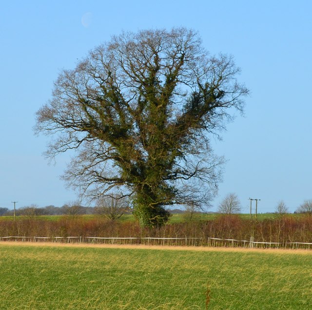
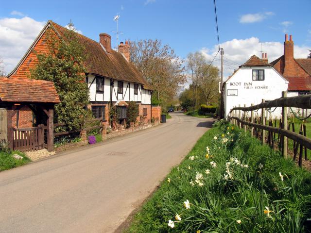
Birchlands Copse is a picturesque woodland located in Berkshire, England. Spanning approximately 100 acres, it is a popular destination for nature enthusiasts and outdoor lovers. The copse is characterized by its dense population of birch trees, which lend it its name and create a stunning landscape throughout the year.

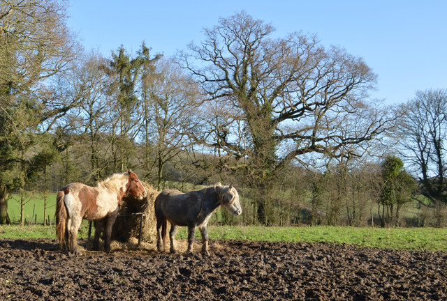
Situated on the outskirts of a small village, Birchlands Copse offers a peaceful and tranquil setting, making it an ideal escape from the hustle and bustle of city life. The woodland is home to a diverse range of flora and fauna, including various species of birds, mammals, and insects. Visitors can expect to encounter squirrels, deer, and a variety of songbirds as they explore the area.

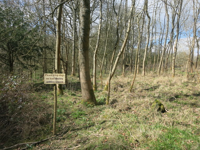
There are several well-maintained walking trails that wind through Birchlands Copse, allowing visitors to fully immerse themselves in the natural beauty of the forest. These trails are suitable for all ability levels and provide opportunities for both leisurely strolls and more challenging hikes. Along the way, visitors can enjoy the sights and sounds of the woodland, including the gentle rustling of leaves and the occasional babbling brook.

Birchlands Copse is also a popular spot for photography enthusiasts, as it offers ample opportunities to capture stunning shots of the woodland and its inhabitants. The changing seasons bring a kaleidoscope of colors to the copse, with vibrant autumn foliage and delicate spring blossoms adding to its charm.

Overall, Birchlands Copse is a hidden gem in Berkshire, offering a peaceful retreat and a chance to reconnect with nature. Whether you are a keen hiker, a birdwatcher, or simply seeking solace in the great outdoors, this woodland is sure to captivate and inspire.

If you have any feedback on the listing, please let us know in the comments section below.

Birchlands Copse Images

Images are sourced within 2km of 51.460453/-1.1699465 or Grid Reference SU5773. Thanks to Geograph Open Source API. All images are credited.

Farmland, Stanford Dingley, Berkshire
Field boundary, Bradfield, Berkshire
Footbridge over the M4 The M4 is 190 miles long and runs from London to South Wales. Major centres close to the motorway include Reading, Swindon, Bristol, Newport, Cardiff and Swansea. The motorway was constructed between 1961 and 1996. The M4 originally crossed the first Severn Road Bridge. It has now been diverted to use the Second Severn Crossing and the motorway over the older bridge has been renumbered as M48.
Wikipedia: <span class="nowrap"><a title="http://en.wikipedia.org/wiki/M4_motorway" rel="nofollow ugc noopener" href="http://en.wikipedia.org/wiki/M4_motorway">Link</a><img style="margin-left:2px;" alt="External link" title="External link - shift click to open in new window" src="https://s1.geograph.org.uk/img/external.png" width="10" height="10"/></span>
Footbridge over the M4
The M4 is 190 miles long and runs from London to South Wales. Major centres close to the motorway include Reading, Swindon, Bristol, Newport, Cardiff and Swansea. The motorway was constructed between 1961 and 1996. The M4 originally crossed the first Severn Road Bridge. It has now been diverted to use the Second Severn Crossing and the motorway over the older bridge has been renumbered as M48. Wikipedia: LinkExternal link
Scratchface Lane Bridge, M4 The M4 is 190 miles long and runs from London to South Wales. Major centres close to the motorway include Reading, Swindon, Bristol, Newport, Cardiff and Swansea. The motorway was constructed between 1961 and 1996. The M4 originally crossed the first Severn Road Bridge. It has now been diverted to use the Second Severn Crossing and the motorway over the older bridge has been renumbered as M48.
Wikipedia: <span class="nowrap"><a title="http://en.wikipedia.org/wiki/M4_motorway" rel="nofollow ugc noopener" href="http://en.wikipedia.org/wiki/M4_motorway">Link</a><img style="margin-left:2px;" alt="External link" title="External link - shift click to open in new window" src="https://s1.geograph.org.uk/img/external.png" width="10" height="10"/></span>
Scratchface Lane Bridge, M4
The M4 is 190 miles long and runs from London to South Wales. Major centres close to the motorway include Reading, Swindon, Bristol, Newport, Cardiff and Swansea. The motorway was constructed between 1961 and 1996. The M4 originally crossed the first Severn Road Bridge. It has now been diverted to use the Second Severn Crossing and the motorway over the older bridge has been renumbered as M48. Wikipedia: LinkExternal link
Bag in the Woods Public footpath through mixed woodland known as The Gravels.
I don't know what the bag is about.
It once contained Bartholomew's Bird Seed, so I guess someone's been in here fattening up the pheasants.
Bag in the Woods
Public footpath through mixed woodland known as The Gravels. I don't know what the bag is about. It once contained Bartholomew's Bird Seed, so I guess someone's been in here fattening up the pheasants.
Lane near the Motorway Motorway contractors don't do country lanes. Like many small roads that were in the path of motorway construction, this bit of lane has all the signs of being rebuilt to a much better standard than the unaltered bits at each end, which are still as winding and pot holed as ever.
Lane near the Motorway
Motorway contractors don't do country lanes. Like many small roads that were in the path of motorway construction, this bit of lane has all the signs of being rebuilt to a much better standard than the unaltered bits at each end, which are still as winding and pot holed as ever.
Kiln Pond, Burnt Hill One of the many old clay pits which can be found around here.
Kiln Pond, Burnt Hill
One of the many old clay pits which can be found around here.
Footpath off Scratchface Lane
Scratchface Lane The name suggests it wasn't always as neat as this along here.
Scratchface Lane
The name suggests it wasn't always as neat as this along here.
Miram's Copse This square is about 75% woodland.
Miram's Copse
This square is about 75% woodland.
Ivy Cottage on Yattendon Road, Burnt Hill
House on Yattendon Road, Burnt Hill
House on Yattendon Road, Ashurst Common
The road from Ashampstead Common to Pangbourne There's no name available on any map I can see.
The road from Ashampstead Common to Pangbourne
There's no name available on any map I can see.
House on Yattendon Road, Burnt Hill I haven't worked how they get in but maybe there's a tunnel somewhere.
House on Yattendon Road, Burnt Hill
I haven't worked how they get in but maybe there's a tunnel somewhere.
Plantation of Christmas trees, Burnt Hill
Suck's Lane 'Unsuitable for heavy goods vehicles'.
Suck's Lane
'Unsuitable for heavy goods vehicles'.
Show me another place!

Birchlands Copse is located at Grid Ref: SU5773 (Lat: 51.460453, Lng: -1.1699465)

Unitary Authority: West Berkshire

Police Authority: Thames Valley

What 3 Words

///chimp.balancing.including. Near Upper Basildon, Berkshire

Related Wikis

Ashampstead Common

Ashampstead Common is a common in the English county of Berkshire, within the civil parish of Ashampstead. The common lies north of the M4 motorway, near...

Burnt Hill, Berkshire

Burnt Hill is a hamlet in Berkshire, England. It is just north of the M4 motorway in West Berkshire, in the civil parish of Yattendon, which is also the...

Stanford Dingley

Stanford Dingley is a small village and civil parish in West Berkshire, England, between Newbury and Theale. == Geography == Stanford Dingley fills part...

Bradfield Rural District

Bradfield was a rural district in Berkshire, England, from 1894 to 1974.It was created under the Local Government Act 1894 from the Bradfield rural sanitary...

Nearby Amenities

Located within 500m of 51.460453,-1.1699465
Phone
Check Date: 2023-08-12
Emergency: phone
Ref: 2819A
Lat/Long: 51.4602522/-1.1765749
Phone
Check Date: 2023-08-12
Emergency: phone
Ref: 2819B
Lat/Long: 51.4605894/-1.176602
The data included in this document is from www.openstreetmap.org. The data is made available under ODbL.

Have you been to Birchlands Copse?

Leave your review of Birchlands Copse below (or comments, questions and feedback).