Alcock's Covert
Wood, Forest in Yorkshire Hambleton
England
Alcock's Covert
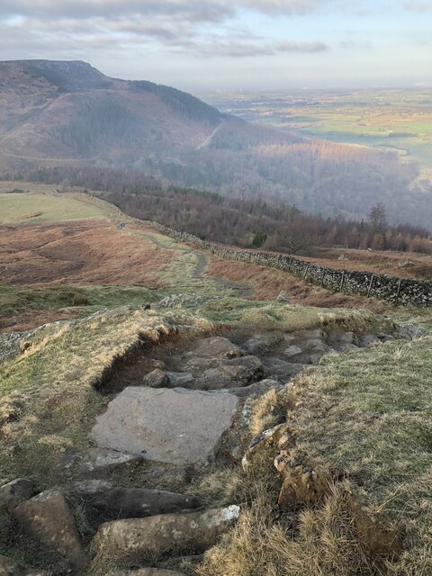
![A block of dressed sandstone with holding down bolts Hidden away in the forestry above Bank Foot is a tramway incline that served the sandstones quarries higher on Greenhow Bank. It first appears on the 1893 OS 25 inch map.
Blocks of sandstone would have been lowered down to a siding by the Rosedale Ironstone railway. I guess here a bridge was built to allow the incline to pass carrying an existing track. The line of the incline can be followed quite easily.
The lowest of these quarries is at 230m level. Here the incline branches, one climbs to a quarry at 330m level, the main incline to one at 290m. The 330m quarry was the subject of a post in 2015.
It is tempting to assume that these quarries, which seem to have been used entirely for building stone were operated by the Ingleby Ironstone & Freestone Company which built the original three mile long narrow gauge line to their ironstone mine at Rudd Scar. However, that mine was abandoned in 1860. Their narrow gauge railway had by then been upgraded to standard gauge by the North Yorkshire and Cleveland Railway.
For sources and references see my blog: Out and about ... (2021). Park Plantation Quarry Tramway. [online] Available at: <span class="nowrap"><a title="http://www.fhithich.uk/?p=24999" rel="nofollow ugc noopener" href="http://www.fhithich.uk/?p=24999">Link</a><img style="margin-left:2px;" alt="External link" title="External link - shift click to open in new window" src="https://s1.geograph.org.uk/img/external.png" width="10" height="10"/></span> [Accessed 11 Dec. 2021].
Update 26/12/21
The quarry was operated by the Ingleby Stone Quarry Company, a company probably under the direction of a Mr. Wren. The stone was lowered down to the Rosedale Railway by an incline known as Wren&#039;s Incline see [The Gazette. (1883). Page 6651 | Issue 25299, 25 December 1883 | London ... [online] Available at: <span class="nowrap"><a title="https://www.thegazette.co.uk/London/issue/25299/page/6651/data.htm" rel="nofollow ugc noopener" href="https://www.thegazette.co.uk/London/issue/25299/page/6651/data.htm">Link</a><img style="margin-left:2px;" alt="External link" title="External link - shift click to open in new window" src="https://s1.geograph.org.uk/img/external.png" width="10" height="10"/></span> [Accessed 22 Oct. 2021].].
In 1866, it was reported that a Mr Wren (the same?) had opened an ironstone mine in the area which was &quot;soon afterwards abandoned&quot; [&#039;The Cleveland Ironstone&#039; (1866) Yorkshire Gazette, 25 Aug, 4, available: <span class="nowrap"><a title="https://link-gale-com.ezproxy.is.ed.ac.uk/apps/doc/JF3231098185/GDCS?u=ed_itw&amp;sid=bookmark-GDCS&amp;xid=baf2da3d" rel="nofollow ugc noopener" href="https://link-gale-com.ezproxy.is.ed.ac.uk/apps/doc/JF3231098185/GDCS?u=ed_itw&amp;sid=bookmark-GDCS&amp;xid=baf2da3d">Link</a><img style="margin-left:2px;" alt="External link" title="External link - shift click to open in new window" src="https://s1.geograph.org.uk/img/external.png" width="10" height="10"/></span> [accessed 26 Dec 2021].]. This must be referring to the Ingleby Manor ironstone mine which briefly operated between 1856 and 1860 [Tuffs, Peter. &quot;Catalogue of Cleveland Ironstone Mines&quot;. Page 17. Cleveland Ironstone Series 1996.]. The mine had been developed with high hopes, having expectations of an annual yield of 150,000 tons [&#039;News&#039; (1857) Newcastle Journal, 12 Dec, 8, available: <span class="nowrap"><a title="https://link-gale-com.ezproxy.is.ed.ac.uk/apps/doc/GR3216193104/GDCS?u=ed_itw&amp;sid=bookmark-GDCS&amp;xid=711c2fad" rel="nofollow ugc noopener" href="https://link-gale-com.ezproxy.is.ed.ac.uk/apps/doc/GR3216193104/GDCS?u=ed_itw&amp;sid=bookmark-GDCS&amp;xid=711c2fad">Link</a><img style="margin-left:2px;" alt="External link" title="External link - shift click to open in new window" src="https://s1.geograph.org.uk/img/external.png" width="10" height="10"/></span> [accessed 26 Dec 2021].].](https://s3.geograph.org.uk/geophotos/07/04/11/7041191_d10cbe10.jpg)
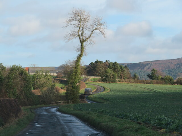
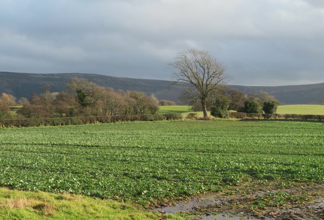
Alcock's Covert is a picturesque woodland located in the county of Yorkshire, England. Situated in the heart of the region, the covert spans a vast area, making it an ideal destination for nature enthusiasts and hikers alike. The woodland is named after the Alcock family, who were the original owners of the land.
Covered in a dense canopy of trees, Alcock's Covert is home to a diverse range of flora and fauna. The wood is primarily composed of deciduous trees, including oak, beech, and ash, which provide a stunning display of colors during the autumn months. Bluebells carpet the forest floor in the spring, creating a mesmerizing sight for visitors.
The covert is crisscrossed by a network of well-maintained trails, allowing visitors to explore its beauty at their own pace. These paths lead to various points of interest, such as a serene pond where ducks and swans can often be seen swimming. Additionally, hidden within the woodland are several ancient monuments, including burial mounds and standing stones, which showcase the rich history of the area.
Wildlife thrives in Alcock's Covert, with sightings of deer, foxes, and a wide variety of bird species being common. The woodland is a haven for birdwatchers, as it attracts rare and migratory birds throughout the year.
Overall, Alcock's Covert offers a tranquil escape from the hustle and bustle of everyday life. Its natural beauty, diverse ecosystem, and historical significance make it a must-visit destination for anyone seeking solace in nature.
If you have any feedback on the listing, please let us know in the comments section below.
Alcock's Covert Images
Images are sourced within 2km of 54.437746/-1.1113741 or Grid Reference NZ5705. Thanks to Geograph Open Source API. All images are credited.


![Track junction ahead Looking south to the junction of forest tracks. The track in the foreground leads [behind camera position] to the road, some 50m below a car parking area at NZ578038, but is potentially muddier than the upper track.](https://s1.geograph.org.uk/geophotos/07/14/76/7147625_dde8ce58.jpg)


Alcock's Covert is located at Grid Ref: NZ5705 (Lat: 54.437746, Lng: -1.1113741)
Division: North Riding
Administrative County: North Yorkshire
District: Hambleton
Police Authority: North Yorkshire
What 3 Words
///behalf.search.seated. Near Ingleby Greenhow, North Yorkshire
Nearby Locations
Related Wikis

Ingleby Greenhow
Ingleby Greenhow is a village and civil parish in the Hambleton district of North Yorkshire, England. It is on the border of the North York Moors and 3...

Ingleby railway station
Ingleby railway station was a railway station built to serve the village of Ingleby Greenhow in North Yorkshire, England. The station was on the North...

Battersby
Battersby is a hamlet in North Yorkshire, England. It lies on the edge of the North York Moors National Park and within the historic boundaries of the...
Battersby railway station
Battersby is a railway station on the Esk Valley Line, which runs between Middlesbrough and Whitby via Nunthorpe. The station, situated 11 miles 4 chains...
Great Broughton, North Yorkshire
Great Broughton is a village in the Great and Little Broughton civil parish of the Hambleton district of North Yorkshire in northern England. == History... ==
Easby, Hambleton
Easby is a village and civil parish in Hambleton District of North Yorkshire, England. It lies approximately 2 miles (3.2 km) south-east of Great Ayton...

Urra Moor
Urra Moor is the highest moor in the North York Moors, North Yorkshire, England. At 1,490 feet (454 m) above sea level it is the highest point in Hambleton...

Kirkby, North Yorkshire
Kirkby (historically known as Kirkby-in-Cleveland) is a village and civil parish in Hambleton district of North Yorkshire, England, near Great Busby and...
Nearby Amenities
Located within 500m of 54.437746,-1.1113741Have you been to Alcock's Covert?
Leave your review of Alcock's Covert below (or comments, questions and feedback).