Monk's Wood

Wood, Forest in Oxfordshire South Oxfordshire

England

Monk's Wood

Santander Bank branch in Headington (2) Located at 116 London Road, this branch is closing permanently after today ie Thursday 12th July 2021. It is one of 111 such branches closing in the Summer 2021. A Cancer Research UK shop can be seen to the right of the photo.
Santander Bank branch in Headington (2) Credit: David Hillas

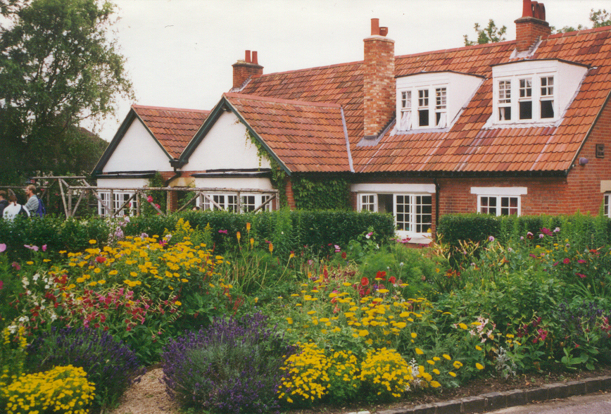
Monk's Wood is a picturesque forest located in Oxfordshire, England. Covering an area of approximately 100 acres, it is a prominent natural landmark in the area. The wood is situated near the village of Sutton Courtenay, offering a serene and tranquil environment for visitors to escape the hustle and bustle of everyday life.

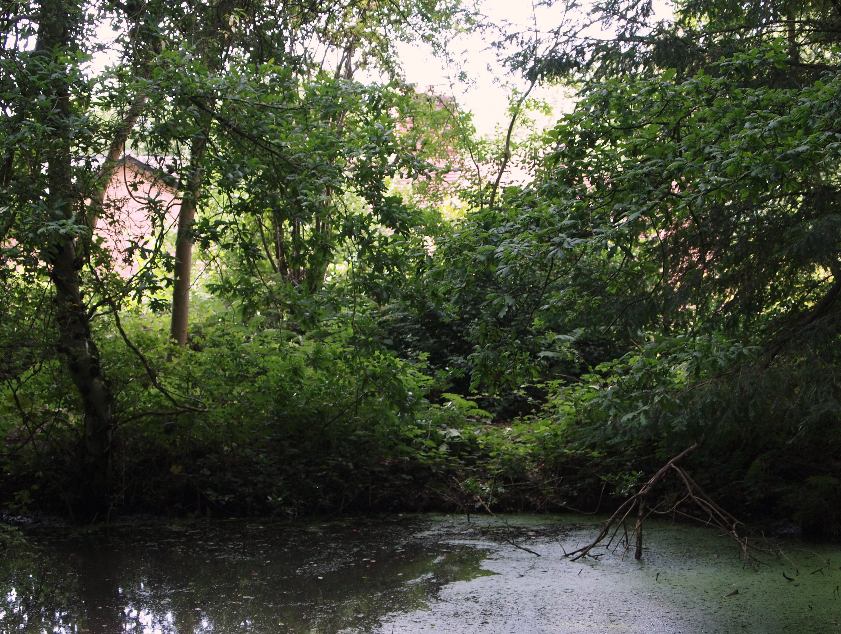
The wood is characterized by its diverse range of flora and fauna, making it a haven for nature enthusiasts and wildlife lovers. Ancient oak trees dominate the landscape, providing a majestic and timeless ambience. The forest floor is carpeted with bluebells during the spring, creating a stunning display of colors. Other plant species, such as wild garlic and primroses, also thrive within the wood.

Monk's Wood is home to a wide variety of animal species, including deer, foxes, badgers, and a multitude of bird species. Birdwatchers can spot woodpeckers, owls, and various songbirds in the area. The wood's peacefulness and natural beauty make it an ideal place for birdwatching and photography.

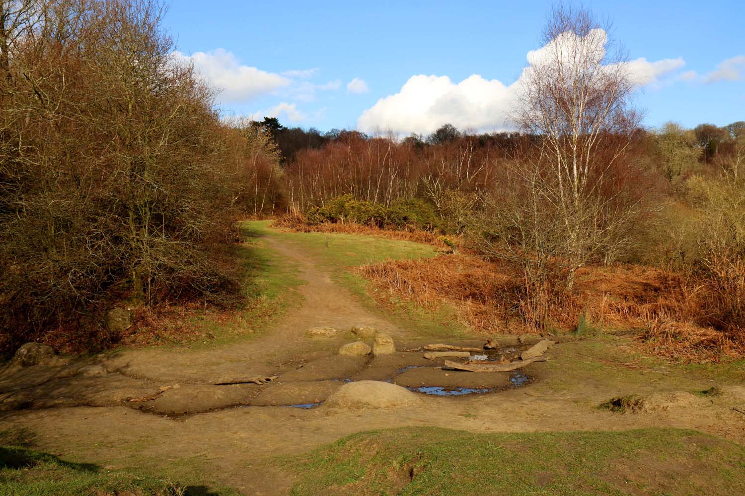
The forest offers several walking trails, allowing visitors to explore its enchanting surroundings. These trails range from easy to moderate difficulty, catering to all fitness levels. The wood is also equipped with picnic areas, making it a popular destination for families and groups looking to enjoy a day outdoors.

Overall, Monk's Wood is a captivating natural gem in Oxfordshire, providing a sanctuary for both wildlife and humans alike. Its beauty and tranquility make it a must-visit destination for nature lovers seeking an escape from the urban landscape.

If you have any feedback on the listing, please let us know in the comments section below.

Monk's Wood Images

Images are sourced within 2km of 51.75554/-1.1833975 or Grid Reference SP5606. Thanks to Geograph Open Source API. All images are credited.

Santander Bank branch in Headington (2) Located at 116 London Road, this branch is closing permanently after today ie Thursday 12th July 2021. It is one of 111 such branches closing in the Summer 2021. A Cancer Research UK shop can be seen to the right of the photo.
Santander Bank branch in Headington (2)
Located at 116 London Road, this branch is closing permanently after today ie Thursday 12th July 2021. It is one of 111 such branches closing in the Summer 2021. A Cancer Research UK shop can be seen to the right of the photo.
Houses on North Way, Barton, Oxford
Quarry Hollow Play Area with children playing in the snow This old quarry was known locally as Munts's, the name of the builder whose yard it was when he built many of the houses in the area in the 1920s.
Quarry Hollow Play Area with children playing in the snow
This old quarry was known locally as Munts's, the name of the builder whose yard it was when he built many of the houses in the area in the 1920s.
Old Milestone by the A420, London Road, Headington Stokenchurch pillar by the A420, in parish of Oxford (Oxford District), London Road; Headington, by No.196, North of Bury Knowle Park, on path in front of low wall.

Inscription reads:-
LII
Miles from
London
II
Miles to
Oxford
Rivet benchmark on top.

Grade II listed.
List Entry Number: 1369694 <span class="nowrap"><a title="https://historicengland.org.uk/listing/the-list/list-entry/1369694" rel="nofollow ugc noopener" href="https://historicengland.org.uk/listing/the-list/list-entry/1369694">Link</a><img style="margin-left:2px;" alt="External link" title="External link - shift click to open in new window" src="https://s1.geograph.org.uk/img/external.png" width="10" height="10"/></span>

Surveyed

Milestone Society National ID: OX_LW52
Old Milestone by the A420, London Road, Headington
Stokenchurch pillar by the A420, in parish of Oxford (Oxford District), London Road; Headington, by No.196, North of Bury Knowle Park, on path in front of low wall. Inscription reads:- LII Miles from London II Miles to Oxford Rivet benchmark on top. Grade II listed. List Entry Number: 1369694 LinkExternal link Surveyed Milestone Society National ID: OX_LW52
Easter Monday Egg Roll Every Easter Sunday, the park rangers hold a 'Best Decorated Egg' competition, followed by the traditional egg roll. A great local event!
Easter Monday Egg Roll
Every Easter Sunday, the park rangers hold a 'Best Decorated Egg' competition, followed by the traditional egg roll. A great local event!
Rock Edge, Oxford Much of Headington is built around old limestone quarries. Only one good exposure of the limestones survive, at Rock Edge (formerly Crossroads Pit), at the junction of Windmill Road and Old Road. The limestones have been quarried since the twelfth century. They provided building stones for the older houses in Oxford, as well as parts of many colleges.
Rock Edge, Oxford
Much of Headington is built around old limestone quarries. Only one good exposure of the limestones survive, at Rock Edge (formerly Crossroads Pit), at the junction of Windmill Road and Old Road. The limestones have been quarried since the twelfth century. They provided building stones for the older houses in Oxford, as well as parts of many colleges.
Thornhill Park and Ride, Oxford
Shotover Country Park, Oxford Shotover Hill, 3 miles (5km) to the east of Oxford, rises steeply to a height of 557 feet (171m) above sea level. Shotover was a Royal Forest from the time of the Domesday book until 1660, by which time the woodland was in such poor condition that it was disafforested or made no longer subject to forest laws.
Shotover Country Park, Oxford
Shotover Hill, 3 miles (5km) to the east of Oxford, rises steeply to a height of 557 feet (171m) above sea level. Shotover was a Royal Forest from the time of the Domesday book until 1660, by which time the woodland was in such poor condition that it was disafforested or made no longer subject to forest laws.
St, Mary's Church, Headington
Obelisk, garden of Shotover House The obelisk was designed by William Kent in the 1730s when he laid out the gardens west of Shotover House. The Oxford Inscriptions website  recorded the story that it marks the place where Elizabeth 1st took leave of Oxford in 1592 on her last visit.
Obelisk, garden of Shotover House
The obelisk was designed by William Kent in the 1730s when he laid out the gardens west of Shotover House. The Oxford Inscriptions website recorded the story that it marks the place where Elizabeth 1st took leave of Oxford in 1592 on her last visit.
Tree-lined avenue to Shotover House This avenue leads from the house to the old Oxford-London road which went over Shotover Hill
Tree-lined avenue to Shotover House
This avenue leads from the house to the old Oxford-London road which went over Shotover Hill
Horspath Reservoir This small reservoir is next to the old road over Shotover Hill.
Horspath Reservoir
This small reservoir is next to the old road over Shotover Hill.
Bean field near Shotover House View from the bridleway along the avenue of trees leading to Shotover House.
Bean field near Shotover House
View from the bridleway along the avenue of trees leading to Shotover House.
Field and wood by Shotover House The wood is on the fringe of the gardens of Shotover House. The agricultural implement in the field is a roller.
Field and wood by Shotover House
The wood is on the fringe of the gardens of Shotover House. The agricultural implement in the field is a roller.
Outbuildings of Shotover House Shotover House is in the background
Outbuildings of Shotover House
Shotover House is in the background
Temple at Shotover House The temple was designed by William Kent when laying out this area of the gardens in the 1730s.
Temple at Shotover House
The temple was designed by William Kent when laying out this area of the gardens in the 1730s.
Restricted Byway, Shotover This byway runs from Shotover Plain to Horspath
Restricted Byway, Shotover
This byway runs from Shotover Plain to Horspath
Toilets and snack bar, A40 Last layby on the A40 from Oxford to London before the M40 motorway. I enjoyed a roll with sausage and onion - cheap and good.
Toilets and snack bar, A40
Last layby on the A40 from Oxford to London before the M40 motorway. I enjoyed a roll with sausage and onion - cheap and good.
Show me another place!

Monk's Wood is located at Grid Ref: SP5606 (Lat: 51.75554, Lng: -1.1833975)

Administrative County: Oxfordshire

District: South Oxfordshire

Police Authority: Thames Valley

What 3 Words

///fund.assets.wipe. Near Cowley, Oxfordshire

Related Wikis

CS Lewis Nature Reserve

CS Lewis Nature Reserve is a 3-hectare (7.4-acre) nature reserve in Risinghurst, a suburb of Oxford in Oxfordshire. It is managed by the Berkshire, Buckinghamshire...

The Kilns

The Kilns, also known as C. S. Lewis House, is the house in Risinghurst, Oxford, England, where the author C. S. Lewis wrote all of his Narnia books and...

Risinghurst

Risinghurst is an outlying residential area of Oxford, England, just outside the Eastern Bypass Road which forms part of the Oxford ring road. It is about...

Shotover

Shotover is a hill and forest in Oxfordshire, England. The hill is 3 miles (4.8 km) east of Oxford. Its highest point is 557 feet (170 m) above sea level...

Old Road, Oxford

Old Road is a long street in Headington, east Oxford, England, extending into Oxfordshire as a road east of Oxford, to Littleworth near Wheatley. It is...

Risinghurst and Sandhills

Risinghurst and Sandhills is a civil parish in the city of Oxford, Oxfordshire, England. It consists of Risinghurst and Sandhills, two areas in the east...

Brasenose Wood and Shotover Hill

Brasenose Wood and Shotover Hill is a 109.2-hectare (270-acre) biological Site of Special Scientific Interest on the eastern outskirts of Oxford in Oxfordshire...

Holy Trinity Church, Headington Quarry

Holy Trinity Church, Headington Quarry, is located in the district of Headington Quarry, Oxford, England. It is an active Anglican parish church in the...

Nearby Amenities

Located within 500m of 51.75554,-1.1833975
Turning Circle
Lat/Long: 51.7566146/-1.1896658
Bench
Backrest: yes
Created By: Potlatch 0.10f
Lat/Long: 51.7516798/-1.1859241
Man Made: tower
Lat/Long: 51.752091/-1.1865452
Bench
Lat/Long: 51.7560063/-1.1891433
Shotover Hill
Ele: 171
Natural: peak
Wikidata: Q7502563
Lat/Long: 51.752216/-1.1865909
Bench
Backrest: yes
Created By: Potlatch 0.10f
Lat/Long: 51.7514141/-1.1828342
Created By: osm2go v0.6.14
Lat/Long: 51.7587369/-1.185857
Bus Stop
Lewis Close
Bench: no
Bin: no
Bus: yes
Lit: yes
Local Ref: opp
Naptan AtcoCode: 340001289LEW
Naptan Bearing: SE
Naptan CommonName: Lewis Close
Naptan Crossing: Lewis Close
Naptan Indicator: OPP
Naptan NaptanCode: oxfgpjpg
Naptan Street: Kiln Lane
Naptan Verified: no
Public Transport: platform
Shelter: no
Source: naptan_import
Tactile Paving: no
Lat/Long: 51.7577413/-1.18897
Barrier: bollard
Bollard: fixed
Lat/Long: 51.7518017/-1.1838731
Shotover Country Park Map
Bicycle: yes
Check Date: 2021-09-25
Hiking: yes
Information: map
Map Size: site
Tourism: information
Lat/Long: 51.7516194/-1.1846753
Bicycle Parking
Bicycle Parking: stands
Capacity: 8
Covered: no
Source Highway: survey
Lat/Long: 51.7516476/-1.1845379
Power: pole
Lat/Long: 51.7535333/-1.1775854
Power: pole
Lat/Long: 51.752859/-1.1778
Power: pole
Lat/Long: 51.7541924/-1.1773252
Power: pole
Lat/Long: 51.7548266/-1.1771026
Power: pole
Lat/Long: 51.7561084/-1.1766171
Direction: 175
Generator Method: photovoltaic
Generator Output Electricity: yes
Generator Solar Modules: 21
Generator Source: solar
Generator Type: solar_photovoltaic_panel
Location: roof
Power: generator
Lat/Long: 51.7567524/-1.1875217
Direction: 145
Generator Method: photovoltaic
Generator Output Electricity: yes
Generator Solar Modules: 6
Generator Source: solar
Generator Type: solar_photovoltaic_panel
Location: roof
Power: generator
Lat/Long: 51.7570243/-1.1869134
Direction: 55
Generator Method: photovoltaic
Generator Output Electricity: yes
Generator Solar Modules: 12
Generator Source: solar
Generator Type: solar_photovoltaic_panel
Location: roof
Power: generator
Lat/Long: 51.7569839/-1.186913
Direction: 235
Fixme: survey for panel count
Generator Method: photovoltaic
Generator Output Electricity: yes
Generator Solar Modules: 12
Generator Source: solar
Generator Type: solar_photovoltaic_panel
Location: roof
Power: generator
Lat/Long: 51.7569499/-1.1869367
Direction: 145
Generator Method: photovoltaic
Generator Output Electricity: yes
Generator Solar Modules: 14
Generator Source: solar
Generator Type: solar_photovoltaic_panel
Location: roof
Power: generator
Lat/Long: 51.7567237/-1.1870272
Direction: 220
Generator Method: photovoltaic
Generator Output Electricity: yes
Generator Solar Modules: 7
Generator Source: solar
Generator Type: solar_photovoltaic_panel
Location: roof
Power: generator
Lat/Long: 51.7531353/-1.1879136
Direction: 150
Generator Method: photovoltaic
Generator Output Electricity: yes
Generator Solar Modules: 5
Generator Source: solar
Generator Type: solar_photovoltaic_panel
Location: roof
Power: generator
Lat/Long: 51.7579843/-1.1875307
Direction: 60
Generator Method: photovoltaic
Generator Output Electricity: yes
Generator Solar Modules: 7
Generator Source: solar
Generator Type: solar_photovoltaic_panel
Location: roof
Power: generator
Lat/Long: 51.7580128/-1.1875057
Direction: 150
Generator Method: photovoltaic
Generator Output Electricity: yes
Generator Solar Modules: 18
Generator Source: solar
Generator Type: solar_photovoltaic_panel
Location: roof
Power: generator
Lat/Long: 51.7583554/-1.1865334
Direction: 150
Generator Method: photovoltaic
Generator Output Electricity: yes
Generator Solar Modules: 4
Generator Source: solar
Generator Type: solar_photovoltaic_panel
Location: roof
Power: generator
Lat/Long: 51.7583799/-1.1864979
Direction: 150
Generator Method: photovoltaic
Generator Output Electricity: yes
Generator Solar Modules: 6
Generator Source: solar
Generator Type: solar_photovoltaic_panel
Location: roof
Power: generator
Lat/Long: 51.7593806/-1.1871109
The data included in this document is from www.openstreetmap.org. The data is made available under ODbL.

Have you been to Monk's Wood?

Leave your review of Monk's Wood below (or comments, questions and feedback).