Aylestone Holt

Wood, Forest in Leicestershire Blaby

England

Aylestone Holt

Tesla charging station at Fosse Park West
Tesla charging station at Fosse Park West Credit: Mat Fascione

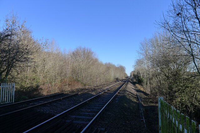
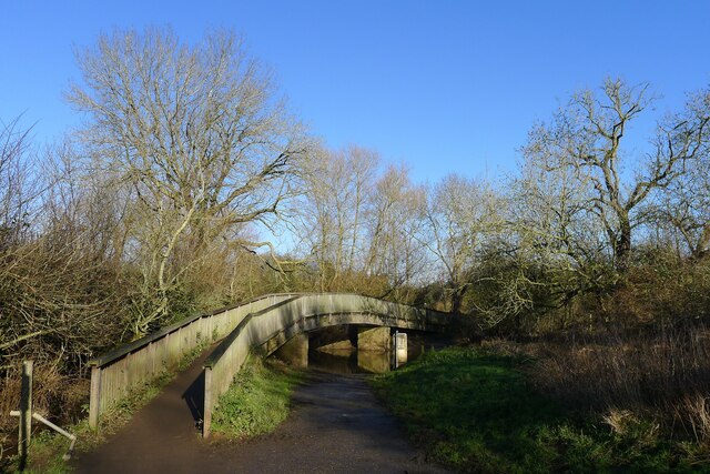
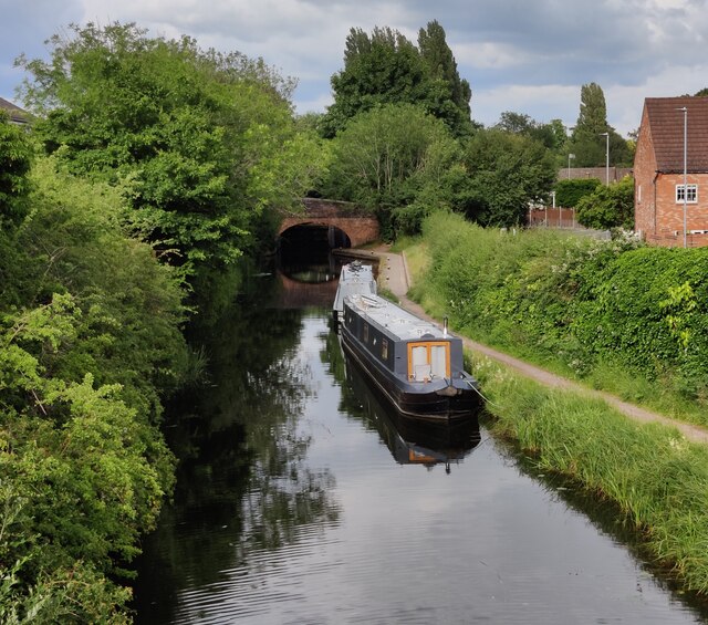
Aylestone Holt is a picturesque woodland located in Leicestershire, England. Situated in the village of Aylestone, it is a popular destination for nature enthusiasts and walkers alike. The holt covers an area of approximately 100 acres and is characterized by its dense, thriving forest.

The woodland is home to a diverse range of flora and fauna, making it a haven for wildlife enthusiasts. Ancient oak trees dominate the landscape, their gnarled branches reaching towards the sky. In addition to oaks, other tree species such as beech, birch, and ash can be found within the holt, adding to its rich biodiversity.

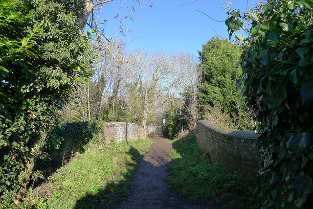
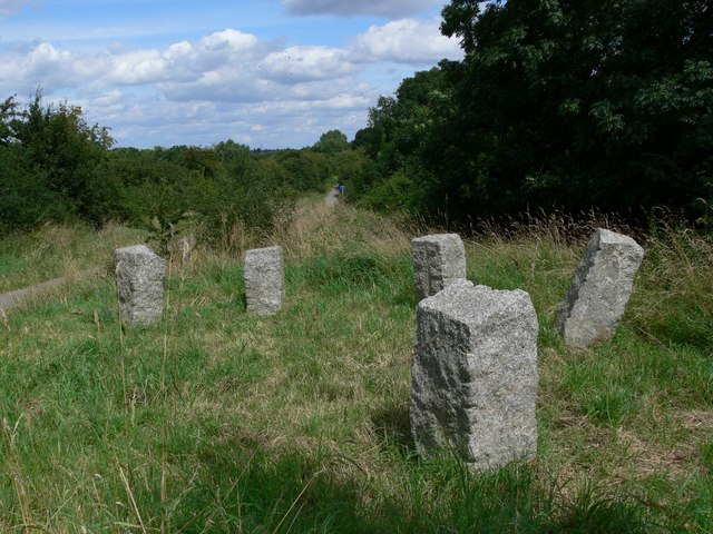
Aylestone Holt boasts a network of well-maintained footpaths, allowing visitors to explore the area and immerse themselves in the natural beauty of the surroundings. The trails wind through the forest, leading to hidden clearings and tranquil spots, perfect for picnics or simply enjoying the peaceful ambiance.

The woodland is also home to a variety of wildlife, including deer, foxes, badgers, and a plethora of bird species. Birdwatchers can spot woodpeckers, owls, and even the occasional rare sighting. The holt is a designated Site of Special Scientific Interest (SSSI), further emphasizing its ecological significance.

Aylestone Holt is not only cherished by locals but also attracts visitors from far and wide. Its serene atmosphere, ancient trees, and abundant wildlife make it an enchanting destination for anyone seeking a break from the hustle and bustle of everyday life.

If you have any feedback on the listing, please let us know in the comments section below.

Aylestone Holt Images

Images are sourced within 2km of 52.591566/-1.1682734 or Grid Reference SP5699. Thanks to Geograph Open Source API. All images are credited.

Tesla charging station at Fosse Park West
Everards brewery and beer hall Opened in June 2021.
Everards brewery and beer hall
Opened in June 2021.
Enderby Park and Ride Enderby Park and Ride, serving motorists visiting Leicester from the south.
Enderby Park and Ride
Enderby Park and Ride, serving motorists visiting Leicester from the south.
Church of St Hugh of Lincoln, Eyres Monsell, Leicester "Built 1955-58, an excellent representative of a mid-20th century parish church designed by the practice of the nationally recognised architect Sir Basil Spence." [Local Heritage Asset Register, Leicester city Council]. This is an 'Anglo Catholic' church <span class="nowrap"><a title="https://sthugheyresmonsell.org.uk/" rel="nofollow ugc noopener" href="https://sthugheyresmonsell.org.uk/">Link</a><img style="margin-left:2px;" alt="External link" title="External link - shift click to open in new window" src="https://s1.geograph.org.uk/img/external.png" width="10" height="10"/></span> within the Church of England.
Church of St Hugh of Lincoln, Eyres Monsell, Leicester
"Built 1955-58, an excellent representative of a mid-20th century parish church designed by the practice of the nationally recognised architect Sir Basil Spence." [Local Heritage Asset Register, Leicester city Council]. This is an 'Anglo Catholic' church LinkExternal link within the Church of England.
The Birmingham-Peterborough cross-country line entering Leicester from the south-west
Footpath over Simpkin's Bridge The footpath, from Blaby, crosses the Grand Union Canal, and the railway line from Birmingham (gate ahead) to enter the City of Leicester (Eyres Monsell ward)
Footpath over Simpkin's Bridge
The footpath, from Blaby, crosses the Grand Union Canal, and the railway line from Birmingham (gate ahead) to enter the City of Leicester (Eyres Monsell ward)
Simpkin's Bridge, Grand Union Canal
Glen Parva Manor (pub restaurant) Listed Grade II "Late C16 or early C17 core extended c1860 and modernised" <span class="nowrap"><a title="https://historicengland.org.uk/listing/the-list/list-entry/1074733?section=official-listing" rel="nofollow ugc noopener" href="https://historicengland.org.uk/listing/the-list/list-entry/1074733?section=official-listing">Link</a><img style="margin-left:2px;" alt="External link" title="External link - shift click to open in new window" src="https://s1.geograph.org.uk/img/external.png" width="10" height="10"/></span>. "Sizable countryside restaurant/bar with outdoor seats and pub grub from grills to global classics." <span class="nowrap"><a title="https://www.glenparvamanorpub.co.uk/" rel="nofollow ugc noopener" href="https://www.glenparvamanorpub.co.uk/">Link</a><img style="margin-left:2px;" alt="External link" title="External link - shift click to open in new window" src="https://s1.geograph.org.uk/img/external.png" width="10" height="10"/></span>
Glen Parva Manor (pub restaurant)
Listed Grade II "Late C16 or early C17 core extended c1860 and modernised" LinkExternal link. "Sizable countryside restaurant/bar with outdoor seats and pub grub from grills to global classics." LinkExternal link
The Ford, Glen Parva Crossing the River Sence
The Ford, Glen Parva
Crossing the River Sence
Ye Olde Bakers Arms in Blaby A thatched pub dating from 1485.
Ye Olde Bakers Arms in Blaby
A thatched pub dating from 1485.
A426 Leicester Road, Blaby Bridge
Narrowboats at Blue Bank Lock No 37 The Leicester section branches off the main line at Braunston and it is 66 miles long with 59 locks (including two five chamber staircase locks at Foxton) and two tunnels. Near Leicester it continues into the River Soar, and briefly along the River Wreake. The navigation then proceeds along the river, with some canalised diversions, to Loughborough and the River Trent south of Long Eaton.
Narrowboats at Blue Bank Lock No 37
The Leicester section branches off the main line at Braunston and it is 66 miles long with 59 locks (including two five chamber staircase locks at Foxton) and two tunnels. Near Leicester it continues into the River Soar, and briefly along the River Wreake. The navigation then proceeds along the river, with some canalised diversions, to Loughborough and the River Trent south of Long Eaton.
Narrowboats moored along the Grand Union Canal The boats are moored between bridges 99 and 99A in Glen Parva.
Narrowboats moored along the Grand Union Canal
The boats are moored between bridges 99 and 99A in Glen Parva.
Railway bridge on Little Glen Road, Glen Parva
Canalside assisted living flats, Glen Parva They are in front of the Grand Union Canal
Canalside assisted living flats, Glen Parva
They are in front of the Grand Union Canal
Art deco building in Glen Parva This was renovated in 2012 by McCarthy and Stone for their Canalside assisted living flats.
Art deco building in Glen Parva
This was renovated in 2012 by McCarthy and Stone for their Canalside assisted living flats.
Leicester Road, Glen Parva
Gilmorton Avenue, Glen Parva
Show me another place!

Aylestone Holt is located at Grid Ref: SP5699 (Lat: 52.591566, Lng: -1.1682734)

Administrative County: Leicestershire

District: Blaby

Police Authority: Leicestershire

What 3 Words

///basic.curvy.remedy. Near Blaby, Leicestershire

Nearby Locations

Aylestone Holt Glen Parva

Related Wikis

Glen Parva Nature Reserve

Glen Parva or Glen Hills is an 11.9 hectares (29 acres) Local Nature Reserve in Glen Parva on the south-western outskirts of Leicester. It is owned and...

Glen Parva

Glen Parva is a civil parish in the Blaby district of Leicestershire, England with a population of over 17,000. The population of the civil parish, including...

Braunstone Park & Rowley Fields

Braunstone Park & Rowley Fields is an electoral ward and administrative division of the city of Leicester, England. It comprises the western Leicester...

Fosse Shopping Park

Fosse Shopping Park is one of Britain's biggest out-of-town shopping parks and it is situated in Enderby parish, in Blaby district, on the southern edge...

Blaby railway station

Blaby railway station was a railway station on the Birmingham to Peterborough Line that served Blaby in Leicestershire, England. The station was opened...

Eyres Monsell

Eyres Monsell is an electoral ward and administrative division in Leicester, England. == Geography == Eyres Monsell is bounded to the north by the historic...

St Andrew's Church, Aylestone

St Andrew's Church is a church in Aylestone, Leicestershire. It is a Grade II* listed building. == History == The church is built of Triassic sandstone...

Aylestone Meadows

Aylestone Meadows is an 8.8-hectare (22-acre) Local Nature Reserve in Leicester, England, United Kingdom. It is owned and managed by Leicester City Council...

Nearby Amenities

Located within 500m of 52.591566,-1.1682734
Millennium Milepost Glen Parva
Description: 1) Leicester 2) Blaby Additional text: Glen Parva
Information: guidepost
Ncn Milepost: mccoll
Sustrans Ref: MP51
Tourism: information
Lat/Long: 52.5907404/-1.1701968
Power: tower
Lat/Long: 52.591353/-1.1749044
Power: tower
Lat/Long: 52.5938474/-1.172974
Bus Stop
Howard Road
Alt Name: Glen Parva - Westview Avenue
Bus: yes
Naptan AltCommonName: Glen Parva - Westview Avenue
Naptan AtcoCode: 260003812
Naptan Bearing: W
Naptan CommonName: Howard Road
Naptan Indicator: outside
Naptan Landmark: 30 West View Avenue
Naptan NaptanCode: leidtdmd
Naptan Notes: Non-Hourly - County
Naptan PlusbusZoneRef: LESTER
Naptan Street: West View Avenue
Naptan Verified: no
Public Transport: platform
Source: naptan_import
Lat/Long: 52.5877467/-1.1655461
Bus Stop
Featherby Drive
Bus: yes
Naptan AtcoCode: 260003813
Naptan Bearing: E
Naptan CommonName: Featherby Drive
Naptan Indicator: outside
Naptan Landmark: 53 West View Avenue
Naptan NaptanCode: leidtdmg
Naptan Notes: Non-Hourly - County
Naptan PlusbusZoneRef: LESTER
Naptan Street: West View Avenue
Naptan Verified: no
Public Transport: platform
Source: naptan_import
Lat/Long: 52.5878372/-1.1656182
Bus Stop
Featherby Drive
Bus: yes
Naptan AtcoCode: 260003815
Naptan Bearing: E
Naptan CommonName: Featherby Drive
Naptan Indicator: opposite
Naptan Landmark: Beck Close
Naptan NaptanCode: leidtdmp
Naptan Notes: Non-Hourly - County
Naptan PlusbusZoneRef: LESTER
Naptan Street: Featherby Drive
Naptan Verified: no
Public Transport: platform
Source: naptan_import
Lat/Long: 52.5886811/-1.1680083
Bus Stop
Dorothy Avenue
Alt Name: Glen Parva - Greendale Road
Bus: yes
Naptan AltCommonName: Glen Parva - Greendale Road
Naptan AtcoCode: 260003816
Naptan Bearing: S
Naptan CommonName: Dorothy Avenue
Naptan Indicator: outside
Naptan Landmark: 1 Greendale Road
Naptan NaptanCode: leidtdmt
Naptan Notes: Non-Hourly - County
Naptan PlusbusZoneRef: LESTER
Naptan Street: Greendale Road
Naptan Verified: no
Public Transport: platform
Source: naptan_import
Lat/Long: 52.5890987/-1.1634834
Dorothy Avenue
Naptan AtcoCode: 260003817
Naptan Bearing: N
Naptan BusStopType: CUS
Naptan CommonName: Dorothy Avenue
Naptan Indicator: opposite
Naptan Landmark: 1 Greendale Road
Naptan NaptanCode: leidtdmw
Naptan Notes: Non-Hourly - County
Naptan PlusbusZoneRef: LESTER
Naptan Street: Greendale Road
Naptan Verified: no
Source: naptan_import
Lat/Long: 52.5891086/-1.163616
Bus Stop
Greendale Road
Bus: yes
Naptan AtcoCode: 260003818
Naptan Bearing: S
Naptan CommonName: Greendale Road
Naptan Indicator: outside
Naptan Landmark: 41 Greendale Road
Naptan NaptanCode: leidtdpa
Naptan Notes: Non-Hourly - County
Naptan PlusbusZoneRef: LESTER
Naptan Street: Greendale Road
Naptan Verified: no
Public Transport: platform
Source: naptan_import
Lat/Long: 52.5910207/-1.1632106
Greendale Road
Alt Name: Glen Parva - Greendale Road
Naptan AltCommonName: Glen Parva - Greendale Road
Naptan AtcoCode: 260003819
Naptan Bearing: N
Naptan BusStopType: CUS
Naptan CommonName: Greendale Road
Naptan Indicator: opposite
Naptan Landmark: 41 Greendale Road
Naptan NaptanCode: leidtdpd
Naptan Notes: Non-Hourly - County
Naptan PlusbusZoneRef: LESTER
Naptan Street: Greendale Road
Naptan Verified: no
Source: naptan_import
Lat/Long: 52.5910126/-1.1633288
Seamark Type: gate
Waterway: lock_gate
Lat/Long: 52.5905332/-1.1716189
Seamark Type: gate
Waterway: lock_gate
Lat/Long: 52.5907837/-1.1716404
Noexit: yes
Lat/Long: 52.5935726/-1.1646439
Dorothy Avenue Adult Outside Gym
Leisure: fitness_station
Sport: fitness
Lat/Long: 52.5889928/-1.166312
Dorothy Avenue Childrens
Access: yes
Leisure: playground
Lat/Long: 52.5886534/-1.1663761
Social Facility
Birch Court
Addr City: Glen Parva
Addr Country: GB
Addr Housenumber: 10
Addr Postcode: LE2 9NH
Addr Street: Bellamy Close
Fhrs Authority: Blaby
Fhrs Id: 1202014
Fhrs Local Authority Id: 43218
Social Facility: group_home
Lat/Long: 52.5876997/-1.1677855
Kindergarten
Glenhills Pre-School
Addr City: Glen Parva
Addr Country: GB
Addr Housename: Memorial Hall
Addr Postcode: LE2 9JE
Addr Street: Dorothy Avenue
Fhrs Authority: Blaby
Fhrs Id: 1202175
Fhrs Local Authority Id: 48517
Lat/Long: 52.5885194/-1.164929
Cafe
The Park Cafe
Addr City: Glen Parva
Addr Country: GB
Addr Housename: Memorial Hall
Addr Postcode: LE2 9JE
Addr Street: Dorothy Avenue
Fhrs Authority: Blaby
Fhrs Id: 1202056
Fhrs Local Authority Id: 46415
Indoor Seating: yes
Outdoor Seating: no
Lat/Long: 52.5886334/-1.1651194
Defibrillator
Emergency: defibrillator
Lat/Long: 52.588565/-1.1648142
The data included in this document is from www.openstreetmap.org. The data is made available under ODbL.

Have you been to Aylestone Holt?

Leave your review of Aylestone Holt below (or comments, questions and feedback).