Dicker's Copse

Wood, Forest in Hampshire Basingstoke and Deane

England

Dicker's Copse

Pylons At this point the pylons run directly in line with the road
Pylons Credit: Nygel Gardner

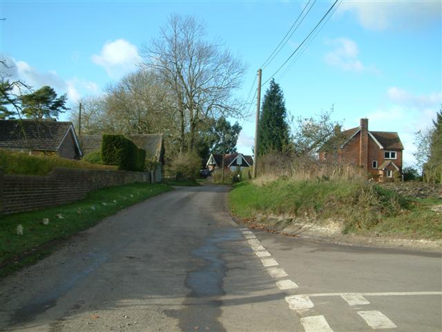
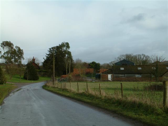
Dicker's Copse is a picturesque woodland located in Hampshire, England. Covering an area of approximately 50 acres, this forest is known for its natural beauty and diverse ecosystem. Situated in a rural setting, Dicker's Copse offers visitors a tranquil escape from the hustle and bustle of city life.

The woodland is mainly composed of native tree species such as oak, beech, and ash, which create a dense canopy overhead. This lush vegetation provides a habitat for a wide range of wildlife, including deer, foxes, and numerous bird species. Nature enthusiasts can enjoy birdwatching, as the forest is home to rare species such as the nightingale and woodpecker.

Dicker's Copse offers several walking trails that wind through the forest, allowing visitors to explore its enchanting surroundings. As one walks along these paths, they can admire the vibrant wildflowers that bloom throughout the seasons, adding bursts of color to the woodland landscape. The forest floor is also home to a variety of ferns, mosses, and fungi, adding to the diversity of the ecosystem.

The forest is well-maintained, with designated picnic areas and benches for visitors to rest and enjoy a packed lunch amidst nature's serenity. Additionally, there are information boards scattered along the trails, providing educational insights into the flora and fauna found within the woodland.

Dicker's Copse is a popular destination for nature lovers, photographers, and families seeking a peaceful retreat in the heart of Hampshire's countryside. Its natural charm and biodiversity make it a must-visit location for anyone looking to connect with nature.

If you have any feedback on the listing, please let us know in the comments section below.

Dicker's Copse Images

Images are sourced within 2km of 51.299827/-1.1924682 or Grid Reference SU5655. Thanks to Geograph Open Source API. All images are credited.

Pylons At this point the pylons run directly in line with the road
Pylons
At this point the pylons run directly in line with the road
Farm Track This picture was taken from the cross roads in the bottom left hand corner of the square looking due east up the farm track.
Farm Track
This picture was taken from the cross roads in the bottom left hand corner of the square looking due east up the farm track.
Farm Track This picture was taken from the end of the farm track in the top left hand corner of the square looking north westerly. This track is private property as was very quickly (politely) pointed out by the farmer - although it is a public bridleway!
Farm Track
This picture was taken from the end of the farm track in the top left hand corner of the square looking north westerly. This track is private property as was very quickly (politely) pointed out by the farmer - although it is a public bridleway!
Dorrel Wood This picture was taken from just outside the square and looks due west to Dorrel Wood which is situated in the centre of this square.
Dorrel Wood
This picture was taken from just outside the square and looks due west to Dorrel Wood which is situated in the centre of this square.
Pitt Hall Farm This is a picture of Pitt Hall Farm looking due north across the main A339.
Pitt Hall Farm
This is a picture of Pitt Hall Farm looking due north across the main A339.
Farmland near Folly Dairy This picture was taken from the end of the track to Folly Dairy looking south westerly across farmland, the road on the left is the main A339 to Basingstoke.
Farmland near Folly Dairy
This picture was taken from the end of the track to Folly Dairy looking south westerly across farmland, the road on the left is the main A339 to Basingstoke.
Water Tank This disused water tank is on the sharp bend in the road at the bottom left hand corner of the square.
Water Tank
This disused water tank is on the sharp bend in the road at the bottom left hand corner of the square.
Farmland Farmland looking south west from 572555
Farmland
Farmland looking south west from 572555
Ibworth
Ibworth
The footpath to Hollybush Farm It looks very overgrown, but the path does a right angle turn, around the back of a large oak tree, and them heads towards the lake.
The footpath to Hollybush Farm
It looks very overgrown, but the path does a right angle turn, around the back of a large oak tree, and them heads towards the lake.
Ewhurst Park
Ewhurst Park
Farmland between Hannington and Ibworth Looking up to Halves Wood. The sunken track is the public bridleway heading north from Ibworth Lane.
Farmland between Hannington and Ibworth
Looking up to Halves Wood. The sunken track is the public bridleway heading north from Ibworth Lane.
Farmland near Ewhurst Park Cut Wood is to the right of the rape-field. The first two pylons are within the grid-square.
Farmland near Ewhurst Park
Cut Wood is to the right of the rape-field. The first two pylons are within the grid-square.
Ewhurst Pond Looking across to Park Copse.
Ewhurst Pond
Looking across to Park Copse.
Farmland near Ibworth From the roadside alongside Week Copse. A large area eastward has had a dose of weedkiller.
Farmland near Ibworth
From the roadside alongside Week Copse. A large area eastward has had a dose of weedkiller.
Farmland, Hannington A pylon beside Vicarage Copse. The bridleway descends to a valley but is itself in a smaller valley.
Farmland, Hannington
A pylon beside Vicarage Copse. The bridleway descends to a valley but is itself in a smaller valley.
Bridleway, Hannington Heading towards the village from the east. A covered reservoir is in mid distance.
Bridleway, Hannington
Heading towards the village from the east. A covered reservoir is in mid distance.
Road and pylons below Hannington The road into the village from the A339 climbs up through a dry valley.
Road and pylons below Hannington
The road into the village from the A339 climbs up through a dry valley.
Show me another place!

Dicker's Copse is located at Grid Ref: SU5655 (Lat: 51.299827, Lng: -1.1924682)

Administrative County: Hampshire

District: Basingstoke and Deane

Police Authority: Hampshire

What 3 Words

///dusters.elder.conqueror. Near Kingsclere, Hampshire

Related Wikis

Ewhurst, Hampshire

Ewhurst is a village in Hampshire, England, and 6.2 miles (10.0 km) northwest of Basingstoke. Its parish church dates from 1682. The village itself is...

Upper Wootton

Upper Wootton is a small village in the civil parish of Wootton St Lawrence with Ramsdell in the Basingstoke and Deane district of Hampshire, England....

Ibworth

Ibworth is a hamlet in Hampshire, England. It is in the civil parish of Hannington. Interesting features include a community notice board and a wall post...

Hannington, Hampshire

Hannington is a civil parish in the English county of Hampshire. It is situated between Basingstoke and Newbury, on the North Hampshire Downs in the North...

Wolverton Common

Wolverton Common is a hamlet in north Hampshire, England. Its nearest town is Tadley, which lies approximately 2.5 miles (4 km) east from the hamlet....

Ramsdell

Ramsdell is a small village in the civil parish of Wootton St Lawrence with Ramsdell, in the Basingstoke and Deane district, in the English county of Hampshire...

Wolverton, Hampshire

Wolverton is a village in north Hampshire, England. It is within the civil parish of Baughurst, and located approximately 7 miles (11 km) from both Newbury...

North Oakley

North Oakley is a hamlet in the civil parish of Hannington in the Basingstoke and Deane district of Hampshire, England. Its nearest town is Tadley, which...

Nearby Amenities

Located within 500m of 51.299827,-1.1924682
Bus Stop
Pitt Hall Farm
Bus: yes
Naptan AtcoCode: 1900HA010176
Naptan Bearing: SE
Naptan CommonName: Pitt Hall Farm
Naptan NaptanCode: hamdptgp
Naptan Street: A339
Naptan Verified: no
Public Transport: platform
Source: naptan_import
Lat/Long: 51.3024562/-1.1880012
Bus Stop
Pitt Hall Farm
Bench: no
Bin: no
Bus: yes
Lit: no
Naptan AtcoCode: 1900HA010177
Naptan Bearing: NW
Naptan CommonName: Pitt Hall Farm
Naptan NaptanCode: hamdptgj
Naptan Street: A339
Naptan Verified: no
Public Transport: platform
Shelter: no
Source: naptan_import
Tactile Paving: no
Lat/Long: 51.3002991/-1.1856364
Postal Code: RG26 5RJ
Lat/Long: 51.3016738/-1.1865073
Breakers Yard;car Repair
FIXME: name
Lat/Long: 51.2988647/-1.1912002
Note: Paved surface ends here
Lat/Long: 51.3010193/-1.1978738
Parking
Access: permissive
Note: parking for pitt hall
Lat/Long: 51.300748/-1.1857097
Post Box
Operator: Royal Mail
Post Box Type: lamp
Ref: RG26 254
Royal Cypher: EIIR
Royal Cypher Wikidata: Q33102113
Lat/Long: 51.3019454/-1.186677
The data included in this document is from www.openstreetmap.org. The data is made available under ODbL.

Have you been to Dicker's Copse?

Leave your review of Dicker's Copse below (or comments, questions and feedback).