Hockley Plantation

Wood, Forest in Hampshire Winchester

England

Hockley Plantation

Damp day on the Allan King Way Farm buildings beside the track from Grange Farm.
Damp day on the Allan King Way Credit: David Martin

Hockley Plantation is a picturesque woodland located in the beautiful county of Hampshire, England. Situated near the village of Hockley, this enchanting forest covers an area of approximately 200 acres, offering a tranquil and serene escape from the bustling city life.

The plantation boasts an impressive variety of tree species, including majestic oak, beech, and ash trees, creating a diverse and vibrant ecosystem. The dense foliage provides a haven for a multitude of wildlife, attracting a wide range of bird species, small mammals, and insects.

Visitors to Hockley Plantation can enjoy an array of walking trails that wind their way through the enchanting woodland. The well-maintained paths cater to both casual strollers and avid hikers, providing an opportunity to explore the natural beauty of the area at one's own pace. Additionally, there are several picnic areas scattered throughout the plantation, allowing visitors to relax and enjoy a peaceful lunch amid the stunning surroundings.

The plantation is a popular destination for nature lovers, photographers, and outdoor enthusiasts. Its serene atmosphere and breathtaking scenery make it an ideal location for those seeking to escape the hustle and bustle of everyday life. Whether it's a leisurely stroll through the woodland, birdwatching, or simply soaking in the tranquil ambiance, Hockley Plantation offers a captivating experience for all who visit.

Overall, Hockley Plantation is a hidden gem in Hampshire, offering a natural oasis of beauty and tranquility. Its rich biodiversity and well-maintained trails make it a must-visit destination for anyone seeking to connect with nature and explore the wonders of the English countryside.

If you have any feedback on the listing, please let us know in the comments section below.

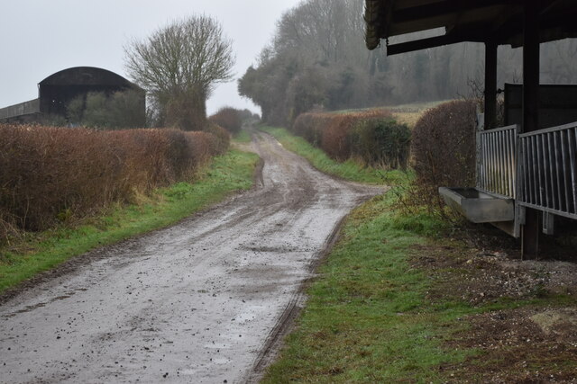
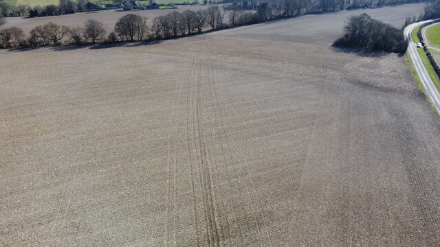
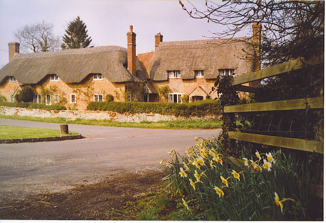
Hockley Plantation Images

Images are sourced within 2km of 51.042302/-1.198022 or Grid Reference SU5627. Thanks to Geograph Open Source API. All images are credited.

Damp day on the Allan King Way Farm buildings beside the track from Grange Farm.
Damp day on the Allan King Way
Farm buildings beside the track from Grange Farm.
Woodland path towards Hill Houses
Dry valley on a wet day
Bend in byway west of Hill Houses
New water pipe from Lane End reservoir Aerial.
New water pipe from Lane End reservoir
Aerial.
New water pipe from Lane End reservoir Aerial.
New water pipe from Lane End reservoir
Aerial.
New fencing on Ganderdown Farm The South Downs Way is ahead to left of the new fence. The diagonal path across the field was a permissive path enabling walkers to 'cut the corner' on the way to Holden Farm. There is a Hampshire gate in the new fencing here. Whether the permissive path will remain is unclear, since the sign denoting it is present here but absent at the far end. I speculate that this fencing is because of excessive worrying of stock by (some of) the many users of the South Downs Way. Although there is pig wire here, further on the fence is merely two strands of plain wire.
New fencing on Ganderdown Farm
The South Downs Way is ahead to left of the new fence. The diagonal path across the field was a permissive path enabling walkers to 'cut the corner' on the way to Holden Farm. There is a Hampshire gate in the new fencing here. Whether the permissive path will remain is unclear, since the sign denoting it is present here but absent at the far end. I speculate that this fencing is because of excessive worrying of stock by (some of) the many users of the South Downs Way. Although there is pig wire here, further on the fence is merely two strands of plain wire.
New fencing on South Downs Way at Ganderdown Farm The South Downs Way is ahead to right of the new fence. This is the other end of <a title="https://www.geograph.org.uk/photo/7111405" href="https://www.geograph.org.uk/photo/7111405">Link</a> . There was a permissive path running ahead off-picture left. Whether this permissive path will remain is unclear, since the sign denoting it is now absent here but present at the far end. I speculate that this fencing is because of excessive worrying of stock by (some of) the many users of the South Downs Way. Although there is pig wire here, further on the fence is merely two strands of plain wire.
New fencing on South Downs Way at Ganderdown Farm
The South Downs Way is ahead to right of the new fence. This is the other end of Link . There was a permissive path running ahead off-picture left. Whether this permissive path will remain is unclear, since the sign denoting it is now absent here but present at the far end. I speculate that this fencing is because of excessive worrying of stock by (some of) the many users of the South Downs Way. Although there is pig wire here, further on the fence is merely two strands of plain wire.
Refurbished barn on Holden Lane Earlier (and opposite direction) see <a title="https://www.geograph.org.uk/photo/3914644" href="https://www.geograph.org.uk/photo/3914644">Link</a> .
Refurbished barn on Holden Lane
Earlier (and opposite direction) see Link .
Careless parking on Rodfield Lane Presumably these vehicles are those of walkers on the South Downs Way. They are parked so as to completely block access to the farm land.
Careless parking on Rodfield Lane
Presumably these vehicles are those of walkers on the South Downs Way. They are parked so as to completely block access to the farm land.
Anti-Gypsy trenching on Holden Farm This recently-dug trench is not for drainage, as evidenced by the fact that there are bunds on both sides of it and there is nothing flowing into it. It is an example of the works that farmers find themselves forced to do to prevent unlawful occupation of their land by so-called travellers. It is a pity that lawyers are incapable of realising the trouble that they cause.
Anti-Gypsy trenching on Holden Farm
This recently-dug trench is not for drainage, as evidenced by the fact that there are bunds on both sides of it and there is nothing flowing into it. It is an example of the works that farmers find themselves forced to do to prevent unlawful occupation of their land by so-called travellers. It is a pity that lawyers are incapable of realising the trouble that they cause.
Muck being spread on Holden Farm Using the curious, red 5-wheeled vehicle, which has only one central wheel at its front.
Muck being spread on Holden Farm
Using the curious, red 5-wheeled vehicle, which has only one central wheel at its front.
Muck spreading on Holden Farm Showing a curious, red, 5-wheeled vehicle that is capable of quite aq turn of speed.
Muck spreading on Holden Farm
Showing a curious, red, 5-wheeled vehicle that is capable of quite aq turn of speed.
Massive straw wall at Lane End Two walls of rectangular straw bales, side by side.
Massive straw wall at Lane End
Two walls of rectangular straw bales, side by side.
OS Pivot Mark Porch step St James Church Beauworth Hampshire
OS Pivot Mark
Porch step St James Church Beauworth Hampshire
Biker heading south at Lane End Down On the road to Owslebury.
Biker heading south at Lane End Down
On the road to Owslebury.
Looking south-southeast at Lane End Down About 170 metres above sea level.
Looking south-southeast at Lane End Down
About 170 metres above sea level.
Looking east at Lane End Down About 170 metres above sea level.
Looking east at Lane End Down
About 170 metres above sea level.
Show me another place!

Hockley Plantation is located at Grid Ref: SU5627 (Lat: 51.042302, Lng: -1.198022)

Administrative County: Hampshire

District: Winchester

Police Authority: Hampshire

What 3 Words

///buffoon.pythons.reinstate. Near New Alresford, Hampshire

Nearby Locations

Hockley Plantation

Related Wikis

Beauworth

Beauworth () is a village and civil parish in the City of Winchester district of Hampshire, England, about eight miles east of Winchester. As of 2013...

Cheriton, Hampshire

Cheriton is a village and civil parish near Alresford in Hampshire, England. The settlement is close to the site of the 1644 Battle of Cheriton, fought...

Kilmeston

Kilmeston is a small village and civil parish in the City of Winchester district of Hampshire, England. Historically the village has been known as Chelmestune...

Tichborne

Tichborne is a village and civil parish 4 miles (6.4 km) east of Winchester in Hampshire, England. == History == In archaeology in the south of the parish...

Nearby Amenities

Located within 500m of 51.042302,-1.198022
Barrier: squeeze
Lat/Long: 51.0436244/-1.1932726
Power: pole
Lat/Long: 51.0383512/-1.1978251
Power: pole
Lat/Long: 51.0378638/-1.1986494
Barrier: fence
Lat/Long: 51.0420917/-1.1994629
Barrier: fence
Lat/Long: 51.0419532/-1.1995596
Gander Down
Ele: 128
Natural: peak
Lat/Long: 51.0432382/-1.1987515
The data included in this document is from www.openstreetmap.org. The data is made available under ODbL.

Have you been to Hockley Plantation?

Leave your review of Hockley Plantation below (or comments, questions and feedback).