Alder Bank Covert

Wood, Forest in Yorkshire Hambleton

England

Alder Bank Covert

Southbrook House
Southbrook House Credit: Mick Garratt

Alder Bank Covert is a picturesque woodland located in Yorkshire, England. Situated in the heart of the countryside, this hidden gem is a haven for nature enthusiasts and those seeking a tranquil escape from the hustle and bustle of everyday life.

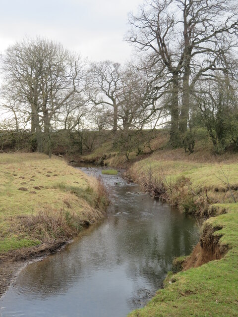
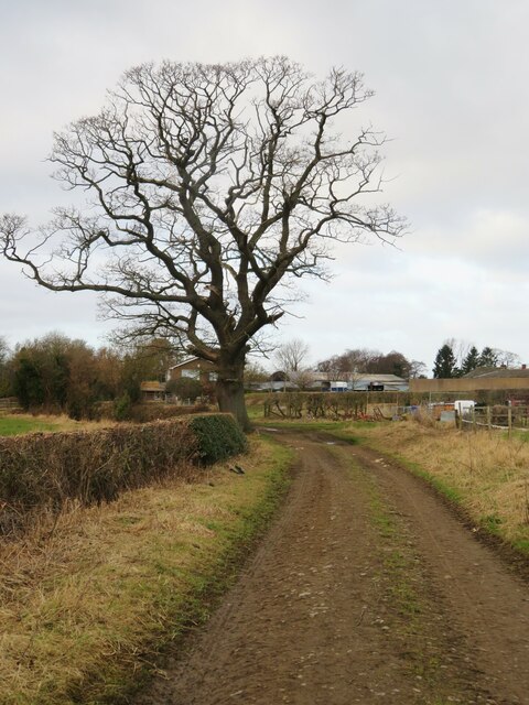
Covering an area of approximately 50 acres, Alder Bank Covert is primarily composed of majestic alder trees, which lend their name to the woodland. These trees create a dense canopy, providing shade and shelter for a variety of flora and fauna that call this woodland home.

Visitors to Alder Bank Covert can expect to be greeted by a serene atmosphere, with the sounds of chirping birds and rustling leaves serving as a soothing soundtrack. The woodland is crisscrossed by a network of well-maintained footpaths, allowing visitors to explore its beauty at their own pace. These paths wind through the forest, leading visitors to hidden clearings, babbling brooks, and enchanting wildflower meadows.

Alder Bank Covert is also home to a diverse range of wildlife. Birdwatchers will be delighted by the presence of species such as woodpeckers, owls, and warblers, while nature lovers may catch a glimpse of deer, foxes, and rabbits roaming the woodland. The abundance of plant life creates an ideal habitat for butterflies and insects, adding to the ecological richness of the area.

Whether it's a leisurely stroll, a picnic amidst nature, or a photography expedition, Alder Bank Covert offers something for everyone. Its untouched beauty and serene atmosphere make it an idyllic destination for those seeking solace in nature's embrace.

If you have any feedback on the listing, please let us know in the comments section below.

Alder Bank Covert Images

Images are sourced within 2km of 54.475233/-1.1325218 or Grid Reference NZ5609. Thanks to Geograph Open Source API. All images are credited.

Southbrook House
Southbrook House
Captain Cook’s Monument from Great Ayton. A distant view of Captain Cook’s Monument from the footpath to Cliff Ridge Wood.
Captain Cook’s Monument from Great Ayton.
A distant view of Captain Cook’s Monument from the footpath to Cliff Ridge Wood.
Low Green, Great Ayton Looking towards the River Leven and the village centre. This being the first day of February, there were no picnickers or children kicking footballs, just the occasional dog walker.
Low Green, Great Ayton
Looking towards the River Leven and the village centre. This being the first day of February, there were no picnickers or children kicking footballs, just the occasional dog walker.
Marwood Drive, Great Ayton Bungalow-ville in Great Ayton, a village which is almost the size of a small town thanks to areas of suburban style building like this. Proximity to Teesside is the likely reason for the expansion of Gt Ayton.
Marwood Drive, Great Ayton
Bungalow-ville in Great Ayton, a village which is almost the size of a small town thanks to areas of suburban style building like this. Proximity to Teesside is the likely reason for the expansion of Gt Ayton.
Footbridge over the Leven One of two footbridges over the River Leven in the Low Green part of the village.
Footbridge over the Leven
One of two footbridges over the River Leven in the Low Green part of the village.
A view from the corner flag Except that the flag isn't there. This is Great Ayton's football club pitch and pavilion.
A view from the corner flag
Except that the flag isn't there. This is Great Ayton's football club pitch and pavilion.
Ridge and furrow in Great Ayton Old plough strips in a field close to the village centre.
Ridge and furrow in Great Ayton
Old plough strips in a field close to the village centre.
River and High Street, Great Ayton The village centre here is attractive with the River Leven running alongside the main street.
River and High Street, Great Ayton
The village centre here is attractive with the River Leven running alongside the main street.
Footbridge over the Leven Footpath number 10.92/5 at the approach to a footbridge close to Little Ayton.
Footbridge over the Leven
Footpath number 10.92/5 at the approach to a footbridge close to Little Ayton.
The Leven at Little Ayton The Leven is a curious little river, seemingly unable to decide which way to go. The headwaters head north east as if to join the becks that run into the Esk, but this way is blocked by glacial debris, so it turns west to flow through Great Ayton, Stokesley and Hutton Rudby, at which point it is only a short distance from waters heading into the Wiske and eventually the Swale. At the last moment the Leven makes up its mind and carves a deep valley to meet the Tees below Yarm.
The Leven at Little Ayton
The Leven is a curious little river, seemingly unable to decide which way to go. The headwaters head north east as if to join the becks that run into the Esk, but this way is blocked by glacial debris, so it turns west to flow through Great Ayton, Stokesley and Hutton Rudby, at which point it is only a short distance from waters heading into the Wiske and eventually the Swale. At the last moment the Leven makes up its mind and carves a deep valley to meet the Tees below Yarm.
Bridleway approaching Brookside Farm Bridleway number 10.92/1 approaching Brookside Farm where there is a farm shop, cafe and several rather small goats.
Bridleway approaching Brookside Farm
Bridleway number 10.92/1 approaching Brookside Farm where there is a farm shop, cafe and several rather small goats.
Looking North West from Great Ayton Station One of the many small stations on the Esk Valley Line between Middlesbrough and Whitby.
This section of railway was opened in 1864, and remarkably escaped the Beeching Cuts a century later.
Looking North West from Great Ayton Station
One of the many small stations on the Esk Valley Line between Middlesbrough and Whitby. This section of railway was opened in 1864, and remarkably escaped the Beeching Cuts a century later.
High Green, Great  Ayton This large village has the luxury of two greens
High Green, Great Ayton
This large village has the luxury of two greens
Mill Farm Guest House, Great Ayton I can recommend this guest house.
Mill Farm Guest House, Great Ayton
I can recommend this guest house.
Little Ayton, Woodhouse Farm The slightly damaged benchmark is cut into an east facing wall of the property which once was a farm stable.
Little Ayton, Woodhouse Farm
The slightly damaged benchmark is cut into an east facing wall of the property which once was a farm stable.
Little Ayton, Woodhouse Farm There is a slightly damaged benchmark cut into the east facing wall of the property which once was a farm stable.
Little Ayton, Woodhouse Farm
There is a slightly damaged benchmark cut into the east facing wall of the property which once was a farm stable.
Former Ford at Great Ayton This is the site of a former ford on the River Leven. The photograph in the following link shows the ford  back in September 2005.

<a title="https://www.geograph.org.uk/photo/59382" href="https://www.geograph.org.uk/photo/59382">Link</a>

 The original school building can be seen in both images.
Former Ford at Great Ayton
This is the site of a former ford on the River Leven. The photograph in the following link shows the ford back in September 2005. Link The original school building can be seen in both images.
Otter Hills Beck Evidence of some recent timber felling close by the beck, which joins the River Leven a short way downstream.
Otter Hills Beck
Evidence of some recent timber felling close by the beck, which joins the River Leven a short way downstream.
Show me another place!

Alder Bank Covert is located at Grid Ref: NZ5609 (Lat: 54.475233, Lng: -1.1325218)

Division: North Riding

Administrative County: North Yorkshire

District: Hambleton

Police Authority: North Yorkshire

What 3 Words

///quest.pressing.shadowing. Near Great Ayton, North Yorkshire

Nearby Locations

Alder Bank Covert

Related Wikis

Little Ayton

Little Ayton is a village and civil parish in Hambleton District of North Yorkshire, England and lies immediately south of Great Ayton. The population...

Great Ayton Friends' School

Great Ayton Friends' School (1841–1997) in Great Ayton, North Yorkshire, England, was an independent, co-educational, agricultural boarding school, run...

Great Ayton

Great Ayton is a village and civil parish in North Yorkshire, England. The River Leven (a tributary of the River Tees) flows through the village, which...

Easby, Hambleton

Easby is a village and civil parish in Hambleton District of North Yorkshire, England. It lies approximately 2 miles (3.2 km) south-east of Great Ayton...

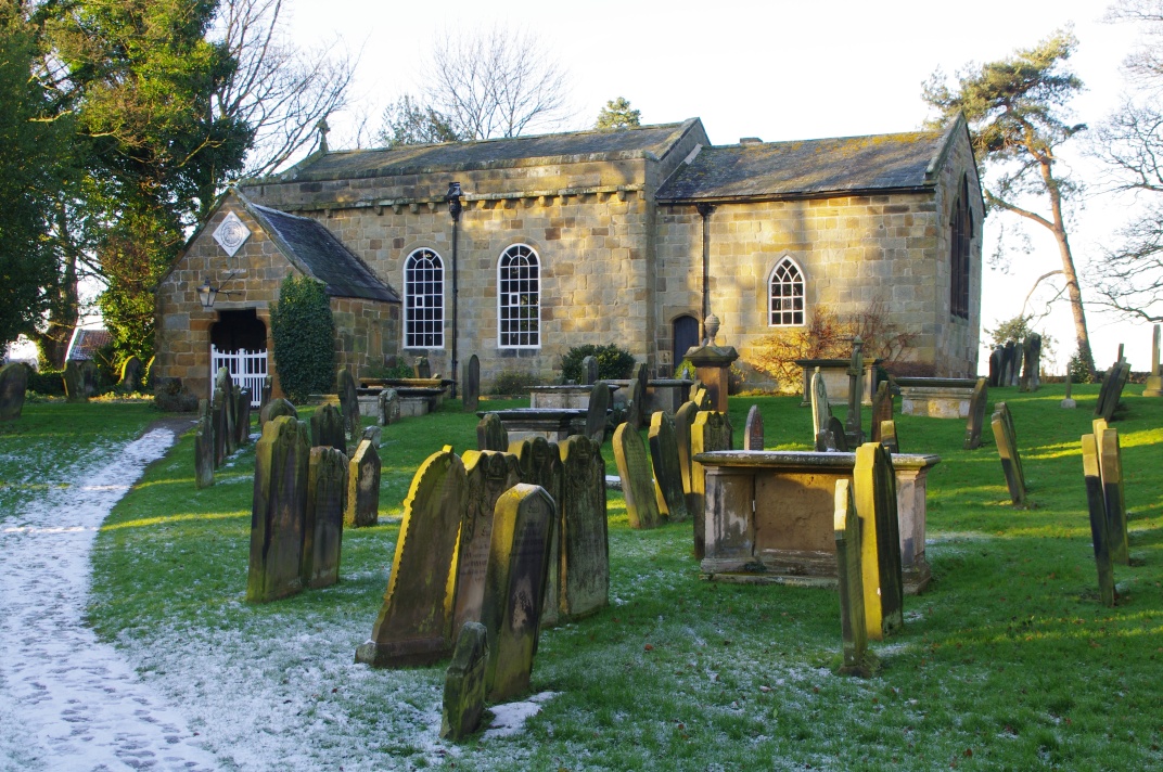
Church of All Saints, Great Ayton

The Church of All Saints is a grade I listed building and former parish church for Great Ayton, North Yorkshire, England. The churchyard is known to contain...

Great Ayton railway station

Great Ayton is a railway station on the Esk Valley Line, which runs between Middlesbrough and Whitby via Nunthorpe. The station, situated 8 miles 37 chains...

Cleveland, Yorkshire

Cleveland is a land of hills and dales from the River Tees to Vale of Pickering, England. The name means “cliff-land”. The area corresponds to the former...

Ingleby railway station

Ingleby railway station was a railway station built to serve the village of Ingleby Greenhow in North Yorkshire, England. The station was on the North...

Nearby Amenities

Located within 500m of 54.475233,-1.1325218
Fixme: Where does the public footpath go from here?
Lat/Long: 54.4767132/-1.1390824
The data included in this document is from www.openstreetmap.org. The data is made available under ODbL.

Have you been to Alder Bank Covert?

Leave your review of Alder Bank Covert below (or comments, questions and feedback).