Dumfries

Settlement in Dumfriesshire

Scotland

Dumfries

Cresswell Gardens, Grierson Avenue
Cresswell Gardens, Grierson Avenue Credit: David Dixon

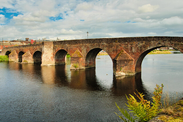
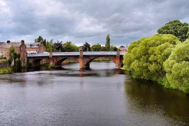
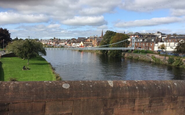
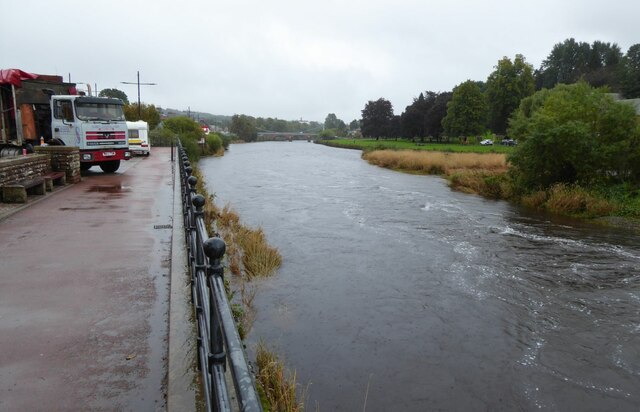
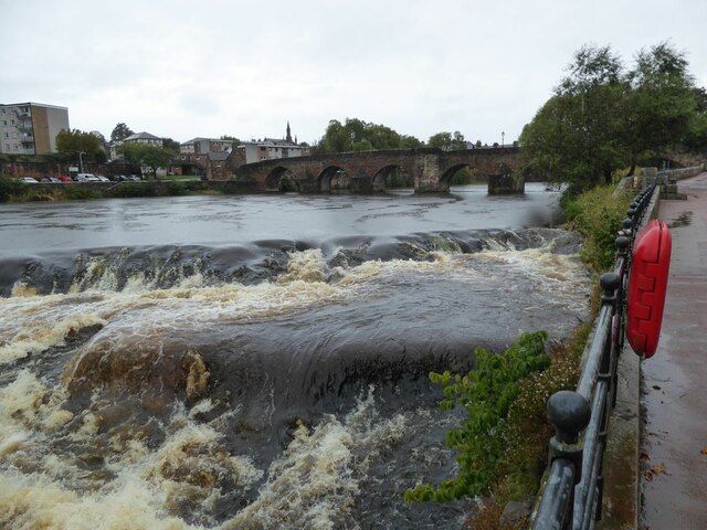
Dumfries, located in the region of Dumfriesshire, Scotland, is a historic market town with a population of around 37,000 people. Situated on the banks of the River Nith, Dumfries is the administrative center of the Dumfries and Galloway council area.

The town boasts a rich history dating back to Roman times, with several archaeological finds indicating its ancient origins. The town's name is derived from the Scottish Gaelic "Dùn Phris," meaning "Fort of the Thicket," reflecting its defensive past.

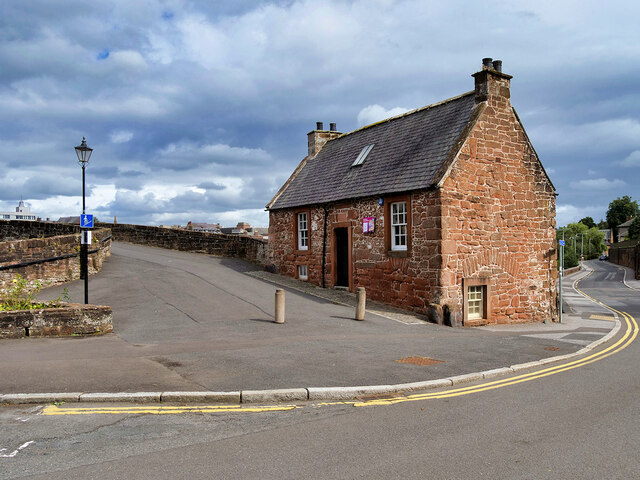
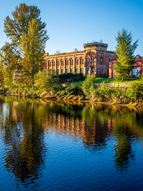
Dumfries offers a blend of history, culture, and natural beauty. Visitors can explore a range of architectural gems, including the magnificent Dumfries House, a Palladian mansion designed by Robert Adam. Other attractions include the Old Bridge House Museum, which provides insights into the town's past, and the Robert Burns House, where the famous poet spent the last years of his life.

The town's vibrant arts scene is showcased through various galleries, theaters, and music venues. The Theatre Royal, dating back to 1792, hosts a diverse program of performances, while the Dumfries and Galloway Arts Festival attracts both local and international artists.

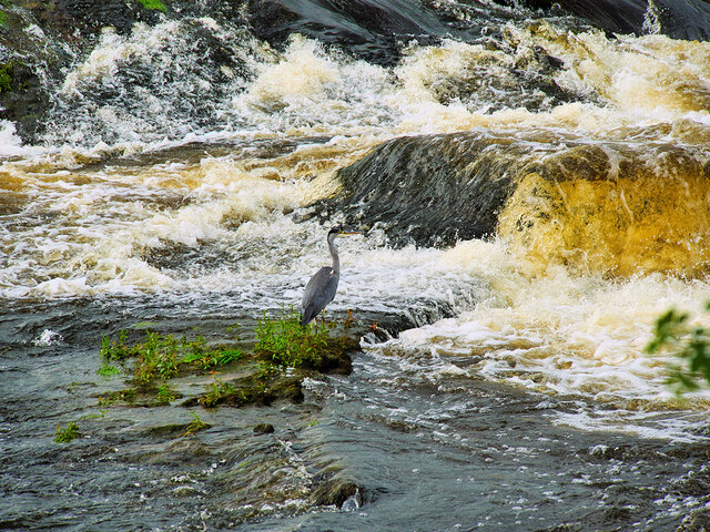
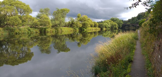
Nature enthusiasts can enjoy the picturesque landscape surrounding Dumfries, with stunning countryside, forests, and nature reserves nearby. The Solway Coast, a designated Area of Outstanding Natural Beauty, offers breathtaking views and opportunities for outdoor activities.

Dumfries has a thriving local economy, with industries such as food processing, retail, and tourism playing significant roles. The town's location, at the crossroads of major transportation routes, makes it an accessible hub for both residents and visitors.

Overall, Dumfries is a charming town that combines its historical heritage with modern amenities, offering a delightful experience for all who visit.

If you have any feedback on the listing, please let us know in the comments section below.
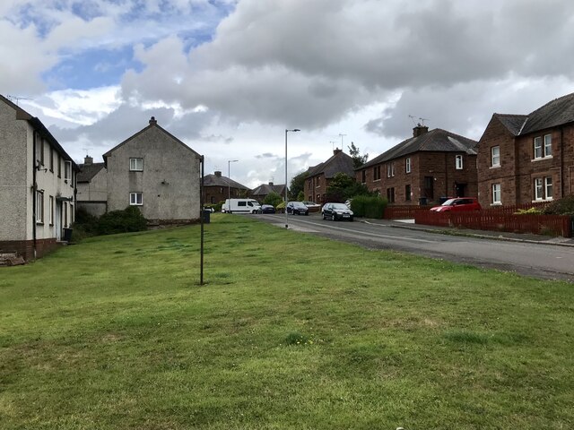
Dumfries Images

Images are sourced within 2km of 55.069794/-3.609296 or Grid Reference NX9776. Thanks to Geograph Open Source API. All images are credited.

Cresswell Gardens, Grierson Avenue
Boundary Stone, Graigs Road Parliamentary & Police Burgh boundary in 1900.

Milestone Society National ID: DF_DUMF02pb
Boundary Stone, Graigs Road
Parliamentary & Police Burgh boundary in 1900. Milestone Society National ID: DF_DUMF02pb
Devorgilla Bridge, Dumfries The original Devorgilla Bridge was built in 1431, replacing an earlier, wooden structure named after Lady Devorgilla, the mother of King John Balliol. The bridge survived for almost two centuries until it was destroyed in a major flood in the 1620s, resulting in a nine-arched bridge being built.

The bridge was shortened by the removal of the three easternmost arches in the late eighteenth century.  It is a Category A listed building (LB26354 <span class="nowrap"><a title="http://portal.historicenvironment.scot/designation/LB26354" rel="nofollow ugc noopener" href="http://portal.historicenvironment.scot/designation/LB26354">Link</a><img style="margin-left:2px;" alt="External link" title="External link - shift click to open in new window" src="https://s1.geograph.org.uk/img/external.png" width="10" height="10"/></span> Historic Environment Scotland).
Devorgilla Bridge, Dumfries
The original Devorgilla Bridge was built in 1431, replacing an earlier, wooden structure named after Lady Devorgilla, the mother of King John Balliol. The bridge survived for almost two centuries until it was destroyed in a major flood in the 1620s, resulting in a nine-arched bridge being built. The bridge was shortened by the removal of the three easternmost arches in the late eighteenth century. It is a Category A listed building (LB26354 LinkExternal link Historic Environment Scotland).
Old Bridge House, Dumfries Built ca1660 at the western end of Devorgilla Bridge by James Birkmyre, a barrel maker, as his house and workshop. It is reputedly the oldest surviving domestic dwelling in Dumfries. It was used as an inn for much of the 18th and 19th centuries and was converted to a museum, following the death of its last occupant in 1959.

It is a Category B listed building (LB26310 <span class="nowrap"><a title="http://portal.historicenvironment.scot/designation/LB26310" rel="nofollow ugc noopener" href="http://portal.historicenvironment.scot/designation/LB26310">Link</a><img style="margin-left:2px;" alt="External link" title="External link - shift click to open in new window" src="https://s1.geograph.org.uk/img/external.png" width="10" height="10"/></span> Historic Environment Scotland).
Old Bridge House, Dumfries
Built ca1660 at the western end of Devorgilla Bridge by James Birkmyre, a barrel maker, as his house and workshop. It is reputedly the oldest surviving domestic dwelling in Dumfries. It was used as an inn for much of the 18th and 19th centuries and was converted to a museum, following the death of its last occupant in 1959. It is a Category B listed building (LB26310 LinkExternal link Historic Environment Scotland).
Buccleuch Street Bridge (Dumfries "New" Bridge) A five-arched bridge over the River Nith, built in 1793. The roadway was widened on steel cantilevers in 1893 (see <a href="https://www.geograph.org.uk/photo/3333780">NX9676 : Plaque on New Bridge</a>). It is a Category B listed building (LB26096 <span class="nowrap"><a title="http://portal.historicenvironment.scot/designation/LB26096" rel="nofollow ugc noopener" href="http://portal.historicenvironment.scot/designation/LB26096">Link</a><img style="margin-left:2px;" alt="External link" title="External link - shift click to open in new window" src="https://s1.geograph.org.uk/img/external.png" width="10" height="10"/></span> Historic Environment Scotland).
Buccleuch Street Bridge (Dumfries "New" Bridge)
A five-arched bridge over the River Nith, built in 1793. The roadway was widened on steel cantilevers in 1893 (see NX9676 : Plaque on New Bridge). It is a Category B listed building (LB26096 LinkExternal link Historic Environment Scotland).
River Nith Weir at Dumfries A solitary heron stands motionless on Whitesands Caul, waiting for fish to tumble over.
River Nith Weir at Dumfries
A solitary heron stands motionless on Whitesands Caul, waiting for fish to tumble over.
Heron at Dumfries A solitary heron stands motionless on Whitesands Caul, waiting for fish to tumble over.
Heron at Dumfries
A solitary heron stands motionless on Whitesands Caul, waiting for fish to tumble over.
River Nith Dumfries The River Nith and towpath near the rowing club headquarters.
River Nith Dumfries
The River Nith and towpath near the rowing club headquarters.
River Nith at Dumfries A beautiful suspension bridge provides a footbridge for pedestrians
River Nith at Dumfries
A beautiful suspension bridge provides a footbridge for pedestrians
Statue of Jean Armour Statue to Robert Burns' wife, standing in Dumfries between her home and her church. Mother to nine of his children, including two sets of twins, while he also had four more children by other women. <span class="nowrap"><a title="https://en.wikipedia.org/wiki/Jean_Armour" rel="nofollow ugc noopener" href="https://en.wikipedia.org/wiki/Jean_Armour">Link</a><img style="margin-left:2px;" alt="External link" title="External link - shift click to open in new window" src="https://s1.geograph.org.uk/img/external.png" width="10" height="10"/></span>
Statue of Jean Armour
Statue to Robert Burns' wife, standing in Dumfries between her home and her church. Mother to nine of his children, including two sets of twins, while he also had four more children by other women. LinkExternal link
Houses on Annan Road, Dumfries
The caul or weir in Dumfries The caul on the Nith below the old Devorgilla Bridge is of early origin, built originally of stakes, but reconstructed many times in timber and rubble. Although the lade is infilled, the site of the sluice gate at the S end of the caul can still be seen.
The caul or weir in Dumfries
The caul on the Nith below the old Devorgilla Bridge is of early origin, built originally of stakes, but reconstructed many times in timber and rubble. Although the lade is infilled, the site of the sluice gate at the S end of the caul can still be seen.
St Michael's Primary School Originally, the school began as a Church School attached to the South Free Territorial Church. The school opened in 1865 and provided a general education - including Latin, for some pupils.

'At St Michael’s Primary we aim to provide a secure, supportive and friendly environment in which the children will develop skills and experiences, which will allow them to reach their full potential.' <span class="nowrap"><a title="https://stmichaelsdumfries.dumgal.sch.uk/" rel="nofollow ugc noopener" href="https://stmichaelsdumfries.dumgal.sch.uk/">Link</a><img style="margin-left:2px;" alt="External link" title="External link - shift click to open in new window" src="https://s1.geograph.org.uk/img/external.png" width="10" height="10"/></span>
St Michael's Primary School
Originally, the school began as a Church School attached to the South Free Territorial Church. The school opened in 1865 and provided a general education - including Latin, for some pupils. 'At St Michael’s Primary we aim to provide a secure, supportive and friendly environment in which the children will develop skills and experiences, which will allow them to reach their full potential.' LinkExternal link
Advert at St Michael's Services garage Nith Inshore Rescue is an independent lifeboat serving the Dumfries area. We are based in Glencaple, 5 miles south of Dumfries in south-west Scotland, on the estuary of the River Nith close to where it joins the Solway Firth.
Advert at St Michael's Services garage
Nith Inshore Rescue is an independent lifeboat serving the Dumfries area. We are based in Glencaple, 5 miles south of Dumfries in south-west Scotland, on the estuary of the River Nith close to where it joins the Solway Firth.
The River Nith in Dumfries The lorry is unloading the components of the fair being erected beside the river.
The River Nith in Dumfries
The lorry is unloading the components of the fair being erected beside the river.
Dumfries Old Bridge This bridge carries a footpath across the River Nith to the N of the weir (caul), the end of which is visible in image, and on the W side of the central area of Dumfries.
Dumfries Old Bridge
This bridge carries a footpath across the River Nith to the N of the weir (caul), the end of which is visible in image, and on the W side of the central area of Dumfries.
Derelict Mill, Dumfries
Old Boundary Marker on the B726 Kingholm Road, Dumfries War Department Boundary Marker inscribed in a gatepost on the northwest side of the B726 Kingholm Road, Dumfries, where a footpath leaves towards the riverside. 

Milestone Society National ID: DF_WDKING02em
Old Boundary Marker on the B726 Kingholm Road, Dumfries
War Department Boundary Marker inscribed in a gatepost on the northwest side of the B726 Kingholm Road, Dumfries, where a footpath leaves towards the riverside. Milestone Society National ID: DF_WDKING02em
Show me another place!

Dumfries is located at Grid Ref: NX9776 (Lat: 55.069794, Lng: -3.609296)

Unitary Authority: Dumfries and Galloway

Police Authority: Dumfries and Galloway

What 3 Words

///toddler.obstinate.outbid. Near Dumfries, Dumfries & Galloway

Nearby Locations

Dumfries

Related Wikis

Loreburn Hall

The Loreburn Hall is a military installation in Dumfries, Scotland. == History == The building was designed by Alan Burgess Crombie as the headquarters...

Diocese of Galloway

The Diocese of Galloway was one of the thirteen (after 1633 fourteen) dioceses of the pre-1689 Scottish Church. The Diocese was led by the Bishop of Galloway...

Dumfries and Galloway (UK Parliament constituency)

Dumfries and Galloway is a county constituency in the House of Commons of the Parliament of the United Kingdom. It was first used in the 2005 general election...

Midsteeple, Dumfries

The Midsteeple is a municipal building in the High Street in Dumfries, Dumfries and Galloway, Scotland. The structure, which is used as a ticket office...

Nearby Amenities

Located within 500m of 55.069794,-3.609296
Source: PGS
Lat/Long: 55.0655841/-3.611545
Source: PGS
Lat/Long: 55.0658141/-3.6118766
Source: PGS
Lat/Long: 55.065984/-3.612131
Source: PGS
Lat/Long: 55.0662249/-3.6125453
Source: PGS
Lat/Long: 55.066466/-3.6130885
Source: PGS
Lat/Long: 55.0667099/-3.6137958
Created By: almien_coastlines
Source: PGS
Lat/Long: 55.0669147/-3.6144178
Source: PGS
Lat/Long: 55.067194/-3.6153345
Source: PGS
Lat/Long: 55.0675085/-3.6160382
Source: PGS
Lat/Long: 55.0724925/-3.6134096
Source: PGS
Lat/Long: 55.0726687/-3.612047
Source: PGS
Lat/Long: 55.0728284/-3.6113604
Source: PGS
Lat/Long: 55.0731232/-3.6106523
Source: PGS
Lat/Long: 55.0734427/-3.6100729
Source: PGS
Lat/Long: 55.0738235/-3.6094077
Source: PGS
Lat/Long: 55.0741306/-3.6090859
Source: PGS
Lat/Long: 55.0741122/-3.6082919
Source: PGS
Lat/Long: 55.0735901/-3.6087962
Source: PGS
Lat/Long: 55.0732763/-3.6094158
Source: PGS
Lat/Long: 55.0728733/-3.6101025
Source: PGS
Lat/Long: 55.0726768/-3.6106175
Source: PGS
Lat/Long: 55.0725293/-3.6110037
Source: PGS
Lat/Long: 55.0722775/-3.6118646
Source: PGS
Lat/Long: 55.0722221/-3.6123153
Source: PGS
Lat/Long: 55.0720718/-3.6131121
Source: PGS
Lat/Long: 55.0719683/-3.6137634
Source: PGS
Lat/Long: 55.0718352/-3.6146148
Source: PGS
Lat/Long: 55.0716263/-3.6157414
Source: PGS
Lat/Long: 55.0714134/-3.6165709
Source: PGS
Lat/Long: 55.0690198/-3.6169608
Source: PGS
Lat/Long: 55.0687802/-3.6167141
Source: PGS
Lat/Long: 55.0685713/-3.6163064
Source: PGS
Lat/Long: 55.0684168/-3.6158077
Source: PGS
Lat/Long: 55.0682203/-3.6154624
Source: PGS
Lat/Long: 55.0680932/-3.6152191
Source: PGS
Lat/Long: 55.0678961/-3.6147524
Source: PGS
Lat/Long: 55.0676779/-3.6142402
Source: PGS
Lat/Long: 55.0673869/-3.6135658
Created By: almien_coastlines
Source: PGS
Lat/Long: 55.0672808/-3.6133602
Source: PGS
Lat/Long: 55.0669304/-3.6126663
Source: PGS
Lat/Long: 55.0666376/-3.6120768
Source: PGS
Lat/Long: 55.066415/-3.6116535
Source: PGS
Lat/Long: 55.0660887/-3.6111502
Source: PGS
Lat/Long: 55.065708/-3.6105336
Source: PGS
Lat/Long: 55.0655738/-3.6103166
Source: PGS
Lat/Long: 55.065395/-3.6101401
Dumfries
Name Gd: Dùn Phrìs
Naptan AtcoCode: 9100DUMFRES
Network: National Rail
Network Website: https://www.nationalrail.co.uk/stations/dmf/
Network Wikidata: Q26334
Operator: ScotRail
Operator Website: https://www.scotrail.co.uk/plan-your-journey/stations-and-facilities/dmf
Operator Wikidata: Q18356161
Public Transport: station
Railway: station
Ref Crs: DMF
Source: NPE
Source Name Gd: survey
Train: yes
Wikidata: Q597956
Wikipedia: en:Dumfries railway station
Lat/Long: 55.0727039/-3.6044458
Traffic Signals
Lat/Long: 55.0714247/-3.6109809
Crossing
Crossing: traffic_signals
Crossing Island: yes
Tactile Paving: yes
Lat/Long: 55.0700012/-3.6053526
Traffic Signals
Lat/Long: 55.0702192/-3.6041068
Crossing
Crossing: traffic_signals
Crossing Island: no
Lat/Long: 55.0666221/-3.6050161
Crossing
Crossing: traffic_signals
Crossing Island: no
Tactile Paving: yes
Lat/Long: 55.0702627/-3.6132372
Traffic Signals
Traffic Signals: signal
Lat/Long: 55.0702904/-3.6130534
Crossing
Crossing: traffic_signals
Crossing Island: no
Tactile Paving: yes
Lat/Long: 55.0702696/-3.6129595
Crossing
Crossing: traffic_signals
Crossing Island: no
Lat/Long: 55.0704445/-3.6122585
Traffic Signals
Lat/Long: 55.0692327/-3.616678
Traffic Signals
Lat/Long: 55.065699/-3.6102012
Traffic Signals
Lat/Long: 55.0661888/-3.6099687
Traffic Signals
Lat/Long: 55.0692669/-3.6069487
Crossing
Crossing: traffic_signals
Crossing Ref: pelican
Lat/Long: 55.0693056/-3.6044568
Glencairn Villa
Addr Housenumber: 45
Addr Postcode: DG1 1JD
Addr Street: Rae Street
Tourism: guest_house
Lat/Long: 55.0715353/-3.6083584
Library
Ewart Library
Wheelchair: yes
Lat/Long: 55.071394/-3.6095186
Traffic Signals
Lat/Long: 55.0726494/-3.6094738
Traffic Signals
Traffic Signals: signal
Lat/Long: 55.0670487/-3.6037696
Police
Dumfries (Loreborn Street) Police Station
Addr City: Dumfries
Addr Postcode: DG1 1HP
Addr Street: Loreburn Street
Operator: Police Scotland
Operator Wikidata: Q7209499
Lat/Long: 55.0702289/-3.6095044
Bus Stop
Whitesands
Bus: yes
Local Ref: 1
Naptan AtcoCode: 680000001501
Naptan CommonName: Whitesands
Naptan Indicator: Stance 1
Naptan Landmark: Rural Stances
Naptan NaptanCode: 34232637
Naptan Notes: none
Naptan PlusbusZoneRef: DUMFRES
Naptan ShortCommonName: Dfs Whitesands 1
Naptan Street: Whitesands
Naptan Verified: no
Public Transport: platform
Source: naptan_import
Lat/Long: 55.0682506/-3.6149972
Bus Stop
Whitesands
Bus: yes
Local Ref: 2
Naptan AtcoCode: 680000001502
Naptan CommonName: Whitesands
Naptan Indicator: Stance 2
Naptan Landmark: Rural Stances
Naptan NaptanCode: 34232638
Naptan Notes: none
Naptan PlusbusZoneRef: DUMFRES
Naptan ShortCommonName: Dfs Whitesands 2
Naptan Street: Whitesands
Naptan Verified: no
Public Transport: platform
Source: naptan_import
Lat/Long: 55.0683293/-3.6151569
Bus Stop
Whitesands
Bus: yes
Local Ref: 3
Naptan AtcoCode: 680000001503
Naptan CommonName: Whitesands
Naptan Indicator: Stance 3
Naptan Landmark: Rural Stances
Naptan NaptanCode: 34232639
Naptan Notes: none
Naptan PlusbusZoneRef: DUMFRES
Naptan ShortCommonName: Dfs Whitesands 3
Naptan Street: Whitesands
Naptan Verified: no
Public Transport: platform
Source: naptan_import
Lat/Long: 55.0683991/-3.6153164
Bus Stop
Whitesands
Bus: yes
Local Ref: 4
Naptan AtcoCode: 680000001504
Naptan CommonName: Whitesands
Naptan Indicator: Stance 4
Naptan Landmark: Rural Stances
Naptan NaptanCode: 34232642
Naptan Notes: none
Naptan PlusbusZoneRef: DUMFRES
Naptan ShortCommonName: Dfs Whitesands 4
Naptan Street: Whitesands
Naptan Verified: no
Public Transport: platform
Source: naptan_import
Lat/Long: 55.0684956/-3.6154925
Bus Stop
Whitesands
Bench: yes
Bus: yes
Local Ref: 5
Naptan AtcoCode: 680000001505
Naptan CommonName: Whitesands
Naptan Indicator: Stance 5
Naptan Landmark: Rural Stances
Naptan NaptanCode: 34232643
Naptan Notes: none
Naptan PlusbusZoneRef: DUMFRES
Naptan ShortCommonName: Dfs Whitesands 5
Naptan Street: Whitesands
Naptan Verified: no
Public Transport: platform
Shelter: yes
Source: naptan_import
Lat/Long: 55.0686962/-3.6159548
Bus Stop
Whitesands
Bus: yes
Local Ref: 6
Naptan AtcoCode: 680000001506
Naptan Bearing: SE
Naptan CommonName: Whitesands
Naptan Indicator: Stance 6
Naptan Landmark: Opp Rural Stances
Naptan NaptanCode: 34232825
Naptan Notes: none
Naptan PlusbusZoneRef: DUMFRES
Naptan Street: Whitesands
Naptan Verified: no
Public Transport: platform
Source: naptan_import
Lat/Long: 55.0688686/-3.6158365
Bus Stop
Great King St
Bus: yes
Naptan AtcoCode: 680000001508
Naptan Bearing: NE
Naptan CommonName: Great King St
Naptan Indicator: Old PO
Naptan Landmark: Post Office
Naptan NaptanCode: 34234624
Naptan Notes: none
Naptan PlusbusZoneRef: DUMFRES
Naptan Street: Great King Street
Naptan Verified: no
Public Transport: platform
Source: naptan_import
Wheelchair: yes
Lat/Long: 55.0694857/-3.6101492
Bus Stop
Loreburn Shopping Centre
Naptan AtcoCode: 680000001510
Naptan CommonName: Loreburne Centre 1
Naptan Indicator: at centre
Naptan Landmark: Shopping Centre
Naptan NaptanCode: 34234626
Naptan Notes: none
Naptan PlusbusZoneRef: DUMFRES
Naptan ShortCommonName: Dfs Loreburne Cntre
Naptan Street: Shakespeare Street
Naptan Verified: no
Shelter: yes
Source: naptan_import
Wheelchair: yes
Lat/Long: 55.0665132/-3.6097748
Bus Stop
Loreburn Shopping Centre
Naptan AtcoCode: 680000001511
Naptan CommonName: Loreburne Centre 2
Naptan Indicator: at Centre
Naptan Landmark: Shopping Centre
Naptan NaptanCode: 34234627
Naptan Notes: none
Naptan PlusbusZoneRef: DUMFRES
Naptan ShortCommonName: Dfs Loreburne Cntre
Naptan Street: Shakespeare Street
Naptan Verified: no
Shelter: yes
Source: naptan_import
Wheelchair: limited
Lat/Long: 55.0664405/-3.6098345
Bus Stop
Leafield Road
Bus: yes
Naptan AtcoCode: 680000001512
Naptan Bearing: NW
Naptan CommonName: Leafield Road
Naptan Indicator: Opp Morrisons
Naptan Landmark: Scottish Power
Naptan NaptanCode: 34234629
Naptan Notes: none
Naptan PlusbusZoneRef: DUMFRES
Naptan Street: Leafield Road
Naptan Verified: no
Public Transport: platform
Source: naptan_import
Lat/Long: 55.0683319/-3.6033652
Bus Stop
Leafield Road
Bus: yes
Naptan AtcoCode: 680000001513
Naptan Bearing: SE
Naptan CommonName: Leafield Road
Naptan Indicator: Morrisons
Naptan Landmark: Morrisons
Naptan NaptanCode: 34234632
Naptan Notes: none
Naptan PlusbusZoneRef: DUMFRES
Naptan Street: Leafield Road
Naptan Verified: no
Public Transport: platform
Source: naptan_import
Lat/Long: 55.0688152/-3.6035556
Bus Stop
Burns Statue
Bus: yes
Naptan AtcoCode: 680000001514
Naptan Bearing: NW
Naptan CommonName: Burns Statue
Naptan Indicator: Blockbuster
Naptan Landmark: Statue
Naptan NaptanCode: 34236275
Naptan Notes: none
Naptan PlusbusZoneRef: DUMFRES
Naptan ShortCommonName: Dfs Burns Statue
Naptan Street: High Street
Naptan Verified: no
Public Transport: platform
Source: naptan_import
Wheelchair: yes
Lat/Long: 55.0701392/-3.6128649
Coach and Horses
Naptan AtcoCode: 680000001516
Naptan Bearing: SE
Naptan BusStopType: CUS
Naptan CommonName: Coach and Horses
Naptan Indicator: o/s Pub
Naptan Landmark: Bank Street
Naptan NaptanCode: 34238493
Naptan Notes: none
Naptan PlusbusZoneRef: DUMFRES
Naptan Street: Brewery Street
Naptan Verified: no
Source: naptan_import
Lat/Long: 55.0677488/-3.612847
Bus Stop
Railway Station
Bus: yes
Naptan AtcoCode: 680000001517
Naptan Bearing: SE
Naptan CommonName: Railway Station
Naptan Indicator: o/s Station
Naptan Landmark: Station Hotel
Naptan NaptanCode: 34238492
Naptan Notes: none
Naptan PlusbusZoneRef: DUMFRES
Naptan Street: Station Road
Naptan Verified: no
Public Transport: platform
Source: naptan_import
Lat/Long: 55.0722512/-3.6047111
Bus Stop
English Street
Bus: yes
Naptan AtcoCode: 680000005502
Naptan Bearing: SW
Naptan CommonName: English Street
Naptan Indicator: Cairndale
Naptan Landmark: Cairndale Hotel
Naptan NaptanCode: 34234635
Naptan Notes: none
Naptan PlusbusZoneRef: DUMFRES
Naptan Street: English Street
Naptan Verified: no
Public Transport: platform
Source: naptan_import
Lat/Long: 55.0696017/-3.6059364
Bus Stop
DG One A
Bus: yes
Local Ref: A
Naptan AtcoCode: 680000005503
Naptan Bearing: W
Naptan CommonName: DG One A
Naptan Indicator: Stance A
Naptan Landmark: Leisure Centre
Naptan NaptanCode: 34238624
Naptan PlusbusZoneRef: DUMFRES
Naptan ShortCommonName: Dumfries DG One
Naptan Street: Hoods Loaning
Naptan Verified: no
Public Transport: platform
Source: naptan_import
Lat/Long: 55.0692802/-3.6057825
Bus Stop
DG One B
Bus: yes
Local Ref: B
Naptan AtcoCode: 680000005504
Naptan Bearing: W
Naptan CommonName: DG One B
Naptan Indicator: Stance B
Naptan Landmark: Leisure Centre
Naptan NaptanCode: 34238625
Naptan PlusbusZoneRef: DUMFRES
Naptan ShortCommonName: Dumfries DG One
Naptan Street: Hoods Loaning
Naptan Verified: no
Public Transport: platform
Source: naptan_import
Lat/Long: 55.0692358/-3.6050603
Bus Stop
DG One C
Bus: yes
Local Ref: C
Naptan AtcoCode: 680000005505
Naptan Bearing: E
Naptan CommonName: DG One C
Naptan Indicator: Stance C
Naptan Landmark: Leisure Centre
Naptan NaptanCode: 34238626
Naptan PlusbusZoneRef: DUMFRES
Naptan ShortCommonName: Dumfries DG One
Naptan Street: Hoods Loaning
Naptan Verified: no
Public Transport: platform
Source: naptan_import
Lat/Long: 55.0693538/-3.6049711
Bus Stop
DG One D
Bus: yes
Local Ref: D
Naptan AtcoCode: 680000005506
Naptan Bearing: E
Naptan CommonName: DG One D
Naptan Indicator: Stance D
Naptan Landmark: Leisure Centre
Naptan NaptanCode: 34238627
Naptan PlusbusZoneRef: DUMFRES
Naptan ShortCommonName: Dumfries DG One
Naptan Street: Hoods Loaning
Naptan Verified: no
Public Transport: platform
Source: naptan_import
Lat/Long: 55.0693694/-3.6054719
Bus Stop
Irish Street
Naptan AtcoCode: 680000124444
Naptan Bearing: SE
Naptan CommonName: Irish Street
Naptan Indicator: Loreburne Centre
Naptan Landmark: Shopping Centre
Naptan NaptanCode: 34238373
Naptan Notes: none
Naptan PlusbusZoneRef: DUMFRES
Naptan Street: Irish Street
Naptan Verified: no
Source: naptan_import
Wheelchair: limited
Lat/Long: 55.067545/-3.6112727
Bus Stop
Loreburn Street
Bus: yes
Naptan AtcoCode: 680000133111
Naptan Bearing: SE
Naptan CommonName: Loreburn Street
Naptan Indicator: opp Car Park
Naptan Landmark: Rae Street
Naptan NaptanCode: 34234598
Naptan Notes: none
Naptan PlusbusZoneRef: DUMFRES
Naptan Street: Loreburn Street
Public Transport: platform
Source: naptan_import
Wheelchair: yes
Lat/Long: 55.0707155/-3.6100688
Bus Stop
Lovers Walk
Bus: yes
Naptan AtcoCode: 680000134111
Naptan Bearing: SE
Naptan CommonName: Lovers Walk
Naptan Indicator: Station Hotel
Naptan Landmark: Railway Station
Naptan NaptanCode: 34234597
Naptan Notes: none
Naptan PlusbusZoneRef: DUMFRES
Naptan Street: Lovers Walk
Naptan Verified: no
Public Transport: platform
Source: naptan_import
Lat/Long: 55.0720907/-3.6052999
Bus Stop
Lovers Walk
Bus: yes
Naptan AtcoCode: 680000134222
Naptan Bearing: NW
Naptan CommonName: Lovers Walk
Naptan Indicator: opp Station Hotel
Naptan Landmark: Railway Station
Naptan NaptanCode: 34234596
Naptan Notes: none
Naptan PlusbusZoneRef: DUMFRES
Naptan Street: Lovers Walk
Naptan Verified: no
Public Transport: platform
Source: naptan_import
Lat/Long: 55.0714091/-3.6045051
Bus Stop
Queen Street
Bus: yes
Naptan AtcoCode: 680000175111
Naptan Bearing: NW
Naptan CommonName: Queen Street
Naptan Indicator: opp Fire Station
Naptan Landmark: Brooms Road
Naptan NaptanCode: 34234628
Naptan Notes: none
Naptan PlusbusZoneRef: DUMFRES
Naptan Street: Queen Street
Naptan Verified: no
Public Transport: platform
Source: naptan_import
Lat/Long: 55.067239/-3.6044949
Bus Stop
Academy Street
Bench: yes
Bus: yes
Naptan AtcoCode: 680000198111
Naptan Bearing: NE
Naptan CommonName: Academy Street
Naptan Indicator: o/s School
Naptan Landmark: Catherine Street
Naptan NaptanCode: 34232827
Naptan Notes: none
Naptan PlusbusZoneRef: DUMFRES
Naptan Street: Academy Street
Naptan Verified: no
Public Transport: platform
Shelter: yes
Source: naptan_import
Lat/Long: 55.0718114/-3.6105578
Bus Stop
Academy Street
Bus: yes
Naptan AtcoCode: 680000198333
Naptan Bearing: SW
Naptan CommonName: Academy Street
Naptan Indicator: Opp School
Naptan Landmark: Queensberry Street
Naptan NaptanCode: 34236279
Naptan Notes: none
Naptan PlusbusZoneRef: DUMFRES
Naptan Street: Academy Street
Public Transport: platform
Source: naptan_import
Lat/Long: 55.0712043/-3.6113433
Bus Stop
Buccleuch Street
Bus: yes
Naptan AtcoCode: 680000549111
Naptan Bearing: NE
Naptan CommonName: Buccleuch Street
Naptan Indicator: opp Court
Naptan Landmark: Sherriff Court
Naptan NaptanCode: 34232826
Naptan Notes: none
Naptan PlusbusZoneRef: DUMFRES
Naptan Street: Buccleuch Street
Naptan Verified: no
Public Transport: platform
Shelter: no
Source: naptan_import
Lat/Long: 55.0699545/-3.614473
Bus Stop
Buccleuch Street
Bus: yes
Naptan AtcoCode: 680000549222
Naptan Bearing: SW
Naptan CommonName: Buccleuch Street
Naptan Indicator: Court
Naptan Landmark: Sherriff Court
Naptan NaptanCode: 34238576
Naptan Notes: None
Naptan PlusbusZoneRef: DUMFRES
Naptan Street: Buccleuch Street
Naptan Verified: no
Public Transport: platform
Shelter: yes
Source: naptan_import
Lat/Long: 55.0697268/-3.6148217
Bus Stop
George Street
Naptan AtcoCode: 680004008222
Naptan Bearing: SW
Naptan BusStopType: CUS
Naptan CommonName: George Street
Naptan Indicator: opp School
Naptan Landmark: Opp School
Naptan NaptanCode: 34238732
Naptan PlusbusZoneRef: DUMFRES
Naptan Street: George Street
Naptan Verified: no
Source: naptan_import
Lat/Long: 55.0702303/-3.6154841
Taxi
Munches Street
Naptan AtcoCode: 680007000222
Naptan CommonName: Munches Street
Naptan Indicator: Top of Taxi Rank
Naptan Landmark: Chancers Nightclub
Naptan NaptanCode: 34238593
Naptan Notes: None.
Naptan PlusbusZoneRef: DUMFRES
Naptan Street: Munches Street
Naptan Verified: no
Source: naptan_import
Lat/Long: 55.0692982/-3.6091818
Pub
Robert the Bruce
Addr City: Dumfries
Addr Housenumber: 81-85
Addr Street: Buccleuch Street
Brand: Wetherspoon
Brand Wikidata: Q6109362
Brand Wikipedia: en:Wetherspoons
Fhrs Id: 876230
Website: https://www.jdwetherspoon.com/pubs/all-pubs/scotland/dumfries-and-galloway/the-robert-the-bruce-dumfries
Wheelchair: yes
Lat/Long: 55.0703639/-3.6135373
Bicycle Parking
Capacity: 8
Lat/Long: 55.0697233/-3.6088097
Pub
The Granary
Addr City: Dumfries
Addr Street: Loreburn Street
Brand: Belhaven Pubs
Brand Wikidata: Q105516156
Fhrs Id: 876268
Website: https://www.belhaven.co.uk/pubs/dumfries-and-galloway/granary
Wheelchair: yes
Lat/Long: 55.0691101/-3.6091104
Clock
Midsteeple
Man Made: tower
Start Date: 1707
Lat/Long: 55.0687676/-3.6107142
Alexander Thomson & sons
Shop: yes
Lat/Long: 55.0686982/-3.6104582
Bench
Lat/Long: 55.0691909/-3.6105387
Bicycle Parking
Capacity: 4
Lat/Long: 55.0693156/-3.6106287
Waste Basket
Lat/Long: 55.069448/-3.6105108
Pub
Hole in ... Inn
Wheelchair: yes
Lat/Long: 55.0694343/-3.611386
Post Box
Brand: Royal Mail
Brand Wikidata: Q638098
Collection Times: Mo-Fr 16:00; Sa 12:00
Operator: Royal Mail
Operator Wikidata: Q638098
Post Box Type: pillar
Ref: DG1 204
Royal Cypher: scottish_crown
Source: survey
Lat/Long: 55.069868/-3.6120435
Phone: +44 1387267360
Removed Amenity: telephone
Lat/Long: 55.069891/-3.6120478
Bicycle Parking
Capacity: 6
Lat/Long: 55.069817/-3.6121251
Argos
Brand: Argos
Brand Wikidata: Q4789707
Brand Wikipedia: en:Argos (retailer)
Contact Website: https://www.argos.co.uk/stores/157-dumfries-church-place-argos
Shop: catalogue
Lat/Long: 55.0698621/-3.6118726
Bench
Lat/Long: 55.0698294/-3.6121128
Bench
Lat/Long: 55.0699181/-3.6120519
Toytown
Brand: Toytown
Brand Wikidata: Q24887651
Shop: toys
Lat/Long: 55.0700813/-3.6119751
Bank
Nationwide
Addr City: Dumfries
Addr Housenumber: 2
Addr Postcode: DG1 1EW
Addr Street: Church Crescent
Atm: yes
Brand: Nationwide
Brand Wikidata: Q846735
Brand Wikipedia: en:Nationwide Building Society
Contact Website: https://locations.nationwidebranches.co.uk/dumfries/2-church-crescent
Drive Through: no
Operator: Nationwide
Wheelchair: yes
Lat/Long: 55.070212/-3.6120915
Moshulu
Brand: Moshulu
Brand Wikidata: Q81555702
Shop: shoes
Lat/Long: 55.069473/-3.6114646
Ryman
Brand: Ryman
Brand Wikidata: Q7385188
Brand Wikipedia: en:Ryman
Shop: stationery
Lat/Long: 55.0695267/-3.6115301
Bank
Cumberland Building Society
Atm: yes
Brand: Cumberland Building Society
Brand Wikidata: Q5193845
Brand Wikipedia: en:Cumberland Building Society
Operator: Cumberland Building Society
Wheelchair: limited
Lat/Long: 55.0695885/-3.6116131
Fast Food
Greggs
Brand: Greggs
Brand Wikidata: Q3403981
Brand Wikipedia: en:Greggs
Cuisine: sandwich;bakery
Takeaway: yes
Wheelchair: yes
Lat/Long: 55.0696405/-3.611709
Amenity Disused: pub
Lat/Long: 55.0701813/-3.611749
Restaurant
Imperial
Addr City: Dumfries
Addr Housenumber: 126
Addr Street: Queensberry Street
Cuisine: chinese
Fhrs Id: 876277
Wheelchair: limited
Lat/Long: 55.0705047/-3.6112748
Barnardo's
Brand: Barnardo's
Brand Wikidata: Q2884670
Brand Wikipedia: en:Barnardo's
Shop: charity
Lat/Long: 55.0706347/-3.6116524
Charlotte Boyd
Shop: photo
Lat/Long: 55.0708034/-3.6115433
Devorgilla Gallery
Tourism: gallery
Lat/Long: 55.0708459/-3.6115389
Fast Food
Benvenuto Take Away
Cuisine: italian
Phone: +44 1387270988
Wheelchair: limited
Lat/Long: 55.070902/-3.6115203
Rico's Tuck Shop
Shop: confectionery
Lat/Long: 55.0709858/-3.6114344
Addr City: Dumfries
Addr Housenumber: 16
Addr Street: Academy Street
Lat/Long: 55.0711012/-3.6112521
Addr City: Dumfries
Addr Housenumber: 18
Addr Street: Academy Street
Lat/Long: 55.0711282/-3.6112157
Addr City: Dumfries
Addr Housenumber: 20
Addr Street: Academy Street
Lat/Long: 55.071169/-3.6111171
Addr City: Dumfries
Addr Housenumber: 24
Addr Street: Academy Street
Lat/Long: 55.0712043/-3.6110687
Addr Housenumber: 22
Addr Street: Academy Street
Lat/Long: 55.0711795/-3.6110789
Addr City: Dumfries
Addr Housenumber: 26
Addr Street: Academy Street
Lat/Long: 55.0712289/-3.6110227
Lindean House
Addr Housenumber: 50
Addr Postcode: DG1 1JE
Addr Street: Rae Street
Phone: +44 1387251888
Tourism: guest_house
Lat/Long: 55.0715486/-3.6080174
Post Box
Ref: DG1 1000
Lat/Long: 55.0695195/-3.6100164
Pub
The Last Post
Wheelchair: no
Lat/Long: 55.0715563/-3.6106376
Post Box
Brand: Royal Mail
Brand Wikidata: Q638098
Collection Times: Mo-Fr 16:45; Sa 12:00
Operator: Royal Mail
Operator Wikidata: Q638098
Post Box Type: wall
Ref: DG1 1
Royal Cypher: scottish_crown
Source: survey
Lat/Long: 55.0717757/-3.6103045
Bicycle Parking
Bicycle Parking: stands
Capacity: 8
Covered: no
Lat/Long: 55.0687314/-3.6165275
Post Box
Brand: Royal Mail
Brand Wikidata: Q638098
Collection Times: Mo-Fr 17:00; Sa 12:00
Colour: red
Operator: Royal Mail
Operator Wikidata: Q638098
Post Box Design: type_b
Post Box Type: pillar
Ref: DG1 27
Royal Cypher: GVIR
Royal Cypher Wikidata: Q33102169
Source: survey
Lat/Long: 55.0669103/-3.6118019
Bicycle Parking
Capacity: 5
Lat/Long: 55.067846/-3.6127489
Visit Scotland iCentre Dumfries
Operator: Visit Scotland
Tourism: information
Wheelchair: yes
Lat/Long: 55.068057/-3.6125346
Robert Burns Centre
Fee: yes
Tourism: museum
Wikidata: Q38914761
Lat/Long: 55.0665811/-3.6141039
Cafe
Costa
Addr Housenumber: 52-54
Addr Street: High Street
Brand: Costa
Brand Wikidata: Q608845
Brand Wikipedia: en:Costa Coffee
Cuisine: coffee_shop
Fhrs Id: 876266
Takeaway: yes
Wheelchair: limited
Lat/Long: 55.0675517/-3.6098235
Bicycle Parking
Capacity: 42
Shelter: yes
Lat/Long: 55.0688826/-3.6056855
Bicycle Parking
Capacity: 20
Lat/Long: 55.0691184/-3.6048994
Ncn Milepost: mills
Sustrans Ref: MP942
Lat/Long: 55.0724164/-3.6055946
Crossing
Crossing: traffic_signals
Crossing Ref: pelican
Lat/Long: 55.0693434/-3.6067173
Noexit: yes
Lat/Long: 55.0692608/-3.6162903
Pub
Queensberry Pub
Wheelchair: yes
Wikidata: Q17794000
Lat/Long: 55.0682084/-3.6094404
Cafe
Marks and Spencer Cafe
Addr City: Dumfries
Addr Housenumber: 59-65
Addr Street: High Street
Addr Suburb: Town Centre
Fhrs Id: 876261
Lat/Long: 55.0672991/-3.6105562
Holly Garden
Addr Housenumber: 47
Addr Street: Rae Street
Tourism: guest_house
Lat/Long: 55.0715824/-3.6083122
Torbay Lodge
Addr City: Dumfries
Addr Housenumber: 31
Addr Street: Lovers' Walk
Fhrs Id: 955086
Phone: +44 1387253922
Tourism: guest_house
Website: http://www.torbaylodge.co.uk/
Lat/Long: 55.0722063/-3.6070739
Dumfries Villa
Addr City: Dumfries
Addr Housenumber: 33
Addr Postcode: DG1 1LR
Addr Street: Lovers Walk
Phone: +44 1387 248609
Tourism: guest_house
Website: https://www.dumfriesvilla.co.uk/
Lat/Long: 55.0722579/-3.6066862
Station Hotel
Addr City: Dumfries
Addr Housenumber: 49
Addr Street: Lovers' Walk
Fhrs Id: 876296
Tourism: hotel
Lat/Long: 55.0718742/-3.6048305
Post Box
Ref: DG1 21
Lat/Long: 55.0723529/-3.6045693
Source: PGS
Lat/Long: 55.0722018/-3.6158021
Source: PGS
Lat/Long: 55.0723247/-3.6150297
Source: PGS
Lat/Long: 55.072509/-3.6130126
Crossing
Crossing: traffic_signals
Lat/Long: 55.0674784/-3.6081925
Kirkpatrick Cycles
Shop: bicycle
Wheelchair: no
Lat/Long: 55.0682444/-3.60854
Railway: buffer_stop
Lat/Long: 55.0696942/-3.6017767
Railway: switch
Lat/Long: 55.0702286/-3.6018205
Tourism: guest_house
Lat/Long: 55.0719541/-3.6055493
Parking
Lat/Long: 55.0709336/-3.6136684
Parking
Lat/Long: 55.0713529/-3.6126371
Post Box
Ref: DG1 3
Lat/Long: 55.0668551/-3.6047891
Post Box
Collection Times: Mo-Fr 17:15
Ref: DG1 4
Royal Cypher: scottish_crown
Lat/Long: 55.0696979/-3.6146952
Whitesands - Dumfries Cycle Hire Station
Source: gosmart
Lat/Long: 55.068583/-3.6153258
DG One - Dumfries Cycle Hire Station
Source: gosmart
Lat/Long: 55.0691642/-3.6049743
Telephone
Booth: KX100
Covered: booth
Mapillary: 175622784451231
Source: survey
Survey Date: 2020-08-27
Lat/Long: 55.0669009/-3.6041148
Cafe
Nona Lous
Cuisine: regional
Opening Hours: Mo-Sa 09:00-17:00
Lat/Long: 55.0680256/-3.6047852
Dentist
Lat/Long: 55.0660179/-3.6096433
Source: PGS
Lat/Long: 55.0724598/-3.6139782
Restaurant
The Pancake Place
Addr City: Dumfries
Addr Housenumber: 20
Addr Postcode: DG1 2BY
Addr Street: English Street
Cuisine: american,_brunch
Opening Hours: Mo-Sa 09:00-17:00, Su 11:00-16:00
Phone: +44 1387 268523
Website: http://thepancakeplace.net/
Lat/Long: 55.0683491/-3.609283
Entrance: main
Lat/Long: 55.0718869/-3.6110544
Traffic Calming: cushion
Lat/Long: 55.0702686/-3.615648
Crossing
Crossing: traffic_signals
Crossing Island: no
Lat/Long: 55.0713462/-3.6108319
Barrier: bollard
Lat/Long: 55.0717272/-3.6023229
Barrier: bollard
Lat/Long: 55.0720046/-3.6026165
Barrier: bollard
Lat/Long: 55.0720489/-3.6030625
Barrier: bollard
Lat/Long: 55.0717501/-3.6032024
Bar
New Bazaar
Name En: New Bazaar
Lat/Long: 55.0683026/-3.6142486
Dumfries War Memorial
Historic: memorial
Memorial: war_memorial
Lat/Long: 55.0720809/-3.6066014
Nightclub
Venue Dumfries
Lat/Long: 55.070166/-3.6119119
Place Of Worship
Greyfriars Kirk
Addr City: Dumfries
Addr Housename: Church Crescent
Addr Postcode: DG1 1DF
Denomination: anglican
Religion: christian
Service Times: Sundays, 11,30
Website: https://www.greyfriarsdumfries.com/
Wikidata: Q17570292
Lat/Long: 55.0703894/-3.6126386
Pub
Caven Arms
Addr City: Dumfries
Addr Housenumber: 20
Addr Street: Buccleuch Street
Fhrs Id: 876232
Lat/Long: 55.0693767/-3.6158593
Crossing
Crossing: traffic_signals
Crossing Ref: pelican
Tactile Paving: yes
Lat/Long: 55.0686211/-3.6155707
Entrance: yes
Lat/Long: 55.0661214/-3.6081172
Pub
Coach and Horses
Addr City: Dumfries
Addr Housenumber: 66
Addr Street: Whitesands
Fhrs Id: 876292
Lat/Long: 55.0677409/-3.6125989
John Douglas Music
Addr City: Dumfries
Addr Housenumber: 9
Addr Postcode: DG1 1BA
Addr Street: Great King Street
Payment Cash: yes
Payment Credit Cards: yes
Payment Debit Cards: yes
Shop: musical_instrument
Lat/Long: 55.0696973/-3.6094696
Post Office
Royal Mail Delivery Office
Lat/Long: 55.0695646/-3.6099623
Pharmacy
Boots
Brand: Boots
Brand Wikidata: Q6123139
Brand Wikipedia: en:Boots UK
Dispensing: yes
Healthcare: pharmacy
Website: https://www.boots.com/stores/641-dumfries-high-street-dg1-2bs
Lat/Long: 55.0677988/-3.6098229
Jean Armour Statue
Artist Name: Nautilus Burleighfield
Artwork Type: statue
Material: bronze
Tourism: artwork
Lat/Long: 55.0654763/-3.6072615
Drinking Water
Top Up Tap
Access: yes
Bottle: yes
Fee: no
Operator: Scottish Water
Operator Wikidata: Q7438022
Lat/Long: 55.0693049/-3.6107785
Burns Statue
Artist Name: Amelia Paton Hill
Artwork Type: statue
Material: stone
Tourism: artwork
Wikidata: Q17793546
Lat/Long: 55.0700393/-3.6123404
Atm
Lat/Long: 55.0698282/-3.6125628
Atm
Lat/Long: 55.0697336/-3.6118292
Atm
Lat/Long: 55.0701919/-3.6120367
Atm
Lat/Long: 55.0676088/-3.612529
Atm
Lat/Long: 55.0670848/-3.6120475
Spray Sparkle Wax Bar
Addr City: Dumfries
Addr Street: Bank Street
Beauty: waxing
Phone: +44 7766018059
Shop: beauty
Lat/Long: 55.0676617/-3.6123658
In Step Dance Studio
Addr City: Dumfries
Addr Housenumber: 14
Addr Postcode: DG1 2RR
Addr Street: Whitesands
Dance Teaching: yes
Leisure: dance
Phone: +447824374008
Lat/Long: 55.0688833/-3.6158915
Cafe
Starbucks
Addr City: Dumfries
Addr Housenumber: 144-148
Addr Street: High Street
Brand: Starbucks
Brand Wikidata: Q37158
Brand Wikipedia: en:Starbucks
Cuisine: coffee_shop
Fhrs Id: 1152637
Official Name: Starbucks Coffee
Takeaway: yes
Website: https://www.starbucks.com/store-locator/store/1005194/dumfries-high-street-144-148-high-street-dumfries-sct-dg-1-2-ba-gb
Lat/Long: 55.0692957/-3.611194
Bank
TSB
Brand: TSB
Brand Wikidata: Q7671560
Brand Wikipedia: en:TSB Bank (United Kingdom)
Website: https://branches.tsb.co.uk/dumfries/dumfries.html
Lat/Long: 55.0694155/-3.6108105
Restaurant
The Back Street
Addr City: Dumfries
Addr Housenumber: 103
Addr Street: Queensberry Street
Phone: +44 1387 248008
Lat/Long: 55.070118/-3.611299
Vodafone
Brand: Vodafone
Brand Wikidata: Q122141
Brand Wikipedia: en:Vodafone
Shop: mobile_phone
Lat/Long: 55.0684017/-3.6106044
Coral
Brand: Coral
Brand Wikidata: Q54621344
Brand Wikipedia: en:Coral (bookmaker)
Shop: bookmaker
Lat/Long: 55.0683407/-3.6105786
Boots Opticians
Brand: Boots Opticians
Brand Wikidata: Q4944037
Brand Wikipedia: en:Boots Opticians
Shop: optician
Short Name: Boots
Lat/Long: 55.0691874/-3.6103619
Pharmacy
Rowlands Pharmacy
Brand: Rowlands Pharmacy
Brand Wikidata: Q62663235
Dispensing: yes
Healthcare: pharmacy
Website: https://rowlandspharmacy.co.uk/find-local-pharmacy#!/l/dumfries/12-castle-street/1751
Lat/Long: 55.0703858/-3.6129678
Jan de Vries
Shop: health_food
Lat/Long: 55.0702815/-3.6121583
Cycleway: asl
Lat/Long: 55.0725287/-3.6096015
Cycleway: asl
Lat/Long: 55.0725992/-3.6092691
Cycleway: asl
Lat/Long: 55.0728186/-3.6093002
Traffic Signals
Traffic Signals: signal
Lat/Long: 55.0658685/-3.6104954
Crossing
Crossing: traffic_signals
Lat/Long: 55.0662219/-3.6100752
Restaurant
The Corner Eatery and Bar Store
Addr City: Dumfries
Addr Country: GB
Addr Housenumber: 23
Addr Postcode: DG1 2NX
Addr Street: Bank Street
Contact Phone: +44 1387 249421
Contact Website: https://www.thecornerdumfries.co.uk/
Lat/Long: 55.0681594/-3.6115965
Generator Source: solar
Location: roof
Power: generator
Lat/Long: 55.068169/-3.611634
Generator Source: solar
Location: roof
Power: generator
Lat/Long: 55.0681491/-3.6116159
Courthouse
Dumfries Sheriff Court
Wheelchair: yes
Lat/Long: 55.0694783/-3.6149061
Crossing
Crossing: traffic_signals
Crossing Island: no
Tactile Paving: yes
Lat/Long: 55.0703442/-3.6131276
Cycleway: asl
Lat/Long: 55.0702345/-3.6133258
Cycleway: asl
Lat/Long: 55.0702191/-3.6128614
Shop: car
Lat/Long: 55.070919/-3.6042287
Cycleway: asl
Lat/Long: 55.0693981/-3.6161508
Crossing
Crossing: traffic_signals
Crossing Island: yes
Tactile Paving: yes
Lat/Long: 55.0702246/-3.6039019
Crossing
Crossing: traffic_signals
Crossing Island: no
Tactile Paving: yes
Lat/Long: 55.0713194/-3.604105
Crossing
Crossing: traffic_signals
Crossing Island: no
Tactile Paving: yes
Lat/Long: 55.0714131/-3.6039
Crossing
Crossing: traffic_signals
Crossing Island: no
Tactile Paving: yes
Lat/Long: 55.0712095/-3.6041455
Crossing
Crossing: traffic_signals
Tactile Paving: yes
Lat/Long: 55.0702229/-3.6050043
Crossing
Crossing: traffic_signals
Tactile Paving: yes
Lat/Long: 55.0702251/-3.6051746
Crossing
Crossing: traffic_signals
Crossing Island: yes
Tactile Paving: yes
Lat/Long: 55.0700755/-3.6040967
Crossing
Crossing: traffic_signals
Crossing Island: no
Lat/Long: 55.0727717/-3.6093441
Crossing
Crossing: traffic_signals
Crossing Island: no
Lat/Long: 55.0725521/-3.6095841
Crossing
Crossing: traffic_signals
Crossing Island: no
Lat/Long: 55.0726066/-3.6092944
Crossing
Crossing: traffic_signals
Crossing Island: yes
Lat/Long: 55.0715014/-3.6108377
Crossing
Crossing: traffic_signals
Crossing Island: yes
Lat/Long: 55.0712486/-3.6112491
Crossing
Crossing: traffic_signals
Crossing Island: yes
Lat/Long: 55.069362/-3.6162762
Cycleway: asl
Lat/Long: 55.0671653/-3.6039562
Post Office
Dumfries Post Office
Addr City: Dumfries
Addr Country: GB
Addr Housenumber: 73-74
Addr Postcode: DG1 2RT
Addr Street: Whitesands
Brand: Post Office
Brand Wikidata: Q1783168
Check Date: 2022-05-27
Contact Website: https://www.postoffice.co.uk/branch-finder/1528181/dumfries
Ref Pol Id: 70704
Lat/Long: 55.06711/-3.61162
Defibrillator
Defibrillator Location: Cairndale Hotel, English Street entrance, left hand side of door
Emergency: defibrillator
Indoor: no
Lat/Long: 55.0696514/-3.6056287
Crossing
Bicycle: yes
Button Operated: yes
Crossing: traffic_signals
Traffic Signals: traffic_lights
Lat/Long: 55.0696712/-3.609212
Disused Shop: clothes
Old Name: Burton
Lat/Long: 55.0685438/-3.6103123
Cafe
Your Sweet Home
Addr City: Dumfries
Addr Housenumber: 42
Addr Street: Brooke Street
Fhrs Id: 990096
Lat/Long: 55.0679215/-3.6055174
Cafe
The Frothy Bike Co.
Lat/Long: 55.0667927/-3.6116016
Kings Coffee and Books
Shop: books
Lat/Long: 55.0686074/-3.610028
Iceland
Addr City: Dumfries
Addr Hamlet: High Street
Addr Housenumber: 165-171
Addr Postcode: DG1 2QT
Addr Street: High Street
Brand: Iceland
Brand Wikidata: Q721810
Fhrs Id: 893375
Shop: frozen_food
Website: https://www.iceland.co.uk/store-finder/store?StoreID=1298&StoreName=DUMFRIES
Lat/Long: 55.0694322/-3.6118332
Shop: yes
Lat/Long: 55.0659075/-3.6058787
Grit Bin
Colour: Yellow
Material: plastic
Lat/Long: 55.0720572/-3.6042439
Grit Bin
Colour: Yellow
Material: plastic
Lat/Long: 55.0721411/-3.6038846
Defibrillator
Defibrillator Location: Platform 1 left if Gents toilet.
Emergency: defibrillator
Indoor: no
Lat/Long: 55.072498/-3.6045201
Crossing
Crossing: traffic_signals
Lat/Long: 55.0658742/-3.6102845
Bus Stop
Bus: yes
Public Transport: platform
Lat/Long: 55.0683259/-3.6030682
Crossing
Crossing: traffic_signals
Lat/Long: 55.0685408/-3.603437
Crossing
Crossing: traffic_signals
Lat/Long: 55.0658198/-3.6101772
Crossing
Crossing: traffic_signals
Lat/Long: 55.0657724/-3.6103286
Dumfries
Is In: Dumfries & Galloway, Scotland, UK
Name Gd: Dùn Phrìs
Note: Population is Dumfries and Locharbriggs localities from the National Records of Scotland added together and has slightly different borders. NRS uses a postcode-based system. Border used for this area is from DGC LDP3.
Place: town
Population: 39080
Population Date: Mid-2020
Source Population: https://scotland.shinyapps.io/nrs-settlements-localities-map/
Wikidata: Q652035
Lat/Long: 55.0691397/-3.6107936
W.B. Thomson Shoe Repairs
Craft: shoemaker
Lat/Long: 55.0703141/-3.6110716
Pub
Déjà vu
Addr City: Dumfries
Addr Housenumber: 38
Addr Street: Academy Street
Fhrs Id: 1429469
Lat/Long: 55.0714232/-3.6106831
Town Centre
Place: suburb
Lat/Long: 55.0688039/-3.6107846
Crossing
Crossing: traffic_signals
Lat/Long: 55.0672052/-3.6031507
Crossing
Crossing: traffic_signals
Lat/Long: 55.0662559/-3.6099003
Crossing
Crossing: traffic_signals
Lat/Long: 55.0661531/-3.6098119
Crossing
Crossing: traffic_signals
Lat/Long: 55.0675714/-3.613055
Crossing
Crossing: traffic_signals
Lat/Long: 55.0691586/-3.6165481
Crossing
Crossing: traffic_signals
Lat/Long: 55.0696163/-3.6093023
Cycleway: asl
Lat/Long: 55.0671179/-3.6035107
Cycleway: asl
Lat/Long: 55.0669771/-3.6040662
Nightclub
Chancer's
Lat/Long: 55.0693093/-3.6094088
Pub
Slipstream
Addr City: Dumfries
Addr Housenumber: 77
Addr Street: English Street
Fhrs Id: 1025985
Lat/Long: 55.0690324/-3.6081051
Restaurant
New Dragon
Addr City: Dumfries
Addr Housenumber: 91
Addr Street: English Street
Cuisine: chinese
Fhrs Id: 876240
Lat/Long: 55.0691663/-3.6076356
Fast Food
Dante's Fish and Chips
Cuisine: fish_and_chips
Lat/Long: 55.0692446/-3.6073761
Pub
Tam O'Shanter Inn
Addr City: Dumfries
Addr Housenumber: 113-117
Addr Street: Queensberry Street
Fhrs Id: 1051768
Lat/Long: 55.0703178/-3.6114331
Oxfam
Brand: Oxfam
Brand Wikidata: Q267941
Brand Wikipedia: en:Oxfam
Contact Website: https://www.oxfam.org.uk/shops/oxfam-shop-dumfries/
Shop: charity
Lat/Long: 55.0703737/-3.6114993
Generator Method: photovoltaic
Generator Output Electricity: yes
Generator Source: solar
Generator Type: solar_photovoltaic_panel
Power: generator
Lat/Long: 55.0722003/-3.6084703
Generator Method: photovoltaic
Generator Output Electricity: yes
Generator Source: solar
Generator Type: solar_photovoltaic_panel
Power: generator
Lat/Long: 55.0714976/-3.6077287
The data included in this document is from www.openstreetmap.org. The data is made available under ODbL.

Have you been to Dumfries?

Leave your review of Dumfries below (or comments, questions and feedback).