Cook's Plantation

Wood, Forest in Leicestershire Charnwood

England

Cook's Plantation

Pump house at the top of Swithland Reservoir Victorian pump house at the Northern end of Swithland Reservoir, also known to Geocachers as Dumbledore's Retreat.
Pump house at the top of Swithland Reservoir Credit: Andy Bryant

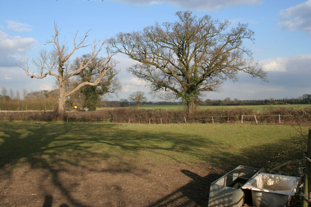
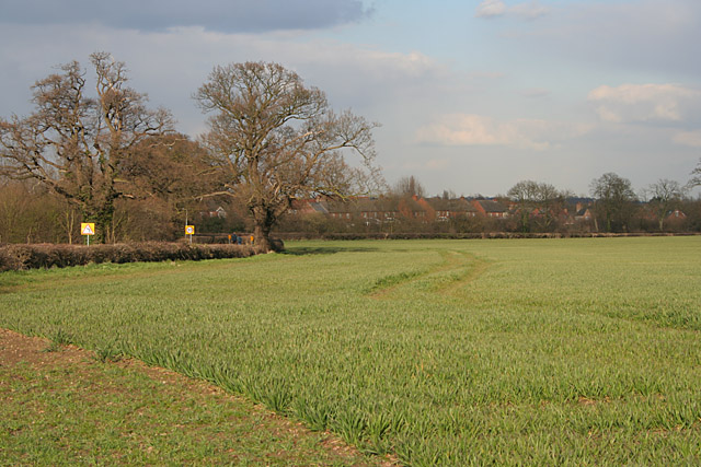
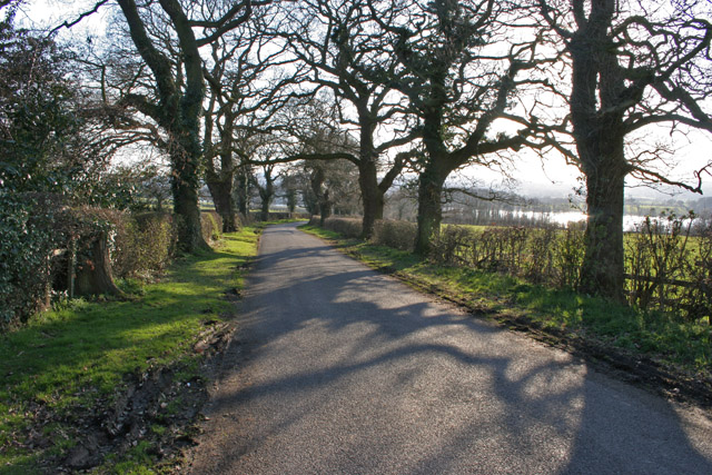
Cook's Plantation is a picturesque woodland located in Leicestershire, England. Situated in the heart of the county, it covers an area of approximately 50 acres and is a popular destination for nature enthusiasts and hikers alike.

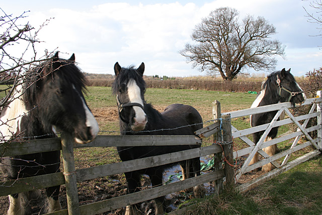
The plantation is primarily composed of a diverse range of trees, including oak, beech, and birch, which create a dense and enchanting forest environment. This rich variety of flora provides a habitat for a wide array of wildlife, from birds and butterflies to small mammals and insects.

The woodland is crisscrossed by a network of well-maintained footpaths, allowing visitors to explore its natural beauty at their own pace. These paths lead through a mix of open meadows, tranquil ponds, and ancient woodlands, providing a captivating blend of landscapes to discover.

One of the standout features of Cook's Plantation is its historical significance. The site is believed to have been named after the Cook family, who were prominent landowners in the area during the 18th century. The plantation has remained relatively untouched over the years, creating a sense of stepping back in time and immersing oneself in the region's past.

Visitors to Cook's Plantation can enjoy a peaceful and idyllic escape from the hustle and bustle of everyday life. Whether it's a leisurely stroll, a picnic in the meadows, or simply relishing the tranquility of nature, this woodland offers a refreshing retreat for all who venture within its borders.

If you have any feedback on the listing, please let us know in the comments section below.

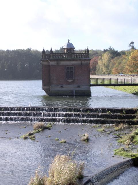
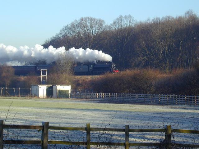
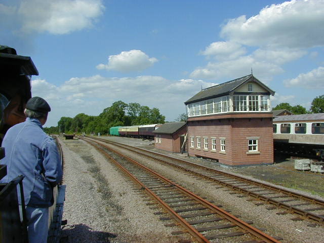
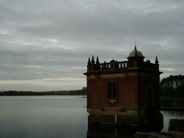
Cook's Plantation Images

Images are sourced within 2km of 52.712242/-1.1727754 or Grid Reference SK5513. Thanks to Geograph Open Source API. All images are credited.

Pump house at the top of Swithland Reservoir Victorian pump house at the Northern end of Swithland Reservoir, also known to Geocachers as Dumbledore's Retreat.
Pump house at the top of Swithland Reservoir
Victorian pump house at the Northern end of Swithland Reservoir, also known to Geocachers as Dumbledore's Retreat.
Great Central Railway
St Leonards, Swithland
Swithland The 'Tower House' and village pub, looking NW.
Swithland
The 'Tower House' and village pub, looking NW.
Rothley Station Rothley Station on the preserved Great Central Railway.
Rothley Station
Rothley Station on the preserved Great Central Railway.
Sidings Sidings just before Swithland reservoir on the great central railway.
Sidings
Sidings just before Swithland reservoir on the great central railway.
Pump house on Swithland reservoir An early morning view on a dull day.
Pump house on Swithland reservoir
An early morning view on a dull day.
Farmland near Mountsorrel, Leicestershire West Cross Lane follows the line of the hedge across the centre of the photograph.
Farmland near Mountsorrel, Leicestershire
West Cross Lane follows the line of the hedge across the centre of the photograph.
Winter Wheat near Mountsorrel This field of winter wheat is growing strongly next to West Cross Lane. Modern houses in Mountsorrel are just behind the trees.
Winter Wheat near Mountsorrel
This field of winter wheat is growing strongly next to West Cross Lane. Modern houses in Mountsorrel are just behind the trees.
Horses on West Cross Lane, near Mountsorrel Three curious ponies.
Horses on West Cross Lane, near Mountsorrel
Three curious ponies.
Roundabout on Halstead Road, Mountsorrel There is a great deal of new housing in Mountsorrel, transforming it from a sleepy village to a busy commuter area, handy for Leicester and Loughborough. This estate is built on Walton Way to the south west of the village.
Roundabout on Halstead Road, Mountsorrel
There is a great deal of new housing in Mountsorrel, transforming it from a sleepy village to a busy commuter area, handy for Leicester and Loughborough. This estate is built on Walton Way to the south west of the village.
Kinchley Lane near Mountsorrel, Leicestershire This road leads down to Swithland Reservoir visible through the trees.
Kinchley Lane near Mountsorrel, Leicestershire
This road leads down to Swithland Reservoir visible through the trees.
Stone barn near Swithland Reservoir The iron railings in the foreground run along both sides of Kinchley Lane and round most of the reservoir. The hill behind the barn screens the huge quarry behind.
Stone barn near Swithland Reservoir
The iron railings in the foreground run along both sides of Kinchley Lane and round most of the reservoir. The hill behind the barn screens the huge quarry behind.
Swithland Reservoir from Kinchley Lane Looking towards the opposite bank in <a href="https://www.geograph.org.uk/gridref/SK5514">SK5514</a>
Swithland Reservoir from Kinchley Lane
Looking towards the opposite bank in SK5514
Kinchley Lane at Swithland Reservoir These trees form part of all that is left of Budden Wood which once covered most of Budden Hill. Now that the hill is being eaten into by a vast quarry they form a ring round the industrial site.
Kinchley Lane at Swithland Reservoir
These trees form part of all that is left of Budden Wood which once covered most of Budden Hill. Now that the hill is being eaten into by a vast quarry they form a ring round the industrial site.
Swithland Reservoir Looking SE from the dam. The bank in the view is all in <a href="https://www.geograph.org.uk/gridref/SK5614">SK5614</a>. Swithland Reservoir is the most reliable place in the county to see Peregrines in the winter and the best time is a calm evening such as in this picture. In fact there were about six serious bird watchers on the dam with all the serious birdwatching gear while I was there. See <span class="nowrap"><a title="http://www.lros.org.uk/swithland.htm" rel="nofollow ugc noopener" href="http://www.lros.org.uk/swithland.htm">Link</a><img style="margin-left:2px;" alt="External link" title="External link - shift click to open in new window" src="https://s1.geograph.org.uk/img/external.png" width="10" height="10"/></span> for more bird watching information. The reservoir was built in 1896 and the pump house is a fine example of Victorian Industrial architecture.
Swithland Reservoir
Looking SE from the dam. The bank in the view is all in SK5614. Swithland Reservoir is the most reliable place in the county to see Peregrines in the winter and the best time is a calm evening such as in this picture. In fact there were about six serious bird watchers on the dam with all the serious birdwatching gear while I was there. See LinkExternal link for more bird watching information. The reservoir was built in 1896 and the pump house is a fine example of Victorian Industrial architecture.
Spillway at Swithland Reservoir The spillway has been blasted out of the hillside. This photograph demonstrates why Budden Hill is being systematically demolished by quarrying.
Spillway at Swithland Reservoir
The spillway has been blasted out of the hillside. This photograph demonstrates why Budden Hill is being systematically demolished by quarrying.
Wood Lane between Rothley and Quorn, Leicestershire Looking SE from Budden Hill. The pylons are in <a href="https://www.geograph.org.uk/gridref/SK5714">SK5714</a>.
Wood Lane between Rothley and Quorn, Leicestershire
Looking SE from Budden Hill. The pylons are in SK5714.
Show me another place!

Cook's Plantation is located at Grid Ref: SK5513 (Lat: 52.712242, Lng: -1.1727754)

Administrative County: Leicestershire

District: Charnwood

Police Authority: Leicestershire

What 3 Words

///budding.catapult.attends. Near Mountsorrel, Leicestershire

Related Wikis

Swithland railway station

Swithland was a railway station which was constructed on the Great Central Main Line between Rothley and Quorn and Woodhouse. The station was due to open...

Swithland Hall

Swithland Hall is a 19th-century Neoclassical country house in Swithland, Leicestershire, designed by James Pennethorne . == History == The present Swithland...

Swithland Sidings

Swithland Sidings is a set of railway sidings on the preserved Great Central Railway, situated just south of Swithland Reservoir and Swithland Viaduct...

Mountsorrel Cross

The Mountsorrel Cross is a market cross that dates from the Middle Ages. It originally stood on Main Street in the village of Mountsorrel, Leicestershire...

Nearby Amenities

Located within 500m of 52.712242,-1.1727754
Railway: buffer_stop
Lat/Long: 52.7139369/-1.1670774
Railway: buffer_stop
Lat/Long: 52.7138815/-1.1671465
Railway: switch
Lat/Long: 52.7146008/-1.1685112
Railway: buffer_stop
Lat/Long: 52.7139066/-1.1671122
Railway: switch
Lat/Long: 52.7135539/-1.1672174
Railway: switch
Lat/Long: 52.7141809/-1.1677894
Railway: switch
Lat/Long: 52.7153971/-1.1685088
Railway: buffer_stop
Lat/Long: 52.7135166/-1.1661545
Railway: buffer_stop
Lat/Long: 52.7135587/-1.1660518
The data included in this document is from www.openstreetmap.org. The data is made available under ODbL.

Have you been to Cook's Plantation?

Leave your review of Cook's Plantation below (or comments, questions and feedback).