Beech Copse

Wood, Forest in Hampshire Basingstoke and Deane

England

Beech Copse

Farmland near Baughurst This square is largely farmland and a network of minor roads. This view was taken near the footpath, at the intersection in the adjacent square. The view looks southeast along the road.
Farmland near Baughurst Credit: Pam Brophy

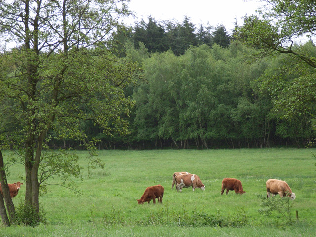
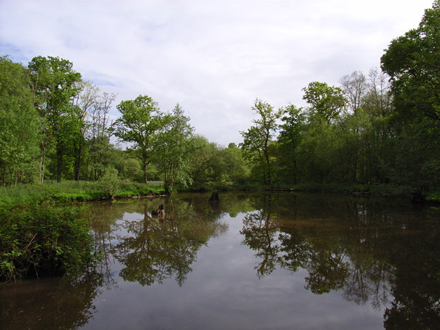
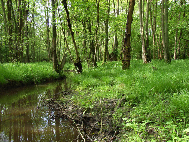
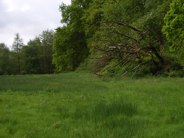
Beech Copse is a picturesque woodland located in the county of Hampshire, England. Situated in the southern part of the county, this beautiful beech forest covers an area of approximately 100 acres. The copse is renowned for its dense and majestic beech trees, which dominate the landscape and create a serene and tranquil atmosphere.

The forest is home to a wide variety of wildlife, including deer, foxes, and numerous species of birds. The rich biodiversity of Beech Copse makes it an attractive destination for nature enthusiasts and photographers, who can explore the forest's diverse flora and fauna.

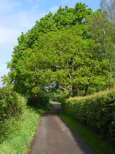
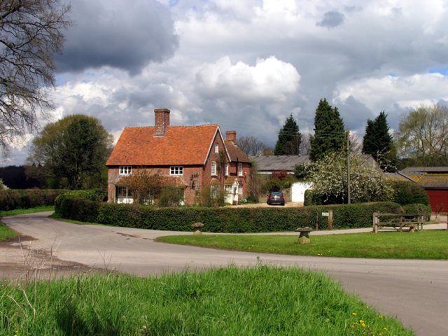
Visitors can enjoy a leisurely stroll through the copse along the well-maintained footpaths, which wind their way through the trees. The paths are marked with informative signs that provide interesting facts about the woodland and its inhabitants. The forest also features a small picnic area, where visitors can relax and enjoy a meal surrounded by the sights and sounds of nature.

The changing seasons transform Beech Copse into a kaleidoscope of colors. In the spring, the forest floor is carpeted with bluebells, creating a breathtaking display. During the summer months, the canopy of leaves provides much-needed shade, while in the autumn, the trees showcase a stunning array of golden hues. Even in the winter, the beech trees retain their beauty, with their bare branches creating an enchanting silhouette against the sky.

Beech Copse is a haven for those seeking solace in nature, offering a peaceful retreat from the hustle and bustle of everyday life. Its natural beauty and abundant wildlife make it an idyllic destination for anyone wishing to immerse themselves in the wonders of the Hampshire countryside.

If you have any feedback on the listing, please let us know in the comments section below.

Beech Copse Images

Images are sourced within 2km of 51.334587/-1.2038726 or Grid Reference SU5559. Thanks to Geograph Open Source API. All images are credited.

Farmland near Baughurst This square is largely farmland and a network of minor roads. This view was taken near the footpath, at the intersection in the adjacent square. The view looks southeast along the road.
Farmland near Baughurst
This square is largely farmland and a network of minor roads. This view was taken near the footpath, at the intersection in the adjacent square. The view looks southeast along the road.
Country house This picture was taken from approx 545582 and looks due north to a house just across the main A339
Country house
This picture was taken from approx 545582 and looks due north to a house just across the main A339
The Wolverton Road The section of the road opposite Wolverton Wood in the south eastern section of the grid square. It runs diagonally across this section of the square and the field on the western side of the road is just visible. The picture was taken looking north east along the road.
The Wolverton Road
The section of the road opposite Wolverton Wood in the south eastern section of the grid square. It runs diagonally across this section of the square and the field on the western side of the road is just visible. The picture was taken looking north east along the road.
The George & Dragon Inn, Towns End
Towns End
Towns End
St. Catherine's Church, Crabbs Hill, Wolverton
Wolverton Common
Wolverton Common
Frith Common Looking across to Sandford Wood.
Frith Common
Looking across to Sandford Wood.
Pond near Frith Common One of two ponds in the vicinity that are not shown by the Ordnance Survey.
Pond near Frith Common
One of two ponds in the vicinity that are not shown by the Ordnance Survey.
Woodland stream, Frith Common The stream emanates from Sandford Springs, which give their name to the nearby golf club.
Woodland stream, Frith Common
The stream emanates from Sandford Springs, which give their name to the nearby golf club.
Lane at Frith Common Farm A public footpath on a private road.
Lane at Frith Common Farm
A public footpath on a private road.
Clinker's Copse The fringe of the wood where it meets a rather boggy meadow.
Clinker's Copse
The fringe of the wood where it meets a rather boggy meadow.
St Catherine's Church, Wolverton An early Georgian Church (1717) in a lovely rural setting. Locked unfortunately but the brick exterior provides a casing for the original medieval interior.
St Catherine's Church, Wolverton
An early Georgian Church (1717) in a lovely rural setting. Locked unfortunately but the brick exterior provides a casing for the original medieval interior.
St Catherine's Church The unusual east end of the church.
St Catherine's Church
The unusual east end of the church.
St Catherine's Churchyard, Wolverton A well kept churchyard with levelled graves and a lovely view.
St Catherine's Churchyard, Wolverton
A well kept churchyard with levelled graves and a lovely view.
The tower, St Catherine's Church, Wolverton Looking almost straight up at the tower at the early Georgian St Catherine's Church, Wolverton.
The tower, St Catherine's Church, Wolverton
Looking almost straight up at the tower at the early Georgian St Catherine's Church, Wolverton.
St Catherine's Church, Wolverton Built in 1717 of light red brick. Nikolaus Pevsner called it "the best Early Georgian church in Hampshire", though some complain that the tower dwarfs the rest of the church.

In fact the church is a "re-casing" and inside the roof is medieval. Perhaps both sides of the argument have a point: the tower is fine - and it is large. 

The door was firmly locked on my visit...
St Catherine's Church, Wolverton
Built in 1717 of light red brick. Nikolaus Pevsner called it "the best Early Georgian church in Hampshire", though some complain that the tower dwarfs the rest of the church. In fact the church is a "re-casing" and inside the roof is medieval. Perhaps both sides of the argument have a point: the tower is fine - and it is large. The door was firmly locked on my visit...
Wolverton House A handsome late Georgian manor house. Strangely, the house attracts no attention from most Hampshire guides. Perhaps its proximity to St Catherine's Church means that it is overlooked by visitors.

Wolverton formed part of the estate of the Duke of Wellington until the mid-20th century.
Wolverton House
A handsome late Georgian manor house. Strangely, the house attracts no attention from most Hampshire guides. Perhaps its proximity to St Catherine's Church means that it is overlooked by visitors. Wolverton formed part of the estate of the Duke of Wellington until the mid-20th century.
Show me another place!

Beech Copse is located at Grid Ref: SU5559 (Lat: 51.334587, Lng: -1.2038726)

Administrative County: Hampshire

District: Basingstoke and Deane

Police Authority: Hampshire

What 3 Words

///snowy.configure.gains. Near Kingsclere, Hampshire

Related Wikis

Axmansford

Axmansford is a village in Hampshire, England. It is in the civil parish of Baughurst. == External links == Media related to Axmansford at Wikimedia Commons

Wolverton, Hampshire

Wolverton is a village in north Hampshire, England. It is within the civil parish of Baughurst, and located approximately 7 miles (11 km) from both Newbury...

Wolverton Common

Wolverton Common is a hamlet in north Hampshire, England. Its nearest town is Tadley, which lies approximately 2.5 miles (4 km) east from the hamlet....

Ashford Hill

Ashford Hill is a village in Basingstoke and Deane, Hampshire, England. == Governance == The village of Ashford Hill is part of the civil parish of Ashford...

Ashford Hill Woods and Meadows

Ashford Hill Woods and Meadows is a 141.5-hectare (350-acre) biological Site of Special Scientific Interest near Ashford Hill in Hampshire. An area of...

Ashford Hill NNR

Ashford Hill is a British national nature reserve next to the village of Ashford Hill in Hampshire. Part of the reserve is a designated a Site of Special...

Inhurst

Inhurst is a hamlet in Hampshire, England. It is in the civil parish of Baughurst. == History == Inhurst House was established as a school in the 1960s...

Kingsclere

Kingsclere is a large village and civil parish in Hampshire, England. == Geography == Kingsclere is approximately equidistant 13 kilometres (8.1 mi) from...

Nearby Amenities

Located within 500m of 51.334587,-1.2038726
Springfield Farm
Landuse: farm
Note Retag: CS #48756035
Lat/Long: 51.335411/-1.198475
Barrier: kissing_gate
Lat/Long: 51.3336662/-1.2012855
Barrier: kissing_gate
Lat/Long: 51.3352329/-1.2005667
Barrier: kissing_gate
Lat/Long: 51.3340582/-1.2001644
Barrier: kissing_gate
Lat/Long: 51.3340296/-1.2000556
The data included in this document is from www.openstreetmap.org. The data is made available under ODbL.

Have you been to Beech Copse?

Leave your review of Beech Copse below (or comments, questions and feedback).