Ryehill Wood
Wood, Forest in Yorkshire
England
Ryehill Wood

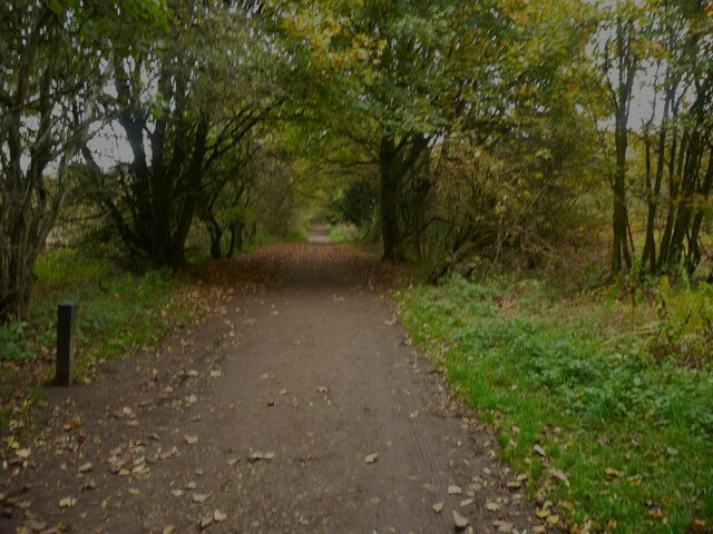
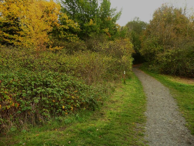
Ryehill Wood is a picturesque woodland located in the county of Yorkshire, England. Covering an area of approximately 100 acres, it is a well-known natural attraction for locals and tourists alike. Situated near the village of Ryehill, the wood is easily accessible and offers a tranquil escape from the hustle and bustle of urban life.
The woodland is predominantly made up of native tree species such as oak, beech, and birch, creating a diverse and vibrant ecosystem. These trees provide a stunning display throughout the year, with vibrant green foliage in the spring and summer, and a breathtaking array of colors in autumn.
Ryehill Wood is home to a variety of wildlife, including deer, foxes, and a plethora of bird species. Nature enthusiasts will appreciate the opportunity to observe and photograph these creatures in their natural habitat.
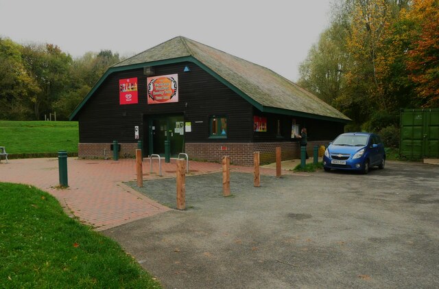
Visitors to the wood can enjoy a range of activities such as walking, hiking, and picnicking. There are well-maintained trails that wind through the woodland, offering stunning views and a chance to immerse oneself in nature. The wood also features a designated picnic area, complete with benches and tables, making it an ideal spot for a family outing or a peaceful lunch break.
Overall, Ryehill Wood in Yorkshire is a beautiful and tranquil woodland that provides a refreshing escape for those seeking solace in nature. With its diverse flora and fauna, as well as its recreational opportunities, it is a must-visit destination for nature lovers and outdoor enthusiasts in the region.
If you have any feedback on the listing, please let us know in the comments section below.
Ryehill Wood Images
Images are sourced within 2km of 54.544865/-1.1437678 or Grid Reference NZ5516. Thanks to Geograph Open Source API. All images are credited.


Ryehill Wood is located at Grid Ref: NZ5516 (Lat: 54.544865, Lng: -1.1437678)
Division: North Riding
Unitary Authority: Redcar and Cleveland
Police Authority: Cleveland
What 3 Words
///defeat.became.foster. Near South Bank, North Yorkshire
Related Wikis

Middlesbrough South and East Cleveland (UK Parliament constituency)
Middlesbrough South and East Cleveland is a constituency created in 1997 represented in the House of Commons of the UK Parliament since 2017 by Simon Clarke...
Normanby Hall, Redcar and Cleveland
Normanby Hall is a mansion on the western side of Normanby in Redcar and Cleveland. The manor of Normanby was held at an early period by the de Brus family...
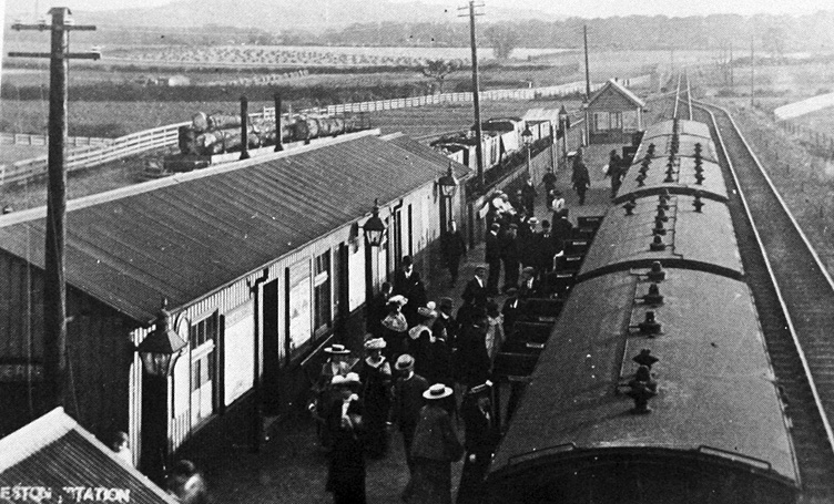
Eston railway station
Eston railway station formerly served the North Yorkshire town of Eston. It was used as a passenger station between 1902 and 1929 and as a goods-only station...

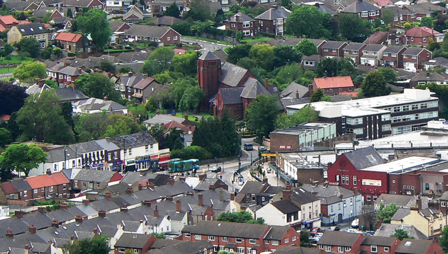
Normanby, Redcar and Cleveland
Normanby is an area in the borough of Redcar and Cleveland, North Yorkshire, England. A ward covering the area had a population of 6,930 at the 2011 census...

Greater Eston
Greater Eston is part of the Borough of Redcar and Cleveland, North Yorkshire, England. The name is used by the borough council to describe the centres...
Eston
Eston is an area of Redcar and Cleveland in North Yorkshire, England. The local authority ward covering the area (as well as Lackenby, Lazenby and Wilton...

Nunthorpe Academy
Nunthorpe Academy is an 11-18 Specialist Science, Business and Enterprise Academy in Nunthorpe, Middlesbrough, North Yorkshire, England. Houses are Endeavour...
Outwood Academy Ormesby
Outwood Academy Ormesby (formerly Ormesby School) is a mixed secondary school with academy status, located in the Netherfields area of Middlesbrough, England...
Nearby Amenities
Located within 500m of 54.544865,-1.1437678Have you been to Ryehill Wood?
Leave your review of Ryehill Wood below (or comments, questions and feedback).