Valeclose Plantation

Wood, Forest in Nottinghamshire Mansfield

England

Valeclose Plantation

Yard off High Street, Mansfield Woodhouse Yards are a common feature of the older parts of Mansfield Woodhouse. This one shows that the building fronting High Street is partly timber framed.
Yard off High Street, Mansfield Woodhouse Credit: Jonathan Thacker

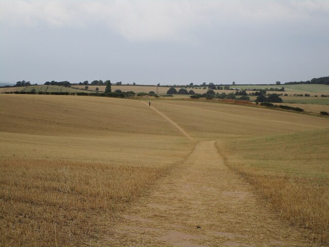
Valeclose Plantation is a wooded area located in Nottinghamshire, England. The plantation covers approximately 400 acres of land and is known for its diverse range of tree species, including oak, beech, and birch. The area is popular among nature enthusiasts and hikers, offering a peaceful and picturesque setting for outdoor activities.

The plantation is home to a variety of wildlife, including deer, birds, and small mammals, making it a popular spot for birdwatching and wildlife photography. The dense vegetation and tall trees provide a habitat for many species, creating a thriving ecosystem within the plantation.

Visitors to Valeclose Plantation can enjoy walking along the well-maintained trails that wind through the woods, offering scenic views of the surrounding countryside. The plantation is a designated Site of Special Scientific Interest (SSSI), recognizing its importance for biodiversity and conservation efforts.

Overall, Valeclose Plantation is a stunning natural area that offers a tranquil escape from the hustle and bustle of city life, providing a peaceful retreat for those looking to connect with nature.

If you have any feedback on the listing, please let us know in the comments section below.

Valeclose Plantation Images

Images are sourced within 2km of 53.151741/-1.1741499 or Grid Reference SK5561. Thanks to Geograph Open Source API. All images are credited.

Yard off High Street, Mansfield Woodhouse Yards are a common feature of the older parts of Mansfield Woodhouse. This one shows that the building fronting High Street is partly timber framed.
Yard off High Street, Mansfield Woodhouse
Yards are a common feature of the older parts of Mansfield Woodhouse. This one shows that the building fronting High Street is partly timber framed.
Footpath to Warren Farm A lone figure walks through the stubble field in the direction of Warren Farm.
Footpath to Warren Farm
A lone figure walks through the stubble field in the direction of Warren Farm.
Stubble field near Forest Town
Remains of the Market Cross, Mansfield Woodhouse Dates from the early fourteenth century <span class="nowrap"><a title="https://historicengland.org.uk/listing/the-list/list-entry/1253491" rel="nofollow ugc noopener" href="https://historicengland.org.uk/listing/the-list/list-entry/1253491">Link</a><img style="margin-left:2px;" alt="External link" title="External link - shift click to open in new window" src="https://s1.geograph.org.uk/img/external.png" width="10" height="10"/></span>
Remains of the Market Cross, Mansfield Woodhouse
Dates from the early fourteenth century LinkExternal link
The Library, Mansfield Woodhouse A CLASP building of 1960. Designed by Robert Matthews, Johnson-Marshall and Partners.
The Library, Mansfield Woodhouse
A CLASP building of 1960. Designed by Robert Matthews, Johnson-Marshall and Partners.
The Angel Inn, Mansfield Woodhouse Early nineteenth century inn <span class="nowrap"><a title="https://historicengland.org.uk/listing/the-list/list-entry/1254406" rel="nofollow ugc noopener" href="https://historicengland.org.uk/listing/the-list/list-entry/1254406">Link</a><img style="margin-left:2px;" alt="External link" title="External link - shift click to open in new window" src="https://s1.geograph.org.uk/img/external.png" width="10" height="10"/></span>
The Angel Inn, Mansfield Woodhouse
Early nineteenth century inn LinkExternal link
Trinity Methodist Church, Mansfield Woodhouse Designed by Arthur Marshall <span class="nowrap"><a title="https://en.wikipedia.org/wiki/Arthur_George_Marshall" rel="nofollow ugc noopener" href="https://en.wikipedia.org/wiki/Arthur_George_Marshall">Link</a><img style="margin-left:2px;" alt="External link" title="External link - shift click to open in new window" src="https://s1.geograph.org.uk/img/external.png" width="10" height="10"/></span> 1883-4.
Trinity Methodist Church, Mansfield Woodhouse
Designed by Arthur Marshall LinkExternal link 1883-4.
Houses off the High Street, Mansfield Woodhouse One of the many yards off High Street and Station Street.
Houses off the High Street, Mansfield Woodhouse
One of the many yards off High Street and Station Street.
The Hair Boutique, Mansfield Woodhouse
Seventh Day Adventist Church, Mansfield Woodhouse The former Bethel Church but originally built as a Primitive Methodist church. Dates from 1905.
Seventh Day Adventist Church, Mansfield Woodhouse
The former Bethel Church but originally built as a Primitive Methodist church. Dates from 1905.
Sherwood Dental Practice, Mansfield Woodhouse
Cottages, Portland Street, Mansfield Woodhouse
The Beeches, Mansfield Woodhouse Early nineteenth century former farmhouse <span class="nowrap"><a title="https://historicengland.org.uk/listing/the-list/list-entry/1251843" rel="nofollow ugc noopener" href="https://historicengland.org.uk/listing/the-list/list-entry/1251843">Link</a><img style="margin-left:2px;" alt="External link" title="External link - shift click to open in new window" src="https://s1.geograph.org.uk/img/external.png" width="10" height="10"/></span>
The Beeches, Mansfield Woodhouse
Early nineteenth century former farmhouse LinkExternal link
The Greyhound, Mansfield Woodhouse
12 Church Street, Mansfield Woodhouse Early eighteenth century house <span class="nowrap"><a title="https://historicengland.org.uk/listing/the-list/list-entry/1262572" rel="nofollow ugc noopener" href="https://historicengland.org.uk/listing/the-list/list-entry/1262572">Link</a><img style="margin-left:2px;" alt="External link" title="External link - shift click to open in new window" src="https://s1.geograph.org.uk/img/external.png" width="10" height="10"/></span>
12 Church Street, Mansfield Woodhouse
Early eighteenth century house LinkExternal link
St. Edmund's church, Mansfield Woodhouse Fourteenth century church much restored in the nineteenth century <span class="nowrap"><a title="https://historicengland.org.uk/listing/the-list/list-entry/1251828" rel="nofollow ugc noopener" href="https://historicengland.org.uk/listing/the-list/list-entry/1251828">Link</a><img style="margin-left:2px;" alt="External link" title="External link - shift click to open in new window" src="https://s1.geograph.org.uk/img/external.png" width="10" height="10"/></span>
St. Edmund's church, Mansfield Woodhouse
Fourteenth century church much restored in the nineteenth century LinkExternal link
The Manor House, Mansfield Woodhouse Has seventeenth century origins but much altered and extended. Now flats. <span class="nowrap"><a title="https://historicengland.org.uk/listing/the-list/list-entry/1261279" rel="nofollow ugc noopener" href="https://historicengland.org.uk/listing/the-list/list-entry/1261279">Link</a><img style="margin-left:2px;" alt="External link" title="External link - shift click to open in new window" src="https://s1.geograph.org.uk/img/external.png" width="10" height="10"/></span>
The Manor House, Mansfield Woodhouse
Has seventeenth century origins but much altered and extended. Now flats. LinkExternal link
Public garden, Church Street, Mansfield Woodhouse The boundary wall is listed <span class="nowrap"><a title="https://historicengland.org.uk/listing/the-list/list-entry/1262571" rel="nofollow ugc noopener" href="https://historicengland.org.uk/listing/the-list/list-entry/1262571">Link</a><img style="margin-left:2px;" alt="External link" title="External link - shift click to open in new window" src="https://s1.geograph.org.uk/img/external.png" width="10" height="10"/></span>
Public garden, Church Street, Mansfield Woodhouse
The boundary wall is listed LinkExternal link
Show me another place!

Valeclose Plantation is located at Grid Ref: SK5561 (Lat: 53.151741, Lng: -1.1741499)

Administrative County: Nottinghamshire

District: Mansfield

Police Authority: Nottinghamshire

What 3 Words

///admiral.guitar.basin. Near Mansfield Woodhouse, Nottinghamshire

Related Wikis

Samworth Church Academy

The Samworth Church Academy is a coeducational secondary school and sixth form with academy status, located in Mansfield in the English county of Nottinghamshire...

A.F.C. Mansfield

A.F.C. Mansfield is a football club based in Forest Town, a suburb of Mansfield, Nottinghamshire, England. Nicknamed 'The Bulls', they are currently members...

The Brunts Academy

The Brunts Academy, a large secondary school in Mansfield, Nottinghamshire, England, is a member of the Greenwood Academies Trust. The school specialises...

Forest Town, Nottinghamshire

Forest Town is a former mining village on the outskirts of Mansfield, Nottinghamshire, England. After continuous development it is no longer a separate...

Nearby Amenities

Located within 500m of 53.151741,-1.1741499
Bus Stop
Mossdale Road
Bus: yes
Naptan AtcoCode: 3300MA0360
Naptan Bearing: NE
Naptan CommonName: Mossdale Road
Naptan Crossing: Mossdale Road
Naptan Indicator: opp
Naptan NaptanCode: ntsdmpdj
Naptan Notes: BW
Naptan PlusbusZoneRef: MFLDTWN
Naptan Street: Barringer Road
Naptan Verified: no
Public Transport: platform
Source: naptan_import
Lat/Long: 53.1520852/-1.1783324
Bus Stop
Sanders Avenue
Bus: yes
Naptan AtcoCode: 3300MA0361
Naptan Bearing: S
Naptan CommonName: Sanders Avenue
Naptan Crossing: Sanders Avenue
Naptan Indicator: adj
Naptan Landmark: Recreation Centre
Naptan NaptanCode: ntsdmpdm
Naptan Notes: BW
Naptan PlusbusZoneRef: MFLDTWN
Naptan Street: Barringer Road
Naptan Verified: no
Public Transport: platform
Source: naptan_import
Lat/Long: 53.1493965/-1.1795052
Bus Stop
Ravensdale Avenue
Bench: no
Bin: no
Bus: yes
Naptan AtcoCode: 3300MA0394
Naptan Bearing: SE
Naptan CommonName: Ravensdale Avenue
Naptan Crossing: Ravensdale Avenue
Naptan Indicator: opp
Naptan NaptanCode: ntsdmpgw
Naptan Notes: none
Naptan PlusbusZoneRef: MFLDTWN
Naptan Street: Ravensdale Road
Naptan Verified: yes
Public Transport: platform
Shelter: yes
Source: naptan_import
Lat/Long: 53.1489579/-1.1793195
Bus Stop
Ravensdale Avenue
Bus: yes
Naptan AtcoCode: 3300MA0395
Naptan Bearing: NW
Naptan CommonName: Ravensdale Avenue
Naptan Crossing: Ravensdale Avenue
Naptan Indicator: adj
Naptan NaptanCode: ntsdmpja
Naptan Notes: none
Naptan PlusbusZoneRef: MFLDTWN
Naptan Street: Ravensdale Road
Naptan Verified: no
Public Transport: platform
Source: naptan_import
Lat/Long: 53.1487359/-1.1788748
Bus Stop
Alcock Avenue
Bus: yes
Naptan AtcoCode: 3300MA0396
Naptan Bearing: NW
Naptan CommonName: Alcock Avenue
Naptan Crossing: Alcock Avenue
Naptan Indicator: adj
Naptan Landmark: The Ravensdale Inn
Naptan NaptanCode: ntsdmpjd
Naptan Notes: BW
Naptan PlusbusZoneRef: MFLDTWN
Naptan Street: Ravensdale Road
Naptan Verified: no
Public Transport: platform
Source: naptan_import
Lat/Long: 53.1477721/-1.1733907
Bus Stop
Chadburn Road
Bus: yes
Naptan AtcoCode: 3300MA0402
Naptan Bearing: SW
Naptan CommonName: Chadburn Road
Naptan Crossing: Chadburn Road
Naptan Indicator: opp
Naptan NaptanCode: ntsdjtag
Naptan Notes: none
Naptan PlusbusZoneRef: MFLDTWN
Naptan Street: Sherwood Hall Road
Naptan Verified: no
Public Transport: platform
Source: naptan_import
Lat/Long: 53.1486268/-1.1709071
Bus Stop
Chadburn Road
Bench: yes
Bin: yes
Bus: yes
Naptan AtcoCode: 3300MA0403
Naptan Bearing: NE
Naptan CommonName: Chadburn Road
Naptan Crossing: Chadburn Road
Naptan Indicator: adj
Naptan NaptanCode: ntsdjtaj
Naptan Notes: none
Naptan PlusbusZoneRef: MFLDTWN
Naptan Street: Sherwood Hall Road
Naptan Verified: yes
Public Transport: platform
Shelter: yes
Lat/Long: 53.1494163/-1.170331
Bus Stop
Clipstone Road West
Bus: yes
Naptan AtcoCode: 3300MA0404
Naptan Bearing: SW
Naptan CommonName: Clipstone Road West
Naptan Crossing: Stuart Avenue
Naptan Indicator: SW-bound
Naptan NaptanCode: ntsdjtam
Naptan Notes: none
Naptan PlusbusZoneRef: MFLDTWN
Naptan Street: Clipstone Road West
Naptan Verified: no
Public Transport: platform
Source: naptan_import
Lat/Long: 53.1505697/-1.1672211
Bus Stop
Heatherly Drive
Bus: yes
Naptan AtcoCode: 3300MA0448
Naptan Bearing: NW
Naptan CommonName: Heatherly Drive
Naptan Crossing: Heatherly Drive
Naptan Indicator: adj
Naptan NaptanCode: ntsdjtjp
Naptan Notes: none
Naptan PlusbusZoneRef: MFLDTWN
Naptan Street: Old Mill Lane
Naptan Verified: yes
Public Transport: platform
Source: naptan_import
Lat/Long: 53.1555401/-1.1734879
Bus Stop
Blenheim Close
Bus: yes
Naptan AtcoCode: 3300MA0454
Naptan Bearing: SE
Naptan CommonName: Blenheim Close
Naptan Crossing: Blenheim Close
Naptan Indicator: opp
Naptan NaptanCode: ntsamgaj
Naptan Notes: none
Naptan PlusbusZoneRef: MFLDTWN
Naptan Street: Barringer Road
Naptan Verified: no
Public Transport: platform
Source: naptan_import
Lat/Long: 53.1539712/-1.1780721
Bus Stop
The Ridings
Bus: yes
Naptan AtcoCode: 3300MA0460
Naptan Bearing: SE
Naptan CommonName: The Ridings
Naptan Crossing: The Ridings
Naptan Indicator: adj
Naptan NaptanCode: ntsamgdg
Naptan Notes: none
Naptan PlusbusZoneRef: MFLDTWN
Naptan Street: Old Mill Lane
Naptan Verified: no
Public Transport: platform
Source: naptan_import
Lat/Long: 53.1545539/-1.1700602
Bus Stop
Blenheim Close
Bus: yes
Naptan AtcoCode: 3300MA0462
Naptan Bearing: NW
Naptan CommonName: Blenheim Close
Naptan Crossing: Blenheim Close
Naptan Indicator: adj
Naptan NaptanCode: ntsamgdm
Naptan Notes: none
Naptan PlusbusZoneRef: MFLDTWN
Naptan Street: Barringer Road
Naptan Verified: no
Public Transport: platform
Source: naptan_import
Lat/Long: 53.1541621/-1.1783825
Bus Stop
Linden Road
Bus: yes
Naptan AtcoCode: 3300MA0494
Naptan Bearing: NE
Naptan CommonName: Linden Road
Naptan Crossing: Linden Road
Naptan Indicator: adj
Naptan NaptanCode: ntsamgpm
Naptan Notes: none
Naptan PlusbusZoneRef: MFLDTWN
Naptan Street: Ellesmere Road
Naptan Verified: no
Public Transport: platform
Source: naptan_import
Lat/Long: 53.1511317/-1.1691691
Bus Stop
Stuart Avenue
Bus: yes
Naptan AtcoCode: 3300MA0495
Naptan Bearing: NW
Naptan CommonName: Stuart Avenue
Naptan Crossing: Clipstone Road West
Naptan Indicator: NW-bound
Naptan Landmark: Mechanics Institute
Naptan NaptanCode: ntsamgpt
Naptan Notes: none
Naptan PlusbusZoneRef: MFLDTWN
Naptan Street: Stuart Avenue
Naptan Verified: no
Public Transport: platform
Source: naptan_import
Lat/Long: 53.1500905/-1.1681126
Bus Stop
Stuart Avenue
Bus: yes
Naptan AtcoCode: 3300MA0547
Naptan Bearing: SE
Naptan CommonName: Stuart Avenue
Naptan Crossing: Clipstone Road West
Naptan Indicator: SE-bound
Naptan Landmark: Mechanics Institute
Naptan NaptanCode: ntsamawj
Naptan Notes: None
Naptan PlusbusZoneRef: MFLDTWN
Naptan Street: Stuart Avenue
Naptan Verified: no
Public Transport: platform
Source: naptan_import
Lat/Long: 53.1498902/-1.1677426
Bus Stop
Mossdale Road
Bus: yes
Naptan AtcoCode: 3300MA0613
Naptan Bearing: SW
Naptan BusStopType: CUS
Naptan CommonName: Mossdale Road
Naptan Crossing: Mossdale Road
Naptan Indicator: adj
Naptan NaptanCode: ntsgjgam
Naptan Notes: CUS--3300MA0360
Naptan PlusbusZoneRef: MFLDTWN
Naptan Street: Barringer Road
Naptan Verified: no
Public Transport: platform
Source: naptan_import
Lat/Long: 53.1519947/-1.1782444
Bus Stop
Sanders Avenue
Bus: yes
Naptan AtcoCode: 3300MA0614
Naptan Bearing: NE
Naptan BusStopType: CUS
Naptan CommonName: Sanders Avenue
Naptan Crossing: Sanders Avenue
Naptan Indicator: opp
Naptan Landmark: Recreation Centre
Naptan NaptanCode: ntsgjgap
Naptan Notes: CUS--3300MA0361
Naptan PlusbusZoneRef: MFLDTWN
Naptan Street: Barringer Road
Naptan Verified: no
Public Transport: platform
Source: naptan_import
Lat/Long: 53.1495481/-1.1795499
Bus Stop
Alcock Avenue
Bus: yes
Naptan AtcoCode: 3300MA0615
Naptan Bearing: SE
Naptan BusStopType: CUS
Naptan CommonName: Alcock Avenue
Naptan Crossing: Alcock Avenue
Naptan Indicator: opp
Naptan Landmark: The Ravensdale Inn
Naptan NaptanCode: ntsgjgat
Naptan Notes: CUS--3300MA0396
Naptan PlusbusZoneRef: MFLDTWN
Naptan Street: Ravensdale Road
Naptan Verified: no
Public Transport: platform
Source: naptan_import
Lat/Long: 53.1478421/-1.1731202
Turning Circle
Source: Bing
Lat/Long: 53.1474306/-1.1756064
Crossing
Crossing: traffic_signals
Crossing Markings: yes
Crossing Signals: yes
Crossing Ref: pelican
Source: Bing
Lat/Long: 53.1482562/-1.1715084
Turning Circle
Lat/Long: 53.1508148/-1.1750693
Turning Circle
Lat/Long: 53.1501076/-1.1752785
Crossing
Crossing: marked
Crossing Markings: yes
Crossing Ref: pelican
Lat/Long: 53.1549182/-1.171229
Shop: convenience
Lat/Long: 53.153758/-1.1776918
Fast Food
The Mandarin
Addr Housenumber: 70
Addr Postcode: NG18 2DF
Addr Street: Barringer Road
Cuisine: chinese
Source Addr: FHRS Open Data
Source Addr Website: http://ratings.food.gov.uk/business/en-GB/223264
Lat/Long: 53.1536912/-1.177665
Crossing
Crossing: marked
Crossing Markings: yes
Crossing Ref: zebra
Source: Bing
Lat/Long: 53.1554602/-1.1704892
Crossing
Crossing: marked
Crossing Markings: yes
Crossing Ref: zebra
Source: Bing
Lat/Long: 53.1550476/-1.1707864
Barrier: cycle_barrier
Lat/Long: 53.1546517/-1.1797491
Barrier: cycle_barrier
Lat/Long: 53.1540189/-1.1794552
Turning Circle
Lat/Long: 53.1511413/-1.1726045
Turning Circle
Lat/Long: 53.1542926/-1.1719821
Turning Circle
Lat/Long: 53.15357/-1.1684285
Turning Circle
Lat/Long: 53.1547696/-1.1718639
Turning Circle
Lat/Long: 53.1549977/-1.1760314
Turning Circle
Lat/Long: 53.1555709/-1.1756944
Turning Circle
Lat/Long: 53.1511053/-1.1782126
Turning Circle
Lat/Long: 53.155461/-1.1782676
Turning Circle
Lat/Long: 53.1495828/-1.1690043
Turning Circle
Lat/Long: 53.1529444/-1.1746783
Turning Circle
Lat/Long: 53.1545302/-1.1740954
Turning Circle
Lat/Long: 53.153204/-1.1757285
Turning Circle
Lat/Long: 53.1550903/-1.172901
Turning Circle
Source: Bing
Lat/Long: 53.1553289/-1.173824
Turning Circle
Turning Circle: hammer
Lat/Long: 53.1551255/-1.1776319
Crossing
Crossing: unmarked
Crossing Island: no
Crossing Markings: no
Tactile Paving: no
Lat/Long: 53.154272/-1.1784064
Source: Bing
Lat/Long: 53.1540539/-1.1788901
Noexit: yes
Lat/Long: 53.1518458/-1.1785969
Crossing
Crossing: unmarked
Crossing Island: no
Crossing Markings: no
Tactile Paving: no
Lat/Long: 53.1538328/-1.1780511
Turning Circle
Lat/Long: 53.1519905/-1.178988
Noexit: yes
Lat/Long: 53.1510393/-1.1786238
Turning Circle
Lat/Long: 53.1533866/-1.1696157
Turning Circle
Lat/Long: 53.1546032/-1.1708475
Turning Circle
Source: Bing
Turning Circle: circle
Lat/Long: 53.1530526/-1.1700311
Turning Circle
Lat/Long: 53.1538009/-1.1696036
Turning Circle
Lat/Long: 53.1527758/-1.1689232
Barrier: lift_gate
Lat/Long: 53.1482295/-1.1710584
Cemetery: grave
Earliest Start Date: 1998
End Date: 2013-10-12
Grave: unmarked
Source: BBC News
Source Website: http://www.bbc.co.uk/news/uk-england-nottinghamshire-24522344
Lat/Long: 53.1546806/-1.1790032
Turning Circle
Lat/Long: 53.1489625/-1.1694101
Barrier: cycle_barrier
Lat/Long: 53.1551147/-1.17821
Barrier: cycle_barrier
Lat/Long: 53.1552354/-1.178641
Barrier: cycle_barrier
Lat/Long: 53.1556756/-1.1756689
Barrier: cycle_barrier
Lat/Long: 53.1549566/-1.1776443
Barrier: cycle_barrier
Lat/Long: 53.1548768/-1.1767825
Barrier: cycle_barrier
Lat/Long: 53.1552326/-1.1765607
Barrier: cycle_barrier
Lat/Long: 53.1558345/-1.1761049
Barrier: cycle_barrier
Lat/Long: 53.155663/-1.1762368
Barrier: cycle_barrier
Lat/Long: 53.1558424/-1.1760611
Crossing
Button Operated: yes
Crossing: traffic_signals
Crossing Island: no
Tactile Paving: yes
Lat/Long: 53.155431/-1.1729928
Fast Food
Fillets
Cuisine: fish_and_chips
Lat/Long: 53.1560341/-1.1731706
Barrier: cycle_barrier
Lat/Long: 53.154495/-1.1702416
Fast Food
Subway
Brand: Subway
Brand Wikidata: Q244457
Brand Wikipedia: en:Subway (restaurant)
Contact Website: https://restaurants.subway.com/united-kingdom/en/mansfield/unit-e-sandlands-court
Cuisine: sandwich
Takeaway: yes
Lat/Long: 53.1561676/-1.1735327
Innovations
Shop: hairdresser
Lat/Long: 53.1560806/-1.1732937
Shop: yes
Lat/Long: 53.1562126/-1.1736505
Dentist
Shine
Healthcare: dentist
Lat/Long: 53.1561225/-1.1734067
Barrier: cycle_barrier
Lat/Long: 53.1536651/-1.1674655
Barrier: cycle_barrier
Lat/Long: 53.1547458/-1.1714913
Barrier: cycle_barrier
Lat/Long: 53.1560037/-1.1717941
Crossing
Crossing: unmarked
Crossing Island: no
Crossing Markings: no
Crossing Signals: no
Tactile Paving: no
Lat/Long: 53.1498763/-1.1699179
Crossing
Crossing: marked
Crossing Markings: yes
Lat/Long: 53.1561369/-1.1728875
Turning Circle
Lat/Long: 53.1557756/-1.1754991
Generator Method: photovoltaic
Generator Output Electricity: yes
Generator Source: solar
Generator Type: solar_photovoltaic_panel
Location: roof
Power: generator
Lat/Long: 53.1534648/-1.173047
Generator Method: photovoltaic
Generator Output Electricity: yes
Generator Source: solar
Generator Type: solar_photovoltaic_panel
Location: roof
Power: generator
Lat/Long: 53.1529192/-1.1751833
Generator Method: photovoltaic
Generator Output Electricity: yes
Generator Source: solar
Generator Type: solar_photovoltaic_panel
Location: roof
Power: generator
Lat/Long: 53.1528613/-1.1750492
Generator Method: photovoltaic
Generator Output Electricity: yes
Generator Source: solar
Generator Type: solar_photovoltaic_panel
Location: roof
Power: generator
Lat/Long: 53.1551002/-1.1757305
Generator Method: photovoltaic
Generator Output Electricity: yes
Generator Source: solar
Generator Type: solar_photovoltaic_panel
Location: roof
Power: generator
Lat/Long: 53.1551066/-1.1758753
Generator Method: photovoltaic
Generator Output Electricity: yes
Generator Source: solar
Generator Type: solar_photovoltaic_panel
Location: roof
Power: generator
Lat/Long: 53.1553318/-1.1742392
Generator Method: photovoltaic
Generator Output Electricity: yes
Generator Source: solar
Generator Type: solar_photovoltaic_panel
Location: roof
Power: generator
Lat/Long: 53.1558722/-1.1748561
Generator Method: photovoltaic
Generator Output Electricity: yes
Generator Source: solar
Generator Type: solar_photovoltaic_panel
Location: roof
Power: generator
Lat/Long: 53.1550282/-1.1732936
Generator Method: photovoltaic
Generator Output Electricity: yes
Generator Source: solar
Generator Type: solar_photovoltaic_panel
Location: roof
Power: generator
Lat/Long: 53.154877/-1.1728054
Generator Method: photovoltaic
Generator Output Electricity: yes
Generator Source: solar
Generator Type: solar_photovoltaic_panel
Location: roof
Power: generator
Lat/Long: 53.1550845/-1.1743262
Generator Method: photovoltaic
Generator Output Electricity: yes
Generator Source: solar
Generator Type: solar_photovoltaic_panel
Location: roof
Power: generator
Lat/Long: 53.1556941/-1.1754045
Generator Method: photovoltaic
Generator Output Electricity: yes
Generator Source: solar
Generator Type: solar_photovoltaic_panel
Location: roof
Power: generator
Lat/Long: 53.1558195/-1.1751791
Generator Method: photovoltaic
Generator Output Electricity: yes
Generator Source: solar
Generator Type: solar_photovoltaic_panel
Location: roof
Power: generator
Lat/Long: 53.1551955/-1.1788994
Generator Method: photovoltaic
Generator Output Electricity: yes
Generator Source: solar
Generator Type: solar_photovoltaic_panel
Location: roof
Power: generator
Lat/Long: 53.1551971/-1.1788591
Generator Method: photovoltaic
Generator Output Electricity: yes
Generator Source: solar
Generator Type: solar_photovoltaic_panel
Location: roof
Power: generator
Lat/Long: 53.1553113/-1.1781886
Generator Method: photovoltaic
Generator Output Electricity: yes
Generator Source: solar
Generator Type: solar_photovoltaic_panel
Location: roof
Power: generator
Lat/Long: 53.1552984/-1.178151
Generator Method: photovoltaic
Generator Output Electricity: yes
Generator Source: solar
Generator Type: solar_photovoltaic_panel
Location: roof
Power: generator
Lat/Long: 53.1545036/-1.1794249
Generator Method: photovoltaic
Generator Output Electricity: yes
Generator Source: solar
Generator Type: solar_photovoltaic_panel
Location: roof
Power: generator
Lat/Long: 53.1549429/-1.1764961
Generator Method: photovoltaic
Generator Output Electricity: yes
Generator Source: solar
Generator Type: solar_photovoltaic_panel
Location: roof
Power: generator
Lat/Long: 53.1534825/-1.1714133
Generator Method: photovoltaic
Generator Output Electricity: yes
Generator Source: solar
Generator Type: solar_photovoltaic_panel
Location: roof
Power: generator
Lat/Long: 53.1532396/-1.1692488
Generator Method: photovoltaic
Generator Output Electricity: yes
Generator Source: solar
Generator Type: solar_photovoltaic_panel
Location: roof
Power: generator
Lat/Long: 53.1531511/-1.1687986
Generator Method: photovoltaic
Generator Output Electricity: yes
Generator Source: solar
Generator Type: solar_photovoltaic_panel
Location: roof
Power: generator
Lat/Long: 53.1529774/-1.1693185
Generator Method: photovoltaic
Generator Output Electricity: yes
Generator Source: solar
Generator Type: solar_photovoltaic_panel
Location: roof
Power: generator
Lat/Long: 53.1529485/-1.1675778
Generator Method: photovoltaic
Generator Output Electricity: yes
Generator Source: solar
Generator Type: solar_photovoltaic_panel
Location: roof
Power: generator
Lat/Long: 53.1519577/-1.169635
Generator Method: photovoltaic
Generator Output Electricity: yes
Generator Source: solar
Generator Type: solar_photovoltaic_panel
Location: roof
Power: generator
Lat/Long: 53.1490429/-1.168994
Generator Method: photovoltaic
Generator Output Electricity: yes
Generator Source: solar
Generator Type: solar_photovoltaic_panel
Location: roof
Power: generator
Lat/Long: 53.1487518/-1.1693534
Crossing
Crossing: marked
Crossing Markings: yes
Lat/Long: 53.1556692/-1.1722357
Generator Method: photovoltaic
Generator Output Electricity: yes
Generator Source: solar
Generator Type: solar_photovoltaic_panel
Location: roof
Power: generator
Lat/Long: 53.1537856/-1.1701485
Turning Circle
Lat/Long: 53.1516424/-1.1711145
Turning Circle
Lat/Long: 53.151835/-1.1711782
Crossing
Lat/Long: 53.1495172/-1.1703831
Entrance: yes
Lat/Long: 53.1557504/-1.1723694
Generator Method: photovoltaic
Generator Output Electricity: yes
Generator Source: solar
Generator Type: solar_photovoltaic_panel
Location: roof
Power: generator
Lat/Long: 53.1542554/-1.1777822
Generator Method: photovoltaic
Generator Output Electricity: yes
Generator Source: solar
Generator Type: solar_photovoltaic_panel
Location: roof
Power: generator
Lat/Long: 53.1542594/-1.1777447
Generator Method: photovoltaic
Generator Output Electricity: yes
Generator Source: solar
Generator Type: solar_photovoltaic_panel
Location: roof
Power: generator
Lat/Long: 53.1514327/-1.178198
Generator Method: photovoltaic
Generator Output Electricity: yes
Generator Source: solar
Generator Type: solar_photovoltaic_panel
Location: roof
Power: generator
Lat/Long: 53.1508069/-1.1787263
Generator Method: photovoltaic
Generator Output Electricity: yes
Generator Source: solar
Generator Type: solar_photovoltaic_panel
Location: roof
Power: generator
Lat/Long: 53.1508343/-1.1787585
Generator Method: photovoltaic
Generator Output Electricity: yes
Generator Source: solar
Generator Type: solar_photovoltaic_panel
Location: roof
Power: generator
Lat/Long: 53.1508102/-1.178788
Traffic Signals
Crossing: no
Traffic Signals Direction: forward
Lat/Long: 53.1554207/-1.1729508
Traffic Signals
Crossing: no
Traffic Signals Direction: backward
Lat/Long: 53.1554444/-1.1730467
Camera Mount: pole
Camera Type: dome
Man Made: surveillance
Surveillance: public
Surveillance Type: camera
Surveillance Zone: town
Lat/Long: 53.1490836/-1.1799948
Crossing
Crossing: unmarked
Crossing Island: yes
Crossing Markings: no
Tactile Paving: yes
Lat/Long: 53.1555316/-1.1719081
Crossing
Crossing: unmarked
Crossing Island: yes
Crossing Markings: no
Tactile Paving: yes
Lat/Long: 53.1555696/-1.1720414
Bus Stop
Bus: yes
Public Transport: platform
Lat/Long: 53.1559215/-1.1718243
Tactile Paving: yes
Lat/Long: 53.1560147/-1.1718247
Bicycle Parking
Lat/Long: 53.1557187/-1.1723091
Waste Basket
Lat/Long: 53.1557357/-1.172344
Waste Basket
Lat/Long: 53.1556935/-1.1724243
Turning Circle
Lat/Long: 53.149506/-1.169775
Crossing
Crossing: unmarked
Crossing Island: no
Crossing Markings: no
Crossing Signals: no
Tactile Paving: no
Lat/Long: 53.1499734/-1.1696413
Crossing
Crossing: unmarked
Crossing Island: no
Crossing Markings: no
Crossing Signals: no
Tactile Paving: no
Lat/Long: 53.1501485/-1.169155
Crossing
Crossing: unmarked
Crossing Island: yes
Crossing Markings: no
Crossing Signals: no
Tactile Paving: yes
Lat/Long: 53.1495561/-1.1699539
Crossing
Lat/Long: 53.1494744/-1.170268
Post Office
Clipstone Road West Post Office
Addr Postcode: NG19 0EF
Brand: Post Office
Brand Wikidata: Q1783168
Fixme Addr 1: 15 Clipstone Road West
Fixme Addr City: Mansfield
Opening Hours: Mo-Fr 07:00-20:00; Sa 07:30-20:00; Su 08:00-18:00
Ref Pol Id: 135716
Lat/Long: 53.1505452/-1.1683498
Crossing
Crossing: unmarked
Crossing Island: yes
Crossing Markings: no
Tactile Paving: yes
Lat/Long: 53.1554058/-1.1725204
Crossing
Crossing: unmarked
Crossing Island: yes
Crossing Markings: no
Tactile Paving: yes
Lat/Long: 53.1553005/-1.1725584
Crossing
Crossing: unmarked
Crossing Markings: no
Lat/Long: 53.1552213/-1.1717662
Crossing
Crossing: unmarked
Crossing Markings: no
Lat/Long: 53.1551443/-1.1718632
Crossing
Crossing: unmarked
Crossing Markings: no
Lat/Long: 53.1551111/-1.1722281
Crossing
Crossing: unmarked
Crossing Markings: no
Lat/Long: 53.1551363/-1.1723141
Crossing
Crossing: unmarked
Crossing Island: yes
Crossing Markings: no
Tactile Paving: no
Lat/Long: 53.1518645/-1.1783894
Crossing
Crossing: unmarked
Crossing Island: yes
Crossing Markings: no
Tactile Paving: no
Lat/Long: 53.1515538/-1.1785855
Bicycle Bypass: yes
Traffic Calming: choker
Lat/Long: 53.1496566/-1.179353
Crossing
Crossing: unmarked
Crossing Island: no
Crossing Markings: no
Tactile Paving: yes
Lat/Long: 53.1491783/-1.1797653
Crossing
Crossing: unmarked
Crossing Island: yes
Crossing Markings: no
Tactile Paving: yes
Lat/Long: 53.1489297/-1.1796809
Crossing
Crossing: unmarked
Crossing Island: yes
Crossing Markings: no
Tactile Paving: yes
Lat/Long: 53.1489739/-1.179662
Post Box
Post Box Type: pillar
Royal Cypher: GR
Lat/Long: 53.1489863/-1.1793444
Telephone
Booth: KX100
Covered: booth
Lat/Long: 53.1490029/-1.1794146
Advertising: board
Lat/Long: 53.1489605/-1.1790675
Waste Basket
Lat/Long: 53.1489754/-1.1790533
Crossing
Crossing: unmarked
Crossing Island: yes
Crossing Markings: no
Tactile Paving: no
Lat/Long: 53.1504696/-1.1790353
Crossing
Crossing: unmarked
Crossing Island: yes
Crossing Markings: no
Tactile Paving: no
Lat/Long: 53.150196/-1.1790866
The data included in this document is from www.openstreetmap.org. The data is made available under ODbL.

Have you been to Valeclose Plantation?

Leave your review of Valeclose Plantation below (or comments, questions and feedback).