Haggnook Wood

Wood, Forest in Nottinghamshire Gedling

England

Haggnook Wood

Newstead Abbey Back door to the Abbey, downpipe showing two different symbols .
Newstead Abbey Credit: GARY ROE

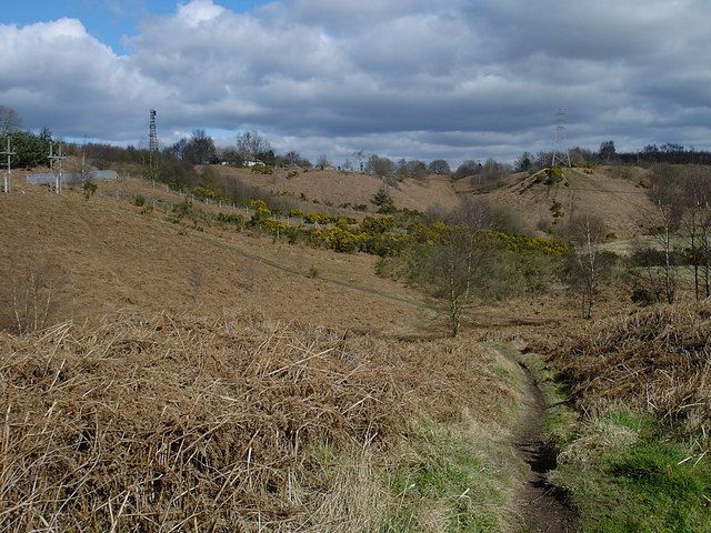
Haggnook Wood is an enchanting forest located in the county of Nottinghamshire, England. Covering an area of approximately 100 acres, it is a cherished natural gem that offers a tranquil retreat for nature enthusiasts and outdoor adventurers alike.

This ancient woodland is characterized by its dense canopy of towering trees, including oak, beech, and birch, which provide a rich habitat for a diverse array of flora and fauna. The forest floor is carpeted with a vibrant tapestry of wildflowers, ferns, and mosses, creating a picturesque landscape that changes with the seasons.

Haggnook Wood is traversed by a network of well-maintained footpaths and bridleways, allowing visitors to explore its hidden nooks and crannies. As they meander through the forest, visitors may stumble upon babbling brooks, hidden ponds, and charming clearings, adding to the sense of discovery and adventure.

Nature enthusiasts will relish the opportunity to spot a variety of wildlife in Haggnook Wood. The forest is home to an abundance of bird species, including woodpeckers, owls, and thrushes, which can be heard singing their melodious tunes. Squirrels scamper through the treetops, while badgers, foxes, and deer can occasionally be spotted among the undergrowth.

Haggnook Wood is not only a haven for nature lovers but also provides valuable ecological services. Its trees act as carbon sinks, promoting cleaner air, and its diverse ecosystem supports biodiversity, making it an important site for conservation.

Overall, Haggnook Wood is a treasure trove of natural beauty, offering a peaceful escape from the hustle and bustle of everyday life. With its enchanting atmosphere and stunning scenery, it is a must-visit destination for anyone seeking a connection with nature.

If you have any feedback on the listing, please let us know in the comments section below.

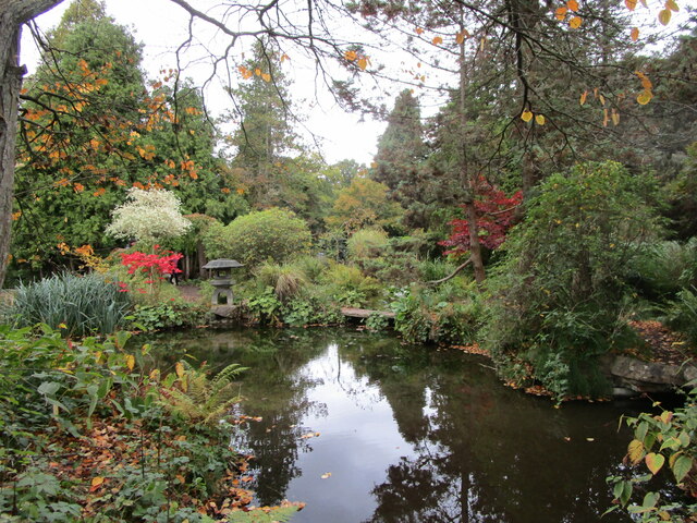
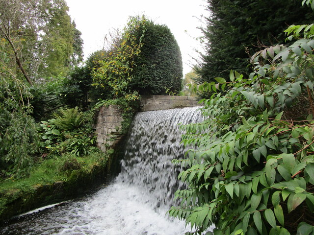
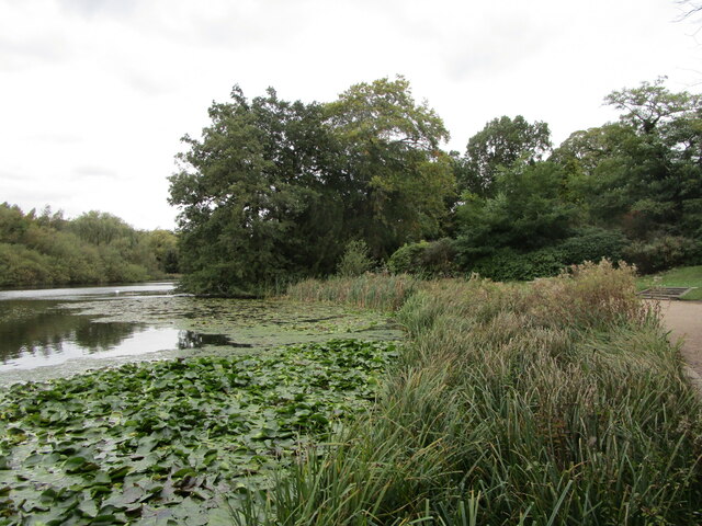
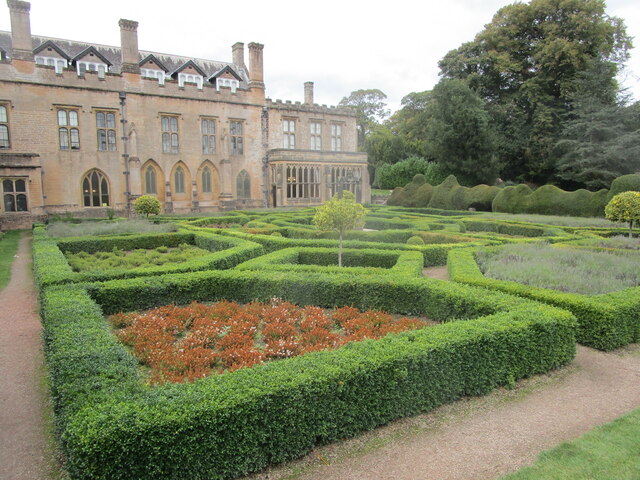
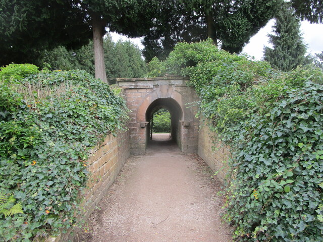
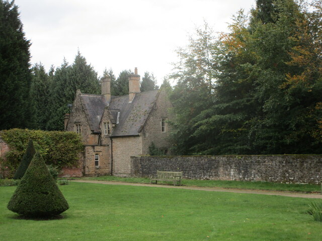
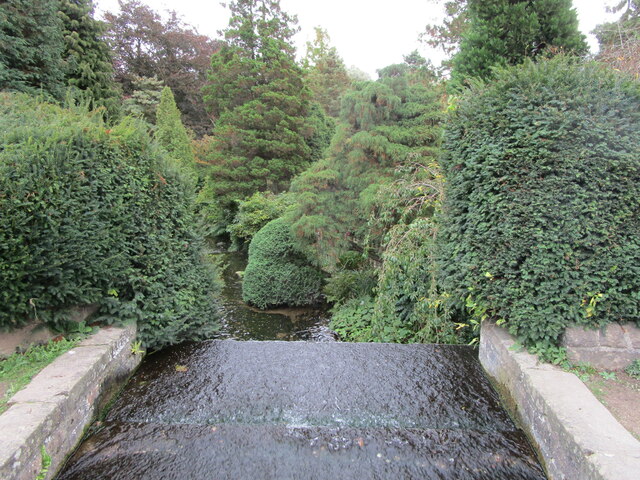
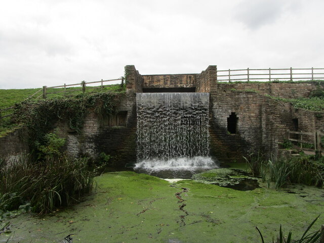
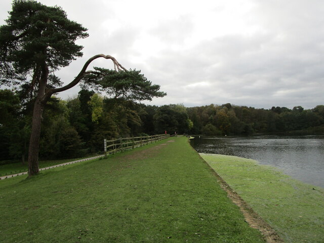
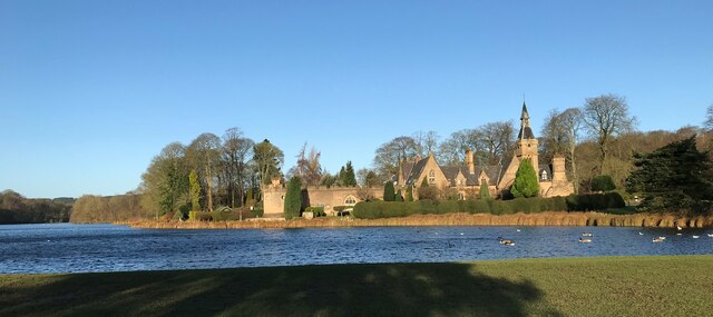
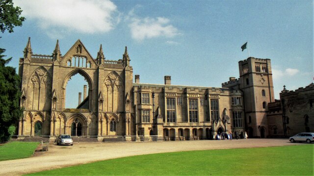
Haggnook Wood Images

Images are sourced within 2km of 53.090524/-1.1846247 or Grid Reference SK5455. Thanks to Geograph Open Source API. All images are credited.

Newstead Abbey Back door to the Abbey, downpipe showing two different symbols .
Newstead Abbey
Back door to the Abbey, downpipe showing two different symbols .
Lake, The Fort and stable block, Newstead Abbey The Stable range (on the right) dates from 1862 <span class="nowrap"><a title="https://historicengland.org.uk/listing/the-list/list-entry/1264301" rel="nofollow ugc noopener" href="https://historicengland.org.uk/listing/the-list/list-entry/1264301">Link</a><img style="margin-left:2px;" alt="External link" title="External link - shift click to open in new window" src="https://s1.geograph.org.uk/img/external.png" width="10" height="10"/></span> The Fort (on the left) dates from about 1770 but much modified a century later <span class="nowrap"><a title="https://historicengland.org.uk/listing/the-list/list-entry/1265327" rel="nofollow ugc noopener" href="https://historicengland.org.uk/listing/the-list/list-entry/1265327">Link</a><img style="margin-left:2px;" alt="External link" title="External link - shift click to open in new window" src="https://s1.geograph.org.uk/img/external.png" width="10" height="10"/></span>
Lake, The Fort and stable block, Newstead Abbey
The Stable range (on the right) dates from 1862 LinkExternal link The Fort (on the left) dates from about 1770 but much modified a century later LinkExternal link
The Japanese Garden, Newstead Abbey Created for Ethel Webb in the early years of the twentieth century.
The Japanese Garden, Newstead Abbey
Created for Ethel Webb in the early years of the twentieth century.
Weir below the Garden Lake, Newstead Abbey
The Stew Pond, Newstead Abbey
The Garden Lake, Newstead Abbey
Former stables. Newstead Abbey Designed by M.E.Hadfield 1862-3 <span class="nowrap"><a title="https://en.wikipedia.org/wiki/Matthew_Ellison_Hadfield" rel="nofollow ugc noopener" href="https://en.wikipedia.org/wiki/Matthew_Ellison_Hadfield">Link</a><img style="margin-left:2px;" alt="External link" title="External link - shift click to open in new window" src="https://s1.geograph.org.uk/img/external.png" width="10" height="10"/></span> Now housing <span class="nowrap"><a title="https://historicengland.org.uk/listing/the-list/list-entry/1264301" rel="nofollow ugc noopener" href="https://historicengland.org.uk/listing/the-list/list-entry/1264301">Link</a><img style="margin-left:2px;" alt="External link" title="External link - shift click to open in new window" src="https://s1.geograph.org.uk/img/external.png" width="10" height="10"/></span>
Former stables. Newstead Abbey
Designed by M.E.Hadfield 1862-3 LinkExternal link Now housing LinkExternal link
The Eagle Pool and the east facade of Newstead Abbey The inside of the west front of the medieval abbey visible in the right <span class="nowrap"><a title="https://historicengland.org.uk/listing/the-list/list-entry/1265325" rel="nofollow ugc noopener" href="https://historicengland.org.uk/listing/the-list/list-entry/1265325">Link</a><img style="margin-left:2px;" alt="External link" title="External link - shift click to open in new window" src="https://s1.geograph.org.uk/img/external.png" width="10" height="10"/></span>
The Eagle Pool and the east facade of Newstead Abbey
The inside of the west front of the medieval abbey visible in the right LinkExternal link
Satyr, Newstead Abbey Early eighteenth century <span class="nowrap"><a title="https://historicengland.org.uk/listing/the-list/list-entry/1227526" rel="nofollow ugc noopener" href="https://historicengland.org.uk/listing/the-list/list-entry/1227526">Link</a><img style="margin-left:2px;" alt="External link" title="External link - shift click to open in new window" src="https://s1.geograph.org.uk/img/external.png" width="10" height="10"/></span> Probably the work of Jan van Nost the Elder <span class="nowrap"><a title="https://en.wikipedia.org/wiki/John_Nost" rel="nofollow ugc noopener" href="https://en.wikipedia.org/wiki/John_Nost">Link</a><img style="margin-left:2px;" alt="External link" title="External link - shift click to open in new window" src="https://s1.geograph.org.uk/img/external.png" width="10" height="10"/></span>
Satyr, Newstead Abbey
Early eighteenth century LinkExternal link Probably the work of Jan van Nost the Elder LinkExternal link
Monument to Boatswain Boatswain was Lord Byron's dog,
Monument to Boatswain
Boatswain was Lord Byron's dog,
The Spanish Garden, Newstead Abbey Originally created in the early eighteenth century.
The Gothic windows in the building beyond light the chapel which has been created from the chapter house of the original abbey (actually a priory).
The Spanish Garden, Newstead Abbey
Originally created in the early eighteenth century. The Gothic windows in the building beyond light the chapel which has been created from the chapter house of the original abbey (actually a priory).
Archway through the garden wall, Newstead Abbey
The Garden House, Newstead Abbey
Weir above the Japanese Garden, Newstead  Abbey This is the much modified River Leen.
Weir above the Japanese Garden, Newstead Abbey
This is the much modified River Leen.
Waterfall below the Upper Lake, Newstead Abbey The much modified River Leen.
Waterfall below the Upper Lake, Newstead Abbey
The much modified River Leen.
The dam of the Upper Lake, Newstead Abbey
Newstead Abbey January 2022 the top lake at Newstead Abbey fed by the River Leen
Newstead Abbey
January 2022 the top lake at Newstead Abbey fed by the River Leen
Newstead Abbey in 2002 The west front
Newstead Abbey in 2002
The west front
Show me another place!

Haggnook Wood is located at Grid Ref: SK5455 (Lat: 53.090524, Lng: -1.1846247)

Administrative County: Nottinghamshire

District: Gedling

Police Authority: Nottinghamshire

What 3 Words

///first.string.decent. Near Ravenshead, Nottinghamshire

Related Wikis

Ravenshead

Ravenshead is a large village and civil parish in the Gedling district of Nottinghamshire, England. It borders Papplewick, Newstead Abbey and Blidworth...
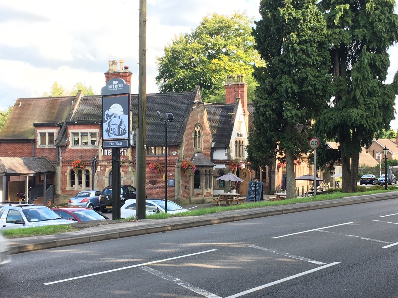
The Hutt

The Hutt is a public house located in the village of Ravenshead in Nottinghamshire, opposite Newstead Abbey. The pub was built on the site of The Royal...
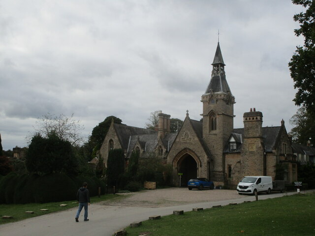
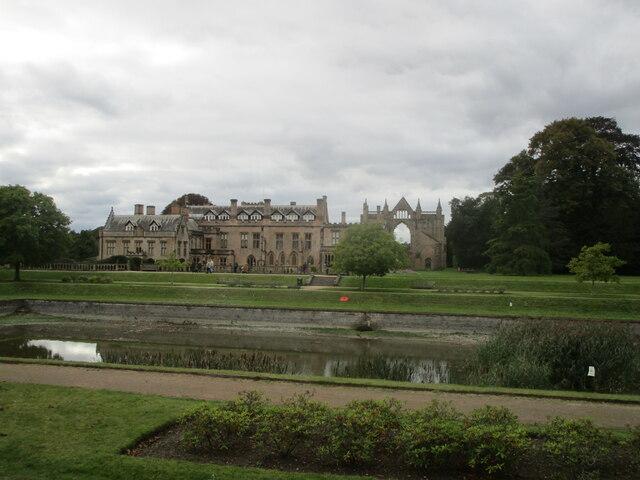
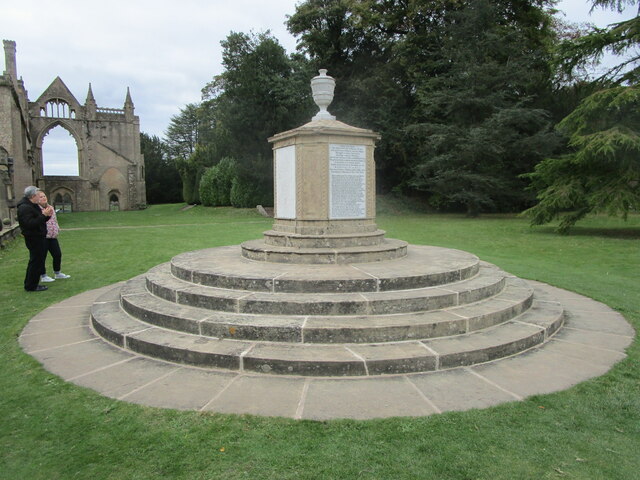
Newstead Abbey

Newstead Abbey, in Nottinghamshire, England, was formerly an Augustinian priory. Converted to a domestic home following the Dissolution of the Monasteries...

Portland College

Portland College is an education establishment near Ravenshead, Nottinghamshire, England. It is situated in 20 acres (81,000 m2) of Sherwood Forest approximately...

Robin Hood Hills, Nottinghamshire

Robin Hood Hills are a steep sided range of sandstone hills forming a natural amphitheatre surrounding the villages of Annesley and Newstead in Nottinghamshire...

Skegby Rural District

Skegby was a rural district in Nottinghamshire, England from 1894 to 1935. It was created under the Local Government Act 1894 based on that part of the...

Notts Golf Club

Notts Golf Club, more commonly referred to simply as Hollinwell, is an 18-hole members golf club in Nottinghamshire, England which has hosted a number...

1906 News of the World Match Play

The 1906 News of the World Match Play was the fourth News of the World Match Play tournament. It was played from Tuesday 2 to Thursday 4 October at Notts...

Nearby Amenities

Located within 500m of 53.090524,-1.1846247
Traffic Signals
Lat/Long: 53.0921986/-1.1777701
Bus Stop
Larch Farm
Bench: stand_up_bench
Bus: yes
Local Ref: NR
Naptan AtcoCode: 3300GE0104
Naptan Bearing: N
Naptan CommonName: Larch Farm
Naptan Crossing: Main Street
Naptan Indicator: nr
Naptan Landmark: Larch Farm
Naptan NaptanCode: ntsaptwt
Naptan Notes: none
Naptan PlusbusZoneRef: MFLDTWN
Naptan Street: Nottingham Road
Naptan Verified: yes
Passenger Information Display: yes
Public Transport: platform
Shelter: yes
Source: naptan_import
Tactile Paving: no
Lat/Long: 53.0914372/-1.1776215
Bus Stop
Kirkby Road
Bus: yes
Naptan AtcoCode: 3300GE0168
Naptan Bearing: SE
Naptan CommonName: Kirkby Road
Naptan Crossing: Mansfield Road
Naptan Indicator: SE-bound
Naptan Landmark: Larch Farm
Naptan NaptanCode: ntsawpam
Naptan Notes: none
Naptan PlusbusZoneRef: MFLDTWN
Naptan Street: Kirkby Road
Naptan Verified: no
Public Transport: platform
Source: naptan_import
Lat/Long: 53.0924343/-1.1788121
Bus Stop
Kirkby Road
Bench: no
Bus: yes
Naptan AtcoCode: 3300GE0727
Naptan Bearing: NW
Naptan CommonName: Kirkby Road
Naptan Crossing: Nottingham Road
Naptan Indicator: NW-bound
Naptan Landmark: Larch Farm
Naptan NaptanCode: ntsgjdwj
Naptan PlusbusZoneRef: MFLDTWN
Naptan Street: Kirkby Road
Naptan Verified: no
Public Transport: platform
Shelter: no
Source: naptan_import
Tactile Paving: no
Lat/Long: 53.0923083/-1.1787996
Turning Circle
Lat/Long: 53.0903435/-1.1903065
Turning Circle
Lat/Long: 53.0902774/-1.1900379
Turning Circle
Lat/Long: 53.0907067/-1.1909105
Turning Circle
Lat/Long: 53.0906316/-1.1906924
Turning Circle
Lat/Long: 53.0901009/-1.1883741
Turning Circle
Lat/Long: 53.0901934/-1.1881705
Turning Circle
Lat/Long: 53.0909975/-1.1877928
Turning Circle
Lat/Long: 53.0908565/-1.1878808
Bench
Lat/Long: 53.0877705/-1.1866698
Ele: 155.38
Lat/Long: 53.0927616/-1.1881753
Ele: 155.86
Lat/Long: 53.0928606/-1.1882155
Ele: 130.62
Lat/Long: 53.086749/-1.1863578
Ele: 152
Lat/Long: 53.0923935/-1.1877802
Ele: 154.9
Lat/Long: 53.0927125/-1.1880337
Ele: 130
Lat/Long: 53.0898773/-1.1871623
Ele: 130
Lat/Long: 53.0897193/-1.1871338
Ele: 130.14
Lat/Long: 53.0890376/-1.1869639
Ele: 126.78
Lat/Long: 53.0877656/-1.1867053
Information: route_marker
Tourism: information
Lat/Long: 53.0928756/-1.1882388
Fixme: Longer than this
Lat/Long: 53.0926485/-1.1908043
Information: route_marker
Tourism: information
Lat/Long: 53.0938388/-1.1883661
Information: route_marker
Tourism: information
Lat/Long: 53.0898748/-1.1870979
Power: pole
Lat/Long: 53.0928555/-1.1875308
Power: pole
Lat/Long: 53.0927514/-1.1909477
Generator Method: photovoltaic
Generator Output Electricity: yes
Generator Source: solar
Generator Type: solar_photovoltaic_panel
Location: roof
Power: generator
Lat/Long: 53.0920753/-1.1808489
Generator Method: photovoltaic
Generator Output Electricity: yes
Generator Source: solar
Generator Type: solar_photovoltaic_panel
Location: roof
Power: generator
Lat/Long: 53.0922202/-1.1805673
Post Box
Collection Times: Mo-Fr 09:00; Sa 15:00
Post Box Type: wall
Ref: NG15 38
Lat/Long: 53.0921966/-1.1781041
Generator Method: photovoltaic
Generator Output Electricity: yes
Generator Source: solar
Generator Type: solar_photovoltaic_panel
Location: roof
Power: generator
Lat/Long: 53.0910253/-1.1884204
Generator Method: photovoltaic
Generator Output Electricity: yes
Generator Source: solar
Generator Type: solar_photovoltaic_panel
Location: roof
Power: generator
Lat/Long: 53.0910442/-1.1885143
Generator Method: photovoltaic
Generator Output Electricity: yes
Generator Source: solar
Generator Type: solar_photovoltaic_panel
Location: roof
Power: generator
Lat/Long: 53.0918286/-1.1881093
Generator Method: photovoltaic
Generator Output Electricity: yes
Generator Source: solar
Generator Type: solar_photovoltaic_panel
Location: roof
Power: generator
Lat/Long: 53.0919539/-1.1916109
Direction: SSW
Generator Method: photovoltaic
Generator Output Electricity: yes
Generator Source: solar
Generator Type: solar_photovoltaic_panel
Location: roof
Power: generator
Lat/Long: 53.0899484/-1.1847965
Direction: 175
Generator Method: photovoltaic
Generator Output Electricity: yes
Generator Solar Modules: 10
Generator Source: solar
Generator Type: solar_photovoltaic_panel
Power: generator
Lat/Long: 53.0938596/-1.1830922
Location Transition: yes
Power: pole
Lat/Long: 53.0932783/-1.1842141
Location Transition: yes
Power: pole
Lat/Long: 53.0932074/-1.1841926
Direction: 280
Man Made: surveillance
Surveillance: public
Surveillance Type: ALPR
Surveillance Zone: traffic
Lat/Long: 53.0933684/-1.1834426
The data included in this document is from www.openstreetmap.org. The data is made available under ODbL.

Have you been to Haggnook Wood?

Leave your review of Haggnook Wood below (or comments, questions and feedback).