Thieves' Wood

Wood, Forest in Nottinghamshire Ashfield

England

Thieves' Wood

Crossroads near Coxmoor Farm The A611 Derby Road intersects the B6139 Coxmoor Road here.
Crossroads near Coxmoor Farm Credit: Jonathan Clitheroe

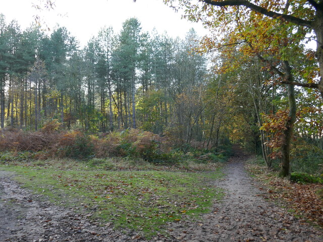
Thieves' Wood, located in Nottinghamshire, England, is a picturesque forest area with a rich history and captivating natural beauty. Covering an expansive area of approximately 150 hectares, the wood is renowned for its dense woodland, vibrant flora, and diverse wildlife.

The forest is situated near the village of Arnold, just a few miles northwest of Nottingham city center. It is easily accessible by road and offers ample parking facilities for visitors. Thieves' Wood is part of the wider Sherwood Forest area, which is famous for its association with the legendary outlaw Robin Hood.

The wood derives its intriguing name from its past reputation as a notorious hideout for criminals and thieves. In the Middle Ages, the dense foliage and remote location provided an ideal refuge for outlaws, making it a hotspot for illegal activities. Today, Thieves' Wood has shed its criminal associations and is a popular destination for nature enthusiasts, hikers, and families.

The forest boasts a diverse range of tree species, including oak, birch, and ash, which create a captivating canopy overhead. The woodland floor is adorned with a colorful carpet of wildflowers during the spring and summer months. Visitors can explore the numerous walking trails that wind through the wood, offering stunning views of the surrounding scenery.

Thieves' Wood is also home to various wildlife, including deer, foxes, badgers, and a variety of bird species, making it a haven for nature lovers and wildlife photographers. The forest is carefully managed to preserve its natural beauty and habitat, ensuring a thriving ecosystem for both flora and fauna.

Whether it be for a peaceful stroll, a family picnic, or a chance to immerse oneself in nature's tranquility, Thieves' Wood offers a serene escape from the bustling city life of Nottinghamshire.

If you have any feedback on the listing, please let us know in the comments section below.

Thieves' Wood Images

Images are sourced within 2km of 53.101106/-1.1927588 or Grid Reference SK5456. Thanks to Geograph Open Source API. All images are credited.

Crossroads near Coxmoor Farm The A611 Derby Road intersects the B6139 Coxmoor Road here.
Crossroads near Coxmoor Farm
The A611 Derby Road intersects the B6139 Coxmoor Road here.
Entrance to Two Oaks Quarry Operated by the Mansfield Sand Company for the extraction of silica sand. Although  operations began in 2014 there's no sign of the quarry on the 2015 OS Explorer 270 map I was carrying on the day - just the original Two Oaks Farm located at SK53755705.
Entrance to Two Oaks Quarry
Operated by the Mansfield Sand Company for the extraction of silica sand. Although operations began in 2014 there's no sign of the quarry on the 2015 OS Explorer 270 map I was carrying on the day - just the original Two Oaks Farm located at SK53755705.
B6139 Road at Normanshill Wood The road splits this wood in two - with Little Normanshill Road to the right. This photo is taken from a spot close near the marked car park.
B6139 Road at Normanshill Wood
The road splits this wood in two - with Little Normanshill Road to the right. This photo is taken from a spot close near the marked car park.
A Debated Area of Thieves Wood For those who are interested in the unexplained - this site (and this part of the wood specifically) is associated with the 'Thunderbolt Incident' which occurred on the night of 12th November 1987.
A Debated Area of Thieves Wood
For those who are interested in the unexplained - this site (and this part of the wood specifically) is associated with the 'Thunderbolt Incident' which occurred on the night of 12th November 1987.
Thieves' Wood Lane
Thieves' Wood Lane
Entrance to Harlow Academy
Portland College Portland College provides educational, social and employmnet support for people with disabilities.
Portland College
Portland College provides educational, social and employmnet support for people with disabilities.
The Robin Hood Way Pictured at the eastern periphery of the square at its junction with an unofficial path.
The Robin Hood Way
Pictured at the eastern periphery of the square at its junction with an unofficial path.
Thieves Wood Lane
Thieves Wood Lane
Bike lane avoids the bus stop Beside the A60 at Harlow Academy.
Bike lane avoids the bus stop
Beside the A60 at Harlow Academy.
The A60 From the dip created by Rainworth Water.
The A60
From the dip created by Rainworth Water.
Roadway to Forest Farm
Prepared field and Normanshill Wood
Little Ricket Lane
Little Ricket Lane
Path in Harlow Wood
Path in Harlow Wood
Farm track parallel to Blidworth Road Blidworth Road is to the left.
Farm track parallel to Blidworth Road
Blidworth Road is to the left.
Prepared field looking towards Campfield Farm
Farmland with Yellow Rapeseed A small bunch of silver birch trees in this field of oilseed rape.
Farmland with Yellow Rapeseed
A small bunch of silver birch trees in this field of oilseed rape.
Show me another place!

Thieves' Wood is located at Grid Ref: SK5456 (Lat: 53.101106, Lng: -1.1927588)

Administrative County: Nottinghamshire

District: Ashfield

Police Authority: Nottinghamshire

What 3 Words

///agreed.verbs.when. Near Ravenshead, Nottinghamshire

Related Wikis

Portland College

Portland College is an education establishment near Ravenshead, Nottinghamshire, England. It is situated in 20 acres (81,000 m2) of Sherwood Forest, approximately...

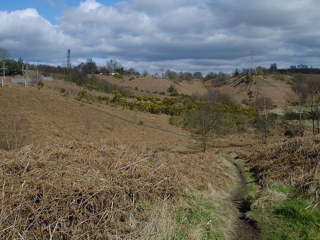
Robin Hood Hills, Nottinghamshire

Robin Hood Hills are a steep sided range of sandstone hills forming a natural amphitheatre surrounding the villages of Annesley and Newstead in Nottinghamshire...

Ravenshead

Ravenshead is a large village and civil parish in the Gedling district of Nottinghamshire, England. It borders Papplewick, Newstead Abbey and Blidworth...

Sherwood Observatory

Sherwood Observatory is an amateur astronomical observatory in Nottinghamshire, England, owned and operated by Mansfield and Sutton Astronomical Society...

Mansfield and Sutton Astronomical Society

Mansfield and Sutton Astronomical Society (MSAS) is an amateur astronomical society in the East Midlands of England. It was formed in 1969. It is based...
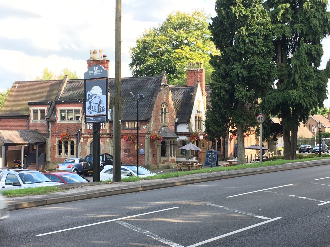
The Hutt

The Hutt is a public house located in the village of Ravenshead in Nottinghamshire, opposite Newstead Abbey. The pub was built on the site of The Royal...

Newstead Abbey

Newstead Abbey, in Nottinghamshire, England, was formerly an Augustinian priory. Converted to a domestic home following the Dissolution of the Monasteries...

Notts Golf Club

Notts Golf Club, more commonly referred to simply as Hollinwell, is an 18-hole members golf club in Nottinghamshire, England which has hosted a number...

Nearby Amenities

Located within 500m of 53.101106,-1.1927588
Bench
Ele: 133
Lat/Long: 53.0970009/-1.1933534
Ele: 132.79
Information: board
Tourism: information
Lat/Long: 53.0976245/-1.1925381
Parking
Ele: 146.0048828
Lat/Long: 53.0989078/-1.1990354
Ele: 126
Lat/Long: 53.0986239/-1.1872609
Ele: 128
Lat/Long: 53.0972345/-1.1900773
Ele: 144
Lat/Long: 53.1022383/-1.1872336
Ele: 136
Lat/Long: 53.1015044/-1.1886533
Ele: 145
Lat/Long: 53.1018966/-1.186032
Ele: 152.25
Lat/Long: 53.1049941/-1.1932562
Ele: 137
Lat/Long: 53.1026589/-1.1955841
Ele: 138
Lat/Long: 53.1020518/-1.1958571
Ele: 145
Lat/Long: 53.0995008/-1.1945265
Ele: 147.69
Lat/Long: 53.0988774/-1.1953832
Ele: 147
Lat/Long: 53.098618/-1.1957687
Ele: 147
Lat/Long: 53.0980845/-1.1965112
Ele: 138
Lat/Long: 53.0968428/-1.191469
Ele: 131
Lat/Long: 53.0972886/-1.1902978
Ele: 133
Lat/Long: 53.0966691/-1.1926147
Ele: 152.97
Lat/Long: 53.1038739/-1.1944328
Ele: 147
Lat/Long: 53.0986351/-1.1943468
Ele: 138
Lat/Long: 53.101322/-1.1910311
Information: route_marker
Tourism: information
Lat/Long: 53.1031005/-1.1931561
Information: route_marker
Tourism: information
Lat/Long: 53.1005714/-1.1930682
Information: route_marker
Tourism: information
Lat/Long: 53.1043281/-1.1916648
Information: route_marker
Tourism: information
Lat/Long: 53.101798/-1.1934651
Tourism: picnic_site
Lat/Long: 53.0971421/-1.1934862
The data included in this document is from www.openstreetmap.org. The data is made available under ODbL.

Have you been to Thieves' Wood?

Leave your review of Thieves' Wood below (or comments, questions and feedback).