Duckmanton

Settlement in Derbyshire Chesterfield

England

Duckmanton

parkrun: it's good to be back! parkrun returned to England on 24th July, 2021 after a gap of 16 months during the Covid-19 restrictions. 198 runners, joggers and walkers are here setting off on the 5k route at Poolsbrook Country Park.
parkrun: it's good to be back! Credit: Graham Hogg

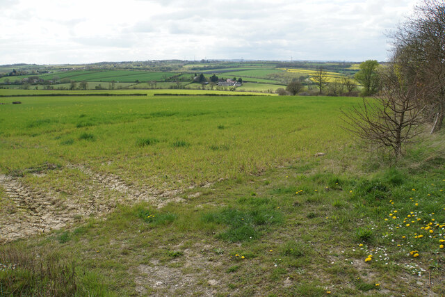
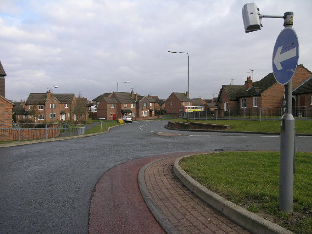
Duckmanton is a small village located in the county of Derbyshire, England. Situated approximately 3 miles east of Chesterfield, it falls within the Bolsover district. The village is surrounded by picturesque countryside and is known for its tranquil and rural setting.

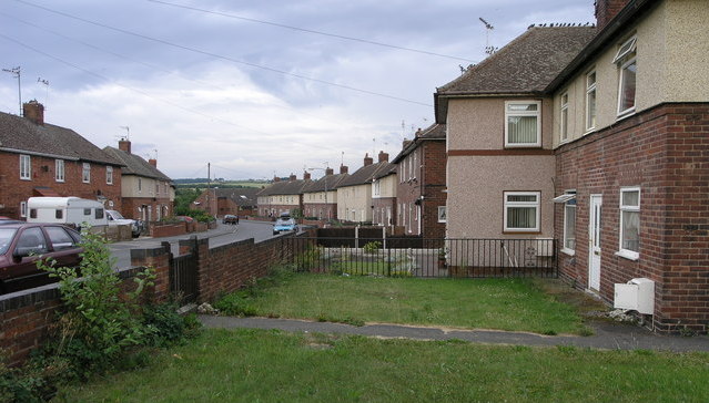
With a population of just over 1,000 residents, Duckmanton maintains a close-knit community atmosphere. The village is primarily residential, consisting of a mix of historic stone cottages and more modern housing developments. There is a local primary school that serves the village and the surrounding areas.

Duckmanton benefits from its proximity to Chesterfield, which provides easy access to a range of amenities and services. The town offers a wider range of shopping facilities, supermarkets, restaurants, and entertainment options. Chesterfield is also well-connected to other major towns and cities in the region, with a railway station providing regular train services.

The village itself has a few local amenities, including a village hall that hosts various community events throughout the year. The surrounding countryside offers numerous opportunities for outdoor activities, such as hiking, cycling, and horse riding. The nearby Peak District National Park is within easy reach, providing stunning landscapes and further recreational opportunities.

Overall, Duckmanton offers a peaceful and idyllic place to live, surrounded by natural beauty while still benefiting from the conveniences of nearby Chesterfield.

If you have any feedback on the listing, please let us know in the comments section below.
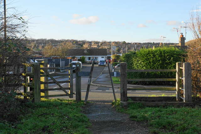
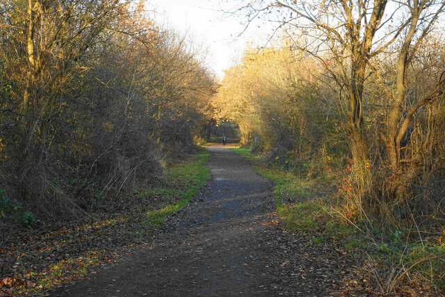
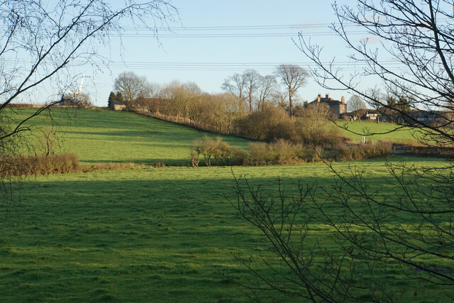
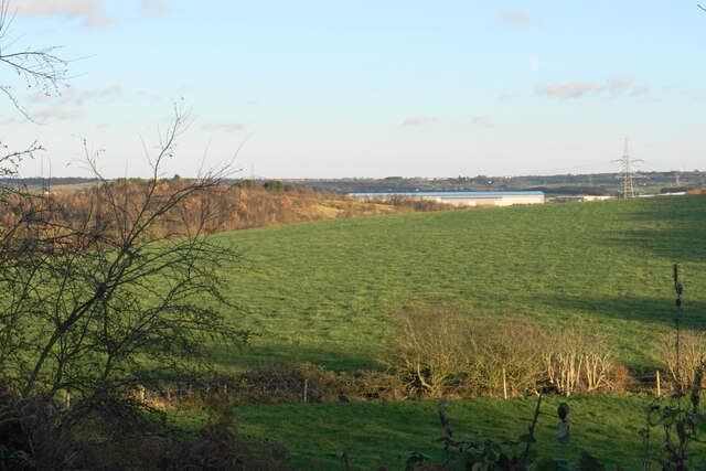
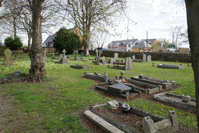
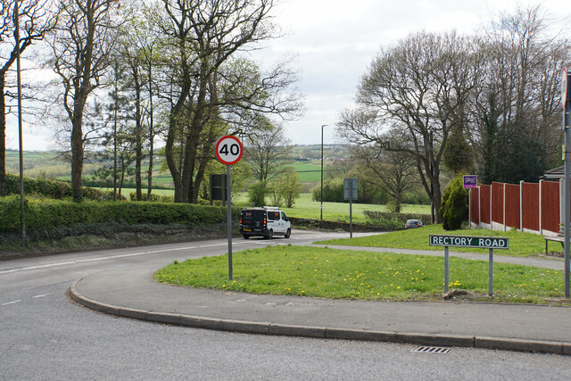
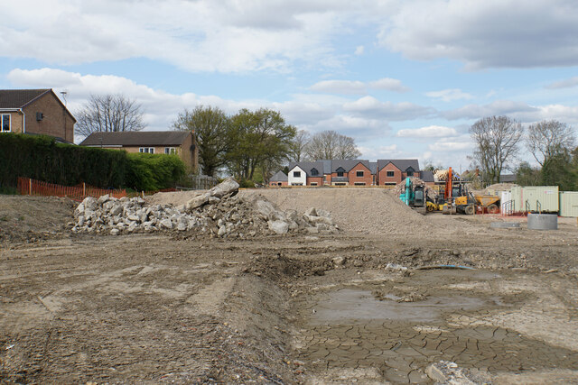
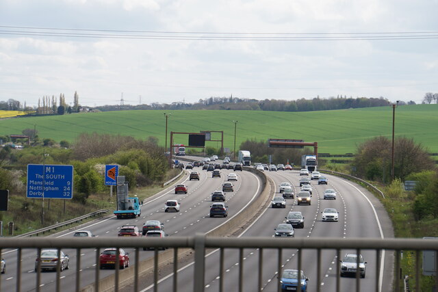
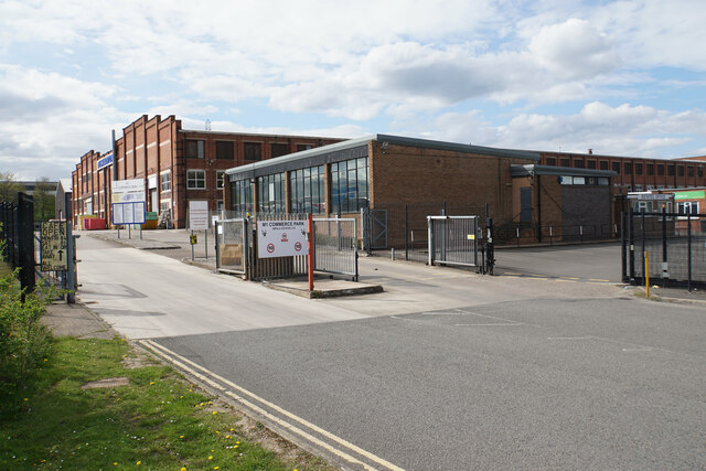
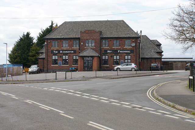
Duckmanton Images

Images are sourced within 2km of 53.244233/-1.335361 or Grid Reference SK4472. Thanks to Geograph Open Source API. All images are credited.

parkrun: it's good to be back! parkrun returned to England on 24th July, 2021 after a gap of 16 months during the Covid-19 restrictions. 198 runners, joggers and walkers are here setting off on the 5k route at Poolsbrook Country Park.
parkrun: it's good to be back!
parkrun returned to England on 24th July, 2021 after a gap of 16 months during the Covid-19 restrictions. 198 runners, joggers and walkers are here setting off on the 5k route at Poolsbrook Country Park.
Exit from the Trans Pennine Trail The Trans Pennine Trail here is on the course of a former railway. This access point is opposite Milford Road in Inkersall Green. Behind that you can see the Hop Flower, the pub built on this part of the estate.
Exit from the Trans Pennine Trail
The Trans Pennine Trail here is on the course of a former railway. This access point is opposite Milford Road in Inkersall Green. Behind that you can see the Hop Flower, the pub built on this part of the estate.
Trans Pennine Trail passing Inkersall Green The trail is using a former Great Central Railway link line.
Trans Pennine Trail passing Inkersall Green
The trail is using a former Great Central Railway link line.
Fields below Inkersall Farm The eastern side of the Trans Pennine Trail, in contrast to the western side which has all been developed as part of Inkersall Green.
Fields below Inkersall Farm
The eastern side of the Trans Pennine Trail, in contrast to the western side which has all been developed as part of Inkersall Green.
Fields near Inkersall Green The fields are on the opposite side of the Trans Pennine Trail to the housing development of Inkersall Green. In this view, the wooded hillside to the left is part of Pools Brook Country Park. The Great Bear distribution warehouse near Junction 29a of the M1 is seen straight ahead and behind that you can see moving traffic on the M1.
Fields near Inkersall Green
The fields are on the opposite side of the Trans Pennine Trail to the housing development of Inkersall Green. In this view, the wooded hillside to the left is part of Pools Brook Country Park. The Great Bear distribution warehouse near Junction 29a of the M1 is seen straight ahead and behind that you can see moving traffic on the M1.
Churchyard of St Peter & St Paul, Duckmanton The church building is behind but has now been closed as a place of worship.
Churchyard of St Peter & St Paul, Duckmanton
The church building is behind but has now been closed as a place of worship.
The southern end of Rectory Road Here it meets the A632. Beyond, there are green fields between Bolsover and Chesterfield.
The southern end of Rectory Road
Here it meets the A632. Beyond, there are green fields between Bolsover and Chesterfield.
Hilltop Farm Living up to its name, the farm sits on the top of the Duckmanton ridge.
Hilltop Farm
Living up to its name, the farm sits on the top of the Duckmanton ridge.
New housing development site in Long Duckmanton Houses are appearing at the far end, near to St Peter & St Paul's Church.
New housing development site in Long Duckmanton
Houses are appearing at the far end, near to St Peter & St Paul's Church.
The M1 near Bolsover Looking south from the A632 bridge over the motorway.
The M1 near Bolsover
Looking south from the A632 bridge over the motorway.
The A632 to Bolsover Bolsover Castle is prominent on the hill to the left.
The A632 to Bolsover
Bolsover Castle is prominent on the hill to the left.
Cycle route to Bolsover The cycle paths are very good around the Markham Vale roundabout on the A632 but do not extend very far away from it.
Cycle route to Bolsover
The cycle paths are very good around the Markham Vale roundabout on the A632 but do not extend very far away from it.
Markham Vale roundabout on the A632 Bolsover Castle is seen on the hill ahead, and the River Doe Lea flows in the valley between.
Markham Vale roundabout on the A632
Bolsover Castle is seen on the hill ahead, and the River Doe Lea flows in the valley between.
M1 Commerce Park, Markham Vale A former works now in multiple occupation with over 60 units operating on the site.
M1 Commerce Park, Markham Vale
A former works now in multiple occupation with over 60 units operating on the site.
Roundabout in Markham Vale Dominated by a large Great Bear warehouse. This was formerly the site of Markham Vale Colliery.
Roundabout in Markham Vale
Dominated by a large Great Bear warehouse. This was formerly the site of Markham Vale Colliery.
Peak Stores The village stores in Duckmanton.
Peak Stores
The village stores in Duckmanton.
The Duckmanton It appears to be advertising itself as a Hot Freehouse. The final two letters of the word Hotel have faded.
The Duckmanton
It appears to be advertising itself as a Hot Freehouse. The final two letters of the word Hotel have faded.
Farmland below Duckmanton Looking into the valley of Pools Brook. Much of the land between here and Chesterfield is quite green.
Farmland below Duckmanton
Looking into the valley of Pools Brook. Much of the land between here and Chesterfield is quite green.
Show me another place!

Duckmanton is located at Grid Ref: SK4472 (Lat: 53.244233, Lng: -1.335361)

Administrative County: Derbyshire

District: Chesterfield

Police Authority: Derbyshire

What 3 Words

///segments.palm.additives. Near Staveley, Derbyshire

Nearby Locations

Duckmanton

Related Wikis

Markham Colliery disaster

Mining accidents at the Markham Colliery at Staveley near Chesterfield, Derbyshire, England. == Accident in 1973 == On 30 July 1973, 18 coal miners lost...

Duckmanton

Duckmanton is a village within the civil parish of Sutton cum Duckmanton, in North East Derbyshire, between Bolsover and Chesterfield. Duckmanton is a...

Sutton cum Duckmanton

Sutton cum Duckmanton is a civil parish in Derbyshire, England, between Bolsover and Chesterfield in the district of North East Derbyshire. The village...

Long Duckmanton

Long Duckmanton is a village in the civil parish of Sutton cum Duckmanton between Bolsover and Chesterfield, in North East Derbyshire, England. It is located...

Poolsbrook

Poolsbrook (grid reference SK442736) is a former mining village near Staveley in North East Derbyshire, England. The village was built by Staveley Coal...

Arkwright Town Junction

Arkwright Town Junction is a former railway junction near Arkwright Town in Derbyshire, England. == Context == Arkwright Town Junction was one of four...

Arkwright Town

Arkwright Town, usually referred to as Arkwright, is a village in Sutton cum Duckmanton, North East Derbyshire, England that is notable for being moved...

Duckmanton East Junction

Duckmanton East Junction is a former railway junction near Arkwright Town in Derbyshire, England. == Context == Duckmanton East Junction was one of four...

Nearby Amenities

Located within 500m of 53.244233,-1.335361
Duckmanton
Place: village
Source Location: local_knowledge
Wikidata: Q5311536
Lat/Long: 53.2459286/-1.3379973
Crossing
Crossing: unmarked
Tactile Paving: yes
Lat/Long: 53.2461533/-1.3334915
Pub
The Duckmanton
Addr Street: Tom Lane
Parking: yes
Real Ale: no
Lat/Long: 53.2464055/-1.3405167
Power: tower
Source: Bing
Lat/Long: 53.2407732/-1.3315555
Power: tower
Source: Bing
Lat/Long: 53.2435207/-1.3311831
Give Way
Lat/Long: 53.2456052/-1.333293
Castle Hill Chemicals
Man Made: works
Source: survey
Lat/Long: 53.2457343/-1.3291655
Note: National speed limit sign
Lat/Long: 53.2458907/-1.3304533
Ele: 106
Lat/Long: 53.2462007/-1.3411342
Bench
Backrest: yes
Ele: 103.0
Lat/Long: 53.2460635/-1.3403035
Bus Stop
Bus: yes
Ele: 101.0
Public Transport: platform
Lat/Long: 53.2456526/-1.3398743
Bus Stop
Bench: no
Bus: yes
Ele: 99.0
Lit: no
Public Transport: platform
Shelter: no
Lat/Long: 53.2439497/-1.3389571
Crossing
Lat/Long: 53.2421282/-1.3343226
Power: tower
Lat/Long: 53.246408/-1.3300024
Building: manufacture
Source: bing
Lat/Long: 53.2467927/-1.3294017
Fast Food
McDonald's
Addr City: Chesterfield
Addr Country: GB
Addr Place: Markham Vale Services
Addr Postcode: S44 5HQ
Brand: McDonald's
Brand Wikidata: Q38076
Brand Wikipedia: en:McDonald's
Contact Website: https://www.mcdonalds.com/gb/en-gb/location/duckmanton/markham-vale/plot-7-m1-commerce-park/8261398.html
Cuisine: burger
Drive Through: yes
Fhrs Id: 544581
Operator: McDonalds Restaurants Ltd
Outdoor Seating: yes
Takeaway: yes
Lat/Long: 53.2440571/-1.3333311
Barrier: cycle_barrier
Lat/Long: 53.242192/-1.3341177
Barrier: horse_stile
Lat/Long: 53.2421636/-1.3341173
Barrier: horse_stile
Lat/Long: 53.2414949/-1.3361221
Barrier: cycle_barrier
Lat/Long: 53.2415047/-1.3361339
Barrier: horse_stile
Lat/Long: 53.2421549/-1.3345323
Barrier: cycle_barrier
Lat/Long: 53.2421795/-1.3345389
Spar
Addr City: Chesterfield
Addr Parentstreet: Enterprise Way
Addr Postcode: S44 5HS
Addr Street: Markham Vale Services
Addr Suburb: Duckmanton
Brand: Spar
Brand Wikidata: Q610492
Brand Wikipedia: en:SPAR (retailer)
Fhrs Id: 691844
Shop: convenience
Lat/Long: 53.2433374/-1.333434
Fuel
Shell
Access: no
Addr City: Chesterfield
Addr Postcode: S44 5HB
Addr Street: Enterprise Way
Addr Suburb: Duckmanton
Brand: Shell
Brand Wikidata: Q110716465
Hgv: yes
Opening Hours: 24/7
Operator: Eurogarages
Phone: +44 1246 240328
Ref Navads: NVDS353_12281659
Source Opening Hours: I've never seen it shut
Website: https://find.shell.com/gb/fuel/12281659-eg-markham-vale-service-station
Lat/Long: 53.243566/-1.3335296
Bus Stop
Bench: no
Bin: no
Bus: yes
Public Transport: platform
Shelter: no
Tactile Paving: no
Lat/Long: 53.2415001/-1.3386291
Fast Food
KFC
Alt Name: Kentucky Fried Chicken
Brand: KFC
Brand Wikidata: Q524757
Brand Wikipedia: en:KFC
Contact Website: https://www.kfc.co.uk/kfc-near-me/chesterfield-enterprise-way
Cuisine: chicken
Drive Through: yes
Takeaway: yes
Lat/Long: 53.2444273/-1.3334312
Fast Food
Greggs
Brand: Greggs
Brand Wikidata: Q3403981
Brand Wikipedia: en:Greggs
Contact Website: https://www.greggs.co.uk/shop-finder?shop-code=2426
Cuisine: sandwich;bakery
Fhrs Id: 1279933
Source: Sign outside
Takeaway: yes
Lat/Long: 53.2433639/-1.3333318
Mini Roundabout
Lat/Long: 53.244187/-1.3339712
Fast Food
Royal Bengal
Cuisine: indian
Lat/Long: 53.2461166/-1.3391607
Peak Stores
Brand: Premier
Brand Wikidata: Q7240340
Shop: convenience
Lat/Long: 53.2460652/-1.3389354
Fast Food
Subway
Brand: Subway
Brand Wikidata: Q244457
Brand Wikipedia: en:Subway (restaurant)
Contact Website: https://restaurants.subway.com/united-kingdom/en/markham-vale/markham-lane
Cuisine: sandwich
Fhrs Id: 1279931
Name En: Subway
Takeaway: yes
Lat/Long: 53.2433545/-1.3332333
Give Way
Lat/Long: 53.2463355/-1.3301742
Crossing
Crossing: unmarked
Lat/Long: 53.2459575/-1.3302982
Give Way
Lat/Long: 53.2462452/-1.3304179
Crossing
Crossing: unmarked
Lat/Long: 53.2461472/-1.3305493
Crossing
Crossing: uncontrolled
Crossing Ref: zebra
Lat/Long: 53.2441061/-1.333564
Give Way
Lat/Long: 53.2461308/-1.329875
Give Way
Lat/Long: 53.2457231/-1.3337303
Give Way
Lat/Long: 53.2460935/-1.3333043
Give Way
Lat/Long: 53.2459117/-1.3329305
Crossing
Crossing: unmarked
Lat/Long: 53.2459416/-1.332894
Crossing
Crossing: unmarked
Lat/Long: 53.2460224/-1.3329543
Crossing
Crossing: unmarked
Tactile Paving: yes
Lat/Long: 53.2460183/-1.3337565
Crossing
Crossing: unmarked
Lat/Long: 53.2456226/-1.3336723
Crossing
Crossing: unmarked
Tactile Paving: yes
Lat/Long: 53.2456726/-1.333778
Crossing
Crossing: unmarked
Tactile Paving: yes
Lat/Long: 53.2461578/-1.3333609
Give Way
Lat/Long: 53.2460065/-1.3336906
Crossing
Crossing: unmarked
Tactile Paving: yes
Lat/Long: 53.2459519/-1.3338441
Crossing
Crossing: unmarked
Tactile Paving: yes
Lat/Long: 53.2462325/-1.3305185
Crossing
Crossing: unmarked
Tactile Paving: yes
Lat/Long: 53.2450113/-1.3285558
Direction: WSW
Generator Method: photovoltaic
Generator Output Electricity: yes
Generator Solar Modules: 10
Generator Source: solar
Generator Type: solar_photovoltaic_panel
Location: roof
Power: generator
Lat/Long: 53.2483858/-1.336856
Direction: 175
Generator Method: photovoltaic
Generator Output Electricity: yes
Generator Solar Modules: 16
Generator Source: solar
Generator Type: solar_photovoltaic_panel
Location: roof
Power: generator
Lat/Long: 53.2463584/-1.3356067
Generator Method: photovoltaic
Generator Output Electricity: yes
Generator Source: solar
Generator Type: solar_photovoltaic_panel
Location: roof
Power: generator
Lat/Long: 53.2468641/-1.3377256
Direction: SSW
Generator Method: photovoltaic
Generator Output Electricity: yes
Generator Solar Modules: 18
Generator Source: solar
Generator Type: solar_photovoltaic_panel
Location: roof
Power: generator
Lat/Long: 53.2470491/-1.3371852
Direction: 190
Generator Method: photovoltaic
Generator Output Electricity: yes
Generator Solar Modules: 16
Generator Source: solar
Generator Type: solar_photovoltaic_panel
Location: roof
Power: generator
Lat/Long: 53.2478961/-1.3386248
Generator Method: photovoltaic
Generator Output Electricity: yes
Generator Source: solar
Generator Type: solar_photovoltaic_panel
Location: roof
Power: generator
Lat/Long: 53.2474901/-1.3384445
Direction: 170
Generator Method: photovoltaic
Generator Output Electricity: yes
Generator Solar Modules: 17
Generator Source: solar
Generator Type: solar_photovoltaic_panel
Location: roof
Power: generator
Lat/Long: 53.2461166/-1.339734
Direction: 170
Generator Method: photovoltaic
Generator Output Electricity: yes
Generator Solar Modules: 17
Generator Source: solar
Generator Type: solar_photovoltaic_panel
Location: roof
Power: generator
Lat/Long: 53.2461042/-1.3398359
Direction: 125
Generator Method: photovoltaic
Generator Output Electricity: yes
Generator Solar Modules: 16
Generator Source: solar
Generator Type: solar_photovoltaic_panel
Location: roof
Power: generator
Lat/Long: 53.2460189/-1.3407645
Direction: WSW
Generator Method: photovoltaic
Generator Output Electricity: yes
Generator Solar Modules: 16
Generator Source: solar
Generator Type: solar_photovoltaic_panel
Location: roof
Power: generator
Lat/Long: 53.2456427/-1.3403488
Direction: SSE
Generator Method: photovoltaic
Generator Output Electricity: yes
Generator Solar Modules: 18
Generator Source: solar
Generator Type: solar_photovoltaic_panel
Location: roof
Power: generator
Lat/Long: 53.2450373/-1.3375285
Direction: 145
Generator Method: photovoltaic
Generator Output Electricity: yes
Generator Solar Modules: 11
Generator Source: solar
Generator Type: solar_photovoltaic_panel
Location: roof
Power: generator
Lat/Long: 53.2451324/-1.3361807
Direction: E
Generator Method: photovoltaic
Generator Output Electricity: yes
Generator Solar Modules: 15
Generator Source: solar
Generator Type: solar_photovoltaic_panel
Location: roof
Power: generator
Lat/Long: 53.2458457/-1.3365927
Direction: 165
Generator Method: photovoltaic
Generator Output Electricity: yes
Generator Solar Modules: 18
Generator Source: solar
Generator Type: solar_photovoltaic_panel
Location: roof
Power: generator
Lat/Long: 53.2426056/-1.3385262
Direction: SSE
Generator Method: photovoltaic
Generator Output Electricity: yes
Generator Solar Modules: 4
Generator Source: solar
Generator Type: solar_photovoltaic_panel
Location: roof
Power: generator
Lat/Long: 53.2446515/-1.3390962
Direction: WSW
Generator Method: photovoltaic
Generator Output Electricity: yes
Generator Solar Modules: 9
Generator Source: solar
Generator Type: solar_photovoltaic_panel
Location: roof
Power: generator
Lat/Long: 53.244674/-1.3391405
Direction: WSW
Generator Method: photovoltaic
Generator Output Electricity: yes
Generator Solar Modules: 9
Generator Source: solar
Generator Type: solar_photovoltaic_panel
Location: roof
Power: generator
Lat/Long: 53.2447125/-1.3391754
Direction: ENE
Generator Method: photovoltaic
Generator Output Electricity: yes
Generator Solar Modules: 10
Generator Source: solar
Generator Type: solar_photovoltaic_panel
Location: roof
Power: generator
Lat/Long: 53.2456267/-1.3381977
Direction: WSW
Generator Method: photovoltaic
Generator Output Electricity: yes
Generator Solar Modules: 10
Generator Source: solar
Generator Type: solar_photovoltaic_panel
Location: roof
Power: generator
Lat/Long: 53.2456187/-1.3382446
Direction: 195
Generator Method: photovoltaic
Generator Output Electricity: yes
Generator Solar Modules: 5
Generator Source: solar
Generator Type: solar_photovoltaic_panel
Location: roof
Power: generator
Lat/Long: 53.2467117/-1.3370618
Direction: 195
Generator Method: photovoltaic
Generator Output Electricity: yes
Generator Solar Modules: 5
Generator Source: solar
Generator Type: solar_photovoltaic_panel
Location: roof
Power: generator
Lat/Long: 53.2467067/-1.3370182
Direction: 105
Generator Method: photovoltaic
Generator Output Electricity: yes
Generator Solar Modules: 7
Generator Source: solar
Generator Type: solar_photovoltaic_panel
Location: roof
Power: generator
Lat/Long: 53.246731/-1.3369659
Direction: 210
Generator Method: photovoltaic
Generator Output Electricity: yes
Generator Solar Modules: 6
Generator Source: solar
Generator Type: solar_photovoltaic_panel
Location: roof
Power: generator
Lat/Long: 53.2466393/-1.3367406
Direction: 120
Generator Method: photovoltaic
Generator Output Electricity: yes
Generator Solar Modules: 6
Generator Source: solar
Generator Type: solar_photovoltaic_panel
Location: roof
Power: generator
Lat/Long: 53.2466437/-1.336654
Direction: 55
Generator Method: photovoltaic
Generator Output Electricity: yes
Generator Solar Modules: 5
Generator Source: solar
Generator Type: solar_photovoltaic_panel
Location: roof
Power: generator
Lat/Long: 53.2451731/-1.3361539
Noexit: yes
Lat/Long: 53.2446913/-1.3333793
Direction: WSW
Generator Method: photovoltaic
Generator Output Electricity: yes
Generator Solar Modules: 6
Generator Source: solar
Generator Type: solar_photovoltaic_panel
Location: roof
Power: generator
Lat/Long: 53.2483659/-1.3369046
Direction: 165
Generator Method: photovoltaic
Generator Output Electricity: yes
Generator Solar Modules: 3
Generator Source: solar
Generator Type: solar_photovoltaic_panel
Location: roof
Power: generator
Lat/Long: 53.2449619/-1.3377727
Direction: SSW
Generator Method: photovoltaic
Generator Output Electricity: yes
Generator Solar Modules: 3
Generator Source: solar
Generator Type: solar_photovoltaic_panel
Location: roof
Power: generator
Lat/Long: 53.244988/-1.337835
Power: substation
Lat/Long: 53.2440459/-1.3341214
Fuel
Shell
Addr City: Chesterfield
Addr Postcode: S44 5HB
Addr Street: Enterprise Way
Addr Suburb: Duckmanton
Brand: Shell
Brand Wikidata: Q110716465
Hgv: no
Motor Vehicle: yes
Opening Hours: 24/7
Operator: Eurogarages
Phone: +44 1246 240328
Ref Navads: NVDS353_12281659
Source Opening Hours: I've never seen it shut
Website: https://find.shell.com/gb/fuel/12281659-eg-markham-vale-service-station
Lat/Long: 53.2431857/-1.3333995
Crossing
Crossing: uncontrolled
Crossing Ref: zebra
Lat/Long: 53.2443677/-1.3332596
Crossing
Crossing: uncontrolled
Crossing Ref: zebra
Lat/Long: 53.2443039/-1.3336236
Charging Station
Capacity: 3
Operator: Osprey
Lat/Long: 53.2446546/-1.3342012
Crossing
Crossing: uncontrolled
Crossing Ref: zebra
Lat/Long: 53.2432869/-1.3338822
Crossing
Crossing: uncontrolled
Crossing Ref: zebra
Lat/Long: 53.2433419/-1.3337487
Camera Mount: pole
Camera Type: panning
Man Made: surveillance
Surveillance: public
Surveillance Type: camera
Surveillance Zone: traffic
Lat/Long: 53.2413001/-1.3328234
Location Transition: yes
Power: pole
Lat/Long: 53.2420599/-1.3363269
Location Transition: yes
Power: pole
Lat/Long: 53.2419511/-1.3362715
Power: pole
Lat/Long: 53.2419331/-1.3365475
Power: pole
Lat/Long: 53.2413629/-1.3393494
Power: pole
Lat/Long: 53.2410955/-1.3406435
Crossing
Crossing: unmarked
Crossing Island: yes
Tactile Paving: yes
Lat/Long: 53.2436393/-1.3345791
Crossing
Crossing: unmarked
Crossing Island: yes
Tactile Paving: yes
Lat/Long: 53.2444999/-1.3346474
Post Box
Collection Times: Mo-Fr 14:00; Sa 08:30
Post Box Type: wall
Ref: S44 167
Royal Cypher: EIIR
Royal Cypher Wikidata: Q33102113
Lat/Long: 53.2461444/-1.3389318
Post Box
Collection Times: Mo-Fr 16:00; Sa 08:30
Post Box Type: wall
Ref: S44 92
Royal Cypher: EIIR
Royal Cypher Wikidata: Q33102113
Lat/Long: 53.2436589/-1.3290679
Power: pole
Lat/Long: 53.2415741/-1.3383116
Noexit: yes
Lat/Long: 53.2419405/-1.3386242
Noexit: yes
Lat/Long: 53.2424835/-1.338791
Turning Loop
Lat/Long: 53.2427136/-1.3386141
Crossing
Lat/Long: 53.2421883/-1.3343249
Fast Food
Chesters
Cuisine: fish_and_chips
Lat/Long: 53.243766/-1.3341252
Bus Stop
Bus: yes
Naptan AtcoCode: 1000DDMW6943
Naptan NaptanCode: dbsajwpj
Public Transport: platform
Source: bustimes.org
Source Location: bing
Lat/Long: 53.246309/-1.339583
Bus Stop
Bus: yes
Naptan AtcoCode: 1000DDMW6944
Naptan NaptanCode: dbsajwpt
Public Transport: platform
Shelter: yes
Source: bustimes.org
Source Location: bing
Source Shelter: bing
Lat/Long: 53.2461717/-1.3400665
The data included in this document is from www.openstreetmap.org. The data is made available under ODbL.

Have you been to Duckmanton?

Leave your review of Duckmanton below (or comments, questions and feedback).