Deer Park Wood

Wood, Forest in Leicestershire Charnwood

England

Deer Park Wood

Old John Tower The picture was taken just after dawn, close to the longest day.  The tower was built in 1784 to commemorate an unlikely accident.

The 21st birthday of the Earl of Stamford was being celebrated on the site of a windmill that had stood at the top of the hill.  Bizarrely, a bonfire was lit around a wooden flagpole and the miller, Old John, was told to mind the fire.  Inevitably the flagpole burnt through and fell on Old John, killing him in the process.
Old John Tower Credit: Bob Tinley

Deer Park Wood is a picturesque woodland located in Leicestershire, England. Covering an area of approximately 150 acres, it is known for its stunning natural beauty and diverse collection of flora and fauna. The wood is situated near the village of Deer Park, hence its name.

The woodland is primarily composed of broadleaved trees, such as oak, beech, and ash, which create a dense canopy, providing a cool and shaded environment. The forest floor is adorned with a variety of wildflowers, including bluebells, primroses, and wood anemones, adding bursts of color to the landscape during the spring months.

Deer Park Wood is also home to a rich array of wildlife. As the name suggests, it is a popular habitat for deer, with several species, including roe deer and red deer, roaming freely throughout the wood. Additionally, the woodland is a haven for birdwatchers, as it attracts a variety of bird species, including woodpeckers, buzzards, and owls.

The wood offers numerous walking trails and footpaths, allowing visitors to explore its natural wonders at their own pace. It is a favorite destination for nature enthusiasts, families, and dog walkers, who can enjoy the peaceful atmosphere and the chance to spot wildlife in their natural habitat.

Overall, Deer Park Wood is a cherished natural treasure in Leicestershire, offering a tranquil escape from the bustling city life and providing an opportunity to appreciate the beauty of the British countryside.

If you have any feedback on the listing, please let us know in the comments section below.

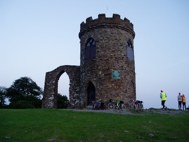
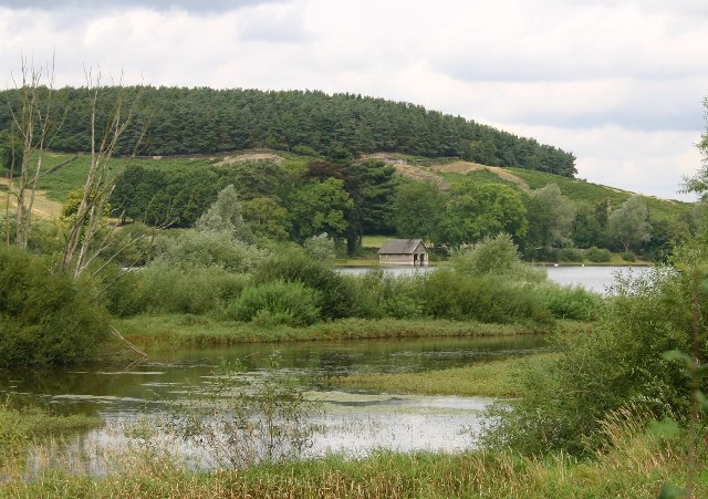
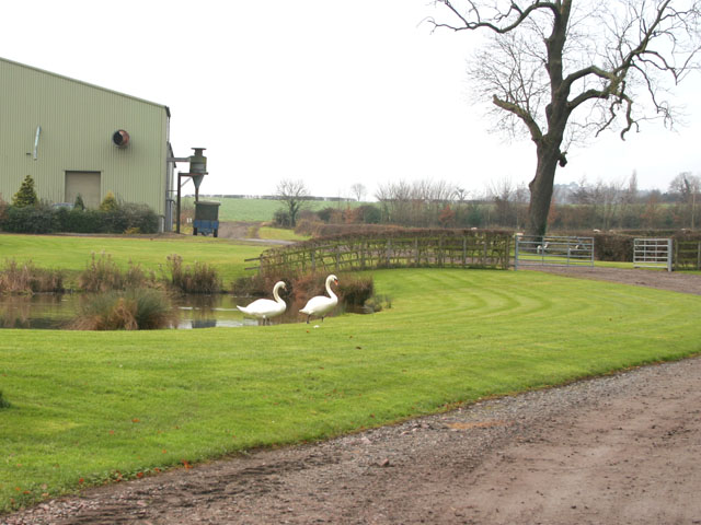
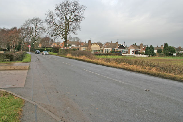
Deer Park Wood Images

Images are sourced within 2km of 52.689947/-1.2055238 or Grid Reference SK5310. Thanks to Geograph Open Source API. All images are credited.

Old John Tower The picture was taken just after dawn, close to the longest day.  The tower was built in 1784 to commemorate an unlikely accident.

The 21st birthday of the Earl of Stamford was being celebrated on the site of a windmill that had stood at the top of the hill.  Bizarrely, a bonfire was lit around a wooden flagpole and the miller, Old John, was told to mind the fire.  Inevitably the flagpole burnt through and fell on Old John, killing him in the process.
Old John Tower
The picture was taken just after dawn, close to the longest day. The tower was built in 1784 to commemorate an unlikely accident. The 21st birthday of the Earl of Stamford was being celebrated on the site of a windmill that had stood at the top of the hill. Bizarrely, a bonfire was lit around a wooden flagpole and the miller, Old John, was told to mind the fire. Inevitably the flagpole burnt through and fell on Old John, killing him in the process.
Bradgate Park Bradgate Park is a popular spot for a Sunday afternoon stroll for the population of Leicester, but if you get there at dawn you can get quite close to the local residents.
Bradgate Park
Bradgate Park is a popular spot for a Sunday afternoon stroll for the population of Leicester, but if you get there at dawn you can get quite close to the local residents.
Bradgate Park Bradgate Park is an ancient deer park and provides a very popular spot for a stroll for the inhabitants of nearby Leicester.
Bradgate Park
Bradgate Park is an ancient deer park and provides a very popular spot for a stroll for the inhabitants of nearby Leicester.
Boathouse and Cropston Reservoir The paths in Bradgate park lead round this reservoir.
Boathouse and Cropston Reservoir
The paths in Bradgate park lead round this reservoir.
Station Road, Cropston, near Leicester Station Road meets Reservoir Road, Cropston Road and Causeway Lane at this crossroad in the centre of the old village.
Station Road, Cropston, near Leicester
Station Road meets Reservoir Road, Cropston Road and Causeway Lane at this crossroad in the centre of the old village.
Cropston House Farm This farm is on the southern edge of the village
Cropston House Farm
This farm is on the southern edge of the village
Cropston Road, Cropston near Leicester Cropston has grown into a substantial village. These houses are on Waterfield Road.
Cropston Road, Cropston near Leicester
Cropston has grown into a substantial village. These houses are on Waterfield Road.
Cropston Reservoir, near Leicester To the east of Bradgate Park, this Severn Trent reservoir was constructed in 1866 to supply water to Leicester. It is important for wildlife and has an Education Centre. Taken from Reservoir Road on the embankment.
Cropston Reservoir, near Leicester
To the east of Bradgate Park, this Severn Trent reservoir was constructed in 1866 to supply water to Leicester. It is important for wildlife and has an Education Centre. Taken from Reservoir Road on the embankment.
Cropston Reservoir, near Leicester This semi-circular weir in the south east corner is the emergency overflow for the reservoir. It appears that it hasn't been needed for a long time. See <a href="https://www.geograph.org.uk/photo/93663">SK5511 : Reservoir Spillway, Cropston</a>.
Cropston Reservoir, near Leicester
This semi-circular weir in the south east corner is the emergency overflow for the reservoir. It appears that it hasn't been needed for a long time. See SK5511 : Reservoir Spillway, Cropston.
Reservoir Spillway, Cropston This flood overflow doesn't look as if it has been used for several years although the OS map marks it as water. It runs along side the water treatment works between Reservoir Road (which goes along the dam) and Bradgate Road, before joining the stream that feeds Swithland reservoir in <a href="https://www.geograph.org.uk/gridref/SK5613">SK5613</a>. See <a href="https://www.geograph.org.uk/photo/93659">SK5510 : Cropston Reservoir, near Leicester</a>
Reservoir Spillway, Cropston
This flood overflow doesn't look as if it has been used for several years although the OS map marks it as water. It runs along side the water treatment works between Reservoir Road (which goes along the dam) and Bradgate Road, before joining the stream that feeds Swithland reservoir in SK5613. See SK5510 : Cropston Reservoir, near Leicester
Waterworks Waterworks building on the edge of Bradgate Country Park.
Waterworks
Waterworks building on the edge of Bradgate Country Park.
The Chapel at Bradgate House Bradgate House, now a ruin, was the birthplace of the ill-fated Lady Jane Grey, Queen of England for just nine days in 1553.
The Chapel at Bradgate House
Bradgate House, now a ruin, was the birthplace of the ill-fated Lady Jane Grey, Queen of England for just nine days in 1553.
Disused slate quarry in Swithland Wood
Bridleway off Leicester Lane Looking towards Swithland <a href="https://www.geograph.org.uk/gridref/SK5512">SK5512</a>
Bridleway off Leicester Lane
Looking towards Swithland SK5512
Swithland Wood, Leicestershire Looking north east from the Roecliffe Road car park, this bridleway goes to Swithland through <a href="https://www.geograph.org.uk/gridref/SK5412">SK5412</a>.
Swithland Wood, Leicestershire
Looking north east from the Roecliffe Road car park, this bridleway goes to Swithland through SK5412.
Countryside at Swithland Wood Looking towards Cropston. The reservoir <a href="https://www.geograph.org.uk/gridref/SK5411">SK5411</a> is behind the trees in the centre of the picture. The wall is made of local Mountsorrel granite.
Countryside at Swithland Wood
Looking towards Cropston. The reservoir SK5411 is behind the trees in the centre of the picture. The wall is made of local Mountsorrel granite.
No parking on the verge The Bradgate Park car park nearest to Old John is just over the road in the distance and it isn't free.
No parking on the verge
The Bradgate Park car park nearest to Old John is just over the road in the distance and it isn't free.
Old John, Bradgate Park Local folklore would seem to suggest that Old John was a Groundsman who owned a windmill on this site. He was killed in a bizzarre bonfire incident, by a flagpole that fell on him that was burned by the bonfire when it had got out of control...
Old John, Bradgate Park
Local folklore would seem to suggest that Old John was a Groundsman who owned a windmill on this site. He was killed in a bizzarre bonfire incident, by a flagpole that fell on him that was burned by the bonfire when it had got out of control...
Show me another place!

Deer Park Wood is located at Grid Ref: SK5310 (Lat: 52.689947, Lng: -1.2055238)

Administrative County: Leicestershire

District: Charnwood

Police Authority: Leicestershire

What 3 Words

///exchanges.retain.unity. Near Anstey, Leicestershire

Related Wikis

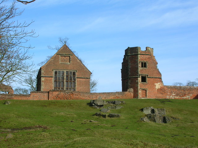
Bradgate House, Bradgate Park

Bradgate House is a 16th-century ruin in Bradgate Park, Leicestershire, England. Edward Grey's son Sir John Grey of Groby married Elizabeth Woodville,...

Bradgate Park and Cropston Reservoir

Bradgate Park and Cropston Reservoir is a 399.7-hectare (988-acre) geological Site of Special Scientific Interest north–west of Leicester. It is also a...
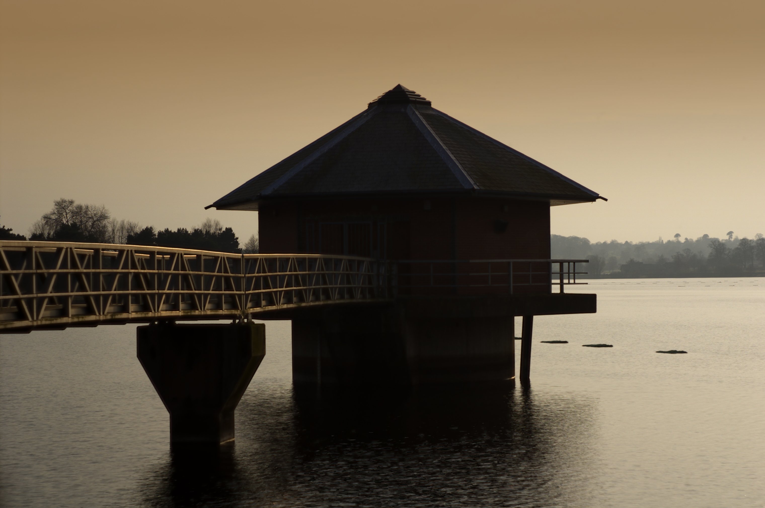
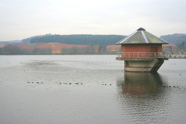
Cropston Reservoir

Cropston Reservoir (originally known as Bradgate Reservoir) lies in Charnwood Forest in Leicestershire, England. The dam and associated water works are...
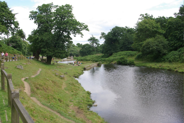
Bradgate Park

Bradgate Park () is a public park in Charnwood Forest, in Leicestershire, England, northwest of Leicester. It covers 850 acres (340 hectares). The park...

Bradgate Electoral Division

Bradgate Electoral Division is a County Council electoral division in Leicestershire, England, taking its name from Bradgate Park which is at the centre...

Charnwood (UK Parliament constituency)

Charnwood is a constituency in Leicestershire represented in the House of Commons of the UK Parliament since 2015 by Edward Argar, a Conservative.Further...
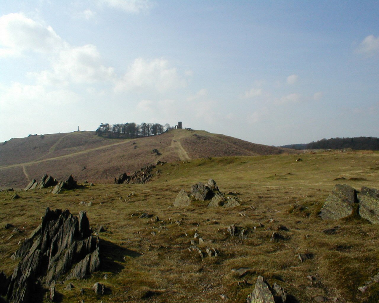
Old John

Old John is the highest hill in Bradgate Park, Leicestershire, England, on the southern edge of Charnwood Forest. It gives its name to the folly that...

The Martin High School, Anstey

The Martin High School is a coeducational secondary school with academy status, located in the village of Anstey, Leicestershire, on the outskirts of Leicester...

Nearby Amenities

Located within 500m of 52.689947,-1.2055238
Cafe
Deer Barn Tea Room
Cuisine: baked_potatoes,_cheese_toasties,_cake,_tea._coffee,_soft_drinks
Toilets: yes
Toilets Wheelchair: yes
Wheelchair: yes
Lat/Long: 52.6882869/-1.203731
Toilets
Toilets Wheelchair: yes
Wheelchair: yes
Lat/Long: 52.6880968/-1.2039317
Hide
Leisure: bird_hide
Lat/Long: 52.6884044/-1.202776
Defibrillator
Emergency: defibrillator
Indoor: no
Operator: Bradgate Park Trust
Ref GB The Circuit: D0587A5E-98C6-4800-9FB7-E65AAEEA0028
Lat/Long: 52.6880605/-1.203956
Bench
Lat/Long: 52.6912204/-1.2006865
Stag
Tourism: artwork
Lat/Long: 52.6915721/-1.2013169
Bradgate Park Visitor Centre
Tourism: information
Lat/Long: 52.6881891/-1.2038592
Bench
Lat/Long: 52.6915993/-1.2013614
Ford: yes
Lat/Long: 52.6898117/-1.2113488
Ford: yes
Lat/Long: 52.6900004/-1.2109548
Ford: yes
Lat/Long: 52.6902268/-1.2102674
Dale Spinny
Natural: wood
Lat/Long: 52.6932652/-1.2085606
The data included in this document is from www.openstreetmap.org. The data is made available under ODbL.

Have you been to Deer Park Wood?

Leave your review of Deer Park Wood below (or comments, questions and feedback).