Ashburton

Settlement in Devon Teignbridge

England

Ashburton

Ashburton - West Street Ashburton is a small market town and also was a stannary town (a centre for administration of tin mining).
Note the celebrated Old Exeter Inn where Sir Walter Raleigh was arrested in 1603.
<span class="nowrap"><a title="www.discoverashburton.info" rel="nofollow ugc noopener" href="http://www.discoverashburton.info">Link</a><img style="margin-left:2px;" alt="External link" title="External link - shift click to open in new window" src="https://s1.geograph.org.uk/img/external.png" width="10" height="10"/></span>
Ashburton - West Street Credit: Colin Smith

Ashburton is a small market town located in the county of Devon, in southwestern England. It is situated on the eastern edge of Dartmoor National Park, surrounded by beautiful countryside and rolling hills. The town is positioned about 20 miles south of Exeter and 10 miles north of the coastal town of Newton Abbot.

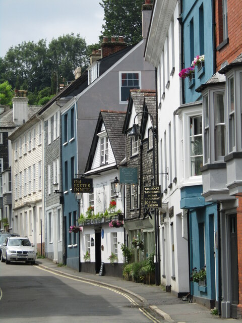
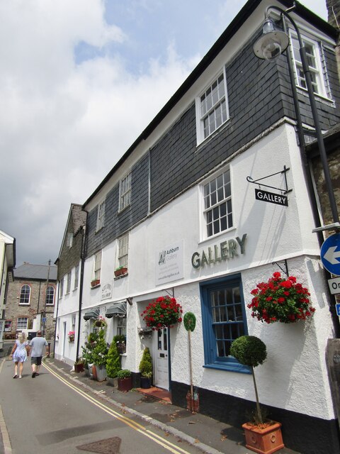
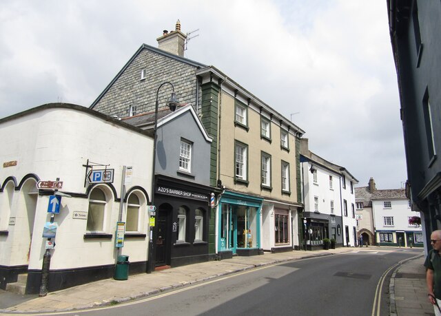
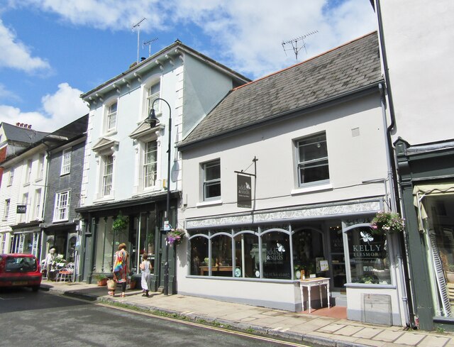
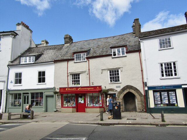
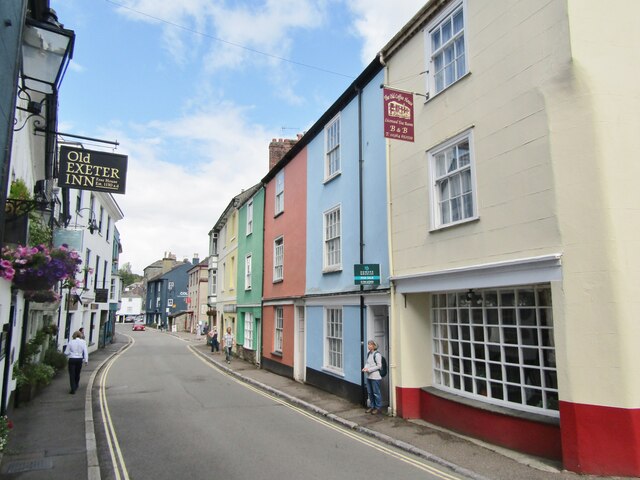
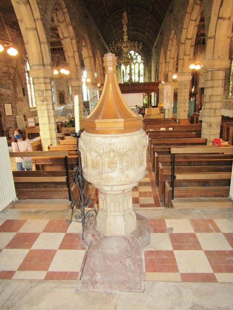
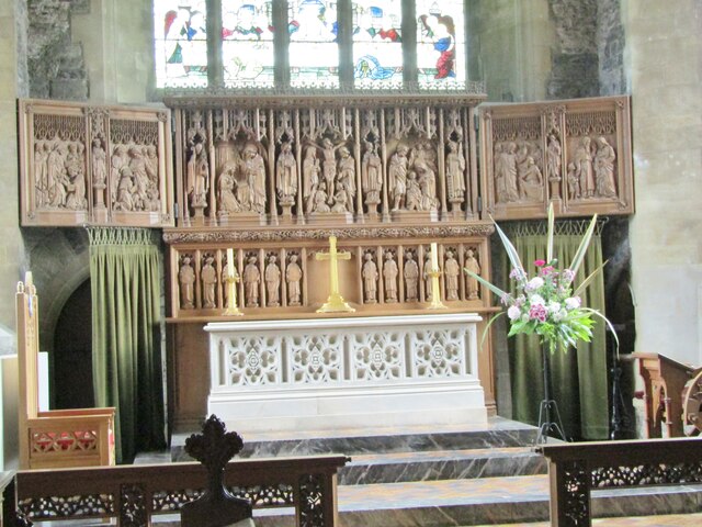
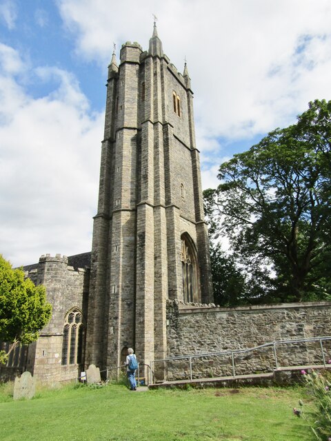
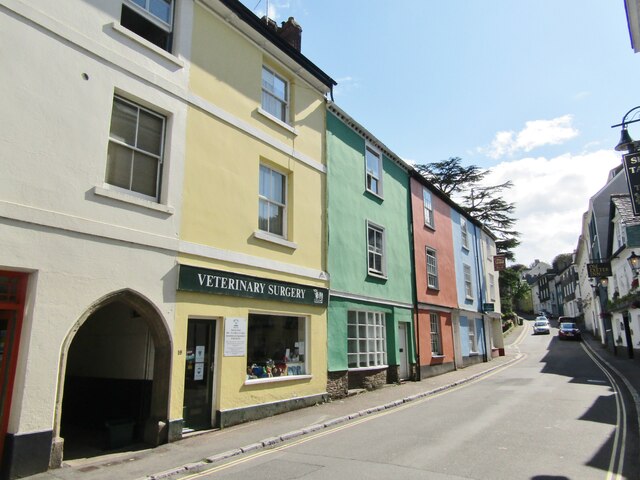
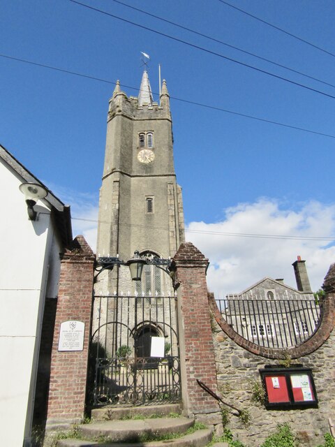
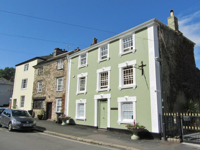
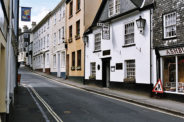
With a population of around 4,200 residents, Ashburton has a rich history dating back to Saxon times. Its historic center is characterized by narrow streets lined with traditional buildings, many of which are constructed from local granite. The town's most notable landmark is St. Andrew's Church, an impressive medieval structure that dominates the skyline.

Ashburton is renowned for its thriving antiques trade, attracting collectors and enthusiasts from far and wide. The town has a number of antique shops, auction houses, and regular antique fairs, making it a popular destination for those seeking unique treasures. Additionally, Ashburton hosts a regular farmers market, showcasing the best of local produce and crafts.

Outdoor enthusiasts are drawn to Ashburton due to its proximity to Dartmoor National Park. The park offers ample opportunities for walking, cycling, and horse riding, with its rugged landscapes, ancient woodlands, and picturesque rivers. The nearby River Dart is a popular spot for fishing and canoeing.

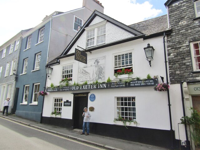
The town also boasts several traditional pubs, cafes, and restaurants, offering a range of culinary delights. Local festivals and events, such as the Ashburton Blues Festival and the Ashburton Food and Drink Festival, add vibrancy to the community throughout the year.

Overall, Ashburton provides a charming and picturesque base for exploring the natural beauty of Dartmoor, while offering a unique blend of history, culture, and antique shopping for visitors and residents alike.

If you have any feedback on the listing, please let us know in the comments section below.

Ashburton Images

Images are sourced within 2km of 50.515552/-3.755689 or Grid Reference SX7569. Thanks to Geograph Open Source API. All images are credited.

Ashburton - West Street Ashburton is a small market town and also was a stannary town (a centre for administration of tin mining).
Note the celebrated Old Exeter Inn where Sir Walter Raleigh was arrested in 1603.
<span class="nowrap"><a title="www.discoverashburton.info" rel="nofollow ugc noopener" href="http://www.discoverashburton.info">Link</a><img style="margin-left:2px;" alt="External link" title="External link - shift click to open in new window" src="https://s1.geograph.org.uk/img/external.png" width="10" height="10"/></span>
Ashburton - West Street
Ashburton is a small market town and also was a stannary town (a centre for administration of tin mining). Note the celebrated Old Exeter Inn where Sir Walter Raleigh was arrested in 1603. LinkExternal link
Ashburton - Kingsbridge Lane Ashburn Gallery in the town centre.
<span class="nowrap"><a title="www.ashburngallery.co.uk" rel="nofollow ugc noopener" href="http://www.ashburngallery.co.uk">Link</a><img style="margin-left:2px;" alt="External link" title="External link - shift click to open in new window" src="https://s1.geograph.org.uk/img/external.png" width="10" height="10"/></span>
Ashburton - Kingsbridge Lane
Ashburn Gallery in the town centre. LinkExternal link
Ashburton - West Street Ashburton is a small market town and also was a stannary town (a centre for administration of tin mining).
<span class="nowrap"><a title="www.discoverashburton.info" rel="nofollow ugc noopener" href="http://www.discoverashburton.info">Link</a><img style="margin-left:2px;" alt="External link" title="External link - shift click to open in new window" src="https://s1.geograph.org.uk/img/external.png" width="10" height="10"/></span>
Ashburton - West Street
Ashburton is a small market town and also was a stannary town (a centre for administration of tin mining). LinkExternal link
Ashburton - North Street Shopping street in downtown Ashburton containing a variety of independent traders e.g. Odds & Suds (interiors, furniture and soaps).
<span class="nowrap"><a title="www.discoverashburton.info" rel="nofollow ugc noopener" href="http://www.discoverashburton.info">Link</a><img style="margin-left:2px;" alt="External link" title="External link - shift click to open in new window" src="https://s1.geograph.org.uk/img/external.png" width="10" height="10"/></span>
Ashburton - North Street
Shopping street in downtown Ashburton containing a variety of independent traders e.g. Odds & Suds (interiors, furniture and soaps). LinkExternal link
Ashburton - North Street Historic shopping street in downtown Ashburton containing a variety of independent traders e.g. Church's Ironmongers in a building where Fairfax was quartered during the English Civil War.
<span class="nowrap"><a title="www.discoverashburton.info" rel="nofollow ugc noopener" href="http://www.discoverashburton.info">Link</a><img style="margin-left:2px;" alt="External link" title="External link - shift click to open in new window" src="https://s1.geograph.org.uk/img/external.png" width="10" height="10"/></span>
Ashburton - North Street
Historic shopping street in downtown Ashburton containing a variety of independent traders e.g. Church's Ironmongers in a building where Fairfax was quartered during the English Civil War. LinkExternal link
Ashburton - Old Exeter Inn The oldest pub in Ashburton, first built 1130, but originally named the Church House Inn. The blue plaque remembers the arrest of Sir Walter Raleigh here in 1603 (see mural and gable).
<span class="nowrap"><a title="www.discoverashburton.info" rel="nofollow ugc noopener" href="http://www.discoverashburton.info">Link</a><img style="margin-left:2px;" alt="External link" title="External link - shift click to open in new window" src="https://s1.geograph.org.uk/img/external.png" width="10" height="10"/></span>
Ashburton - Old Exeter Inn
The oldest pub in Ashburton, first built 1130, but originally named the Church House Inn. The blue plaque remembers the arrest of Sir Walter Raleigh here in 1603 (see mural and gable). LinkExternal link
Ashburton - Sir Walter Raleigh Blue plaque at the Old Exeter Inn where he was arrested in 1603.
<span class="nowrap"><a title="www.discoverashburton.info" rel="nofollow ugc noopener" href="http://www.discoverashburton.info">Link</a><img style="margin-left:2px;" alt="External link" title="External link - shift click to open in new window" src="https://s1.geograph.org.uk/img/external.png" width="10" height="10"/></span>
Ashburton - Sir Walter Raleigh
Blue plaque at the Old Exeter Inn where he was arrested in 1603. LinkExternal link
Ashburton - West Street Colourfully painted buildings in the centre of this old Devon market town.
Ashburton - West Street
Colourfully painted buildings in the centre of this old Devon market town.
Ashburton - St Andrew's Church Font inside the parish church.
<span class="nowrap"><a title="www.discoverashburton.info" rel="nofollow ugc noopener" href="http://www.discoverashburton.info">Link</a><img style="margin-left:2px;" alt="External link" title="External link - shift click to open in new window" src="https://s1.geograph.org.uk/img/external.png" width="10" height="10"/></span>
Ashburton - St Andrew's Church
Font inside the parish church. LinkExternal link
Ashburton - Triptych Artpiece and altar inside Ashburton's parish church, St Andrew's.
<span class="nowrap"><a title="www.discoverashburton.info" rel="nofollow ugc noopener" href="http://www.discoverashburton.info">Link</a><img style="margin-left:2px;" alt="External link" title="External link - shift click to open in new window" src="https://s1.geograph.org.uk/img/external.png" width="10" height="10"/></span>
Ashburton - Triptych
Artpiece and altar inside Ashburton's parish church, St Andrew's. LinkExternal link
Ashburton - St Andrew's Church Imposing parish church tower on West Street.
<span class="nowrap"><a title="www.discoverashburton.info" rel="nofollow ugc noopener" href="http://www.discoverashburton.info">Link</a><img style="margin-left:2px;" alt="External link" title="External link - shift click to open in new window" src="https://s1.geograph.org.uk/img/external.png" width="10" height="10"/></span>
Ashburton - St Andrew's Church
Imposing parish church tower on West Street. LinkExternal link
Ashburton - West Street Colourfully painted buildings in the centre of this old Devon market town.
<span class="nowrap"><a title="www.discoverashburton.info" rel="nofollow ugc noopener" href="http://www.discoverashburton.info">Link</a><img style="margin-left:2px;" alt="External link" title="External link - shift click to open in new window" src="https://s1.geograph.org.uk/img/external.png" width="10" height="10"/></span>
Ashburton - West Street
Colourfully painted buildings in the centre of this old Devon market town. LinkExternal link
Ashburton - Chapel of St Lawrence Historic chantry, grammar school and courthouse on St Lawrence Lane.
<span class="nowrap"><a title="www.discoverashburton.info" rel="nofollow ugc noopener" href="http://www.discoverashburton.info">Link</a><img style="margin-left:2px;" alt="External link" title="External link - shift click to open in new window" src="https://s1.geograph.org.uk/img/external.png" width="10" height="10"/></span>
Ashburton - Chapel of St Lawrence
Historic chantry, grammar school and courthouse on St Lawrence Lane. LinkExternal link
Ashburton - North Street Striking historic building, The Meeting House, in the market town of Ashburton.
<span class="nowrap"><a title="www.discoverashburton.info" rel="nofollow ugc noopener" href="http://www.discoverashburton.info">Link</a><img style="margin-left:2px;" alt="External link" title="External link - shift click to open in new window" src="https://s1.geograph.org.uk/img/external.png" width="10" height="10"/></span>
Ashburton - North Street
Striking historic building, The Meeting House, in the market town of Ashburton. LinkExternal link
Old Milestone (Parole stone), West of Hele Cross The milestone is now located in front of the main post of the side gate to the west of the main entrance to Dart Vale, on the north side of the road. Originally the milestone was located opposite the entrance to Dart Vale, on the south side of the road.  Parish of Ashburton (Teignbridge District). Carved stone post, Ashburton Parole stone design, erected by the Government in the 18th century. (French prisoners of war on parole were stationed in Ashburton 1794-98 and were allowed to walk up to one mile from the town)

Inscription reads:-
1 / Mile

Milestone Society National ID: DV_ASPS01B
Old Milestone (Parole stone), West of Hele Cross
The milestone is now located in front of the main post of the side gate to the west of the main entrance to Dart Vale, on the north side of the road. Originally the milestone was located opposite the entrance to Dart Vale, on the south side of the road. Parish of Ashburton (Teignbridge District). Carved stone post, Ashburton Parole stone design, erected by the Government in the 18th century. (French prisoners of war on parole were stationed in Ashburton 1794-98 and were allowed to walk up to one mile from the town) Inscription reads:- 1 / Mile Milestone Society National ID: DV_ASPS01B
A38 (Devon Expressway) near Ashburton The A38 is a major A-class trunk route. When first designated in 1922, it ran from Derby to Plymouth but it was later extended at both ends so that it now runs for 292 miles from Mansfield in Nottinghamshire to Bodmin in Cornwall.

Prior to the opening of the M5 motorway in the 1960s and 1970s, the A38 formed the main "holiday route" from the Midlands to Somerset, Devon and Cornwall and the south-western section was notorious at holiday times for the congestion. Nowadays, for most of the southern section, the A38 is a fairly quiet road shadowing the M5 extremely closely; often running alongside the motorway as a single carriageway road. The section between Exeter and Plymouth is, however, a busy dual carriageway which serves as the southern extension of the M5 and is known as “the Devon Expressway”.

More information at <span class="nowrap"><a title="http://en.wikipedia.org/wiki/A38_road" rel="nofollow ugc noopener" href="http://en.wikipedia.org/wiki/A38_road">Link</a><img style="margin-left:2px;" alt="External link" title="External link - shift click to open in new window" src="https://s1.geograph.org.uk/img/external.png" width="10" height="10"/></span>  (Wikipedia) and <span class="nowrap"><a title="http://www.sabre-roads.org.uk/wiki/index.php?title=A38" rel="nofollow ugc noopener" href="http://www.sabre-roads.org.uk/wiki/index.php?title=A38">Link</a><img style="margin-left:2px;" alt="External link" title="External link - shift click to open in new window" src="https://s1.geograph.org.uk/img/external.png" width="10" height="10"/></span>  (SABRE).
A38 (Devon Expressway) near Ashburton
The A38 is a major A-class trunk route. When first designated in 1922, it ran from Derby to Plymouth but it was later extended at both ends so that it now runs for 292 miles from Mansfield in Nottinghamshire to Bodmin in Cornwall. Prior to the opening of the M5 motorway in the 1960s and 1970s, the A38 formed the main "holiday route" from the Midlands to Somerset, Devon and Cornwall and the south-western section was notorious at holiday times for the congestion. Nowadays, for most of the southern section, the A38 is a fairly quiet road shadowing the M5 extremely closely; often running alongside the motorway as a single carriageway road. The section between Exeter and Plymouth is, however, a busy dual carriageway which serves as the southern extension of the M5 and is known as “the Devon Expressway”. More information at LinkExternal link (Wikipedia) and LinkExternal link (SABRE).
Devon Expressway (A38), Exit Sliproad at Peartree Junction The A38 is a major A-class trunk route. When first designated in 1922, it ran from Derby to Plymouth but it was later extended at both ends so that it now runs for 292 miles from Mansfield in Nottinghamshire to Bodmin in Cornwall.

Prior to the opening of the M5 motorway in the 1960s and 1970s, the A38 formed the main "holiday route" from the Midlands to Somerset, Devon and Cornwall and the south-western section was notorious at holiday times for the congestion. Nowadays, for most of the southern section, the A38 is a fairly quiet road shadowing the M5 extremely closely; often running alongside the motorway as a single carriageway road. The section between Exeter and Plymouth is, however, a busy dual carriageway which serves as the southern extension of the M5 and is known as “the Devon Expressway”.

More information at <span class="nowrap"><a title="http://en.wikipedia.org/wiki/A38_road" rel="nofollow ugc noopener" href="http://en.wikipedia.org/wiki/A38_road">Link</a><img style="margin-left:2px;" alt="External link" title="External link - shift click to open in new window" src="https://s1.geograph.org.uk/img/external.png" width="10" height="10"/></span>  (Wikipedia) and <span class="nowrap"><a title="http://www.sabre-roads.org.uk/wiki/index.php?title=A38" rel="nofollow ugc noopener" href="http://www.sabre-roads.org.uk/wiki/index.php?title=A38">Link</a><img style="margin-left:2px;" alt="External link" title="External link - shift click to open in new window" src="https://s1.geograph.org.uk/img/external.png" width="10" height="10"/></span>  (SABRE).
Devon Expressway (A38), Exit Sliproad at Peartree Junction
The A38 is a major A-class trunk route. When first designated in 1922, it ran from Derby to Plymouth but it was later extended at both ends so that it now runs for 292 miles from Mansfield in Nottinghamshire to Bodmin in Cornwall. Prior to the opening of the M5 motorway in the 1960s and 1970s, the A38 formed the main "holiday route" from the Midlands to Somerset, Devon and Cornwall and the south-western section was notorious at holiday times for the congestion. Nowadays, for most of the southern section, the A38 is a fairly quiet road shadowing the M5 extremely closely; often running alongside the motorway as a single carriageway road. The section between Exeter and Plymouth is, however, a busy dual carriageway which serves as the southern extension of the M5 and is known as “the Devon Expressway”. More information at LinkExternal link (Wikipedia) and LinkExternal link (SABRE).
A38 near Buckfast The A38 is a major A-class trunk route. When first designated in 1922, it ran from Derby to Plymouth but it was later extended at both ends so that it now runs for 292 miles from Mansfield in Nottinghamshire to Bodmin in Cornwall.

Prior to the opening of the M5 motorway in the 1960s and 1970s, the A38 formed the main "holiday route" from the Midlands to Somerset, Devon and Cornwall and the south-western section was notorious at holiday times for the congestion. Nowadays, for most of the southern section, the A38 is a fairly quiet road shadowing the M5 extremely closely; often running alongside the motorway as a single carriageway road. The section between Exeter and Plymouth is, however, a busy dual carriageway which serves as the southern extension of the M5 and is known as “the Devon Expressway”.

More information at <span class="nowrap"><a title="http://en.wikipedia.org/wiki/A38_road" rel="nofollow ugc noopener" href="http://en.wikipedia.org/wiki/A38_road">Link</a><img style="margin-left:2px;" alt="External link" title="External link - shift click to open in new window" src="https://s1.geograph.org.uk/img/external.png" width="10" height="10"/></span>  (Wikipedia) and <span class="nowrap"><a title="http://www.sabre-roads.org.uk/wiki/index.php?title=A38" rel="nofollow ugc noopener" href="http://www.sabre-roads.org.uk/wiki/index.php?title=A38">Link</a><img style="margin-left:2px;" alt="External link" title="External link - shift click to open in new window" src="https://s1.geograph.org.uk/img/external.png" width="10" height="10"/></span>  (SABRE).
A38 near Buckfast
The A38 is a major A-class trunk route. When first designated in 1922, it ran from Derby to Plymouth but it was later extended at both ends so that it now runs for 292 miles from Mansfield in Nottinghamshire to Bodmin in Cornwall. Prior to the opening of the M5 motorway in the 1960s and 1970s, the A38 formed the main "holiday route" from the Midlands to Somerset, Devon and Cornwall and the south-western section was notorious at holiday times for the congestion. Nowadays, for most of the southern section, the A38 is a fairly quiet road shadowing the M5 extremely closely; often running alongside the motorway as a single carriageway road. The section between Exeter and Plymouth is, however, a busy dual carriageway which serves as the southern extension of the M5 and is known as “the Devon Expressway”. More information at LinkExternal link (Wikipedia) and LinkExternal link (SABRE).
Show me another place!

Ashburton is located at Grid Ref: SX7569 (Lat: 50.515552, Lng: -3.755689)

Administrative County: Devon

District: Teignbridge

Police Authority: Devon and Cornwall

What 3 Words

///typed.startles.throat. Near Ashburton, Devon

Nearby Locations

Ashburton

Related Wikis

Ashburton Town Hall

Ashburton Town Hall is a municipal building in the North Street, Ashburton, Devon, England. The town hall, which is the meeting place of Ashburton Town...

Ashburton railway station

Ashburton railway station is a closed railway station situated in the town of Ashburton in Devon, England. It was the terminus of a branch line from Totnes...

Sands School

Sands School is a democratic school in Ashburton, Devon in England. == Background == Sands School is the second democratic school in England which was...

Ashburton, Devon

Ashburton is a town on the south-southeastern edge of Dartmoor in Devon, England, adjacent to the A38. The town is 20 miles (32 km) northeast of Plymouth...

Nearby Amenities

Located within 500m of 50.515552,-3.755689
Ashburton
Is In: Devon, England, UK
Place: town
Lat/Long: 50.5156249/-3.7563037
Post Office
Ashburton Post Office
Addr City: Ashburton
Addr Country: GB
Addr Housenumber: 4
Addr Postcode: TQ13 7DD
Addr Street: St Lawrence Lane
Brand: Post Office
Brand Wikidata: Q1783168
Contact Website: https://www.postoffice.co.uk/branch-finder/2205521/ashburton
Opening Hours: Mo-Sa 08:00-17:30; Su 09:00-13:00
Ref Pol Id: 8234
Wheelchair: yes
Lat/Long: 50.5152793/-3.7553953
Old Coffee House Tea Rooms
Created By: Potlatch 0.10f
Tourism: guest_house
Lat/Long: 50.514683/-3.7573026
Place Of Worship
Lat/Long: 50.5174636/-3.7504669
Bus Stop
Lat/Long: 50.5171391/-3.7516211
Bus Stop
Lat/Long: 50.5170072/-3.7517661
Post Box
Brand: Royal Mail
Brand Wikidata: Q638098
Brand Wikipedia: en:Royal Mail
Collection Times: Mo-Fr 13:00; Sa 12:00; Su off
Drive Through: no
Operator: Royal Mail
Operator Wikidata: Q638098
Post Box Design: type_b
Post Box Type: wall
Ref: TQ13 39
Royal Cypher: VR
Royal Cypher Wikidata: Q33102356
Source: survey;streetlevel imagery;aerial imagery
Lat/Long: 50.5172577/-3.7514903
Telephone
Booth: K6
Covered: booth
Listed Status: Grade II
Lat/Long: 50.5173118/-3.7513741
Doctors
ashburton surgery
Lat/Long: 50.5176683/-3.7509138
Toilets
Wheelchair: no
Lat/Long: 50.5153654/-3.7565951
Townhall
Wheelchair: limited
Lat/Long: 50.5159419/-3.7570618
Atm
Wheelchair: yes
Lat/Long: 50.5153325/-3.7553636
Pub
Silent Whistle
Wheelchair: no
Wikidata: Q80476196
Lat/Long: 50.5146174/-3.7543663
Ashburton Station
Historic Railway: halt
Wikidata: Q800401
Wikipedia: en:Ashburton railway station
Lat/Long: 50.5142158/-3.7543466
Restaurant
The Old Library
Lat/Long: 50.5158202/-3.7571666
Post Box
Brand: Royal Mail
Brand Wikidata: Q638098
Brand Wikipedia: en:Royal Mail
Collection Times: Mo-Fr 12:00; Sa 10:30; Su off
Drive Through: no
Operator: Royal Mail
Operator Wikidata: Q638098
Post Box Design: type_b
Post Box Mounting: brick_pillar
Post Box Type: wall
Ref: TQ13 34
Royal Cypher: EIIR
Royal Cypher Wikidata: Q33102113
Source: survey;streetlevel imagery;aerial imagery
Lat/Long: 50.5123245/-3.7584997
Drinking Water
Lat/Long: 50.5171453/-3.7583709
Pub
Lat/Long: 50.5169619/-3.7582575
Pharmacy
Lloyds Pharmacy
Addr City: Newton Abbot
Addr Housenumber: 8
Addr Postcode: TQ13 7QD
Addr Street: North Street
Alt Name: Lloyds Ashburton
Brand: Lloyds Pharmacy
Brand Wikidata: Q6662870
Brand Wikipedia: en:LloydsPharmacy
Dispensing: yes
Healthcare: pharmacy
Lat/Long: 50.5157006/-3.7562965
Historic: memorial
Memorial: war_memorial
Lat/Long: 50.5172886/-3.7510666
Post Box
Collection Times: Mo-Fr 12:00; Sa 11:00; Su off
Drive Through: no
Operator: Royal Mail
Operator Wikidata: Q638098
Post Box Design: type_a
Post Box Type: pillar
Ref: TQ13 238
Royal Cypher: EIIR
Royal Cypher Wikidata: Q33102113
Source: survey;streetlevel imagery;aerial imagery
Lat/Long: 50.5158249/-3.7574411
Library
Ashburton Library
Wheelchair: yes
Wikidata: Q55121696
Lat/Long: 50.5152808/-3.7553432
Addr City: Ashburton
Addr Housenumber: 4
Addr Postcode: TQ13 7BD
Addr Street: Roborough Terrace
Lat/Long: 50.5183747/-3.7531814
Addr City: Ashburton
Addr Housenumber: 1
Addr Street: Roborough Terrace
Lat/Long: 50.5182526/-3.753347
Addr City: Ashburton
Addr Housenumber: 12
Addr Street: Roborough Terrace
Lat/Long: 50.5186953/-3.7527925
Leisure: picnic_table
Lat/Long: 50.5165903/-3.7581772
Leisure: picnic_table
Lat/Long: 50.5166304/-3.7582335
Power: pole
Lat/Long: 50.5123264/-3.751477
Power: pole
Lat/Long: 50.5129507/-3.7509969
Power: pole
Lat/Long: 50.5140098/-3.7503183
Power: pole
Lat/Long: 50.5145352/-3.7500125
Power: pole
Lat/Long: 50.5149581/-3.7497068
Power: pole
Lat/Long: 50.5154698/-3.7493446
Power: pole
Lat/Long: 50.5161418/-3.7489155
Generator Method: photovoltaic
Generator Output Electricity: yes
Generator Source: solar
Generator Type: solar_photovoltaic_panel
Location: roof
Power: generator
Lat/Long: 50.5190987/-3.7525482
Generator Method: photovoltaic
Generator Output Electricity: yes
Generator Source: solar
Generator Type: solar_photovoltaic_panel
Location: roof
Power: generator
Lat/Long: 50.5151862/-3.7528325
Generator Method: photovoltaic
Generator Output Electricity: yes
Generator Source: solar
Generator Type: solar_photovoltaic_panel
Location: roof
Power: generator
Lat/Long: 50.5150702/-3.7523283
Generator Method: photovoltaic
Generator Output Electricity: yes
Generator Source: solar
Generator Type: solar_photovoltaic_panel
Location: roof
Power: generator
Lat/Long: 50.5151145/-3.7527762
Generator Method: photovoltaic
Generator Output Electricity: yes
Generator Source: solar
Generator Type: solar_photovoltaic_panel
Location: roof
Power: generator
Lat/Long: 50.5130199/-3.7576179
Generator Method: photovoltaic
Generator Output Electricity: yes
Generator Source: solar
Generator Type: solar_photovoltaic_panel
Location: roof
Power: generator
Lat/Long: 50.5127211/-3.7580053
Generator Method: photovoltaic
Generator Output Electricity: yes
Generator Source: solar
Generator Type: solar_photovoltaic_panel
Location: roof
Power: generator
Lat/Long: 50.5126333/-3.7580401
Generator Method: photovoltaic
Generator Output Electricity: yes
Generator Source: solar
Generator Type: solar_photovoltaic_panel
Location: roof
Power: generator
Lat/Long: 50.5134823/-3.7596528
Generator Method: photovoltaic
Generator Output Electricity: yes
Generator Source: solar
Generator Type: solar_photovoltaic_panel
Location: roof
Power: generator
Lat/Long: 50.5184423/-3.7523464
Generator Method: photovoltaic
Generator Output Electricity: yes
Generator Source: solar
Generator Type: solar_photovoltaic_panel
Location: roof
Power: generator
Lat/Long: 50.5176339/-3.7524752
Generator Method: photovoltaic
Generator Output Electricity: yes
Generator Source: solar
Generator Type: solar_photovoltaic_panel
Location: roof
Power: generator
Lat/Long: 50.5176392/-3.7597279
Generator Method: photovoltaic
Generator Output Electricity: yes
Generator Source: solar
Generator Type: solar_photovoltaic_panel
Location: roof
Power: generator
Lat/Long: 50.5176341/-3.7597627
Generator Method: photovoltaic
Generator Output Electricity: yes
Generator Source: solar
Generator Type: solar_photovoltaic_panel
Location: roof
Power: generator
Lat/Long: 50.5167583/-3.7590399
Generator Method: photovoltaic
Generator Output Electricity: yes
Generator Source: solar
Generator Type: solar_photovoltaic_panel
Location: roof
Power: generator
Lat/Long: 50.5141037/-3.7540624
Generator Method: photovoltaic
Generator Output Electricity: yes
Generator Source: solar
Generator Type: solar_photovoltaic_panel
Location: roof
Power: generator
Lat/Long: 50.5166798/-3.7519443
Generator Method: photovoltaic
Generator Output Electricity: yes
Generator Source: solar
Generator Type: solar_photovoltaic_panel
Location: roof
Power: generator
Lat/Long: 50.5172883/-3.754121
Generator Method: photovoltaic
Generator Output Electricity: yes
Generator Source: solar
Generator Type: solar_photovoltaic_panel
Location: roof
Power: generator
Lat/Long: 50.5172606/-3.7539956
Generator Method: photovoltaic
Generator Output Electricity: yes
Generator Source: solar
Generator Type: solar_photovoltaic_panel
Location: roof
Power: generator
Lat/Long: 50.5181227/-3.7599018
Generator Method: photovoltaic
Generator Output Electricity: yes
Generator Source: solar
Generator Type: solar_photovoltaic_panel
Location: roof
Power: generator
Lat/Long: 50.512949/-3.760343
Generator Method: photovoltaic
Generator Output Electricity: yes
Generator Source: solar
Generator Type: solar_photovoltaic_panel
Location: roof
Power: generator
Lat/Long: 50.5129421/-3.7604181
Generator Method: photovoltaic
Generator Output Electricity: yes
Generator Source: solar
Generator Type: solar_photovoltaic_panel
Location: roof
Power: generator
Lat/Long: 50.5133464/-3.7574248
Cafe
Rafikis
Addr City: Newton Abbot
Addr Housenumber: 17
Addr Postcode: TQ13 7DT
Addr Street: West Street
Addr Town: Ashburton
Fhrs Id: 1091012
Outdoor Seating: yes
Source Addr: FHRS Open Data
Lat/Long: 50.5148868/-3.7570163
Post Box
Brand: Royal Mail
Brand Wikidata: Q638098
Collection Times: Mo-Fr 17:00; Sa 12:30; Su off
Drive Through: no
Operator: Royal Mail
Operator Wikidata: Q638098
Post Box Design: type_a
Post Box Mounting: building
Post Box Type: wall
Ref: TQ13 255
Royal Cypher: GR
Royal Cypher Wikidata: Q33102273
Source: survey;streetlevel imagery;aerial imagery
Lat/Long: 50.5153644/-3.7553596
Defibrillator
Defibrillator Location: Attached to outer wall of the building
Emergency: defibrillator
Indoor: no
Lat/Long: 50.5159187/-3.7572976
Historic: memorial
Inscription: Sir Walter Raleigh 1552-1618 Explorer, Spy, Politician, Writer & Poet Arrested for treason here at Exeter Inn July 19 1603 and imprisoned in the Tower of London. Beheaded at Old Palace Yard, Westminster October 29 1618
Memorial: blue_plaque
Openplaques Id: 56160
Lat/Long: 50.514813/-3.7573745
Telephone
Booth: K6
Covered: booth
Listed Status: Grade II
Lat/Long: 50.5165647/-3.7577201
The data included in this document is from www.openstreetmap.org. The data is made available under ODbL.

Have you been to Ashburton?

Leave your review of Ashburton below (or comments, questions and feedback).