Duck End

Settlement in Essex Uttlesford

England

Duck End

Gallows Green Road The village of Lindsell is a little way ahead.
Gallows Green Road Credit: Marathon

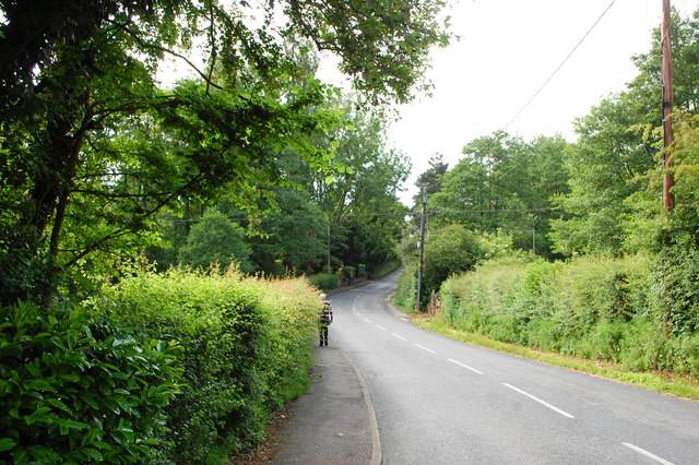
Duck End is a small rural village located in the county of Essex, England. Situated in the Uttlesford district, it is surrounded by picturesque countryside and offers a peaceful and idyllic setting for its residents. The village is situated approximately 30 miles northeast of London, making it an ideal location for those seeking a quieter lifestyle while still having access to the city.

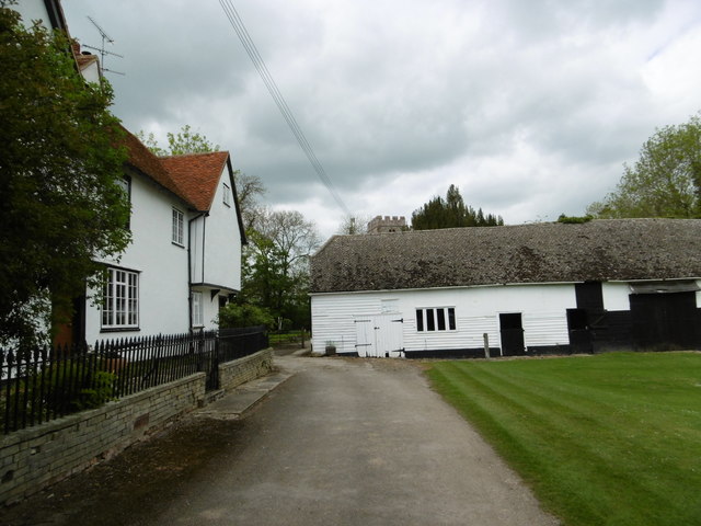
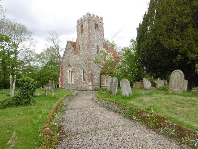
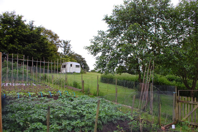
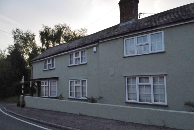
Duck End is characterized by its charming and quaint atmosphere, with traditional thatched cottages and well-maintained gardens lining the streets. The village is home to a close-knit community, with a population of around 200 residents. The villagers take great pride in their local heritage, and there are various community events organized throughout the year to celebrate this.

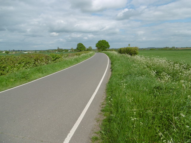
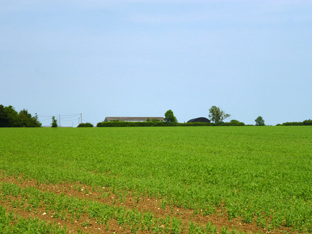
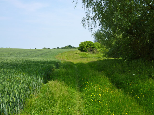
One of the notable features of Duck End is its proximity to nature. The village is surrounded by lush green fields, offering ample opportunities for outdoor activities such as walking, cycling, and picnicking. The nearby River Stort also provides a tranquil spot for fishing and boating enthusiasts.

In terms of amenities, Duck End has a small village hall that serves as a hub for social gatherings and events. However, for more extensive amenities such as shops and schools, residents typically travel to nearby towns and villages.

Overall, Duck End, Essex, offers a charming and peaceful countryside retreat for those seeking a slower pace of life while still being within reach of urban conveniences. Its natural beauty and strong sense of community make it a desirable place to reside.

If you have any feedback on the listing, please let us know in the comments section below.
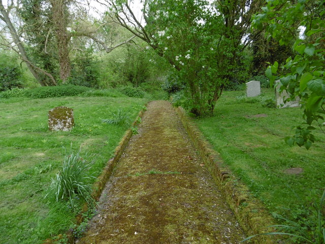
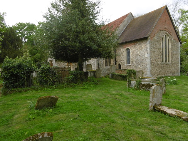
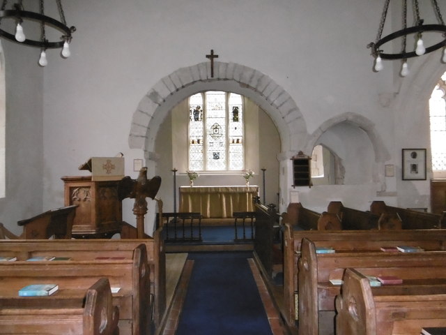
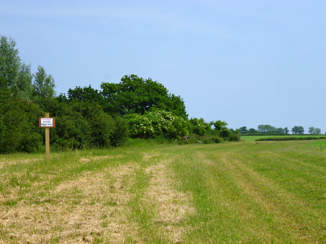
Duck End Images

Images are sourced within 2km of 51.9106/0.404696 or Grid Reference TL6526. Thanks to Geograph Open Source API. All images are credited.

Gallows Green Road The village of Lindsell is a little way ahead.
Gallows Green Road
The village of Lindsell is a little way ahead.
Approach to St Mary the Virgin Church, Lindsell Pevsner describes St Mary the Virgin Church, Lindsell as "A charming approach through the yard of Lindsell Hall." The church tower can just be seen peeping over the barn.
Approach to St Mary the Virgin Church, Lindsell
Pevsner describes St Mary the Virgin Church, Lindsell as "A charming approach through the yard of Lindsell Hall." The church tower can just be seen peeping over the barn.
Lindsell Lane This is at Church End, Lindsell. The lane on the right leads past the cricket ground.
Lindsell Lane
This is at Church End, Lindsell. The lane on the right leads past the cricket ground.
The Cottage, Lindsell This view is just next to the cricket ground. The lane leads eventually to Great Easton.
The Cottage, Lindsell
This view is just next to the cricket ground. The lane leads eventually to Great Easton.
St Mary the Virgin Church, Lindsell Pevsner describes St Mary the Virgin Church, Lindsell as "A charming approach through the yard of Lindsell Hall." He goes on to say "The church is small and compact, and of an unusual colour ... The tower moreover is in an unusual position, at the south-west end. It is of the late 16th century, stone, with diagonal buttress and battlements." The nave shows evidence of a Norman building.
St Mary the Virgin Church, Lindsell
Pevsner describes St Mary the Virgin Church, Lindsell as "A charming approach through the yard of Lindsell Hall." He goes on to say "The church is small and compact, and of an unusual colour ... The tower moreover is in an unusual position, at the south-west end. It is of the late 16th century, stone, with diagonal buttress and battlements." The nave shows evidence of a Norman building.
St Mary the Virgin Churchyard, Lindsell Pevsner describes St Mary the Virgin Church, Lindsell as "A charming approach through the yard of Lindsell Hall." He goes on to say "The church is small and compact, and of an unusual colour ... The tower moreover is in an unusual position, at the south-west end. It is of the late 16th century, stone, with diagonal buttress and battlements." The nave shows evidence of a Norman building.

The churchyard too is delightful and has the feel of a real country churchyard. It is peaceful and this path to the south of the church descends beyond the churchyard into woodland.
St Mary the Virgin Churchyard, Lindsell
Pevsner describes St Mary the Virgin Church, Lindsell as "A charming approach through the yard of Lindsell Hall." He goes on to say "The church is small and compact, and of an unusual colour ... The tower moreover is in an unusual position, at the south-west end. It is of the late 16th century, stone, with diagonal buttress and battlements." The nave shows evidence of a Norman building. The churchyard too is delightful and has the feel of a real country churchyard. It is peaceful and this path to the south of the church descends beyond the churchyard into woodland.
Path in St Mary the Virgin Churchyard, Lindsell Pevsner describes St Mary the Virgin Church, Lindsell as "A charming approach through the yard of Lindsell Hall." He goes on to say "The church is small and compact, and of an unusual colour ... The tower moreover is in an unusual position, at the south-west end. It is of the late 16th century, stone, with diagonal buttress and battlements." The nave shows evidence of a Norman building.

The churchyard too is delightful and has the feel of a real country churchyard. It is peaceful and this path to the south of the church descends beyond the churchyard into woodland.
Path in St Mary the Virgin Churchyard, Lindsell
Pevsner describes St Mary the Virgin Church, Lindsell as "A charming approach through the yard of Lindsell Hall." He goes on to say "The church is small and compact, and of an unusual colour ... The tower moreover is in an unusual position, at the south-west end. It is of the late 16th century, stone, with diagonal buttress and battlements." The nave shows evidence of a Norman building. The churchyard too is delightful and has the feel of a real country churchyard. It is peaceful and this path to the south of the church descends beyond the churchyard into woodland.
St Mary the Virgin Church, Lindsell Pevsner describes St Mary the Virgin Church, Lindsell as "A charming approach through the yard of Lindsell Hall." He goes on to say "The church is small and compact, and of an unusual colour ... The tower moreover is in an unusual position, at the south-west end. It is of the late 16th century, stone, with diagonal buttress and battlements." The nave shows evidence of a Norman building.

The churchyard too is delightful and has the feel of a real country churchyard. It is peaceful and a path to the south of the church descends beyond the churchyard into woodland - see <a title="https://www.geograph.org.uk/photo/4951314" href="https://www.geograph.org.uk/photo/4951314">Link</a>
St Mary the Virgin Church, Lindsell
Pevsner describes St Mary the Virgin Church, Lindsell as "A charming approach through the yard of Lindsell Hall." He goes on to say "The church is small and compact, and of an unusual colour ... The tower moreover is in an unusual position, at the south-west end. It is of the late 16th century, stone, with diagonal buttress and battlements." The nave shows evidence of a Norman building. The churchyard too is delightful and has the feel of a real country churchyard. It is peaceful and a path to the south of the church descends beyond the churchyard into woodland - see Link
Interior of St Mary the Virgin Church, Lindsell Pevsner describes St Mary the Virgin Church, Lindsell as "A charming approach through the yard of Lindsell Hall." He goes on to say "The church is small and compact, and of an unusual colour ... The tower moreover is in an unusual position, at the south-west end. It is of the late 16th century, stone, with diagonal buttress and battlements." The nave shows evidence of a Norman building.

The arch to the chancel is clearly Norman and to the right of it is a squinch arch which enabled members of the congregation in the south aisle to see the communion in the chancel. The glass in the east window dates from the 13th century to the 16th century.
Interior of St Mary the Virgin Church, Lindsell
Pevsner describes St Mary the Virgin Church, Lindsell as "A charming approach through the yard of Lindsell Hall." He goes on to say "The church is small and compact, and of an unusual colour ... The tower moreover is in an unusual position, at the south-west end. It is of the late 16th century, stone, with diagonal buttress and battlements." The nave shows evidence of a Norman building. The arch to the chancel is clearly Norman and to the right of it is a squinch arch which enabled members of the congregation in the south aisle to see the communion in the chancel. The glass in the east window dates from the 13th century to the 16th century.
Anchorite cell in St Mary the Virgin Church, Lindsell Pevsner describes St Mary the Virgin Church, Lindsell as "A charming approach through the yard of Lindsell Hall." He goes on to say "The church is small and compact, and of an unusual colour ... The tower moreover is in an unusual position, at the south-west end. It is of the late 16th century, stone, with diagonal buttress and battlements." The nave shows evidence of a Norman building.

The arch to the chancel is clearly Norman. The small door to the left of the chair is the hatch to an anchorite's cell. This was only discovered in 1927 and the hatch into the chancel was its only opening - see <span class="nowrap"><a title="https://books.google.co.uk/books?id=rcyvUVS66nMC&pg=PA38&lpg=PA38&dq=anchorite+cell+lindsell&source=bl&ots=KrgjyBQPas&sig=BeGCF03knyLZ-nfwWsEcHDEn7Ag&hl=en&sa=X&ved=0ahUKEwjFsMeE9dzMAhWmF8AKHYBYCHgQ6AEIOjAJ#v=onepage&q=anchorite%20cell%20lindsell&f=false" rel="nofollow ugc noopener" href="https://books.google.co.uk/books?id=rcyvUVS66nMC&pg=PA38&lpg=PA38&dq=anchorite+cell+lindsell&source=bl&ots=KrgjyBQPas&sig=BeGCF03knyLZ-nfwWsEcHDEn7Ag&hl=en&sa=X&ved=0ahUKEwjFsMeE9dzMAhWmF8AKHYBYCHgQ6AEIOjAJ#v=onepage&q=anchorite%20cell%20lindsell&f=false">Link</a><img style="margin-left:2px;" alt="External link" title="External link - shift click to open in new window" src="https://s1.geograph.org.uk/img/external.png" width="10" height="10"/></span>
Anchorite cell in St Mary the Virgin Church, Lindsell
Pevsner describes St Mary the Virgin Church, Lindsell as "A charming approach through the yard of Lindsell Hall." He goes on to say "The church is small and compact, and of an unusual colour ... The tower moreover is in an unusual position, at the south-west end. It is of the late 16th century, stone, with diagonal buttress and battlements." The nave shows evidence of a Norman building. The arch to the chancel is clearly Norman. The small door to the left of the chair is the hatch to an anchorite's cell. This was only discovered in 1927 and the hatch into the chancel was its only opening - see LinkExternal link
Interior of St Mary the Virgin Church, Lindsell Pevsner describes St Mary the Virgin Church, Lindsell as "A charming approach through the yard of Lindsell Hall." He goes on to say "The church is small and compact, and of an unusual colour ... The tower moreover is in an unusual position, at the south-west end. It is of the late 16th century, stone, with diagonal buttress and battlements." The nave shows evidence of a Norman building.

The arch to the chancel is clearly Norman and to the right of it is a squinch arch which enabled members of the congregation in the south aisle to see the communion in the chancel. Beyond the chancel arch, the small door to the left of the chair is the hatch to an anchorite's cell. This was only discovered in 1927 and the hatch into the chancel was its only opening - see <span class="nowrap"><a title="https://books.google.co.uk/books?id=rcyvUVS66nMC&pg=PA38&lpg=PA38&dq=anchorite+cell+lindsell&source=bl&ots=KrgjyBQPas&sig=BeGCF03knyLZ-nfwWsEcHDEn7Ag&hl=en&sa=X&ved=0ahUKEwjFsMeE9dzMAhWmF8AKHYBYCHgQ6AEIOjAJ#v=onepage&q=anchorite%20cell%20lindsell&f=false" rel="nofollow ugc noopener" href="https://books.google.co.uk/books?id=rcyvUVS66nMC&pg=PA38&lpg=PA38&dq=anchorite+cell+lindsell&source=bl&ots=KrgjyBQPas&sig=BeGCF03knyLZ-nfwWsEcHDEn7Ag&hl=en&sa=X&ved=0ahUKEwjFsMeE9dzMAhWmF8AKHYBYCHgQ6AEIOjAJ#v=onepage&q=anchorite%20cell%20lindsell&f=false">Link</a><img style="margin-left:2px;" alt="External link" title="External link - shift click to open in new window" src="https://s1.geograph.org.uk/img/external.png" width="10" height="10"/></span>
Interior of St Mary the Virgin Church, Lindsell
Pevsner describes St Mary the Virgin Church, Lindsell as "A charming approach through the yard of Lindsell Hall." He goes on to say "The church is small and compact, and of an unusual colour ... The tower moreover is in an unusual position, at the south-west end. It is of the late 16th century, stone, with diagonal buttress and battlements." The nave shows evidence of a Norman building. The arch to the chancel is clearly Norman and to the right of it is a squinch arch which enabled members of the congregation in the south aisle to see the communion in the chancel. Beyond the chancel arch, the small door to the left of the chair is the hatch to an anchorite's cell. This was only discovered in 1927 and the hatch into the chancel was its only opening - see LinkExternal link
Private property  Please keep out And a hand addition beneath is 'Essex Farms'. These are frequently encountered in this area by those straying from the right-of-way. In this case there is a good excuse - you have to stray some way to actually read the sign.
Private property Please keep out
And a hand addition beneath is 'Essex Farms'. These are frequently encountered in this area by those straying from the right-of-way. In this case there is a good excuse - you have to stray some way to actually read the sign.
A field of peas Probably grown as a nitrogen fixing fertilizer rather than as a crop. The barns beyond are at Holt's Farm.
A field of peas
Probably grown as a nitrogen fixing fertilizer rather than as a crop. The barns beyond are at Holt's Farm.
Field edge path The mapped public route is shown as cutting the corner of the field on the left, reaching this route a little way ahead, and then passing through the marshy, scrubby area on the right with a crossing of a stream somewhere in the middle. There was no sign of either of these, and the only practical route is to follow the cultivated field edges round the marshy area.
Field edge path
The mapped public route is shown as cutting the corner of the field on the left, reaching this route a little way ahead, and then passing through the marshy, scrubby area on the right with a crossing of a stream somewhere in the middle. There was no sign of either of these, and the only practical route is to follow the cultivated field edges round the marshy area.
High Street, Stebbing North of the main village approaching Bran End.
High Street, Stebbing
North of the main village approaching Bran End.
Allotments at Bran End On Brick Kiln Lane.
Allotments at Bran End
On Brick Kiln Lane.
House on the B1057, Bran End This was painted blue and added the wall since 2010.
House on the B1057, Bran End
This was painted blue and added the wall since 2010.
Path through a field, Lindsell
Show me another place!

Duck End is located at Grid Ref: TL6526 (Lat: 51.9106, Lng: 0.404696)

Administrative County: Essex

District: Uttlesford

Police Authority: Essex

What 3 Words

///composers.registers.surfer. Near Great Bardfield, Essex

Nearby Locations

Duck End

Related Wikis

Lindsell

Lindsell is a village and civil parish in the district of Uttlesford in the county of Essex, England. Nearby settlements include the parish hamlets of...

Stebbing

Stebbing is a small village in the Uttlesford district of northern Essex, England. The village is situated north of the ancient Roman road Stane Street...

Bustard Green

Bustard Green is a hamlet in the civil parish of Lindsell, and the Uttlesford district of Essex, England, and is just under 1 mile (2 km) north from the...

Bran End

Bran End is a village in Essex, England. == External links == Media related to Bran End at Wikimedia Commons

Nearby Amenities

Located within 500m of 51.9106,0.404696
Duck End
Created By: Potlatch 0.10f
Place: hamlet
Source: npe
Lat/Long: 51.9090095/0.4080527
The data included in this document is from www.openstreetmap.org. The data is made available under ODbL.

Have you been to Duck End?

Leave your review of Duck End below (or comments, questions and feedback).