Avenell's Copse

Wood, Forest in Berkshire

England

Avenell's Copse

Hyde End Lane
Hyde End Lane Credit: Oscar

Avenell's Copse is a beautiful woodland area located in Berkshire, England. Covering an area of approximately 100 acres, it is a popular destination for nature enthusiasts and those seeking a peaceful retreat. The copse is named after the Avenell family, who were the original owners of the land.

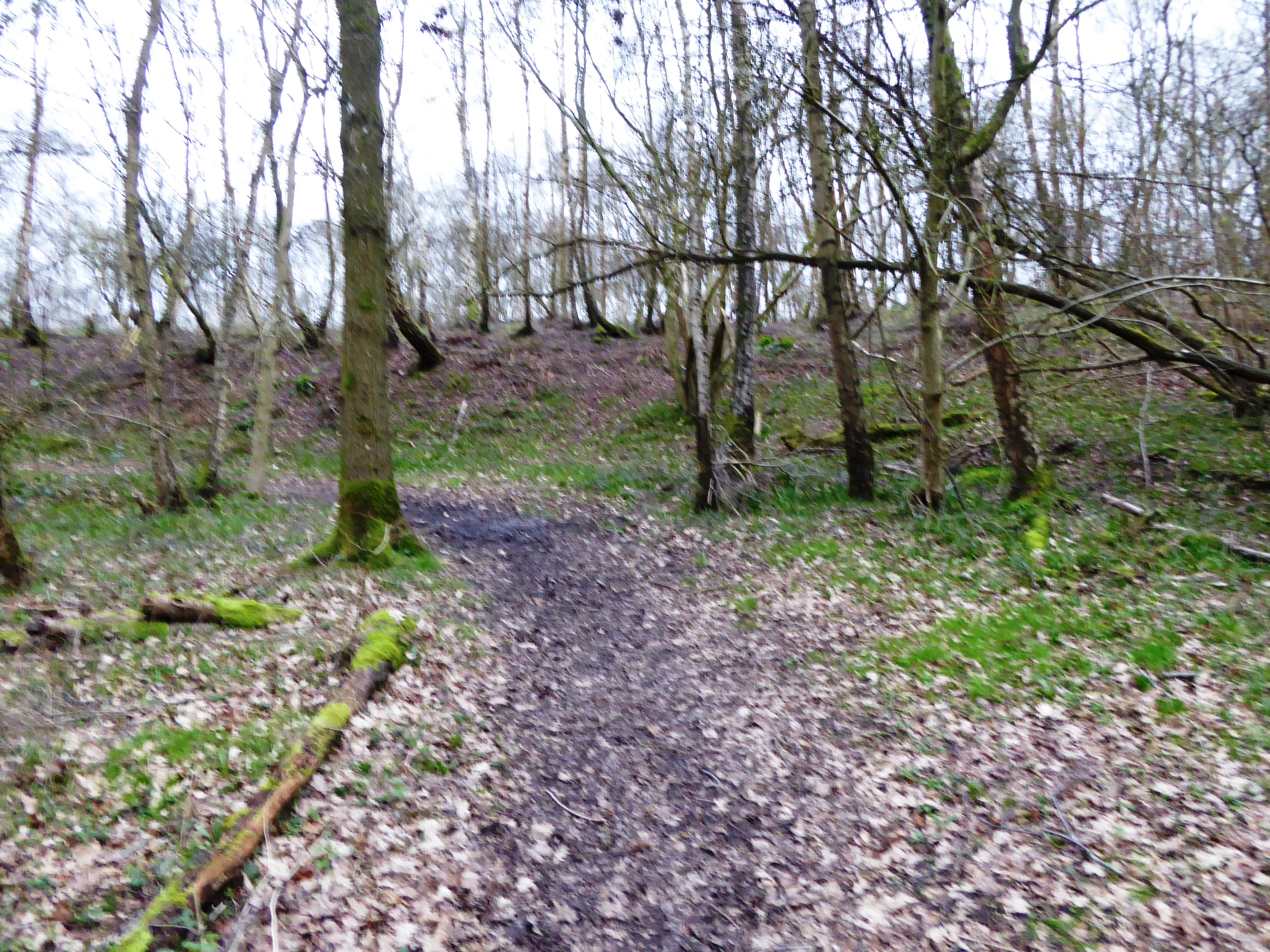
The woodland is characterized by its diverse range of tree species, including oak, beech, ash, and birch. These majestic trees create a dense canopy, providing shelter and habitat for a variety of wildlife. Visitors to Avenell's Copse can expect to see an array of bird species, such as woodpeckers, owls, and various songbirds. Squirrels, badgers, and foxes are also commonly spotted within the copse.

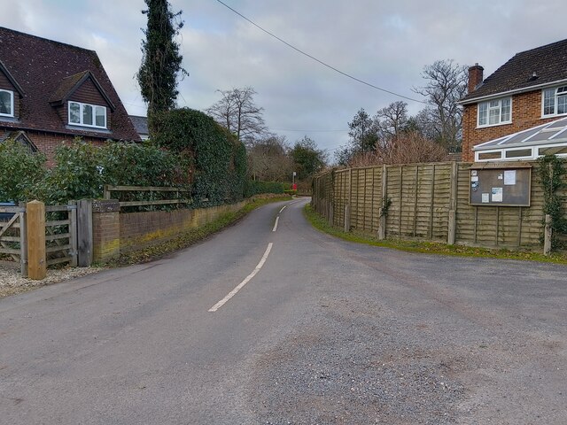
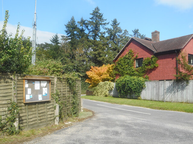
The woodland is crisscrossed by a network of well-maintained footpaths, allowing visitors to explore its natural beauty at their leisure. These paths wind through the trees, leading to open clearings and picturesque viewpoints. Avenell's Copse also features a small pond, which is home to frogs, newts, and other aquatic life.

The copse is managed by the local council, which ensures its preservation and maintenance. It is a designated Site of Special Scientific Interest (SSSI) due to its rich biodiversity and rare plant species. The council organizes guided walks and educational programs for visitors, promoting environmental awareness and conservation efforts.

Overall, Avenell's Copse offers a tranquil escape from the bustling city life, providing an opportunity to connect with nature and appreciate the beauty of Berkshire's woodlands.

If you have any feedback on the listing, please let us know in the comments section below.

Avenell's Copse Images

Images are sourced within 2km of 51.383724/-1.2414026 or Grid Reference SU5265. Thanks to Geograph Open Source API. All images are credited.

Hyde End Lane
Hyde End Lane
Parish Notices, Hyde End Lane Between Brimpton and Crookham is a group of houses around the junction of Crookham Common Road and Hyde End Lane. A Brimpton Parish Council notice board is on the back fence of a house on the corner.
Parish Notices, Hyde End Lane
Between Brimpton and Crookham is a group of houses around the junction of Crookham Common Road and Hyde End Lane. A Brimpton Parish Council notice board is on the back fence of a house on the corner.
Old Pit on Crookham Common One of several small ponds on the common near here. I don't know why the map doesn't show this area as access land like the rest of the common, because on the ground there is no distinction.
Old Pit on Crookham Common
One of several small ponds on the common near here. I don't know why the map doesn't show this area as access land like the rest of the common, because on the ground there is no distinction.
The Edge of the Common A path beside Bury's Bank Road which is the northern boundary of Crookham Common along here.
The Edge of the Common
A path beside Bury's Bank Road which is the northern boundary of Crookham Common along here.
Grazed pasture on Chamberhouse Farm, Thatcham Although Chamberhouse Farm is no longer a working farm the fields are rented out and it is good to see cattle grazing the damp meadows.
Grazed pasture on Chamberhouse Farm, Thatcham
Although Chamberhouse Farm is no longer a working farm the fields are rented out and it is good to see cattle grazing the damp meadows.
Towing path by Kennet and Avon Canal Looking east towards Thatcham Station on the Kennet and Avon Canal towing path.
Towing path by Kennet and Avon Canal
Looking east towards Thatcham Station on the Kennet and Avon Canal towing path.
Towing path by Kennet and Avon Canal Looking east towards Thatcham Station on the Kennet and Avon Canal towing path.
Towing path by Kennet and Avon Canal
Looking east towards Thatcham Station on the Kennet and Avon Canal towing path.
Canadian geese on the Kennet and Avon Canal Canadian geese (and some goslings on the bank) on the Kennet and Avon Canal.
Canadian geese on the Kennet and Avon Canal
Canadian geese (and some goslings on the bank) on the Kennet and Avon Canal.
Painting the Kennet and Avon Canal An artist making the most of the lush green scenery by painting the Kennet and Avon Canal on an easel.
Painting the Kennet and Avon Canal
An artist making the most of the lush green scenery by painting the Kennet and Avon Canal on an easel.
Towing path by Kennet and Avon Canal Looking east towards Thatcham Station on the Kennet and Avon Canal towing path.
Towing path by Kennet and Avon Canal
Looking east towards Thatcham Station on the Kennet and Avon Canal towing path.
Towing path by Kennet and Avon Canal Looking east towards Thatcham Station on the Kennet and Avon Canal towing path.
Towing path by Kennet and Avon Canal
Looking east towards Thatcham Station on the Kennet and Avon Canal towing path.
Towing path by Kennet and Avon Canal Looking east towards Thatcham Station on the Kennet and Avon Canal towing path.
Towing path by Kennet and Avon Canal
Looking east towards Thatcham Station on the Kennet and Avon Canal towing path.
Swans by the Kennet and Avon Canal Two swans by the Kennet and Avon Canal.
Swans by the Kennet and Avon Canal
Two swans by the Kennet and Avon Canal.
Monkey Marsh Swingbridge Monkey Marsh Swingbridge (number 44) on the Kennet and Avon Canal between Thatcham Station and Newbury.
Monkey Marsh Swingbridge
Monkey Marsh Swingbridge (number 44) on the Kennet and Avon Canal between Thatcham Station and Newbury.
Monkey Marsh Swingbridge Monkey Marsh Swingbridge (number 44) on the Kennet and Avon Canal between Thatcham Station and Newbury.
Monkey Marsh Swingbridge
Monkey Marsh Swingbridge (number 44) on the Kennet and Avon Canal between Thatcham Station and Newbury.
Towing path by Kennet and Avon Canal Looking east towards Thatcham Station on the Kennet and Avon Canal towing path.
Towing path by Kennet and Avon Canal
Looking east towards Thatcham Station on the Kennet and Avon Canal towing path.
Kennet and Avon Canal from Monkey Marsh Swingbridge Looking west along the Kennet and Avon Canal from Monkey Marsh Swingbridge.
Kennet and Avon Canal from Monkey Marsh Swingbridge
Looking west along the Kennet and Avon Canal from Monkey Marsh Swingbridge.
Kennet and Avon Canal from Monkey Marsh Swingbridge Looking east along the Kennet and Avon Canal from Monkey Marsh Swingbridge.
Kennet and Avon Canal from Monkey Marsh Swingbridge
Looking east along the Kennet and Avon Canal from Monkey Marsh Swingbridge.
Show me another place!

Avenell's Copse is located at Grid Ref: SU5265 (Lat: 51.383724, Lng: -1.2414026)

Unitary Authority: West Berkshire

Police Authority: Thames Valley

What 3 Words

///fuzzy.painter.sues. Near Thatcham, Berkshire

Related Wikis

A.F.C. Aldermaston

A.F.C. Aldermaston is a football club based in Aldermaston, Berkshire, England. Affiliated to the Berks & Bucks Football Association, the club are currently...

Monkey Marsh Lock

Monkey Marsh Lock is a lock on the Kennet and Avon Canal, at Thatcham, Berkshire, England. Monkey Marsh Lock was built between 1718 and 1723 under the...

Crookham, Berkshire

Crookham is a dispersed hamlet in the English county of Berkshire, and part of the civil parish of Thatcham. == Geography == The settlement lies near...

Thatcham railway station

Thatcham railway station serves the market town of Thatcham in Berkshire, England. It is 49 miles 45 chains (49.56 mi; 79.8 km) measured from the zero...

Colthrop Lock

Colthrop Lock is a lock on the Kennet and Avon Canal, at Thatcham, Berkshire, England. Colthrop Lock was built between 1718 and 1723 under the supervision...

Bowdown and Chamberhouse Woods

Bowdown and Chamberhouse Woods is a 67.9-hectare (168-acre) biological Site of Special Scientific Interest south of Thatcham in Berkshire. An area of 55...

Hyde End, Berkshire

Hyde End is a small hamlet in Berkshire, England, and part of the civil parish of Brimpton. The settlement lies south of the A4 road and approximately...

Kennet School

Kennet School is an academy secondary school in Thatcham, Berkshire, England. In 2011, Kennet was the highest achieving state school in West Berkshire...

Nearby Amenities

Located within 500m of 51.383724,-1.2414026
Power: pole
Lat/Long: 51.3857662/-1.246385
Power: pole
Lat/Long: 51.3855185/-1.2446523
Power: pole
Lat/Long: 51.3852641/-1.2428445
Power: pole
Lat/Long: 51.3850833/-1.2405485
Power: pole
Lat/Long: 51.3846782/-1.2360424
The data included in this document is from www.openstreetmap.org. The data is made available under ODbL.

Have you been to Avenell's Copse?

Leave your review of Avenell's Copse below (or comments, questions and feedback).