Bradshaw Wood
Wood, Forest in Derbyshire Bolsover
England
Bradshaw Wood

Bradshaw Wood is a picturesque woodland located in Derbyshire, England. Covering an area of approximately 100 acres, it is a popular destination for nature enthusiasts and outdoor lovers. The wood is situated on the outskirts of the small village of Bradshaw, surrounded by rolling hills and beautiful countryside.
The wood is predominantly composed of deciduous trees, such as oak, beech, and ash, which create a vibrant display of colors during the autumn season. The canopy of the wood provides a sheltered habitat for a diverse range of flora and fauna, including bluebells, wild garlic, and various bird species.
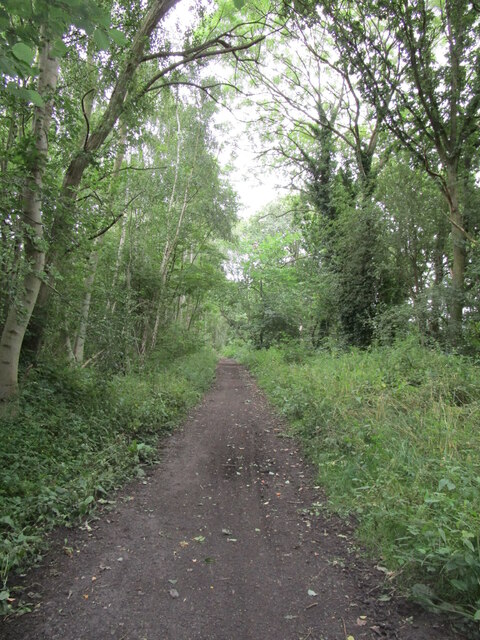
There are several walking trails that wind through the wood, allowing visitors to explore its natural beauty. These trails are well-maintained and suitable for all ages and fitness levels. Along the way, you may encounter old stone walls, remnants of the wood's history as a former grazing area.
Bradshaw Wood offers a tranquil and peaceful escape from the hustle and bustle of everyday life. It is a haven for wildlife, providing a habitat for deer, rabbits, and squirrels. Birdwatchers will also appreciate the opportunity to spot woodland birds, such as woodpeckers and owls.
The wood is easily accessible, with a small car park nearby for visitors. It is a popular spot for picnics and family outings, with designated areas for relaxation and enjoying the natural surroundings. Whether you're looking for a leisurely stroll or a peaceful retreat, Bradshaw Wood is a perfect destination for nature lovers seeking to immerse themselves in the beauty of Derbyshire's woodlands.
If you have any feedback on the listing, please let us know in the comments section below.
Bradshaw Wood Images
Images are sourced within 2km of 53.214157/-1.2120501 or Grid Reference SK5268. Thanks to Geograph Open Source API. All images are credited.


Bradshaw Wood is located at Grid Ref: SK5268 (Lat: 53.214157, Lng: -1.2120501)
Administrative County: Derbyshire
District: Bolsover
Police Authority: Derbyshire
What 3 Words
///bright.ambition.positives. Near Shirebrook, Derbyshire
Nearby Locations
Related Wikis

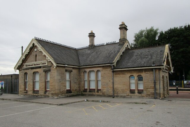
Shirebrook North railway station
Shirebrook North railway station was a railway station serving the town of Shirebrook in Derbyshire, England. It was on the Lancashire, Derbyshire and...

Langwith Junction
Langwith Junction is a suburb of Shirebrook, in Derbyshire, England. Its name derives from the former Shirebrook North railway station, which was on the...
Nether Langwith
Nether Langwith is a village and civil parish, in the Bassetlaw district of Nottinghamshire, England. It is located 9 miles (14 km) east of Chesterfield...
Shirebrook Town F.C.
Shirebrook Town Football Club are a semi-professional football club based in Shirebrook, England. They are currently members of Northern Counties East...
F.C. Bolsover
Football Club Bolsover was a football club based in Bolsover, Derbyshire, England. They played at Shirebrook Town's Langwith Road ground. == History... ==
Langwith railway station
Langwith is a former railway station in the Langwith Maltings area of Langwith in north eastern Derbyshire, England. == Context == The station was built...

Shirebrook
Shirebrook is a town in the Bolsover district in Derbyshire, England. Close to the boundaries with the districts of Mansfield and Bassetlaw of Nottinghamshire...

Shirebrook Academy
Shirebrook Academy (formerly Shirebrook School) is a coeducational secondary school with academy status, located in Shirebrook in the county of Derbyshire...
Nearby Amenities
Located within 500m of 53.214157,-1.2120501Have you been to Bradshaw Wood?
Leave your review of Bradshaw Wood below (or comments, questions and feedback).