Gotham Hill Wood

Wood, Forest in Nottinghamshire Rushcliffe

England

Gotham Hill Wood

Power Station view from West Leake Lane The power station in question is at Ratcliffe-on-Soar
Power Station view from West Leake Lane Credit: Neil Theasby

Gotham Hill Wood is a picturesque woodland located in Nottinghamshire, England. Covering an area of approximately 50 hectares, it is situated near the village of Gotham, south of Nottingham. The wood is part of the wider Sherwood Forest, a renowned ancient forest in the region.

Gotham Hill Wood is characterized by its diverse range of tree species, including oak, beech, birch, and conifers. These trees create a dense canopy, providing a habitat for a variety of wildlife. Visitors can expect to encounter numerous bird species, such as woodpeckers, owls, and thrushes, as well as mammals like foxes, badgers, and deer.

The wood offers several walking trails, allowing visitors to explore its natural beauty. The paths wind through the woodland, passing by tranquil ponds, meadows, and vibrant wildflower displays during the spring and summer months. The wood also features a designated picnic area, perfect for enjoying a leisurely lunch amidst the peaceful surroundings.

Gotham Hill Wood is not only a haven for nature enthusiasts but also holds historical significance. It is believed to have been part of the ancient royal hunting grounds and has a rich cultural heritage associated with the legend of Robin Hood. The wood provides an opportunity for visitors to immerse themselves in the folklore and legends that surround Sherwood Forest.

In conclusion, Gotham Hill Wood is a charming and biodiverse woodland in Nottinghamshire. With its stunning scenery, abundant wildlife, and historical connections, it offers a delightful experience for nature lovers and those interested in the region's heritage.

If you have any feedback on the listing, please let us know in the comments section below.

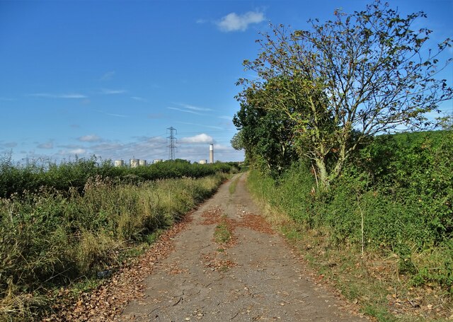
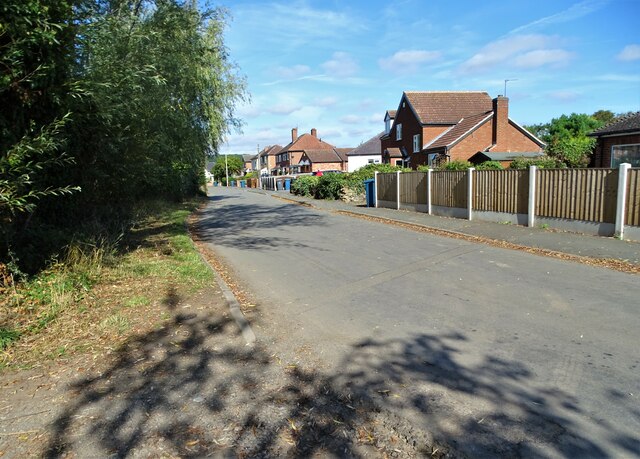
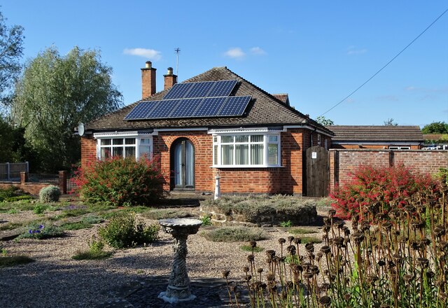
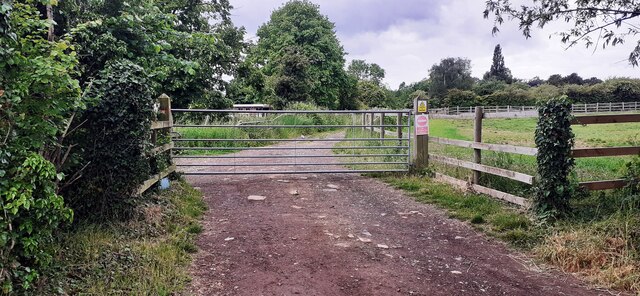
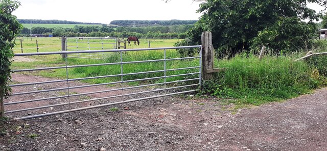
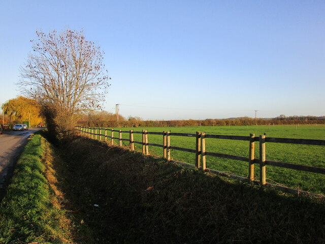
Gotham Hill Wood Images

Images are sourced within 2km of 52.870774/-1.2243611 or Grid Reference SK5230. Thanks to Geograph Open Source API. All images are credited.

Power Station view from West Leake Lane The power station in question is at Ratcliffe-on-Soar
Power Station view from West Leake Lane
The power station in question is at Ratcliffe-on-Soar
Track south of Stonepit Farm It is also a public footpath that lads eventually to Ratcliffe on Soar. You can just see the power station ahead.
Track south of Stonepit Farm
It is also a public footpath that lads eventually to Ratcliffe on Soar. You can just see the power station ahead.
Moor Lane, Gotham
Moor Lane, Gotham
Bungalow on Moor Lane, Gotham
Track to farmland from west side of Moor Road
Horses in field at junction of farmland tracks SW of Moor Lane
Drain alongside Moor Lane, Gotham
Lane on Gotham Moor This well surfaced lane is not a public road for vehicles, but is classified as a public bridleway.
Lane on Gotham Moor
This well surfaced lane is not a public road for vehicles, but is classified as a public bridleway.
Commemorative panel, Leake Road bus stop, Gotham This is the stop outside the former South Notts bus company garage which closed in March 2021, with operation being transferred to Nottingham City Transport's other garages. It records the whole history of South Notts from its formation in 1926. See Wikipedia <span class="nowrap"><a title="https://en.wikipedia.org/wiki/South_Notts_Bus_Company#" rel="nofollow ugc noopener" href="https://en.wikipedia.org/wiki/South_Notts_Bus_Company#">Link</a><img style="margin-left:2px;" alt="External link" title="External link - shift click to open in new window" src="https://s1.geograph.org.uk/img/external.png" width="10" height="10"/></span>
Commemorative panel, Leake Road bus stop, Gotham
This is the stop outside the former South Notts bus company garage which closed in March 2021, with operation being transferred to Nottingham City Transport's other garages. It records the whole history of South Notts from its formation in 1926. See Wikipedia LinkExternal link
Please be on your bus behaviour This South Notts bus is running to East Leake Academy to pick up students, with a suitable exhortation on the destination display – which will doubtless be completely disregarded!

Bus 642 is a Scania N230UD with ADL bodywork, new in 2015.
Please be on your bus behaviour
This South Notts bus is running to East Leake Academy to pick up students, with a suitable exhortation on the destination display – which will doubtless be completely disregarded! Bus 642 is a Scania N230UD with ADL bodywork, new in 2015.
Crop Field near Winking Hill
Field Entrance near Stonepit Farm Pictured from the nearby public footpath.
Field Entrance near Stonepit Farm
Pictured from the nearby public footpath.
Footpath Approaching Kegworth Road The pair of large stone blocks ahead create a formidable barrier against potential miscreant off-roaders.
Footpath Approaching Kegworth Road
The pair of large stone blocks ahead create a formidable barrier against potential miscreant off-roaders.
Works Access Road Driveway leading to Hardstaff, Hartshorne Group and Readypower. These companies deal with heavy machinery for both road and rail operations.
Works Access Road
Driveway leading to Hardstaff, Hartshorne Group and Readypower. These companies deal with heavy machinery for both road and rail operations.
Cyclist Takes a Break This elderly chap has ridden from out Loughborough and is having a rest at a quiet crossroads near New Kingston.
Cyclist Takes a Break
This elderly chap has ridden from out Loughborough and is having a rest at a quiet crossroads near New Kingston.
A453 at the entrance to Ratcliffe power station
Kegworth Road towards Gotham
Towards Cottagers Hill
Show me another place!

Gotham Hill Wood is located at Grid Ref: SK5230 (Lat: 52.870774, Lng: -1.2243611)

Administrative County: Nottinghamshire

District: Rushcliffe

Police Authority: Nottinghamshire

What 3 Words

///resonates.prank.warns. Near Gotham, Nottinghamshire

Related Wikis

Gotham, Nottinghamshire

Gotham ( GOHT-əm) is a village in Nottinghamshire, England, with a population of about 1,600, measured at 1,563 in the 2011 census, and 1,569 in the 2021...
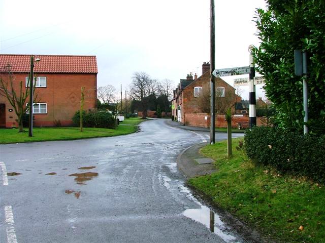
Thrumpton

Thrumpton is a village and civil parish in Nottinghamshire, England. At the time of the 2001 census it had a population of 152, increasing to 165 at the...

St Lawrence's Church, Gotham

St. Lawrence's Church, Gotham is a Grade I listed parish church in the Church of England in Gotham, Nottinghamshire. It is part of an informal grouping...

Trent Valley Way

The Trent Valley Way is a waymarked long-distance footpath in England following the River Trent and its valley in the counties of Nottinghamshire and...

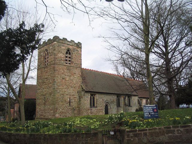
All Saints Church, Thrumpton

All Saints’ Church, Thrumpton is a Grade II* listed parish church in the Church of England in Thrumpton, Nottinghamshire. A stone font in the churchyard...

Thrumpton Hall

Thrumpton Hall is an English country house in the village of Thrumpton near Nottingham. It operated as a wedding venue until November 2020. == History... ==

St George's Church, Barton in Fabis

St George's Church is a parish church in the Church of England in Barton in Fabis, Nottinghamshire. == History == The church is medieval and is a Grade...

Barton in Fabis

Barton in Fabis is a village and civil parish in the Rushcliffe district of Nottinghamshire. It has a population of about 250, being measured at 266 in...

Nearby Amenities

Located within 500m of 52.870774,-1.2243611
Power: tower
Source: OS OpenData VectorDistrict
Lat/Long: 52.8731471/-1.2241211
Power: tower
Source: OS OpenData VectorDistrict
Lat/Long: 52.8746592/-1.2253117
Location Transition: yes
Power: tower
Lat/Long: 52.8696652/-1.2309281
Power: tower
Source: OS OpenData VectorDistrict
Lat/Long: 52.8713972/-1.2275646
Power: tower
Source: OS OpenData VectorDistrict
Lat/Long: 52.8732119/-1.229206
Barrier: yes
Source: GPS
Lat/Long: 52.871938/-1.2191468
Barrier: kissing_gate
Lat/Long: 52.8719239/-1.2191499
Gotham Hill
Natural: peak
Lat/Long: 52.8702251/-1.2250863
Power: pole
Lat/Long: 52.8706646/-1.2313807
Power: pole
Lat/Long: 52.8701174/-1.2316811
Power: pole
Lat/Long: 52.8714029/-1.2309355
The data included in this document is from www.openstreetmap.org. The data is made available under ODbL.

Have you been to Gotham Hill Wood?

Leave your review of Gotham Hill Wood below (or comments, questions and feedback).