Easton's Plantation

Wood, Forest in Berkshire South Oxfordshire

England

Easton's Plantation

Line up at Didcot A line up of BR blue liveried locomotives.  Left to right: GWR 6023 'King Edward II'; LNER A4 60007 'Sir Nigel Gresley'; LNER A1 60163 'Tornado'.
Line up at Didcot Credit: Bob Walters

Easton's Plantation is a picturesque woodland area located in Berkshire, England. Nestled in the heart of the county, this plantation is renowned for its lush greenery, serene atmosphere, and diverse range of plant and animal species.

Covering a vast area, Easton's Plantation is a thriving forest that showcases the natural beauty of the Berkshire landscape. The plantation is predominantly composed of deciduous trees, including oak, beech, and birch, which provide a vibrant display of colors throughout the seasons. The dense foliage provides ample shade, making it an ideal spot for leisurely walks and picnics.

The plantation is home to an array of wildlife, including deer, foxes, rabbits, and various bird species, making it a popular destination for nature enthusiasts and birdwatchers. The tranquil environment offers a sanctuary for these creatures, allowing visitors to observe them in their natural habitat.

Easton's Plantation is also known for its well-maintained walking trails, which wind through the forest, offering visitors the opportunity to explore its hidden treasures. The trails are suitable for all levels of fitness, with options for both short strolls and longer hikes. Along the way, visitors can discover enchanting streams, charming bridges, and captivating viewpoints that provide breathtaking vistas of the surrounding countryside.

With its serene atmosphere and abundant natural beauty, Easton's Plantation in Berkshire is a haven for those seeking solace in nature. Whether you are a nature lover, a photographer, or simply someone looking to escape the hustle and bustle of everyday life, this plantation offers a tranquil retreat that is sure to leave a lasting impression.

If you have any feedback on the listing, please let us know in the comments section below.

Easton's Plantation Images

Images are sourced within 2km of 51.616248/-1.2512691 or Grid Reference SU5191. Thanks to Geograph Open Source API. All images are credited.

Line up at Didcot A line up of BR blue liveried locomotives.  Left to right: GWR 6023 'King Edward II'; LNER A4 60007 'Sir Nigel Gresley'; LNER A1 60163 'Tornado'.
Line up at Didcot
A line up of BR blue liveried locomotives. Left to right: GWR 6023 'King Edward II'; LNER A4 60007 'Sir Nigel Gresley'; LNER A1 60163 'Tornado'.
Path heading up to the Great Western Park From Cow Lane the newly initiated public footpath heading up to the Great Western Park housing development
Path heading up to the Great Western Park
From Cow Lane the newly initiated public footpath heading up to the Great Western Park housing development
Oxford Road at Didcot Railway Centre
B4016 nearing Bow Bridge
Looking from the War Memorial Gardens towards Blenheim Close
Didcot Fire Station: late March 2022
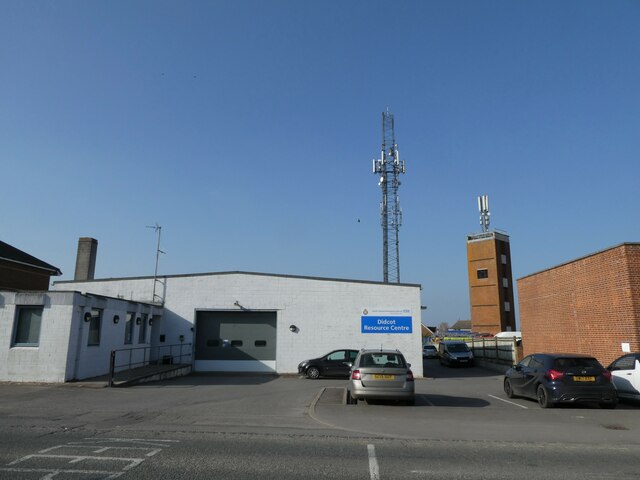
Didcot Ambulance Resource Centre: late March 2022
Looking eastwards along The Broadway
Didcot Bowls Club: late March 2022
Didcot War Memorial Gardens: late March 2022
Car park at Didcot Civic Centre: late March 2022
Jubilee postbox Postbox along Haydon Road in Didcot with a decoration in celebration of The Queen's Platinum Jubilee
Jubilee postbox
Postbox along Haydon Road in Didcot with a decoration in celebration of The Queen's Platinum Jubilee
Queen's Jubilee Post box decoration in celebration of the Queen's Platinum Jubilee along Haydon Road in Didcot
Queen's Jubilee
Post box decoration in celebration of the Queen's Platinum Jubilee along Haydon Road in Didcot
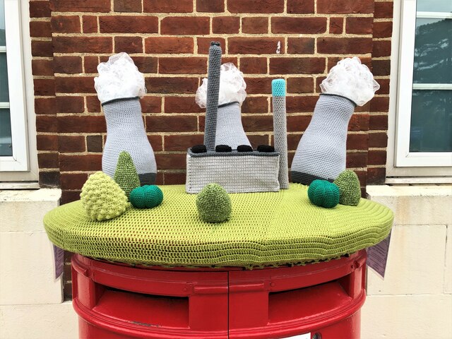
Smoky Towers Postbox decoration outside the old post office along Broadway Didcot
Smoky Towers
Postbox decoration outside the old post office along Broadway Didcot
Grandad's Smoky Towers Postbox decoration called Grandad's Smoky Towers along Broadway, Didcot.
Grandad's Smoky Towers
Postbox decoration called Grandad's Smoky Towers along Broadway, Didcot.
Track and field north of Didcot
Grassland towards Moor Ditch North of Didcot
Grassland towards Moor Ditch
North of Didcot
Milk Tanker at the Railway Centre One of Didcot Railway Centre's collection of preserved freight wagons.
Milk Tanker at the Railway Centre
One of Didcot Railway Centre's collection of preserved freight wagons.
Show me another place!

Easton's Plantation is located at Grid Ref: SU5191 (Lat: 51.616248, Lng: -1.2512691)

Administrative County: Oxfordshire

District: South Oxfordshire

Police Authority: Thames Valley

What 3 Words

///landscape.farmland.disposal. Near Didcot, Oxfordshire

Nearby Locations

Easton's Plantation

Related Wikis

Didcot Railway Centre

Didcot Railway Centre is a railway museum and preservation engineering site in Didcot, Oxfordshire, England. The site was formerly a Great Western Railway...

Didcot Parkway railway station

Didcot Parkway is a railway station serving Didcot, a town in Oxfordshire, England. The station was opened as Didcot on 12 June 1844 and was renamed Didcot...

Didcot Town F.C.

Didcot Town Football Club are a football club based in Didcot in Oxfordshire, England. The club is affiliated to the Berks & Bucks Football Association...

Vauxhall Barracks

Vauxhall Barracks is a British Army installation in Didcot, Oxfordshire. It is set to close in 2034. == History == The barracks were established during...

Nearby Amenities

Located within 500m of 51.616248,-1.2512691
Operator: Network Rail
Railway: switch
Source: bing
Lat/Long: 51.6129625/-1.2463509
Operator: Network Rail
Railway: switch
Lat/Long: 51.6171723/-1.2469859
Operator: Network Rail
Railway: switch
Source: bing
Lat/Long: 51.6170142/-1.2469217
Railway: buffer_stop
Source: Bing
Lat/Long: 51.6180304/-1.2453945
Crossing
Crossing: unmarked
Kerb: lowered
Lat/Long: 51.6143742/-1.2502782
Traffic Signals
Traffic Signals Direction: backward
Lat/Long: 51.6142626/-1.2503684
Traffic Signals
Traffic Signals Direction: forward
Lat/Long: 51.6149111/-1.2504462
Traffic Calming: bump
Lat/Long: 51.6157815/-1.2552135
Traffic Calming: bump
Lat/Long: 51.6165381/-1.2566169
Bus Stop
Station Road
Bus: yes
Naptan AtcoCode: 340001125RBT
Naptan Bearing: W
Naptan CommonName: Station Road
Naptan Indicator: Roundabout Westbound
Naptan Landmark: Foxhall Road Roundabout
Naptan NaptanCode: oxfadgtd
Naptan Street: Station Road
Naptan Verified: no
Public Transport: platform
Source: naptan_import
Lat/Long: 51.6128136/-1.2496895
Bus Stop
Station Road
Bus: yes
Naptan AtcoCode: 340001125STN
Naptan Bearing: E
Naptan CommonName: Station Road
Naptan Indicator: Roundabout Eastbound
Naptan Landmark: Foxhall Road Roundabout
Naptan NaptanCode: oxfadgta
Naptan Street: Station Road
Naptan Verified: no
Public Transport: platform
Shelter: yes
Source: naptan_import
Lat/Long: 51.6128116/-1.2493941
Bus Stop
Foxhall Manor Park
Bus: yes
Naptan AtcoCode: 340001843OPE
Naptan Bearing: E
Naptan CommonName: Foxhall Manor Park
Naptan Indicator: Opposite
Naptan Landmark: Foxhall Manor Park
Naptan NaptanCode: oxfgjpwp
Naptan Street: Basil Hill Road
Naptan Verified: no
Public Transport: platform
Shelter: yes
Source: naptan_import
Lat/Long: 51.61645/-1.2548216
Bus Stop
Foxhall Manor Park
Bus: yes
Naptan AtcoCode: 340001843OSE
Naptan Bearing: W
Naptan CommonName: Foxhall Manor Park
Naptan Indicator: Outside
Naptan Landmark: Foxhall Manor Park
Naptan NaptanCode: oxfgjpwm
Naptan Street: Basil Hill Road
Naptan Verified: no
Public Transport: platform
Shelter: yes
Source: naptan_import
Lat/Long: 51.6164839/-1.2553047
Bus Stop
Lyndene Road
Bus: yes
Naptan AtcoCode: 340003044OUT
Naptan Bearing: W
Naptan BusStopType: CUS
Naptan CommonName: F'hall Manor Park E
Naptan Indicator: Outside
Naptan Landmark: Manor Park
Naptan NaptanCode: oxfawawa
Naptan Street: Basil Hill Road
Naptan Verified: no
Public Transport: platform
Shelter: no
Source: naptan_import
Lat/Long: 51.6154476/-1.2517086
Bus Stop
Southmead Industrial Park
Bus: yes
Naptan AtcoCode: 340003053SDL
Naptan Bearing: W
Naptan CommonName: Southmead Industrial Park
Naptan Indicator: Hawksworth Westbound
Naptan Landmark: The Cobden Centre
Naptan NaptanCode: oxfatwap
Naptan Street: Hawksworth
Naptan Verified: no
Public Transport: platform
Source: naptan_import
Lat/Long: 51.6199791/-1.249328
Operator: Network Rail
Railway: switch
Source: bing
Lat/Long: 51.6136131/-1.2469717
Operator: Network Rail
Railway: switch
Source: bing
Lat/Long: 51.6135131/-1.2468738
Railway: buffer_stop
Source: Bing
Lat/Long: 51.6145713/-1.2448849
Operator: Great Western Society
Railway: switch
Source: bing
Lat/Long: 51.6147367/-1.2458209
Operator: Great Western Society
Railway: switch
Lat/Long: 51.617144/-1.2459679
Operator: Great Western Society
Railway: switch
Lat/Long: 51.6168946/-1.246094
Operator: Great Western Society
Railway: switch
Lat/Long: 51.6143366/-1.2451698
Operator: Network Rail
Railway: switch
Lat/Long: 51.6145668/-1.2545586
Railway: buffer_stop
Source: Bing
Lat/Long: 51.613125/-1.2462072
Operator: Network Rail
Railway: switch
Source: bing
Lat/Long: 51.6135624/-1.2462981
Operator: Network Rail
Railway: switch
Source: bing
Lat/Long: 51.6138125/-1.24647
Operator: Network Rail
Railway: switch
Lat/Long: 51.6139066/-1.2525527
Operator: Network Rail
Railway: switch
Source: bing
Lat/Long: 51.6139674/-1.2474263
Railway: buffer_stop
Source: Bing
Lat/Long: 51.6142359/-1.2464368
Operator: Great Western Society
Railway: switch
Lat/Long: 51.6143858/-1.2454747
Operator: Network Rail
Railway: railway_crossing
Lat/Long: 51.6144023/-1.2538901
Operator: Network Rail
Railway: switch
Lat/Long: 51.6144142/-1.2542801
Operator: Network Rail
Railway: switch
Lat/Long: 51.6145337/-1.2545603
Operator: Network Rail
Railway: switch
Lat/Long: 51.6146503/-1.2550318
Operator: Network Rail
Railway: switch
Lat/Long: 51.6148955/-1.2562004
Operator: Network Rail
Railway: switch
Lat/Long: 51.6149766/-1.2565284
Operator: Network Rail
Railway: switch
Lat/Long: 51.6151386/-1.2573313
Operator: Network Rail
Railway: switch
Lat/Long: 51.6156131/-1.2467318
Operator: Network Rail
Railway: switch
Source: bing
Lat/Long: 51.6164467/-1.2470413
Operator: Network Rail
Railway: switch
Source: bing
Lat/Long: 51.6167044/-1.2470137
Operator: Network Rail
Railway: railway_crossing
Lat/Long: 51.6168969/-1.2471316
Operator: Network Rail
Railway: switch
Lat/Long: 51.6171624/-1.2469381
Operator: Network Rail
Railway: switch
Source: bing
Lat/Long: 51.6178674/-1.2463397
Operator: Network Rail
Railway: switch
Source: bing
Lat/Long: 51.6183727/-1.2458757
Disused Railway: buffer_stop
Source: Bing
Lat/Long: 51.6184352/-1.2455554
Operator: Network Rail
Railway: switch
Source: bing
Lat/Long: 51.6186737/-1.245721
Operator: Network Rail
Railway: switch
Lat/Long: 51.6152386/-1.2575722
Operator: Network Rail
Railway: switch
Lat/Long: 51.6147423/-1.2552664
Operator: Network Rail
Railway: switch
Lat/Long: 51.6149577/-1.2562686
Operator: Network Rail
Railway: switch
Lat/Long: 51.6150256/-1.2565423
Operator: Network Rail
Railway: switch
Lat/Long: 51.6154205/-1.2581267
Crossing
Crossing: uncontrolled
Crossing Island: yes
Kerb: lowered
Source: survey
Lat/Long: 51.6132706/-1.2510573
Crossing
Bicycle: yes
Crossing: unmarked
Kerb: lowered
Lat/Long: 51.6170764/-1.2576362
Operator: Great Western Society
Railway: switch
Lat/Long: 51.6146066/-1.2460105
Railway: level_crossing
Lat/Long: 51.6149664/-1.246308
Operator: Great Western Society
Railway: switch
Lat/Long: 51.6173821/-1.2459298
Operator: Great Western Society
Railway: switch
Lat/Long: 51.6169399/-1.2461935
Crossing Barrier: no
Railway: crossing
Lat/Long: 51.6142953/-1.2453956
Crossing Barrier: no
Railway: crossing
Lat/Long: 51.6147528/-1.2453054
Crossing Barrier: no
Railway: crossing
Lat/Long: 51.6147607/-1.2452547
Crossing Barrier: no
Railway: crossing
Source: Bing
Lat/Long: 51.6154181/-1.2463005
Operator: Great Western Society
Railway: switch
Source: Bing
Lat/Long: 51.6146784/-1.2451928
Bodmin Water Tank
Man Made: water_tower
Railway Supplies Steam: water
Lat/Long: 51.6150932/-1.2462968
Oxford Road
Public Transport: station
Railway: station
Railway Preserved: yes
Usage: tourism
Wheelchair: limited
Lat/Long: 51.6175522/-1.2453816
Railway: level_crossing
Lat/Long: 51.6149805/-1.246257
Tourism: picnic_site
Lat/Long: 51.6151869/-1.2451588
Operator: Great Western Society
Railway: switch
Source: bing
Lat/Long: 51.6160324/-1.2464055
Crossing
Crossing: uncontrolled
Crossing Island: yes
Kerb: lowered
Source: survey
Tactile Paving: yes
Lat/Long: 51.6131596/-1.2513901
Crossing
Crossing: uncontrolled
Crossing Island: yes
Kerb: lowered
Source: survey
Tactile Paving: yes
Lat/Long: 51.6132141/-1.2513528
Barrier: lift_gate
Lat/Long: 51.6122344/-1.2518132
Crossing
Bicycle: yes
Crossing: unmarked
Kerb: lowered
Lat/Long: 51.6166859/-1.2579925
Crossing
Crossing: unmarked
Kerb: lowered
Lat/Long: 51.6164529/-1.2550593
Crossing
Bicycle: yes
Crossing: unmarked
Crossing Island: yes
Kerb: lowered
Lat/Long: 51.6170306/-1.2571857
Crossing
Bicycle: yes
Crossing: unmarked
Crossing Island: yes
Kerb: lowered
Lat/Long: 51.6170096/-1.2570814
Crossing
Crossing: unmarked
Kerb: lowered
Lat/Long: 51.6140964/-1.2505084
Crossing
Crossing: unmarked
Crossing Markings: no
Source: Bing Streetside
Tactile Paving: yes
Lat/Long: 51.6156587/-1.2521155
Railway: buffer_stop
Source: Bing
Lat/Long: 51.6143255/-1.2483001
Railway: buffer_stop
Source: Bing
Lat/Long: 51.6143967/-1.2482337
Disused Railway: buffer_stop
Source: Bing
Lat/Long: 51.618881/-1.2454164
Railway: buffer_stop
Source: Bing
Lat/Long: 51.6144064/-1.2450757
Railway: buffer_stop
Source: Bing
Lat/Long: 51.6144746/-1.2449123
Burlescombe
Public Transport: station
Railway: station
Railway Preserved: yes
Usage: tourism
Lat/Long: 51.6174907/-1.2459129
Crossing Barrier: no
Railway: crossing
Lat/Long: 51.6142758/-1.2455296
Crossing Barrier: no
Railway: crossing
Lat/Long: 51.6154307/-1.2456457
Crossing Barrier: no
Railway: crossing
Lat/Long: 51.6154307/-1.2457115
Crossing Barrier: no
Railway: crossing
Lat/Long: 51.6154306/-1.2457773
Crossing Barrier: no
Railway: crossing
Lat/Long: 51.6154305/-1.2459089
Crossing Barrier: no
Railway: crossing
Lat/Long: 51.6154305/-1.2459747
Crossing Barrier: no
Railway: crossing
Lat/Long: 51.6154304/-1.2460405
Crossing Barrier: no
Railway: crossing
Lat/Long: 51.6154306/-1.2458431
Crossing Barrier: no
Railway: crossing
Lat/Long: 51.6154303/-1.2461392
Crossing Barrier: no
Railway: crossing
Lat/Long: 51.6148466/-1.2459216
Crossing Barrier: no
Railway: crossing
Lat/Long: 51.6148565/-1.2458925
Railway: buffer_stop
Source: Bing
Lat/Long: 51.6158291/-1.2463396
Didcot Halt
Operator: Didcot Railway Centre
Public Transport: station
Railway: station
Service: preserved
Usage: tourism
Wheelchair: limited
Lat/Long: 51.6143946/-1.2458686
Cycleway: asl
Lat/Long: 51.614887/-1.2504076
Manual Pharmacy
Addr City: Didcot
Addr Housename: Unit A, Accord Healthcare Distribution Centre
Addr Postcode: OX11 7WB
Addr Street: Collett
Opening Hours: Mo-Fr 09:00-17:30
Operator: Manual
Shop: outpost
Lat/Long: 51.6169127/-1.248765
DJ Matthews
Addr City: Didcot
Addr Housenumber: 10
Addr Postcode: OX11 7HP
Addr Street: Moorbrook
Payment Credit Cards: yes
Payment Debit Cards: yes
Shop: car_repair
Website: http://djmatthews.co.uk/
Lat/Long: 51.6202457/-1.2515276
Foxhall Junction
Railway: junction
Lat/Long: 51.6144915/-1.2542831
Didcot West Curve Junction
Note: Railway distance value is based on the way positions on british railway lines and Major Roads in Britain are described as a distance from a major place (I think in this case its based to Paddington but it varies as the Network layout becomes complex so
Note3: to confuse signs now placed at metric distances have text quoting Yards instead of meters its a very quite debate as to wether the road signs should be redone as even the driving test is dual unit'ed now...
Note 2: is more useful to think as a local relitive distance for many puposes) as most railways were built before 1973 Imperial units are common under a legacy agreement that was only to last about 40 years. So like new roads new railways are mesured in metric.
Railway: junction
Railway Position: 53 Miles 51 Chains
Source: bing - NESA PDF JAN2015
Lat/Long: 51.6171675/-1.246961
Man Made: chimney
Lat/Long: 51.6184571/-1.2533992
Traffic Calming: bump
Lat/Long: 51.6154689/-1.2540836
Traffic Calming: bump
Lat/Long: 51.6156958/-1.2537121
Traffic Calming: bump
Lat/Long: 51.6161937/-1.2551318
Traffic Calming: bump
Lat/Long: 51.6164078/-1.2560476
Traffic Calming: bump
Lat/Long: 51.6162204/-1.2567356
Traffic Calming: bump
Lat/Long: 51.61612/-1.2563608
Traffic Calming: bump
Lat/Long: 51.6159581/-1.2558022
Entrance: main
Lat/Long: 51.6149692/-1.2485078
Cycleway: asl
Lat/Long: 51.6142942/-1.2503428
Barrier: kerb
Lat/Long: 51.6180352/-1.2491532
Turning Circle
Lat/Long: 51.6125204/-1.2515985
Crossing
Crossing: uncontrolled
Crossing Ref: zebra
Lat/Long: 51.6123417/-1.2521386
Crossing
Crossing: uncontrolled
Crossing Ref: zebra
Lat/Long: 51.6123083/-1.2523678
Direction: 85
Generator Method: photovoltaic
Generator Output Electricity: yes
Generator Solar Modules: 66
Generator Source: solar
Generator Type: solar_photovoltaic_panel
Location: roof
Power: generator
Tilt: 10
Lat/Long: 51.6159452/-1.2459955
Direction: 265
Generator Method: photovoltaic
Generator Output Electricity: yes
Generator Solar Modules: 122
Generator Source: solar
Generator Type: solar_photovoltaic_panel
Location: roof
Power: generator
Tilt: 10
Lat/Long: 51.6160388/-1.2458757
Traffic Calming: hump
Lat/Long: 51.6159388/-1.2548284
Give Way
Lat/Long: 51.6160791/-1.2547057
Traffic Calming: bump
Lat/Long: 51.6153145/-1.2537117
Traffic Calming: bump
Lat/Long: 51.6157203/-1.2546756
Traffic Calming: bump
Lat/Long: 51.6158632/-1.2554857
Direction: 195
Generator Method: photovoltaic
Generator Output Electricity: yes
Generator Solar Modules: 126
Generator Source: solar
Generator Type: solar_photovoltaic_panel
Location: roof
Power: generator
Tilt: 10
Lat/Long: 51.6199032/-1.2552806
Barrier: kerb
Kerb: raised
Lat/Long: 51.6155254/-1.2519038
Barrier: bollard
Source: Bing Streetside
Lat/Long: 51.6155156/-1.2519298
Bus Stop
Lyndene Road
Bus: yes
Naptan AtcoCode: 340000450BHB
Naptan Bearing: E
Naptan CommonName: F'hall Manor Park E
Naptan Indicator: Opposite
Naptan Landmark: Foxhall Manor Park East
Naptan NaptanCode: oxfaptjp
Naptan Street: Basil Hill Road
Naptan Verified: no
Public Transport: platform
Shelter: no
Source: naptan_import
Lat/Long: 51.6154412/-1.2514921
The data included in this document is from www.openstreetmap.org. The data is made available under ODbL.

Have you been to Easton's Plantation?

Leave your review of Easton's Plantation below (or comments, questions and feedback).