Moss's Copse

Wood, Forest in Hampshire Winchester

England

Moss's Copse

Permissive path on Roman road at Wintershill Although shown as a straight line on the OS map, the public footpath actually dog legs to the left through the stile. The Roman road continues straight ahead which is also a permissive path.
Permissive path on Roman road at Wintershill Credit: Peter Facey

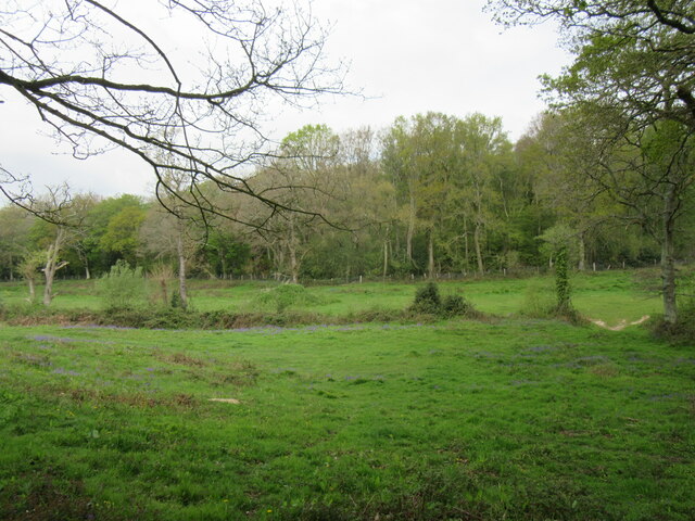
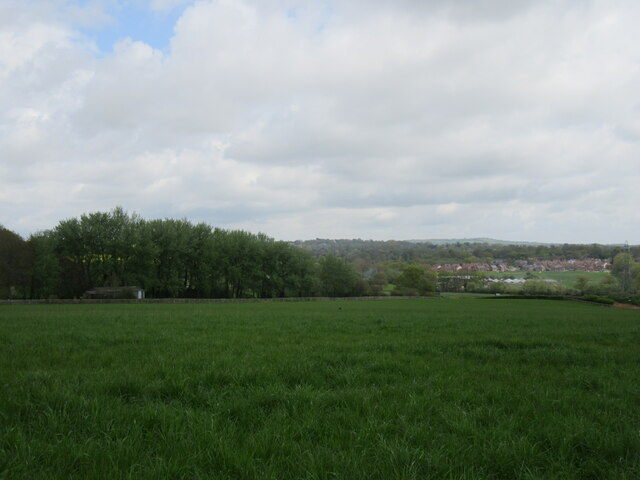
Moss's Copse is a picturesque woodland located in Hampshire, England. Stretching across approximately 50 acres, this enchanting forest is known for its diverse flora and fauna, making it a haven for nature lovers and wildlife enthusiasts alike.

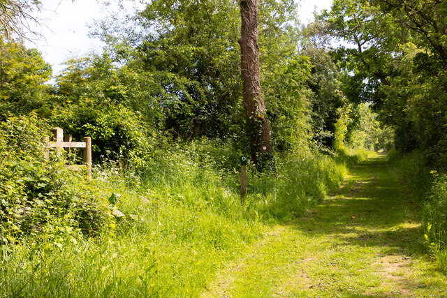
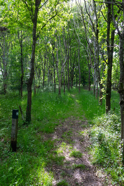
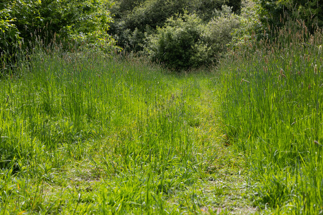
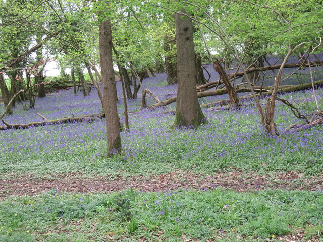
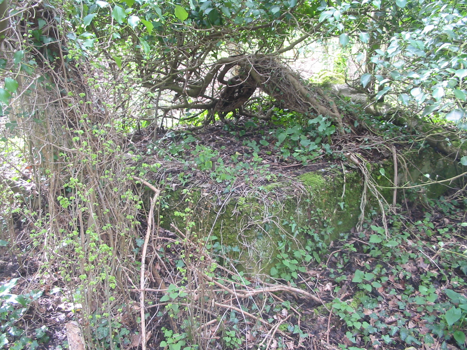
The copse is characterized by its dense canopy of trees, predominantly oak and beech, which provide a cool and shaded atmosphere during the summer months. The forest floor is covered in a thick layer of moss, hence the name, giving it a magical and ethereal appearance. This carpet of moss is interspersed with ferns, bluebells, and wildflowers, creating a vibrant and colorful landscape.

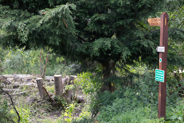
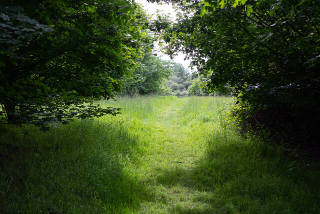
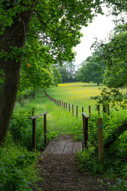
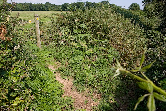
The woodland is crisscrossed with meandering footpaths, allowing visitors to explore its hidden corners and discover its hidden treasures. These paths lead to secluded clearings, babbling brooks, and small ponds, attracting a wide variety of bird species, including woodpeckers, owls, and warblers. Squirrels, rabbits, and deer are also commonly spotted within the copse, adding to its enchanting allure.

Moss's Copse is not only a haven for wildlife but also a popular destination for outdoor activities such as hiking, picnicking, and photography. The peaceful and tranquil atmosphere, combined with the beauty of nature, makes it an ideal spot for relaxation and rejuvenation.

With its diverse ecosystem and natural beauty, Moss's Copse is a true gem in the heart of Hampshire, offering visitors a chance to escape the hustle and bustle of everyday life and immerse themselves in the wonders of nature.

If you have any feedback on the listing, please let us know in the comments section below.

Moss's Copse Images

Images are sourced within 2km of 50.953803/-1.2641811 or Grid Reference SU5117. Thanks to Geograph Open Source API. All images are credited.

Permissive path on Roman road at Wintershill Although shown as a straight line on the OS map, the public footpath actually dog legs to the left through the stile. The Roman road continues straight ahead which is also a permissive path.
Permissive path on Roman road at Wintershill
Although shown as a straight line on the OS map, the public footpath actually dog legs to the left through the stile. The Roman road continues straight ahead which is also a permissive path.
The Wintershill Jubilee path A newly-made permissive path through the Wintershill estate to mark the platinum jubilee of Her Majesty Queen Elizabeth II. It runs from the intersection of the Roman road and Wintershill road, seen here, westwards up Winters Hill to Sciviers Lane. The path runs roughly parallel to Wintershill road, about 30 yards from it. Although the start here is not particularly attractive, it gets better further on.
The Wintershill Jubilee path
A newly-made permissive path through the Wintershill estate to mark the platinum jubilee of Her Majesty Queen Elizabeth II. It runs from the intersection of the Roman road and Wintershill road, seen here, westwards up Winters Hill to Sciviers Lane. The path runs roughly parallel to Wintershill road, about 30 yards from it. Although the start here is not particularly attractive, it gets better further on.
The Wintershill Jubilee path A newly-made permissive path through the Wintershill estate to mark the platinum jubilee of Her Majesty Queen Elizabeth II. It runs from the intersection of the Roman road and Wintershill road, westwards up Winters Hill to Sciviers Lane. The path runs roughly parallel to Wintershill road, about 30 yards from it
The Wintershill Jubilee path
A newly-made permissive path through the Wintershill estate to mark the platinum jubilee of Her Majesty Queen Elizabeth II. It runs from the intersection of the Roman road and Wintershill road, westwards up Winters Hill to Sciviers Lane. The path runs roughly parallel to Wintershill road, about 30 yards from it
The Wintershill Jubilee path A newly-made permissive path through the Wintershill estate to mark the platinum jubilee of Her Majesty Queen Elizabeth II. It runs from the intersection of the Roman road and Wintershill road, seen here, westwards up Winters Hill to Sciviers Lane. The path runs roughly parallel to Wintershill road, about 30 yards from it.
The Wintershill Jubilee path
A newly-made permissive path through the Wintershill estate to mark the platinum jubilee of Her Majesty Queen Elizabeth II. It runs from the intersection of the Roman road and Wintershill road, seen here, westwards up Winters Hill to Sciviers Lane. The path runs roughly parallel to Wintershill road, about 30 yards from it.
The Wintershill Jubilee path With buttercups. A newly-made permissive path through the Wintershill estate to mark the platinum jubilee of Her Majesty Queen Elizabeth II. It runs from the intersection of the Roman road and Wintershill road, seen here, westwards up Winters Hill to Sciviers Lane. The path runs roughly parallel to Wintershill road, about 30 yards from it. A public footpath runs off-picture to the right from here through the centre of the estate.
The Wintershill Jubilee path
With buttercups. A newly-made permissive path through the Wintershill estate to mark the platinum jubilee of Her Majesty Queen Elizabeth II. It runs from the intersection of the Roman road and Wintershill road, seen here, westwards up Winters Hill to Sciviers Lane. The path runs roughly parallel to Wintershill road, about 30 yards from it. A public footpath runs off-picture to the right from here through the centre of the estate.
Esso pipeline works crossing Wintershill Road Aerial. The pipeline here runs diagonally across the road (but left to right in this photo). There are deep excavations in the two works compounds seen in the photo to facilitate an auger boring operation. The launch area is at right and the reception area at left.
Esso pipeline works crossing Wintershill Road
Aerial. The pipeline here runs diagonally across the road (but left to right in this photo). There are deep excavations in the two works compounds seen in the photo to facilitate an auger boring operation. The launch area is at right and the reception area at left.
Reception area for auger boring under Wintershill Road Aerial. Looking vertically down into the deep excavation on the northeast side which is the reception area of the auger boring operation. Something is seen sticking out of the soil near the bottom of the escavation. However, his does not look like the usual ( <a href="https://www.geograph.org.uk/photo/7173777">SU6227 : One of the steel pipes</a>) 323.9 mm diameter steel pipe, so I am assuming it is slightly larger and the real pipe will be threaded through it. That remains to be seen.
Reception area for auger boring under Wintershill Road
Aerial. Looking vertically down into the deep excavation on the northeast side which is the reception area of the auger boring operation. Something is seen sticking out of the soil near the bottom of the escavation. However, his does not look like the usual ( SU6227 : One of the steel pipes) 323.9 mm diameter steel pipe, so I am assuming it is slightly larger and the real pipe will be threaded through it. That remains to be seen.
Launch area for auger boring under Wintershill Road Aerial. This is the deep excavation in the compound on the southwest side which is the launch area of the auger boring operation. The blue machine sitting at the bottom of the excavation may be a hydraulic boring machine. For the other end of this hole see <a href="https://www.geograph.org.uk/photo/7178408">SU5318 : Reception area for auger boring under Wintershill Road</a>. The three items at ground level on the left are, top to bottom: a diesel powered electric generator or hydraulic pump (not sure which), an electric generator and welding kit, and an air compressor.

For a wider view see <a title="https://www.geograph.org.uk/photo/7178951" href="https://www.geograph.org.uk/photo/7178951">Link</a>.
Launch area for auger boring under Wintershill Road
Aerial. This is the deep excavation in the compound on the southwest side which is the launch area of the auger boring operation. The blue machine sitting at the bottom of the excavation may be a hydraulic boring machine. For the other end of this hole see SU5318 : Reception area for auger boring under Wintershill Road. The three items at ground level on the left are, top to bottom: a diesel powered electric generator or hydraulic pump (not sure which), an electric generator and welding kit, and an air compressor. For a wider view see Link.
Launch area for auger boring under Winstershill Road A works compound of the Esso pipeline laying project 2022. Some of the helical augers can be seen beyond the yellow excavator.
Launch area for auger boring under Winstershill Road
A works compound of the Esso pipeline laying project 2022. Some of the helical augers can be seen beyond the yellow excavator.
Launch area for auger boring under Wintershill Road Aerial.
Launch area for auger boring under Wintershill Road
Aerial.
Armadillo security device at Wintershill Road works Four of these devices were deployed by PID Systems ( <span class="nowrap"><a title="https://www.pid-systems.co.uk/" rel="nofollow ugc noopener" href="https://www.pid-systems.co.uk/">Link</a><img style="margin-left:2px;" alt="External link" title="External link - shift click to open in new window" src="https://s1.geograph.org.uk/img/external.png" width="10" height="10"/></span> ) to protect the equipment used in the Esso pipeline laying works, which were unattended on Sundays. They relay CCTV by 4G to a central control room.
Armadillo security device at Wintershill Road works
Four of these devices were deployed by PID Systems ( LinkExternal link ) to protect the equipment used in the Esso pipeline laying works, which were unattended on Sundays. They relay CCTV by 4G to a central control room.
Launch area compound for auger boring operation at Wintershill Road Aerial. Well, Esso had said they would use pipe pushing here, but upon examination of this photo I think they were using auger boring. Esso have subsequently confirmed this. The augers can be seen in the blue racks just below the excavator in this photo. Also to be seen by their shadows are the four Armadillo security devices (<a title="https://www.geograph.org.uk/photo/7178882" href="https://www.geograph.org.uk/photo/7178882">Link</a> ). Going anticlockwise from the deep excavation in this photo: The light blue thing is a diesel powered hydraulic pump (I think), the darker blue thing is an electric generator and welding equipment, the yellow thing is an air compressor. The blue thing just above the arm of the excavator may possibly be a concrete pump. Then there is a Cat 325F excavator, the helical augers already mentioned, and a dump truck.
Launch area compound for auger boring operation at Wintershill Road
Aerial. Well, Esso had said they would use pipe pushing here, but upon examination of this photo I think they were using auger boring. Esso have subsequently confirmed this. The augers can be seen in the blue racks just below the excavator in this photo. Also to be seen by their shadows are the four Armadillo security devices (Link ). Going anticlockwise from the deep excavation in this photo: The light blue thing is a diesel powered hydraulic pump (I think), the darker blue thing is an electric generator and welding equipment, the yellow thing is an air compressor. The blue thing just above the arm of the excavator may possibly be a concrete pump. Then there is a Cat 325F excavator, the helical augers already mentioned, and a dump truck.
Esso pipeline approaching Wintershill Road Aerial. The excavator is at <a href="https://www.geograph.org.uk/photo/7178408">SU5318 : Reception area for auger boring under Wintershill Road</a>.
Esso pipeline approaching Wintershill Road
Durley church The church at Durley.
Durley church
The church at Durley.
Greenwood This woodland is called Greenwood.
Greenwood
This woodland is called Greenwood.
Winters Hill Looking NE.
Winters Hill
Looking NE.
Bluebells Bluebells in a wood near Wintershill.
Bluebells
Bluebells in a wood near Wintershill.
Show me another place!

Moss's Copse is located at Grid Ref: SU5117 (Lat: 50.953803, Lng: -1.2641811)

Administrative County: Hampshire

District: Winchester

Police Authority: Hampshire

What 3 Words

///scowls.comedians.skins. Near Bishops Waltham, Hampshire

Related Wikis

Durley

Durley is a village and civil parish in the City of Winchester district of Hampshire, England. It is located approximately 7½ miles (12.1 km) northeast...

Durley Street

Durley Street is a village in the City of Winchester district of Hampshire, England. It is located approximately 7 miles (11 km) northeast of Southampton...

Wintershill

Wintershill is a hamlet in south Hampshire, England. == References == The geographic coordinates are from the Ordnance Survey.

Fair Oak Lodge

Fair Oak Lodge is a former country house in the village of Fair Oak, Hampshire. Much of the original estate has been built upon with modern housing, but...

Lower Upham

Lower Upham is a small village in Hampshire, England, situated north-west of Bishop's Waltham on the B2177. == Governance == The village is part of the...

King's Way

King's Way or the Allan King Way is a 45-mile-long-distance (72 km) footpath in Hampshire, England. This footpath was created by the Hampshire Area of...

Durley Mill

Durley Mill is a hamlet between Botley and Bishops Waltham in Hampshire, England. It once had a small intermediate halt on the Bishops Waltham branch...

Durley Halt railway station

Durley Halt railway station was the only intermediate stop on the 3+3⁄4 mile Bishops Waltham branch line that connected Bishops Waltham to Botley. Opened...

Nearby Amenities

Located within 500m of 50.953803,-1.2641811
Created By: osmajax
Lat/Long: 50.9564343/-1.2642551
Created By: osmajax
Lat/Long: 50.9534063/-1.2632209
Created By: osmajax
Lat/Long: 50.9510359/-1.2695222
Bus Stop
Middle Farm
Bus: yes
Naptan AtcoCode: 1900HA110546
Naptan Bearing: NE
Naptan CommonName: Middle Farm
Naptan NaptanCode: hamdmgpa
Naptan Street: Durley Street
Naptan Verified: no
Public Transport: platform
Source: naptan_import
Lat/Long: 50.94988/-1.2607573
Bus Stop
Durley Methodist Church
Naptan AtcoCode: 1900HA110547
Naptan Bearing: SW
Naptan CommonName: Durley Methodist Church
Naptan NaptanCode: hamdmjdt
Naptan Street: Durley Street
Naptan Verified: no
Source: naptan_import
Lat/Long: 50.9530779/-1.2571948
Barrier: stile
Lat/Long: 50.9503214/-1.2602709
Barrier: stile
Lat/Long: 50.9501293/-1.2668427
Barrier: stile
Lat/Long: 50.9568601/-1.2597197
Power: pole
Lat/Long: 50.9508015/-1.26876
Power: pole
Lat/Long: 50.9500537/-1.2668771
Power: pole
Lat/Long: 50.9495798/-1.265662
The data included in this document is from www.openstreetmap.org. The data is made available under ODbL.

Have you been to Moss's Copse?

Leave your review of Moss's Copse below (or comments, questions and feedback).