Drumbrae

Settlement in Midlothian

Scotland

Drumbrae

Electric gate country, Barnton Barnton is one of Edinburgh's most expensive housing areas. Big houses hidden behind gates set amongst golf courses.
Electric gate country, Barnton Credit: Richard Webb

Drumbrae is a suburb located in Midlothian, Scotland. Situated approximately five miles west of Edinburgh city center, it is nestled between the districts of Corstorphine to the east and South Gyle to the south.

Primarily a residential area, Drumbrae boasts a mix of housing types, including apartments, semi-detached houses, and detached homes. The suburb is known for its well-maintained green spaces, tree-lined streets, and a peaceful atmosphere, making it an attractive place to live for families and professionals alike.

Residents of Drumbrae benefit from an array of amenities within close proximity. The area is home to several schools, including Drumbrae Primary School and Forrester High School, ensuring educational opportunities for local children. Additionally, there are various shopping options nearby, including a large supermarket and retail park, providing convenience for the community's everyday needs.

For recreational activities, Drumbrae offers easy access to a number of green spaces, such as Drumbrae Park and the nearby Cammo Estate. These areas provide opportunities for outdoor pursuits, including walking, jogging, and picnicking. Furthermore, the suburb benefits from excellent transportation links, with regular bus services connecting it to Edinburgh city center and other surrounding areas.

In summary, Drumbrae in Midlothian is a peaceful residential suburb with a range of housing options, ample amenities, and easy access to green spaces. Its convenient location, combined with its tranquil atmosphere, makes it a desirable place to call home for residents seeking a balance between urban convenience and suburban tranquility.

If you have any feedback on the listing, please let us know in the comments section below.
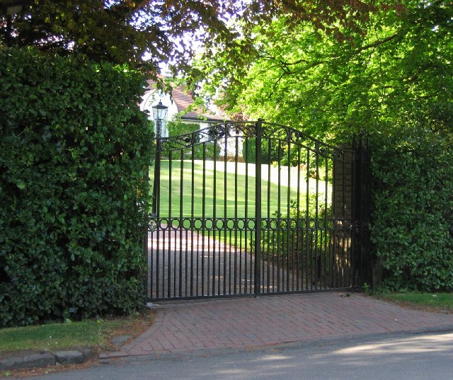
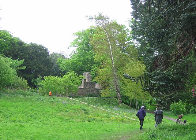
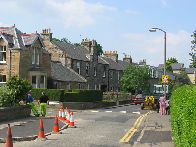
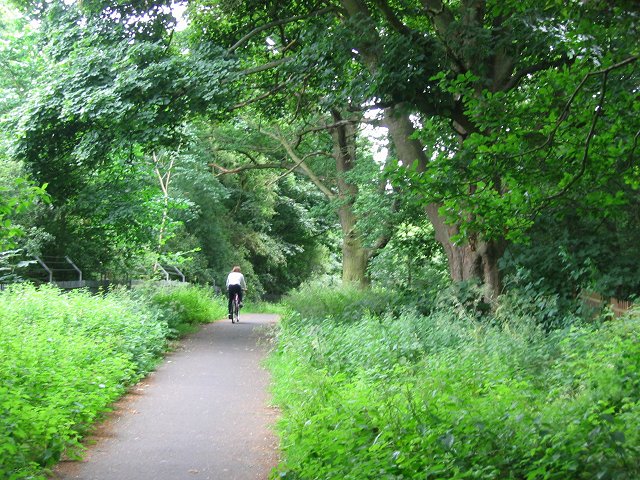
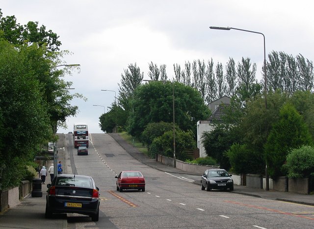
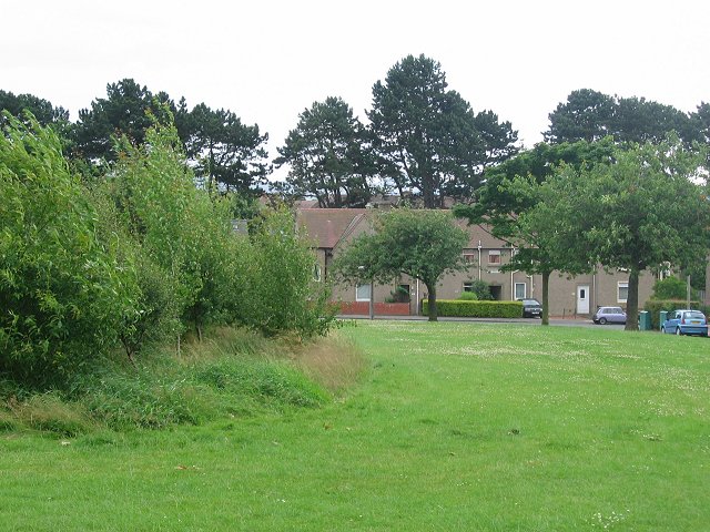
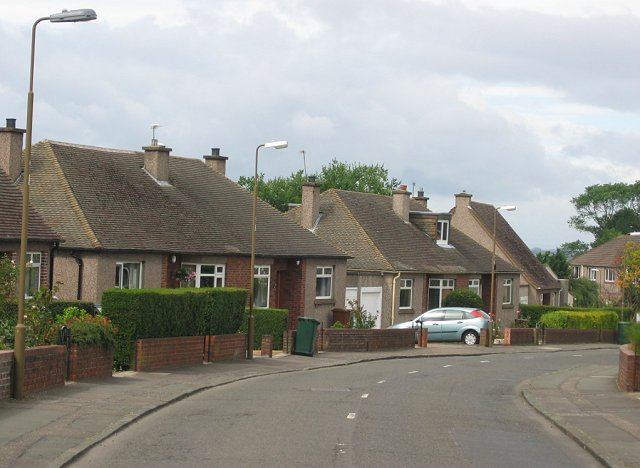
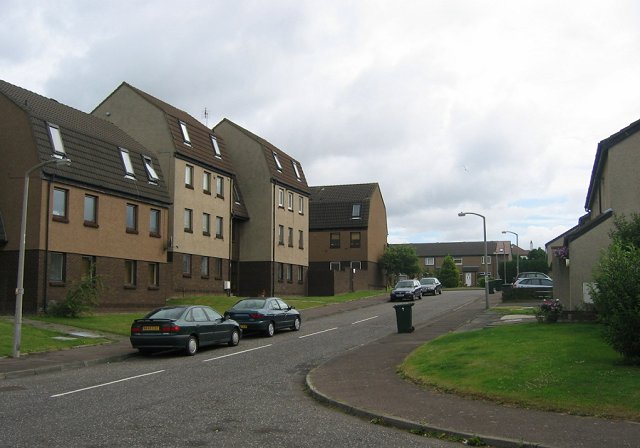
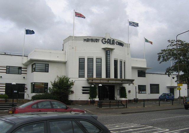
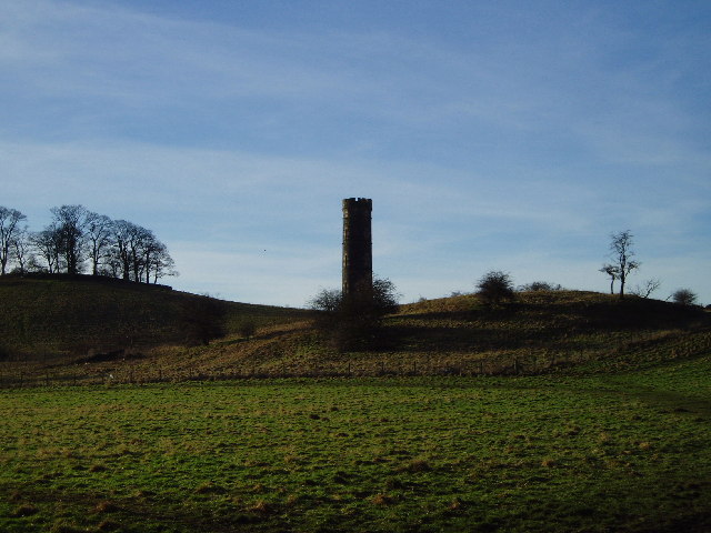
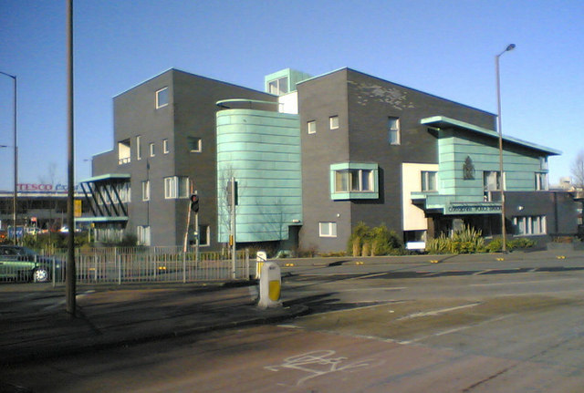
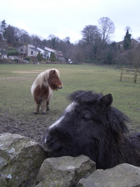
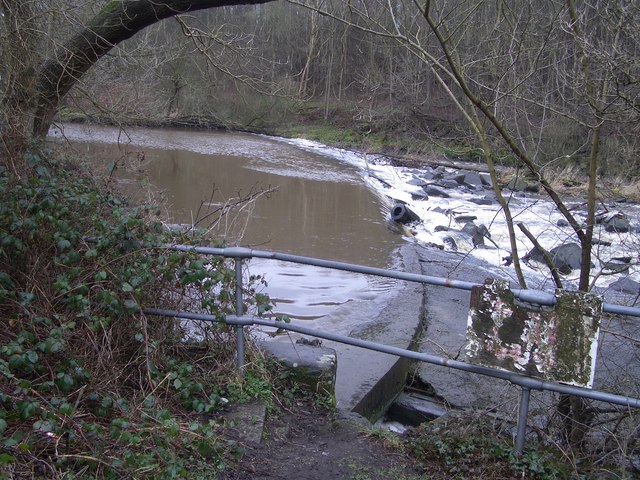
Drumbrae Images

Images are sourced within 2km of 55.954797/-3.298125 or Grid Reference NT1974. Thanks to Geograph Open Source API. All images are credited.

Electric gate country, Barnton Barnton is one of Edinburgh's most expensive housing areas. Big houses hidden behind gates set amongst golf courses.
Electric gate country, Barnton
Barnton is one of Edinburgh's most expensive housing areas. Big houses hidden behind gates set amongst golf courses.
Cammo Once a big house, it is now a ruin, the grounds reverting to wild woodland with some fine specimen trees. The estate is managed as a park by the city council.
Cammo
Once a big house, it is now a ruin, the grounds reverting to wild woodland with some fine specimen trees. The estate is managed as a park by the city council.
Building speed humps, Corstorphine. Edinburgh is home to a lot of speed humps, and they are multiplying. While proven effective in lowering speeds in residential areas, they are a pain when out on the bike. Some studies suggest that road humps are the only effective way of enforcing a 20mph/30kph speed limit.  Residential area just off the busy main shopping street of Corstorphine.
Building speed humps, Corstorphine.
Edinburgh is home to a lot of speed humps, and they are multiplying. While proven effective in lowering speeds in residential areas, they are a pain when out on the bike. Some studies suggest that road humps are the only effective way of enforcing a 20mph/30kph speed limit. Residential area just off the busy main shopping street of Corstorphine.
Cycle path, Barnton. Path between two well defended golf courses, now part of NCN1 up the east coast of Great Britain.  A useful way in and out of Edinburgh from the north and west.
The Barnton area contains many old trees especially oaks and this path runs through them. It also links two very expensive housing areas.
Cycle path, Barnton.
Path between two well defended golf courses, now part of NCN1 up the east coast of Great Britain. A useful way in and out of Edinburgh from the north and west. The Barnton area contains many old trees especially oaks and this path runs through them. It also links two very expensive housing areas.
Drum Brae. Small but notorious hill in the suburbs of West Edinburgh. A busy road, it's fine most of the time; it's a tricky thing in ice or snow.
Drum Brae.
Small but notorious hill in the suburbs of West Edinburgh. A busy road, it's fine most of the time; it's a tricky thing in ice or snow.
Clermiston Large 20th century housing area on the west side of Corstorphine Hill.  The once vare open area in the middle of the estate has been broken up by some tree planting.
Clermiston
Large 20th century housing area on the west side of Corstorphine Hill. The once vare open area in the middle of the estate has been broken up by some tree planting.
Bungaloid Corstorphine. This is the dominant house type in this almost entirely residential square. Sloping ground above Corstorphine.
Bungaloid Corstorphine.
This is the dominant house type in this almost entirely residential square. Sloping ground above Corstorphine.
East Craigs Large 1970's westward expansion of Edinburgh.
East Craigs
Large 1970's westward expansion of Edinburgh.
The Maybury Once a dance hall, often empty, now a casino. A landmark building by a very busy road junction.

This is a well known landmark in the city, once an edge of town roadhouse.
The Maybury
Once a dance hall, often empty, now a casino. A landmark building by a very busy road junction. This is a well known landmark in the city, once an edge of town roadhouse.
Western approaches to Edinburgh Busy junction on the A8 entering Edinburgh from the west. There has been a lot of recent development here; it's a mass of tin shed shopping as well as hotels and some residential areas.
Western approaches to Edinburgh
Busy junction on the A8 entering Edinburgh from the west. There has been a lot of recent development here; it's a mass of tin shed shopping as well as hotels and some residential areas.
Cammo Tower This tower which can be easily seen from the Maybury Road was a water tower for Cammo House. A wind driven pump would fill a cistern near the top and gravity would provide the mansion with water.
Cammo Tower
This tower which can be easily seen from the Maybury Road was a water tower for Cammo House. A wind driven pump would fill a cistern near the top and gravity would provide the mansion with water.
Corstorphine Police Station Maybe it's supposed to look horrible and imposing.  Good grief, they've done a good job.  The whole lot looks a little hastily constructed. The materials don't look like they are all from the same batch. The green facings appear to be rusting in parts.  Heck, it's only been up a couple of years.  Not a pretty building at all but I dare say it wasn't designed with a prize in mind.  Aerial - <span class="nowrap"><a title="http://maps.google.co.uk/?t=h&ll=55.93965,-3.2935&spn=0.002788,0.007124&t=h" rel="nofollow ugc noopener" href="http://maps.google.co.uk/?t=h&ll=55.93965,-3.2935&spn=0.002788,0.007124&t=h">Link</a><img style="margin-left:2px;" alt="External link" title="External link - shift click to open in new window" src="https://s1.geograph.org.uk/img/external.png" width="10" height="10"/></span>
Corstorphine Police Station
Maybe it's supposed to look horrible and imposing. Good grief, they've done a good job. The whole lot looks a little hastily constructed. The materials don't look like they are all from the same batch. The green facings appear to be rusting in parts. Heck, it's only been up a couple of years. Not a pretty building at all but I dare say it wasn't designed with a prize in mind. Aerial - LinkExternal link
Shelties The field is in the square, the pony's nose is somewhere near the edge.
Shelties
The field is in the square, the pony's nose is somewhere near the edge.
Dowies Mill weir
Dowies Mill weir
The Barnton Hotel The Barnton Hotel is a listed building, built in 1895s.  It is one of the oldest buildings in Barnton, situated on the main road from Edinburgh to the North, about mid-way between the Centre of Edinburgh and the Forth Road Bridge.  There are plans to redevelop the building (which closed in 2004) and the site of the former petrol station site beside it to create 70 modern flats.Despite several earlier rejections by Edinburgh City Council Planning Committee and continuing objections to the proposals, particularly concerning the density of the development, lack of green space and possible traffic congestion problems the proposed development has been approved.
The Barnton Hotel
The Barnton Hotel is a listed building, built in 1895s. It is one of the oldest buildings in Barnton, situated on the main road from Edinburgh to the North, about mid-way between the Centre of Edinburgh and the Forth Road Bridge. There are plans to redevelop the building (which closed in 2004) and the site of the former petrol station site beside it to create 70 modern flats.Despite several earlier rejections by Edinburgh City Council Planning Committee and continuing objections to the proposals, particularly concerning the density of the development, lack of green space and possible traffic congestion problems the proposed development has been approved.
Police box At the junction of Queensferry Road and Maybury Road  (The Barnton)
Police box
At the junction of Queensferry Road and Maybury Road (The Barnton)
The Barnton Hotel The tower of The Barnton Hotel which is to be retained in the proposed development . <a href="https://www.geograph.org.uk/photo/426442">NT1874 : The Barnton Hotel</a>
The Barnton Hotel
The tower of The Barnton Hotel which is to be retained in the proposed development . NT1874 : The Barnton Hotel
Pinegrove Gardens Situated at the Barnton end of Maybury Road these flats are built where The Pinegrove Garden Centre used to be, hence the name.
Pinegrove Gardens
Situated at the Barnton end of Maybury Road these flats are built where The Pinegrove Garden Centre used to be, hence the name.
Show me another place!

Drumbrae is located at Grid Ref: NT1974 (Lat: 55.954797, Lng: -3.298125)

Unitary Authority: City of Edinburgh

Police Authority: Edinburgh

What 3 Words

///times.quiet.hulk. Near Colinton, Edinburgh

Nearby Locations

Clermiston Drumbrae

Related Wikis

Drumbrae

Drumbrae or Drum Brae (Scottish Gaelic: Druim BrĂ igh) is the name of a suburb of west Edinburgh, Scotland generally considered to be part of the neighbouring...

Parkgrove

Parkgrove is a suburb of Edinburgh, the capital of Scotland. Approximately 4 miles north-west of Edinburgh city centre. The suburb is located between the...

Bughtlin

Bughtlin is a suburb of Edinburgh, the capital of Scotland. It is east of the A902. The area is near Maybury, Cammo, East Craigs and Barnton. Most of the...

Clermiston

Clermiston is a suburb of Edinburgh, Scotland, to the west of the city and to the immediate north of Corstorphine, on the western slopes of Corstorphine...

Related Videos

Edinburgh Walks: Corstorphine Hill | Scotland Vlog

On the first warm day of the year (and possibly the last - we are in Scotland after all), I got my arse in gear for my Edinburgh Walks ...

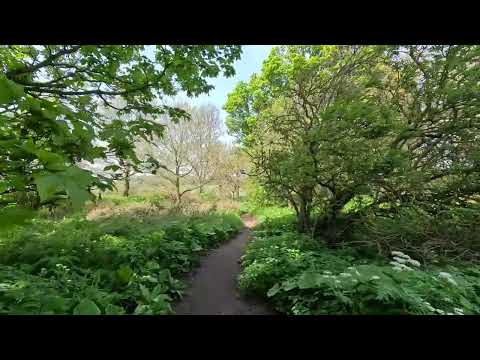
Exploring the Tranquil Beauty of River Almond | Walking Adventure in Edinburgh

Join us on a captivating walking adventure along the picturesque River Almond in Edinburgh. Immerse yourself in the tranquil ...

Edinburgh Walks: Cammo Estate | Scotland Vlog

Walkers! Welcome to the third video in our series of Edinburgh walks sponsored by The Scotsman & the Edinburgh Evening News ...

Nearby Amenities

Located within 500m of 55.954797,-3.298125
Traffic Signals
Traffic Signals: traffic_lights
Traffic Signals Direction: both
Lat/Long: 55.9536986/-3.2975335
Turning Loop
Lat/Long: 55.9575836/-3.3019571
Turning Loop
Lat/Long: 55.9578104/-3.3009494
Traffic Calming: hump
Lat/Long: 55.952178/-3.2981194
Traffic Calming: hump
Lat/Long: 55.9514804/-3.2977576
Traffic Calming: hump
Lat/Long: 55.9506776/-3.3002865
Traffic Calming: hump
Lat/Long: 55.9506701/-3.298873
Traffic Calming: hump
Lat/Long: 55.952993/-3.2985199
Traffic Calming: hump
Lat/Long: 55.9535397/-3.2988822
Give Way
Lat/Long: 55.9534023/-3.2988481
Traffic Calming: hump
Lat/Long: 55.953399/-3.2993319
Traffic Calming: hump
Lat/Long: 55.9530781/-3.3003284
Traffic Calming: hump
Lat/Long: 55.9525967/-3.3013303
Give Way
Lat/Long: 55.9530397/-3.3054425
Give Way
Lat/Long: 55.9527608/-3.3050058
Check Date: 2023-04-29
Traffic Calming: hump
Lat/Long: 55.9545767/-3.2976278
Traffic Calming: hump
Lat/Long: 55.9556555/-3.2928031
Traffic Calming: hump
Lat/Long: 55.9559508/-3.2925594
Traffic Calming: hump
Lat/Long: 55.9563831/-3.2928206
Traffic Calming: hump
Lat/Long: 55.9568093/-3.29237
Traffic Calming: hump
Lat/Long: 55.9569399/-3.2915109
Traffic Calming: hump
Lat/Long: 55.9532223/-3.296599
Traffic Calming: hump
Lat/Long: 55.9533964/-3.295688
Traffic Calming: hump
Lat/Long: 55.9531865/-3.2947576
Post Box
Ref: EH4 530
Lat/Long: 55.9532741/-3.2960634
Post Office
Drumbrae Newsagent
Addr City: Edinburgh
Addr Housenumber: 26
Addr Postcode: EH4 7JP
Addr Street: Duart Crescent
Check Date: 2023-06-27
Website: https://www.postoffice.co.uk/branch-finder/2388243/duart-crescent
Lat/Long: 55.9534317/-3.2962013
Pharmacy
Omnicare
Addr City: Edinburgh
Addr Housenumber: 38
Addr Postcode: EH4 7JP
Addr Street: Duart Crescent
Check Date: 2023-06-27
Dispensing: yes
Drive Through: no
Healthcare: pharmacy
Lat/Long: 55.9533584/-3.2967454
Telephone
Booth: KX100
Covered: booth
Lat/Long: 55.9522127/-3.303572
Give Way
Lat/Long: 55.9536925/-3.2992282
Kerb: raised
Lat/Long: 55.9573102/-3.2958983
Bus Stop
East Craigs Centre
Bench: yes
Bin: yes
Bus: yes
Lit: no
Naptan AdministrativeAreaCode: 124
Naptan Area Name: Edinburgh
Naptan AtcoAreaCode: 620
Naptan AtcoCode: 6200202510
Naptan Bearing: NW
Naptan CommonName: East Craigs Centre
Naptan Indicator: Stop 3
Naptan Landmark: East Craigs Terminus
Naptan LocalityName: East Craigs
Naptan NaptanCode: 36232453
Naptan NptgLocalityCode: N0078330
Naptan PlusbusZoneRef: EDINBUR
Naptan SourceLocalityType: Add
Naptan StopAreaCode: 620G202505
Naptan StopAreaType: GCLS
Naptan StopArea Name: EAST CRAIGS Terminus
Naptan Street: Maybury Drive
Naptan Verified: yes
Public Transport: platform
Shelter: yes
Source: NaPTAN + Survey
Tactile Paving: no
Lat/Long: 55.9521292/-3.3040459
Bus Stop
Parkgrove Drive
Bench: yes
Bin: yes
Lit: no
Naptan AtcoCode: 6200202610
Naptan Bearing: S
Naptan CommonName: Parkgrove Drive
Naptan Indicator: Opp 32
Naptan Landmark: Parkgrove Drive
Naptan NaptanCode: 36237583
Naptan PlusbusZoneRef: EDINBUR
Naptan Street: Drum Brae North
Naptan Verified: no
Public Transport: platform
Shelter: yes
Source: naptan_import
Tactile Paving: yes
Lat/Long: 55.9587957/-3.3001937
Bus Stop
Craigmount Avenue North
Bench: no
Bin: no
Lit: no
Naptan AtcoCode: 6200202620
Naptan Bearing: S
Naptan CommonName: Craigmount Avenue North
Naptan Indicator: At 45
Naptan Landmark: Craigmount Bank
Naptan NaptanCode: 36237584
Naptan PlusbusZoneRef: EDINBUR
Naptan Street: Drum Brae North
Naptan Verified: no
Public Transport: platform
Shelter: no
Source: naptan_import
Tactile Paving: yes
Lat/Long: 55.9572858/-3.2993742
Bus Stop
Drum Brae Drive
Bench: yes
Bin: yes
Bus: yes
Lit: yes
Naptan AdministrativeAreaCode: 124
Naptan Area Name: Edinburgh
Naptan AtcoAreaCode: 620
Naptan AtcoCode: 6200202680
Naptan Bearing: W
Naptan CommonName: Drum Brae Drive
Naptan Indicator: SW-bound
Naptan Landmark: at 167
Naptan LocalityName: Clermiston
Naptan NaptanCode: 36237626
Naptan NptgLocalityCode: N0067256
Naptan PlusbusZoneRef: EDINBUR
Naptan SourceLocalityType: Add
Naptan StopAreaCode: 620G202680
Naptan StopAreaType: GPBS
Naptan StopArea Name: CLERMISTON Drum Brae Drive
Naptan Street: Drum Brae Drive
Naptan Verified: yes
Public Transport: platform
Shelter: yes
Source: NaPTAN + Survey
Tactile Paving: yes
Lat/Long: 55.95453/-3.2935948
Bus Stop
Drum Brae North
Bench: yes
Bin: yes
Bus: yes
Lit: yes
Naptan AdministrativeAreaCode: 124
Naptan Area Name: Edinburgh
Naptan AtcoAreaCode: 620
Naptan AtcoCode: 6200202690
Naptan Bearing: W
Naptan CommonName: Drum Brae North
Naptan Indicator: near
Naptan Landmark: at 221
Naptan LocalityName: Clermiston
Naptan NaptanCode: 36237624
Naptan NptgLocalityCode: N0067256
Naptan PlusbusZoneRef: EDINBUR
Naptan SourceLocalityType: Add
Naptan StopAreaCode: 620G202690
Naptan StopAreaType: GPBS
Naptan StopArea Name: CLERMISTON Drum Brae North
Naptan Street: Drum Brae Drive
Naptan Verified: yes
Public Transport: platform
Shelter: yes
Source: NaPTAN + Survey
Tactile Paving: yes
Lat/Long: 55.9537879/-3.2968199
Bus Stop
Duart Crescent
Bin: yes
Bus: yes
Naptan AdministrativeAreaCode: 124
Naptan Area Name: Edinburgh
Naptan AtcoAreaCode: 620
Naptan AtcoCode: 6200202700
Naptan Bearing: S
Naptan CommonName: Duart Crescent
Naptan Indicator: near
Naptan Landmark: at 84
Naptan LocalityName: East Craigs
Naptan NaptanCode: 36237578
Naptan NptgLocalityCode: N0078330
Naptan PlusbusZoneRef: EDINBUR
Naptan SourceLocalityType: Add
Naptan StopAreaCode: 620G202700
Naptan StopAreaType: GPBS
Naptan StopArea Name: EAST CRAIGS Duart Crescent
Naptan Street: Drum Brae South
Naptan Verified: yes
Public Transport: platform
Shelter: yes
Source: NaPTAN + Survey
Lat/Long: 55.9526179/-3.2968557
Bus Stop
Drum Brae Avenue
Bench: yes
Bin: yes
Bus: yes
Lit: yes
Naptan AdministrativeAreaCode: 124
Naptan Area Name: Edinburgh
Naptan AtcoAreaCode: 620
Naptan AtcoCode: 6200247180
Naptan Bearing: N
Naptan CommonName: Drum Brae Avenue
Naptan Indicator: opp
Naptan Landmark: opp 68
Naptan LocalityName: East Craigs
Naptan NaptanCode: 36237623
Naptan NptgLocalityCode: N0078330
Naptan PlusbusZoneRef: EDINBUR
Naptan SourceLocalityType: Add
Naptan StopAreaCode: 620G202710
Naptan StopAreaType: GPBS
Naptan StopArea Name: EAST CRAIGS Drum Brae Avenue
Naptan Street: Drum Brae South
Naptan Verified: yes
Public Transport: platform
Shelter: yes
Source: NaPTAN + Survey
Tactile Paving: no
Lat/Long: 55.9514807/-3.2964837
Bus Stop
Duart Crescent
Bin: yes
Bus: yes
Naptan AdministrativeAreaCode: 124
Naptan Area Name: Edinburgh
Naptan AtcoAreaCode: 620
Naptan AtcoCode: 6200247190
Naptan Bearing: N
Naptan CommonName: Duart Crescent
Naptan Indicator: opp
Naptan Landmark: at 121
Naptan LocalityName: East Craigs
Naptan NaptanCode: 36237579
Naptan NptgLocalityCode: N0078330
Naptan PlusbusZoneRef: EDINBUR
Naptan SourceLocalityType: Add
Naptan StopAreaCode: 620G202700
Naptan StopAreaType: GPBS
Naptan StopArea Name: EAST CRAIGS Duart Crescent
Naptan Street: Drum Brae South
Naptan Verified: yes
Public Transport: platform
Source: NaPTAN + Survey
Lat/Long: 55.9531967/-3.2973819
Bus Stop
Drum Brae North
Bench: yes
Bin: yes
Bus: yes
Lit: yes
Naptan AdministrativeAreaCode: 124
Naptan Area Name: Edinburgh
Naptan AtcoAreaCode: 620
Naptan AtcoCode: 6200247200
Naptan Bearing: E
Naptan CommonName: Drum Brae North
Naptan Indicator: after
Naptan Landmark: at 214
Naptan LocalityName: Clermiston
Naptan NaptanCode: 36237625
Naptan NptgLocalityCode: N0067256
Naptan PlusbusZoneRef: EDINBUR
Naptan SourceLocalityType: Add
Naptan StopAreaCode: 620G202690
Naptan StopAreaType: GPBS
Naptan StopArea Name: CLERMISTON Drum Brae North
Naptan Street: Drum Brae Drive
Naptan Verified: yes
Operator: Lothian Buses
Public Transport: platform
Shelter: yes
Source: NaPTAN + Survey
Tactile Paving: yes
Lat/Long: 55.9541381/-3.2957554
Bus Stop
Drum Brae Drive
Bench: yes
Bin: yes
Bus: yes
Lit: yes
Naptan AdministrativeAreaCode: 124
Naptan Area Name: Edinburgh
Naptan AtcoAreaCode: 620
Naptan AtcoCode: 6200247210
Naptan Bearing: E
Naptan CommonName: Drum Brae Drive
Naptan Indicator: E-bound
Naptan Landmark: at 158
Naptan LocalityName: Clermiston
Naptan NaptanCode: 36237627
Naptan NptgLocalityCode: N0067256
Naptan PlusbusZoneRef: EDINBUR
Naptan SourceLocalityType: Add
Naptan StopAreaCode: 620G202680
Naptan StopAreaType: GPBS
Naptan StopArea Name: CLERMISTON Drum Brae Drive
Naptan Street: Drum Brae Drive
Naptan Verified: yes
Public Transport: platform
Shelter: yes
Source: NaPTAN + Survey
Tactile Paving: yes
Lat/Long: 55.9547615/-3.2929817
Bus Stop
Craigmount Avenue North
Bench: yes
Bin: yes
Lit: no
Naptan AtcoCode: 6200247280
Naptan Bearing: N
Naptan CommonName: Craigmount Avenue North
Naptan Indicator: At 58
Naptan Landmark: Parkgrove Drive
Naptan NaptanCode: 36237582
Naptan PlusbusZoneRef: EDINBUR
Naptan Street: Drum Brae North
Naptan Verified: no
Public Transport: platform
Shelter: yes
Source: naptan_import
Tactile Paving: yes
Lat/Long: 55.9575519/-3.2997035
Post Box
Ref: EH12 628
Lat/Long: 55.9512182/-3.2954264
Drumbrae Leisure Centre
Access: yes
Leisure: fitness_centre
Lit: yes
Location: indoor
Phone: +44 131 312 7957
Sport: swimming;fitness;multi
Website: https://www.edinburghleisure.co.uk/venues/drumbrae-leisure-centre
Lat/Long: 55.956145/-3.2942798
Give Way
Lat/Long: 55.954626/-3.3008659
Give Way
Lat/Long: 55.9506656/-3.2973992
Give Way
Lat/Long: 55.9506821/-3.3008954
Barrier: cycle_barrier
Bicycle: yes
Cycle Barrier: double
Foot: yes
Lat/Long: 55.9577023/-3.300654
Barrier: cycle_barrier
Bicycle: yes
Cycle Barrier: double
Foot: yes
Lat/Long: 55.9571872/-3.3003777
Check Date: 2023-06-15
Disused Shop: hairdresser
Old Name: Blades of Gold
Source: local knowledge
Lat/Long: 55.9518518/-3.3041593
Traffic Calming: hump
Lat/Long: 55.9527876/-3.2956296
Traffic Calming: hump
Lat/Long: 55.9522724/-3.2962223
Crossing
Crossing: traffic_signals
Lat/Long: 55.9511928/-3.2962587
Veterinary
Drumbrae Veterinary Centre
Lat/Long: 55.9513163/-3.295078
Atm
Lat/Long: 55.9512626/-3.296017
Crossing
Crossing: traffic_signals
Crossing Ref: puffin
Tactile Paving: yes
Lat/Long: 55.9529227/-3.2971336
USave
Addr City: Edinburgh
Addr Housenumber: 34
Addr Postcode: EH4 7JP
Addr Street: Duart Crescent
Brand: USave
Brand Wikidata: Q121435010
Check Date: 2023-06-27
Old Name: Day-Today, Caledonian Off License
Shop: convenience
Source: local knowledge
Lat/Long: 55.9533972/-3.2965637
Fast Food
Marmaris
Addr City: Edinburgh
Addr Housenumber: 40
Addr Postcode: EH4 7JP
Addr Street: Duart Crescent
Fhrs Id: 662791
Source: survey
Source Addr: FHRS Open Data
Lat/Long: 55.953333/-3.2968315
Fast Food
Passion - Fish and Chips
Addr City: Edinburgh
Addr Housenumber: 24
Addr Postcode: EH4 7JP
Addr Street: Duart Crescent
Check Date: 2023-06-27
Fhrs Id: 663413
Source: survey;local knowledge
Source Addr: FHRS Open Data
Lat/Long: 55.9534533/-3.296106
Fast Food
Anna's
Addr City: Edinburgh
Addr Housenumber: 28
Addr Postcode: EH4 7JP
Addr Street: Duart Crescent
Cuisine: chinese
Fhrs Id: 662180
Source: survey
Source Addr: FHRS Open Data
Lat/Long: 55.9534349/-3.296281
Copperhead
Addr City: Edinburgh
Addr Housenumber: 36
Addr Postcode: EH4 7JP
Addr Street: Duart Crescent
Check Date: 2023-06-27
Old Name: Hudson Hair
Shop: hairdresser
Source: survey
Lat/Long: 55.9533755/-3.2966537
Ingleneuk
Addr City: Edinburgh
Addr Housenumber: 31
Addr Street: Drum Brae North
Source: survey
Tourism: guest_house
Lat/Long: 55.9582499/-3.2996109
Telephone
Booth: KX100
Covered: booth
Mapillary: 3019054564993365
Source: survey
Survey Date: 2020-06-26
Lat/Long: 55.9511974/-3.2960148
Fast Food
Nahar
Addr City: Edinburgh
Addr Housenumber: 30
Addr Postcode: EH4 7JP
Addr Street: Duart Crescent
Cuisine: indian;bengali
Fhrs Id: 727841
Phone: +44 131 339 7222
Source: survey
Source Addr: FHRS Open Data
Lat/Long: 55.9534422/-3.2963782
Post Box
Check Date Collection Times: 2022-08-27
Collection Times: Mo-Fr 09:00; Sa 07:00
Operator: Royal Mail
Post Box Type: lamp
Ref: EH4 636D
Royal Cypher: scottish_crown
Lat/Long: 55.9568267/-3.3003596
Dentist
Drumbrae Dental Care
Lat/Long: 55.9512729/-3.2953795
Heads Together
Shop: hairdresser
Lat/Long: 55.9513082/-3.2951413
Traffic Calming: hump
Lat/Long: 55.9511074/-3.2957372
Traffic Calming: hump
Lat/Long: 55.9512984/-3.2943474
Barrier: cycle_barrier
Bicycle: yes
Foot: yes
Lat/Long: 55.9514572/-3.29326
Traffic Calming: hump
Lat/Long: 55.9530361/-3.2968981
Traffic Calming: hump
Lat/Long: 55.9547881/-3.2966217
Traffic Calming: hump
Lat/Long: 55.9549805/-3.2957747
Traffic Calming: hump
Lat/Long: 55.9552004/-3.2948061
Traffic Calming: hump
Lat/Long: 55.955369/-3.2940637
Traffic Calming: hump
Lat/Long: 55.9557745/-3.2921824
Corstorphine Chiropractic
Healthcare: alternative
Healthcare Speciality: chiropractic
Source: survey
Lat/Long: 55.9512626/-3.2954505
Post Box
Collection Times: Mo-Fr 09:00; Sa 07:00
Ref: EH4 476
Royal Cypher: scottish_crown
Lat/Long: 55.9545189/-3.294083
Drumbrae
Name Gd: Druim BrĂ ighe
Place: neighbourhood
Wikidata: Q5309123
Wikipedia: en:Drumbrae
Lat/Long: 55.9549631/-3.2912574
Post Box
Collection Times: Mo-Fr 17:30; Sa 12:30
Note: the rectangular pillar box has been replaced with a more conventional cylindrical type in 2015
Operator: Royal Mail
Operator Wikidata: Q638098
Post Box Type: pillar
Ref: EH12 86
Royal Cypher: no
Lat/Long: 55.9518536/-3.3039721
Entrance: main
Lat/Long: 55.9517875/-3.3028977
Entrance: main
Lat/Long: 55.9520411/-3.3032749
Barrier: bollard
Bicycle: yes
Foot: yes
Lat/Long: 55.9517598/-3.3032258
Barrier: bollard
Bicycle: yes
Foot: yes
Lat/Long: 55.9519402/-3.3033897
Addr City: Edinburgh
Addr Housenumber: 90
Addr Street: Craigmount Avenue North
Lat/Long: 55.952857/-3.2982438
Addr City: Edinburgh
Addr Housenumber: 84
Addr Street: Craigmount Avenue North
Lat/Long: 55.9523746/-3.2979912
Give Way
Lat/Long: 55.9531705/-3.2960325
Ladbrokes
Brand: Ladbrokes
Brand Wikidata: Q1799875
Brand Wikipedia: en:Ladbrokes Coral
Shop: bookmaker
Lat/Long: 55.9533245/-3.2969526
Barrier: bollard
Bicycle: yes
Foot: yes
Lat/Long: 55.9531998/-3.2969554
Traffic Calming: hump
Lat/Long: 55.9525785/-3.2975601
Give Way
Lat/Long: 55.952658/-3.2970743
Give Way
Lat/Long: 55.9524789/-3.2981687
Addr City: Edinburgh
Addr Housenumber: 96
Addr Street: Craigmount Avenue North
Lat/Long: 55.953161/-3.2983516
Give Way
Lat/Long: 55.9534021/-3.2986235
Traffic Calming: hump
Lat/Long: 55.9525458/-3.2913494
Addr City: Edinburgh
Addr Housenumber: 51
Addr Street: Durar Drive
Lat/Long: 55.9526605/-3.2911039
Addr City: Edinburgh
Addr Housenumber: 49
Addr Street: Durar Drive
Lat/Long: 55.9526526/-3.2911535
Addr City: Edinburgh
Addr Housenumber: 47
Addr Street: Durar Drive
Lat/Long: 55.9526216/-3.2913467
Addr City: Edinburgh
Addr Housenumber: 45
Addr Street: Durar Drive
Lat/Long: 55.9526151/-3.2913871
Addr City: Edinburgh
Addr Housenumber: 43
Addr Street: Durar Drive
Lat/Long: 55.952571/-3.2916621
Addr City: Edinburgh
Addr Housenumber: 41
Addr Street: Durar Drive
Lat/Long: 55.9525459/-3.2919879
Addr City: Edinburgh
Addr Housenumber: 39
Addr Street: Durar Drive
Lat/Long: 55.9525369/-3.2920442
Addr City: Edinburgh
Addr Housenumber: 37
Addr Street: Durar Drive
Lat/Long: 55.9525084/-3.2922218
Addr City: Edinburgh
Addr Housenumber: 35
Addr Street: Durar Drive
Lat/Long: 55.9524992/-3.2922792
Addr City: Edinburgh
Addr Housenumber: 33
Addr Street: Durar Drive
Lat/Long: 55.9524729/-3.2925907
Addr City: Edinburgh
Addr Housenumber: 31
Addr Street: Durar Drive
Lat/Long: 55.9524645/-3.2926429
Addr City: Edinburgh
Addr Housenumber: 29
Addr Street: Durar Drive
Lat/Long: 55.9524374/-3.2928119
Addr City: Edinburgh
Addr Housenumber: 27
Addr Street: Durar Drive
Lat/Long: 55.9524262/-3.2928816
Addr City: Edinburgh
Addr Housenumber: 25
Addr Street: Durar Drive
Lat/Long: 55.9523798/-3.2931708
Addr City: Edinburgh
Addr Housenumber: 23
Addr Street: Durar Drive
Lat/Long: 55.9523553/-3.2934733
Addr City: Edinburgh
Addr Housenumber: 21
Addr Street: Durar Drive
Lat/Long: 55.9523458/-3.2935324
Addr City: Edinburgh
Addr Housenumber: 19
Addr Street: Durar Drive
Lat/Long: 55.9523168/-3.2937134
Addr City: Edinburgh
Addr Housenumber: 17
Addr Street: Durar Drive
Lat/Long: 55.9523042/-3.293792
Give Way
Lat/Long: 55.9522139/-3.2944121
Addr City: Edinburgh
Addr Housenumber: 15
Addr Street: Durar Drive
Lat/Long: 55.9522019/-3.2947006
Addr City: Edinburgh
Addr Housenumber: 13
Addr Street: Durar Drive
Lat/Long: 55.9521952/-3.2947546
Addr City: Edinburgh
Addr Housenumber: 11
Addr Street: Durar Drive
Lat/Long: 55.9521741/-3.2949247
Addr City: Edinburgh
Addr Housenumber: 9
Addr Street: Durar Drive
Lat/Long: 55.9521704/-3.2949549
Traffic Calming: hump
Lat/Long: 55.9524044/-3.2924971
Traffic Calming: hump
Lat/Long: 55.9522469/-3.2937285
Traffic Calming: hump
Lat/Long: 55.9524842/-3.2944581
Addr City: Edinburgh
Addr Housenumber: 98
Addr Street: Craigmount Avenue North
Lat/Long: 55.9532729/-3.2984058
Addr City: Edinburgh
Addr Housenumber: 94
Addr Street: Craigmount Avenue North
Lat/Long: 55.953095/-3.2983418
Addr City: Edinburgh
Addr Housenumber: 92
Addr Street: Craigmount Avenue North
Lat/Long: 55.9529465/-3.2982712
Addr City: Edinburgh
Addr Housenumber: 88
Addr Street: Craigmount Avenue North
Lat/Long: 55.9527366/-3.2981763
Addr City: Edinburgh
Addr Housenumber: 86
Addr Street: Craigmount Avenue North
Lat/Long: 55.9526147/-3.2981271
Addr City: Edinburgh
Addr Housenumber: 82
Addr Street: Craigmount Avenue North
Lat/Long: 55.9522912/-3.2979415
Addr City: Edinburgh
Addr Housenumber: 80
Addr Street: Craigmount Avenue North
Lat/Long: 55.952138/-3.2978658
Addr City: Edinburgh
Addr Housenumber: 78
Addr Street: Craigmount Avenue North
Lat/Long: 55.9521056/-3.2978569
Addr City: Edinburgh
Addr Housenumber: 76
Addr Street: Craigmount Avenue North
Lat/Long: 55.9519534/-3.2977738
Addr City: Edinburgh
Addr Housenumber: 57
Addr Street: Craigmount Avenue North
Lat/Long: 55.9530761/-3.2987402
Addr City: Edinburgh
Addr Housenumber: 55
Addr Street: Craigmount Avenue North
Lat/Long: 55.9529685/-3.2986842
Addr City: Edinburgh
Addr Housenumber: 53
Addr Street: Craigmount Avenue North
Lat/Long: 55.9528342/-3.2986125
Addr City: Edinburgh
Addr Housenumber: 51
Addr Street: Craigmount Avenue North
Lat/Long: 55.9527132/-3.2985491
Addr City: Edinburgh
Addr Housenumber: 49
Addr Street: Craigmount Avenue North
Lat/Long: 55.9526275/-3.2985132
Addr City: Edinburgh
Addr Housenumber: 47
Addr Street: Craigmount Avenue North
Lat/Long: 55.9524843/-3.2984652
Addr City: Edinburgh
Addr Housenumber: 45
Addr Street: Craigmount Avenue North
Lat/Long: 55.9523769/-3.2983859
Addr City: Edinburgh
Addr Housenumber: 43
Addr Street: Craigmount Avenue North
Lat/Long: 55.9522644/-3.2983459
Addr City: Edinburgh
Addr Housenumber: 41
Addr Street: Craigmount Avenue North
Lat/Long: 55.9521428/-3.2982793
Addr City: Edinburgh
Addr Housenumber: 39
Addr Street: Craigmount Avenue North
Lat/Long: 55.9520308/-3.298221
Addr City: Edinburgh
Addr Housenumber: 37
Addr Street: Craigmount Avenue North
Lat/Long: 55.951911/-3.2981485
Addr City: Edinburgh
Addr Housenumber: 35
Addr Street: Craigmount Avenue North
Lat/Long: 55.9517933/-3.298084
Addr City: Edinburgh
Addr Housenumber: 33
Addr Street: Craigmount Avenue North
Lat/Long: 55.9516723/-3.2980185
Addr City: Edinburgh
Addr Housenumber: 31
Addr Street: Craigmount Avenue North
Lat/Long: 55.9515565/-3.2979523
Addr City: Edinburgh
Addr Housenumber: 62
Addr Street: Craigmount Avenue North
Lat/Long: 55.9512318/-3.2974284
Addr City: Edinburgh
Addr Housenumber: 60
Addr Street: Craigmount Avenue North
Lat/Long: 55.9511759/-3.2973971
Addr City: Edinburgh
Addr Housenumber: 27
Addr Street: Craigmount Avenue North
Lat/Long: 55.9511339/-3.2977364
Addr City: Edinburgh
Addr Housenumber: 21
Addr Street: Craigmount Avenue North
Lat/Long: 55.9505373/-3.2974081
Addr City: Edinburgh
Addr Housenumber: 19
Addr Street: Craigmount Avenue North
Lat/Long: 55.9504263/-3.2973832
Addr City: Edinburgh
Addr Housenumber: 17
Addr Street: Craigmount Avenue North
Lat/Long: 55.9503559/-3.2973449
Give Way
Lat/Long: 55.9569583/-3.2993974
Give Way
Lat/Long: 55.9538661/-3.2993334
Give Way
Lat/Long: 55.9541518/-3.3000237
Give Way
Lat/Long: 55.9545904/-3.3005467
Traffic Calming: hump
Lat/Long: 55.9506698/-3.2978319
Traffic Calming: hump
Lat/Long: 55.9508986/-3.2974614
Addr City: Edinburgh
Addr Housenumber: 70
Addr Street: Craigmount Avenue North
Lat/Long: 55.9516247/-3.2976363
Addr City: Edinburgh
Addr Housenumber: 74
Addr Street: Craigmount Avenue North
Lat/Long: 55.9518473/-3.2977427
Addr City: Edinburgh
Addr Housenumber: 72
Addr Street: Craigmount Avenue North
Lat/Long: 55.9517352/-3.29768
Addr City: Edinburgh
Addr Housenumber: 68
Addr Street: Craigmount Avenue North
Lat/Long: 55.9515011/-3.2975647
Addr City: Edinburgh
Addr Housenumber: 58
Addr Street: Craigmount Avenue North
Lat/Long: 55.9510172/-3.2972962
Addr City: Edinburgh
Addr Housenumber: 56
Addr Street: Craigmount Avenue North
Lat/Long: 55.9508762/-3.297208
Addr City: Edinburgh
Addr Housenumber: 25
Addr Street: Craigmount Avenue North
Lat/Long: 55.9509643/-3.2976467
Addr City: Edinburgh
Addr Housenumber: 54
Addr Street: Craigmount Avenue North
Lat/Long: 55.9507658/-3.2971908
Addr City: Edinburgh
Addr Housenumber: 52
Addr Street: Craigmount Avenue North
Lat/Long: 55.9506441/-3.2971316
Addr City: Edinburgh
Addr Housenumber: 23
Addr Street: Craigmount Avenue North
Lat/Long: 55.9507685/-3.2975859
Addr City: Edinburgh
Addr Housenumber: 64
Addr Street: Craigmount Avenue North
Lat/Long: 55.951344/-3.2974938
Addr City: Edinburgh
Addr Housenumber: 66
Addr Street: Craigmount Avenue North
Lat/Long: 55.9513955/-3.297517
Addr City: Edinburgh
Addr Housenumber: 29
Addr Street: Craigmount Avenue North
Lat/Long: 55.9512745/-3.297846
Addr City: Edinburgh
Addr Housenumber: 48
Addr Street: Craigmount Avenue North
Lat/Long: 55.9504388/-3.2969786
Addr City: Edinburgh
Addr Housenumber: 50
Addr Street: Craigmount Avenue North
Lat/Long: 55.9505875/-3.2970589
Addr City: Edinburgh
Addr Housenumber: 46
Addr Street: Craigmount Avenue North
Lat/Long: 55.9504022/-3.2969536
Addr City: Edinburgh
Addr Housenumber: 8
Addr Street: Barntongate Terrace
Lat/Long: 55.958616/-3.3020706
Addr City: Edinburgh
Addr Housenumber: 10
Addr Street: Barntongate Terrace
Lat/Long: 55.9584529/-3.3019942
Addr City: Edinburgh
Addr Housenumber: 12
Addr Street: Barntongate Terrace
Lat/Long: 55.9582877/-3.3019372
Addr City: Edinburgh
Addr Housenumber: 14
Addr Street: Barntongate Terrace
Lat/Long: 55.9581629/-3.3018687
Addr City: Edinburgh
Addr Housenumber: 16
Addr Street: Barntongate Terrace
Lat/Long: 55.9580354/-3.3018045
Addr City: Edinburgh
Addr Housenumber: 18
Addr Street: Barntongate Terrace
Lat/Long: 55.9579043/-3.3017416
Addr City: Edinburgh
Addr Housenumber: 20
Addr Street: Barntongate Terrace
Lat/Long: 55.9578023/-3.3016889
Addr City: Edinburgh
Addr Housenumber: 25
Addr Street: Barntongate Terrace
Lat/Long: 55.957888/-3.3013547
Addr City: Edinburgh
Addr Housenumber: 19
Addr Street: Barntongate Terrace
Lat/Long: 55.9582853/-3.3015608
Addr City: Edinburgh
Addr Housenumber: 17
Addr Street: Barntongate Terrace
Lat/Long: 55.9584382/-3.3016456
Addr City: Edinburgh
Addr Housenumber: 15
Addr Street: Barntongate Terrace
Lat/Long: 55.9585544/-3.3017072
Addr City: Edinburgh
Addr Housenumber: 13
Addr Street: Barntongate Terrace
Lat/Long: 55.9587023/-3.3016934
Addr City: Edinburgh
Addr Housenumber: 21
Addr Street: Barntongate Terrace
Lat/Long: 55.958146/-3.301489
Addr City: Edinburgh
Addr Housenumber: 23
Addr Street: Barntongate Terrace
Lat/Long: 55.9580096/-3.3014229
Addr City: Edinburgh
Addr Housenumber: 117
Addr Street: Craigmount Avenue North
Lat/Long: 55.956185/-3.3019941
Addr City: Edinburgh
Addr Housenumber: 115
Addr Street: Craigmount Avenue North
Lat/Long: 55.9562033/-3.3021216
Addr City: Edinburgh
Addr Housenumber: 113
Addr Street: Craigmount Avenue North
Lat/Long: 55.956155/-3.3022024
Addr City: Edinburgh
Addr Housenumber: 111
Addr Street: Craigmount Avenue North
Lat/Long: 55.9561677/-3.3023328
Addr City: Edinburgh
Addr Housenumber: 95
Addr Street: Craigmount Avenue North
Lat/Long: 55.9559036/-3.3024143
Bicycle Parking
Bicycle Parking: stands
Capacity: 10
Lat/Long: 55.9561582/-3.2937819
Give Way
Lat/Long: 55.9513084/-3.2939713
Give Way
Lat/Long: 55.9511405/-3.2950539
Give Way
Lat/Long: 55.9510616/-3.2960512
Give Way
Lat/Long: 55.953503/-3.2949619
Give Way
Lat/Long: 55.9526569/-3.2944308
Give Way
Lat/Long: 55.9528554/-3.2934184
Give Way
Lat/Long: 55.9532094/-3.2907809
Give Way
Lat/Long: 55.9537347/-3.2909569
Give Way
Lat/Long: 55.9543081/-3.2911856
Traffic Calming: hump
Lat/Long: 55.9538815/-3.2909669
Traffic Calming: hump
Lat/Long: 55.9533913/-3.2928121
Traffic Calming: hump
Lat/Long: 55.952775/-3.2936769
Traffic Calming: hump
Lat/Long: 55.9529368/-3.2926071
Traffic Calming: hump
Lat/Long: 55.953113/-3.2914263
Traffic Calming: hump
Lat/Long: 55.9544634/-3.2904562
Traffic Calming: hump
Lat/Long: 55.9543043/-3.2914889
Traffic Calming: hump
Lat/Long: 55.9541388/-3.2924848
Traffic Calming: hump
Lat/Long: 55.9538788/-3.2936335
Traffic Calming: hump
Lat/Long: 55.9536702/-3.2945104
Give Way
Lat/Long: 55.9562754/-3.2988188
Traffic Calming: hump
Lat/Long: 55.9577259/-3.2962568
Traffic Calming: hump
Lat/Long: 55.9580211/-3.2965702
Traffic Calming: hump
Lat/Long: 55.9586455/-3.296735
Traffic Calming: hump
Lat/Long: 55.958317/-3.2983644
Traffic Calming: hump
Lat/Long: 55.9575044/-3.2979582
Give Way
Lat/Long: 55.9579836/-3.2971797
Give Way
Lat/Long: 55.9585212/-3.2973989
Traffic Calming: hump
Lat/Long: 55.9582639/-3.297294
Give Way
Direction: backward
Lat/Long: 55.957834/-3.2980702
Traffic Calming: hump
Lat/Long: 55.9578646/-3.2978329
Give Way
Lat/Long: 55.9584568/-3.2983277
Traffic Calming: hump
Lat/Long: 55.9584859/-3.2980822
Traffic Calming: hump
Lat/Long: 55.9591166/-3.2986092
Give Way
Lat/Long: 55.9576766/-3.2931624
Give Way
Lat/Long: 55.95757/-3.2940221
Give Way
Lat/Long: 55.9583652/-3.2938717
Give Way
Lat/Long: 55.9583348/-3.2934153
Give Way
Lat/Long: 55.9582367/-3.2942906
Give Way
Lat/Long: 55.9581447/-3.2951233
Give Way
Lat/Long: 55.9574742/-3.2948727
Give Way
Lat/Long: 55.9573319/-3.2961058
Give Way
Lat/Long: 55.9579794/-3.2963583
Give Way
Lat/Long: 55.9581689/-3.2956754
Give Way
Lat/Long: 55.9587547/-3.2958116
Give Way
Lat/Long: 55.9587303/-3.2960194
Addr City: Edinburgh
Addr Housenumber: 26
Addr Street: North Bughtlin Gate
Lat/Long: 55.9535625/-3.3036211
Addr City: Edinburgh
Addr Housenumber: 108
Addr Street: Fauldburn
Lat/Long: 55.9549794/-3.3039243
Addr City: Edinburgh
Addr Housenumber: 15
Addr Street: North Bughtlin Bank
Lat/Long: 55.9535703/-3.3048043
Addr City: Edinburgh
Addr Housenumber: 26
Addr Street: Dochart Drive
Lat/Long: 55.9534062/-3.2961072
Addr City: Edinburgh
Addr Housenumber: 7
Addr Street: North Bughtlin Place
Lat/Long: 55.9524145/-3.3039337
Addr City: Edinburgh
Addr Housenumber: 93a
Addr Street: Parkgrove Terrace
Lat/Long: 55.9579932/-3.2954132
Bus Stop
East Craigs
Bench: no
Bin: yes
Bus: yes
Lit: no
Naptan AdministrativeAreaCode: 124
Naptan Area Name: Edinburgh
Naptan AtcoAreaCode: 620
Naptan AtcoCode: 6200202507
Naptan Bearing: SW
Naptan CommonName: East Craigs Centre
Naptan Indicator: Stop 2
Naptan Landmark: East Craigs Terminus
Naptan LocalityName: East Craigs
Naptan NaptanCode: 36253594
Naptan NptgLocalityCode: N0078330
Naptan PlusbusZoneRef: EDINBUR
Naptan SourceLocalityType: Add
Naptan StopAreaCode: 620G202505
Naptan StopAreaType: GCLS
Naptan StopArea Name: EAST CRAIGS Terminus
Naptan Street: Maybury Drive
Naptan Verified: yes
Public Transport: platform
Shelter: no
Source: NaPTAN + Survey
Tactile Paving: no
Lat/Long: 55.9518392/-3.3036547
Bus Stop
East Craigs Centre
Bench: no
Bus: yes
Naptan AdministrativeAreaCode: 124
Naptan Area Name: Edinburgh
Naptan AtcoAreaCode: 620
Naptan AtcoCode: 6200202505
Naptan Bearing: SE
Naptan CommonName: East Craigs Centre
Naptan Indicator: Stop 1
Naptan Landmark: East Craigs Terminus
Naptan LocalityName: East Craigs
Naptan NaptanCode: 36253593
Naptan NptgLocalityCode: N0078330
Naptan PlusbusZoneRef: EDINBUR
Naptan SourceLocalityType: Add
Naptan StopAreaCode: 620G202505
Naptan StopAreaType: GCLS
Naptan StopArea Name: EAST CRAIGS Terminus
Naptan Street: Maybury Drive
Naptan Verified: yes
Public Transport: platform
Shelter: no
Source: NaPTAN + Survey
Lat/Long: 55.9521791/-3.3035457
Fast Food
Sultan
Addr City: Edinburgh
Addr Housenumber: 4
Addr Postcode: EH12 8XP
Addr Street: Bughtlin Market
Cuisine: fish_and_chips
Fhrs Id: 785692
Source Addr: FHRS Open Data
Lat/Long: 55.9519353/-3.3041529
Entrance: yes
Lat/Long: 55.952235/-3.2953092
Addr City: Edinburgh
Addr Housenumber: 33
Addr Street: Drum Brae Avenue
Lat/Long: 55.9515876/-3.2930286
Generator Method: photovoltaic
Generator Output Electricity: yes
Generator Source: solar
Generator Type: solar_photovoltaic_panel
Power: generator
Lat/Long: 55.9505334/-3.2996752
Generator Method: photovoltaic
Generator Output Electricity: yes
Generator Source: solar
Generator Type: solar_photovoltaic_panel
Power: generator
Lat/Long: 55.9505068/-3.2988196
Generator Method: photovoltaic
Generator Output Electricity: yes
Generator Source: solar
Generator Type: solar_photovoltaic_panel
Power: generator
Lat/Long: 55.952776/-3.3010646
Barrier: cycle_barrier
Cycle Barrier: double
Locked: no
Lat/Long: 55.9525751/-3.3036532
Noexit: yes
Lat/Long: 55.9528413/-3.3037573
Generator Method: photovoltaic
Generator Output Electricity: yes
Generator Source: solar
Generator Type: solar_photovoltaic_panel
Power: generator
Lat/Long: 55.9578928/-3.2958875
Generator Method: photovoltaic
Generator Output Electricity: yes
Generator Source: solar
Generator Type: solar_photovoltaic_panel
Power: generator
Lat/Long: 55.9579423/-3.2953673
Generator Method: photovoltaic
Generator Output Electricity: yes
Generator Source: solar
Generator Type: solar_photovoltaic_panel
Power: generator
Lat/Long: 55.9577145/-3.2959052
Generator Method: photovoltaic
Generator Output Electricity: yes
Generator Source: solar
Generator Type: solar_photovoltaic_panel
Power: generator
Lat/Long: 55.9577878/-3.2951938
Communication Mobile Phone: yes
Man Made: mast
Tower Type: communication
Lat/Long: 55.9532401/-3.2970738
Communication Mobile Phone: yes
Man Made: mast
Tower Type: communication
Lat/Long: 55.9526671/-3.2968066
Communication Mobile Phone: yes
Man Made: mast
Tower Construction: tower
Tower Type: communication
Lat/Long: 55.9530947/-3.3053277
Communication Mobile Phone: yes
Man Made: mast
Tower Type: communication
Lat/Long: 55.9513029/-3.2960852
Cute
Addr City: Edinburgh
Addr Housenumber: 32
Addr Postcode: EH4 7JP
Addr Street: Duart Crescent
Beauty: nails
Check Date: 2023-06-27
Contact Facebook: https://www.facebook.com/cuteedinburgh
Phone: +44 7956044691
Shop: beauty
Lat/Long: 55.9534222/-3.2964663
Bus Stop
Parkgrove Avenue
Bus: yes
Public Transport: platform
Lat/Long: 55.959079/-3.2959881
Bus Stop
Clermiston School
Bus: yes
Public Transport: platform
Lat/Long: 55.9523381/-3.2926267
The data included in this document is from www.openstreetmap.org. The data is made available under ODbL.

Have you been to Drumbrae?

Leave your review of Drumbrae below (or comments, questions and feedback).