Dockdell Copse

Wood, Forest in Hampshire Eastleigh

England

Dockdell Copse

Snowdrop Place Care Home Newly opened residential care home operated by Barchester Healthcare.
(See also <a href="https://www.geograph.org.uk/photo/6635397">SU5013 : Snowdrop Place Care Home - under construction</a>).
Snowdrop Place Care Home Credit: Richard Dorrell

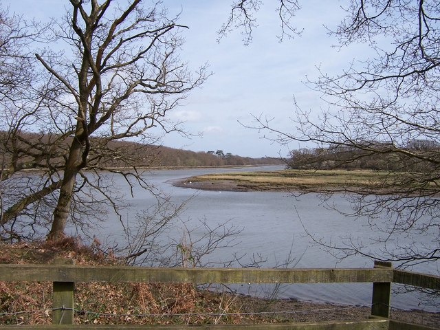
Dockdell Copse is a picturesque woodland located in the county of Hampshire, England. Covering an area of approximately 50 acres, this enchanting forest is a popular destination for nature enthusiasts and outdoor lovers alike.

The copse is characterized by its dense canopy of native trees, including oak, ash, beech, and birch, which create a serene and tranquil atmosphere. The leafy canopy provides a haven for various bird species, such as woodpeckers, owls, and warblers, making it a haven for birdwatchers. Additionally, the woodland floor is carpeted with an array of wildflowers, including bluebells, primroses, and violets, adding a splash of color and beauty to the landscape.

Visitors to Dockdell Copse can explore a network of well-maintained footpaths that wind through the forest, offering opportunities for peaceful walks and hikes. The copse also features a small stream that meanders through the trees, providing a soothing soundtrack and creating a delightful ambiance.

The copse is managed by the local conservation trust, which ensures the preservation of its natural beauty and wildlife. As a result, Dockdell Copse has become a thriving ecosystem, supporting a diverse range of flora and fauna.

Dockdell Copse offers a sanctuary for those seeking respite from the hustle and bustle of everyday life. Whether it's a leisurely stroll, birdwatching, or simply immersing oneself in nature, this enchanting woodland provides a perfect escape for visitors of all ages.

If you have any feedback on the listing, please let us know in the comments section below.

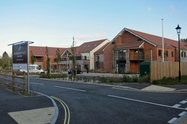
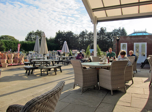
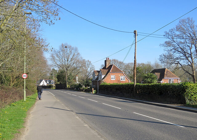
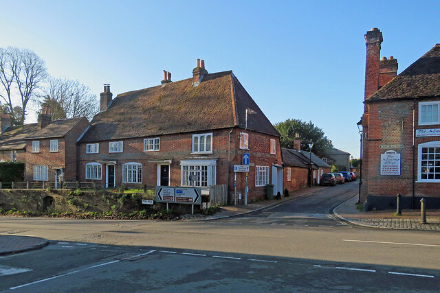
Dockdell Copse Images

Images are sourced within 2km of 50.902847/-1.2851644 or Grid Reference SU5011. Thanks to Geograph Open Source API. All images are credited.

Snowdrop Place Care Home Newly opened residential care home operated by Barchester Healthcare.
(See also <a href="https://www.geograph.org.uk/photo/6635397">SU5013 : Snowdrop Place Care Home - under construction</a>).
Snowdrop Place Care Home
Newly opened residential care home operated by Barchester Healthcare. (See also SU5013 : Snowdrop Place Care Home - under construction).
Garden centre café A pleasant place to enjoy a cup of tea and enjoy the autumn sunshine while thinking about all that gardening you could be doing.
Garden centre café
A pleasant place to enjoy a cup of tea and enjoy the autumn sunshine while thinking about all that gardening you could be doing.
A334 towards Wickham Leaving Botley, crossing the River Hamble.
A334 towards Wickham
Leaving Botley, crossing the River Hamble.
A334 High Street, Botley Eastwards towards Wickham.
A334 High Street, Botley
Eastwards towards Wickham.
A334 towards Botley
A334 towards Botley
Botley: at the corner of Church Lane and Mill Hill High Street is to the left and Winchester Street ahead. The house on the corner is one of many fine Grade II listed 18th-century houses in Botley. The bricks of the single-storey wing on the right are laid in Chinese bond - on their sides, rather than laid flat, they appear larger than bricks laid normally.
Botley: at the corner of Church Lane and Mill Hill
High Street is to the left and Winchester Street ahead. The house on the corner is one of many fine Grade II listed 18th-century houses in Botley. The bricks of the single-storey wing on the right are laid in Chinese bond - on their sides, rather than laid flat, they appear larger than bricks laid normally.
Botley: former maltings, Church Lane Now residential.
Botley: former maltings, Church Lane
Now residential.
Botley: north along Church Lane Looking past  Grade II listed Ivy Cottage towards the former maltings on an April evening.
Botley: north along Church Lane
Looking past Grade II listed Ivy Cottage towards the former maltings on an April evening.
Botley: Cobbetts Cottage, Church Lane This Grade II listed 18th-century house is the only remaining part of the estate of William Cobbett, pamphleteer, journalist and author of "Rural Rides". The south wall is slate-hung.
Botley: Cobbetts Cottage, Church Lane
This Grade II listed 18th-century house is the only remaining part of the estate of William Cobbett, pamphleteer, journalist and author of "Rural Rides". The south wall is slate-hung.
Broadoak, nearing Botley A stretch of the A334 between Hedge End and Botley.
Broadoak, nearing Botley
A stretch of the A334 between Hedge End and Botley.
Botley: William Cobbett memorial and the Market Hall Cobbett, journalist, pamphleteer, reformer and author of "Rural Rides", lived in Botley for some time.

The memorial stone reads

William Cobbett
1763-1835
Lived in Botley near this spot
circa 1805-1817
A great Englishman and
a champion of free journalism
This memorial was erected
by public subscription
Opened by Hampshire members
of the Institute of Journalists
1957

The Grade II listed Market Hall is dated 1848 and the clock turret was added in 1897 to mark Queen Victoria's Diamond Jubilee.
Botley: William Cobbett memorial and the Market Hall
Cobbett, journalist, pamphleteer, reformer and author of "Rural Rides", lived in Botley for some time. The memorial stone reads William Cobbett 1763-1835 Lived in Botley near this spot circa 1805-1817 A great Englishman and a champion of free journalism This memorial was erected by public subscription Opened by Hampshire members of the Institute of Journalists 1957 The Grade II listed Market Hall is dated 1848 and the clock turret was added in 1897 to mark Queen Victoria's Diamond Jubilee.
Botley: Winchester Street Looking from the corner of High Street past a fine Grade II listed timber-framed house of 1610 towards The Brewery Bar.
Botley: Winchester Street
Looking from the corner of High Street past a fine Grade II listed timber-framed house of 1610 towards The Brewery Bar.
Botley: listed buildings at the crossroads Mill Hill is to the left, Church Lane ahead and High Street to the right in this view from the corner of Winchester Street. The house to the left of centre is "Late C18. Two storeys, 4 windows (west end ground floor a bay). Massive red tile roof, half-hipped at one end and fully-hipped at corner; red brick dentil eaves. Walling in Flemish bond, red stretchers/blue headers, flush first floor red band, cambered ground floor openings, plinth. Three and 4-light casements" (Grade II listing).

<a href="https://www.geograph.org.uk/photo/7451183">SU5113 : Botley: at the corner of Church Lane and Mill Hill</a> shows the rear and side of the house from Church Lane.
Botley: listed buildings at the crossroads
Mill Hill is to the left, Church Lane ahead and High Street to the right in this view from the corner of Winchester Street. The house to the left of centre is "Late C18. Two storeys, 4 windows (west end ground floor a bay). Massive red tile roof, half-hipped at one end and fully-hipped at corner; red brick dentil eaves. Walling in Flemish bond, red stretchers/blue headers, flush first floor red band, cambered ground floor openings, plinth. Three and 4-light casements" (Grade II listing). SU5113 : Botley: at the corner of Church Lane and Mill Hill shows the rear and side of the house from Church Lane.
Botley High Street on an April morning The 18th-century Dolphin public house and the mid-Victorian Market Hall are Grade II listed, as are a good number of buildings in this attractive village.
Botley High Street on an April morning
The 18th-century Dolphin public house and the mid-Victorian Market Hall are Grade II listed, as are a good number of buildings in this attractive village.
Botley Church and War Memorial All Saints is Victorian, with later alterations, and Grade II listed. For more about the War Memorial, see the Grade II listing: <span class="nowrap"><a title="https://britishlistedbuildings.co.uk/101450876-botley-war-memorial-botley" rel="nofollow ugc noopener" href="https://britishlistedbuildings.co.uk/101450876-botley-war-memorial-botley">Link</a><img style="margin-left:2px;" alt="External link" title="External link - shift click to open in new window" src="https://s1.geograph.org.uk/img/external.png" width="10" height="10"/></span> .
Botley Church and War Memorial
All Saints is Victorian, with later alterations, and Grade II listed. For more about the War Memorial, see the Grade II listing: LinkExternal link .
Botley: a penny farthing in the window A Grade II listed 18th-century house with a 20th-century shopfront. Chris Downer's <a href="https://www.geograph.org.uk/photo/626351">SU5113 : Botley: old shop</a> shows it in 2007.
Botley: a penny farthing in the window
A Grade II listed 18th-century house with a 20th-century shopfront. Chris Downer's SU5113 : Botley: old shop shows it in 2007.
Botley: High Street houses Some of a good number of fine historic houses in the village, photographed at 7.45 on a bright early-April morning.
Botley: High Street houses
Some of a good number of fine historic houses in the village, photographed at 7.45 on a bright early-April morning.
Botley: a handsome house on Mill Hill "C18. Two storeys, 2 windows. Red tile roof, walling in Flemish bond, red stretchers/blue headers, red rubbed flat arches, stone cills. Sashes in reveals. Large rich doorcase with full Doric order on 3/4 columns (fluted tops), open pediment with swags in relief above arched doorway, fanlight" (Grade II listing).
Botley: a handsome house on Mill Hill
"C18. Two storeys, 2 windows. Red tile roof, walling in Flemish bond, red stretchers/blue headers, red rubbed flat arches, stone cills. Sashes in reveals. Large rich doorcase with full Doric order on 3/4 columns (fluted tops), open pediment with swags in relief above arched doorway, fanlight" (Grade II listing).
Show me another place!

Dockdell Copse is located at Grid Ref: SU5011 (Lat: 50.902847, Lng: -1.2851644)

Administrative County: Hampshire

District: Eastleigh

Police Authority: Hampshire

What 3 Words

///inflamed.muddy.tuned. Near Hedge End, Hampshire

Related Wikis

River Hamble Country Park

River Hamble Country Park is a 144.1-hectare (356-acre) Local Nature Reserve which runs along the west bank of the River Hamble between the villages of...

Upper Hamble Estuary and Woods

Upper Hamble Estuary and Woods is a 151.2-hectare (374-acre) biological Site of Special Scientific Interest east of Southampton in Hampshire. It is part...

HMS Cricket (shore establishment)

HMS Cricket was the name given to a Royal Navy shore establishment on the River Hamble from 1943 to 1946. This name was previously used by the Insect-class...

Grace Dieu (ship)

Grace Dieu was the flagship of King Henry V of England and one of the largest ships of her time. Launched in 1418, she sailed on only one voyage and was...

Edward Sparshott

Edward Sparshott (3 March 1788 – 9 November 1873) was an English officer of the Royal Navy, serving during the Napoleonic Wars. As midshipman on HMS Centaur...
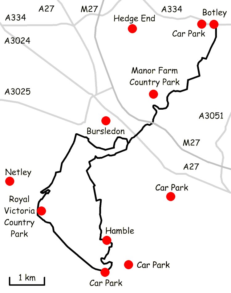
Strawberry Trail

The Strawberry Trail is a 15-mile footpath through Hampshire, England The trail is part linear and part circular. The linear section connects Botley to...

Botley, Hampshire

Botley is a historic village in Hampshire, England. The village was once described as "the most delightful village in the world" by 18th century journalist...

Hedge End

Hedge End is a town and civil parish in Hampshire, England. Situated to the east of the City of Southampton, it adjoins the districts of West End and Botley...

Nearby Amenities

Located within 500m of 50.902847,-1.2851644
Crossing
Crossing: marked
Crossing Markings: yes
Tactile Paving: no
Lat/Long: 50.9006817/-1.2886512
Source: Bing imagery
Traffic Calming: hump
Lat/Long: 50.8995791/-1.2895821
Check Date: 2022-12-23
Source: Bing imagery
Traffic Calming: hump
Lat/Long: 50.9035917/-1.2821749
Source: Bing imagery
Traffic Calming: hump
Lat/Long: 50.9036354/-1.2796112
Bbq
Lat/Long: 50.9006804/-1.2911792
Material: wood
Power: pole
Source: bing
Lat/Long: 50.9055661/-1.2907229
Crossing
Crossing: unmarked
Crossing Markings: no
Lat/Long: 50.8998267/-1.2891933
Crossing
Crossing: marked
Crossing Markings: yes
Tactile Paving: no
Lat/Long: 50.8998599/-1.2893492
Hill Top
Ele: 41
Natural: peak
Lat/Long: 50.9023625/-1.2913246
The data included in this document is from www.openstreetmap.org. The data is made available under ODbL.

Have you been to Dockdell Copse?

Leave your review of Dockdell Copse below (or comments, questions and feedback).