Little Ridge Copse

Wood, Forest in Berkshire

England

Little Ridge Copse

The A34 northbound towards Didcot
The A34 northbound towards Didcot Credit: Ian S

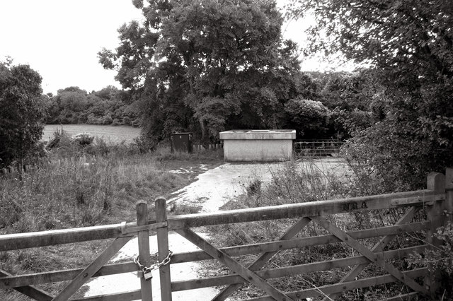
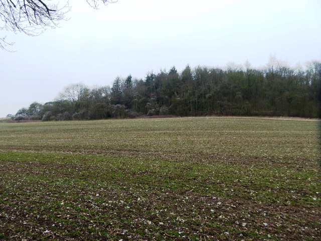
Little Ridge Copse is a charming woodland located in the county of Berkshire, England. Situated near the town of Wokingham, this small but picturesque copse covers an area of approximately 10 hectares. It is nestled in the heart of the Berkshire countryside, surrounded by rolling hills and scenic landscapes.

The copse is predominantly composed of native broadleaf trees, including oak, beech, and birch. These trees create a dense canopy, providing a cool and shady retreat during the hot summer months. The forest floor is adorned with an array of wildflowers and ferns, adding to the natural beauty of the area.

Little Ridge Copse is not only aesthetically pleasing but also serves as an important habitat for various wildlife species. The woodland provides a sanctuary for a diverse range of birds, including woodpeckers, tits, and finches. Additionally, small mammals such as squirrels, voles, and hedgehogs can be found scurrying around the undergrowth.

Visitors to Little Ridge Copse can enjoy a peaceful and tranquil environment, perfect for picnics, leisurely walks, or birdwatching. The copse is crisscrossed with well-maintained footpaths, making it easily accessible for all. Interpretive signs are strategically placed throughout the woodland, providing educational information about the local flora and fauna.

Little Ridge Copse is a true gem within the Berkshire countryside, offering a slice of natural beauty and a chance to immerse oneself in the peacefulness of woodland life.

If you have any feedback on the listing, please let us know in the comments section below.

Little Ridge Copse Images

Images are sourced within 2km of 51.495267/-1.2785761 or Grid Reference SU5077. Thanks to Geograph Open Source API. All images are credited.

The A34 northbound towards Didcot
Ashridge Wood OBH The kiosk houses a groundwater observation bore hole (obh) belonging to the Environment Agency.
The concrete track leads to one of their pumping stations.
Ashridge Wood OBH
The kiosk houses a groundwater observation bore hole (obh) belonging to the Environment Agency. The concrete track leads to one of their pumping stations.
Ashridge Wood Pumping Station A groundwater source owned and operated by the Environment Agency.
Part of a network of similar installations designed to be used for drought alleviation.
Ashridge Wood Pumping Station
A groundwater source owned and operated by the Environment Agency. Part of a network of similar installations designed to be used for drought alleviation.
Ebenezer Wesleyan Chapel This is set into a wall on the corner of a short residential street called Chapel Court.
Presumably the chapel was demolished to make way for the new houses and they kept the foundation stone as a memento.
Ebenezer Wesleyan Chapel
This is set into a wall on the corner of a short residential street called Chapel Court. Presumably the chapel was demolished to make way for the new houses and they kept the foundation stone as a memento.
Chapel Court, World's End Just a context shot for the foundation stone shown in <a href="https://www.geograph.org.uk/photo/4799911">SU4876 : Ebenezer Wesleyan Chapel</a>
Chapel Court, World's End
Just a context shot for the foundation stone shown in SU4876 : Ebenezer Wesleyan Chapel
Football pitch, Beedon Hill The trees mark the line of the A34.
Football pitch, Beedon Hill
The trees mark the line of the A34.
Old Milestone by the A34 near Beedon Carved stone post by the A34, in parish of Beedon (West Berkshire District), slip road to Northern carriageway, inside of bend at base of hill past Ashridge Farm, hidden under a bush on grass verge, on West side of road. Ilsley gable, erected by the Andover & Chilton Pond turnpike trust in the 18th century. Subsequently restored. 

Inscription reads:-
To
Newbury 7
Miles
Ilsley 2
Abingdon 13
Oxford 19
1776

Grade II listed.
List Entry Number: 1319559 <span class="nowrap"><a title="https://historicengland.org.uk/listing/the-list/list-entry/1319559" rel="nofollow ugc noopener" href="https://historicengland.org.uk/listing/the-list/list-entry/1319559">Link</a><img style="margin-left:2px;" alt="External link" title="External link - shift click to open in new window" src="https://s1.geograph.org.uk/img/external.png" width="10" height="10"/></span>

Milestone Society National ID: BE_ABNE13
Old Milestone by the A34 near Beedon
Carved stone post by the A34, in parish of Beedon (West Berkshire District), slip road to Northern carriageway, inside of bend at base of hill past Ashridge Farm, hidden under a bush on grass verge, on West side of road. Ilsley gable, erected by the Andover & Chilton Pond turnpike trust in the 18th century. Subsequently restored. Inscription reads:- To Newbury 7 Miles Ilsley 2 Abingdon 13 Oxford 19 1776 Grade II listed. List Entry Number: 1319559 LinkExternal link Milestone Society National ID: BE_ABNE13
Old Milestone in Worlds End, south of Beedon Carved stone post by the UC road (was A34), in parish of Beedon (West Berkshire District), World's End; by wall of Old Stores Cottage, 10m South of Coach & Horses PH car park, in tarmac pavement with back to brick boundary wall, on East side of road. Ilsley gable, erected by the Andover & Chilton Pond turnpike trust in the 18th century. 

Inscription reads:-
To
Newbury 6
Miles
Ilsley 3
Abingdon 14
Oxford 20
1776

Grade II listed.
List Entry Number: 1319563 <span class="nowrap"><a title="https://historicengland.org.uk/listing/the-list/list-entry/1319563" rel="nofollow ugc noopener" href="https://historicengland.org.uk/listing/the-list/list-entry/1319563">Link</a><img style="margin-left:2px;" alt="External link" title="External link - shift click to open in new window" src="https://s1.geograph.org.uk/img/external.png" width="10" height="10"/></span>

Milestone Society National ID: BE_ABNE14
Old Milestone in Worlds End, south of Beedon
Carved stone post by the UC road (was A34), in parish of Beedon (West Berkshire District), World's End; by wall of Old Stores Cottage, 10m South of Coach & Horses PH car park, in tarmac pavement with back to brick boundary wall, on East side of road. Ilsley gable, erected by the Andover & Chilton Pond turnpike trust in the 18th century. Inscription reads:- To Newbury 6 Miles Ilsley 3 Abingdon 14 Oxford 20 1776 Grade II listed. List Entry Number: 1319563 LinkExternal link Milestone Society National ID: BE_ABNE14
A34 northbound
A34 northbound
A34 northbound
A34 northbound
A34 northbound
A34 northbound
Electricity Cabinets by A34 Quite a tricky square to picture apart from shots of the A34. Most of the area is the private land of Ashridge Farm.
Electricity Cabinets by A34
Quite a tricky square to picture apart from shots of the A34. Most of the area is the private land of Ashridge Farm.
Gate to the manor Th ecurchyard on the north side of St Nicholas Beedon looking towards the gate leading to the manor
Gate to the manor
Th ecurchyard on the north side of St Nicholas Beedon looking towards the gate leading to the manor
Signage to Chieveley and Beedon
Signage on A34
Signage on A34
Manor Farm House, Beedon A grade II listed building, 16th century with additions and alterations every century since.
Manor Farm House, Beedon
A grade II listed building, 16th century with additions and alterations every century since.
Beedon Hill Dropping down to Beedon.
Beedon Hill
Dropping down to Beedon.
Stanmore Road, Beedon Towards Stanmore.
Stanmore Road, Beedon
Towards Stanmore.
Show me another place!

Little Ridge Copse is located at Grid Ref: SU5077 (Lat: 51.495267, Lng: -1.2785761)

Unitary Authority: West Berkshire

Police Authority: Thames Valley

What 3 Words

///stardom.cookbooks.eyeful. Near Compton, Berkshire

Related Wikis

Ashridge Wood

Ashridge Wood is a 15.9-hectare (39-acre) biological Site of Special Scientific Interest south-west of Compton in Berkshire. It is in the North Wessex...

Bothampstead

Bothampstead is a hamlet in the English county of Berkshire, and within the civil parish of Hampstead Norreys. It consists of several houses and a farm...

World's End, Berkshire

World's End is a hamlet in Berkshire, England. It is in the district of West Berkshire, near the A34 north of Newbury. To the north is the village of Beedon...

Perborough Castle

Perborough Castle is the site of an Iron Age univallate hillfort located at Compton in Berkshire. The site covers approximately 14 acres (5.7 ha), and...

Beedon

Beedon is a village and civil parish about 6+1⁄2 miles (10.5 km) north of Newbury in West Berkshire, England. == Geography == The village has outlying...

The Downs School, Compton

The Downs School is a comprehensive secondary school in the village of Compton, Berkshire, England. It is a state school run by West Berkshire Education...

Hampstead Norris railway station

Hampstead Norris railway station was a station on the Didcot, Newbury and Southampton Railway in England. It served the village of Hampstead Norreys in...

East Ilsley

East Ilsley is a village and civil parish in the Berkshire Downs in West Berkshire, north of Newbury. The village is centred immediately east of the A34...

Have you been to Little Ridge Copse?

Leave your review of Little Ridge Copse below (or comments, questions and feedback).