Limekiln Copse
Wood, Forest in Berkshire Vale of White Horse
England
Limekiln Copse
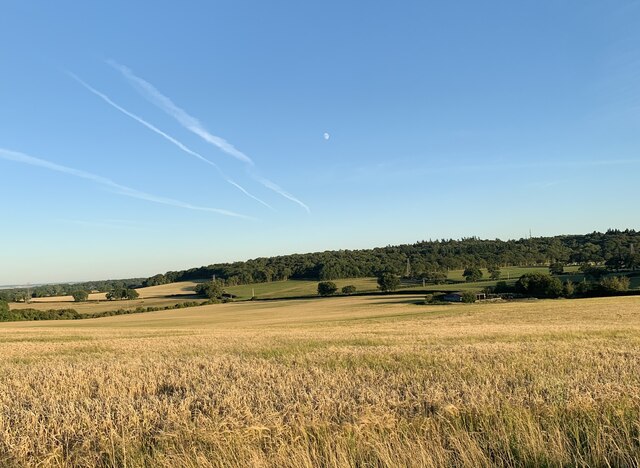
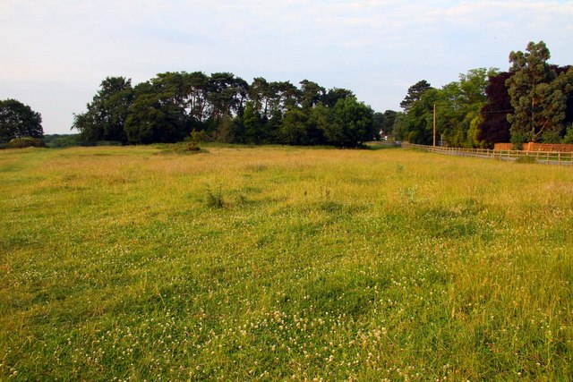
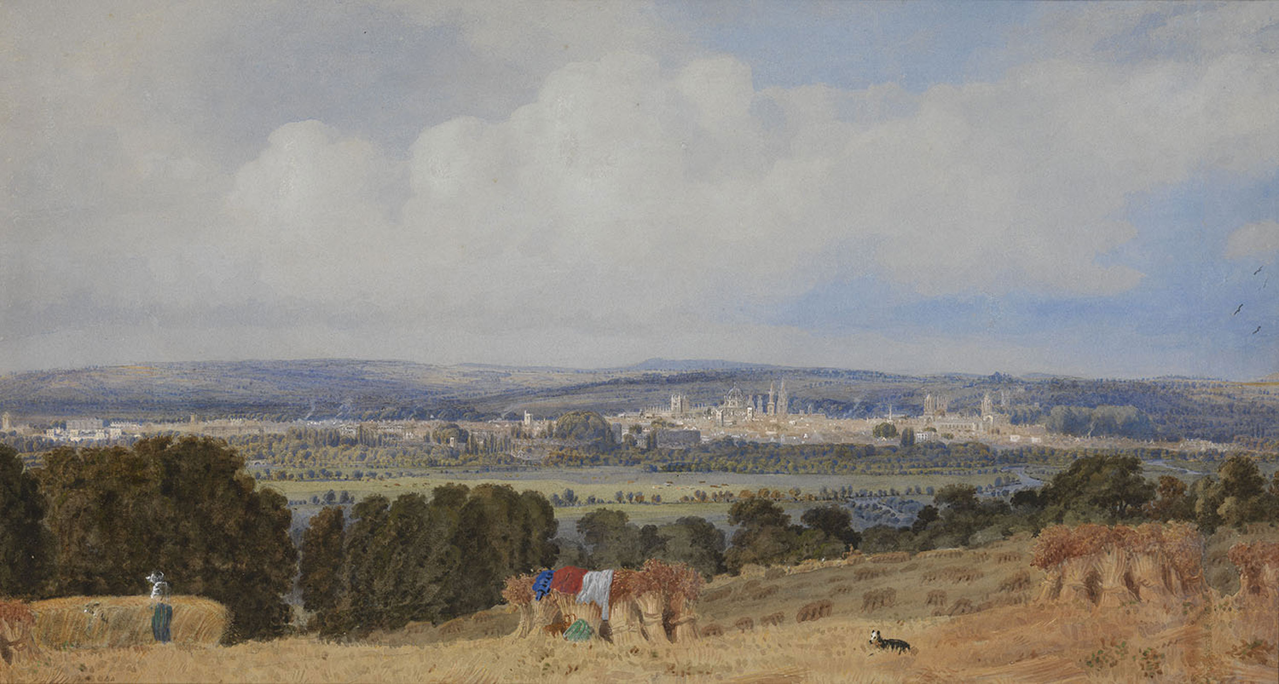
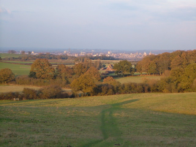
Limekiln Copse is a picturesque woodland located in the county of Berkshire, England. Situated in the southern part of the county, it covers an area of approximately 50 acres. The copse is part of the larger woodland area known as Limekiln Bottom, which is surrounded by rolling hills and meadows.
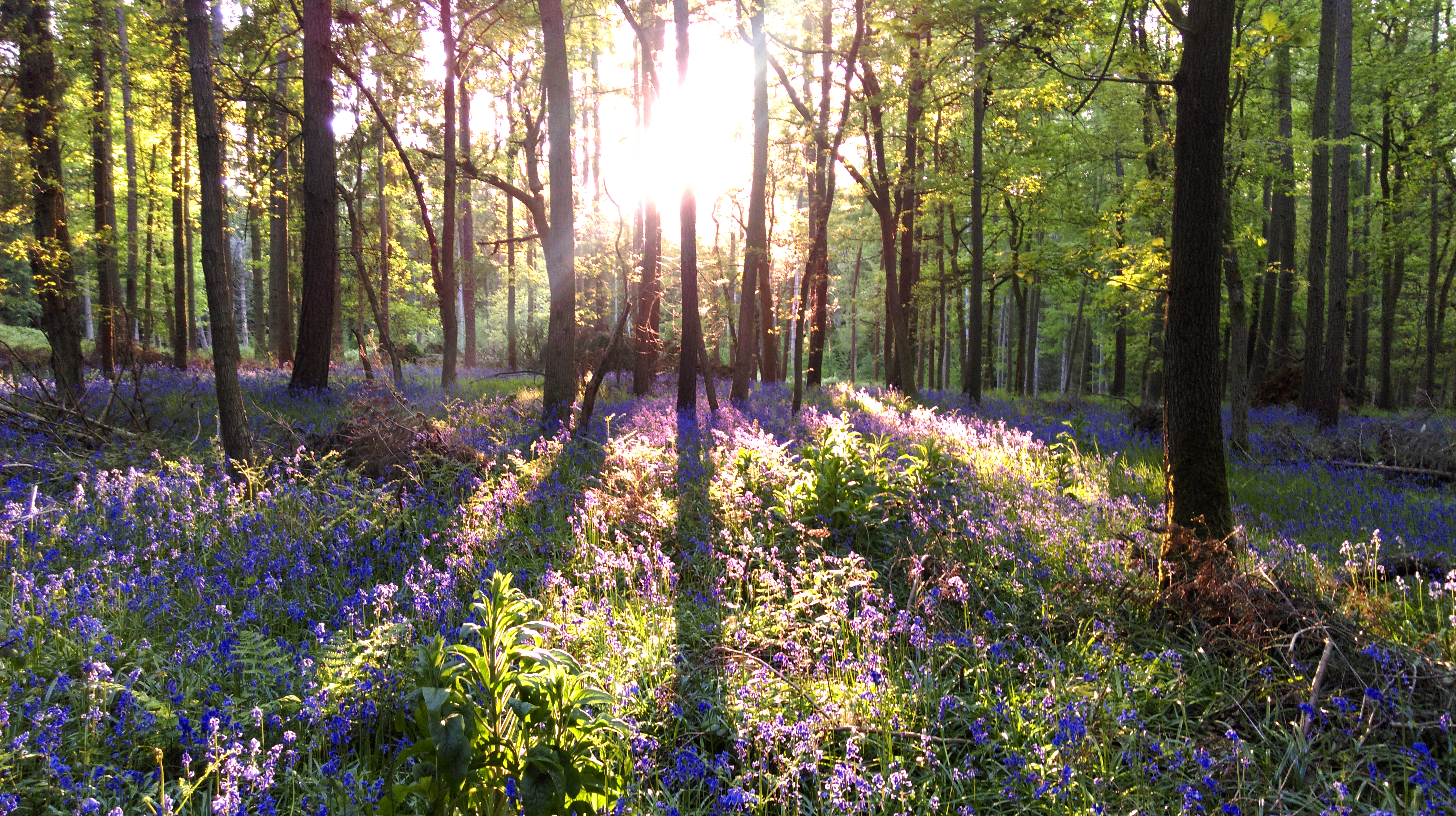
The main feature of Limekiln Copse is its dense and diverse tree population. It is predominantly composed of beech trees, with occasional oak, ash, and birch trees scattered throughout. The woodland floor is covered in a carpet of bluebells during the spring months, adding a vibrant splash of color to the serene surroundings.
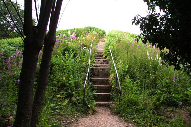
The copse is intersected by a network of footpaths, allowing visitors to explore its natural beauty. These paths meander through the trees, leading to small clearings and secluded spots, perfect for peaceful contemplation or a picnic. The tranquility of the copse is further enhanced by the absence of vehicular access, providing a haven for wildlife and a quiet escape from the outside world.
Limekiln Copse is home to a variety of animal species, including deer, foxes, and a wide range of birdlife. It is a popular destination for birdwatchers, who flock to the area to catch a glimpse of rare species such as the lesser spotted woodpecker and red kites.
Overall, Limekiln Copse offers visitors a serene and enchanting woodland experience. Its rich biodiversity, stunning tree canopy, and peaceful atmosphere make it a cherished natural gem in the heart of Berkshire.
If you have any feedback on the listing, please let us know in the comments section below.
Limekiln Copse Images
Images are sourced within 2km of 51.724077/-1.2762588 or Grid Reference SP5003. Thanks to Geograph Open Source API. All images are credited.


Limekiln Copse is located at Grid Ref: SP5003 (Lat: 51.724077, Lng: -1.2762588)
Administrative County: Oxfordshire
District: Vale of White Horse
Police Authority: Thames Valley
What 3 Words
///excuse.cone.cloth. Near Oxford, Oxfordshire
Nearby Locations
Related Wikis

Chilswell
Chilswell is a small settlement in the parish of Cumnor, Oxfordshire. It lies between the village of South Hinksey and Boars Hill. In 1974 it was transferred...
Hinksey Hill
Hinksey Hill is a hill and residential area 2 miles (3.2 km) south of the centre of Oxford. It is in South Hinksey civil parish, about 0.5 miles (800 m...

Hinksey
Hinksey is a place name associated with Oxford and Oxfordshire. In 1974, many of the places associated with the name were transferred from the county of...
Bagley Wood
Bagley Wood is a wood in the parish of Kennington between Oxford and Abingdon in Oxfordshire, England (in Berkshire until 1974). It is traversed from...
Boars Hill
Boars Hill is a hamlet 3 miles (5 km) southwest of Oxford, straddling the boundary between the civil parishes of Sunningwell and Wootton. Historically...

South Hinksey
South Hinksey is a village and civil parish just over 1 mile (1.6 km) south of the centre of Oxford. The parish includes the residential area of Hinksey...
Midvale Ridge
The Midvale Ridge is a natural region in South Central England formed by a band of low-lying limestone hills that run from southeast to northwest from...
Jarn Mound
Jarn Mound is a mound on Boars Hill which was completed in 1931. It was commissioned by Sir Arthur Evans to provide and preserve the view of the "dreaming...
Related Videos

What's So Interesting About Oxford? - 4K Walking Tour | City Driver Tours
Stay Safe on your Holidays , Buy a Foxy Alarm at : https://ceceswarehouse.com/products/foxyalarm12#aff=beoptimism Visitors can ...
Sunday Walks
I went for a walk at Bagley Woods in Oxfordshire.

Join us at the breakfast club Oxford for a boozy brunch. #travelblogger #breakfast #alcohol #oxford
Join Alfie and Charlie for Charlie's 40th birthday brunch party. #travelblogger #travel #travelling #travelvlog #youtube ...
Dog Walking
Ludo & Phoebe Nr Abingdon Sony RX100mk4 on a CraneM gimbal @ 1080 25p.
Nearby Amenities
Located within 500m of 51.724077,-1.2762588Have you been to Limekiln Copse?
Leave your review of Limekiln Copse below (or comments, questions and feedback).