Calving Close Copse
Wood, Forest in Hampshire
England
Calving Close Copse
Calving Close Copse is a picturesque wood located in the county of Hampshire, England. Situated near the village of Calving Close, this forested area covers an expansive area of approximately 100 acres. Nestled amidst the rolling hills of the Hampshire countryside, the copse is a haven for nature lovers and outdoor enthusiasts.
The wood is characterized by its diverse range of tree species, including oak, beech, and ash trees. These towering giants create a dense canopy that provides shelter and habitat for a variety of wildlife. The forest floor is adorned with a lush carpet of ferns, bluebells, and wildflowers, adding to the copse's natural beauty.
Tranquil footpaths wind their way through the copse, inviting visitors to explore its hidden treasures. As visitors stroll along these paths, they may encounter wildlife such as deer, squirrels, and a rich assortment of bird species. The copse is also home to several small ponds, which attract a myriad of water-loving creatures, including frogs, newts, and dragonflies.
In addition to its natural splendor, Calving Close Copse boasts a rich historical significance. It is believed that the copse has been in existence for centuries, and remnants of ancient settlements and burial mounds have been discovered within its boundaries.
Calving Close Copse offers a peaceful retreat from the hustle and bustle of modern life. Its idyllic setting, diverse flora and fauna, and historical significance make it a cherished natural gem in Hampshire. Whether it's a leisurely walk, birdwatching, or simply immersing oneself in the tranquility of nature, this copse provides an unforgettable experience for all who visit.
If you have any feedback on the listing, please let us know in the comments section below.
Calving Close Copse Images
Images are sourced within 2km of 50.742636/-1.2959817 or Grid Reference SZ4993. Thanks to Geograph Open Source API. All images are credited.


Calving Close Copse is located at Grid Ref: SZ4993 (Lat: 50.742636, Lng: -1.2959817)
Unitary Authority: Isle of Wight
Police Authority: Hampshire
What 3 Words
///talents.causes.confining. Near Northwood, Isle of Wight
Related Wikis

Medina Wharf Halt railway station
Medina Wharf Railway Station was a private halt between Cowes and Newport on the Isle of Wight that provided a way for workers at the nearby wharf to get...
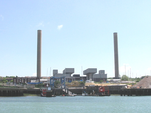
Cowes Power Station
Cowes power station (or Kingston power station) is a 140MW Open Cycle Gas Turbine station powered by two 70MW units. The station is the Isle of Wight's...

Church of St John the Baptist, Northwood
The Church of St. John the Baptist, Northwood is a parish church in the Church of England located in Northwood, Isle of Wight. The church is situated to...
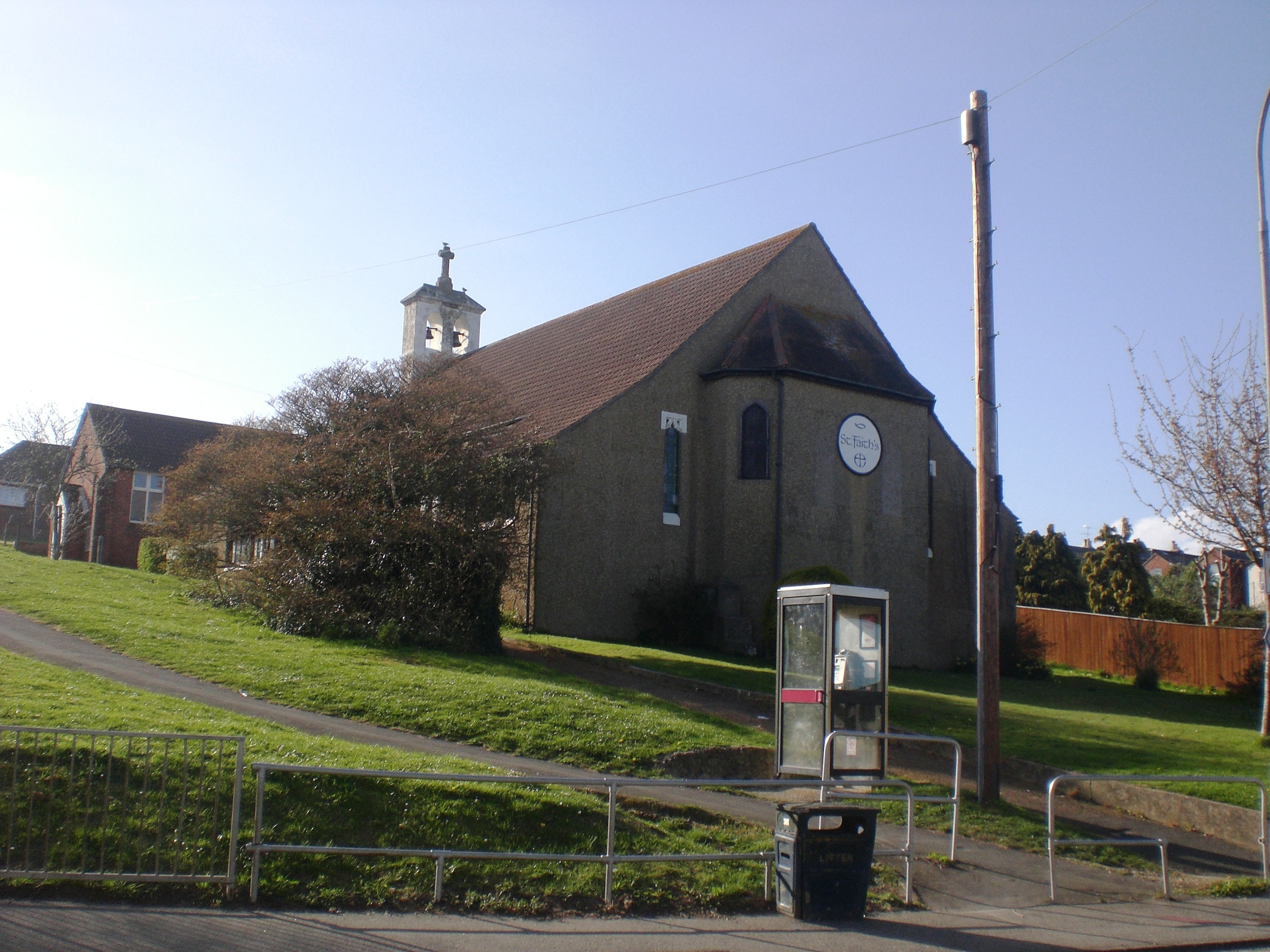
St Faith's Church, Cowes
St Faith's Church, Cowes is a parish church in the Church of England located in Cowes, Isle of Wight. In October 2013, the Diocese of Portsmouth revealed...

Northwood, Isle of Wight
Northwood is a village and civil parish on the Isle of Wight. It lies south of the town of Cowes and has been occupied for about 1000 years. The Church...

East Cowes Victoria Athletic A.F.C.
East Cowes Victoria Athletic Association Football Club is a football club based in East Cowes, Isle of Wight, England They are currently members of the...
Newport (IOW) F.C.
Newport (Isle of Wight) Football Club is a semi-pro football club based in Newport on the Isle of Wight, England. They are currently members of the Wessex...

St Mildred's Church, Whippingham
St Mildred's Church, Whippingham is the Church of England parish church of the village of Whippingham, Isle of Wight. == History == The village of Whippingham...
Nearby Amenities
Located within 500m of 50.742636,-1.2959817Have you been to Calving Close Copse?
Leave your review of Calving Close Copse below (or comments, questions and feedback).