Car Plantation

Wood, Forest in Derbyshire Bolsover

England

Car Plantation

Direction Sign – Signpost on Harthill Field Road, Harthill with Woodall parish Located in Harthill, on the southwest side of the T junction of Harthill Field Road and Common Road, Harthill with Woodall parish. 1 arm and a lost annulus finial. Made by the Royal Label Factory.

Milestone Society National ID: YW_SK4980
Direction Sign – Signpost on Harthill Field Road, Harthill with Woodall parish Credit: C Minto

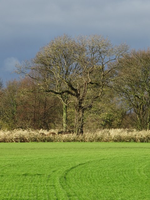
Car Plantation is a picturesque woodland located in Derbyshire, England. Situated in the heart of the county, the plantation is known for its dense wood and serene atmosphere. Spanning a vast area, it is a popular destination for nature enthusiasts, hikers, and those seeking tranquility away from the hustle and bustle of city life.

The woodland is dominated by a variety of tree species, including oak, beech, and birch. Their towering canopies provide ample shade and create a cool, refreshing environment even on hot summer days. The forest floor is covered with a carpet of moss and ferns, adding to the enchanting ambiance of the woodland.

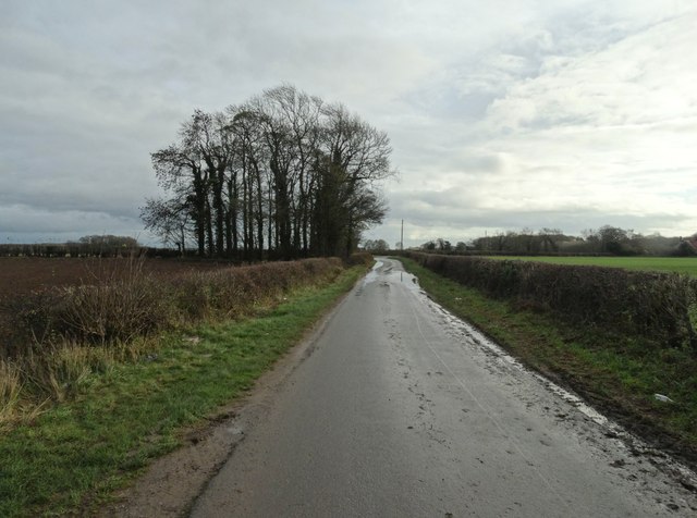
Car Plantation offers numerous walking trails, allowing visitors to explore its natural beauty at their own pace. These trails range from easy strolls to more challenging hikes, catering to all levels of fitness. Along the way, one can spot an array of wildlife, including squirrels, rabbits, and various bird species.

The plantation is well-maintained, with clearly marked paths and informative signposts providing details about the flora and fauna found within the woodland. It is also home to a diverse ecosystem, with several rare and protected plant species thriving in its surroundings.

Whether it's a peaceful walk, a family picnic, or bird-watching, Car Plantation provides a serene and idyllic setting for outdoor activities. Its tranquil atmosphere, coupled with its natural beauty, makes it a must-visit destination for nature lovers and those seeking respite in Derbyshire.

If you have any feedback on the listing, please let us know in the comments section below.

Car Plantation Images

Images are sourced within 2km of 53.302181/-1.2588397 or Grid Reference SK4978. Thanks to Geograph Open Source API. All images are credited.

Direction Sign – Signpost on Harthill Field Road, Harthill with Woodall parish Located in Harthill, on the southwest side of the T junction of Harthill Field Road and Common Road, Harthill with Woodall parish. 1 arm and a lost annulus finial. Made by the Royal Label Factory.

Milestone Society National ID: YW_SK4980
Direction Sign – Signpost on Harthill Field Road, Harthill with Woodall parish
Located in Harthill, on the southwest side of the T junction of Harthill Field Road and Common Road, Harthill with Woodall parish. 1 arm and a lost annulus finial. Made by the Royal Label Factory. Milestone Society National ID: YW_SK4980
A619 Worksop Road with wind turbine ahead
Fuel Forecourt, Welcome Break Woodall Services  The Woodall Services Area lies between junctions 30 and 31 of the M1 motorway near Sheffield. It was opened in 1968 by Trust House Forte (rebranded as Welcome Break in 1986 <span class="nowrap"><a title="https://en.wikipedia.org/wiki/Welcome_Break#Split_from_Trusthouse_Forte" rel="nofollow ugc noopener" href="https://en.wikipedia.org/wiki/Welcome_Break#Split_from_Trusthouse_Forte">Link</a><img style="margin-left:2px;" alt="External link" title="External link - shift click to open in new window" src="https://s1.geograph.org.uk/img/external.png" width="10" height="10"/></span>  ). It takes its name from the nearby village of Woodall.
Fuel Forecourt, Welcome Break Woodall Services
The Woodall Services Area lies between junctions 30 and 31 of the M1 motorway near Sheffield. It was opened in 1968 by Trust House Forte (rebranded as Welcome Break in 1986 LinkExternal link ). It takes its name from the nearby village of Woodall.
Field Boundary near Birkenhead Wood This field boundary is also a county boundary. A path crosses a brook into Derbyshire from South Yorkshire in the right foreground.
Field Boundary near Birkenhead Wood
This field boundary is also a county boundary. A path crosses a brook into Derbyshire from South Yorkshire in the right foreground.
Crop Field near Harthill Reservoir Pictured from an unofficial path which joins the reservoir's edge ahead.
Crop Field near Harthill Reservoir
Pictured from an unofficial path which joins the reservoir's edge ahead.
Harthill Reservoir Pictured from an unofficial path which follows the reservoir edge.
Harthill Reservoir
Pictured from an unofficial path which follows the reservoir edge.
Field of Wheat near Harthill There's a public footpath crossing this field near here but it looks like it's been ploughed out. Note also traffic on the M1 Motorway rumbling across the mid horizon.
Field of Wheat near Harthill
There's a public footpath crossing this field near here but it looks like it's been ploughed out. Note also traffic on the M1 Motorway rumbling across the mid horizon.
Footbridge over M1 near Barlborough Hall The bridge links a right of way through the grounds of the school at Barlborough Hall with a network of paths to the west
Footbridge over M1 near Barlborough Hall
The bridge links a right of way through the grounds of the school at Barlborough Hall with a network of paths to the west
M1, southbound The M1 is a north–south motorway connecting London to Leeds, where it joins the A1(M) near Aberford. It was the first motorway to be completed in the United Kingdom.
The motorway is 193 miles long and was constructed in four phases. Most of the motorway was opened between 1959 and 1968 but the southern end was extended in 1977 and the northern end was extended in 1999.
M1, southbound
The M1 is a north–south motorway connecting London to Leeds, where it joins the A1(M) near Aberford. It was the first motorway to be completed in the United Kingdom. The motorway is 193 miles long and was constructed in four phases. Most of the motorway was opened between 1959 and 1968 but the southern end was extended in 1977 and the northern end was extended in 1999.
Footbridge over the M1 The M1 is a north–south motorway connecting London to Leeds, where it joins the A1(M) near Aberford. It was the first motorway to be completed in the United Kingdom.
The motorway is 193 miles long and was constructed in four phases. Most of the motorway was opened between 1959 and 1968 but the southern end was extended in 1977 and the northern end was extended in 1999.
Footbridge over the M1
The M1 is a north–south motorway connecting London to Leeds, where it joins the A1(M) near Aberford. It was the first motorway to be completed in the United Kingdom. The motorway is 193 miles long and was constructed in four phases. Most of the motorway was opened between 1959 and 1968 but the southern end was extended in 1977 and the northern end was extended in 1999.
Field and trees near Steetley Plantation
Walls Lane -  looking eastwards
Walls Lane - looking eastwards
M1 south of Woodall Services
Access track to Harthill Service Reservoir
Minor road at Nitticarhill
Barlborough Hall School Formerly Barlborough Hall. Built in 1584 by Robert Smithson, who later designed Hardwick Hall
Barlborough Hall School
Formerly Barlborough Hall. Built in 1584 by Robert Smithson, who later designed Hardwick Hall
Footpath towards Harthill
Show me another place!

Car Plantation is located at Grid Ref: SK4978 (Lat: 53.302181, Lng: -1.2588397)

Administrative County: Derbyshire

District: Bolsover

Police Authority: Derbyshire

What 3 Words

///teeth.bead.applied. Near Harthill, South Yorkshire

Nearby Locations

Car Plantation

Related Wikis

Barlborough Hall

Barlborough Hall is a Grade I listed 16th-century country house in Barlborough, Chesterfield, Derbyshire. It was built in around 1583-84 for Sir Francis...

Harthill, South Yorkshire

Harthill is a village in the Metropolitan Borough of Rotherham (part of South Yorkshire, England), on the border with Derbyshire. It lies between Killamarsh...

Whitwell Common

Whitwell Common is a village, in Bolsover District, Derbyshire, lying just North-West of Whitwell, straddling the A619, which runs between Chesterfield...
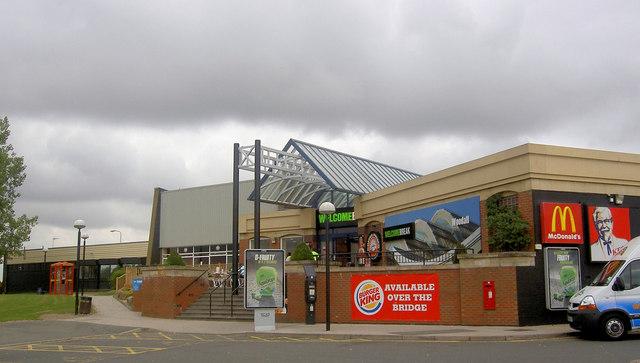
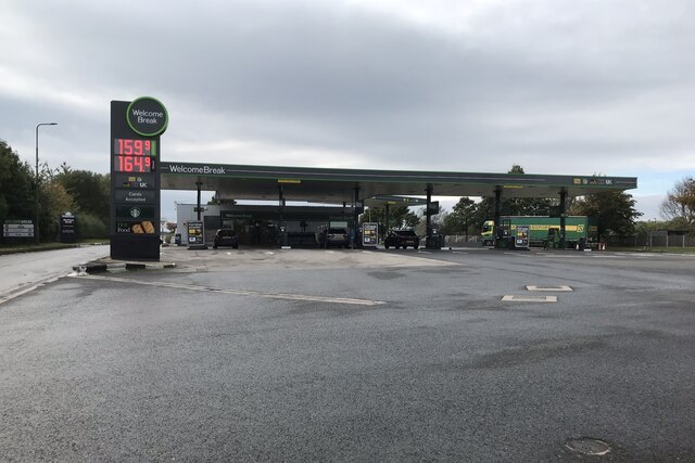
Woodall MSA

Woodall services is a motorway service station on the M1 motorway in Rotherham close to Sheffield in England. It lies between junctions 30 and 31. It was...

All Hallows' Church, Harthill

The All Hallows Church is an Anglican parish church in the Diocese of Sheffield, located in Harthill, South Yorkshire, England. It is a Grade I listed...

Woodall, South Yorkshire

Woodall is a small hamlet in the civil parish of Harthill with Woodall situated in the Metropolitan Borough of Rotherham, South Yorkshire England. In the...

Barlborough

Barlborough is a village and civil parish in the Bolsover district of Derbyshire, England. According to the 2001 census it had a population of 3,018,...

Clowne Rural District

Clowne was a rural district in Derbyshire, England from 1894 to 1974. It was created by the Local Government Act 1894 as that part of the Worksop rural...

Have you been to Car Plantation?

Leave your review of Car Plantation below (or comments, questions and feedback).