Drenewydd Gelli-farch

Settlement in Monmouthshire

Wales

Drenewydd Gelli-farch

Redd Landes, Shirenewton Cul-de-sac on the north side of Earlswood Road. The name Redd Landes appears to be unique in the UK.
Redd Landes, Shirenewton Credit: Jaggery

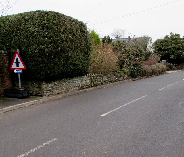
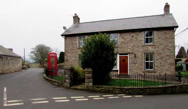
Drenewydd Gelli-farch is a small village located in Monmouthshire, Wales. Situated in the southeastern part of the county, the village is surrounded by picturesque countryside and rolling hills, offering residents and visitors a tranquil and scenic environment.

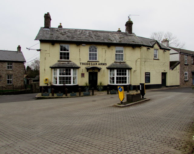
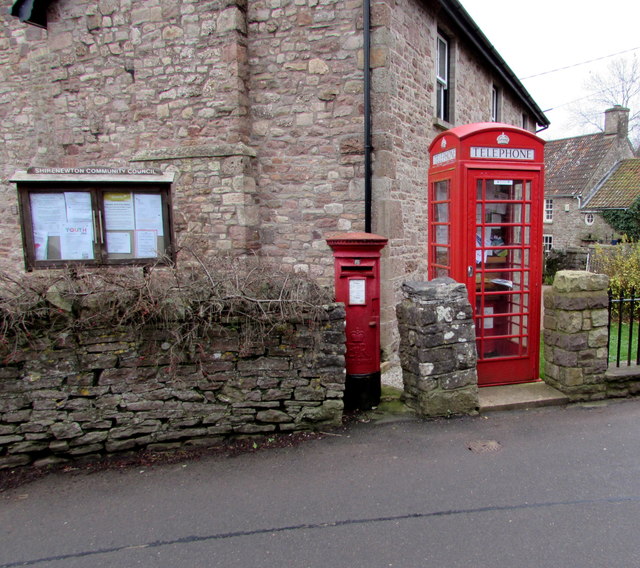
The village is home to a close-knit community of approximately 500 people, making it a tight and friendly community where neighbors often know one another. The village center consists of a few local businesses, including a small grocery store, a post office, and a cozy pub. These establishments serve as gathering places for locals to socialize and catch up on the latest news.

Drenewydd Gelli-farch boasts a rich history, with some buildings dating back to the 17th century. The village is known for its well-preserved architecture, including traditional stone cottages and charming thatched roofs. The local church, St. Mary's, is a prominent feature of the village and holds regular services and community events.

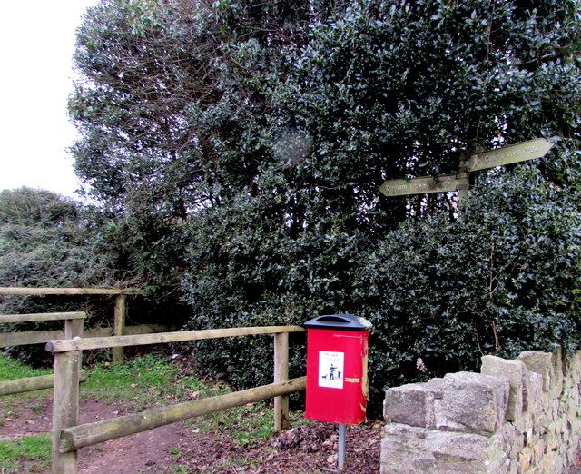
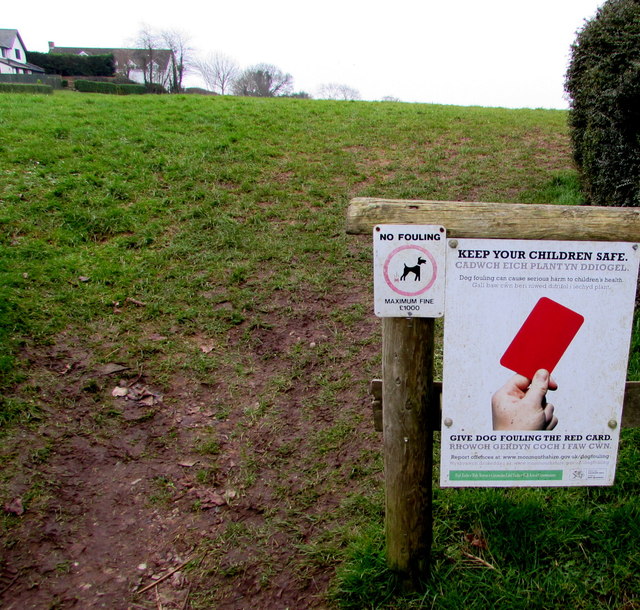
Surrounded by natural beauty, Drenewydd Gelli-farch offers a range of outdoor activities for visitors and residents to enjoy. The village is located near several nature reserves and hiking trails, providing opportunities for walking, birdwatching, and exploring the local flora and fauna.

Overall, Drenewydd Gelli-farch is a peaceful and idyllic village, perfect for those seeking a slower pace of life and a strong sense of community. Its natural beauty, historic charm, and friendly locals make it an appealing destination for tourists and a cherished home for its residents.

If you have any feedback on the listing, please let us know in the comments section below.

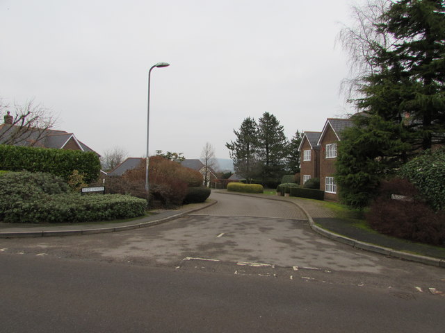
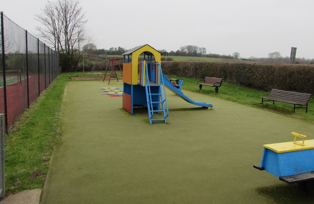
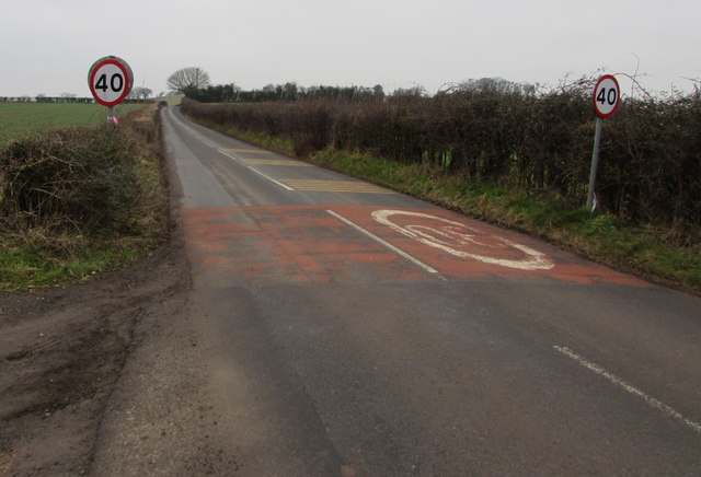
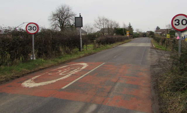
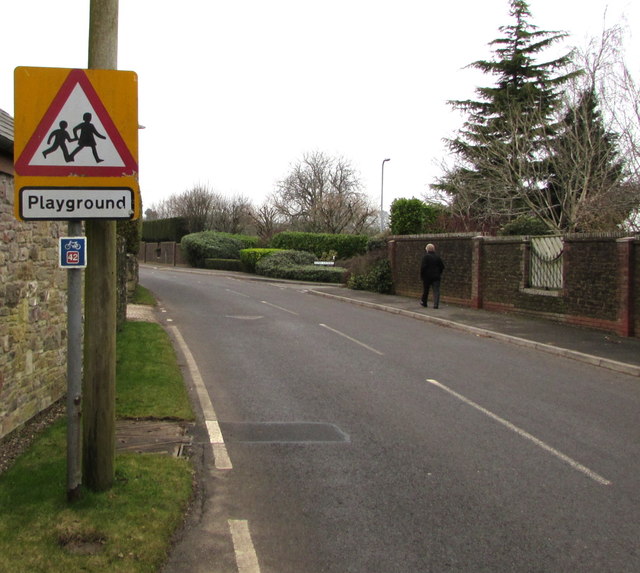
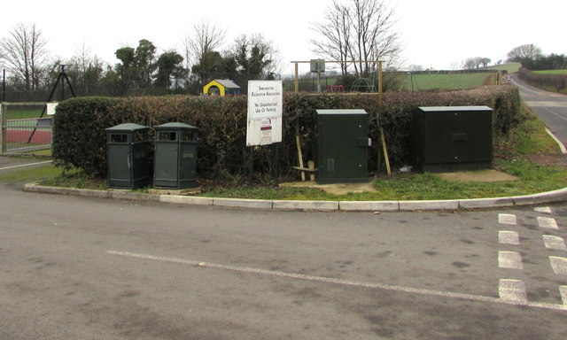
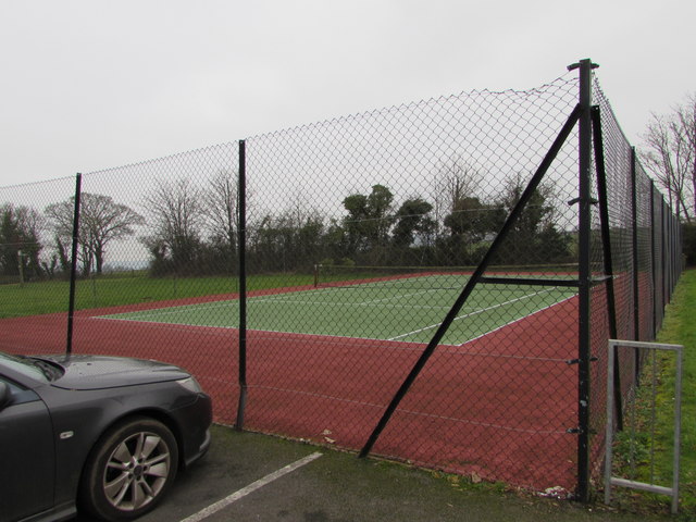
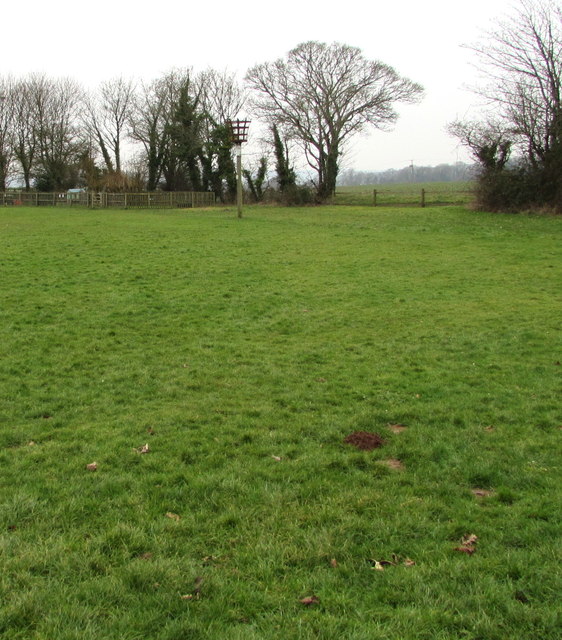
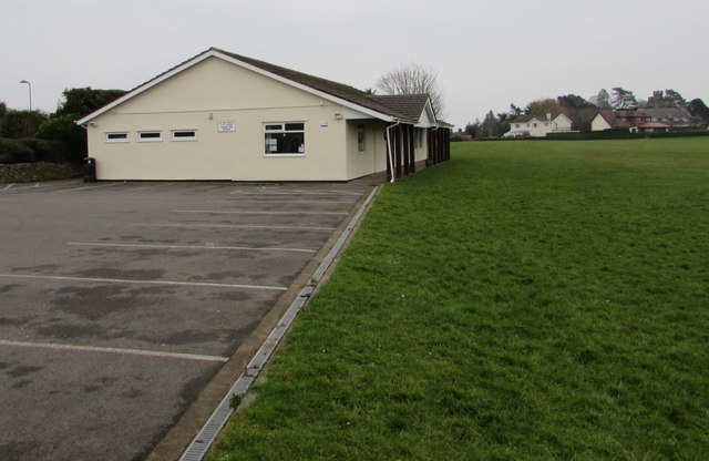
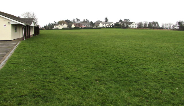
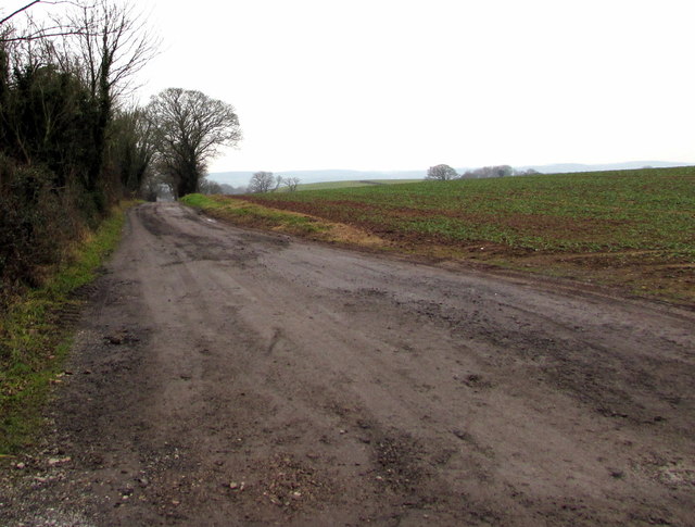
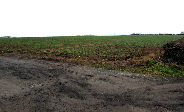
Drenewydd Gelli-farch Images

Images are sourced within 2km of 51.639187/-2.753611 or Grid Reference ST4793. Thanks to Geograph Open Source API. All images are credited.

Redd Landes, Shirenewton Cul-de-sac on the north side of Earlswood Road. The name Redd Landes appears to be unique in the UK.
Redd Landes, Shirenewton
Cul-de-sac on the north side of Earlswood Road. The name Redd Landes appears to be unique in the UK.
Children's play area in Shirenewton At the western edge of the village, between a lawn tennis court and a hedge at the edge of Earlswood Road.
Children's play area in Shirenewton
At the western edge of the village, between a lawn tennis court and a hedge at the edge of Earlswood Road.
End of the 30 zone at the western edge of Shirenewton, Monmouthshire The 30mph speed limit on Earlswood Road increases to 40mph.
End of the 30 zone at the western edge of Shirenewton, Monmouthshire
The 30mph speed limit on Earlswood Road increases to 40mph.
Start of the 30 zone at the western edge of Shirenewton, Monmouthshire The 40mph speed limit on Earlswood Road drops to 30mph.
Start of the 30 zone at the western edge of Shirenewton, Monmouthshire
The 40mph speed limit on Earlswood Road drops to 30mph.
Warning sign - playground, Shirenewton Facing Earlswood Road on the approach to this <a title="https://www.geograph.org.uk/photo/5652529" href="https://www.geograph.org.uk/photo/5652529">Link</a> playground.
The small rectangular sign shows that this road is part of National Cycle Network Route 42.
Warning sign - playground, Shirenewton
Facing Earlswood Road on the approach to this Link playground. The small rectangular sign shows that this road is part of National Cycle Network Route 42.
Two telecoms cabinets and two litter bins, Shirenewton Alongside Earlswood Road at the entrance to the village recreation ground.
A Virgin Media cabinet is on the right, next to a BT cabinet.
Two telecoms cabinets and two litter bins, Shirenewton
Alongside Earlswood Road at the entrance to the village recreation ground. A Virgin Media cabinet is on the right, next to a BT cabinet.
Shirenewton tennis court On the Earlswood Road side of the village recreation ground, next to a children's play area. <a title="https://www.geograph.org.uk/photo/5652529" href="https://www.geograph.org.uk/photo/5652529">Link</a>
Shirenewton tennis court
On the Earlswood Road side of the village recreation ground, next to a children's play area. Link
Towards Shirenewton Beacon The beacon is located near the western edge of the village recreation ground.
Towards Shirenewton Beacon
The beacon is located near the western edge of the village recreation ground.
Shirenewton Recreation Hall, Shirenewton, Monmouthshire On the Earlswood Road side of the village recreation ground.
Shirenewton Recreation Hall, Shirenewton, Monmouthshire
On the Earlswood Road side of the village recreation ground.
Village recreation ground, Shirenewton, Monmouthshire Shirenewton Recreation Hall <a title="https://www.geograph.org.uk/photo/5652580" href="https://www.geograph.org.uk/photo/5652580">Link</a> is on the left.
Village recreation ground, Shirenewton, Monmouthshire
Shirenewton Recreation Hall Link is on the left.
Unnamed lane in Shirenewton From Earlswood Road, the lane leads to Red House Lane.
Unnamed lane in Shirenewton
From Earlswood Road, the lane leads to Red House Lane.
January 2018 view of a field at the western edge of Shirenewton, Monmouthshire  Unhedged on this side, the field is on the south side of Earlswood Road and the west side of this <a title="https://www.geograph.org.uk/photo/5652595" href="https://www.geograph.org.uk/photo/5652595">Link</a> lane.
January 2018 view of a field at the western edge of Shirenewton, Monmouthshire
Unhedged on this side, the field is on the south side of Earlswood Road and the west side of this Link lane.
Warning sign and cycle route 42 sign, Earlswood Road, Shirenewton, Monmouthshire The triangular sign warns that a minor crossroads junction is ahead. The small rectangular sign showing 42 depicts a bicycle. In January 2018, the Sustrans website states that National Route 42 of the National Cycle Network will run west from Gloucester through Cinderford to Chepstow and then north through Abergavenny to join National Route 8 at Glasbury with the option of passing through Hay-on-Wye.
Warning sign and cycle route 42 sign, Earlswood Road, Shirenewton, Monmouthshire
The triangular sign warns that a minor crossroads junction is ahead. The small rectangular sign showing 42 depicts a bicycle. In January 2018, the Sustrans website states that National Route 42 of the National Cycle Network will run west from Gloucester through Cinderford to Chepstow and then north through Abergavenny to join National Route 8 at Glasbury with the option of passing through Hay-on-Wye.
Tredegar Arms, Shirenewton Pub in the centre of the village viewed in January 2018. 
The bricked road surface was not here in July 2011. <a title="https://www.geograph.org.uk/photo/3179271" href="https://www.geograph.org.uk/photo/3179271">Link</a>
Tredegar Arms, Shirenewton
Pub in the centre of the village viewed in January 2018. The bricked road surface was not here in July 2011. Link
Public footpath signpost in Shirenewton Alongside Earlswood Road behind a dog waste bin. The signpost shows left for Dinham 1.6 km.
Right for Coxe's Well 0.2km. No equivalents in miles or yards are shown.
Public footpath signpost in Shirenewton
Alongside Earlswood Road behind a dog waste bin. The signpost shows left for Dinham 1.6 km. Right for Coxe's Well 0.2km. No equivalents in miles or yards are shown.
Keep your children safe - Give dog fouling the red card, Shirenewton The notice faces Earlswood Road at the edge of a public footpath to Dinham.
The smaller notice shows NO FOULING - MAXIMUM FINE £1000.
Dog fouling can cause serious harm to children's health.
Keep your children safe - Give dog fouling the red card, Shirenewton
The notice faces Earlswood Road at the edge of a public footpath to Dinham. The smaller notice shows NO FOULING - MAXIMUM FINE £1000. Dog fouling can cause serious harm to children's health.
The Old Post Office, Shirenewton Dating from the 1850s, the house at the southern end of Ditch Hill Lane was the village post office for more than a century. Viewed in January 2018 when the Post Office Branch Finder shows that the nearest post office is in Caerwent, about 3km away.
The Old Post Office, Shirenewton
Dating from the 1850s, the house at the southern end of Ditch Hill Lane was the village post office for more than a century. Viewed in January 2018 when the Post Office Branch Finder shows that the nearest post office is in Caerwent, about 3km away.
Queen Elizabeth II pillarbox and disused phonebox, Shirenewton At the edge of the Old Post Office <a title="https://www.geograph.org.uk/photo/5652688" href="https://www.geograph.org.uk/photo/5652688">Link</a> viewed across Ditch Hill Lane in January 2018. There are many notices inside the red box which no longer contains a phone. A Shirenewton Community Council noticeboard is on the left.
Queen Elizabeth II pillarbox and disused phonebox, Shirenewton
At the edge of the Old Post Office Link viewed across Ditch Hill Lane in January 2018. There are many notices inside the red box which no longer contains a phone. A Shirenewton Community Council noticeboard is on the left.
Show me another place!

Drenewydd Gelli-farch is located at Grid Ref: ST4793 (Lat: 51.639187, Lng: -2.753611)

Unitary Authority: Monmouthshire

Police Authority: Gwent

Also known as: Shirenewton

What 3 Words

///dentistry.impulses.recent. Near Caerwent, Monmouthshire

Related Wikis

Church of St Thomas a Becket, Shirenewton

The Church of St Thomas a Becket is located in Shirenewton, Monmouthshire, Wales. In the late 12th century the land was inherited by Henry de Bohun. The...

Shirenewton

Shirenewton (Welsh: Drenewydd Gelli-farch) is a village and community in Monmouthshire, south east Wales. It is located 3 miles due west of Chepstow,...

Shirenewton Hall

Shirenewton Hall, originally Shirenewton Court, is a country house and estate adjoining the village of Shirenewton, Monmouthshire, Wales, about 3 miles...

Itton

Itton (Welsh: Llanddinol), is a small village in Monmouthshire, south-east Wales, in the community of Devauden about 3 miles (4.8 km) north-west of Chepstow...

Nearby Amenities

Located within 500m of 51.639187,-2.753611
Shirenewton
Name Cy: Drenewydd Gelli-farch
Place: village
Wikidata: Q62427
Lat/Long: 51.6387222/-2.7532619
Barrier: cycle_barrier
Foot: yes
Lat/Long: 51.6395332/-2.7562087
Place Of Worship
St Thomas a Becket, Shirenewton
Alt Name: Shirenewton Church
Denomination: anglican
Ref Dove: 16917
Religion: christian
Wikidata: Q5117731
Wikipedia: en:Church of St Thomas a Becket, Shirenewton
Lat/Long: 51.6383334/-2.7549027
Pub
Tredegar Arms
Wikidata: Q80582747
Lat/Long: 51.6391724/-2.7544132
Post Box
Post Box Type: pillar
Ref: NP16 449D
Royal Cypher: EIIR
Royal Cypher Wikidata: Q33102113
Lat/Long: 51.639346/-2.7544839
Access: no
Barrier: kissing_gate
Foot: yes
Wheelchair: no
Lat/Long: 51.637061/-2.7569831
Grit Bin
Lat/Long: 51.6395738/-2.7507965
Give Way
Direction: backward
Lat/Long: 51.6396206/-2.7508742
Give Way
Direction: backward
Lat/Long: 51.6391729/-2.7545945
Give Way
Direction: forward
Lat/Long: 51.6392354/-2.7545132
Give Way
Direction: backward
Lat/Long: 51.6391999/-2.7536248
Bus Stop
Shelter: yes
Lat/Long: 51.6393435/-2.7522717
Bus Stop
Naptan AtcoCode: 5330AWB33565
Naptan NaptanCode: gwemagp
Shelter: yes
Lat/Long: 51.6395312/-2.7515971
Give Way
Direction: backward
Lat/Long: 51.6393186/-2.7524188
Give Way
Direction: backward
Lat/Long: 51.6394944/-2.7516962
Direction: 170
Generator Method: photovoltaic
Generator Output Electricity: yes
Generator Solar Modules: 5
Generator Source: solar
Generator Type: solar_photovoltaic_panel
Location: roof
Power: generator
Lat/Long: 51.6387159/-2.7505041
Direction: 260
Generator Method: photovoltaic
Generator Output Electricity: yes
Generator Solar Modules: 6
Generator Source: solar
Generator Type: solar_photovoltaic_panel
Location: roof
Power: generator
Lat/Long: 51.6386951/-2.7505946
Direction: 80
Generator Method: photovoltaic
Generator Output Electricity: yes
Generator Solar Modules: 5
Generator Source: solar
Generator Type: solar_photovoltaic_panel
Location: roof
Power: generator
Lat/Long: 51.6386818/-2.7505437
Direction: SSE
Generator Method: photovoltaic
Generator Output Electricity: yes
Generator Solar Modules: 16
Generator Source: solar
Generator Type: solar_photovoltaic_panel
Location: roof
Power: generator
Lat/Long: 51.6393177/-2.7514999
Direction: SSW
Generator Method: photovoltaic
Generator Output Electricity: yes
Generator Solar Modules: 16
Generator Source: solar
Generator Type: solar_photovoltaic_panel
Location: roof
Power: generator
Lat/Long: 51.6384021/-2.7563198
Direction: 145
Generator Method: photovoltaic
Generator Output Electricity: yes
Generator Solar Modules: 16
Generator Source: solar
Generator Type: solar_photovoltaic_panel
Location: roof
Power: generator
Lat/Long: 51.6434199/-2.751697
Direction: SE
Generator Method: photovoltaic
Generator Output Electricity: yes
Generator Solar Modules: 16
Generator Source: solar
Generator Type: solar_photovoltaic_panel
Location: roof
Power: generator
Lat/Long: 51.6435764/-2.7520504
Direction: 215
Generator Method: photovoltaic
Generator Output Electricity: yes
Generator Solar Modules: 14
Generator Source: solar
Generator Type: solar_photovoltaic_panel
Location: roof
Power: generator
Lat/Long: 51.6433783/-2.7520202
Public Bookcase
Booth: K6
Disused Amenity: telephone
Man Made: telephone_box
Public Bookcase Type: phone_box
Lat/Long: 51.6393279/-2.7544841
The data included in this document is from www.openstreetmap.org. The data is made available under ODbL.

Have you been to Drenewydd Gelli-farch?

Leave your review of Drenewydd Gelli-farch below (or comments, questions and feedback).