Huthwaite Plantation

Wood, Forest in Yorkshire Hambleton

England

Huthwaite Plantation

Autumn colours at Scarth Nick
Autumn colours at Scarth Nick Credit: Alan Pickup

Huthwaite Plantation is a picturesque woodland located in the county of Yorkshire, England. Situated near the village of Huthwaite, this lush forest covers a vast area of approximately 200 acres. The plantation is renowned for its diverse range of trees, making it a haven for nature enthusiasts and a valuable habitat for wildlife.

The plantation primarily consists of broadleaf trees, such as oak, beech, and chestnut, which create a dense canopy and provide a rich habitat for various bird species, mammals, and insects. This biodiversity makes Huthwaite Plantation an ideal destination for birdwatching and wildlife spotting.

Traversing through the woodland, visitors can explore a network of well-maintained footpaths that wind amidst the trees, offering a tranquil and immersive experience in nature. The paths are suitable for leisurely walks, jogging, or cycling, allowing visitors to enjoy the natural beauty of the plantation at their own pace.

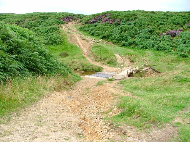
Huthwaite Plantation also features a small stream that meanders through its heart, adding to the charm of the landscape. The stream is home to a variety of aquatic life, including fish, amphibians, and water insects.

The plantation is accessible year-round and offers beautiful vistas throughout the seasons. In spring, the forest floor is carpeted with blooming bluebells, creating a breathtaking sight. During autumn, the foliage transforms into a vibrant display of red, orange, and gold, making it a popular destination for capturing stunning photographs.

With its stunning scenery, diverse flora and fauna, and peaceful ambiance, Huthwaite Plantation is a treasured natural gem in Yorkshire, inviting visitors to connect with nature and experience the tranquility of the woodland environment.

If you have any feedback on the listing, please let us know in the comments section below.

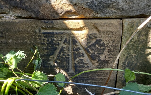
Huthwaite Plantation Images

Images are sourced within 2km of 54.399093/-1.2521339 or Grid Reference NZ4800. Thanks to Geograph Open Source API. All images are credited.

Autumn colours at Scarth Nick
Path junction above Scarth Nick Here a path veers off to the right to meet the road at the summit of the Scarth Nick pass, whilst that to the left drops down to the road and onwards if one is walking the Cleveland Way or Lyke Wake routes. Both the routes continue to drop down into Scugdale at around the 120m contour before a steep ascent to Round Hill at 315m.
Path junction above Scarth Nick
Here a path veers off to the right to meet the road at the summit of the Scarth Nick pass, whilst that to the left drops down to the road and onwards if one is walking the Cleveland Way or Lyke Wake routes. Both the routes continue to drop down into Scugdale at around the 120m contour before a steep ascent to Round Hill at 315m.
Sheep descending the moor side It looks as though at least one sheep decided that it was a good idea to head down towards the road, and the others followed. The hillside here is much disturbed and one might suspect post glacial subsidence, but old maps show a series of small quarries here, so that looks to be the more likely reason. Scarth Nick is a glacial overflow channel where pent up meltwaters around the edge of the Cleveland Plain glacier found a weak point in the hills and rushed through. Another example at a higher elevation can be found to the south east at Stony Ridge. See SE4899 - Holy Well Gill.
Sheep descending the moor side
It looks as though at least one sheep decided that it was a good idea to head down towards the road, and the others followed. The hillside here is much disturbed and one might suspect post glacial subsidence, but old maps show a series of small quarries here, so that looks to be the more likely reason. Scarth Nick is a glacial overflow channel where pent up meltwaters around the edge of the Cleveland Plain glacier found a weak point in the hills and rushed through. Another example at a higher elevation can be found to the south east at Stony Ridge. See SE4899 - Holy Well Gill.
Path junction on the Cleveland Way
Swainby, Maynards Bridge The damaged benchmark is cut into the south face of the northern parapet. Today only the horizontal datum line is obvious.
Swainby, Maynards Bridge
The damaged benchmark is cut into the south face of the northern parapet. Today only the horizontal datum line is obvious.
Swainby, Maynards Bridge There is a damaged benchmark cut into the south face of the northern parapet. Today only the horizontal datum line is obvious.
Swainby, Maynards Bridge
There is a damaged benchmark cut into the south face of the northern parapet. Today only the horizontal datum line is obvious.
Swainby, Middle Bridge The benchmark is cut into the north west face of the northern parapet of the Middle Bridge.
Swainby, Middle Bridge
The benchmark is cut into the north west face of the northern parapet of the Middle Bridge.
Swainby, Middle Bridge There is a benchmark cut into the north west face of the northern parapet of the Middle Bridge. It is to the left of the arch.
Swainby, Middle Bridge
There is a benchmark cut into the north west face of the northern parapet of the Middle Bridge. It is to the left of the arch.
Swainby church The benchmark is cut into the right hand gable end of the church, and is cut into the lowest course of stone.
Swainby church
The benchmark is cut into the right hand gable end of the church, and is cut into the lowest course of stone.
Swainby church There is a benchmark cut into the right hand gable end of the church on the south-west facing wall. It is cut into the lowest course of stone.
Swainby church
There is a benchmark cut into the right hand gable end of the church on the south-west facing wall. It is cut into the lowest course of stone.
Swainby, Castle Bank According to the OS benchmark database there is a benchmark cut into the culvert over the stream at this point on Castle Bank. Nothing was found and it is likely that this is a newer culvert and the benchmark has been destroyed.
Swainby, Castle Bank
According to the OS benchmark database there is a benchmark cut into the culvert over the stream at this point on Castle Bank. Nothing was found and it is likely that this is a newer culvert and the benchmark has been destroyed.
Whorlton Castle The benchmark is cut into the right side of the archway at the entrance to the ruined castle.
Whorlton Castle
The benchmark is cut into the right side of the archway at the entrance to the ruined castle.
Whorlton Castle There is a benchmark cut into the right side of the archway at the entrance to the ruined castle.
Whorlton Castle
There is a benchmark cut into the right side of the archway at the entrance to the ruined castle.
Swainby, Church of the Holy Rood The benchmark is cut into the west face of the tower.
Swainby, Church of the Holy Rood
The benchmark is cut into the west face of the tower.
Swainby, Church of the Holy Rood There is a benchmark cut into the west face of the tower.
Swainby, Church of the Holy Rood
There is a benchmark cut into the west face of the tower.
Swainby, Spring Garden According to the OS benchmark database the cottage on the east side of the lane should have a benchmark cut into the extreme right of the property. This is a private residence and was unable to a check, but it is very likely the mark still exists. There are no visible alterations to the exterior of the property.
Swainby, Spring Garden
According to the OS benchmark database the cottage on the east side of the lane should have a benchmark cut into the extreme right of the property. This is a private residence and was unable to a check, but it is very likely the mark still exists. There are no visible alterations to the exterior of the property.
Swainby, Scarth Croft According to the OS benchmark database there is a mark cut into the south face of the property. This is a private residence and I was unable to make a complete check. The exterior of the property appears to be unaltered and therefore it is likely the mark still exists.
Swainby, Scarth Croft
According to the OS benchmark database there is a mark cut into the south face of the property. This is a private residence and I was unable to make a complete check. The exterior of the property appears to be unaltered and therefore it is likely the mark still exists.
Swainby, 136 High Street The benchmark is cut into the left hand corner of this gable end. The 2nd bar from the top of the wooden gate has obscured the benchmark!
Swainby, 136 High Street
The benchmark is cut into the left hand corner of this gable end. The 2nd bar from the top of the wooden gate has obscured the benchmark!
Show me another place!

Huthwaite Plantation is located at Grid Ref: NZ4800 (Lat: 54.399093, Lng: -1.2521339)

Division: North Riding

Administrative County: North Yorkshire

District: Hambleton

Police Authority: North Yorkshire

What 3 Words

///headsets.eased.worthy. Near Stokesley, North Yorkshire

Related Wikis

Swainby

Swainby is a village in the Hambleton District of North Yorkshire, England. It is situated on the A172 road, 8 miles (13 km) north-east from Northallerton...

Whorlton, North Yorkshire

Whorlton is a hamlet and civil parish in the Hambleton District of North Yorkshire, England. It is very near Swainby and the A19, and 6 miles south west...

Whorlton Castle

Whorlton Castle is a ruined medieval castle situated near the abandoned village of Whorlton (at grid reference NZ4802) in North Yorkshire, England. It...

Sheepwash, North Yorkshire

Sheepwash is a popular tourist spot in the North York Moors, North Yorkshire, England. It is located on Cod Beck which flows into Cod Beck Reservoir near...

Nearby Amenities

Located within 500m of 54.399093,-1.2521339
Bench
Lat/Long: 54.3956271/-1.2477206
Barrier: kissing_gate
Foot: yes
Lat/Long: 54.3956238/-1.2473119
Heathwaite
Place: hamlet
Lat/Long: 54.4022584/-1.2509331
Huthwaite Green
Place: farm
Lat/Long: 54.4006067/-1.2451157
Historic: stone
Lat/Long: 54.3978411/-1.251876
Hiking: yes
Information: guidepost
Tourism: information
Lat/Long: 54.4002176/-1.2571422
Information: guidepost
Tourism: information
Lat/Long: 54.3955988/-1.2475828
Information: stone
Tourism: information
Lat/Long: 54.3956414/-1.2473113
Information: route_marker
Tourism: information
Lat/Long: 54.3956361/-1.2473207
Ford: yes
Source: Bing
Lat/Long: 54.3956275/-1.2472844
Harpleys Well
Man Made: water_well
Lat/Long: 54.4023177/-1.2512901
The data included in this document is from www.openstreetmap.org. The data is made available under ODbL.

Have you been to Huthwaite Plantation?

Leave your review of Huthwaite Plantation below (or comments, questions and feedback).