Burton Pool Wood

Wood, Forest in Warwickshire Rugby

England

Burton Pool Wood

Farmland east of Willey Looking into a corner of this field which is crossed by a poorly defined bridleway. There was evidence of cattle grazing here but none were present at the time of this photograph.
Farmland east of Willey Credit: Stephen McKay

Burton Pool Wood is a picturesque woodland located in the county of Warwickshire, England. Covering an area of approximately 100 acres, it is a thriving natural habitat that offers a tranquil escape for nature enthusiasts and avid walkers alike.

The wood is characterized by a diverse range of tree species, including oak, beech, and ash. These majestic trees form a dense canopy, providing shade and shelter for a variety of wildlife. The forest floor is adorned with a rich carpet of bluebells in the spring, creating a breathtaking display of color.

A network of well-maintained footpaths and trails winds through Burton Pool Wood, allowing visitors to explore the area at their own pace. These paths lead to several points of interest, such as a small pond known as Burton Pool, after which the wood is named. The pond is home to a variety of aquatic plants and attracts a wide array of bird species, making it a popular spot for birdwatchers.

In addition to its natural beauty, Burton Pool Wood also holds historical significance. It was once part of the extensive woodland that covered much of Warwickshire, and remnants of ancient earthworks can still be found within the wood. These earthworks are believed to date back to the Iron Age and provide a glimpse into the area's past.

Overall, Burton Pool Wood offers visitors a chance to immerse themselves in nature, explore its rich biodiversity, and appreciate its historical importance. Whether it is for a leisurely stroll, birdwatching, or simply enjoying the peaceful surroundings, this wood is a hidden gem in the heart of Warwickshire.

If you have any feedback on the listing, please let us know in the comments section below.

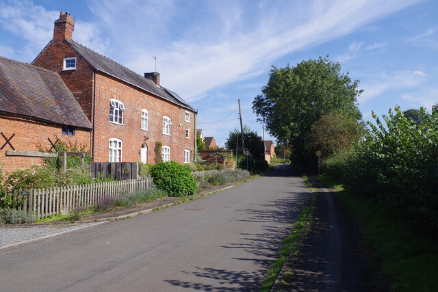
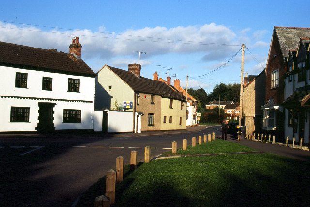
Burton Pool Wood Images

Images are sourced within 2km of 52.451064/-1.2874631 or Grid Reference SP4883. Thanks to Geograph Open Source API. All images are credited.

Farmland east of Willey Looking into a corner of this field which is crossed by a poorly defined bridleway. There was evidence of cattle grazing here but none were present at the time of this photograph.
Farmland east of Willey
Looking into a corner of this field which is crossed by a poorly defined bridleway. There was evidence of cattle grazing here but none were present at the time of this photograph.
Lane to Willey Seen here on a sultry Sunday afternoon at the beginning of September, this narrow lane leads off the A5 and heads towards Willey village.
Lane to Willey
Seen here on a sultry Sunday afternoon at the beginning of September, this narrow lane leads off the A5 and heads towards Willey village.
Farmland near Willey Seen through a gate on the lane to Willey village, these arable fields are well shielded from the adjacent A5.
Farmland near Willey
Seen through a gate on the lane to Willey village, these arable fields are well shielded from the adjacent A5.
Junction for Willey on the A5 This somewhat oversized sign must have caused some schoolboy sniggering over the years. Motorists who take the turn will find a sharp contrast between the dual carriageway A5 and the very narrow lane into Willey village. On this Sunday afternoon traffic was light on the main road with just a few cars and the odd HGV rumbling past.
Junction for Willey on the A5
This somewhat oversized sign must have caused some schoolboy sniggering over the years. Motorists who take the turn will find a sharp contrast between the dual carriageway A5 and the very narrow lane into Willey village. On this Sunday afternoon traffic was light on the main road with just a few cars and the odd HGV rumbling past.
Main Street, Willey This is the northern end of the small village that has a population of about 150.
Main Street, Willey
This is the northern end of the small village that has a population of about 150.
Main Street, Willey Willey is a small village with a population of about 150. It basically stretches long a single street with buildings of different ages. The telephone box just visible in this picture now houses a defibrillator.
Main Street, Willey
Willey is a small village with a population of about 150. It basically stretches long a single street with buildings of different ages. The telephone box just visible in this picture now houses a defibrillator.
Farmland east of Willey These fields are separated from Willey village by a long-abandoned railway cutting. Some of the vast warehouses that make up Magna Park can be seen on the other side of the A5.
Farmland east of Willey
These fields are separated from Willey village by a long-abandoned railway cutting. Some of the vast warehouses that make up Magna Park can be seen on the other side of the A5.
Pigs at Willey The animals came up to the fence grunting vociferously no doubt in the hope of food. They were to be disappointed.
Pigs at Willey
The animals came up to the fence grunting vociferously no doubt in the hope of food. They were to be disappointed.
The Sarah Mansfield, Willey This pub was renamed from the Plough in the 1970s apparently by the then licensee in memory of his grandmother. It closed down during the Covid pandemic and was sold to new owners who have gutted the interior but are now involved in a long running planning dispute with Rugby Borough Council; all work has been stopped. The pub made national news in the summer of 2023 when it was discovered that the owners were the same people that had recently purchased the Crooked House in Staffordshire from Marstons - that pub subsequently burnt down and was then demolished without permission, causing a huge outcry. At the time of writing two men have been arrested and remanded on suspicion of arson. Fortunately the Sarah Mansfield still stands but whether it will ever operate as a pub again remains to be seen. It is fair to say that local people feel very aggrieved. See <span class="nowrap"><a title="https://www.warwickshireworld.com/heritage-and-retro/heritage/rugby-village-pub-thrust-into-spotlight-amid-crooked-house-uproar-4255854" rel="nofollow ugc noopener" href="https://www.warwickshireworld.com/heritage-and-retro/heritage/rugby-village-pub-thrust-into-spotlight-amid-crooked-house-uproar-4255854">Link</a><img style="margin-left:2px;" alt="External link" title="External link - shift click to open in new window" src="https://s1.geograph.org.uk/img/external.png" width="10" height="10"/></span>.
The Sarah Mansfield, Willey
This pub was renamed from the Plough in the 1970s apparently by the then licensee in memory of his grandmother. It closed down during the Covid pandemic and was sold to new owners who have gutted the interior but are now involved in a long running planning dispute with Rugby Borough Council; all work has been stopped. The pub made national news in the summer of 2023 when it was discovered that the owners were the same people that had recently purchased the Crooked House in Staffordshire from Marstons - that pub subsequently burnt down and was then demolished without permission, causing a huge outcry. At the time of writing two men have been arrested and remanded on suspicion of arson. Fortunately the Sarah Mansfield still stands but whether it will ever operate as a pub again remains to be seen. It is fair to say that local people feel very aggrieved. See LinkExternal link.
Willey Church - tower Looking up at the tower of St Leonard's church, which dates from the late 14th or early 15th century.
Willey Church - tower
Looking up at the tower of St Leonard's church, which dates from the late 14th or early 15th century.
A5, southbound The A5 is a major trunk road that runs 260 miles from London to Holyhead. It follows the course of an old Roman Road (Watling Street).
Wikipedia: <span class="nowrap"><a title="http://en.wikipedia.org/wiki/A5_road_(Great_Britain)" rel="nofollow ugc noopener" href="http://en.wikipedia.org/wiki/A5_road_(Great_Britain)">Link</a><img style="margin-left:2px;" alt="External link" title="External link - shift click to open in new window" src="https://s1.geograph.org.uk/img/external.png" width="10" height="10"/></span>
A5, southbound
The A5 is a major trunk road that runs 260 miles from London to Holyhead. It follows the course of an old Roman Road (Watling Street). Wikipedia: LinkExternal link
A5 northbound near Bittesby House
Mere Lane/Watling Street junction near to Cross in Hand Watling Street is the A5 from London to Holyhead and is usually very busy.
Mere Lane/Watling Street junction near to Cross in Hand
Watling Street is the A5 from London to Holyhead and is usually very busy.
Sign at Mere Lane/Watling Street junction near to Cross in Hand
Mere Lane at the junction of Watling Street The roundabout is about a year old.
Mere Lane at the junction of Watling Street
The roundabout is about a year old.
Mere Lane at the junction of Watling Street The roundabout is around a year old.
Mere Lane at the junction of Watling Street
The roundabout is around a year old.
Coal Pit Lane, Lutterworth
Monks Kirby Roman Catholic Burial Ground At the site of the Denbigh Chapel of Remembrance
Monks Kirby Roman Catholic Burial Ground
At the site of the Denbigh Chapel of Remembrance
Show me another place!

Burton Pool Wood is located at Grid Ref: SP4883 (Lat: 52.451064, Lng: -1.2874631)

Administrative County: Warwickshire

District: Rugby

Police Authority: Warwickshire

What 3 Words

///hides.other.locked. Near Lutterworth, Leicestershire

Related Wikis

Monks Kirby Rural District

The Monks Kirby Rural District was a rural district of Warwickshire between 1894 and 1932, based on the part of the Lutterworth Rural Sanitary District...

Willey, Warwickshire

Willey is a rural village and civil parish in the English county of Warwickshire. The parish had a population of 148 as of the 2021 census.Willey is the...

Monks Kirby

Monks Kirby is a village and civil parish in north-eastern Warwickshire, England. The population of the parish is 445. Monks Kirby is located around one...

Monks Kirby Priory

Monks Kirby Priory was a Benedictine priory established in 1077 in Monks Kirby, Warwickshire, England. The priory was suppressed in 1415 when its estates...

Pailton

Pailton is a village and civil parish in the Borough of Rugby, Warwickshire, England. Its population in 2001 was recorded as 482, increasing at the 2011...

Bittesby

Bittesby is a deserted village and former civil parish, now in the parish of Bitteswell with Bittesby, in the Harborough district of Leicestershire, England...

Cestersover

Cestersover is a deserted village in Warwickshire, England, now in the civil parish of Pailton. == History == It was a hamlet of Monks Kirby and was site...

RAF Bitteswell

Royal Air Force Bitteswell or more simply RAF Bitteswell is a former Royal Air Force satellite station located 2.0 miles (3.2 km) west of Lutterworth,...

Nearby Amenities

Located within 500m of 52.451064,-1.2874631
Power: tower
Source: bing
Lat/Long: 52.4511319/-1.2824954
Power: tower
Source: bing
Lat/Long: 52.4532961/-1.2842764
The data included in this document is from www.openstreetmap.org. The data is made available under ODbL.

Have you been to Burton Pool Wood?

Leave your review of Burton Pool Wood below (or comments, questions and feedback).